Trip Date: May 6-7, 2025
Mt. Hood Climbing Trip
Palmer Snowfield
Devil’s Kitchen
Mazama Chute
Mount Hood aka Wy’east (11,253 ft)
Trip Report Summary
Region: Oregon
Sub-Region: Northern Oregon Cascades
Sub-Sub-Region: Mt. Hood Massif
Areas: Mt. Hood National Forest & Mt. Hood Wilderness
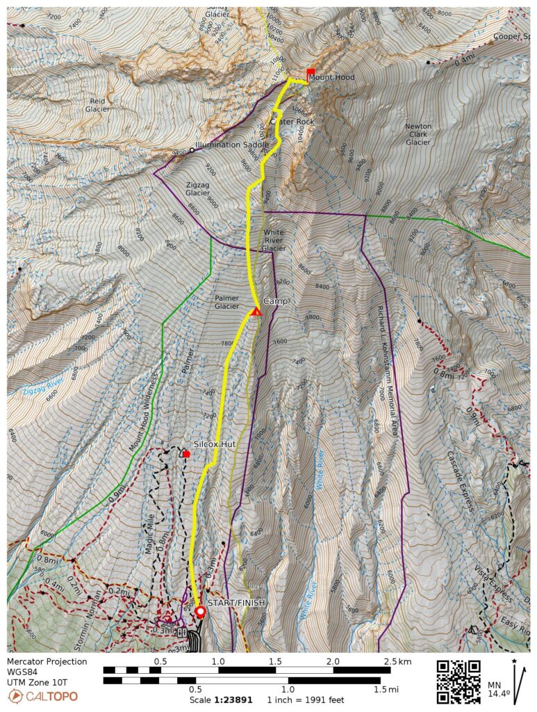
Starting & Ending Point: Timberline Lodge parking lot at end of Timberline Road (Elev. 5900 feet)
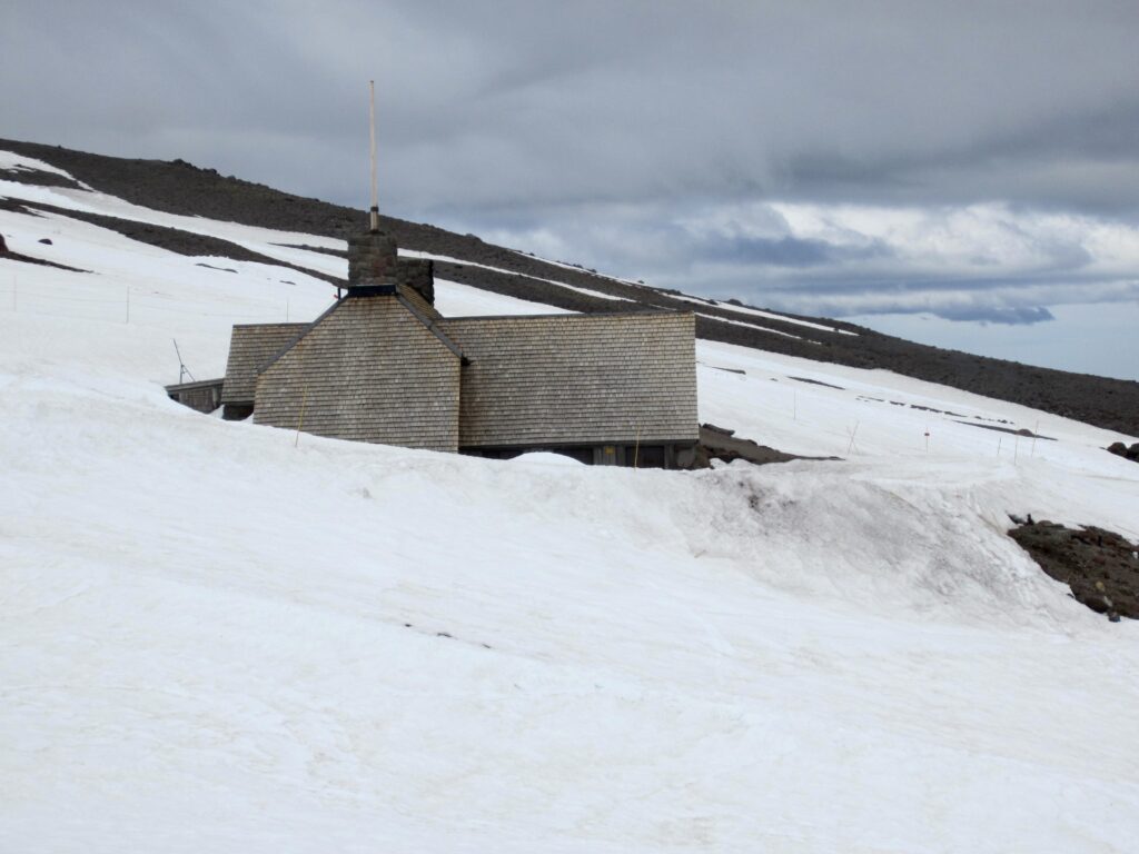
Way Points: Palmer Snowfield & Silcox Hut & East Palmer Cleaver (snow hike / ski ascent)
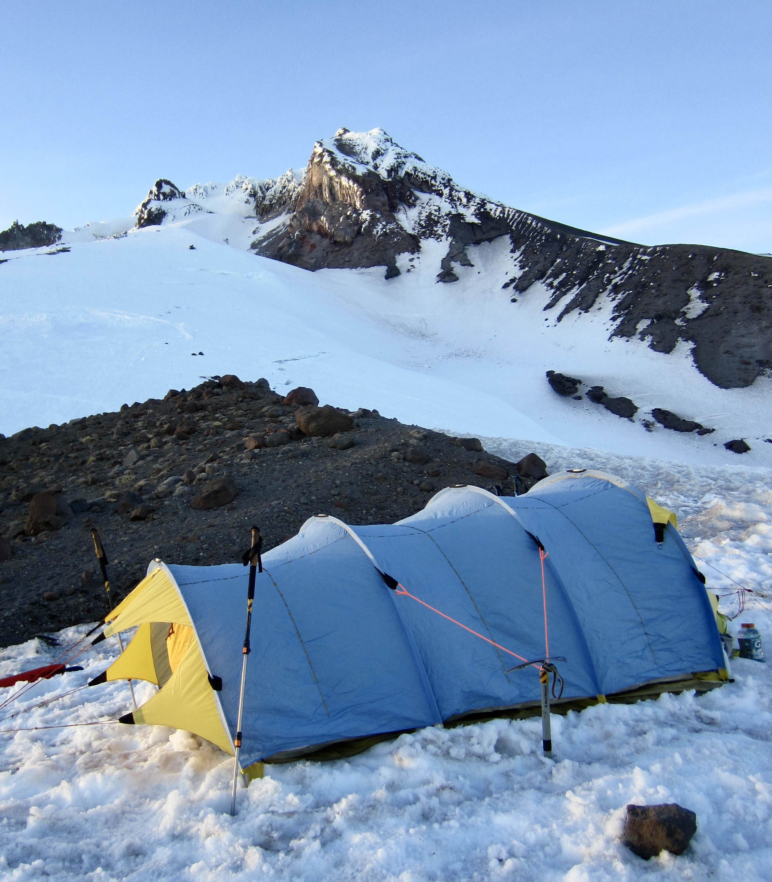
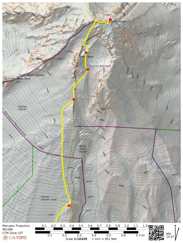
Campsite: East Palmer Cleaver at 8200 feet
Summit: Mt. Hood (snow climb via Upper Palmer Snowfield—Devil’s Kitchen—Mazama Chute—West Ridge)
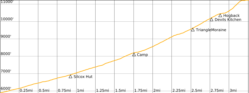
Approximate Stats: 6.5 miles traveled; 5400 feet gained & lost.
Related Post
>>> Mt Hood via Palmer Glacier—Hogback—South Chute – April 9, 1976
Trip Overview
Mt. Hood represents the undisputed topographic and spiritual king of the Oregon Cascades. From any vantage in Southwestern Washington or Northwestern Oregon, its striking countenance serves as an irresistible goal for mountaineers of any level. Various sources proclaim Mt. Hood to be the most frequently climbed glaciated peak in America, as well as one of the most climbed in the world. I don’t have any data to support such a claim, but from my limited observations, I really can’t dispute it.
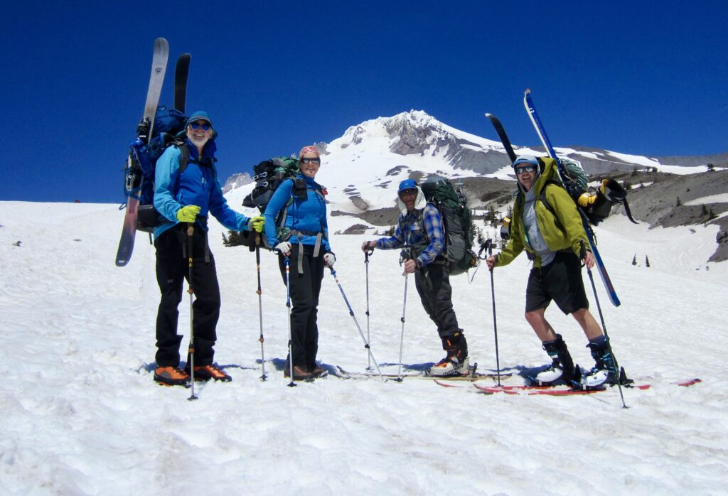
When I proposed a springtime climb of Mt. Hood to Eileen, Tony, and Andrew, they were all quick to sign on. For Eileen and Andrew, it would be their first time attempting this magnificent peak. For Tony, it would be his eighth attempt of the peak and, hopefully, his sixth successful climb. It would also serve as a staunch test of his recently reconstructed knee. For me, the climb would be an appropriate way to celebrate my 50th anniversary of mountaineering. Way back in 1975, during my high school stint, Mt. Hood was the first alpine peak I ever attempted. That initial attempt was unsuccessful, but I later managed to reach the summit in 1976 and 1998.
Our strategy for this year’s climb was a bit unusual. Rather than attempting a traditional one-day ascent and descent from Timberline Lodge, we planned to take two days, with a high camp around 8400 feet. Day 1 would involve riding the Magic Mile and Palmer chairlifts up to camp and then spending a few hours enjoying some lift-assisted skiing on the Palmer Snowfield. Day 2 would involve climbing the peak, booting or skiing back to camp, and then skiing down to Timberline Lodge. It was an excellent plan until it blew up.
Full Trip Report
Day 1 (AM): The Logistical Bombshell
Eileen, Andrew, and I left Seattle at 7:00am on a sunny Tuesday. Tony, who was coming from Portland, was planning to meet us at Timberline Lodge later in the morning. Everything seemed to be in place for executing our ski-and-climb strategy. But then we got Tony’s bombshell text message: The Magic Mile and Palmer chairlifts are closed today due to high winds. WHAT!!? How could this be? There were no high winds in the forecast! Improbable as it seemed, our excellent plan suddenly got tossed out the window.
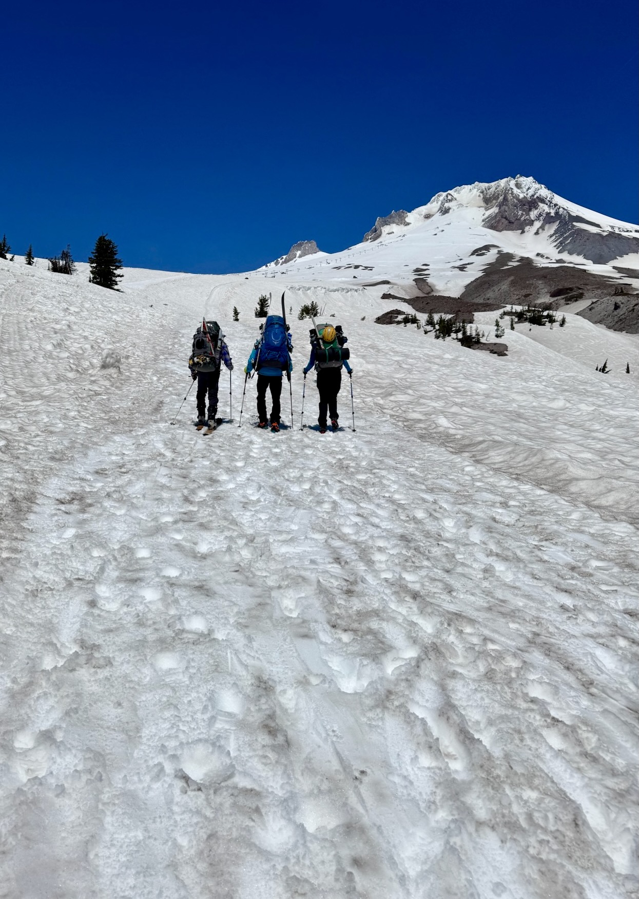
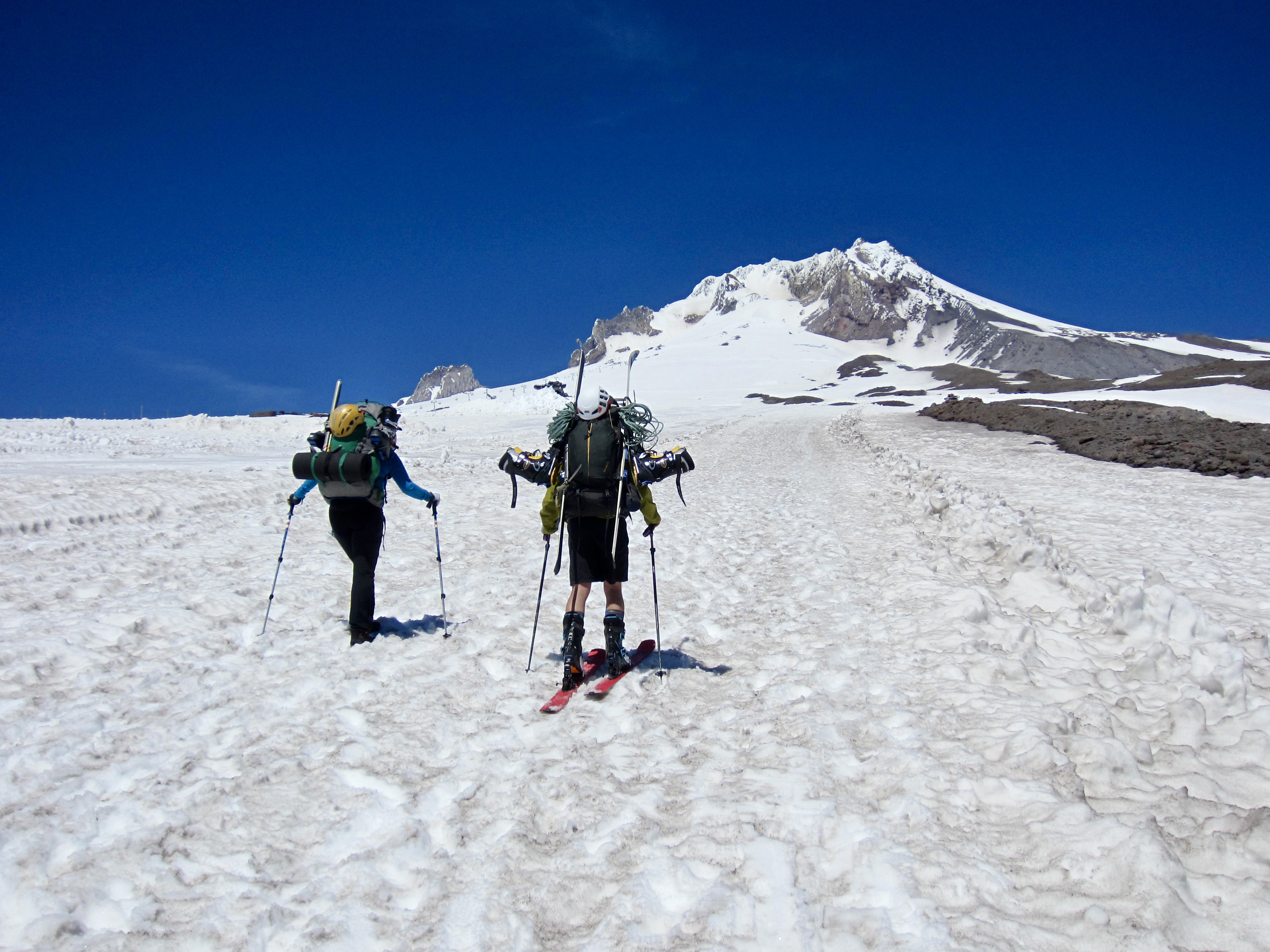
Upon meeting Tony in the Timberline Lodge parking lot at 11:30am, we discussed our options and contrived a new approach strategy. Tony and Andrew, both of whom had brought alpine-touring ski gear, would skin up to our campsite. Eileen and I, on the other hand, would boot up to camp, given that she had brought alpine-downhill gear and I had brought telemark-downhill gear.
After weighing packs and redistributing gear, Andrew ended up carrying my skis and boots, thereby putting his pack weight at a formidable 65 pounds. Meanwhile, I carried Eileen’s skis, putting my pack at a hefty 54 pounds. Schlepping heavy downhill ski gear up to camp was not an appealing proposition, but at least all of us would be able to ski back down to the lodge tomorrow.
.
Day 1 (PM): The Campsite Approach
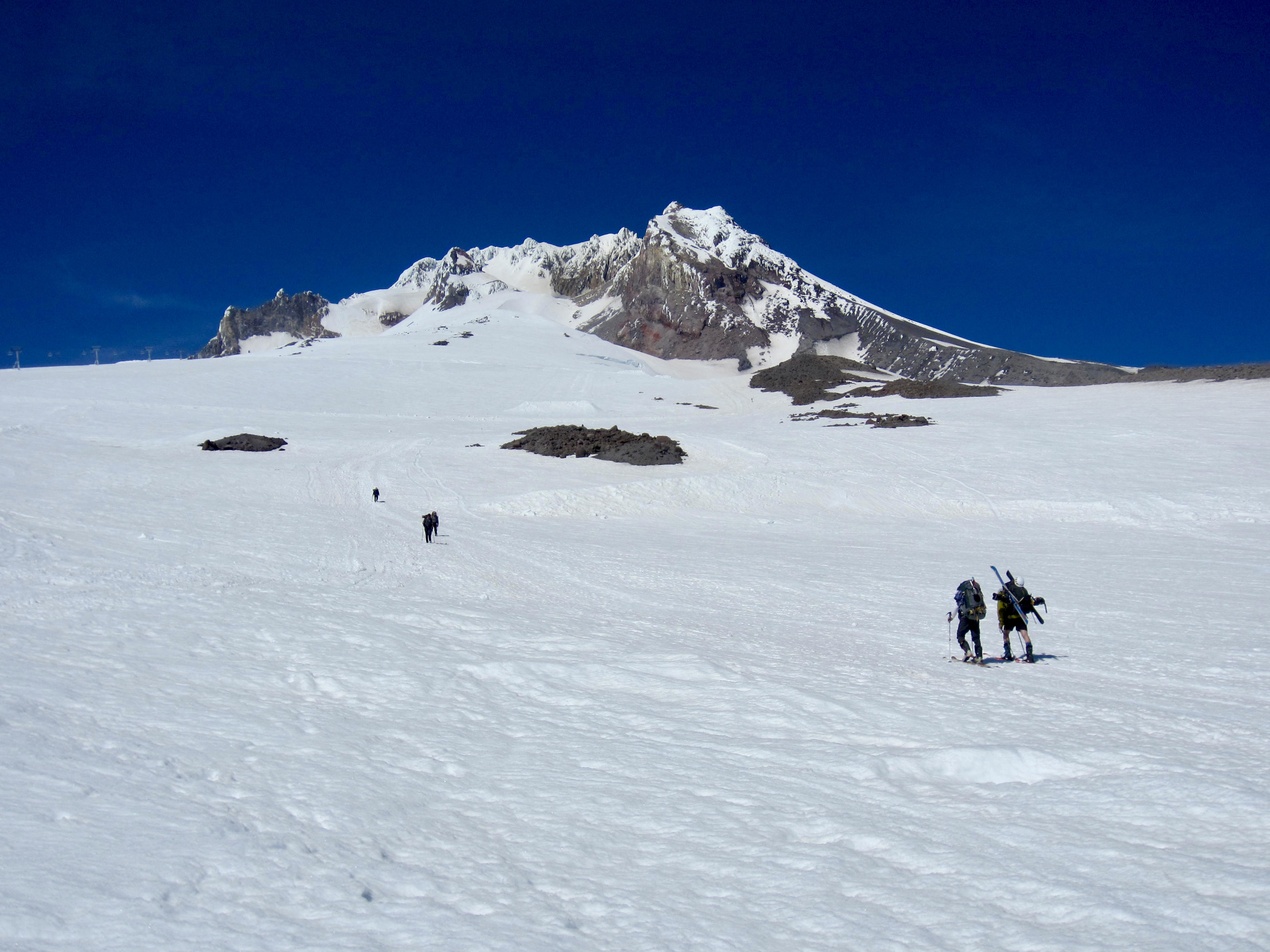
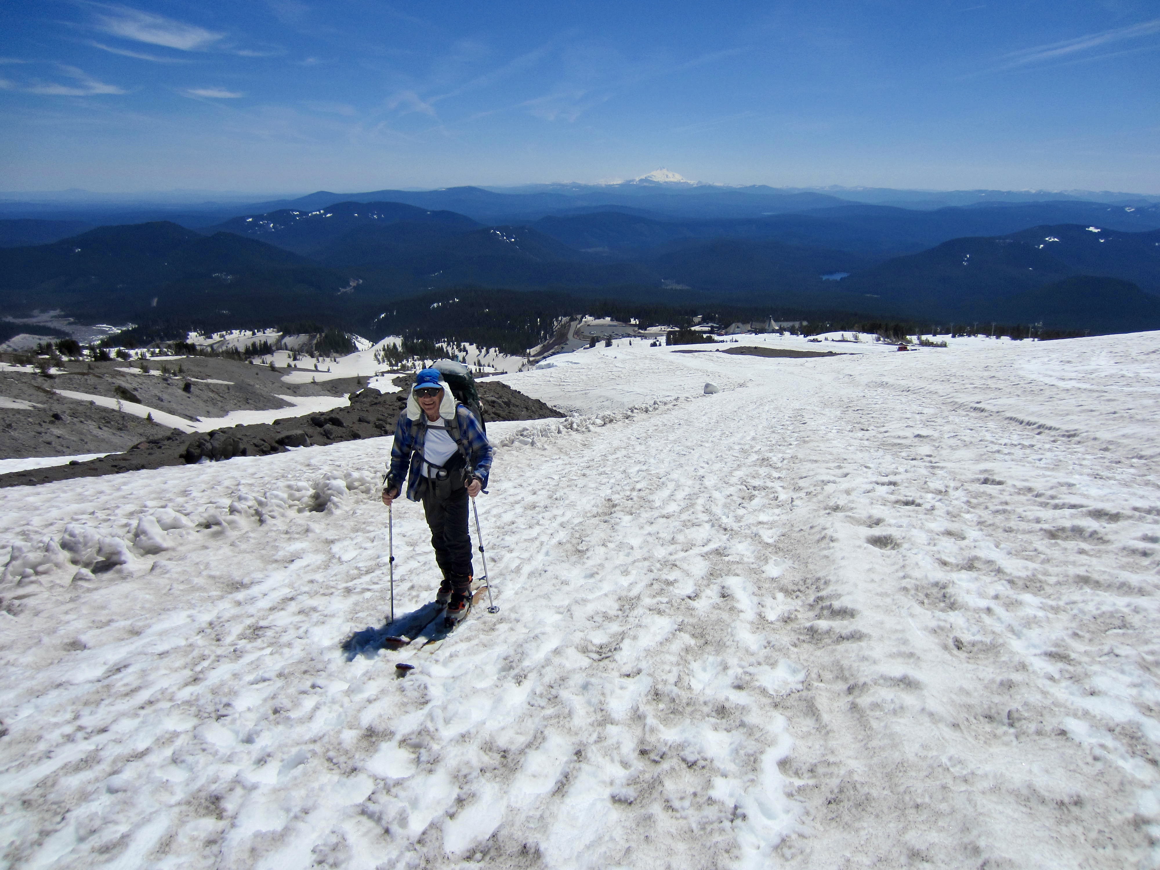
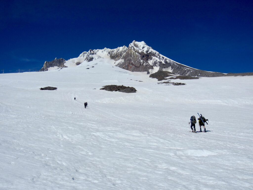
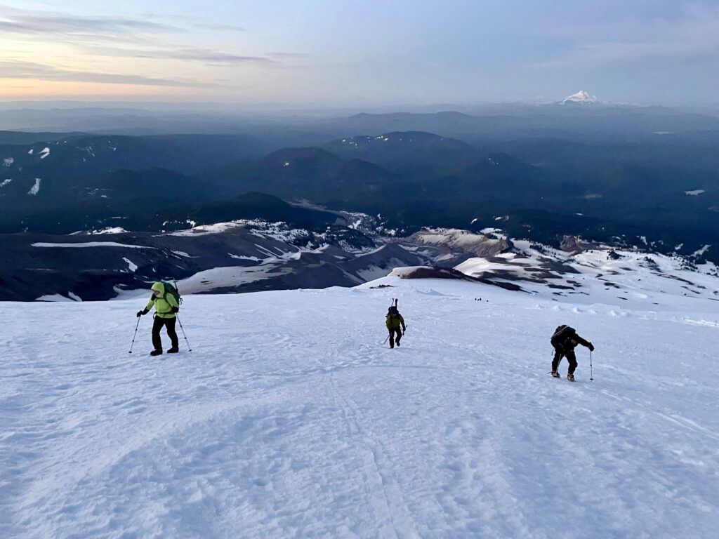
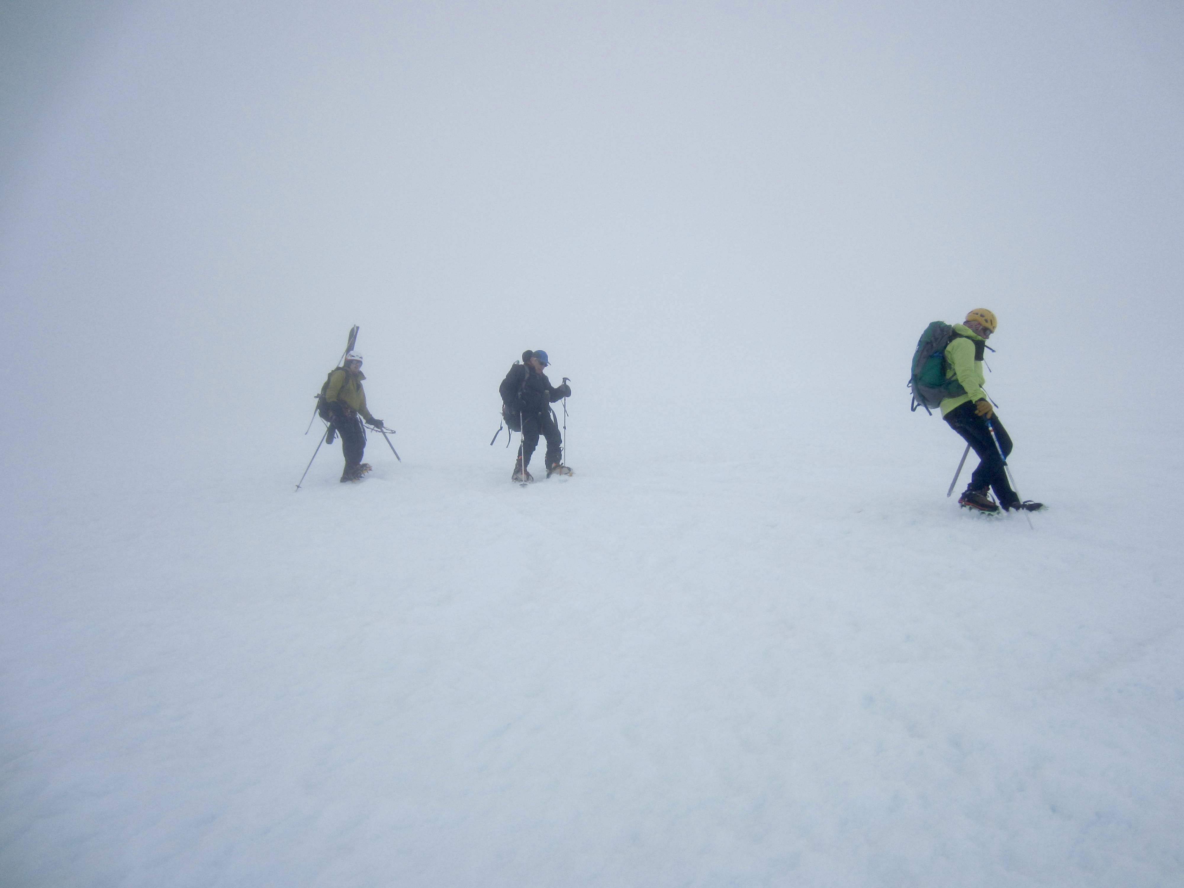
We began skinning or booting up the marked climber’s route in early afternoon. It was a relief to find that snow conditions were very good for both modes of transit, so we made consistent progress up the Palmer Snowfield. There was a steady stream of climbers heading down from the summit, and they all reported favorable conditions higher on the mountain. Things seemed to be back on track now.
.
.
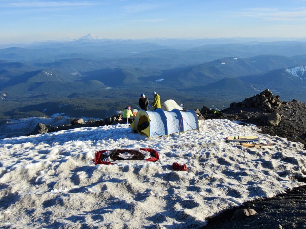
In late afternoon, we found a suitable campsite on the East Palmer Cleaver at 8200 feet (3.7 hours + 2300 feet from parking lot). There were several small tent pads and a patch of flat snow here but no running water, so it was necessary to melt snow.
.
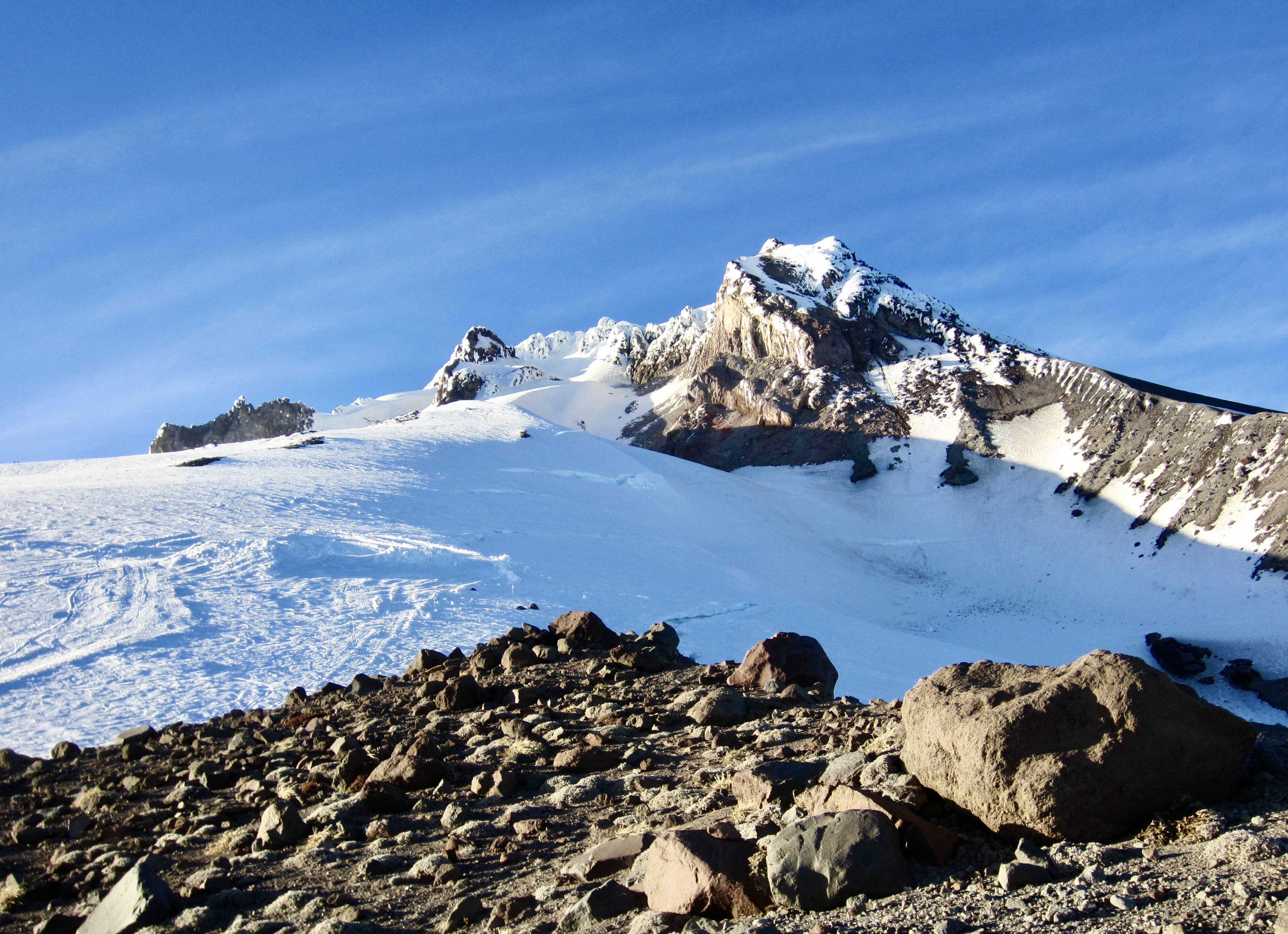
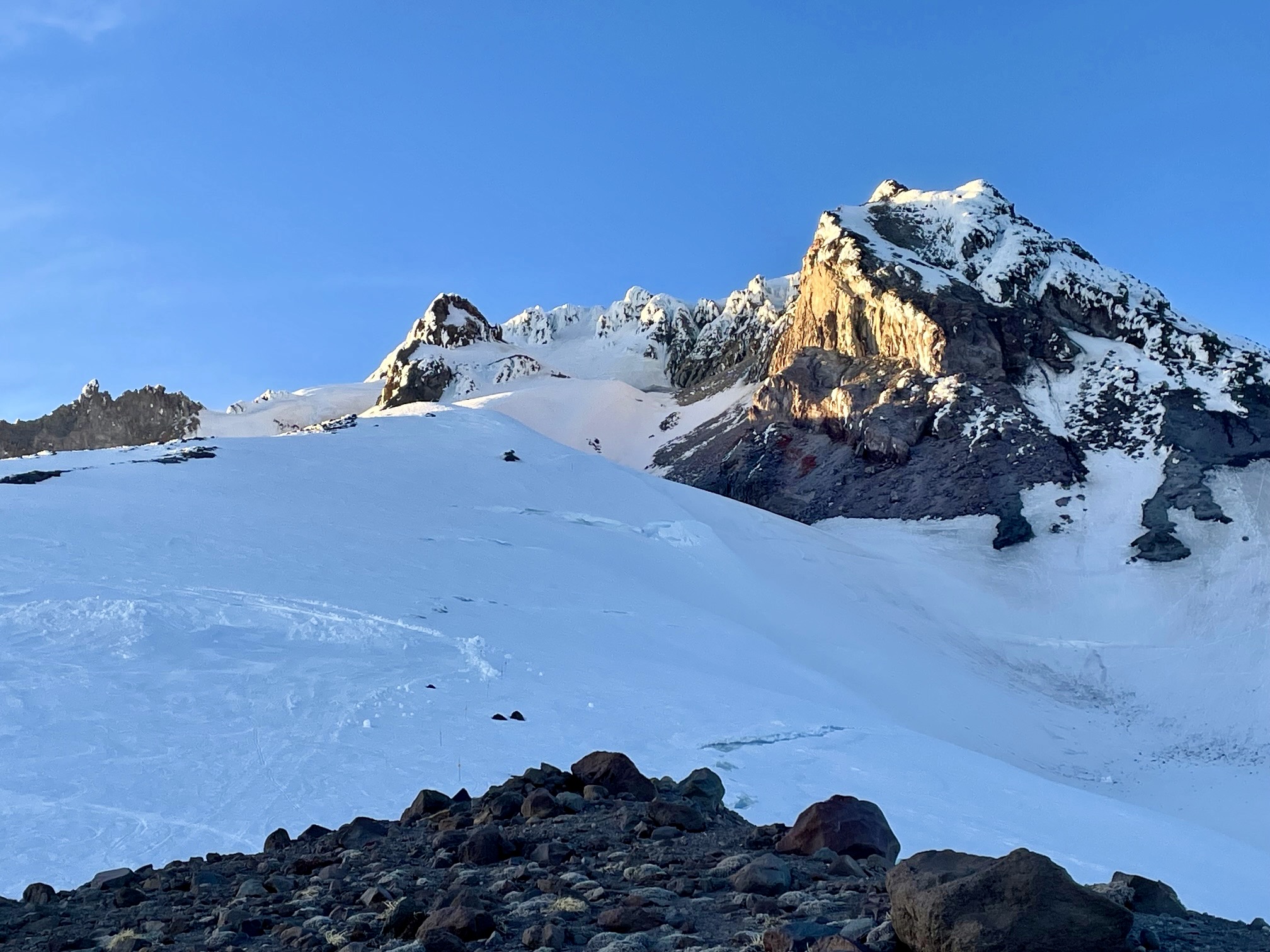
Directly above camp was Mt. Hood’s craggy summit crown, with its rime-plastered array of volcanic horns and ridges. Over to the west were the towers and seats of the Palmer chairlift. Given the meager breezes that we’d experienced all day, we found it extremely annoying to know that the lift had been closed due to “high winds.” In fact, the entire evening was freakishly calm for such an exposed location. Sheesh!
.

.
By 8:30pm, we had all retired to our tents and then gradually dozed off while being serenaded by the distant roar of snowcats on the Palmer Snowfield. Apparently, these snowcats spend 24 hours per day grooming and moving snow so that lift-skiing can continue into July.
Day 2 (early AM): The Summit Climb
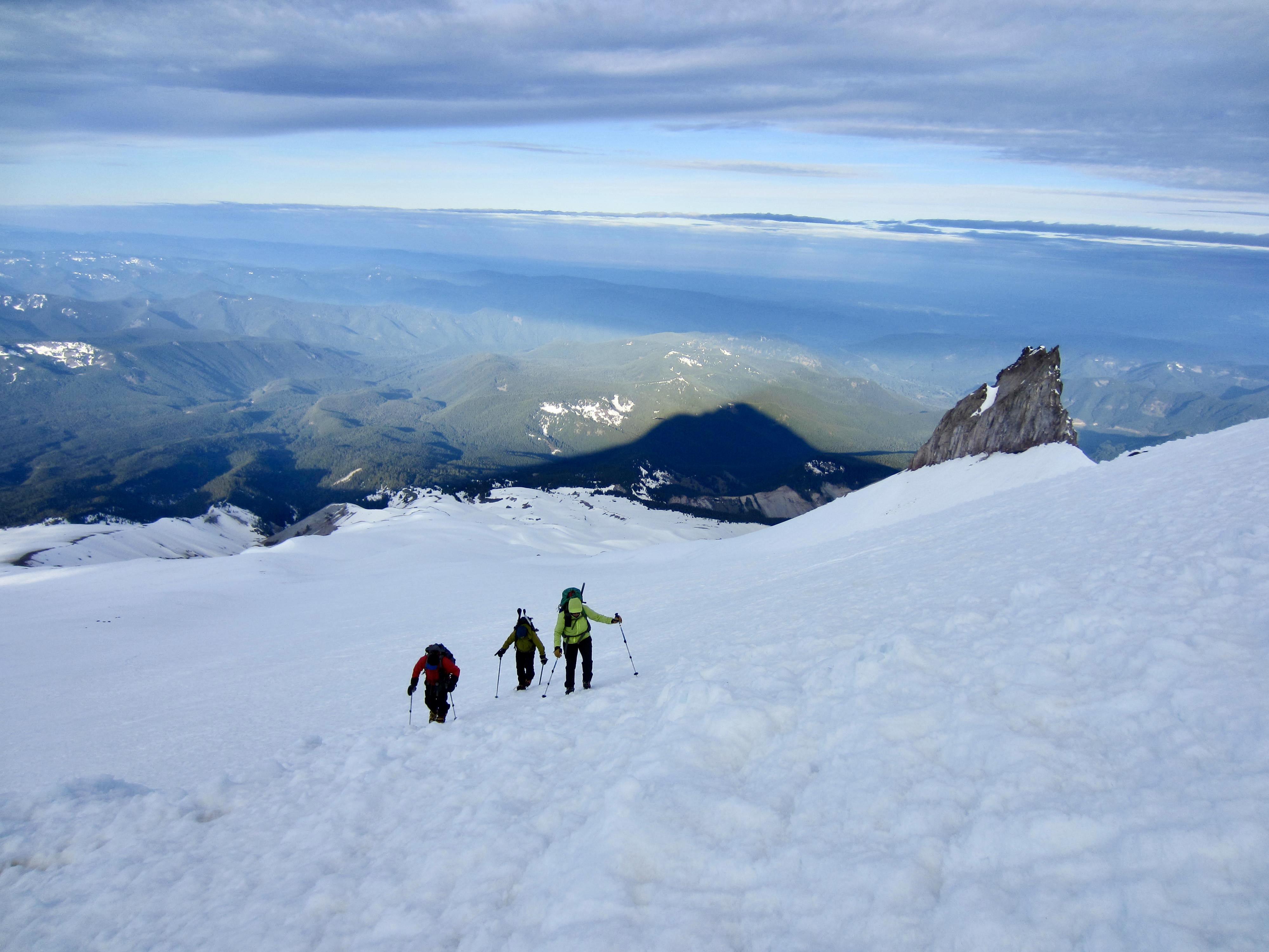
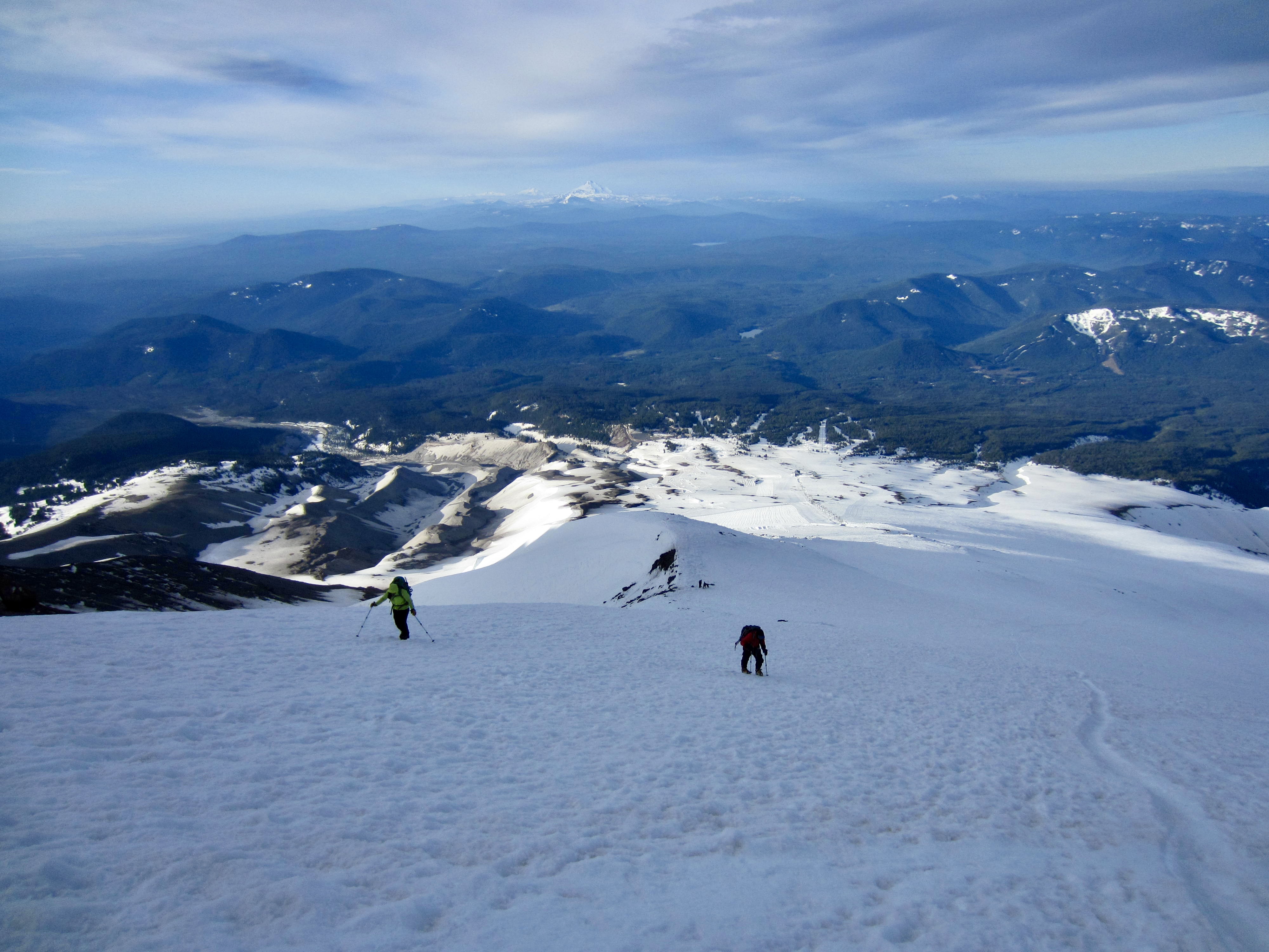
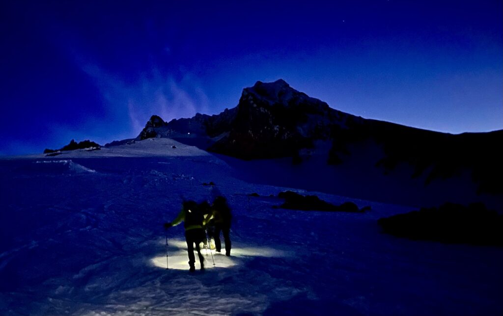
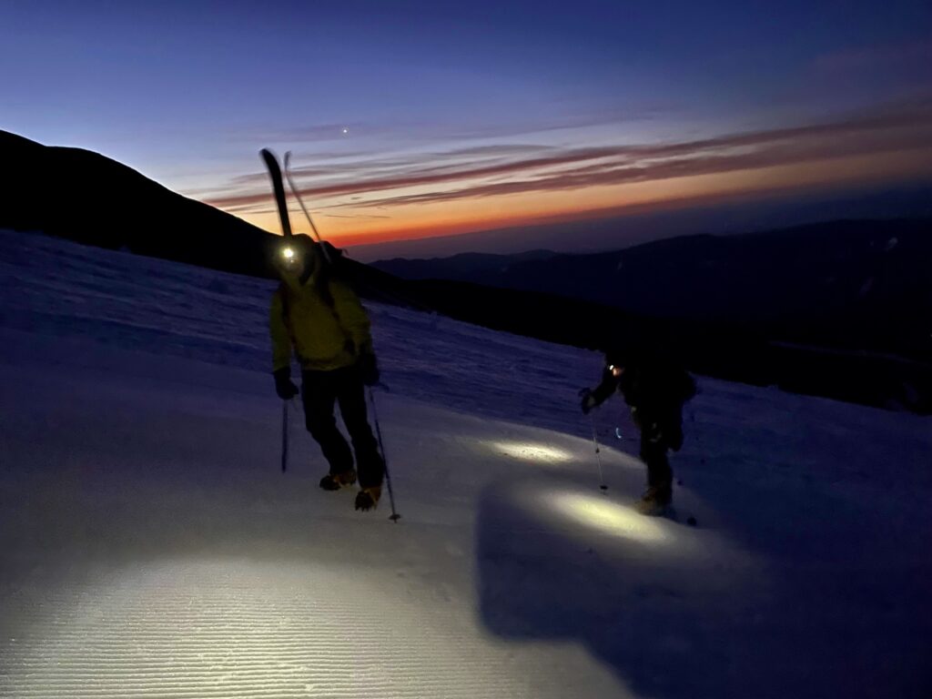
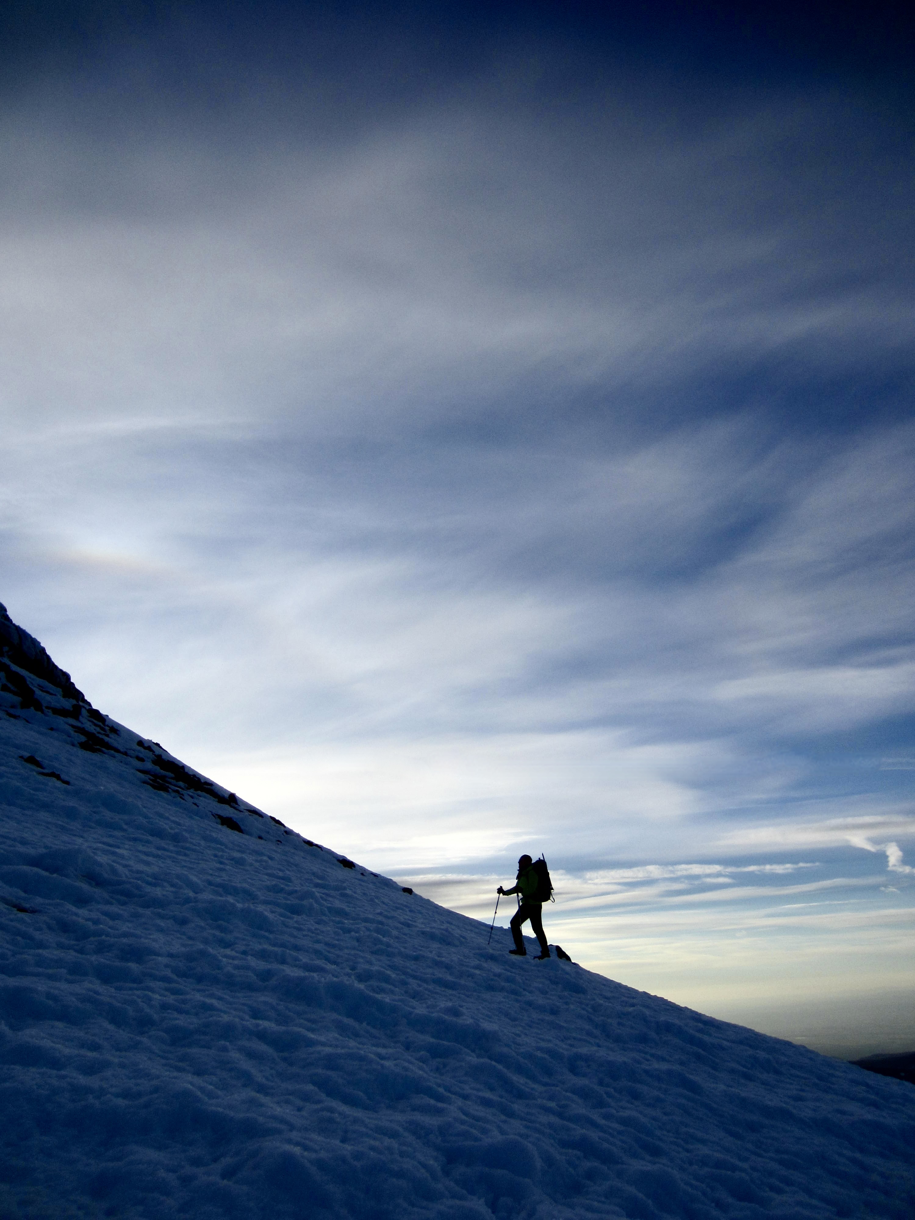
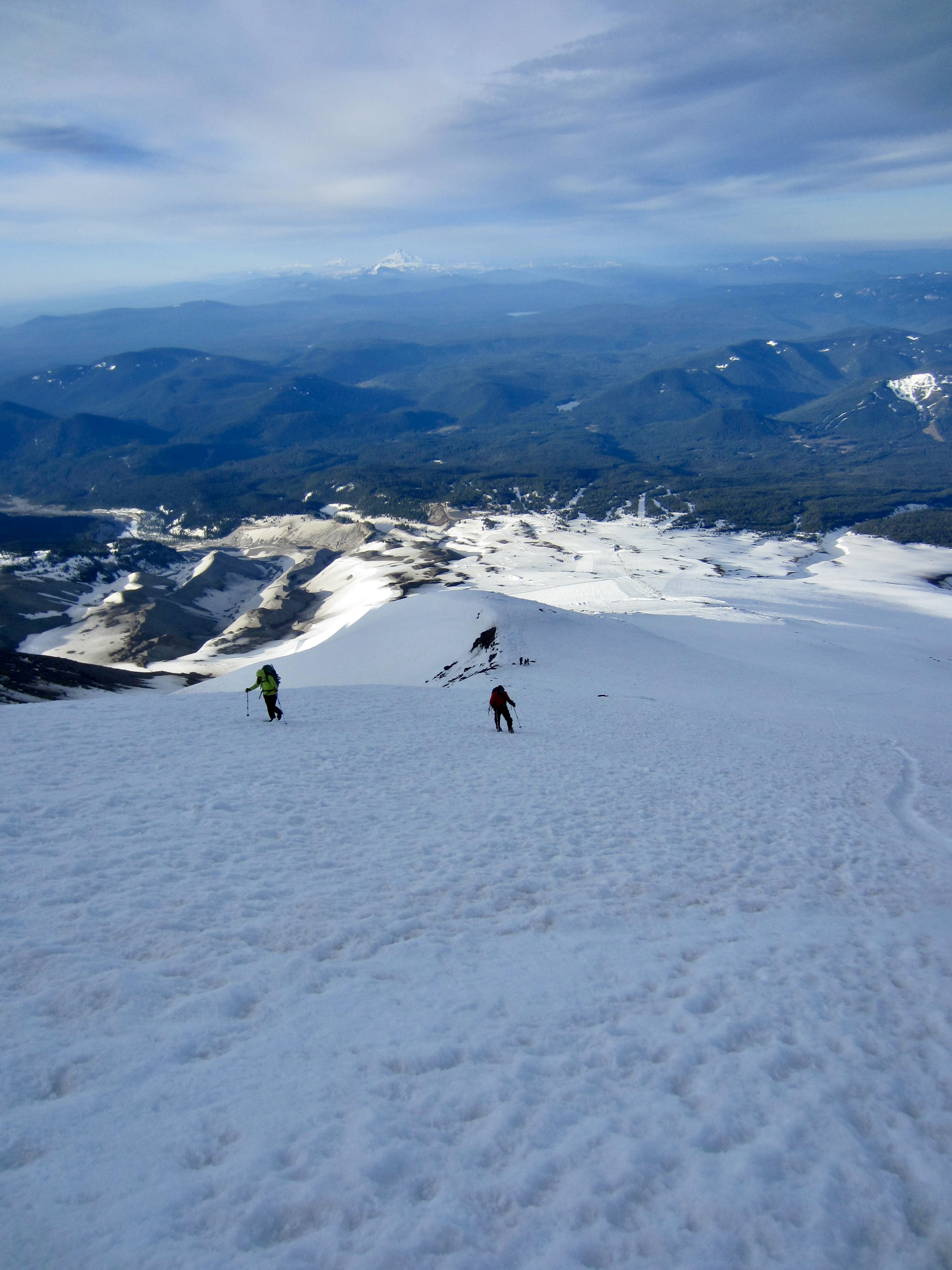
Strong westerly winds picked up after midnight, such that a frigid gale was blowing through camp when we awoke at 3:30am. After getting suited up, eating a hasty breakfast, and loading summit packs, we were underway at 4:45am. The tiny dots of climbers’ headlamps could be seen far up and down the dark mountain. It appeared that we were near the middle of today’s pack train.
.
The snow surface had frozen hard overnight, so crampons were needed from the start. Because Tony was hoping to ski down the lower part of our climbing route, Andrew graciously carried his skis uphill; the rest of us left our skis in camp.
.
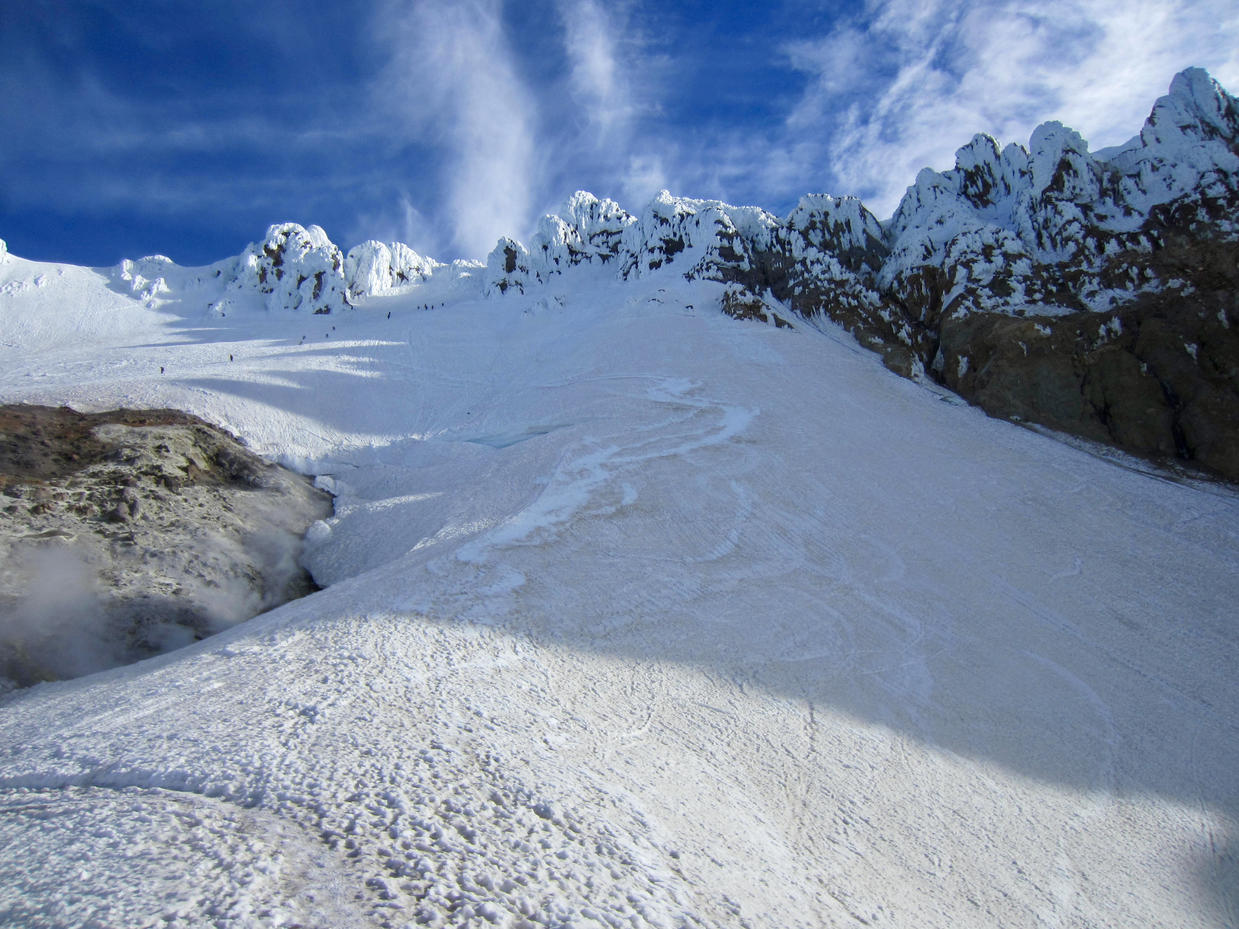
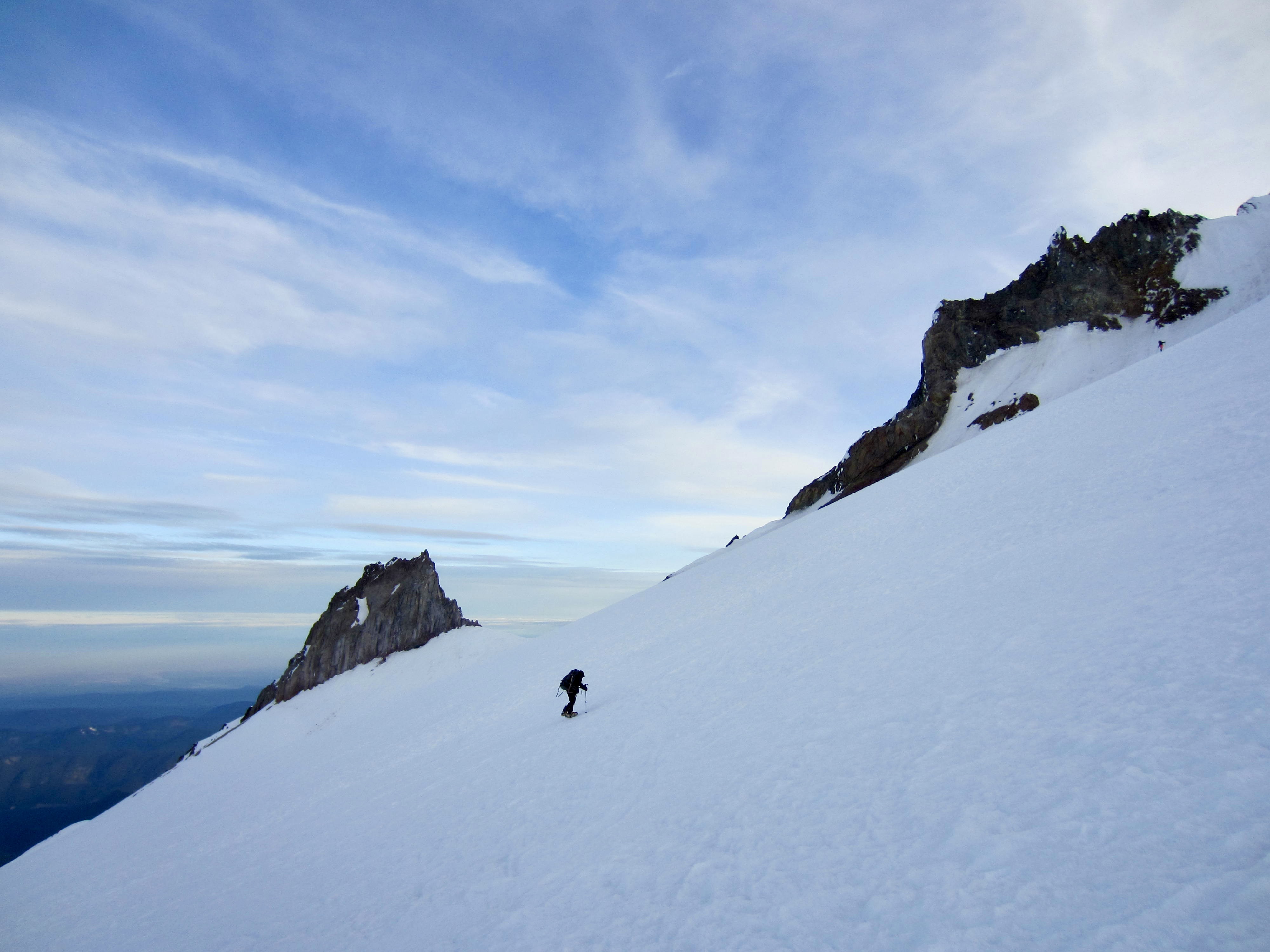
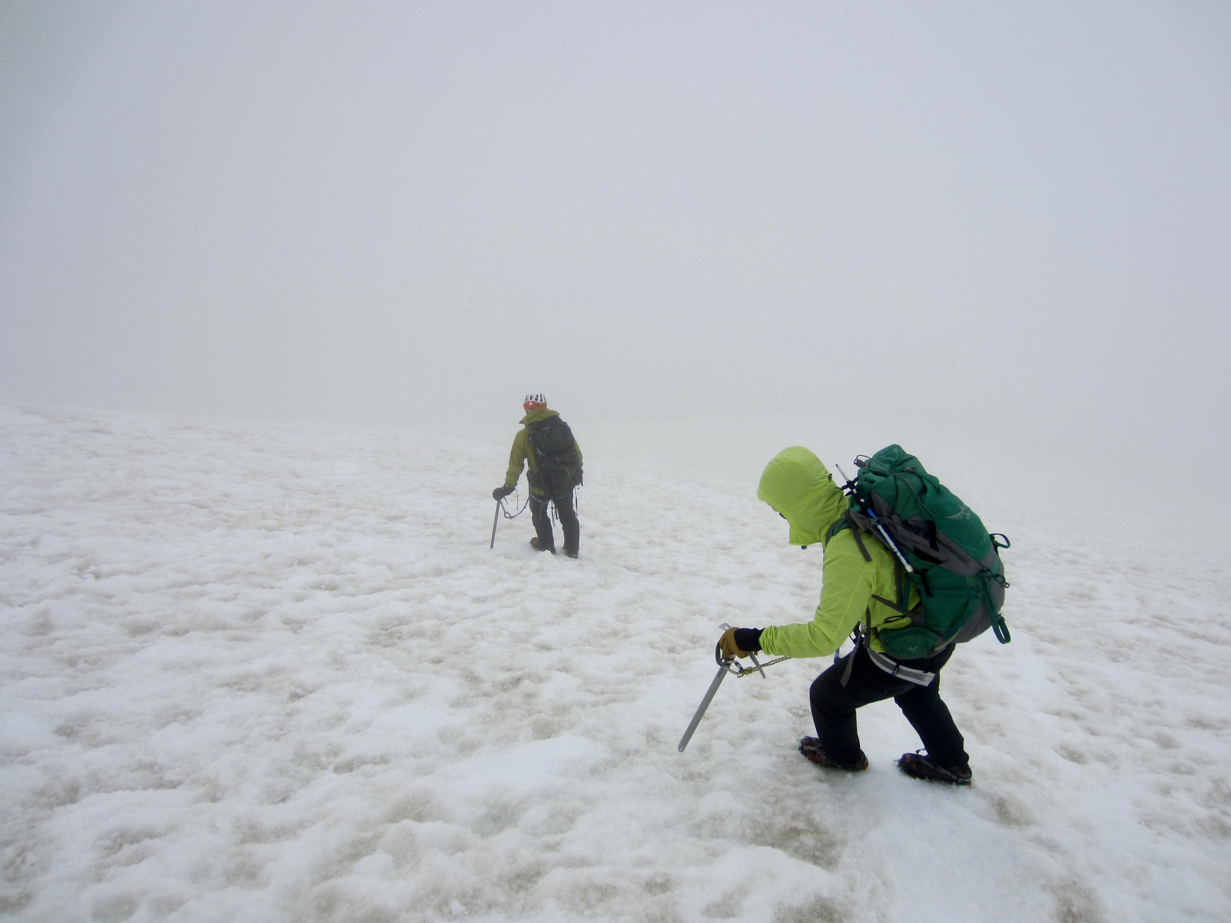
By the time we climbed above the highest extent of groomed snow, it was light enough to dispense with headlamps. We steadily worked our way up the Palmer Snowfield and across the top of the Zigzag Glacier. Neither of these ice bodies appear to be thick enough anymore to develop plastic flow at depth, so crevasses were nonexistent. Sad but convenient.
.
.

.
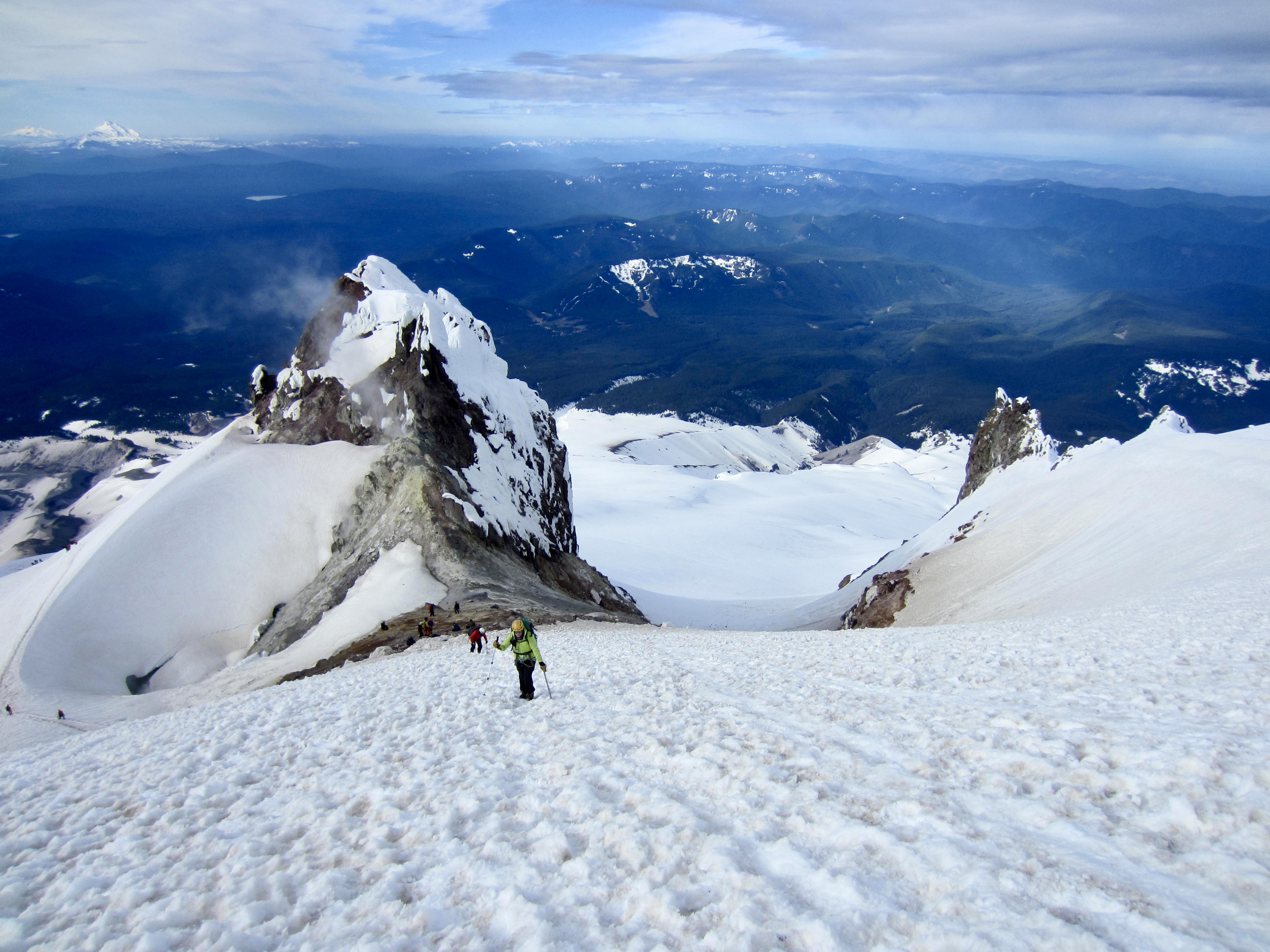
When our elevation rose to match the base of Crater Rock, we could clearly see the summit ridge above. Tony and I both noticed the reduced snowcover compared to previous years. My “then & now” photos below show this change from May 1998 to May 2025.
.
.
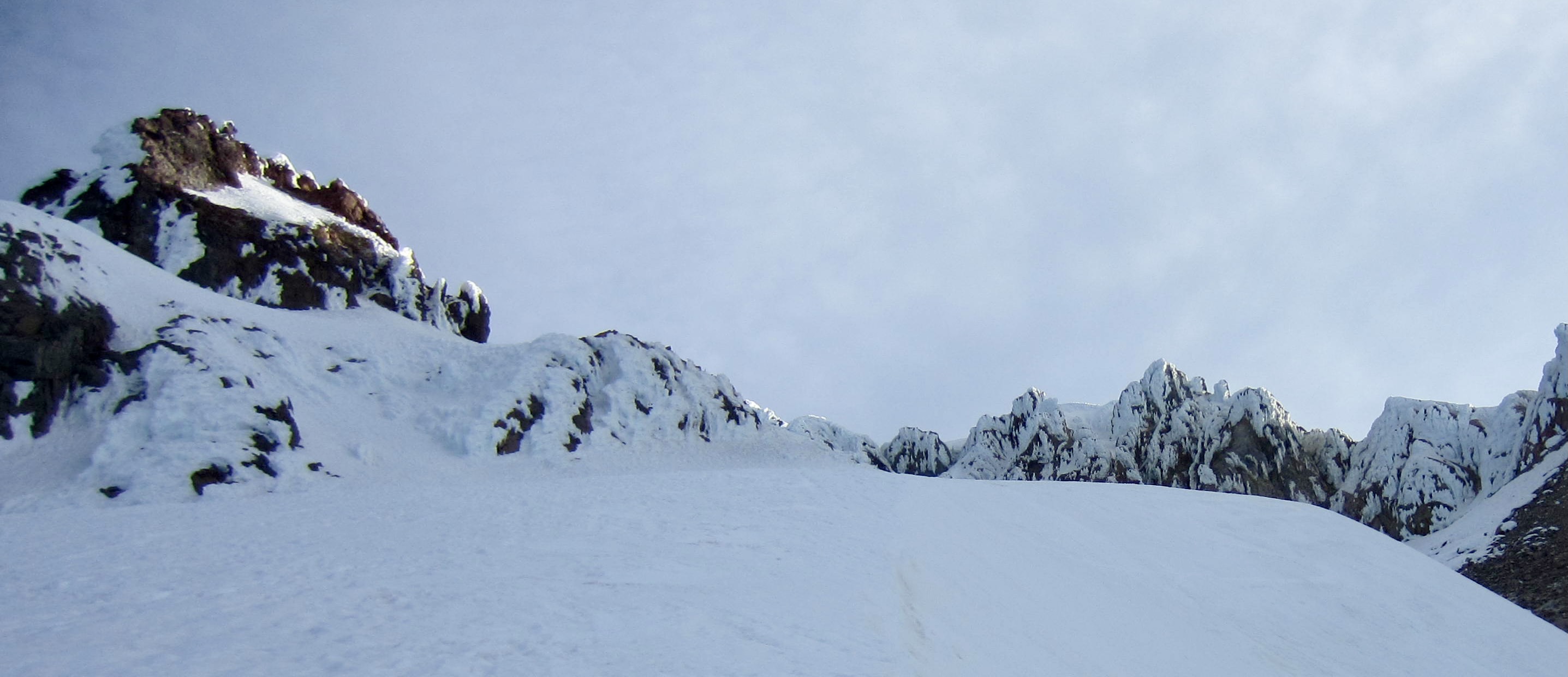
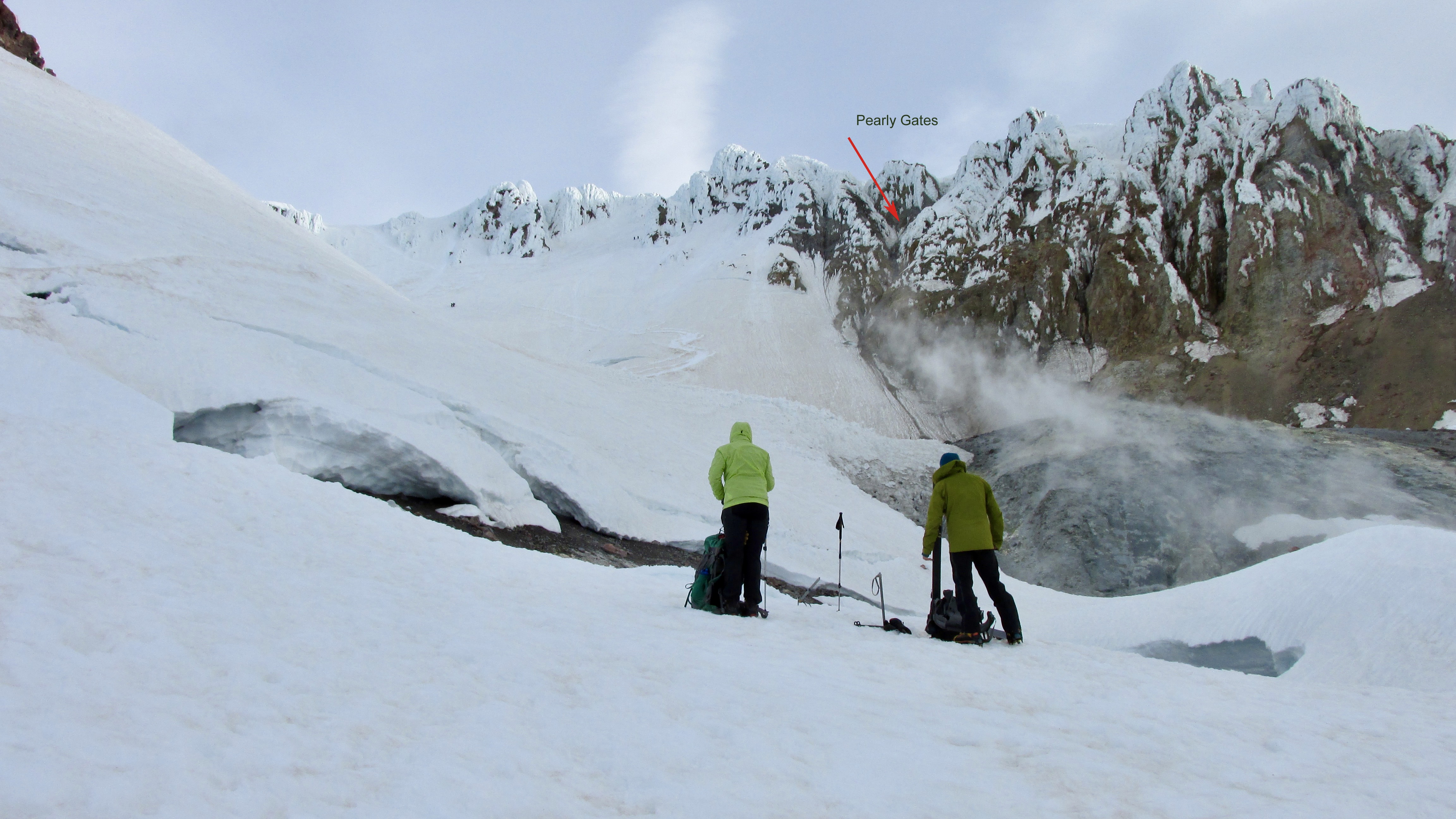
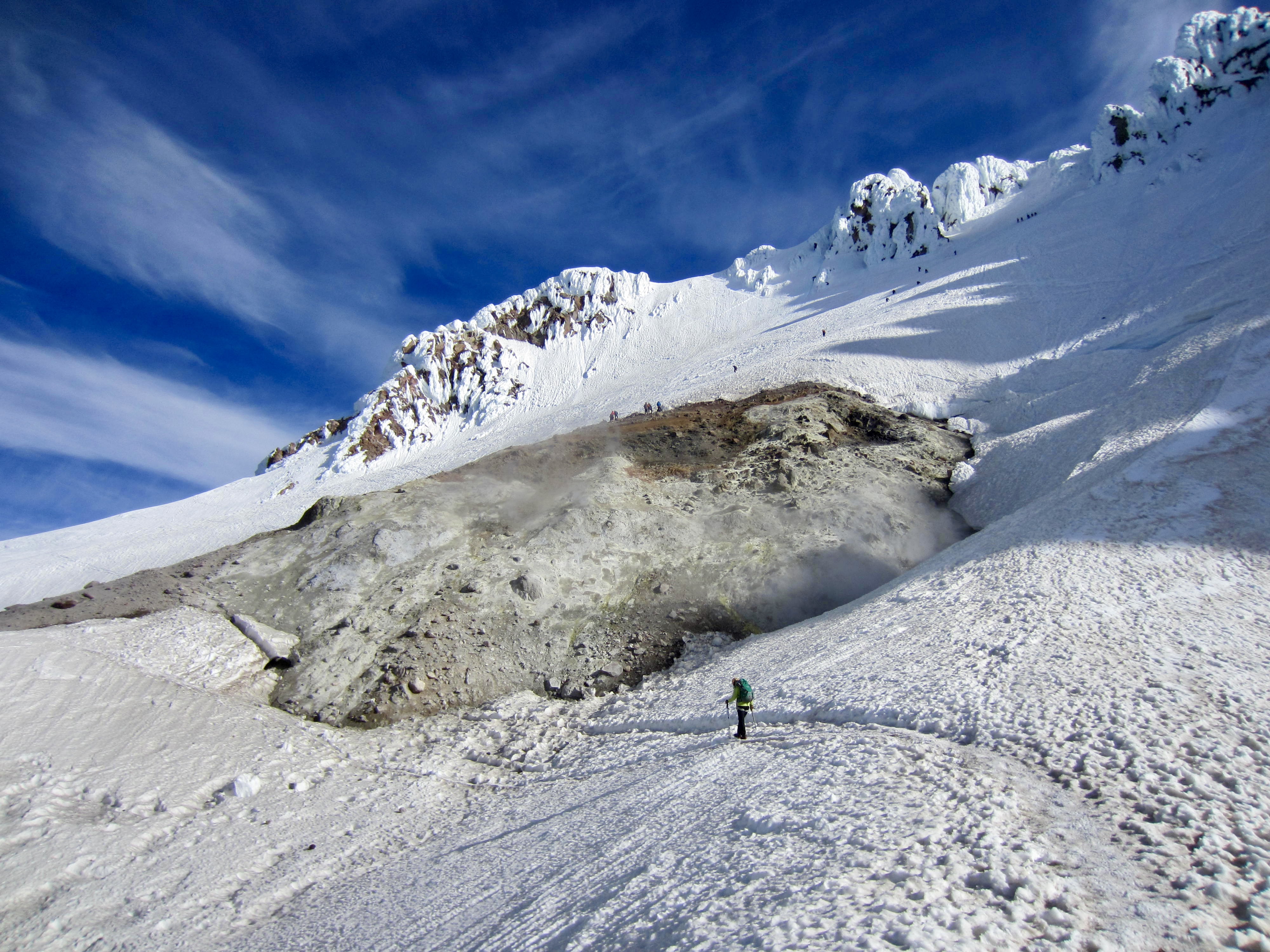
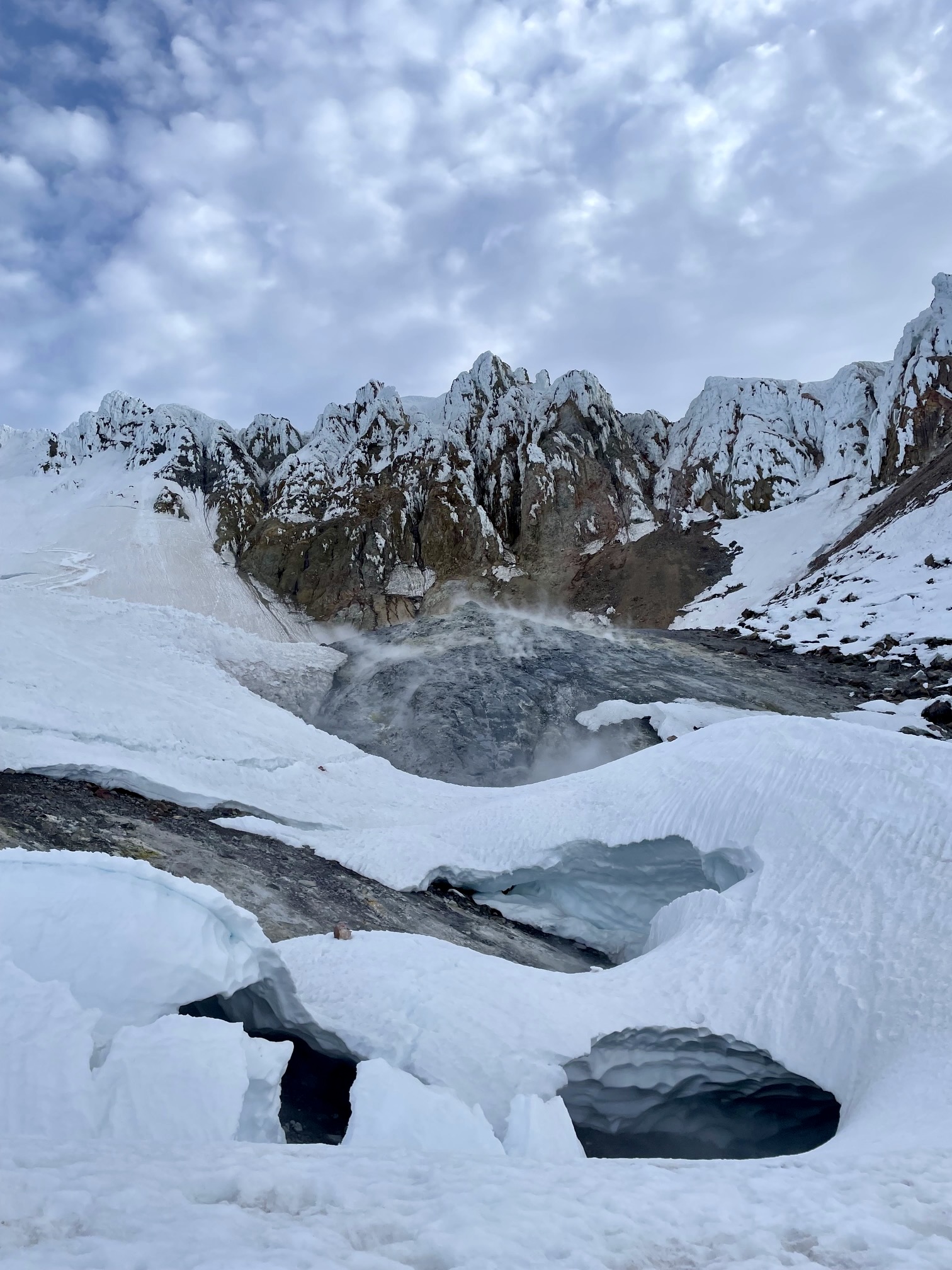
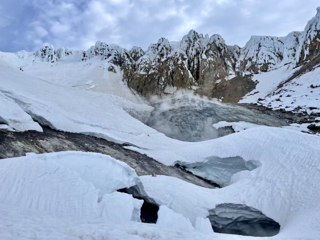
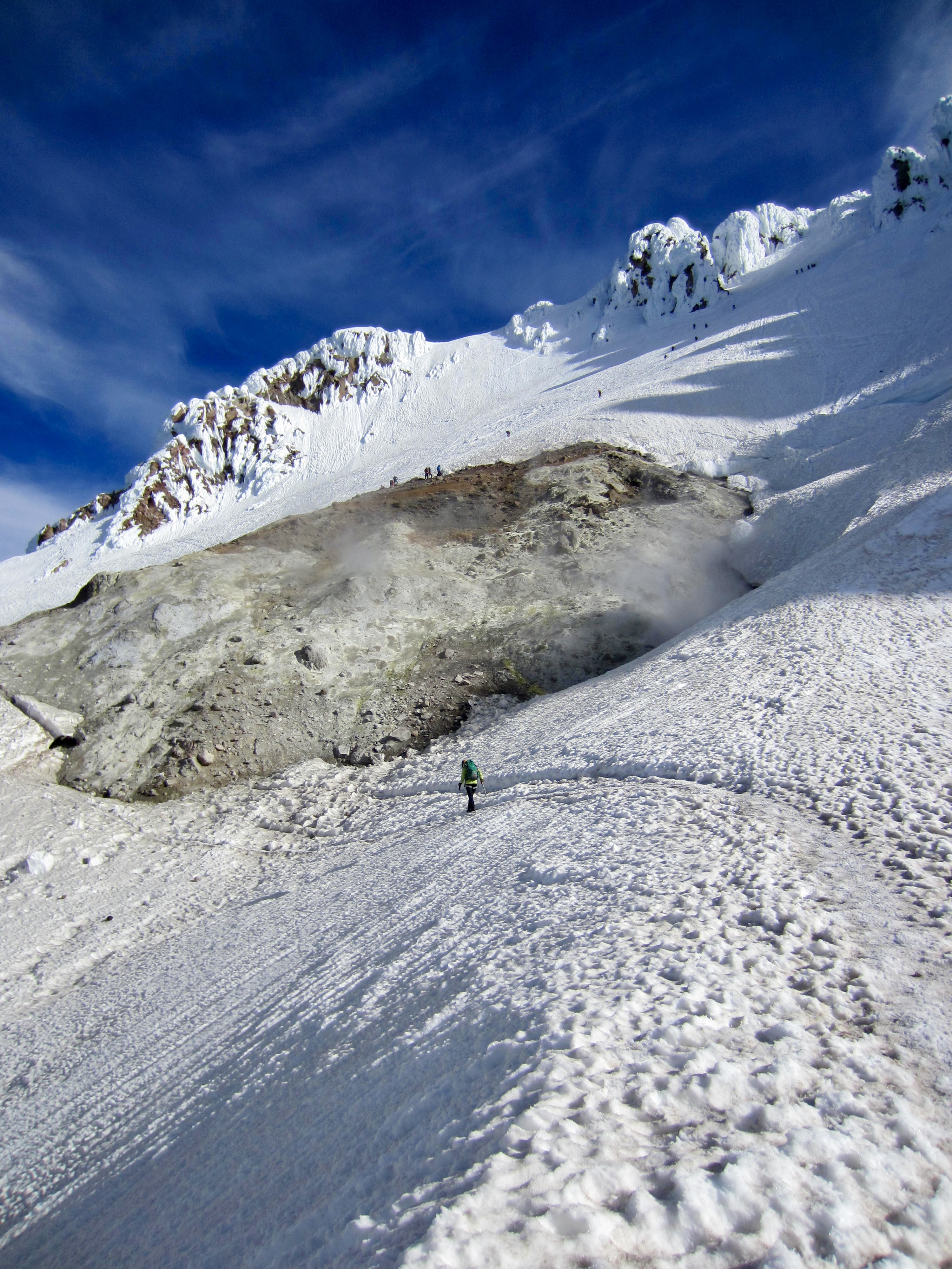
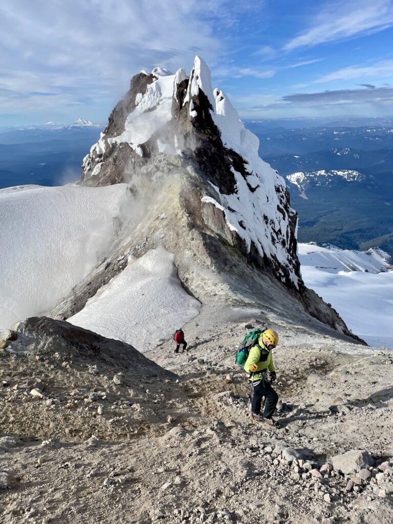
Shortly before 7:30am, we arrived at Devil’s Kitchen (2:40 + 2000 feet from camp). This appropriately named feature comprises a cluster of volcanic fumaroles that emit clouds of water vapor and foul-smelling sulphur gas. If you are easily nauseated, this is not a good place to linger!
.
.
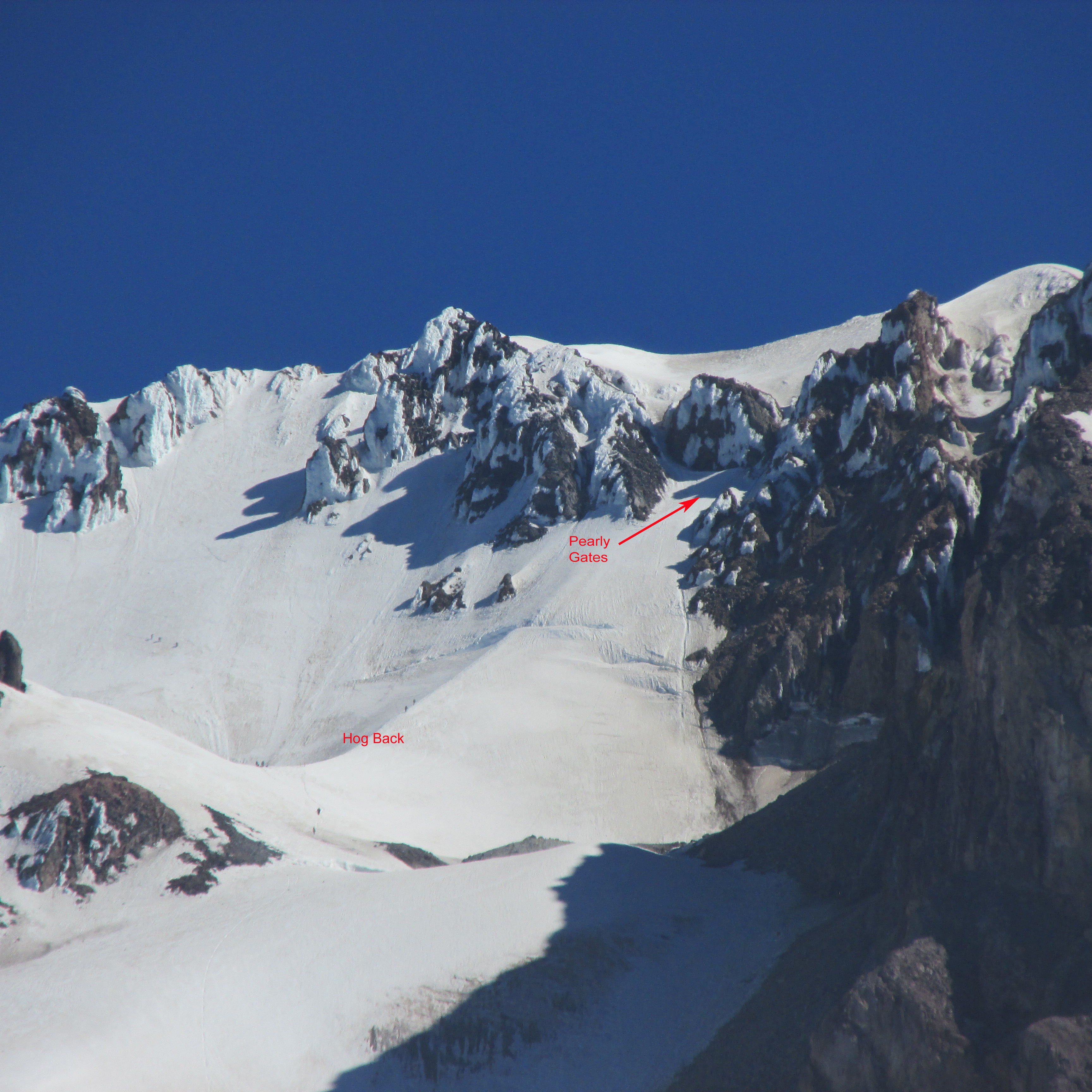
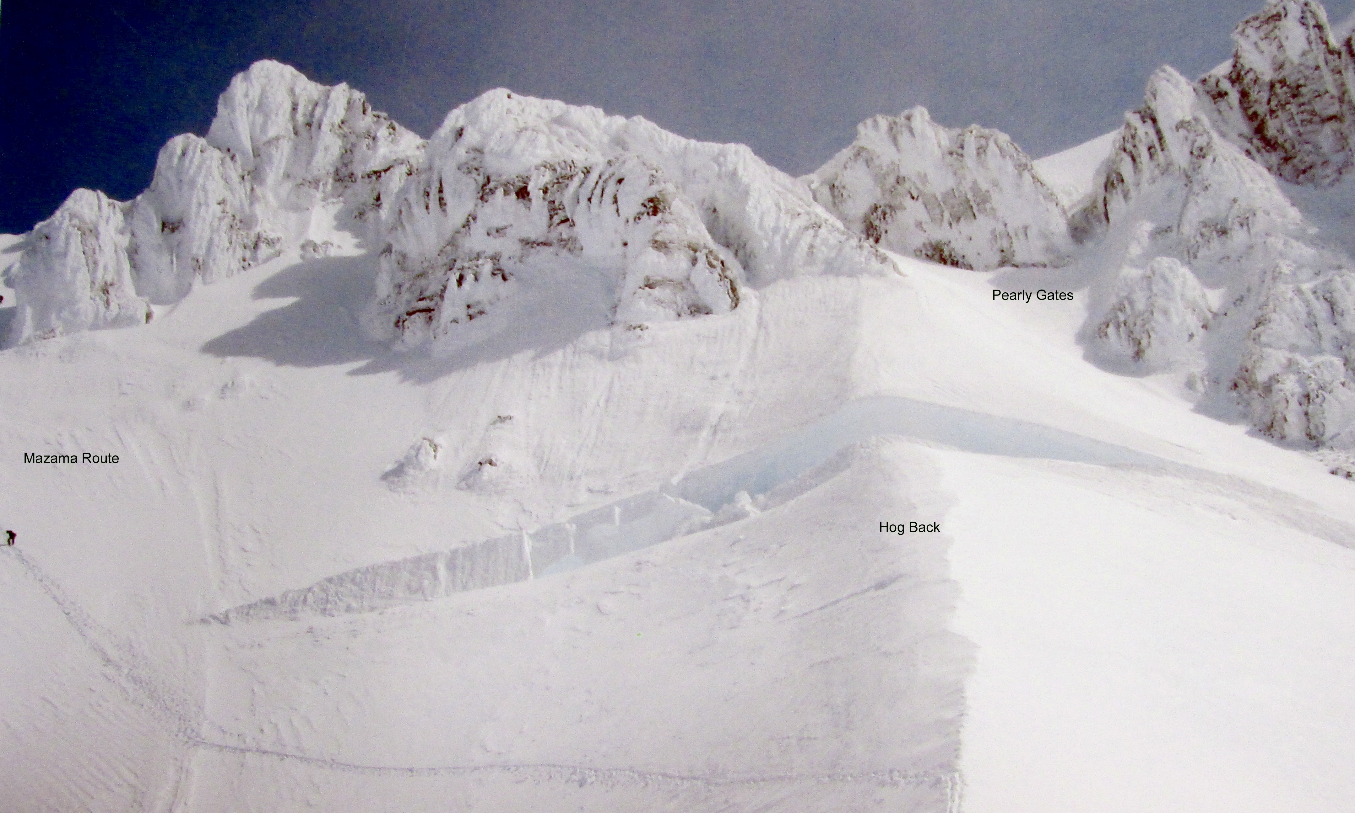
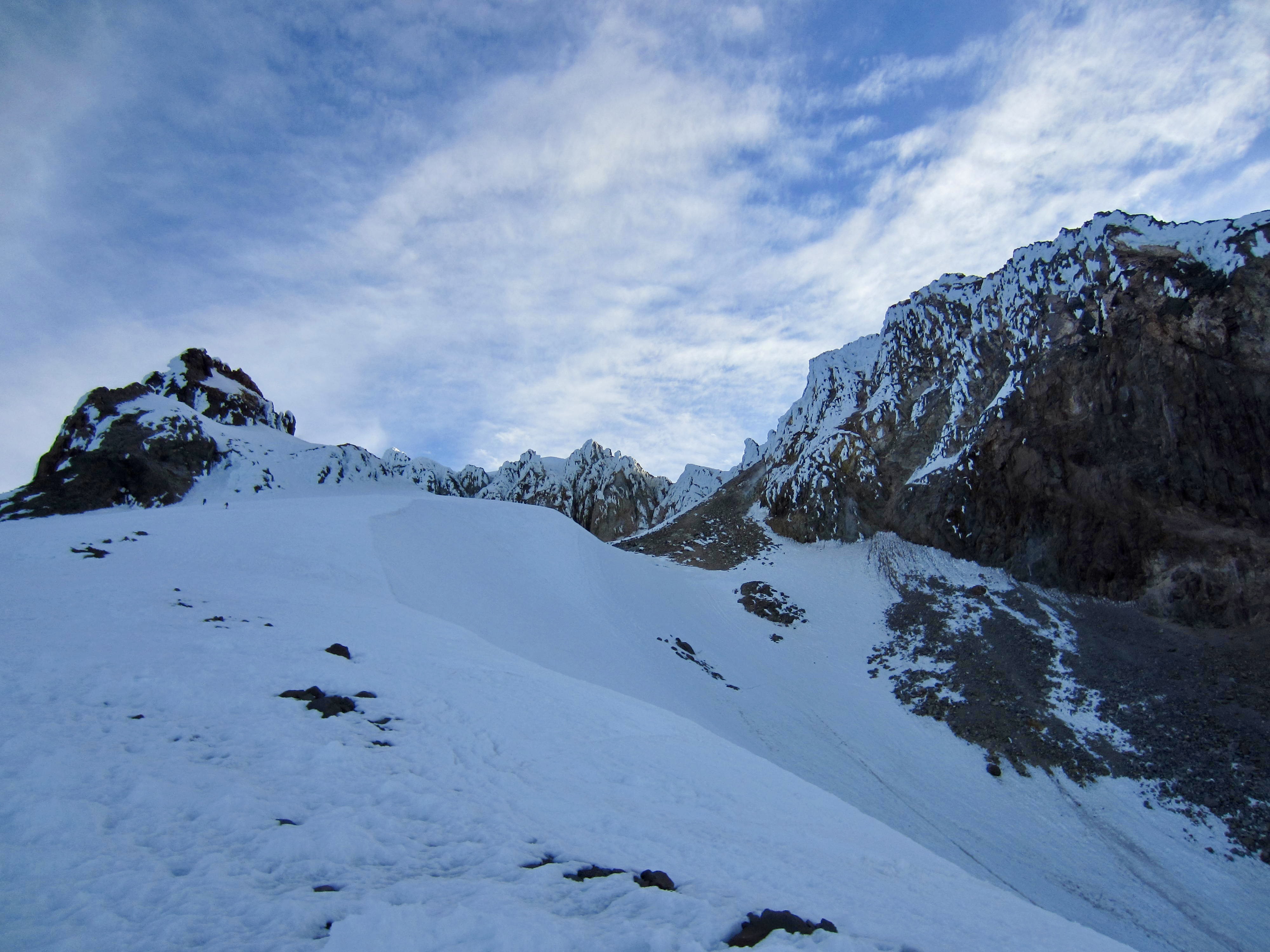
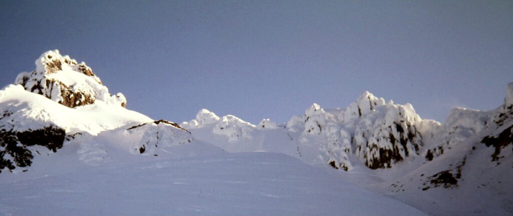
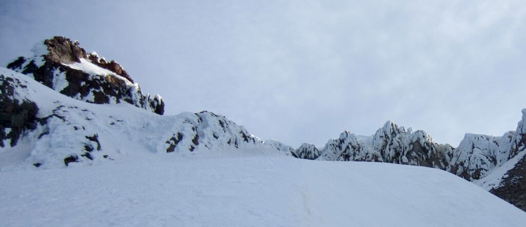
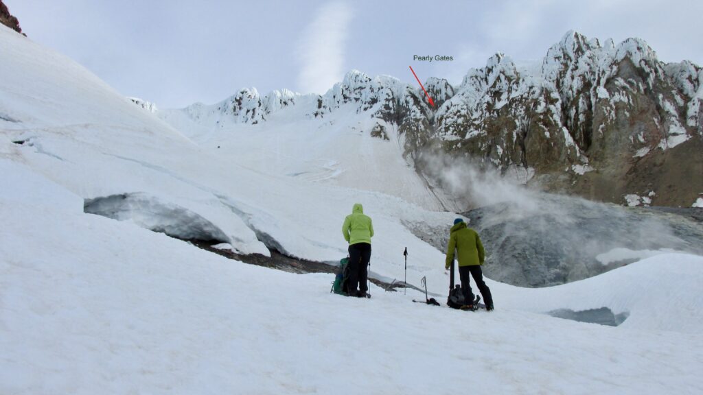
Standing at Devil’s Kitchen, Tony and I were struck by the drastic change in conditions at this location. In past decades, climbers would boot up a solid snow slope to gain a distinctive snow arete known as The Hogback, or Hogsback. This arete swept directly up to the Pearly Gates—a wide snow chute that provided access through rime-covered cliffs. Today, the Hogback was not obvious, and the Pearly Gates were a frighteningly deep, narrow gorge. Tony’s “then & now” photograms below illustrate the changes between 2013 and 2025.

.

.
.
An exposed traverse led us above the fumaroles and over to the top of a rounded snow saddle that appears to be the eastern rim of a former crater. Noah Megowan, a Mt. Hood veteran with more than two dozen summit notches in his ice axe, confirmed that this saddle is a vestige of the Hogback and that the drastic changes here have occurred since last year. If these conditions persist, I foresee “The Hogback” being renamed “The Whaleback.”

.
.
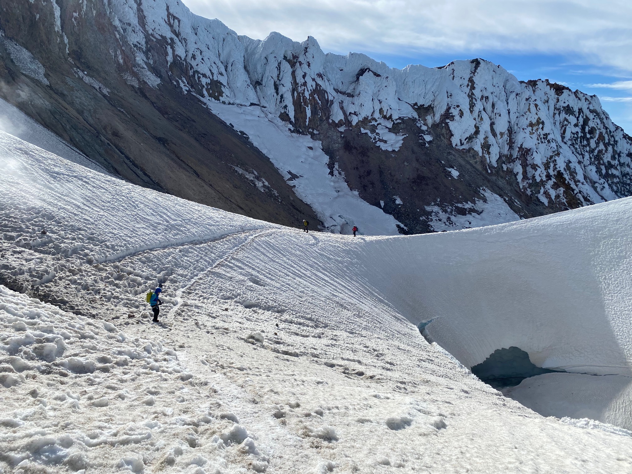
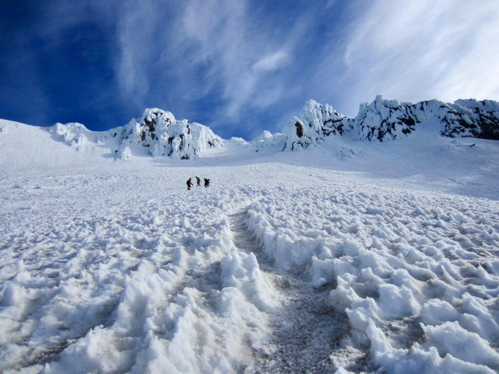
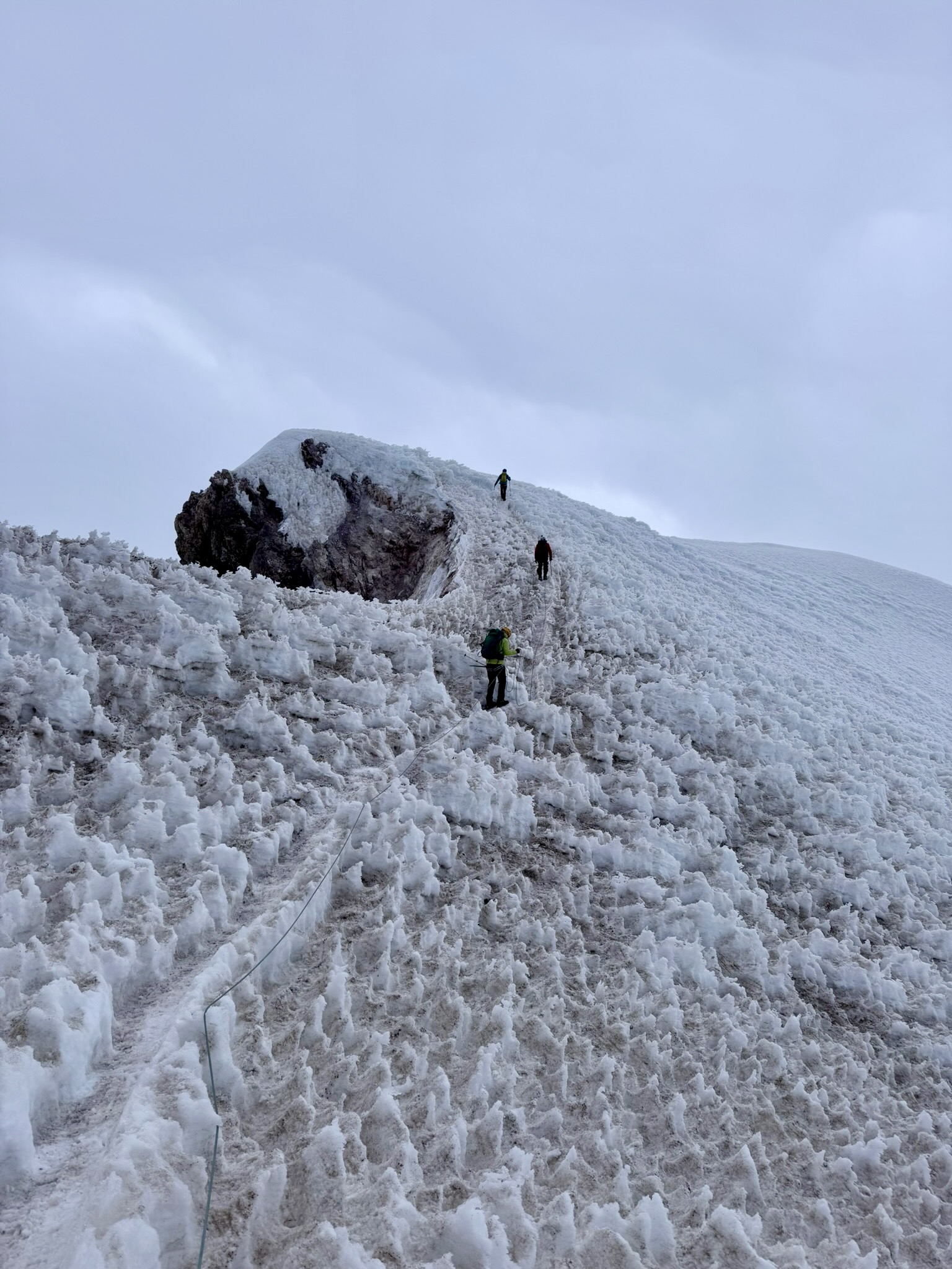
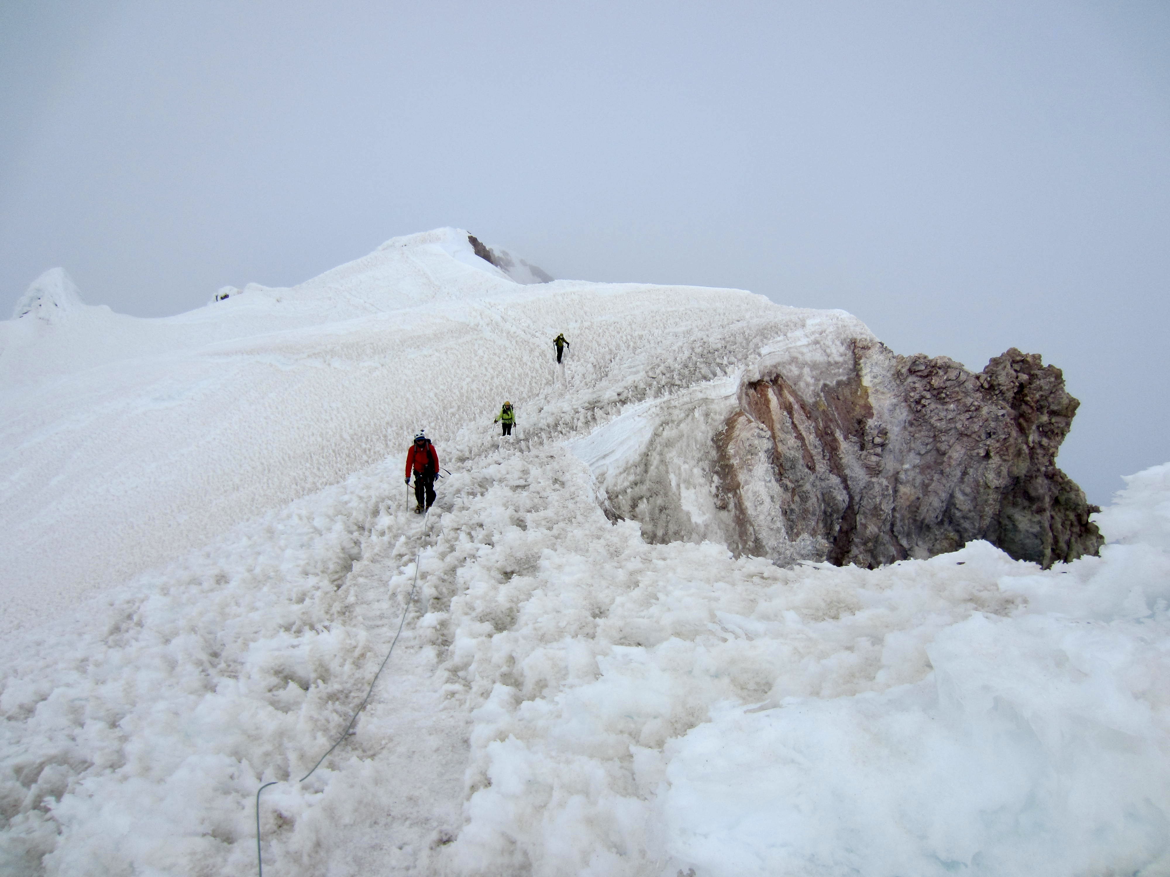
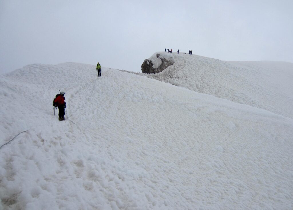
A short traverse around the crater took us to the western rim, which comprises a broad rib of volcanic soil and rock. We easily ascended a boot path that switchbacks up the rib and then transitions to a snow trough. The summit ridge and various access chutes were now directly overhead.
.
.
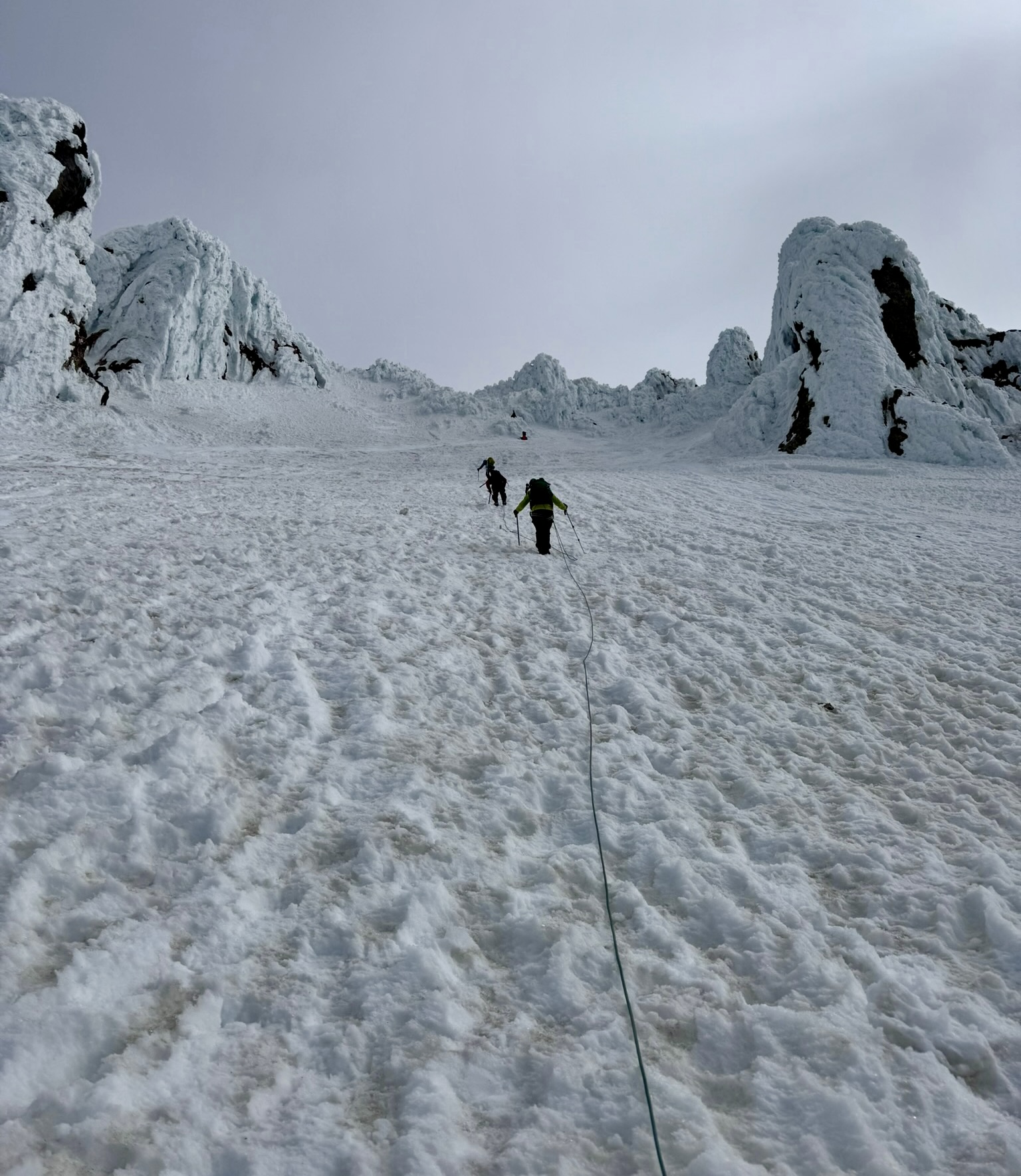
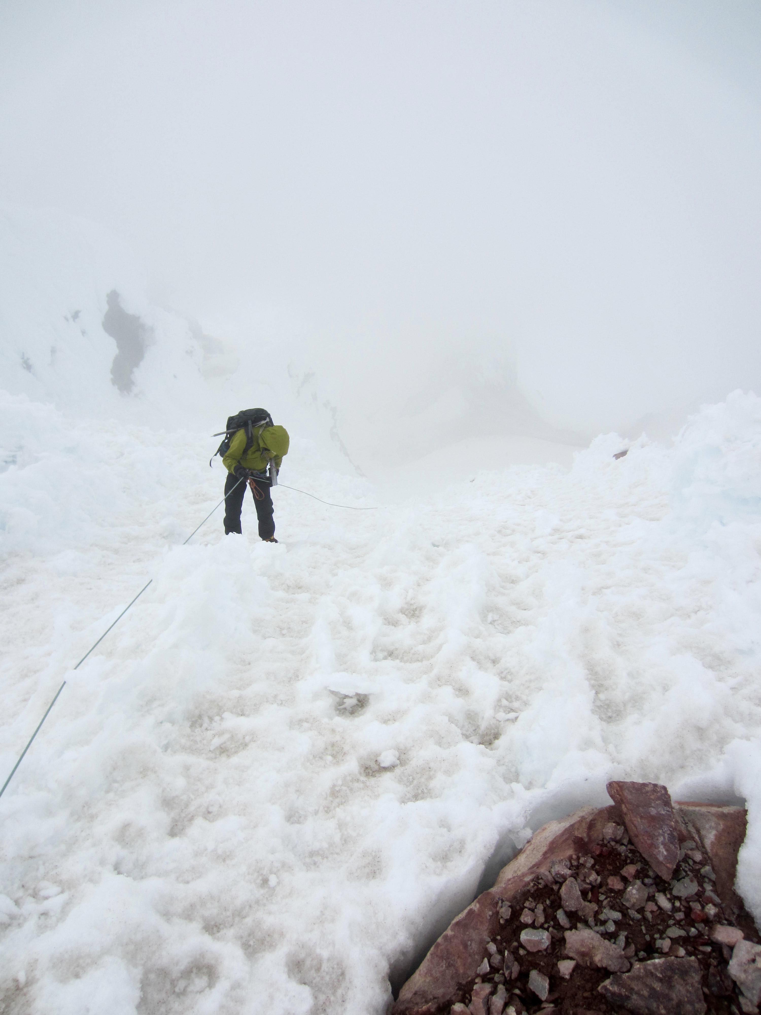
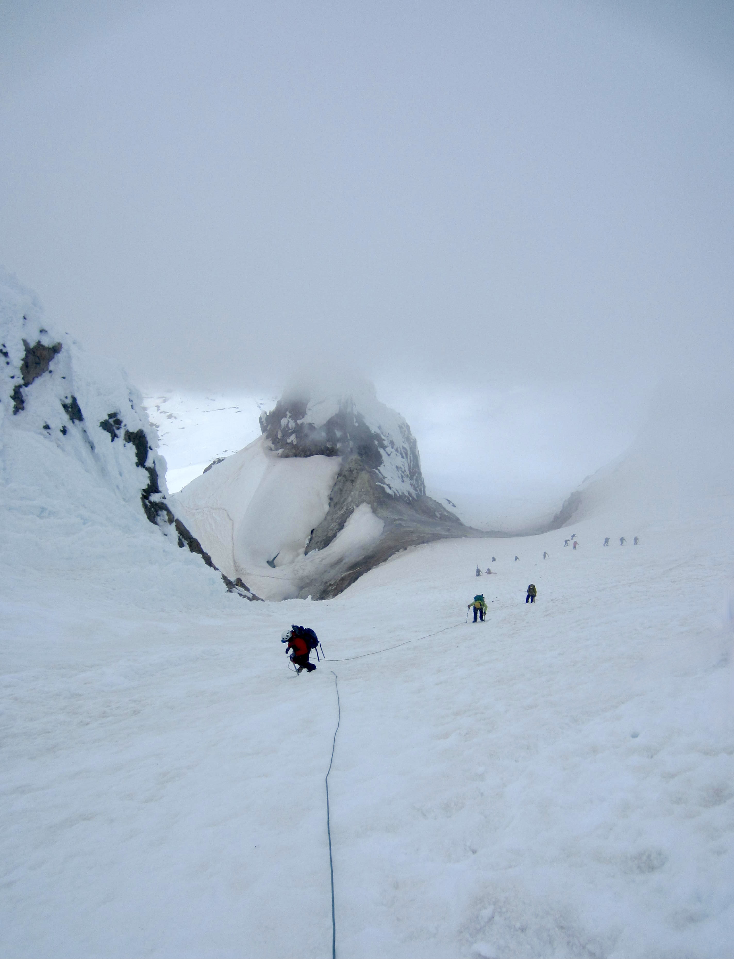
Prompted by the steep and icy conditions, we roped up and pounded in a series of pickets for running-belay protection. This made our ascent safer, but another concern soon presented itself: A dense fog layer began enveloping the upper mountain.
.
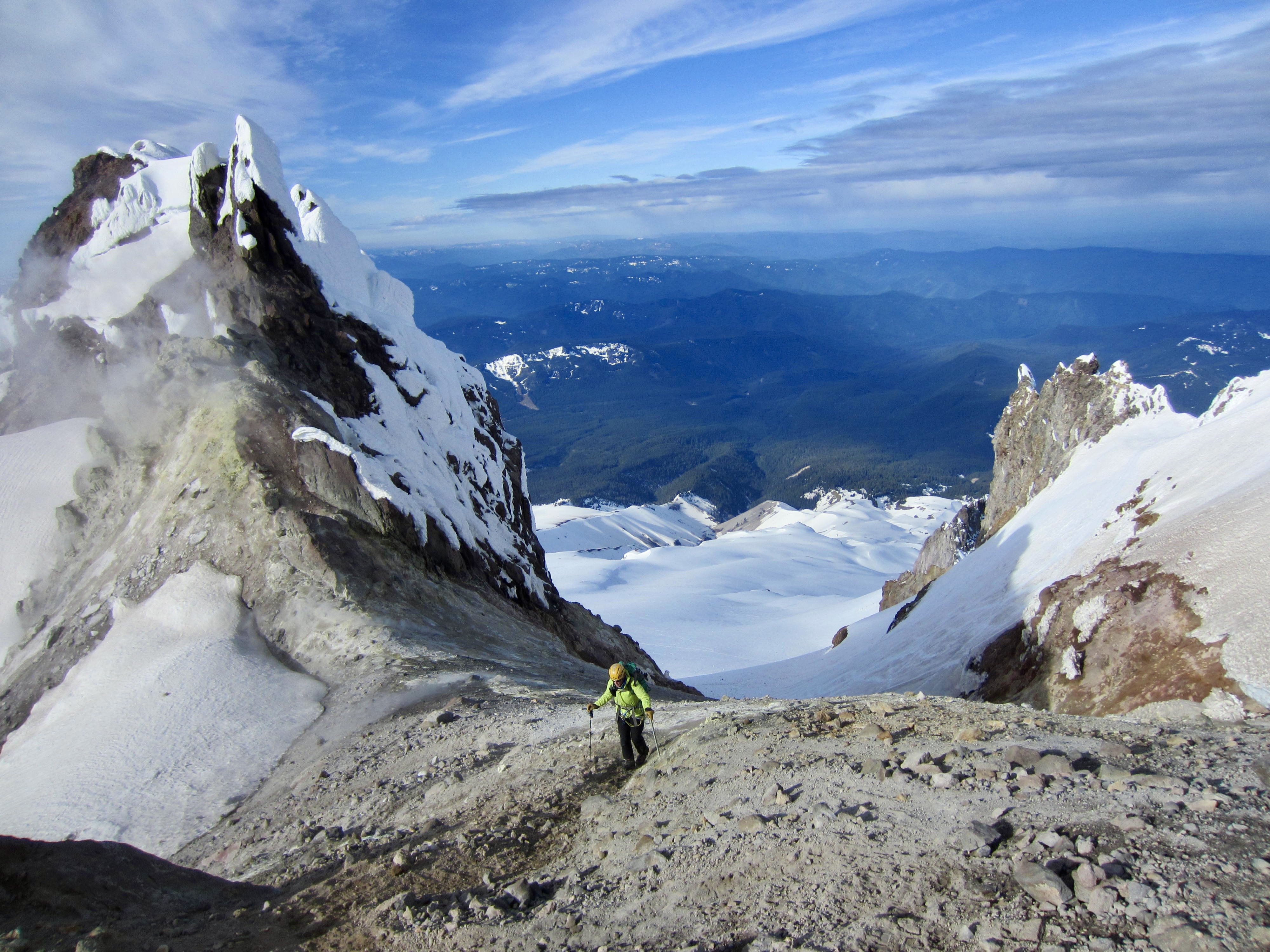
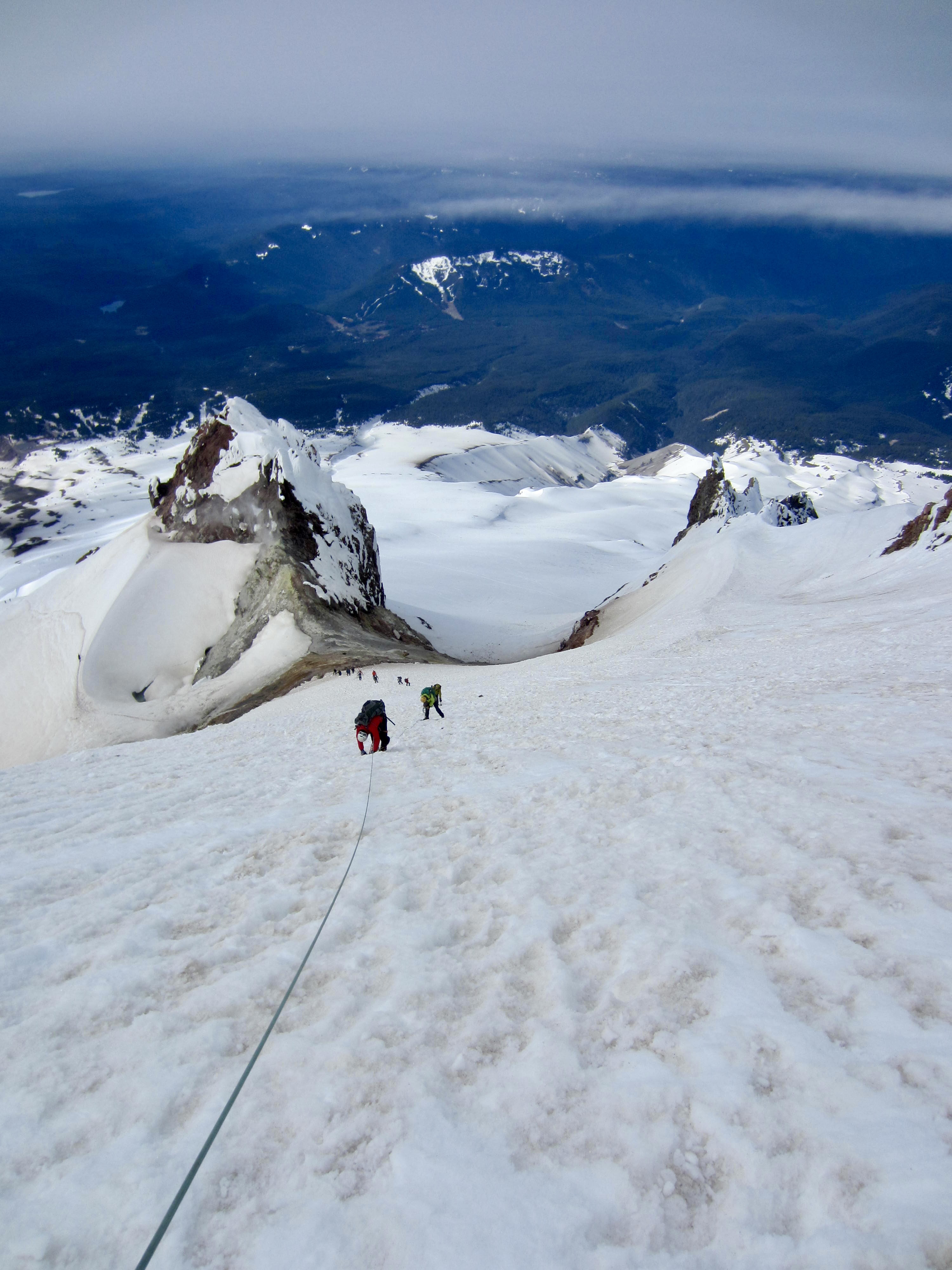
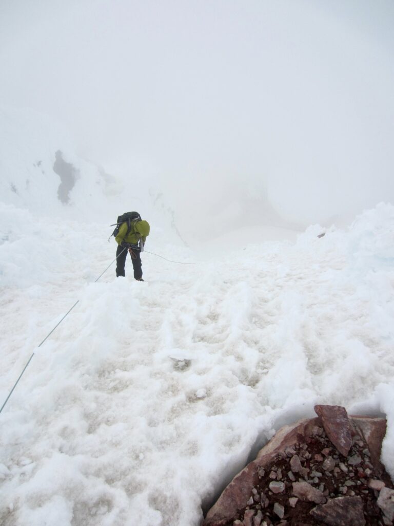
Given the recent demise of the Pearly Gates, many parties are now opting for the Mazama Chute in order to gain the summit ridge. This narrow chute maintains an inclination of approximately 40 degrees for a vertical distance of 100 feet or more. Although most other climbers were going up and down the chute unroped today, we were glad to have a rope and pickets.

.
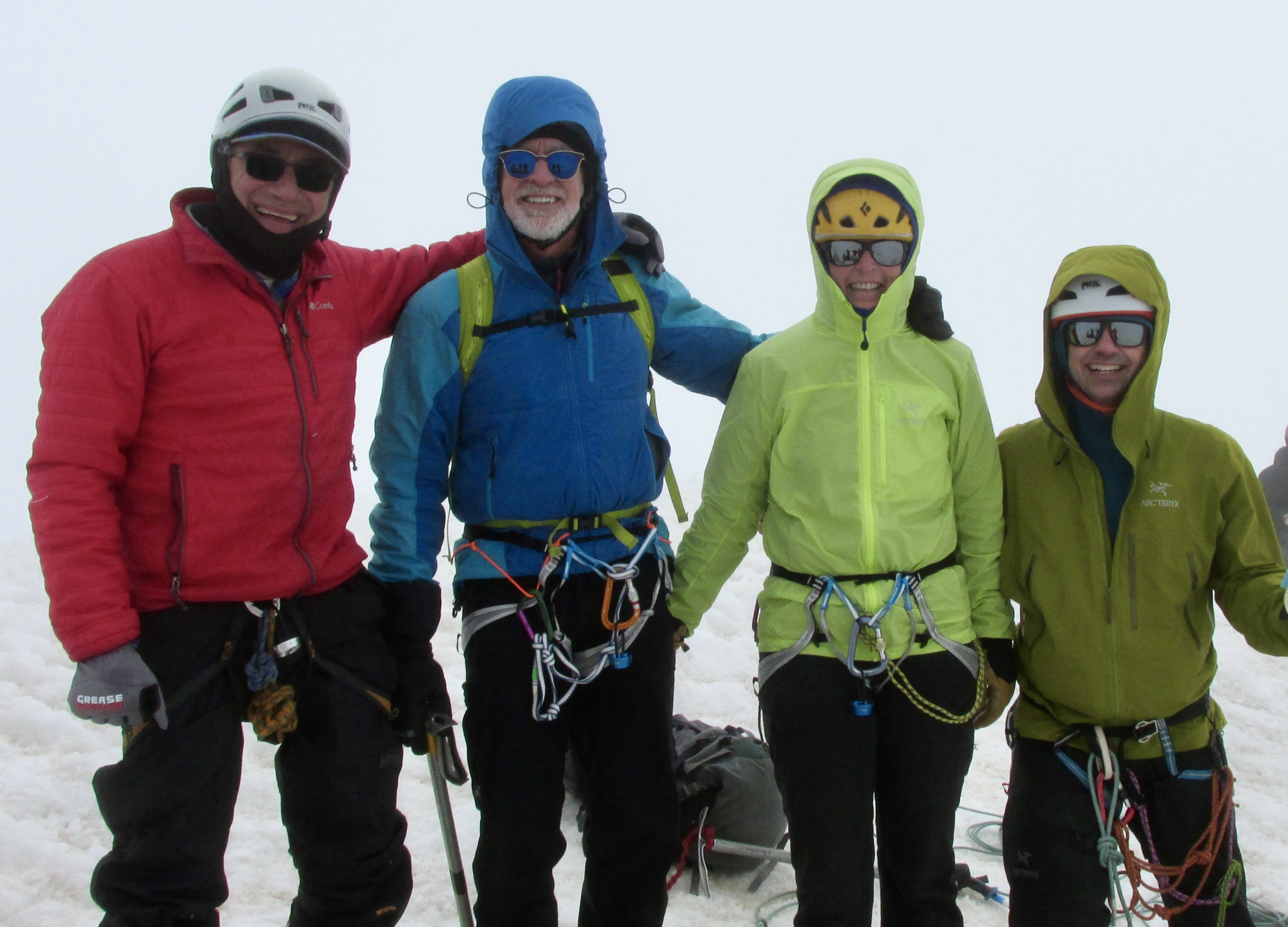
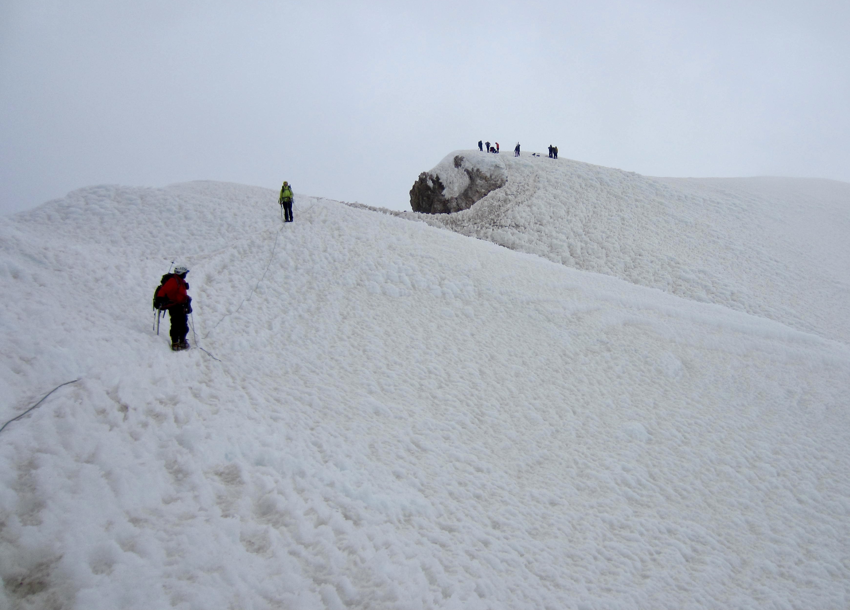
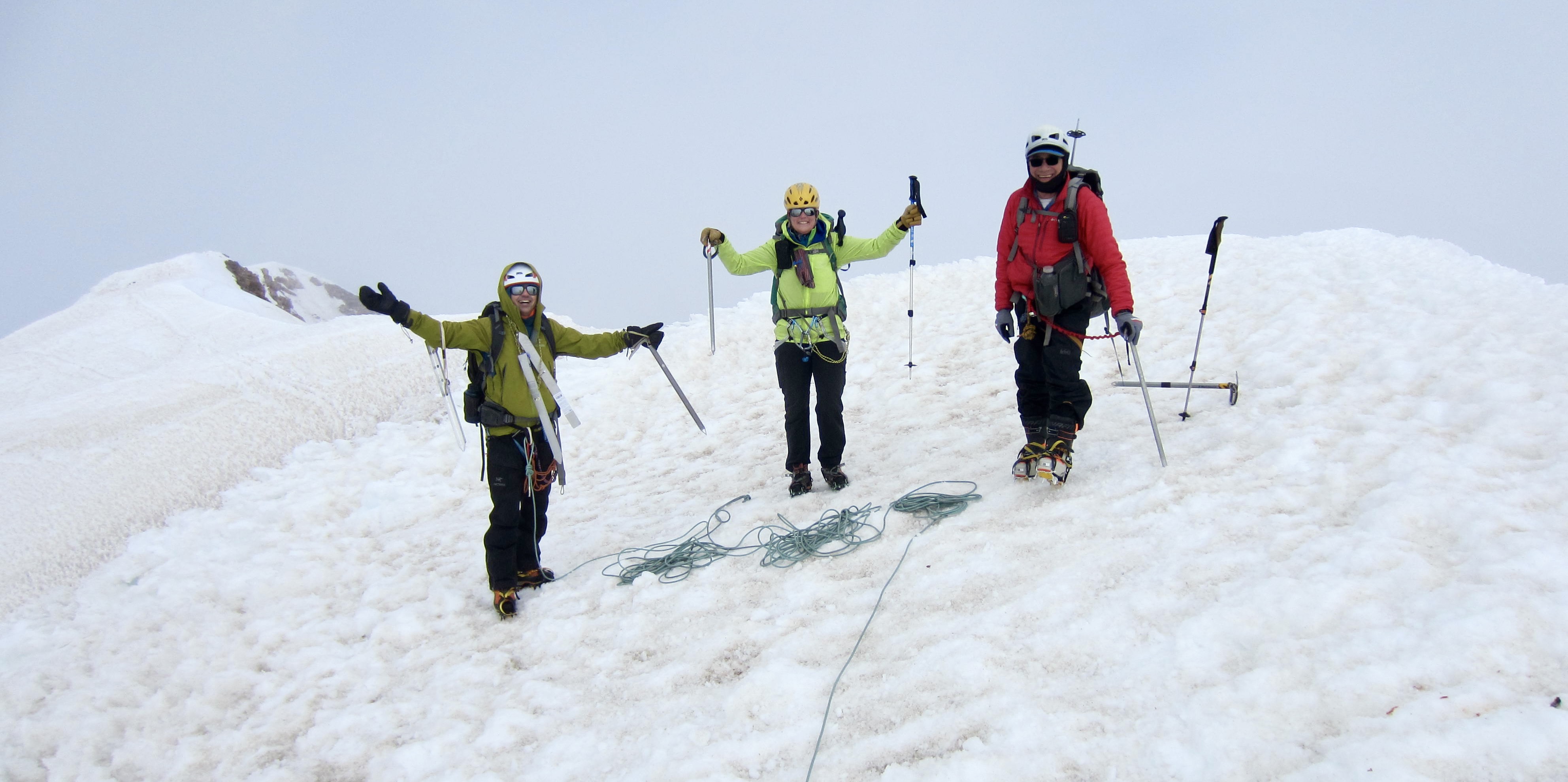
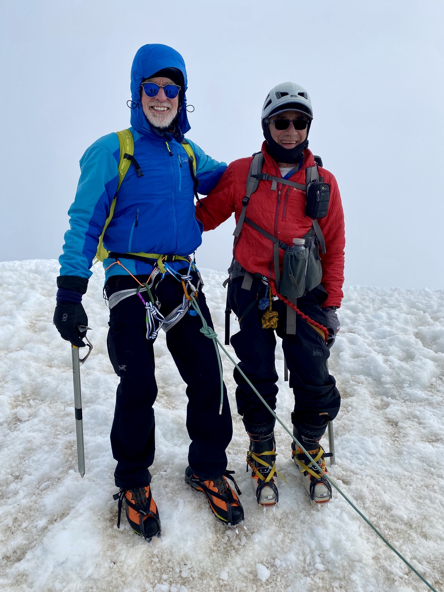
The Mazama Chute tops out at a tiny notch in the summit ridge. From there, a well-trodden path led us along the icy ridge crest and up to the summit at 10:15am (5.5 hours + 3100 feet from camp). Within minutes, we were joined by three other climbing parties. Views were nonexistent due to the swirling fog, and our summit glee was somewhat tempered by our descent apprehension.
.

.
.
Day 2 (late AM & PM): The Descent
We began heading back along the summit ridge at 10:30am. Upon reaching the key notch, we established an anchor for a single-strand rappel down the Mazama Chute. Eileen, Tony, and Andrew successively rapped down the full 60 meters, staying just behind another party of descending climbers. Then, while on belay, I carefully front-pointed down the chute using two ice axes. Very quickly, it occurred to us why most other climbers on the mountain had brought a second ice axe or an ice hammer: They knew that this is a two-tool route!
.
.
For the next 2 hours, we slowly descended through the dense fog, navigating via footprints, ski tracks, terrain features, and GPS waypoints. Tony attempted to ski down from Devil’s Kitchen but found the upper snowfields to be too steep, hard, and rough for his bad knee. However, he was able to ski down the final 500 feet, and by 2:30pm, we were all back in camp (3.9 hours from summit).
.
Packing up camp was a rather chaotic affair, thanks to a cold wind whipping across our cleaver. One by one, we finished packing and headed down the Palmer Snowfield on skis. Laden with heavy backpacks, this part of the descent was not the fun and effortless glide that we’d envisioned. Instead, it was precarious and exhausting, and I had the sensation of carrying a dead body on piggyback! Nonetheless, skiing down the 2300 feet was much faster than booting down, such that we all reached Timberline Lodge by 4:00pm to end a successful but unexpectedly challenging trip.
.
Route Maps & Profile
…
…
…
Photo Gallery
Click to enlarge…