Trip Date: June 30 – July 4, 2024
McGregor Mountain Summit Traverse
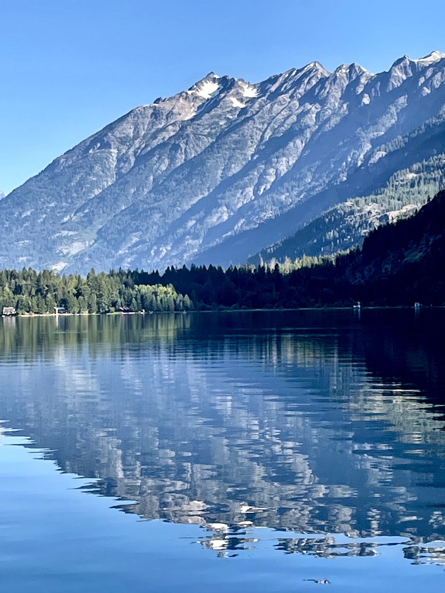
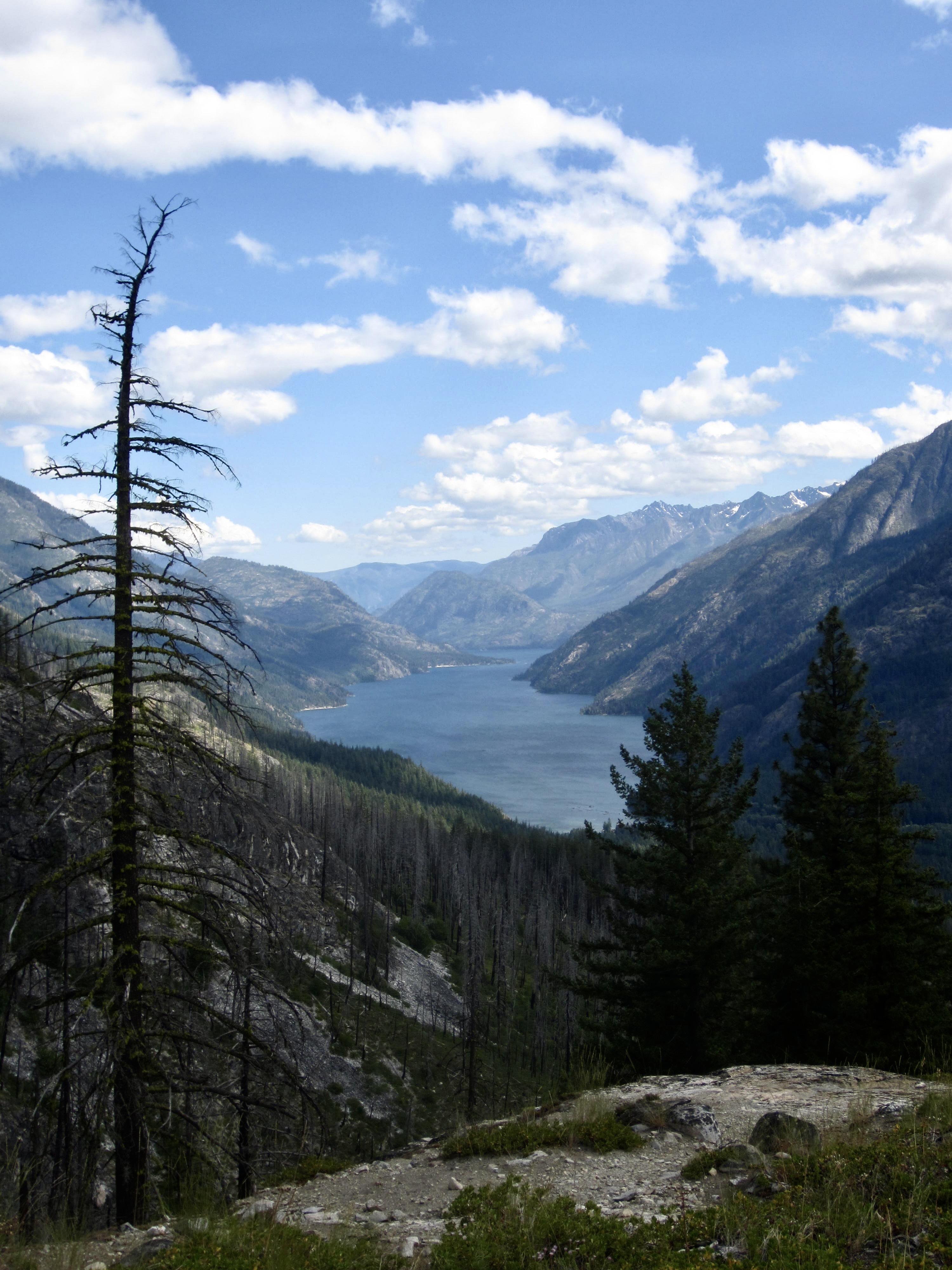
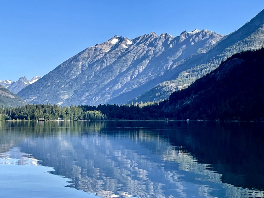
Lake Chelan / Stehekin Landing
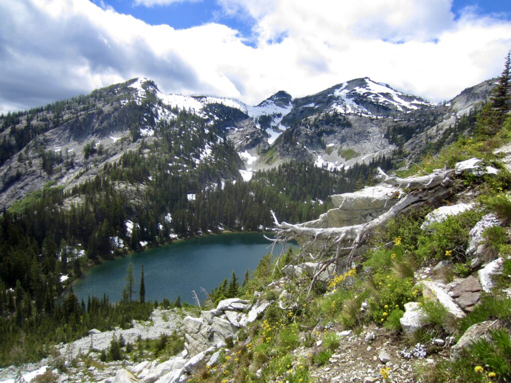
Rainbow Lake
Rainbow Pass
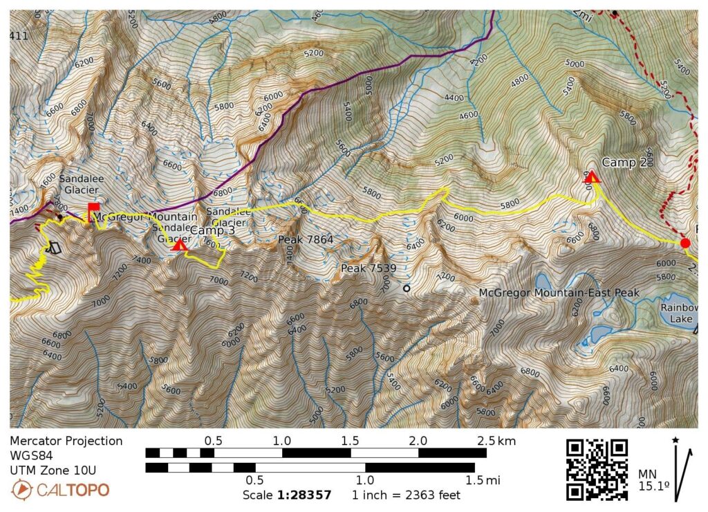
Sandalee Glacier
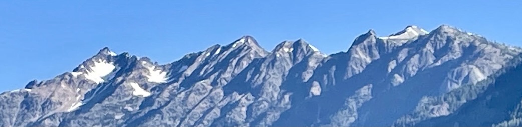
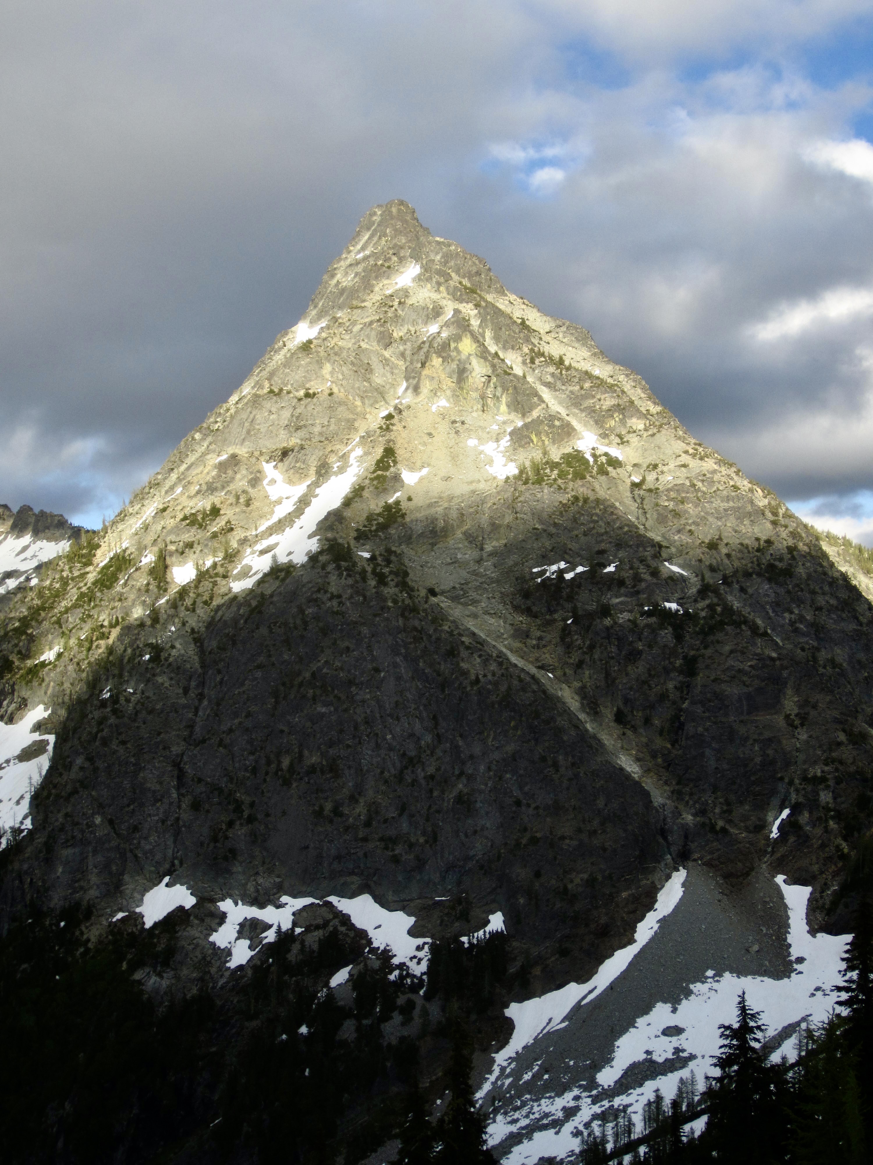
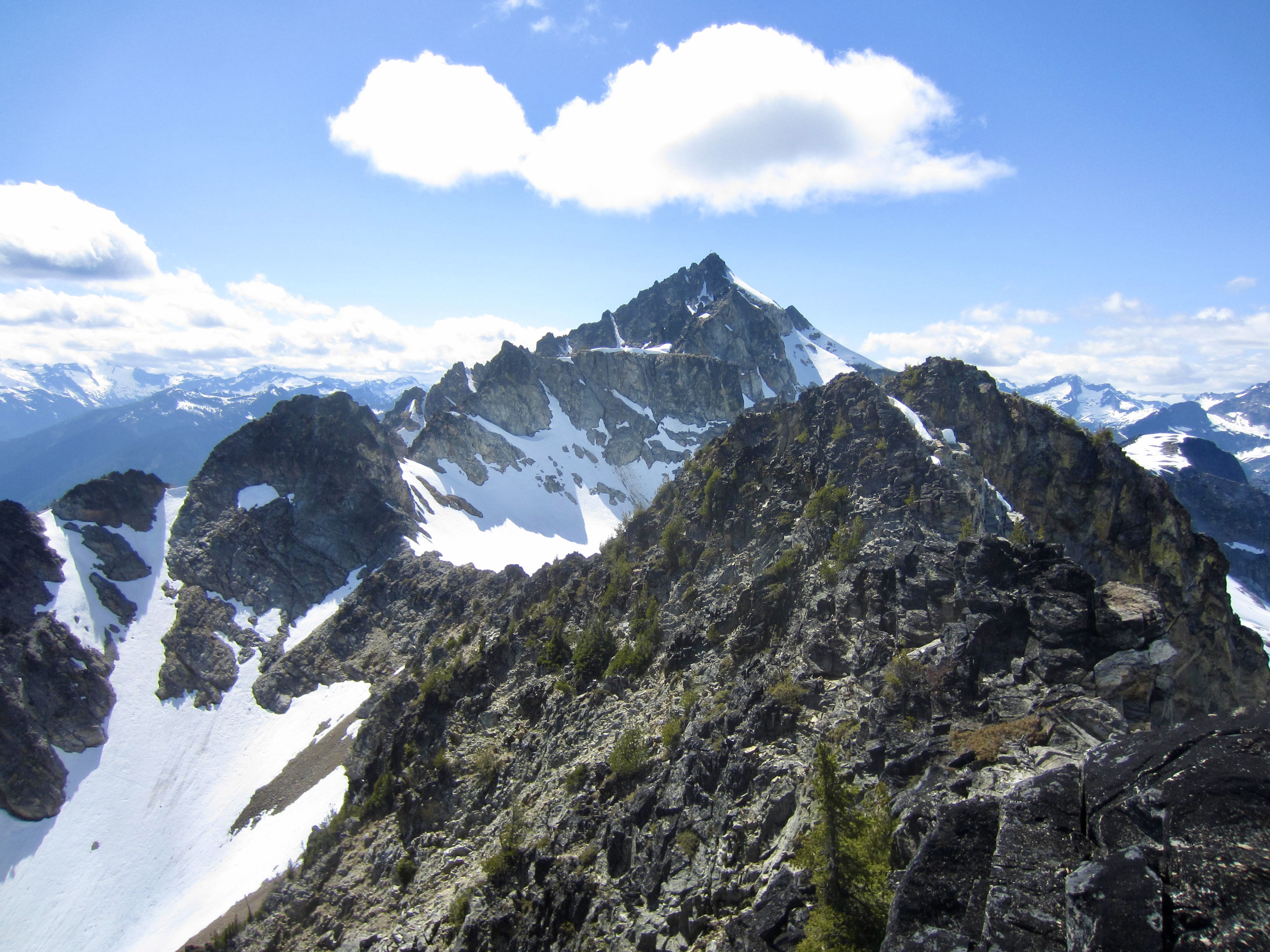
McGregor Mountain / Lookout (8122 ft)
Heaton Basin
Howard Lake
- Trip Report Summary
- Related Posts
- Trip Overview
- Full Trip Report
- Day 1: Stehekin Bakery to Bench Creek Camp
- Day 2: Bench Creek Camp to Rainbow Pass Arm
- Day 3: Rainbow Pass Arm to Middle Sandalee Glacier
- Day 4 (AM): Middle Sandalee Glacier to Summit
- Day 4 (PM): Summit to High Bridge to Stehekin
- Day 5: Stehekin to Fields Point
- Route Maps & Profiles
- Photo Gallery
Trip Report Summary
Region: North-Central Washington Cascades
Sub-Region: North Stehekin Mountains
Area: Lake Chelan National Recreation Area
Starting Point: Stehekin Bakery on Stehekin Valley Road (Elev. 1150 feet)
Way Points: South Rainbow Loop Trailhead (road walk); Rainbow Bluff & Rainbow Bridge Camp & Rainbow Creek Bridge & Rainbow Creek Trail junction & Bench Creek Camp & Rainbow Lake Trail junction & Rainbow Meadows & Rainbow Lake & Rainbow Pass (trail hike); Rainbow Pass Arm & East McGregor Ridge buttress & Col 7100 & Crest 7600 & Saddle 7850 & McGregor Mountain summit & West McGregor Ridge notch & Heaton Basin (snow climb & rock scramble); Howard Creek crossing & Howard Lake & High Bridge (trail hike)
Ending Point: High Bridge Campground & Guard Station on Stehekin Valley Road (Elev. 1600 feet)
Campsites: Bench Creek Camp & Rainbow Pass Arm & Middle Sandalee Glacier
Summit: McGregor Mountain (snow climb via Sandalee Glacier—Northeast Face—Northwest Slope; descent via West Ridge–Southwest Face)
Approximate Stats: 23.0 miles traveled; 9000 feet gained; 8550 feet lost.
Related Posts
>>> McGregor Mountain attempt via East Ridge–Sandalee Glacier – July 2016
>>> McGregor Mountain via Heaton Basin—Southwest Gully – July 1996
Trip Overview
McGregor Mountain is a fairly isolated and often-overlooked major peak located closely above the head of Lake Chelan. Anyone who has visited the village of Stehekin has probably gazed upon its broad, heavily furrowed southern flank and its pointed summit with the distinctive snowfields. The mountain is perhaps best known for being one of the highest fire-lookout sites in the Cascades—and one of the most difficult sites to reach. A cupola-style cabin was built on the summit in 1932 but demolished just two decades later, due in no small part to its poor accessibility.
.
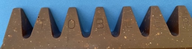
After numerous forays to Stehekin over a period of many years, I became intrigued by McGregor’s long, crenelated east ridge. Its multi-peaked crest is slightly reminiscent of a Toblerone chocolate bar, and its northern flank harbors several remnant patches of the poetically named but now-stagnant Sandalee Glacier.

I made an initial attempt to traverse the east ridge of McGregor Mountain with Jon, Todd, and Adam in late July 2016. From our basecamp at Rainbow Lake, we managed to travel across 2½ miles of scree, talus, heather, and snow on the northern side of the ridge until calling it a day at a 7600-foot dip in the crest. The tedious 5-mile round trip convinced me to alter my strategy: Rather than attempting another mid-summer out-and-back climb, I decided to do an early-season, summit-carryover traverse.
When I mentioned my idea to Eileen and Lisa long ago, they were fully on board with doing a summit-carryover traverse. However, it wasn’t until this year that our schedules and the weather forecast all came together. As a positive, the long delay allowed Andrew to join us, which made for a stronger four-person team.
Our planned traverse was ultimately successful, but there were numerous surprises and challenges along the way. The weather was not quite as favorable as forecasted, the terrain was more difficult than expected, and there was a medical evacuation that prevented one of our party members from completing the traverse. As they say, the only certainty in mountaineering is uncertainty!
Full Trip Report
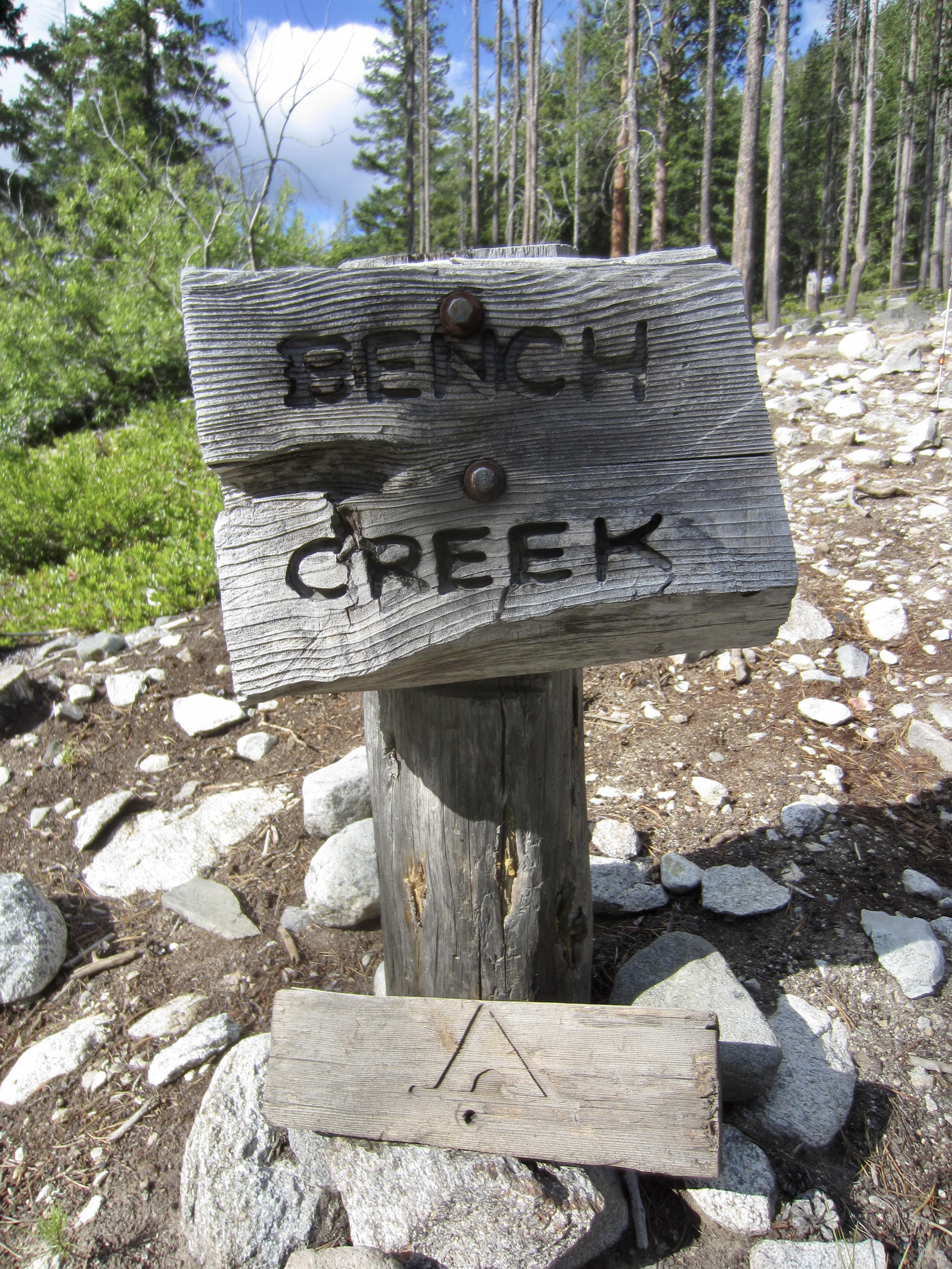
Day 1: Stehekin Bakery to Bench Creek Camp
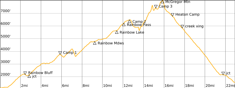
Our trip started by riding the Lady Express from Fields Point to Stehekin and then riding a shuttle bus to the Stehekin Bakery for lunch. From there, we walked ¾ mile up the road to the southern end of the Rainbow Loop Trail. The rest of our day was spent hiking over Rainbow Bluff and up Rainbow Creek in full sun. It was a bit surprising to encounter only two other backpackers on this warm, pre-holiday Sunday afternoon.
.

.
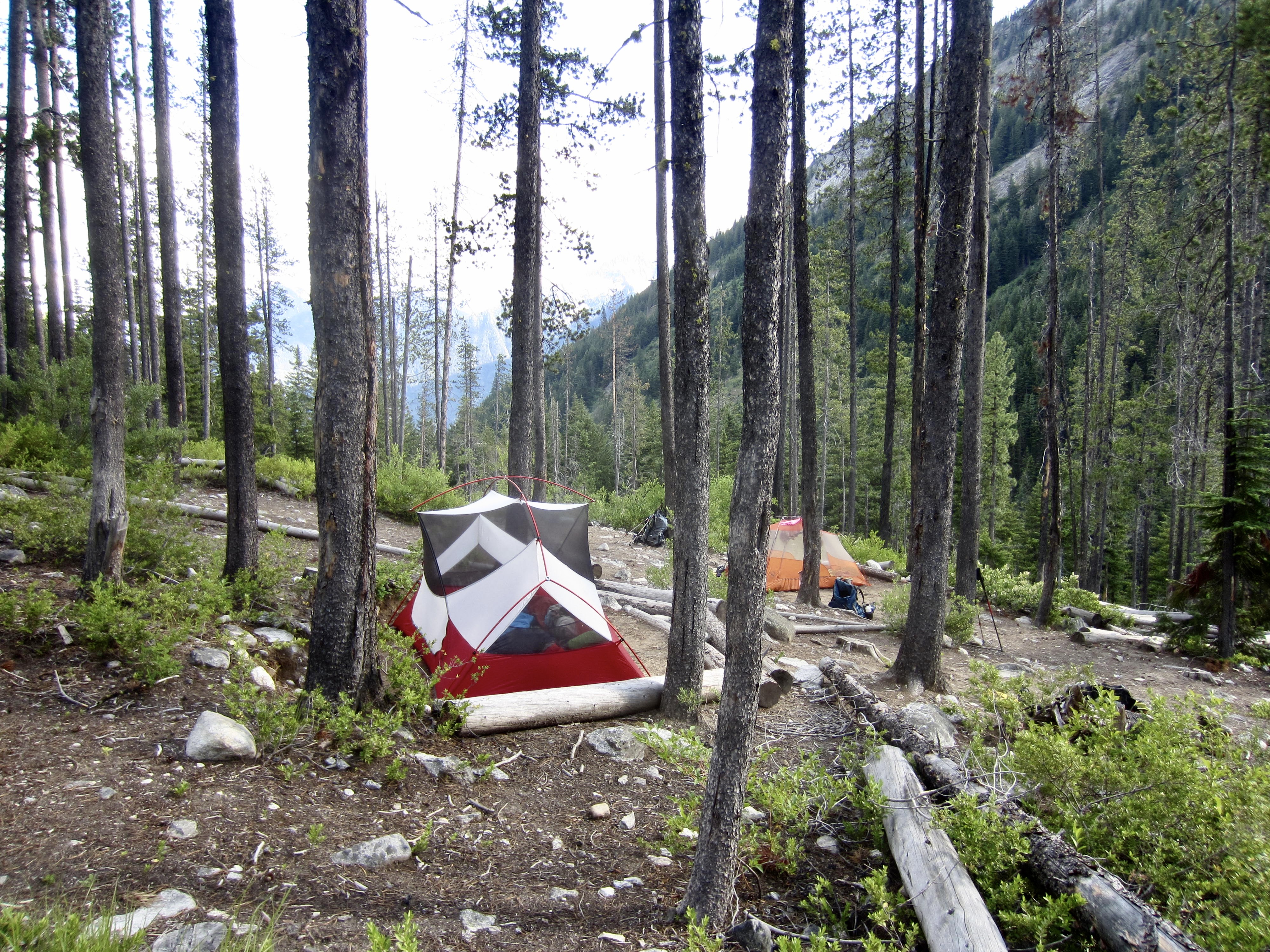
Shortly before 6:00pm, we arrived at the deserted Bench Creek Camp (4.7 hours + 2750 feet from bakery). This camp is situated within a swath of sparse forest littered with hundreds of fallen logs, presumably the result of a former windstorm. We pitched our tents and washed off in nearby Bench Creek.
.
Day 2: Bench Creek Camp to Rainbow Pass Arm
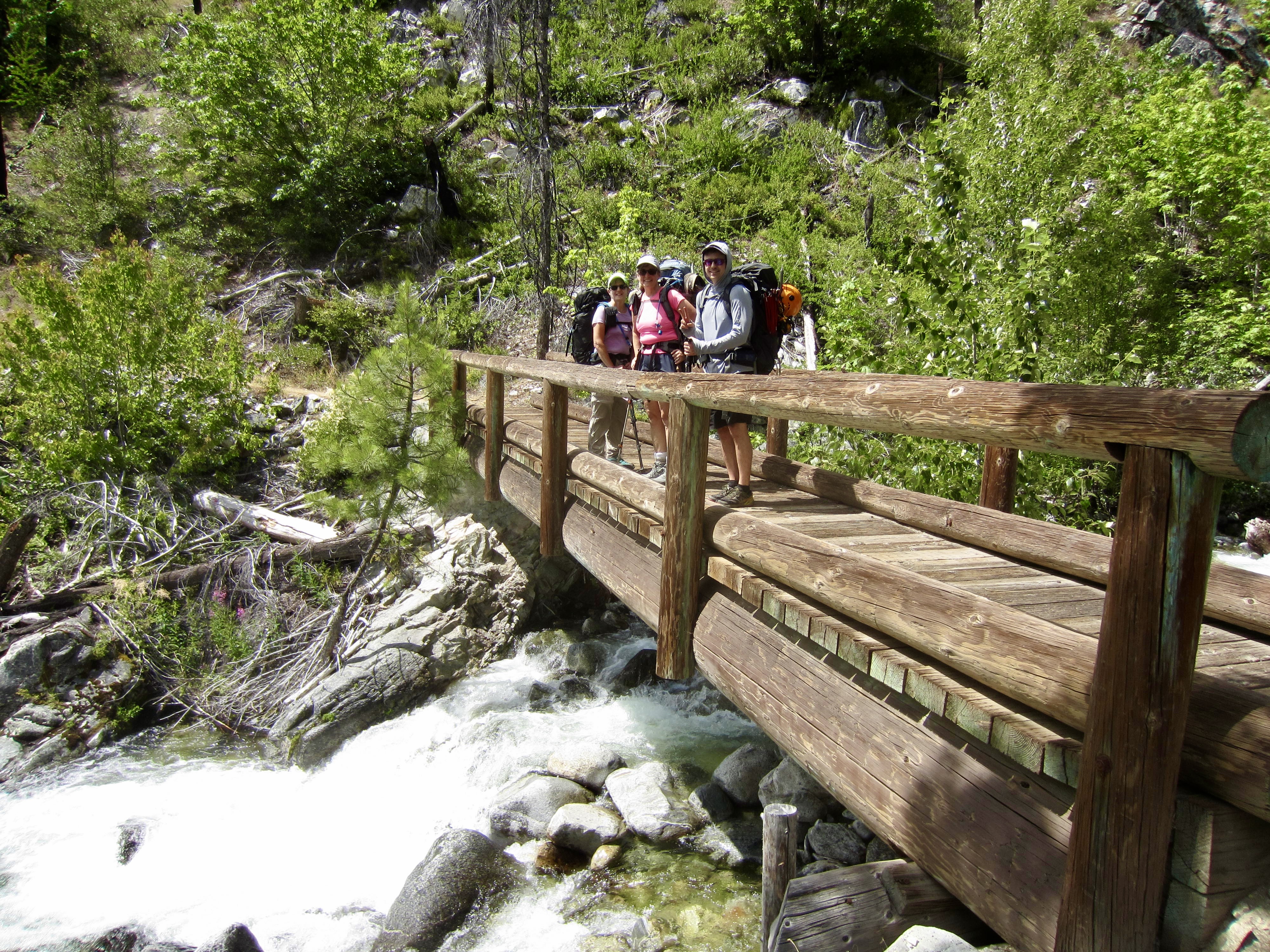
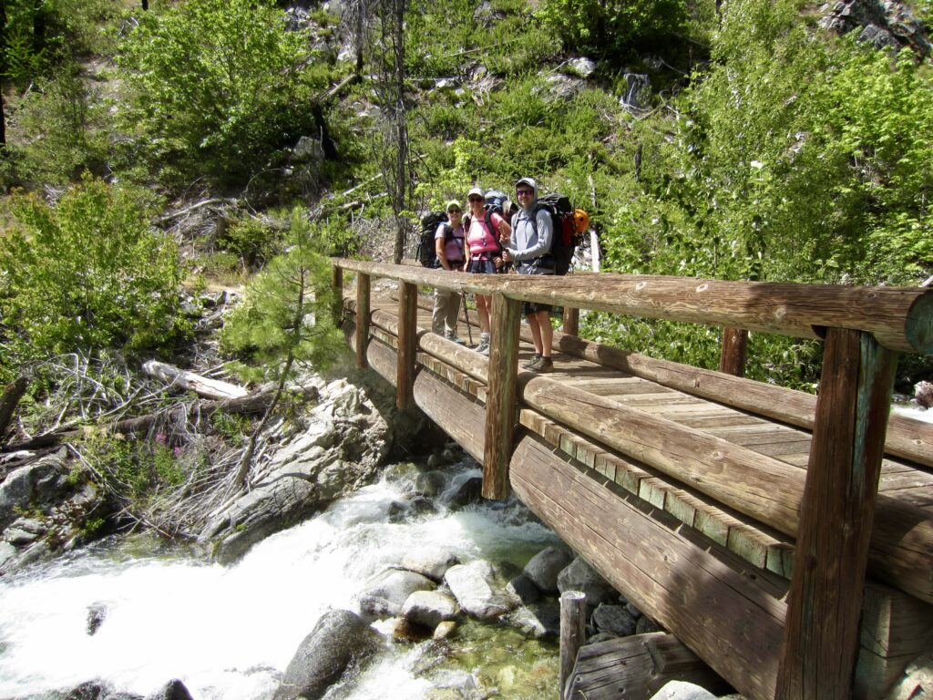
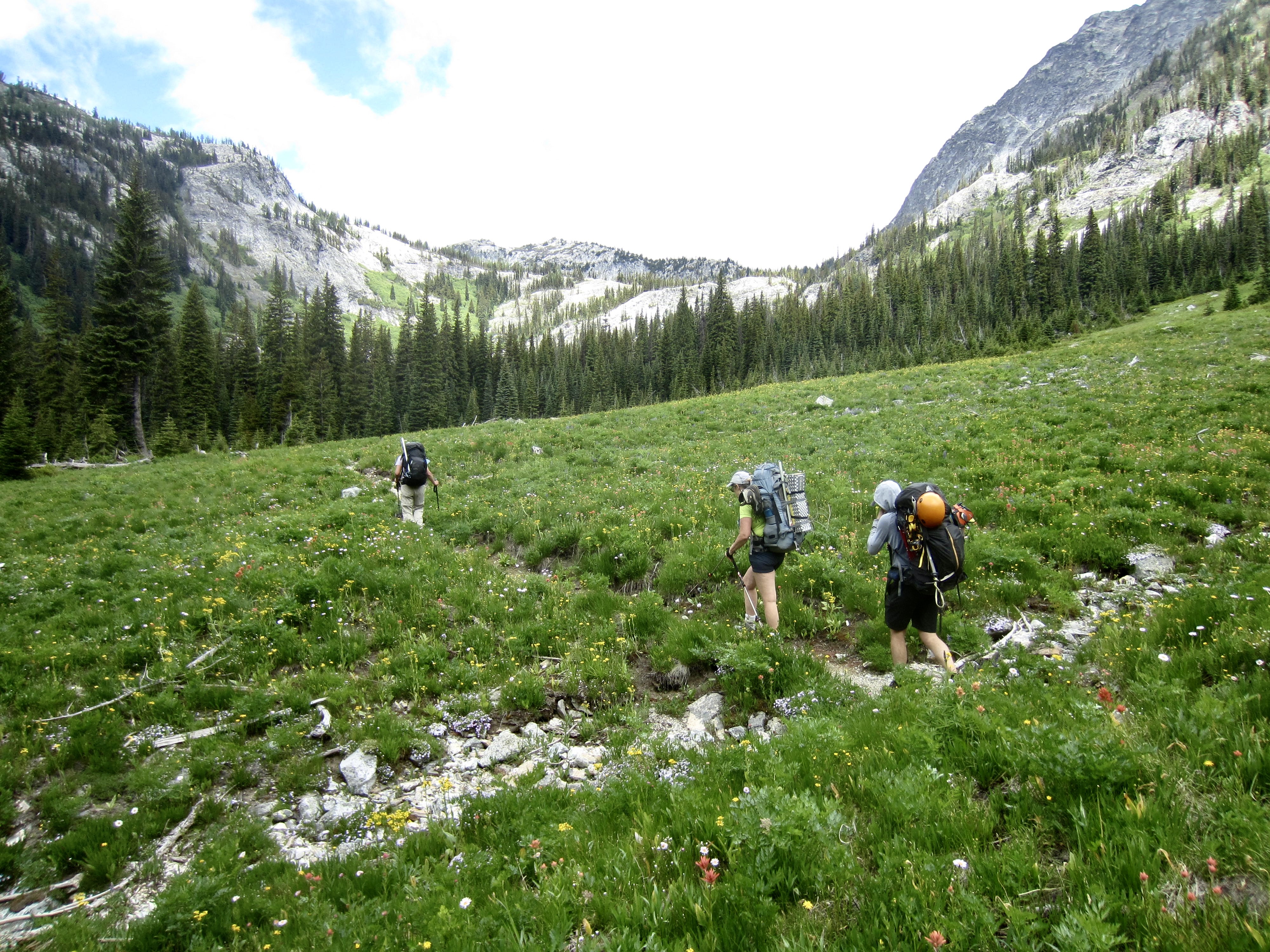
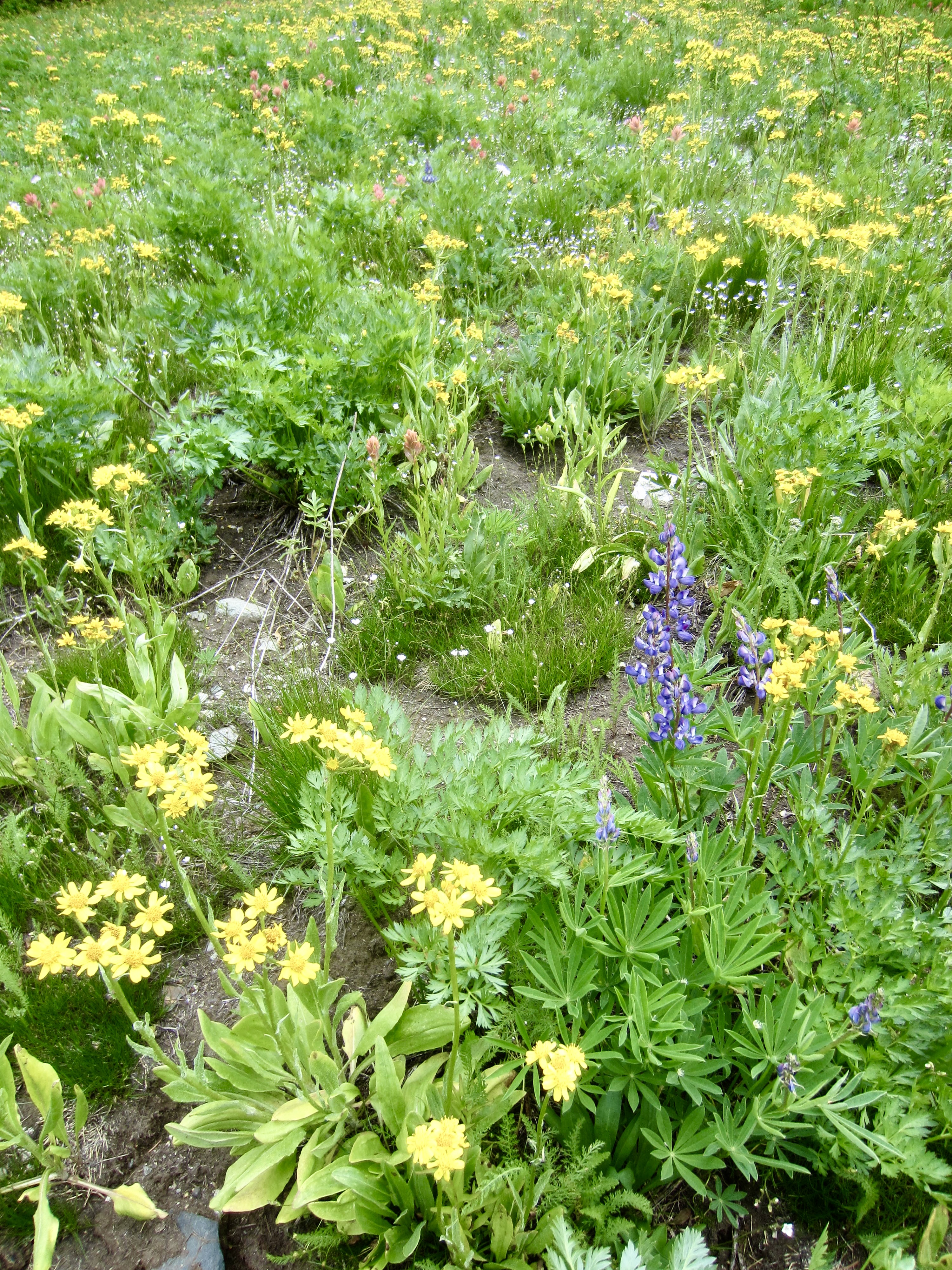
Following a warm night, we awoke to a partly sunny morning with the promise of a hot afternoon. From Bench Creek Camp, we dropped down the Rainbow Lake Trail, crossed Rainbow Creek on a roll-up suspension bridge, and headed up-valley. Our trail took us through wildflower-rich Rainbow Meadows and then up a long talus field.
.
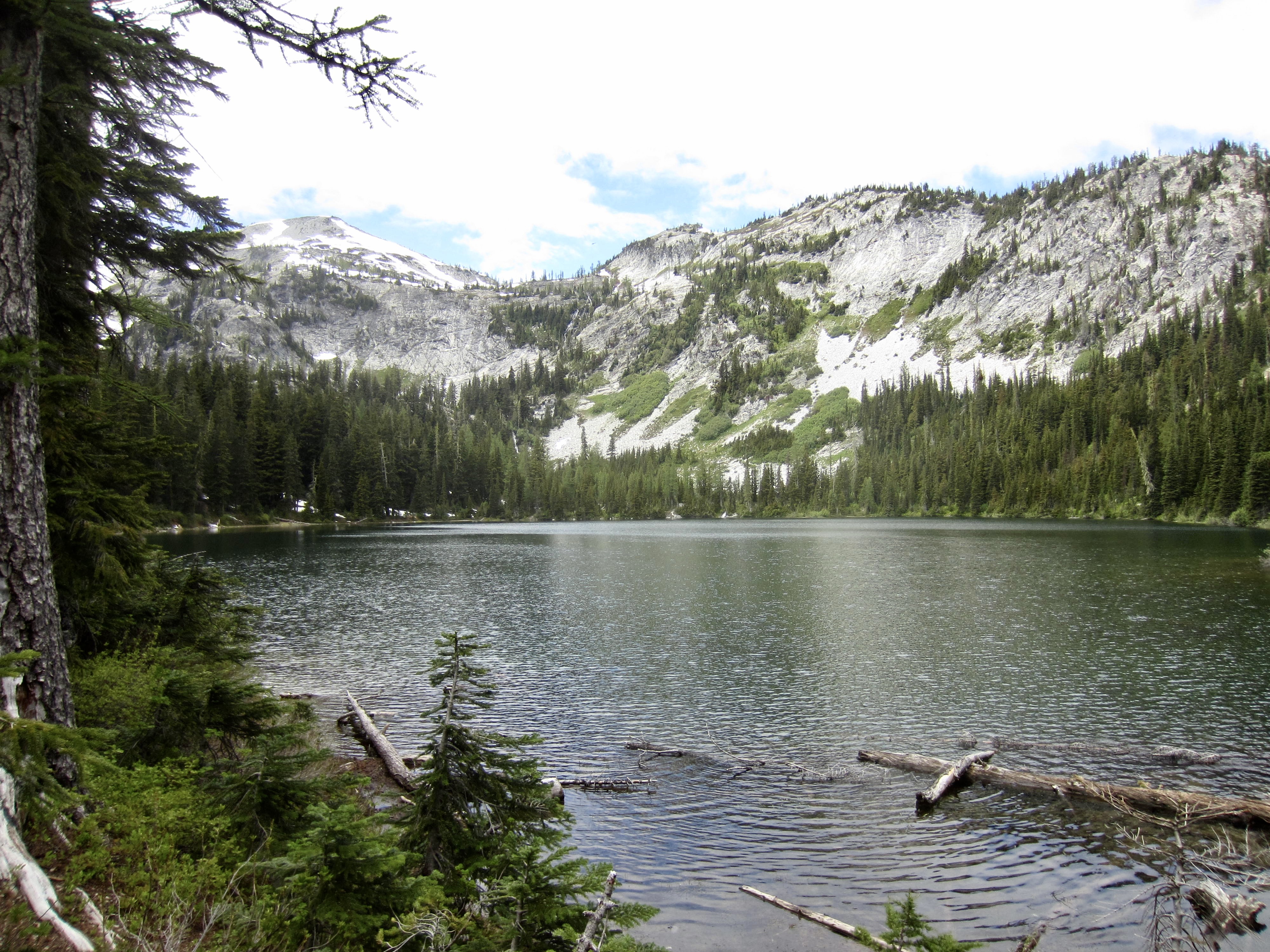
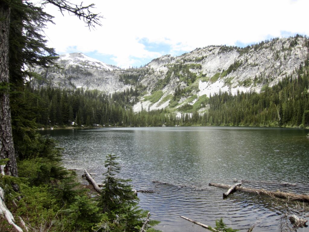
We reached Rainbow Lake in early afternoon (3.3 hours + 2100 feet from Camp 1) and stopped for lunch. However, any hopes for a lunchtime swim were snuffed out by a cold northerly wind.
.
After lunch, we continued up the trail to 6200-foot Rainbow Pass, where we encountered the first snow patches of our hike. Here, we turned left off the trail and made a northwesterly traverse across open snow slopes, aiming for a level 6500-foot arm that projects due north from the main ridgeline.
.

.
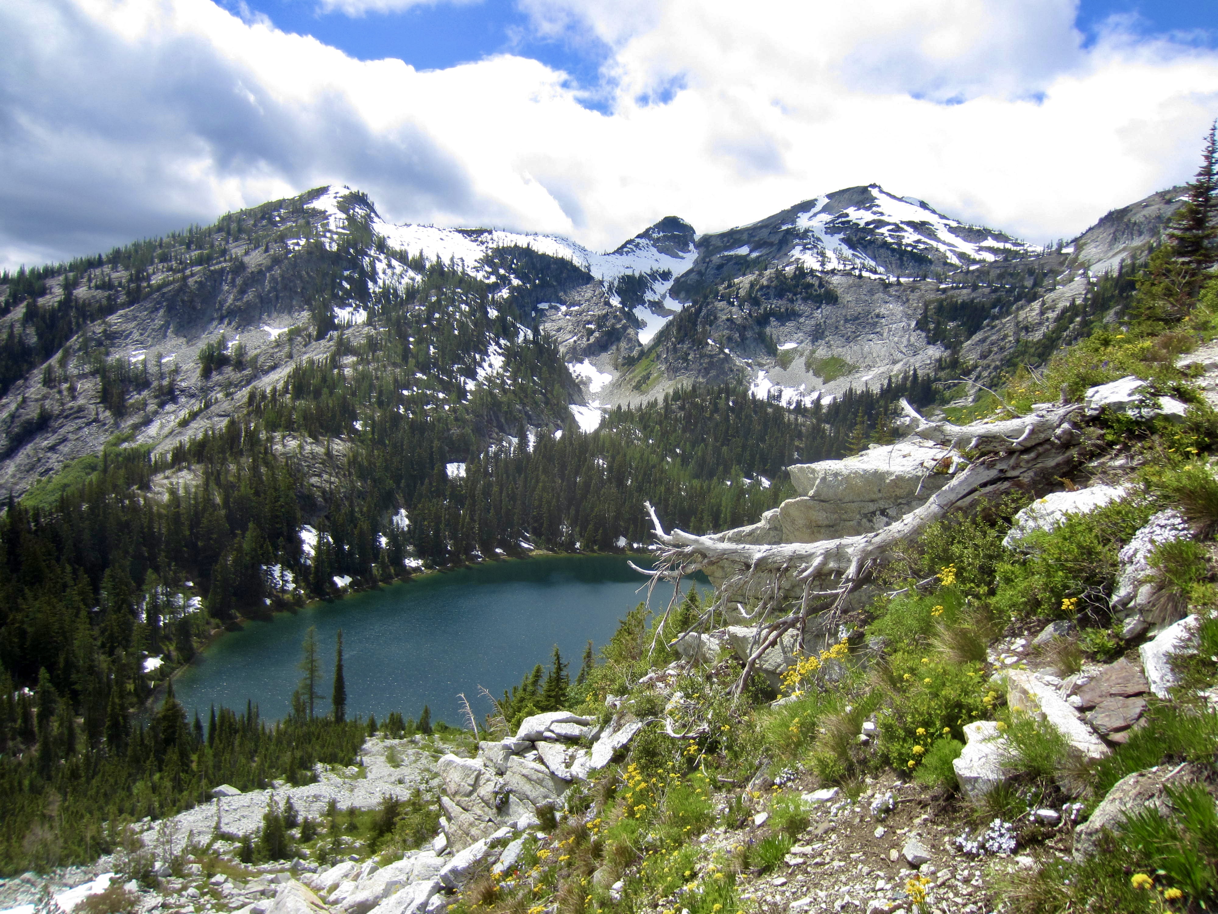
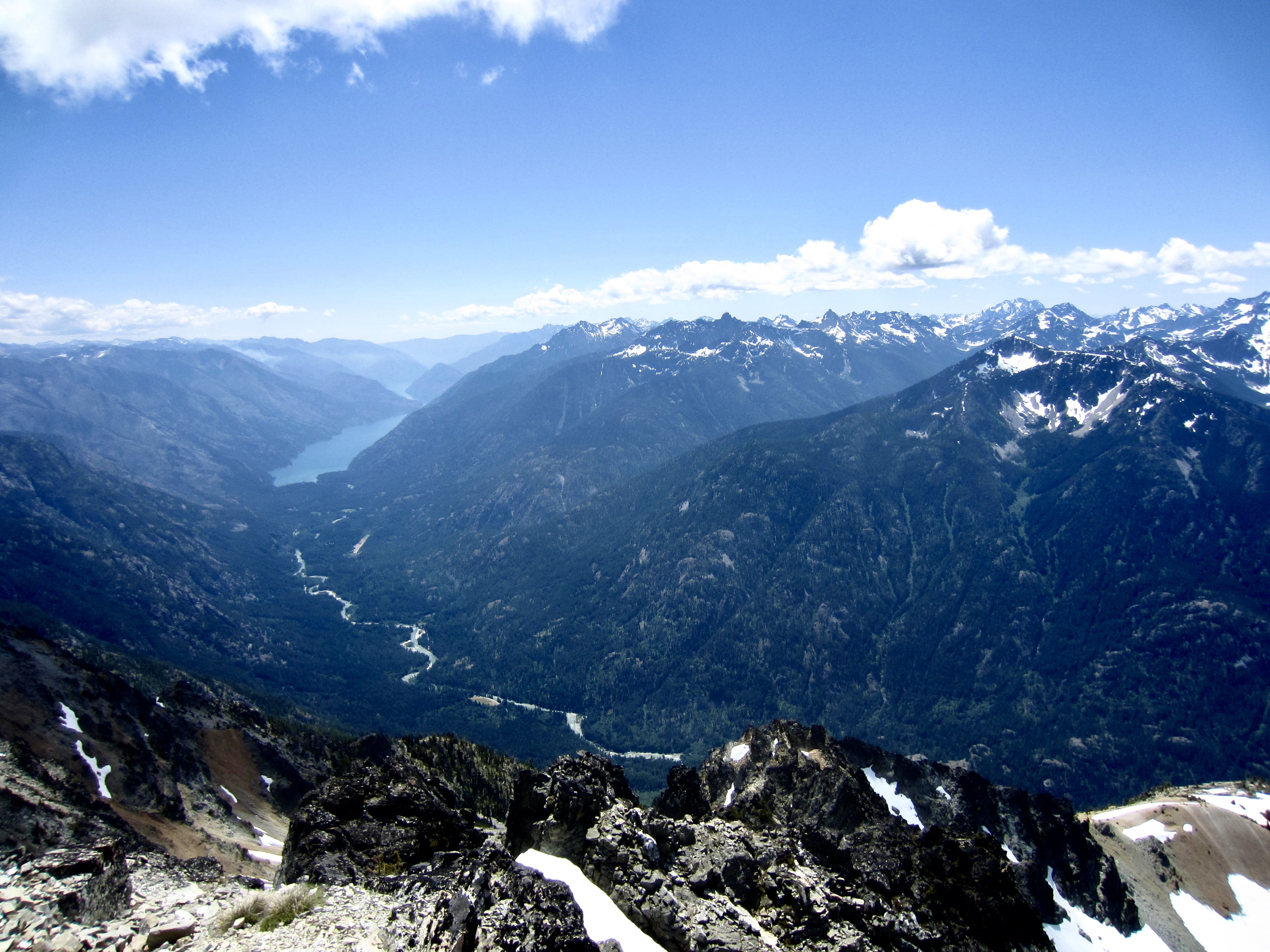
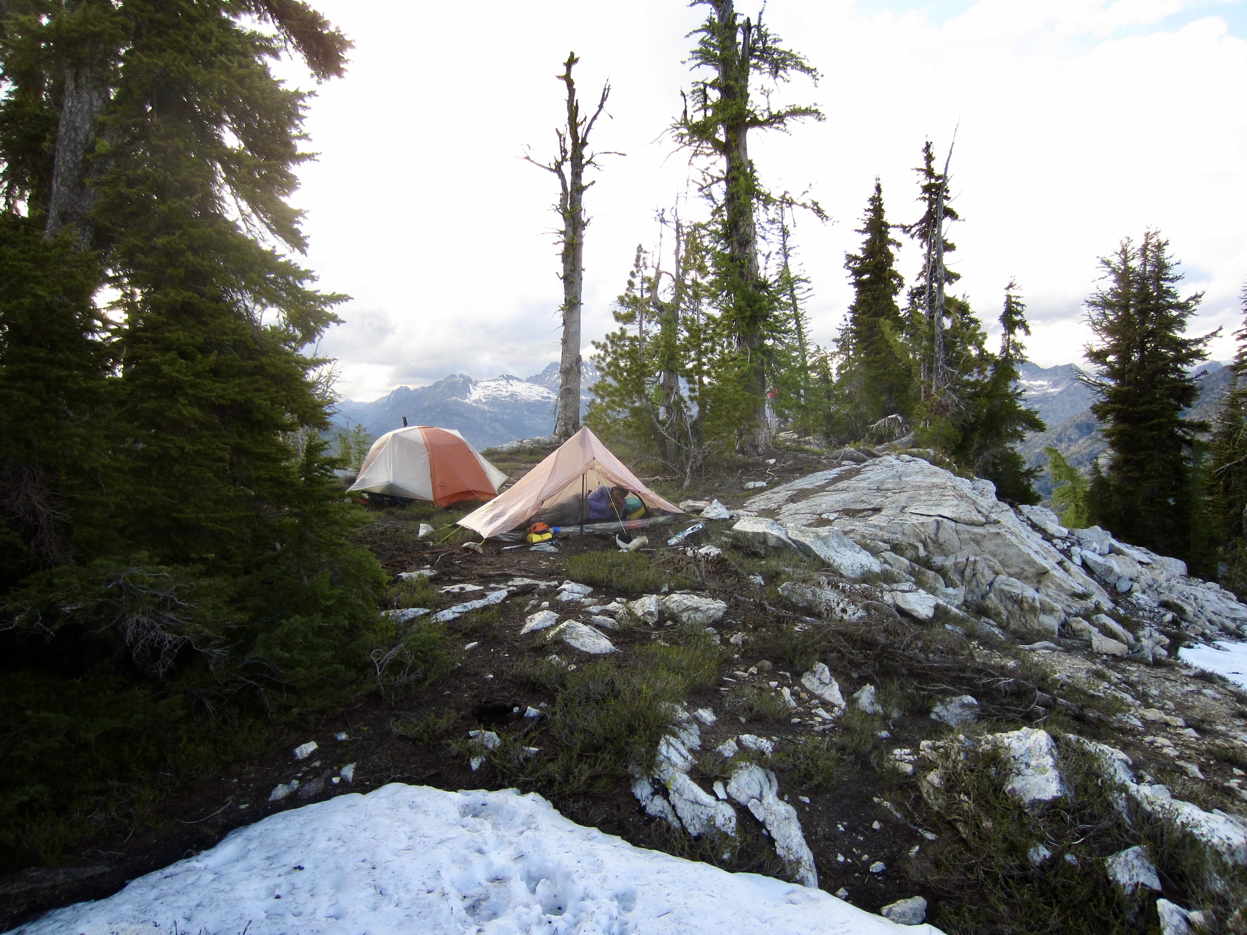
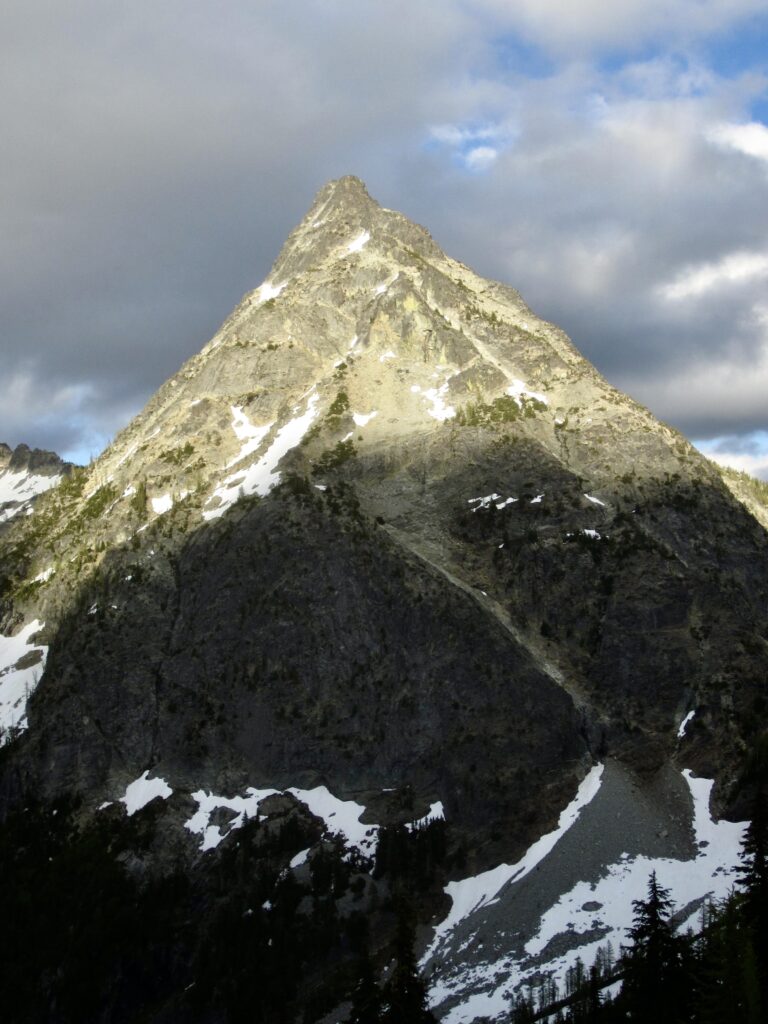
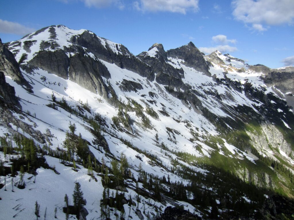
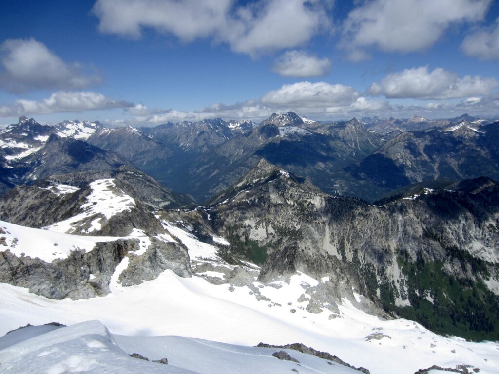
We topped out on the north-pointing arm in mid-afternoon (6.1 hours + 3000 feet from Camp 1) and located a suitable place for our three tents. This arm provides a good view of Bowan Mountain’s imposing west face and McGregor Mountain’s craggy east ridge. We were dismayed, though, to see a steady flow of dark clouds blowing in the from the northwest and enveloping most of the higher summits. How would this affect our visibility tomorrow?
.
.
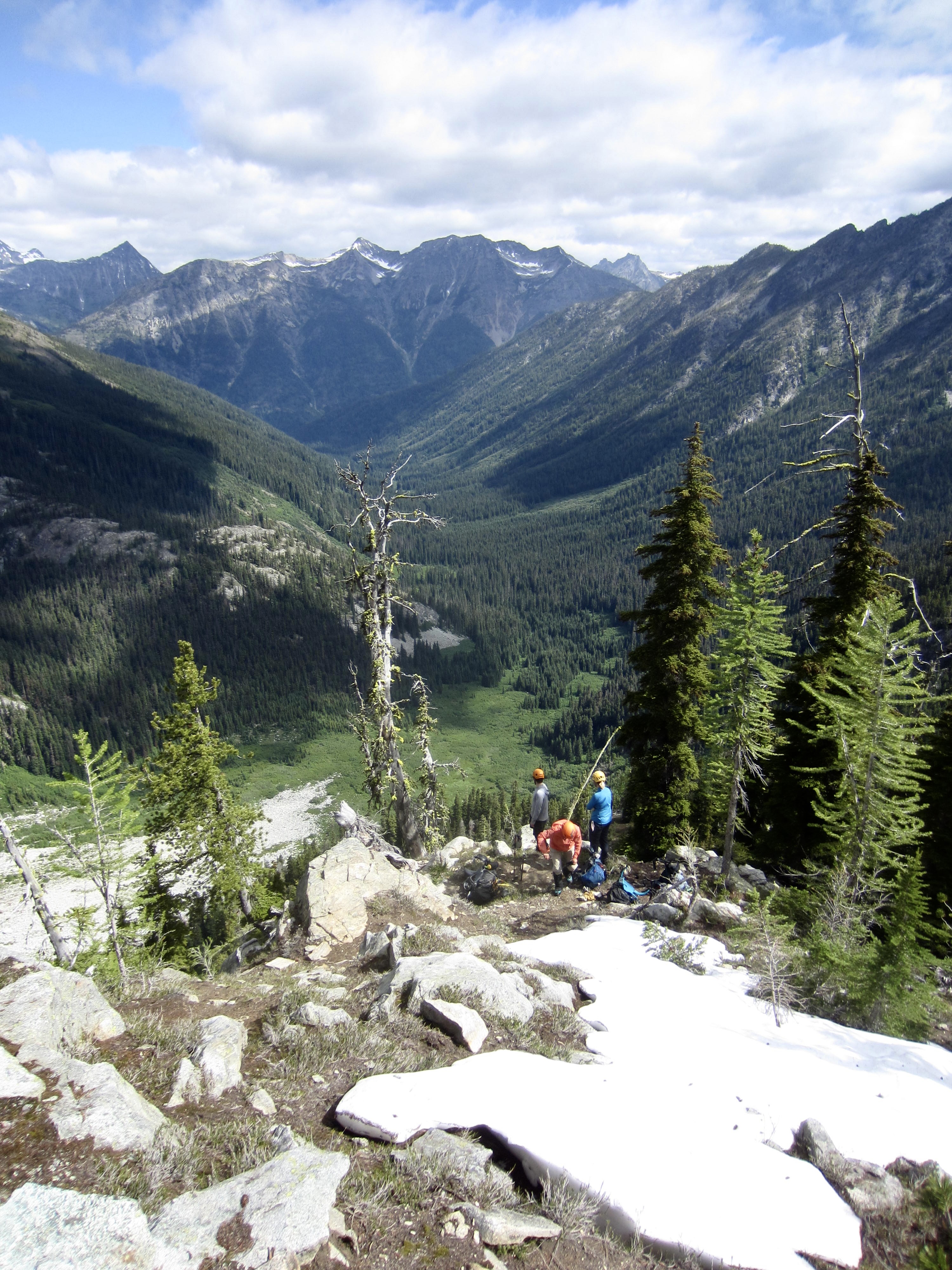
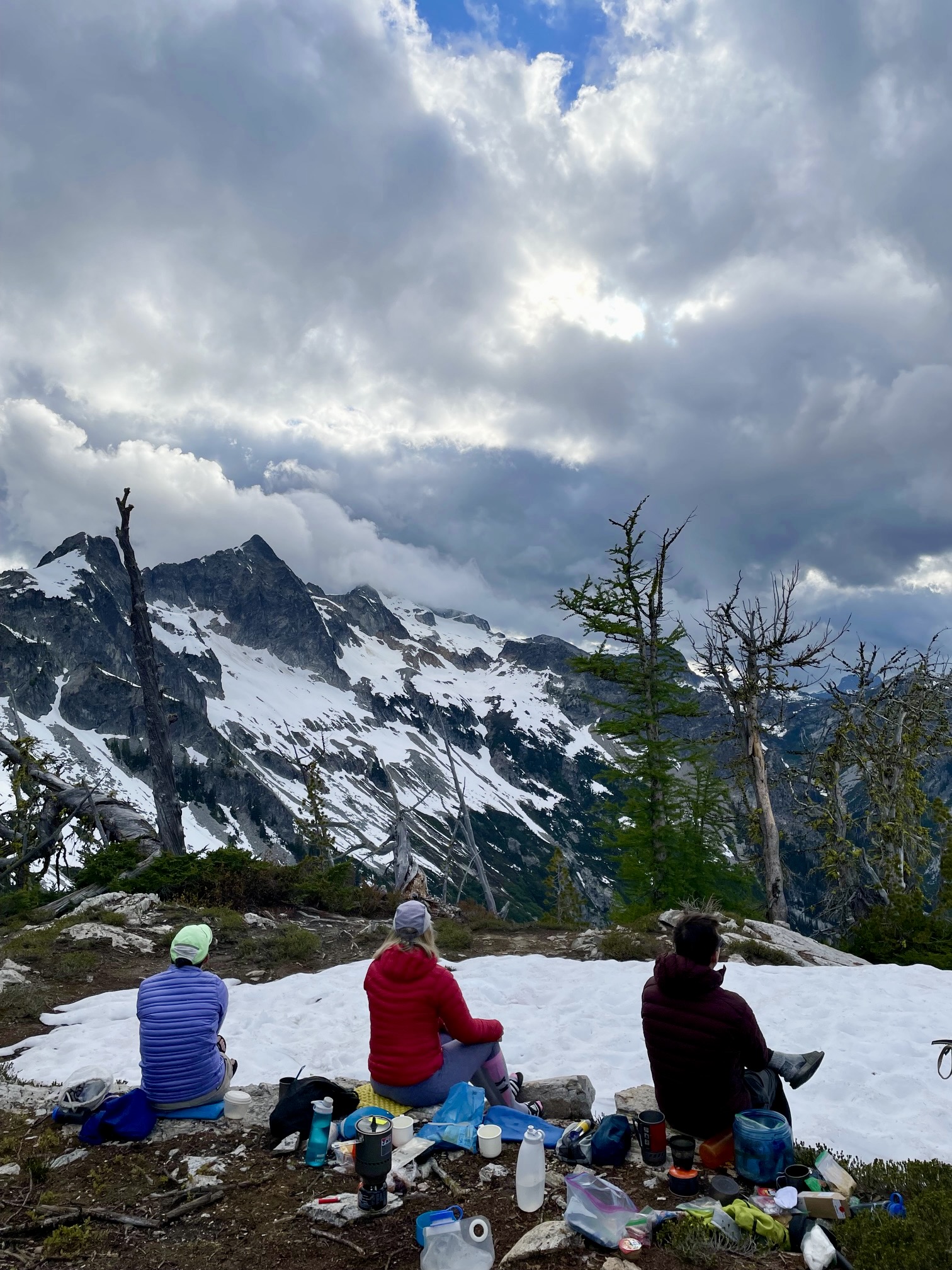
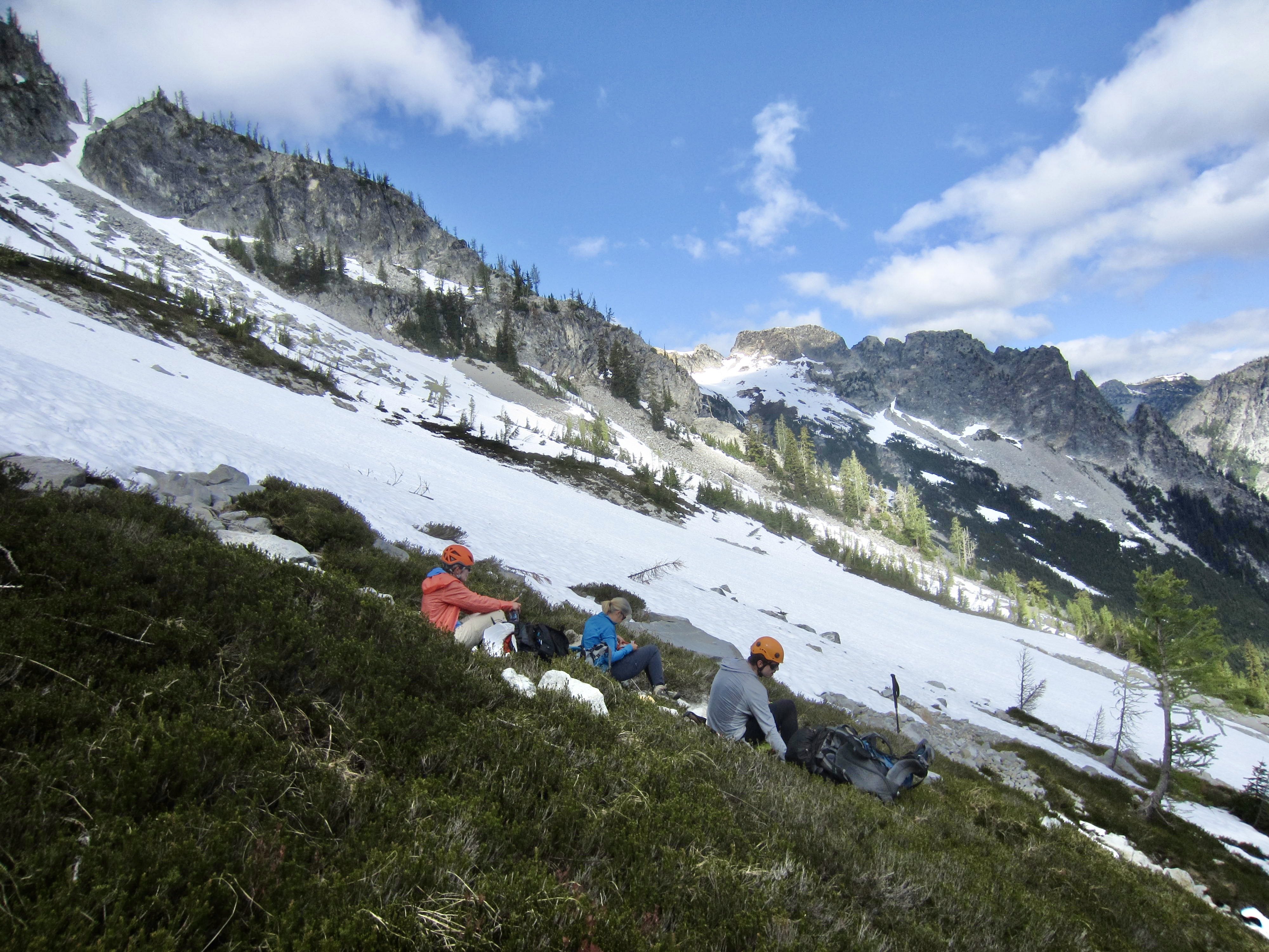
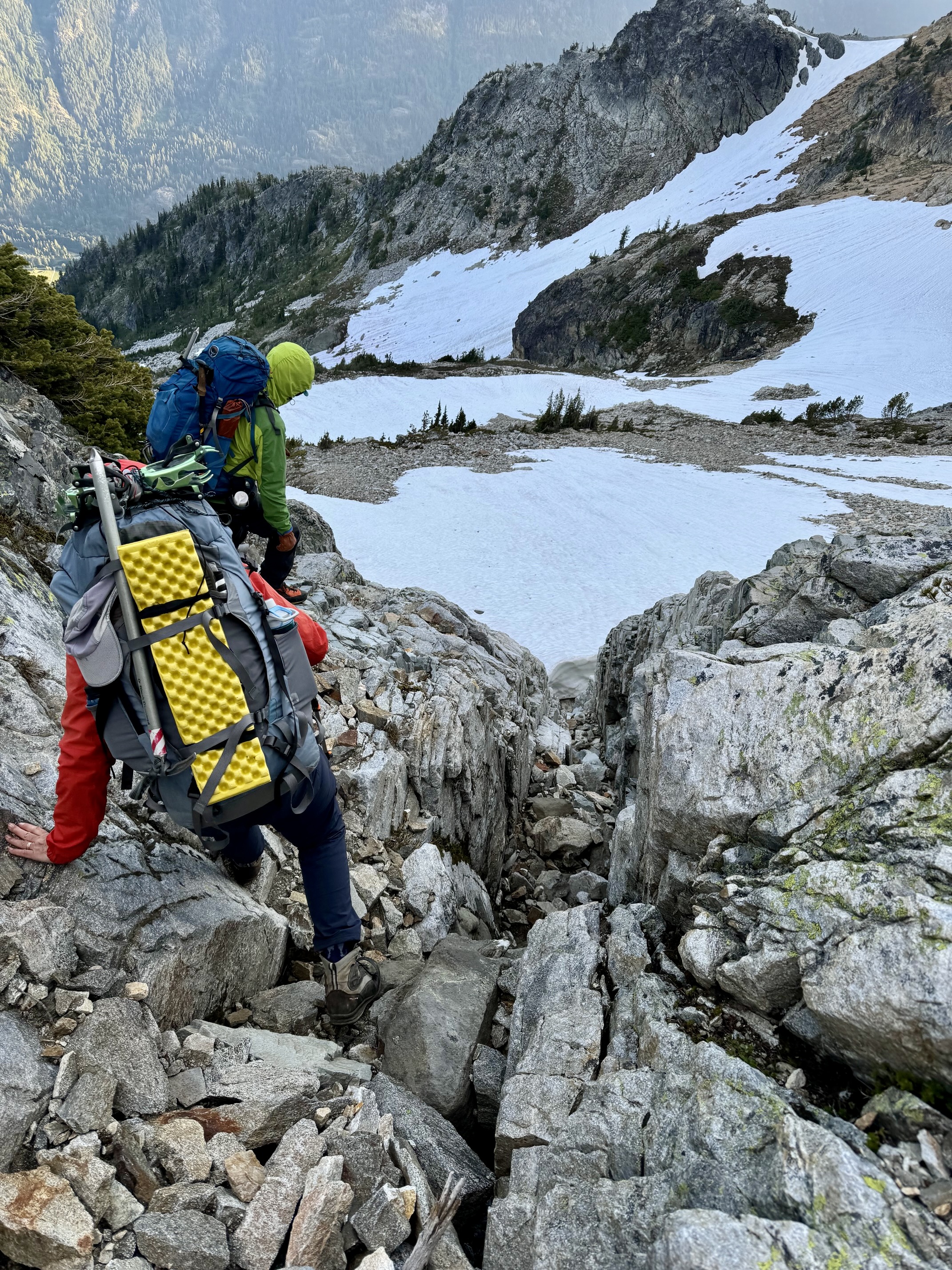
Day 3: Rainbow Pass Arm to Middle Sandalee Glacier
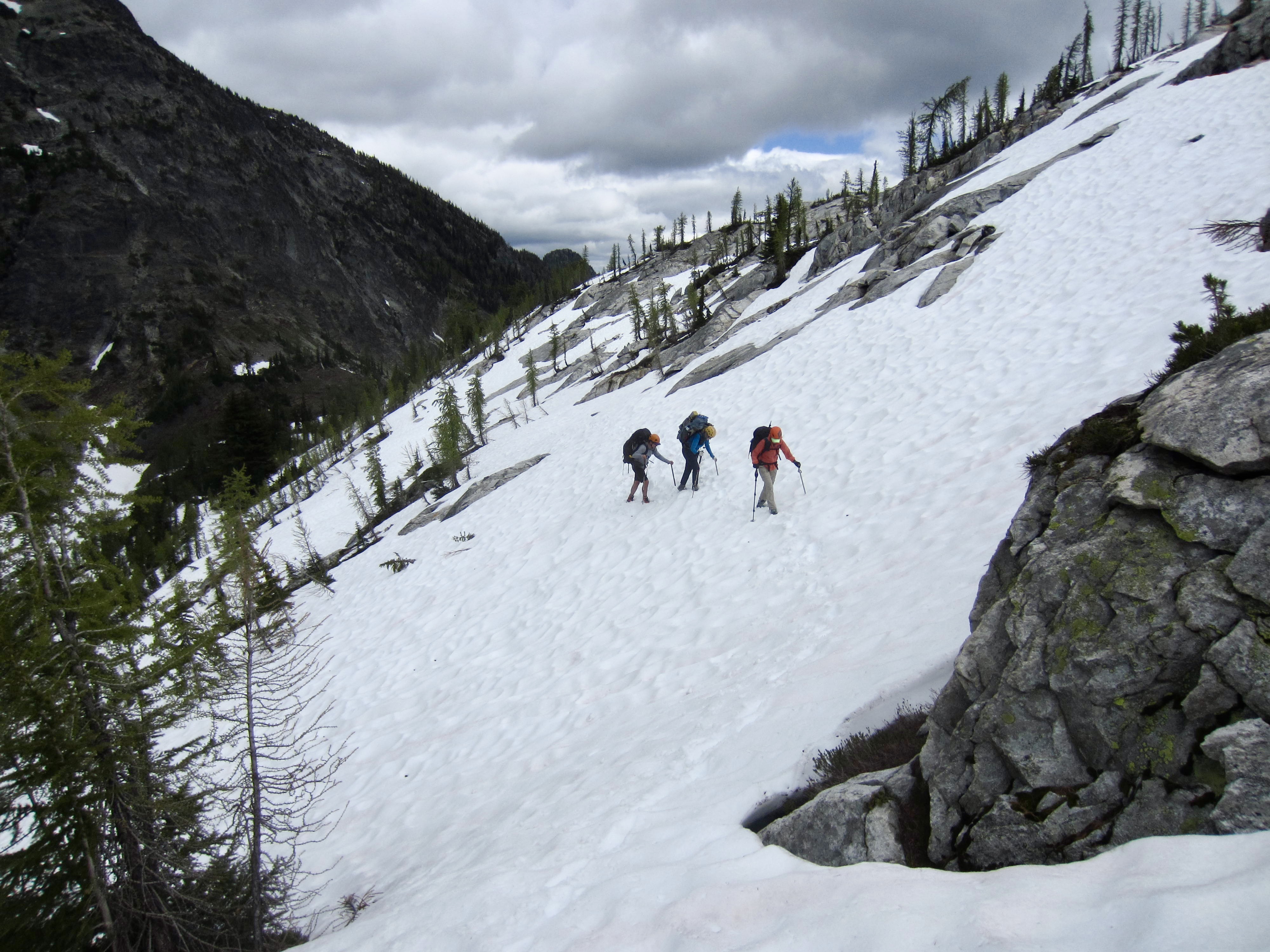
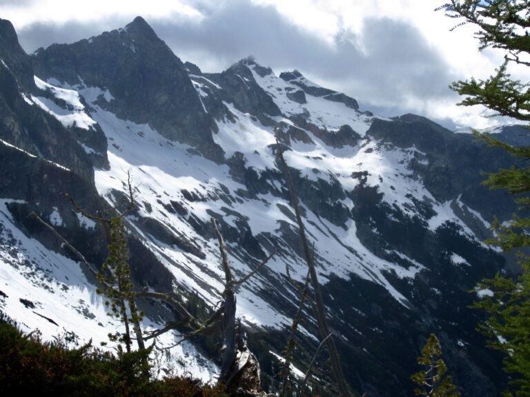
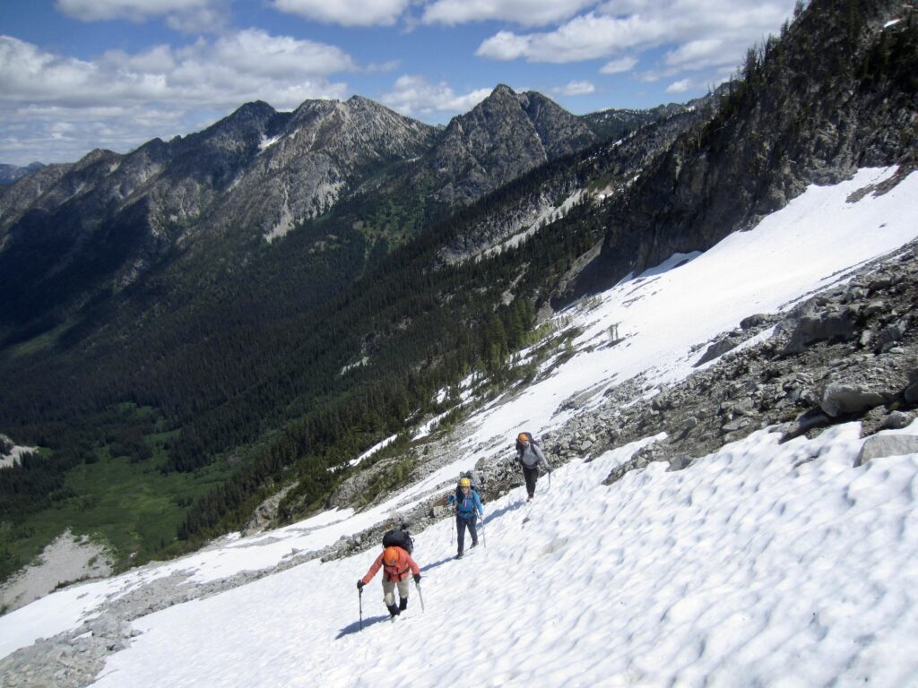
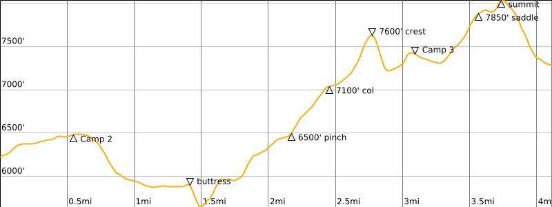
It was a relief to wake up to calm winds and clearing skies in the morning. We took this opportunity to visually trace a likely route across the east ridge hillslope. Having been here 8 years ago, I was confident about parts of the route, but there were other parts that escaped my memory. Furthermore, the extensive snowcover gave everything a different appearance.
.
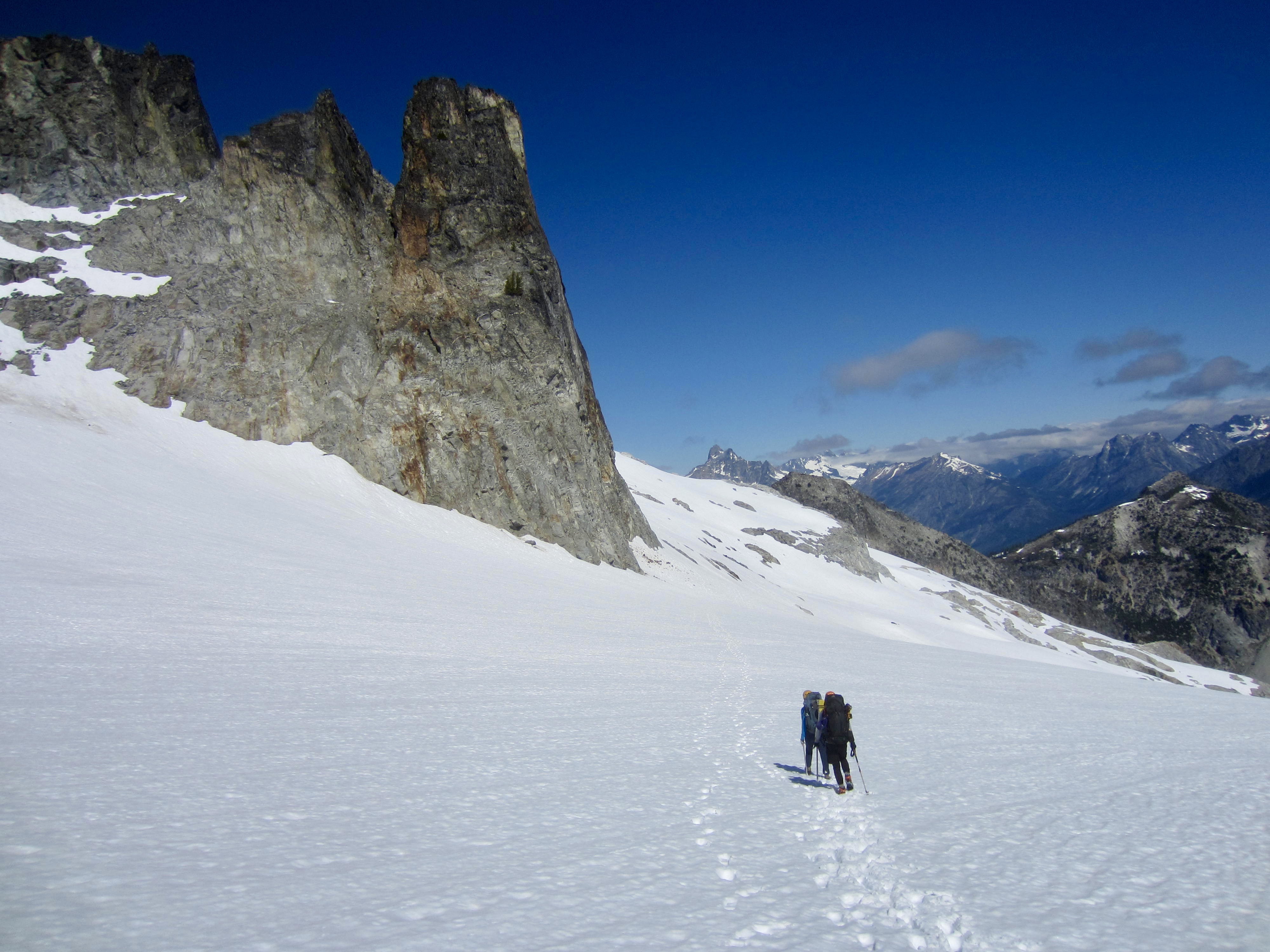
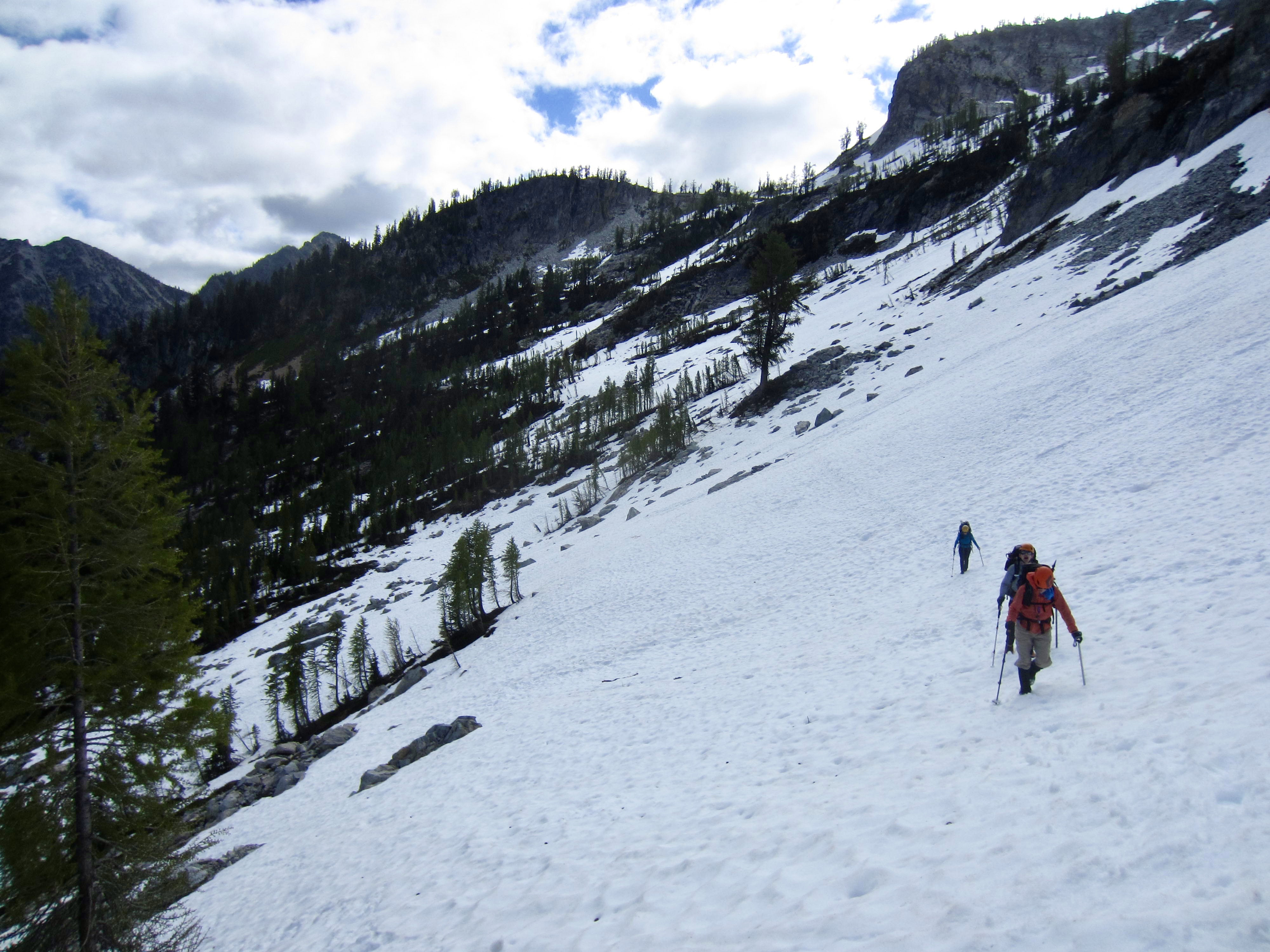
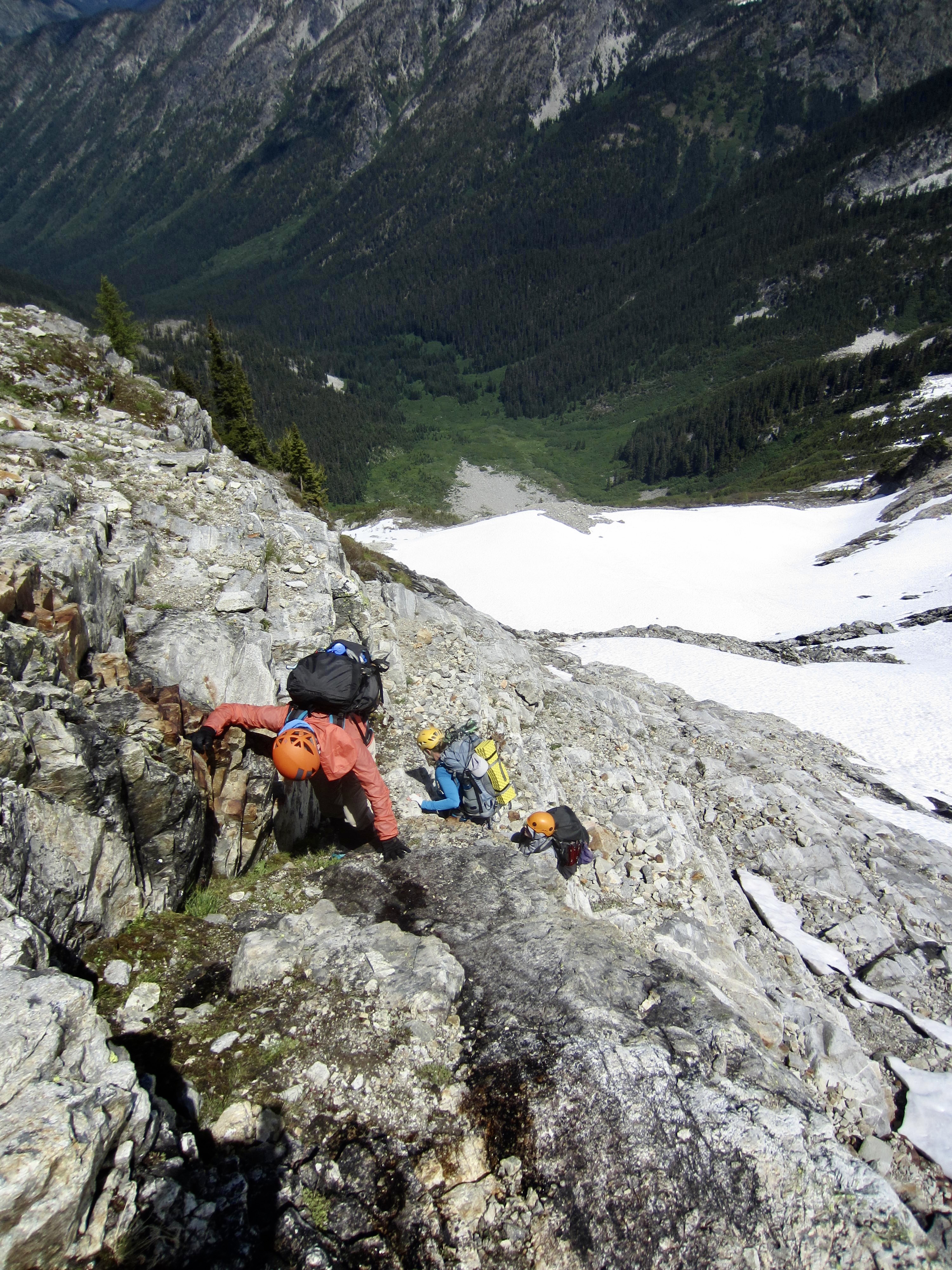
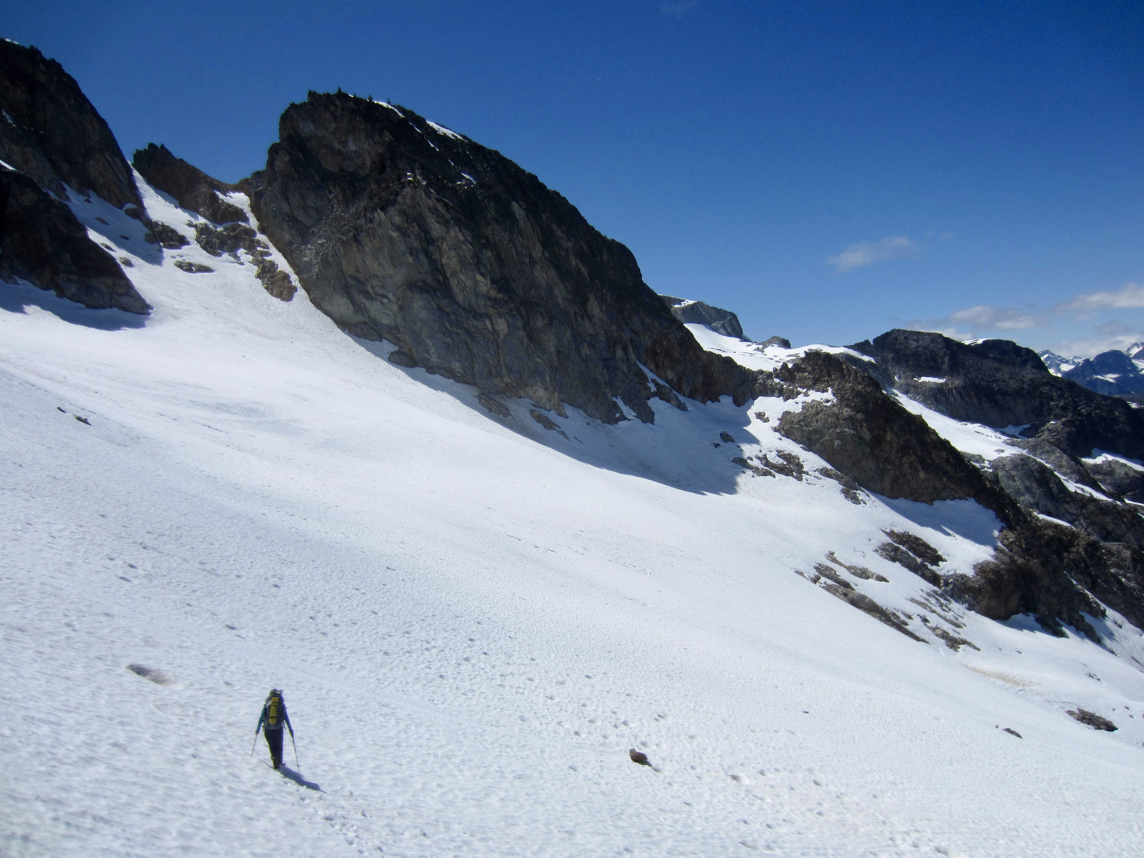
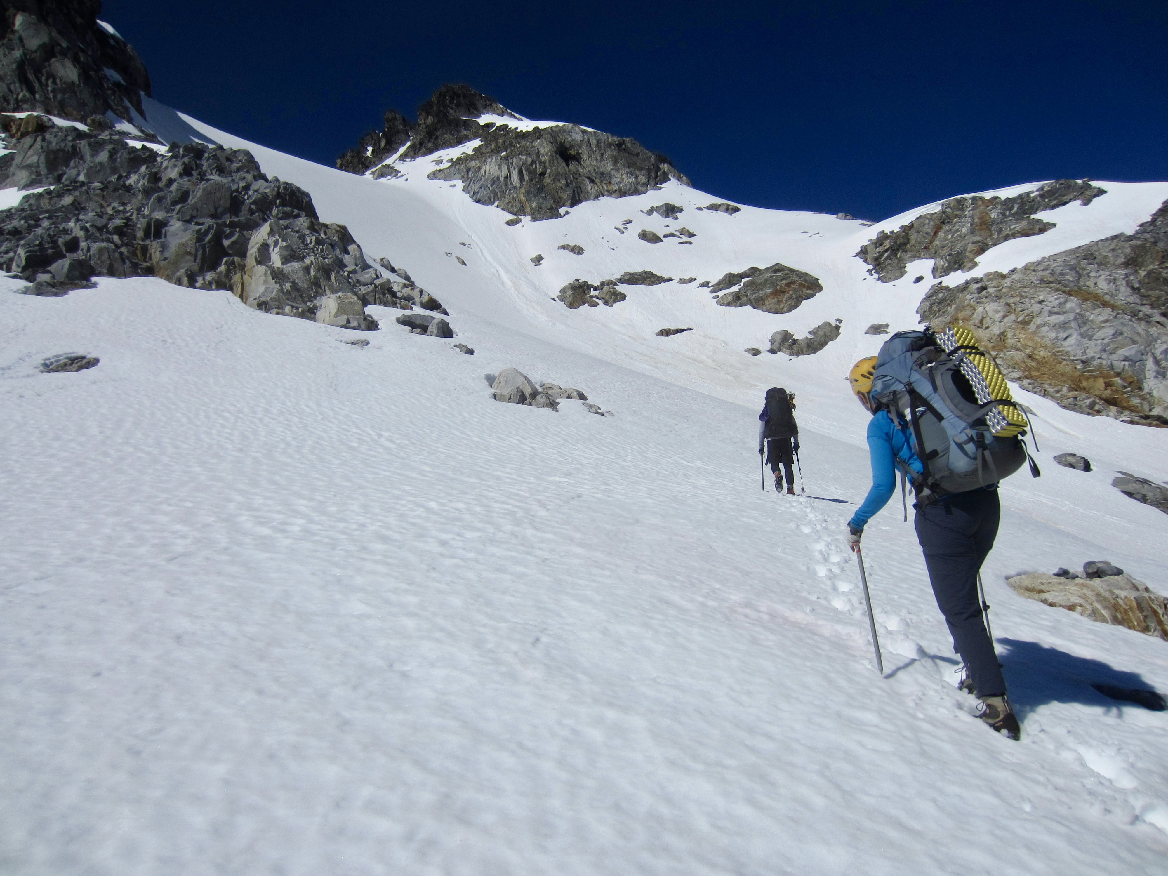
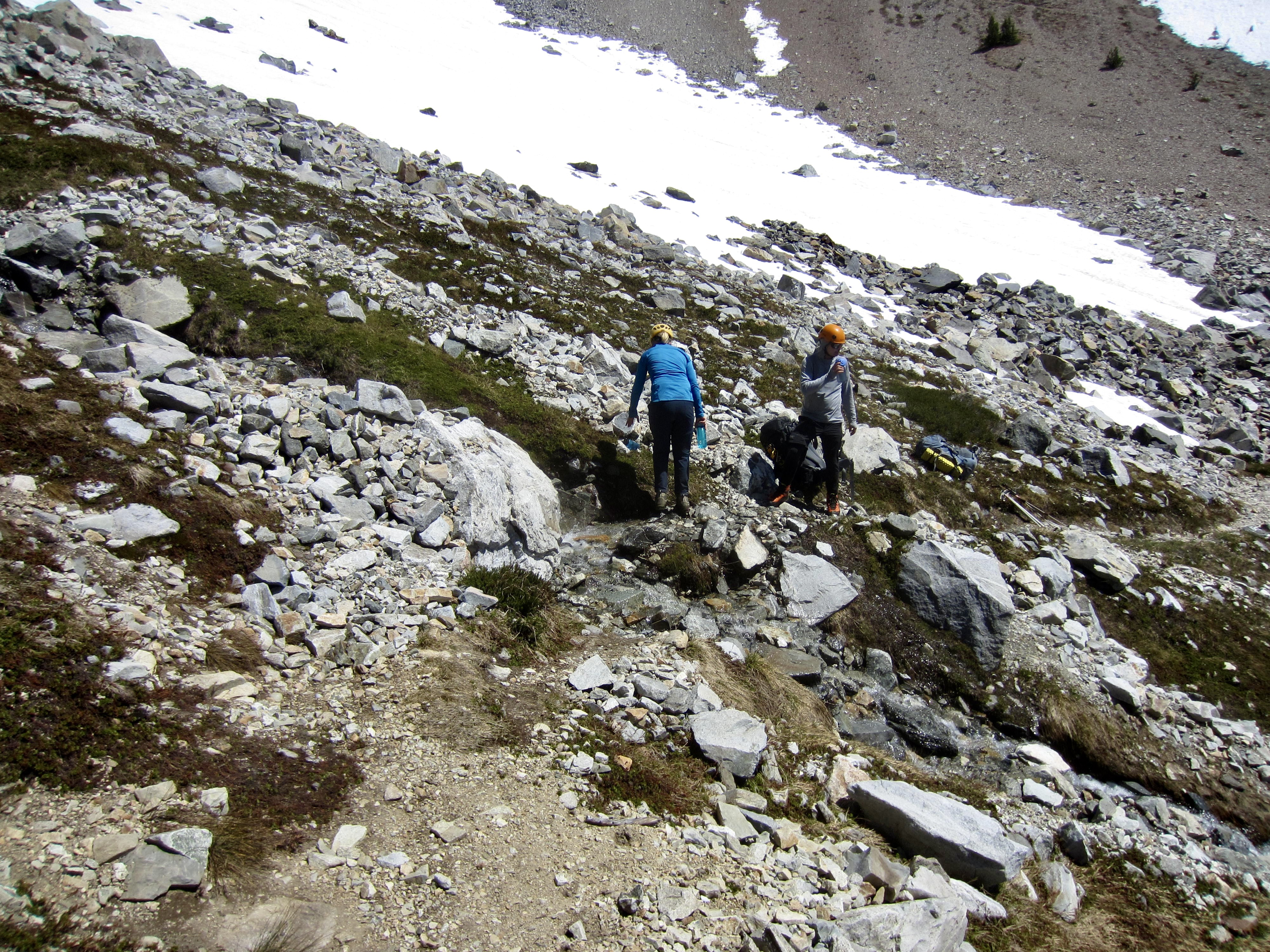
From camp, we easily plunge-stepped 400 feet down the western side of our camping arm and then began contouring across the north-facing hillslope. This would have been a fairly fast and carefree traverse except for the fact that we were traveling on a thin layer of snow over large talus boulders. As such, our feet repeatedly punched through the snow at random locations. It was very nerve-wracking—much like walking across a minefield!
.
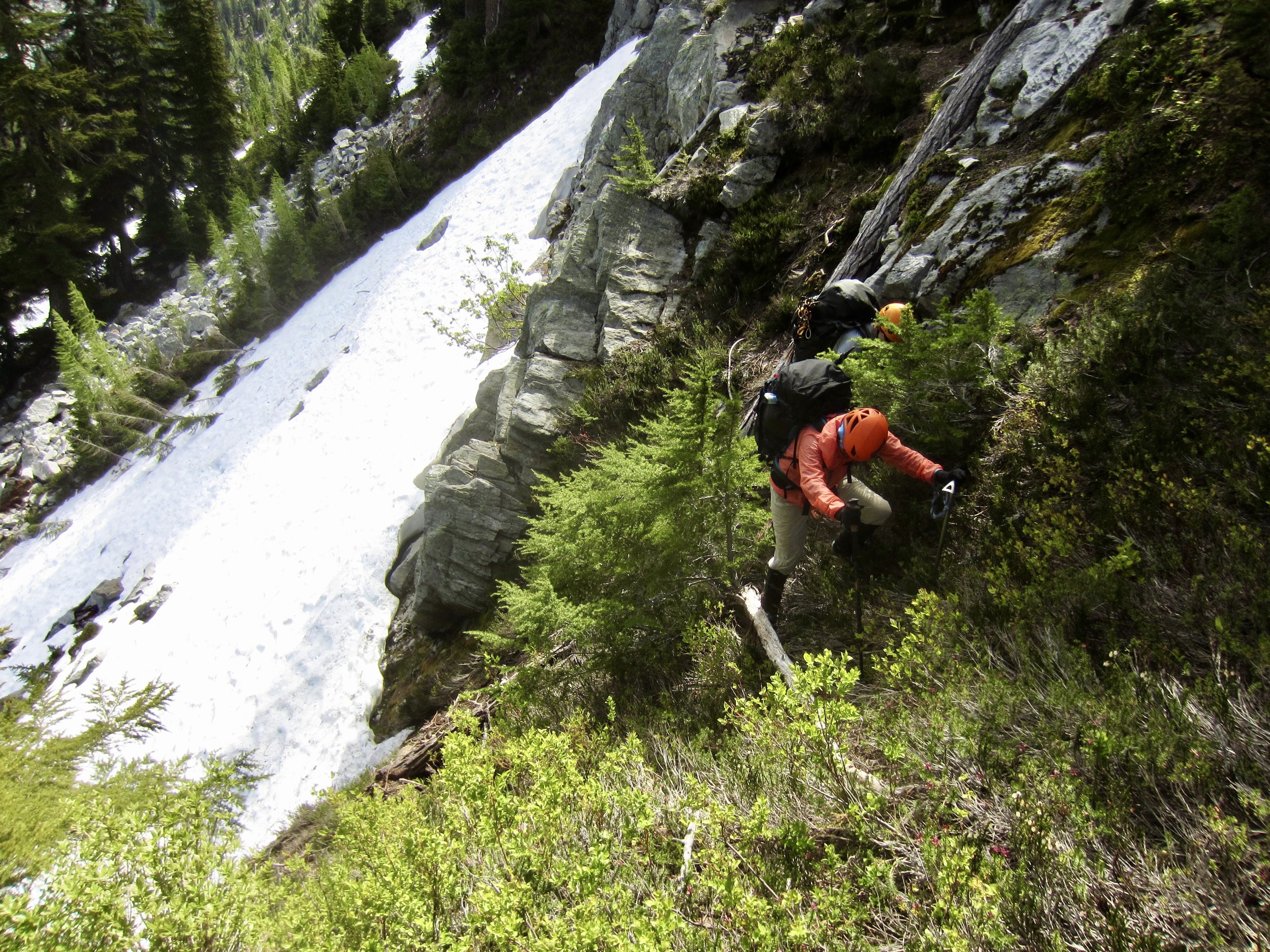
A slow ½ mile of traversing brought us up against a prominent north-trending rock rib at 5900 feet. I poked around in hopes of finding a way of crossing the rib at this elevation but found no feasible route. Instead, we descended 300 feet and crossed under the rib’s buttress at 5600 feet. Once beyond the buttress, we clawed our way up some snow patches and a super-steep heather slope for 400 feet until able to continue traversing.
.
.
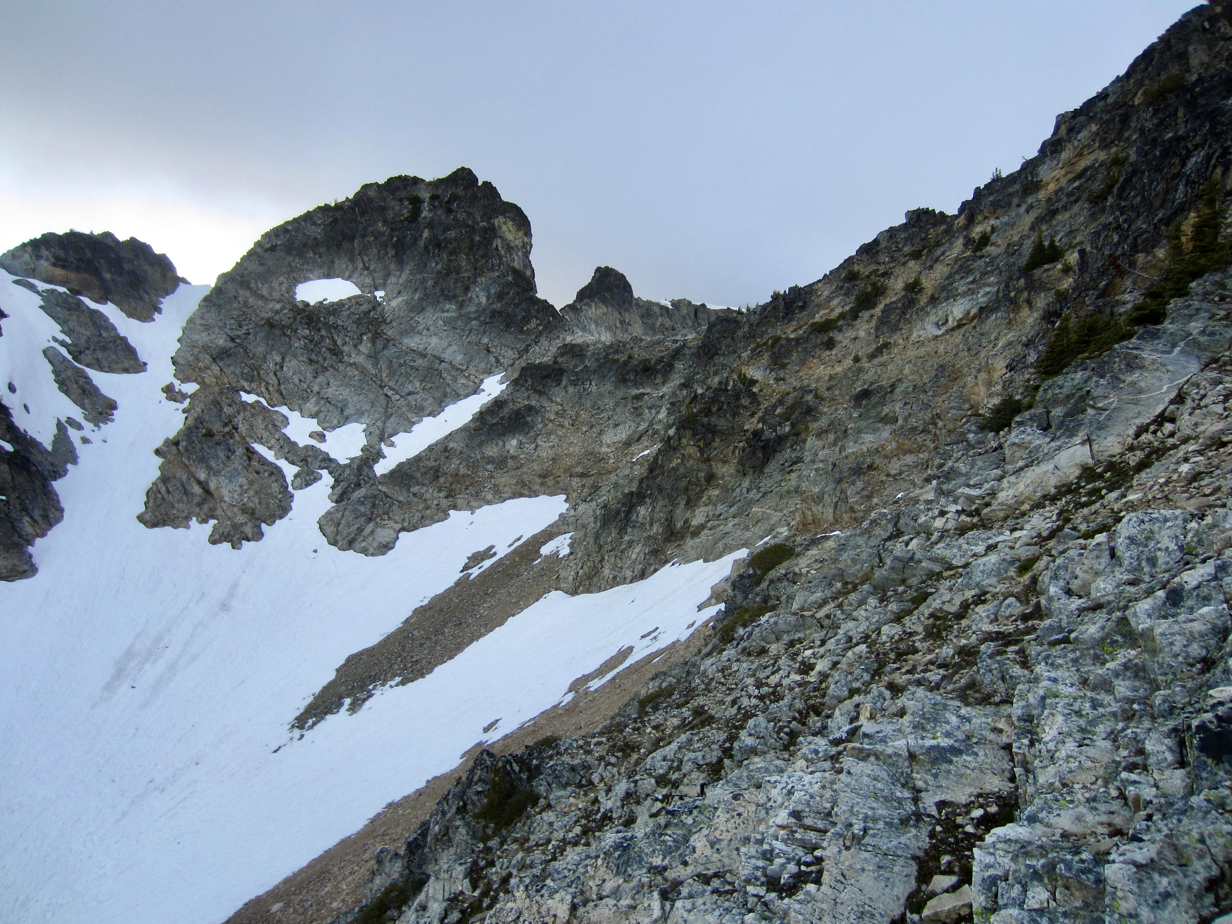
Far ahead, we could see the next questionable spot in our planned traverse route: a point where two separate snowfields pinched out on a low cliff band. The exposed rock at this snow pinch looked terribly steep from a distance, but we hoped that it actually laid back.

.
.
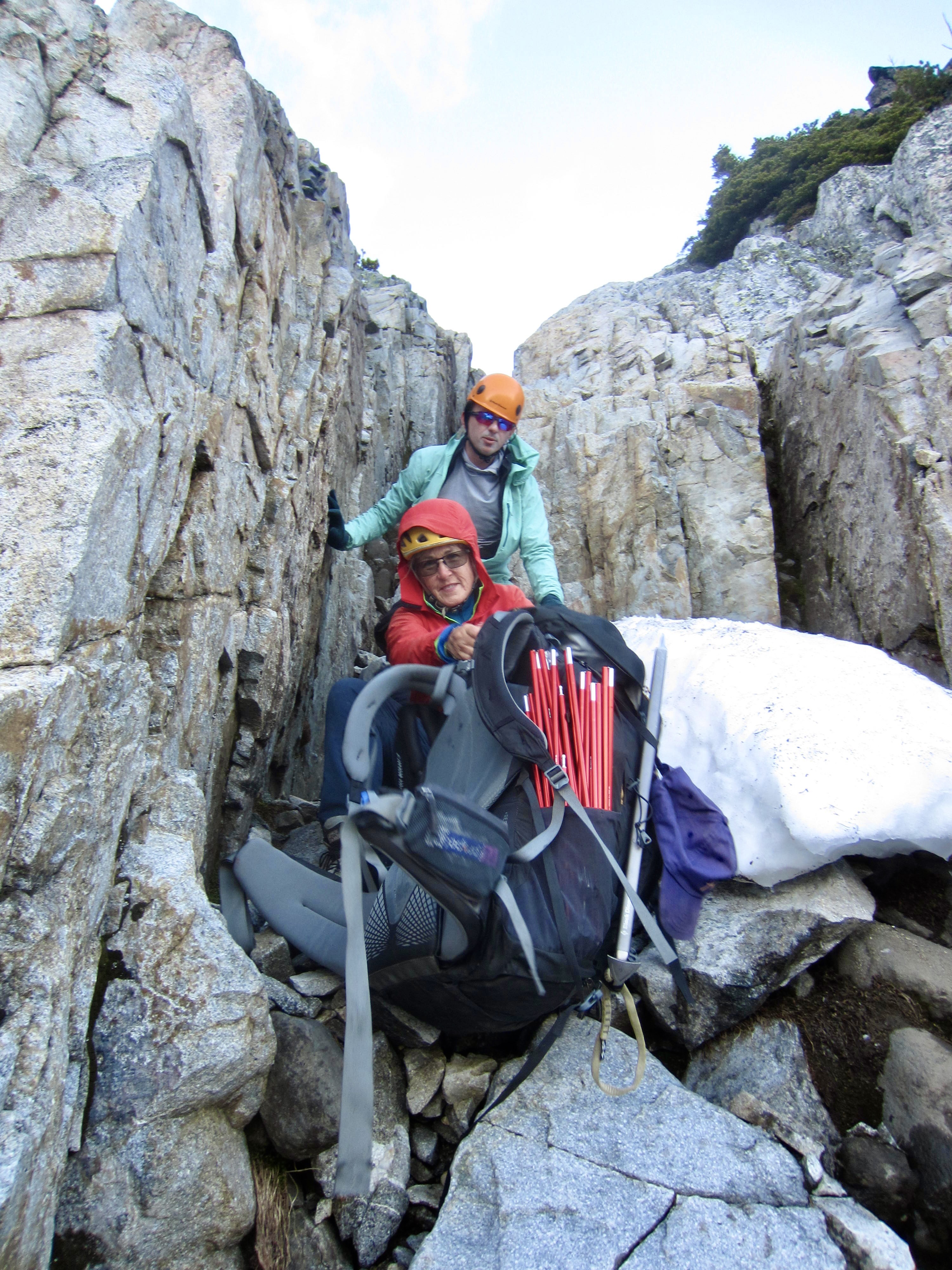
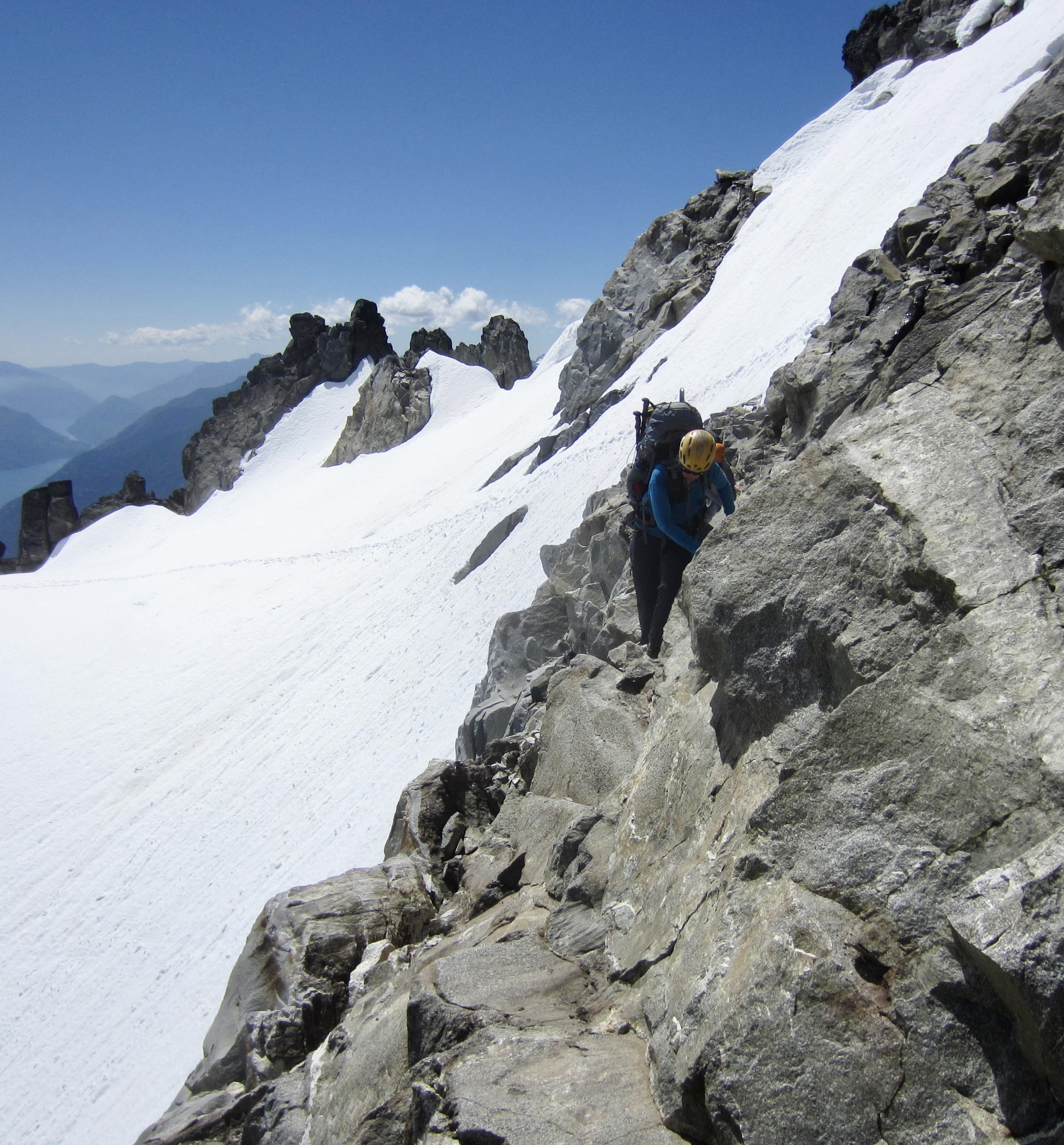
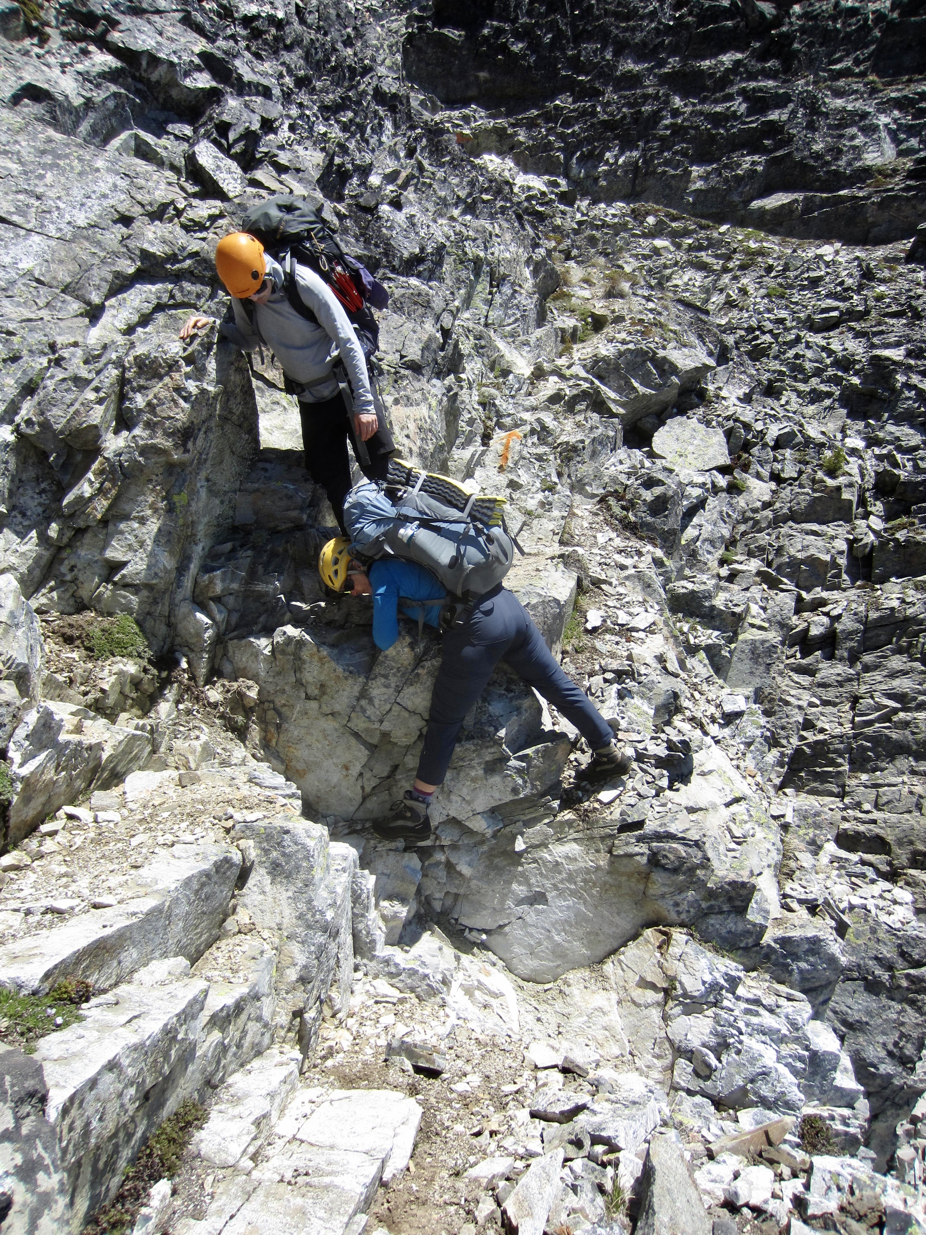
Upon reaching the pinch point, we scoped out a bypass route off to the right. This involved working across a Class 2 ledge and then scrambling up a Class 3 crack with moderate exposure. It would have been easy with light summit packs, but our large backpacks made it fairly sporty.
.
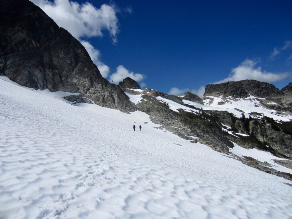
Once past the snow pinch, we were faced with another large rock rib. I knew from my previous visit that we could angle up moderately steep snow to gain a 7100-foot col on the left side of the rock rib. This went very well, and we crossed over the col at 2:30pm (6.1 hours + 1450 feet from Camp 2)
.
The snow col opened onto a glacial cirque that is hemmed in by near-vertical cliffs. Down to the right, the cliffs appear to dive into the glacier; this might provide a route around the base of the cliffs but I have not explored such a possibility. Slightly up to the left is a 7500-foot col that I investigated in 2016 but found to be an impasse. Far up to the left is a hidden snow finger that leads to a 7600-foot notch in the east ridge crest. Jon, Todd, Adam, and I climbed to this notch in 2016, and although we did not explore further, I felt that it would offer a detour around the cliffs and into the next cirque. Today, we chose this option.
.
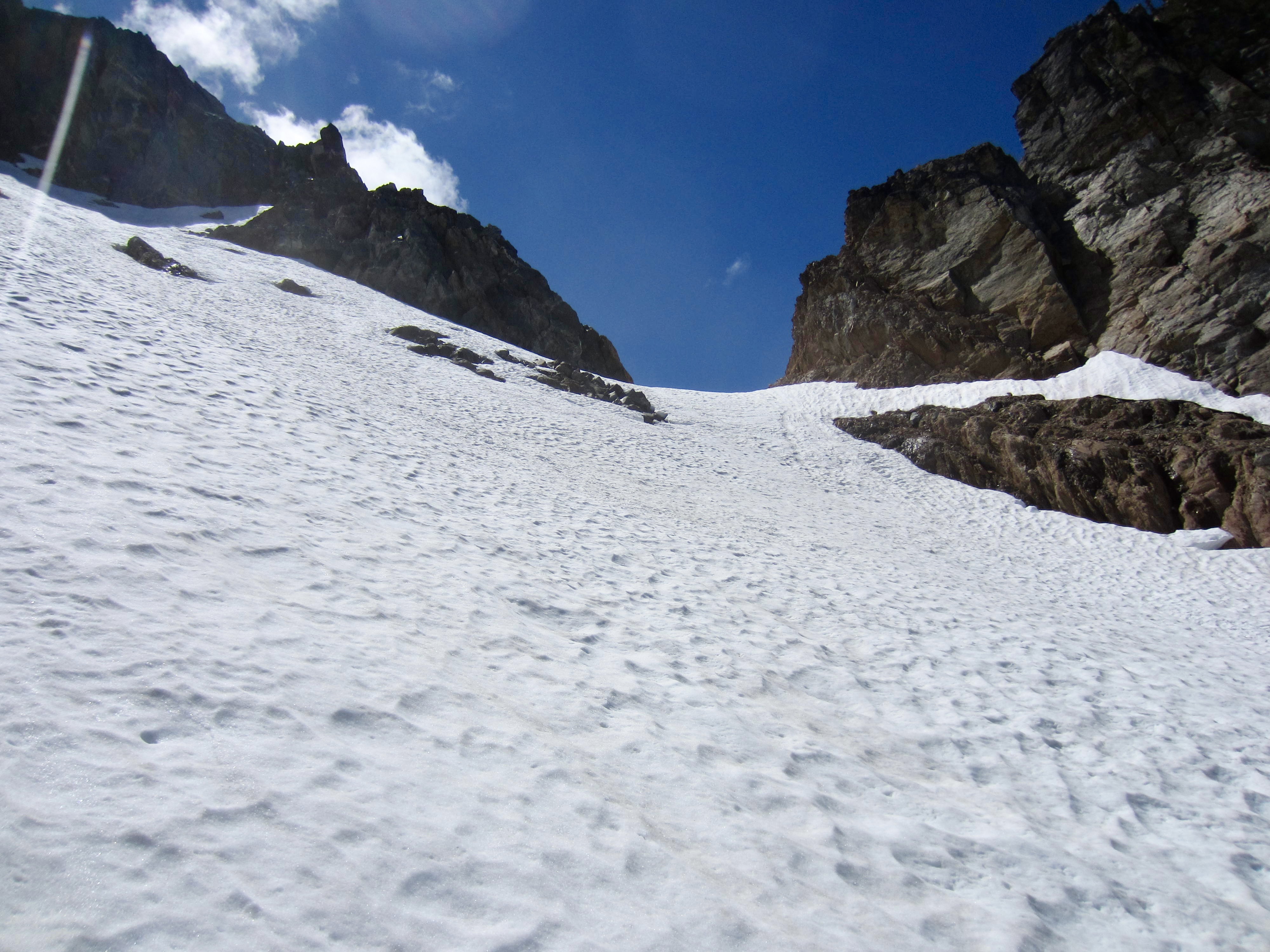
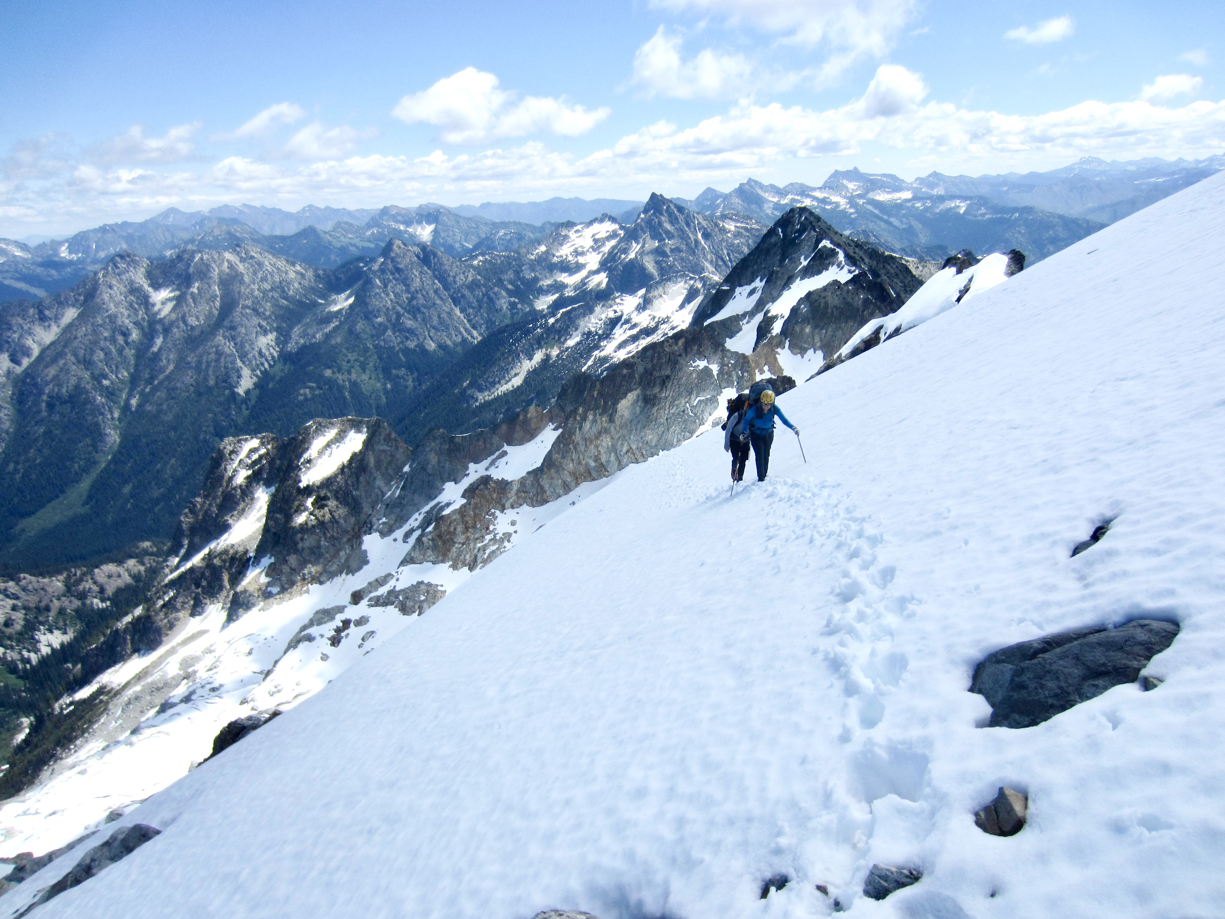
We booted over to the base of the hidden snowfinger, which angles up to the southeast, and then we began zigzagging upward. The gradient of this snowfinger approaches 40 degrees and the runout is pretty bad, but snow conditions were quite favorable. We topped out at a notch in the ridge crest at 3:40pm (7.4 hours + 2050 feet from Camp 2)

.
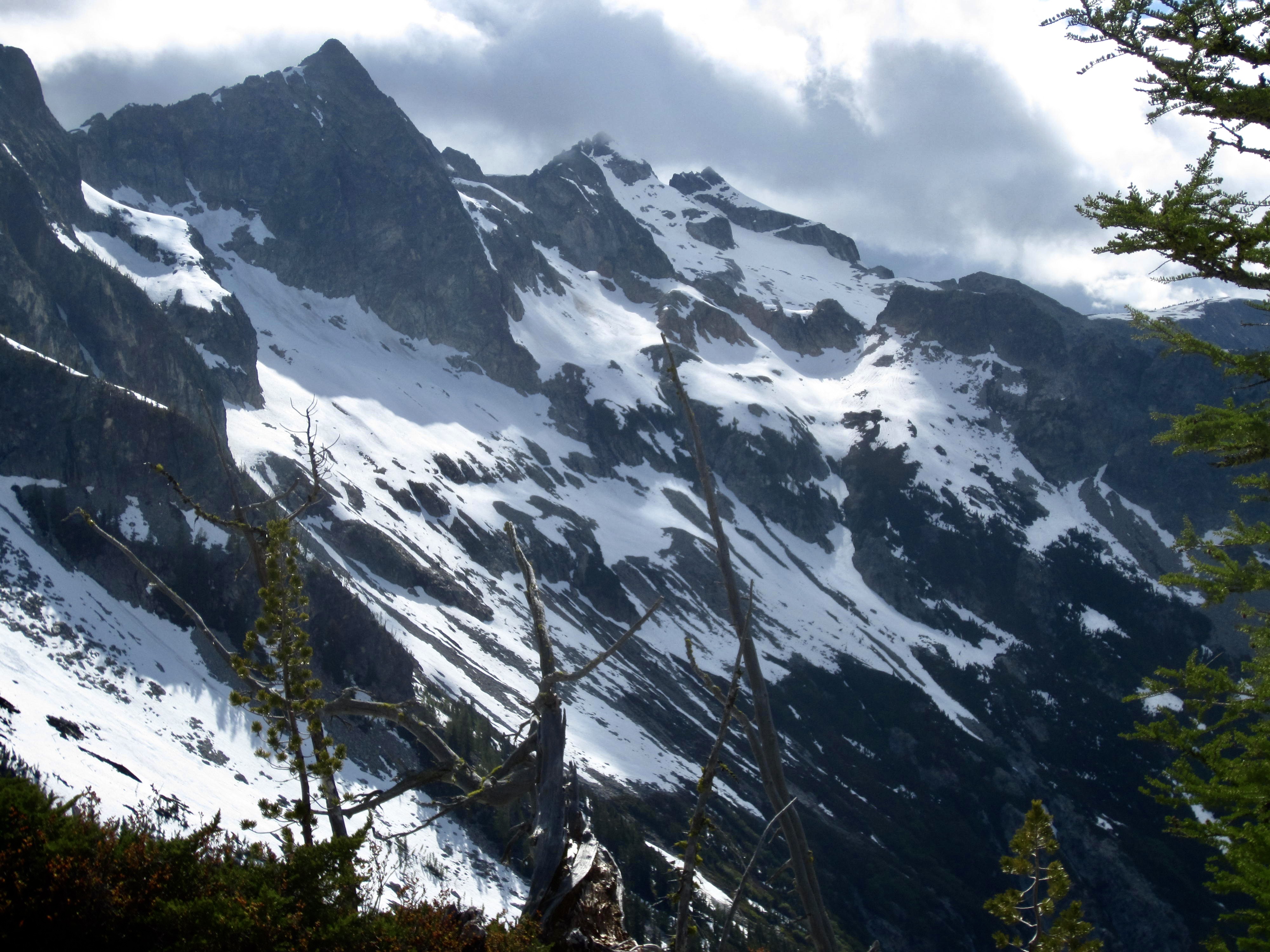
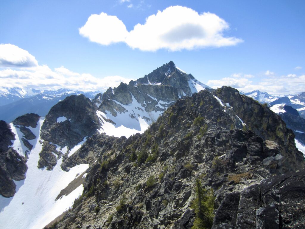
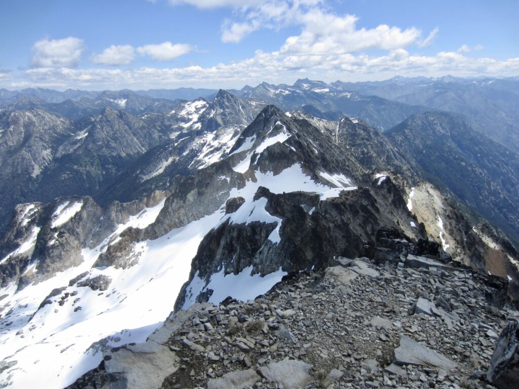
From our notch in the ridge crest, we could see the summit of McGregor Mountain, clearly identifiable by its radio antenna. Between us and the summit was the 7450-foot ridge saddle that we needed to cross in order to reach the adjacent cirque. It was not far away, but the intervening hillslope looked steep, crumbly, and altogether unsavory!
.
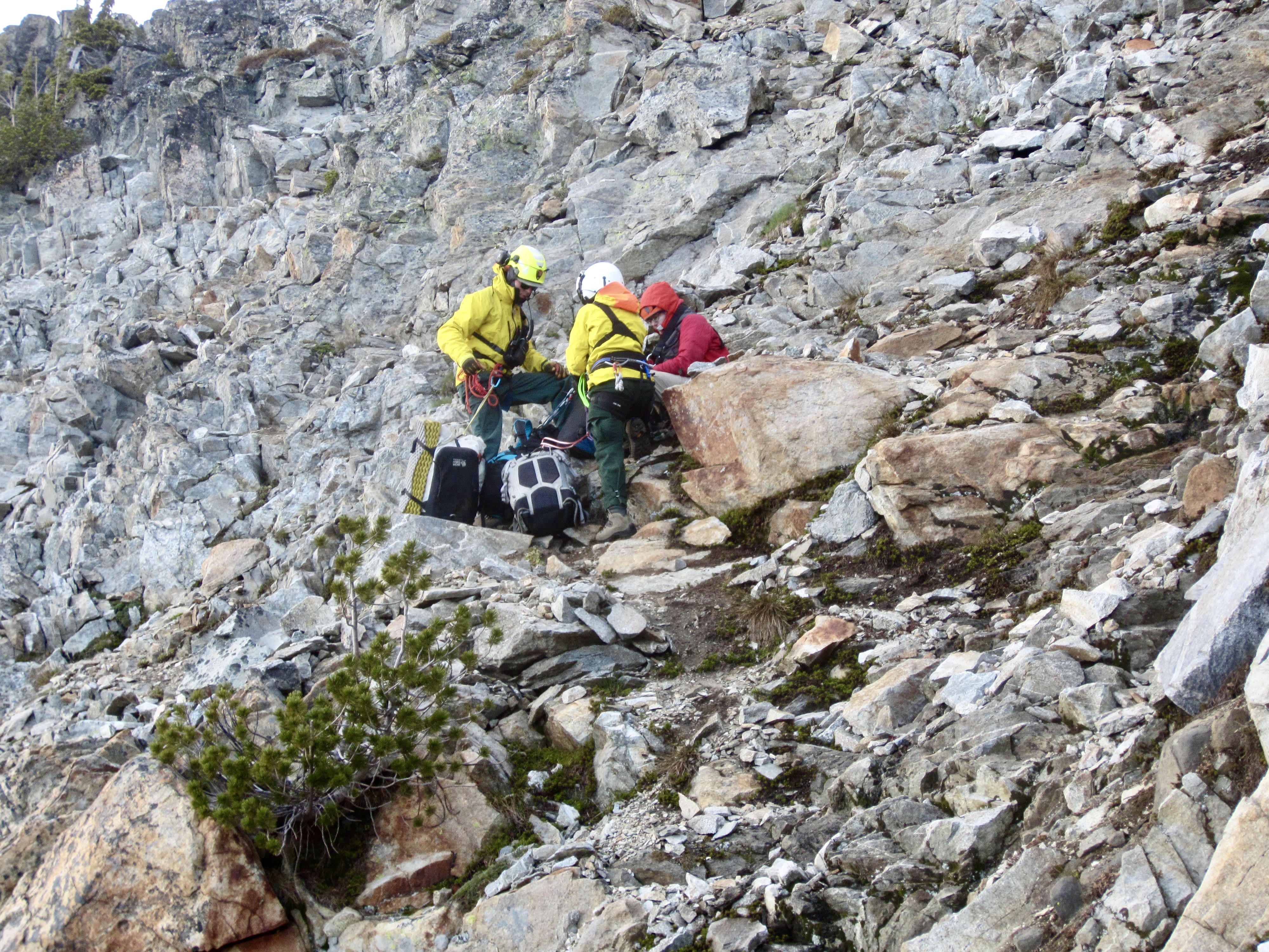
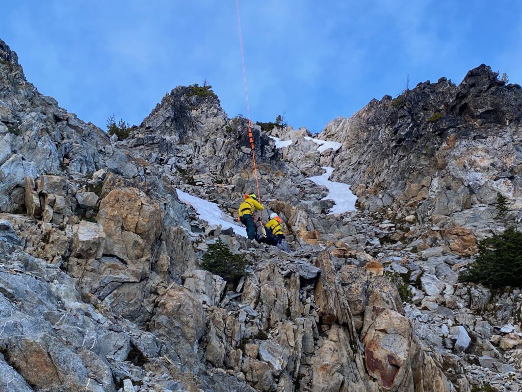
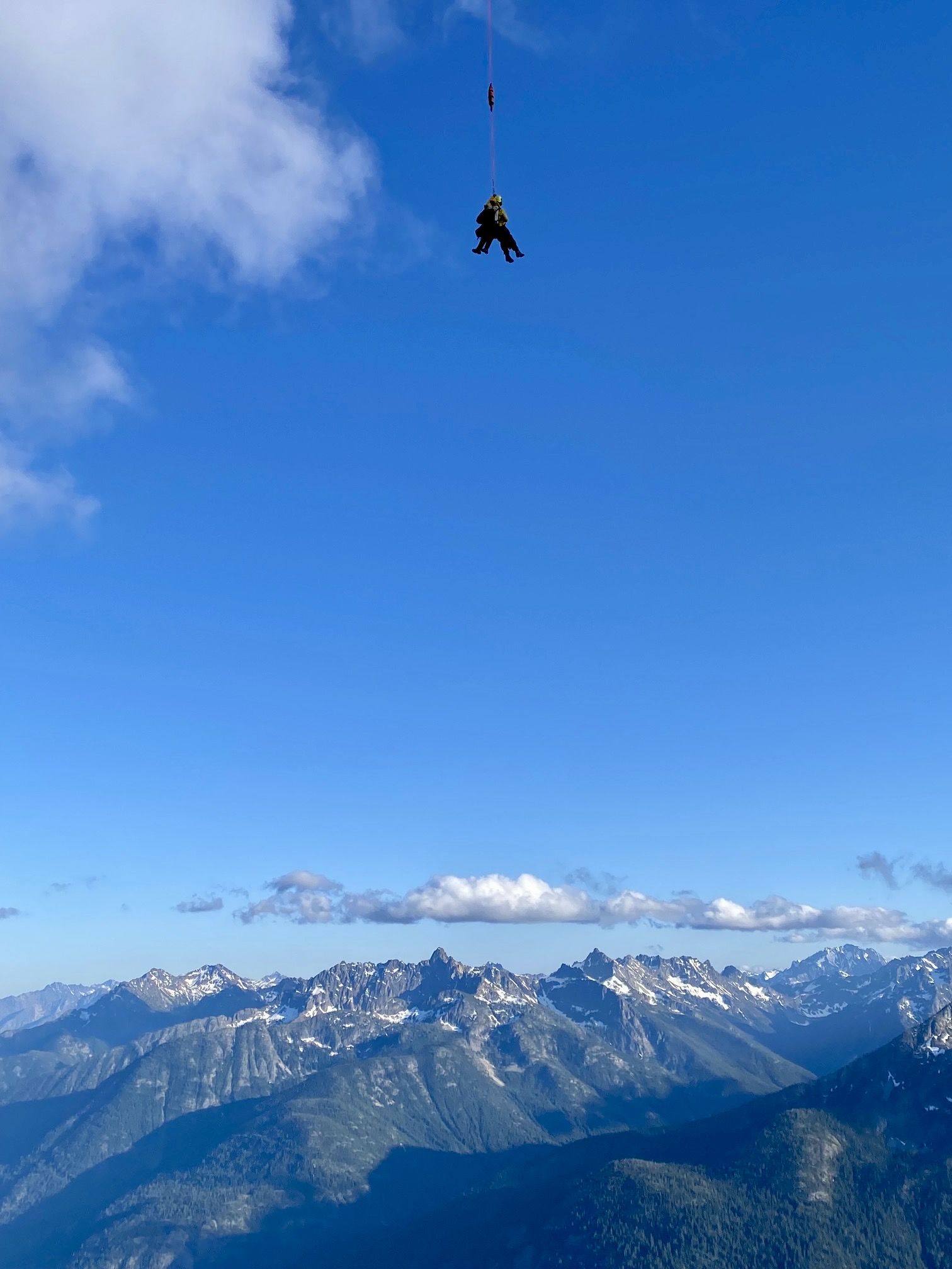
After a snack break on the crest, we began descending the south side of the ridge. Andrew and I went first, trying to avoid dislodging too many loose rocks. Eileen and Lisa came next, slowly and carefully working their way down. During this descent, Lisa began experiencing some cardiac arrhythmia and feeling very weak. She thought a short rest would revive her, but when she complained of pain in her chest and left arm, we all realized that this was a serious situation. It was quickly decided to push the SOS button on our In-Reach satellite texter.
.
The next 2 hours involved a flurry of texting communications, as a rescue operation was put into action. Garmin (the In-Reach maker) contacted the rescue agencies with jurisdiction—Chelan County and National Park Service—as well as our two contact parties back home. Park rangers then texted with us to get details regarding Lisa’s status, prevailing weather conditions, terrain conditions, and other important information. It was another example of how satellite texters have made rescue operations so much more efficient. They are truly a game-changer.
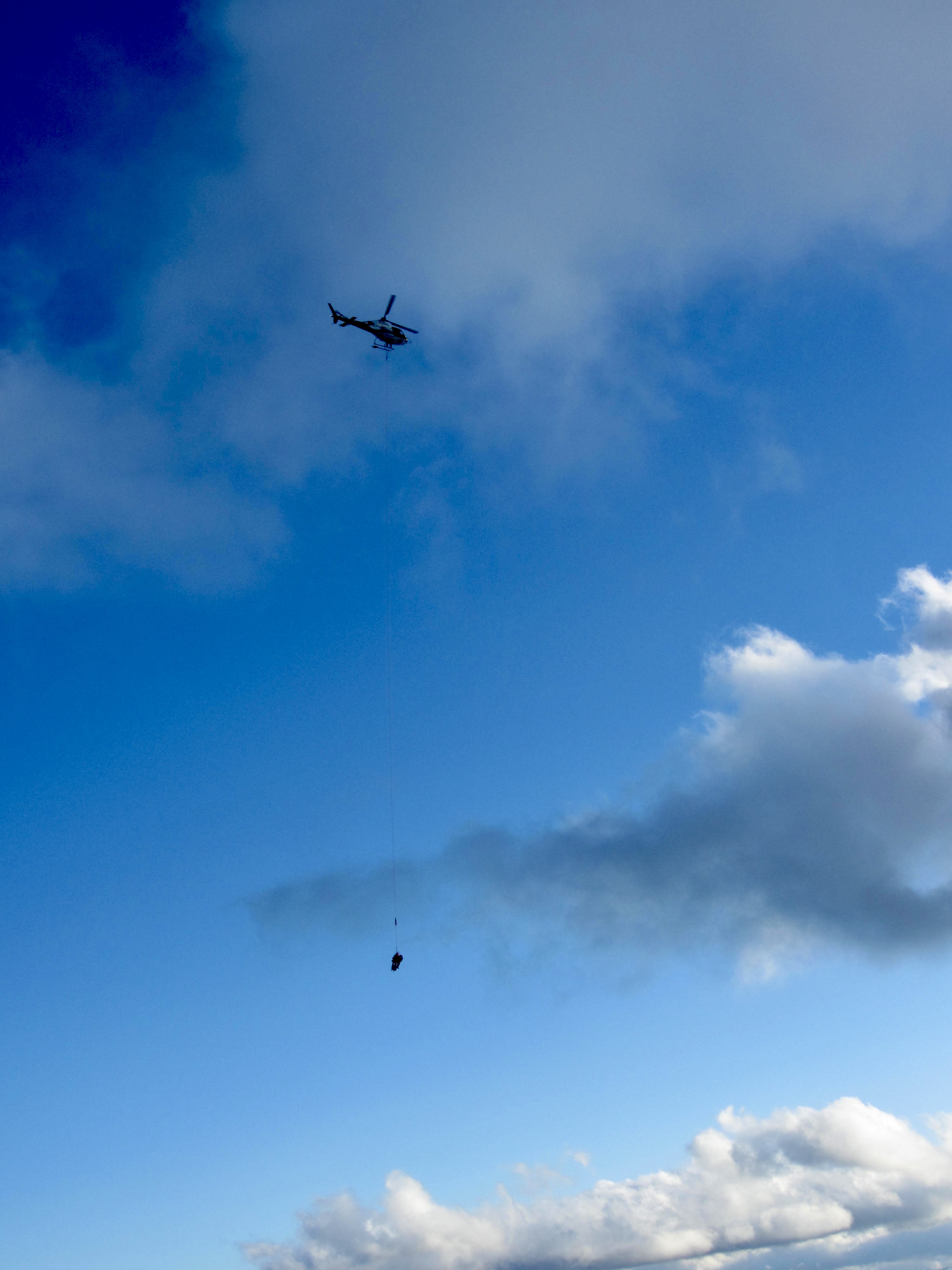
After a remarkably short 2 hours, a helicopter arrived overhead and began an aerial assessment of the local terrain to find a suitable landing zone. We were surrounded by steep slopes, so the helicopter needed to go reconnoiter the opposite side of the mountain. It then reappeared 30 minutes later with two rangers suspended from a short-haul cable. The pilot lowered them precisely to Lisa’s location and they immediately took charge of the situation.

.
The rangers did a quick evaluation of Lisa’s vital signs and asked a few simple questions to check her cognition. There was a humorous moment when they asked her what day it was; she struggled to answer, and I tried to defend her by blurting out, “I don’t even know what day it is!” Seriously, anyone who has been on a multi-day backcountry trek knows that the conventional calendar becomes a nebulous contrivance; mountain days are merely relative (Day 1, Day 2, etc.) and are tracked using tangible metrics, such as how much food is remaining in one’s provision sack.
.
Within 30 minutes after landing, the rangers clipped themselves and Lisa onto the short-haul cable and were whisked away to Chelan. For those of us on the ground, this is a scene that brings such mixed feelings. On one hand, it is always sad to have any team member exit from a trip for any reason. On the other hand, there is great relief in knowing that the person is now in better hands. Lisa had now joined Eileen, me, and countless other climbers as a member of the Helicopter Rescue Club, which fellow member Stefan Feller describes as the club that nobody wants to join. For a detailed description regarding what happens during an InReach-initiated mountain rescue, see my separate informational page.
.
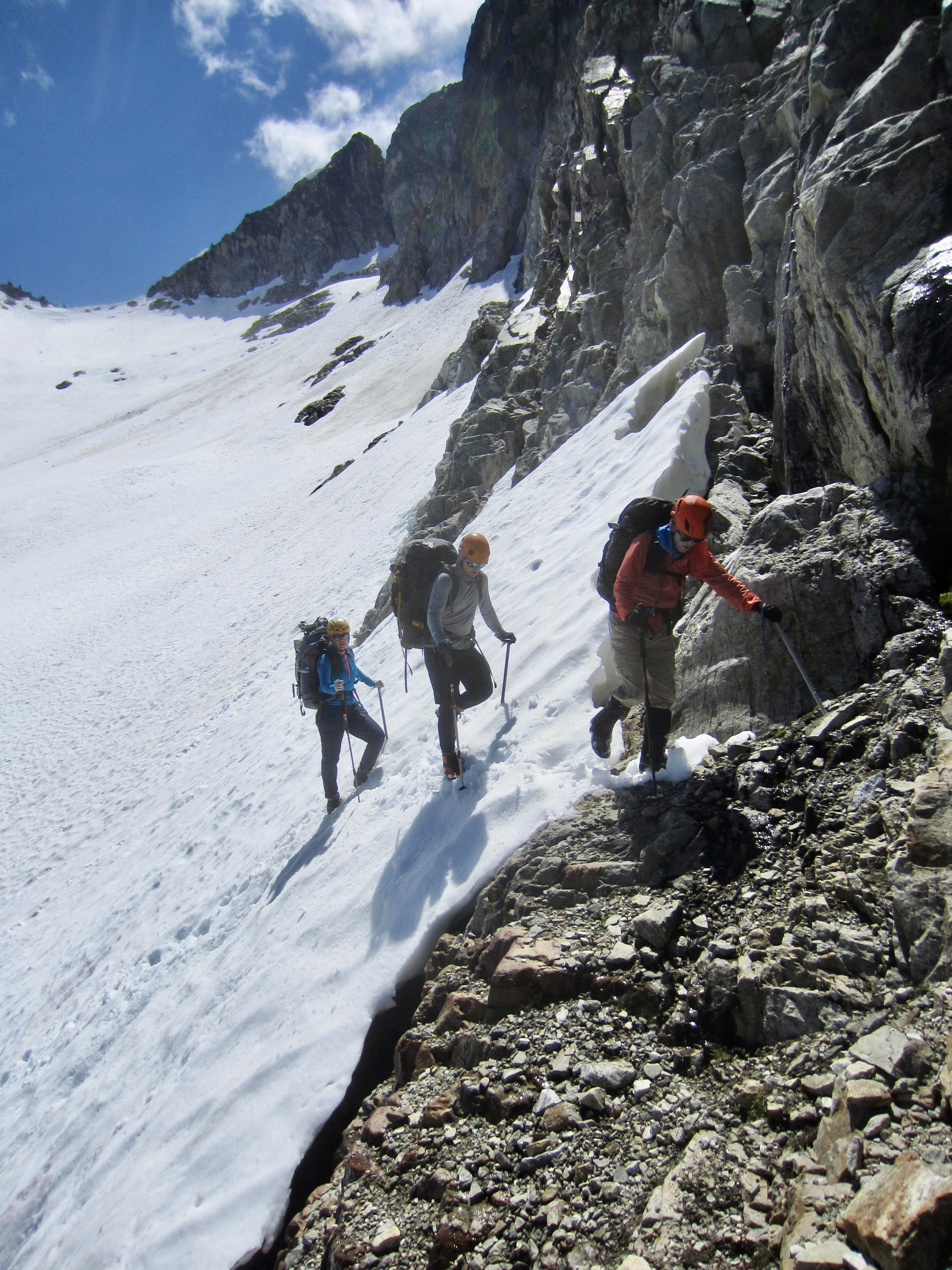
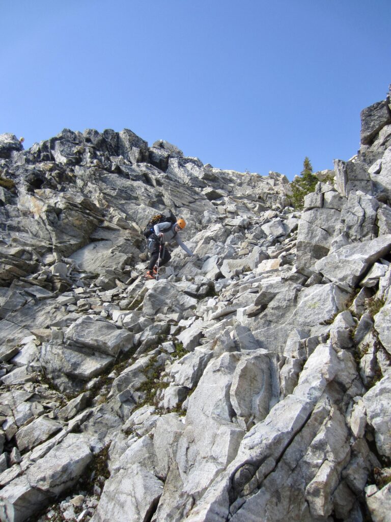
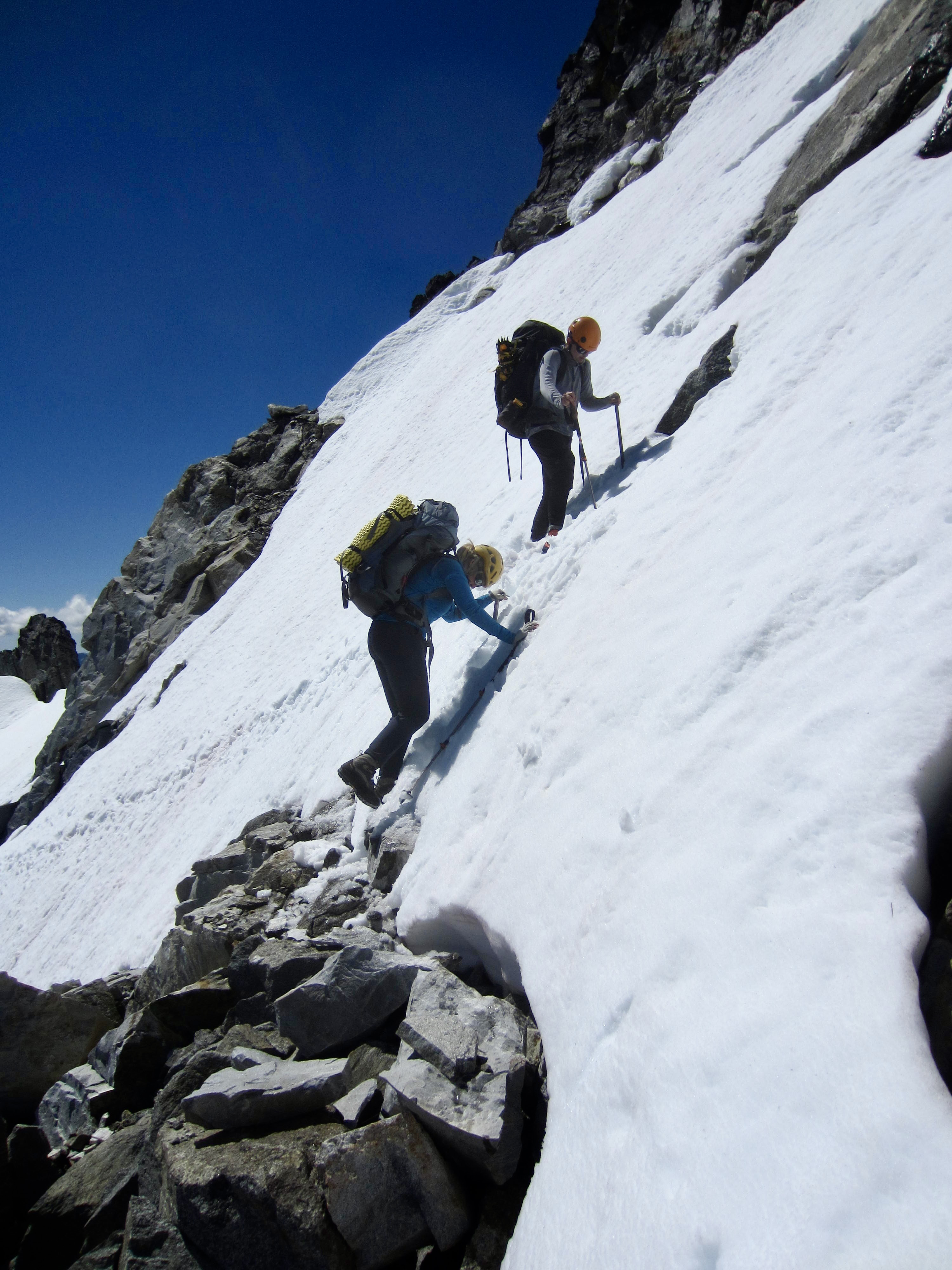
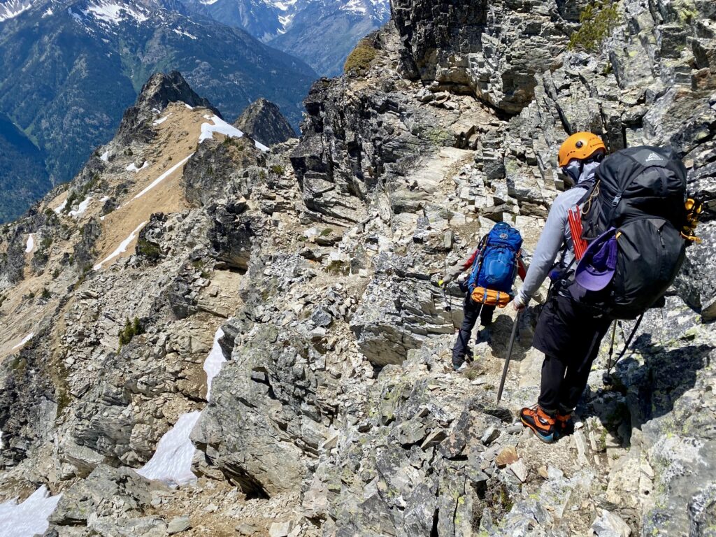
As soon as the helicopter was out of view, Eileen, Andrew, and I donned our backpacks and continued our descent of the ridge slope. We had already crossed the proverbial Rubicon and knew that our best strategy was to push ahead to the summit of McGregor Mountain and then follow the established trail down to High Bridge. Unfortunately, some of the most difficult scrambling of our traverse lay immediately in front of us. Getting down the steep hillside required white-knuckle down-climbing of a Class 3-4 slot that was uncomfortably narrow for our large backpacks. At one spot, we had to lower our packs on a sling.
.
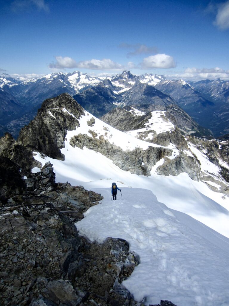
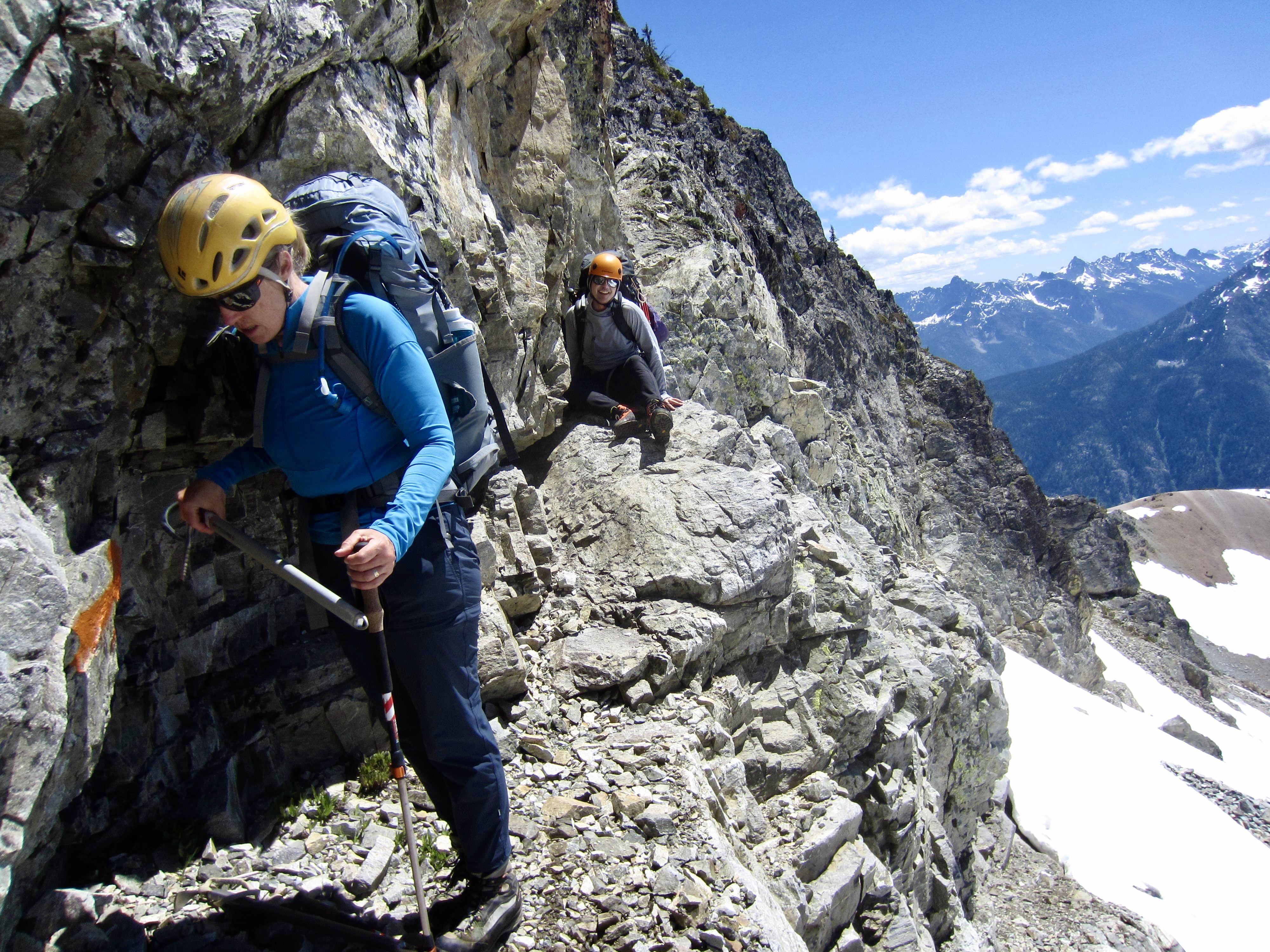
We eventually got through the slot and reached easier terrain below. From there, we could see the 7450-foot saddle that would get us back onto the north side of the ridge. More Class 2-3 scrambling took us across the broken rock slope and up to the saddle.

.
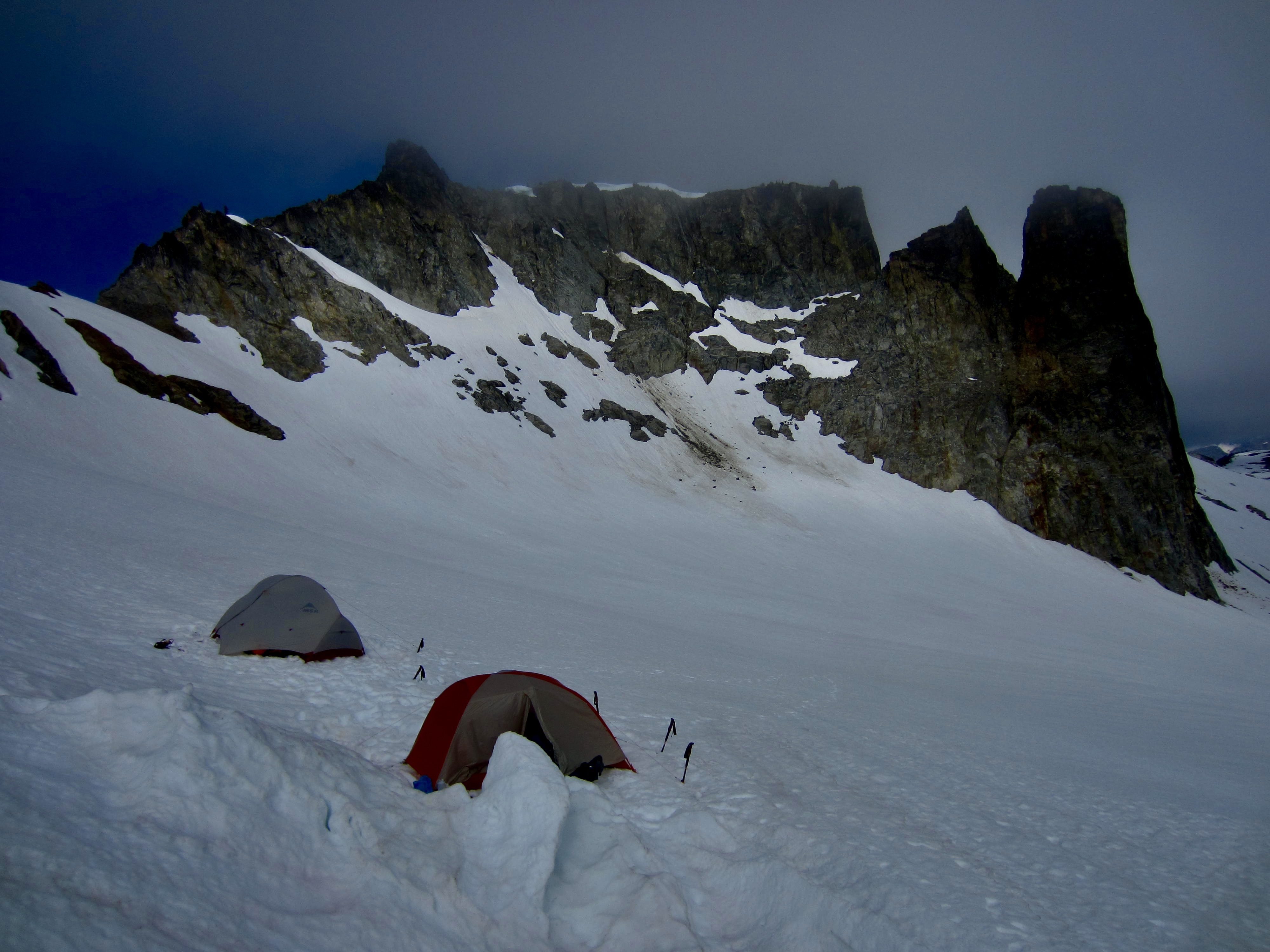
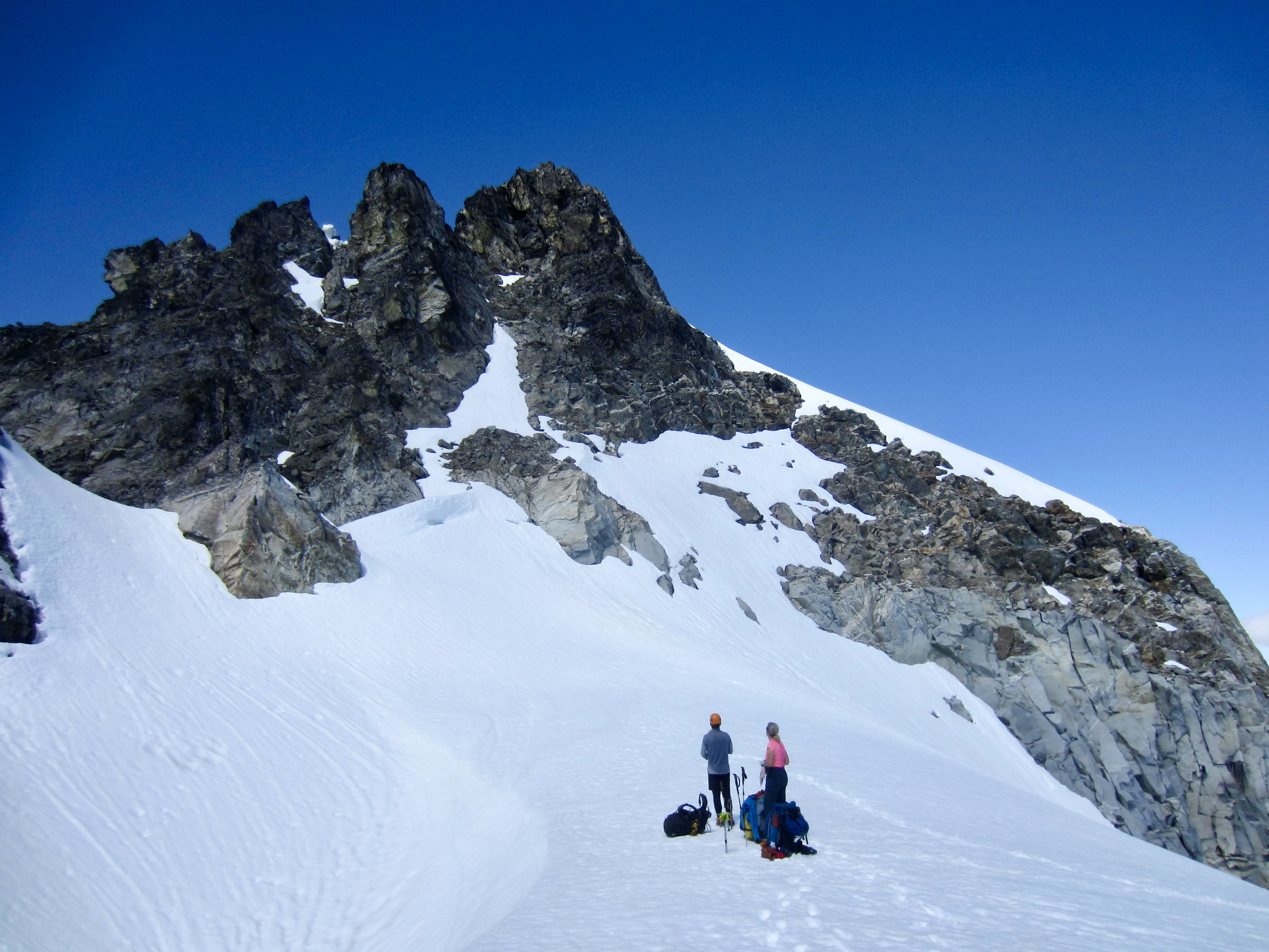
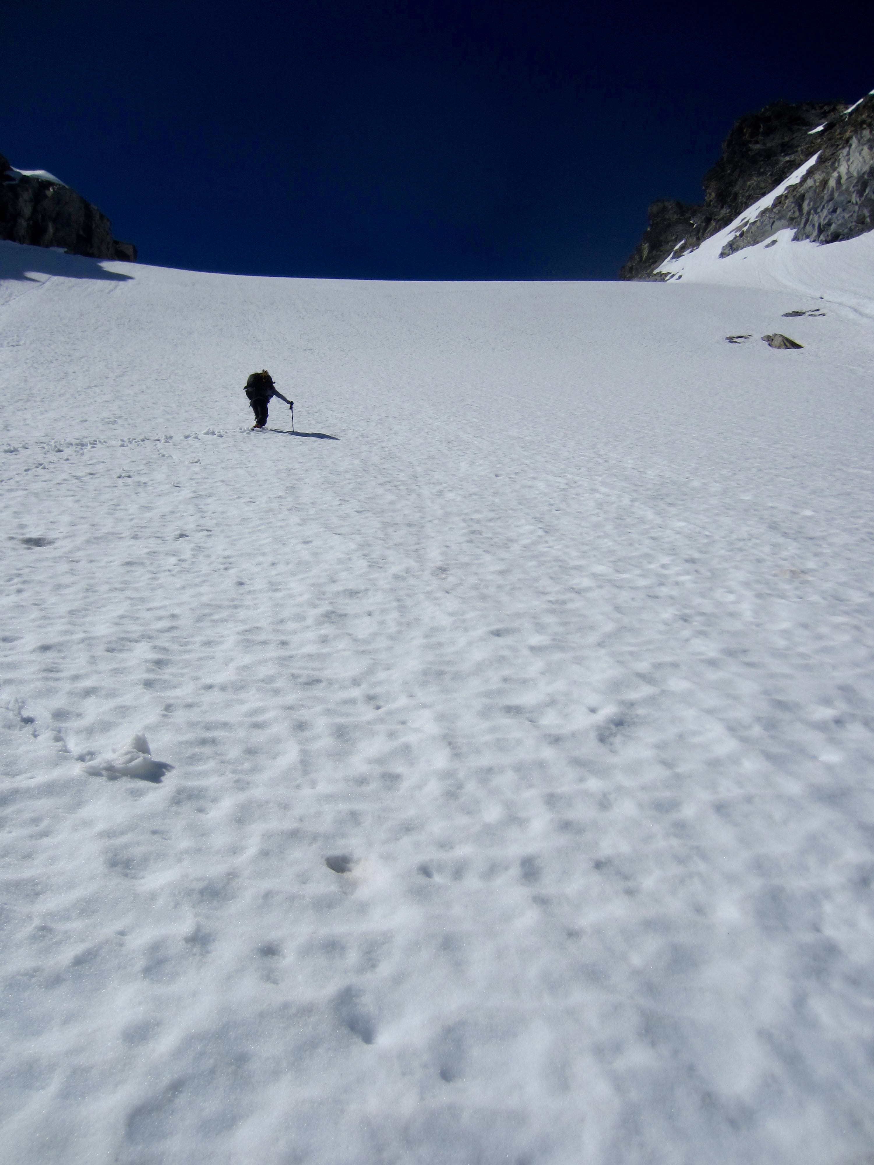
It was after 9:00pm when we crossed over the 7450-foot saddle and dropped onto a middle segment of the Sandalee Glacier. Low clouds were swirling around McGregor’s summit, a cold wind was blowing from the north, and daylight was waning. I was feeling a bit urgent about finding a campsite. We marched across the glacier, looking for any flat surface, but ultimately came back to a small snow depression near the saddle. Tents were hastily pitched and dinners were cooked inside. Our long and taxing day ended when headlamps went off at midnight.

.
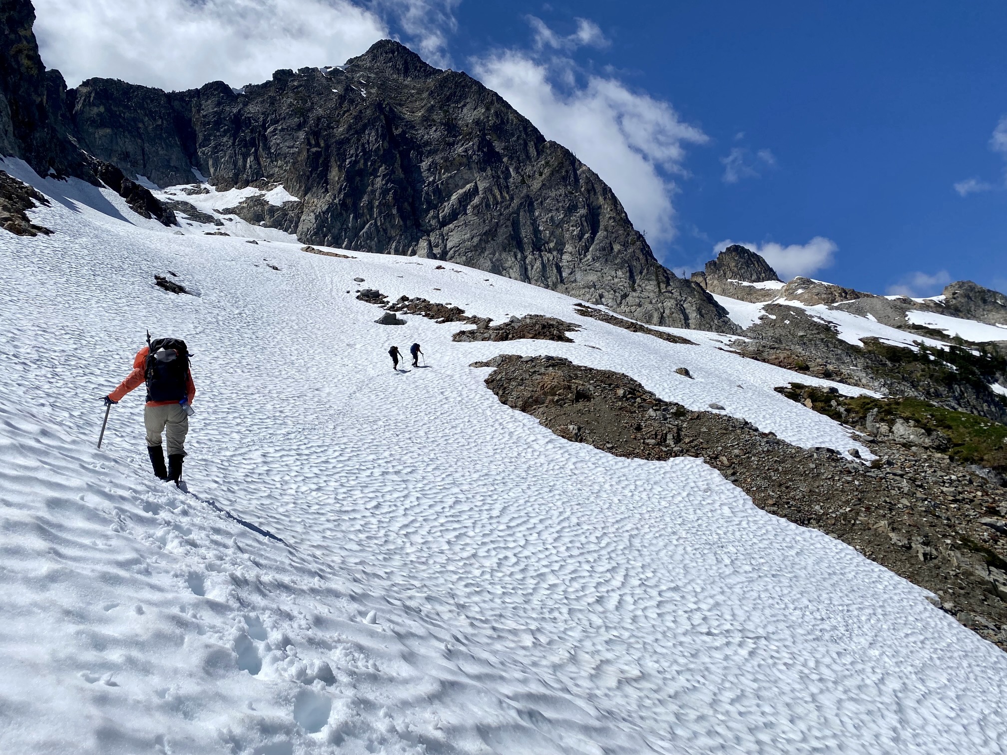
Day 4 (AM): Middle Sandalee Glacier to Summit
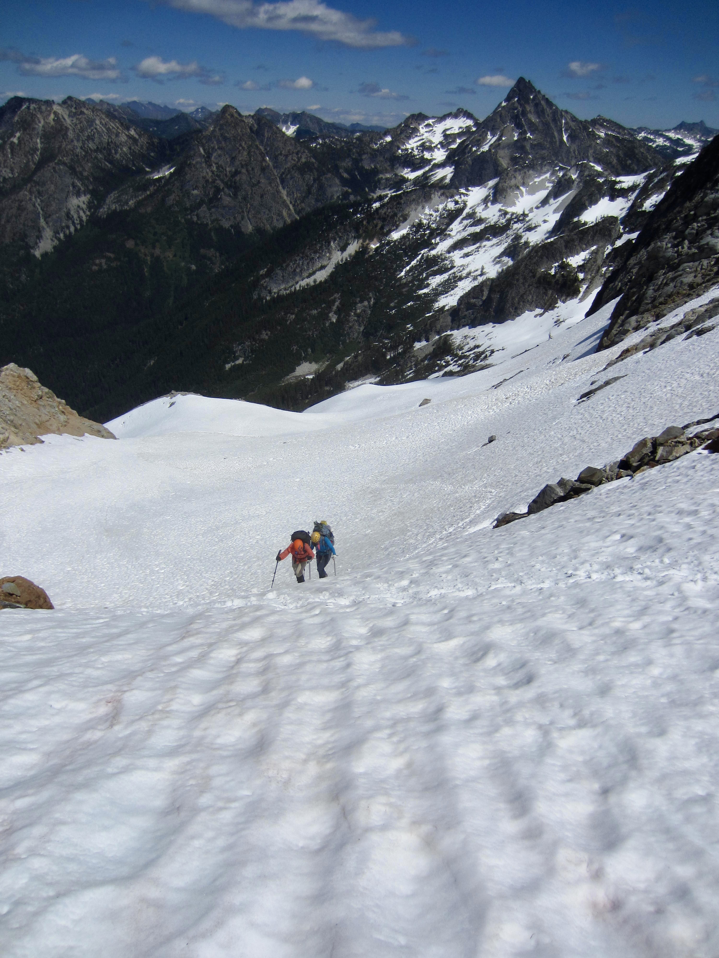
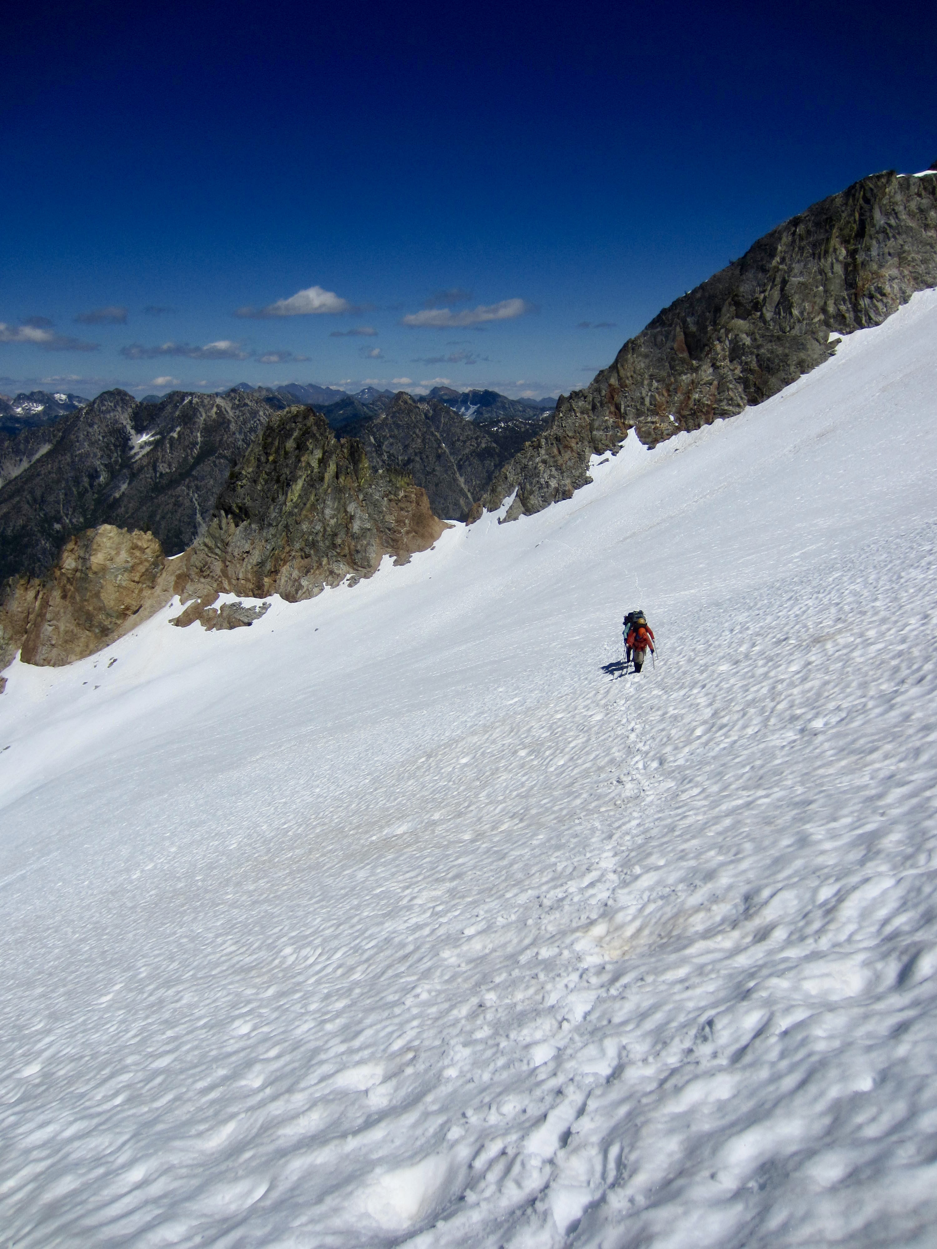
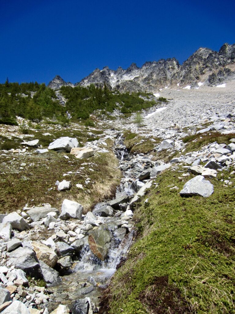
A chilly morning fog greeted us when we awoke, but it burned off by the time we started moving at 10:00am. Our route began with a traverse across the glacier and under a large buttress, then we booted up a steep snow headwall that ended at a broad saddle. The headwall had been broiling in full sun for a couple hours, so the snow was getting very soft and tending to slough below our tracks.

.
.
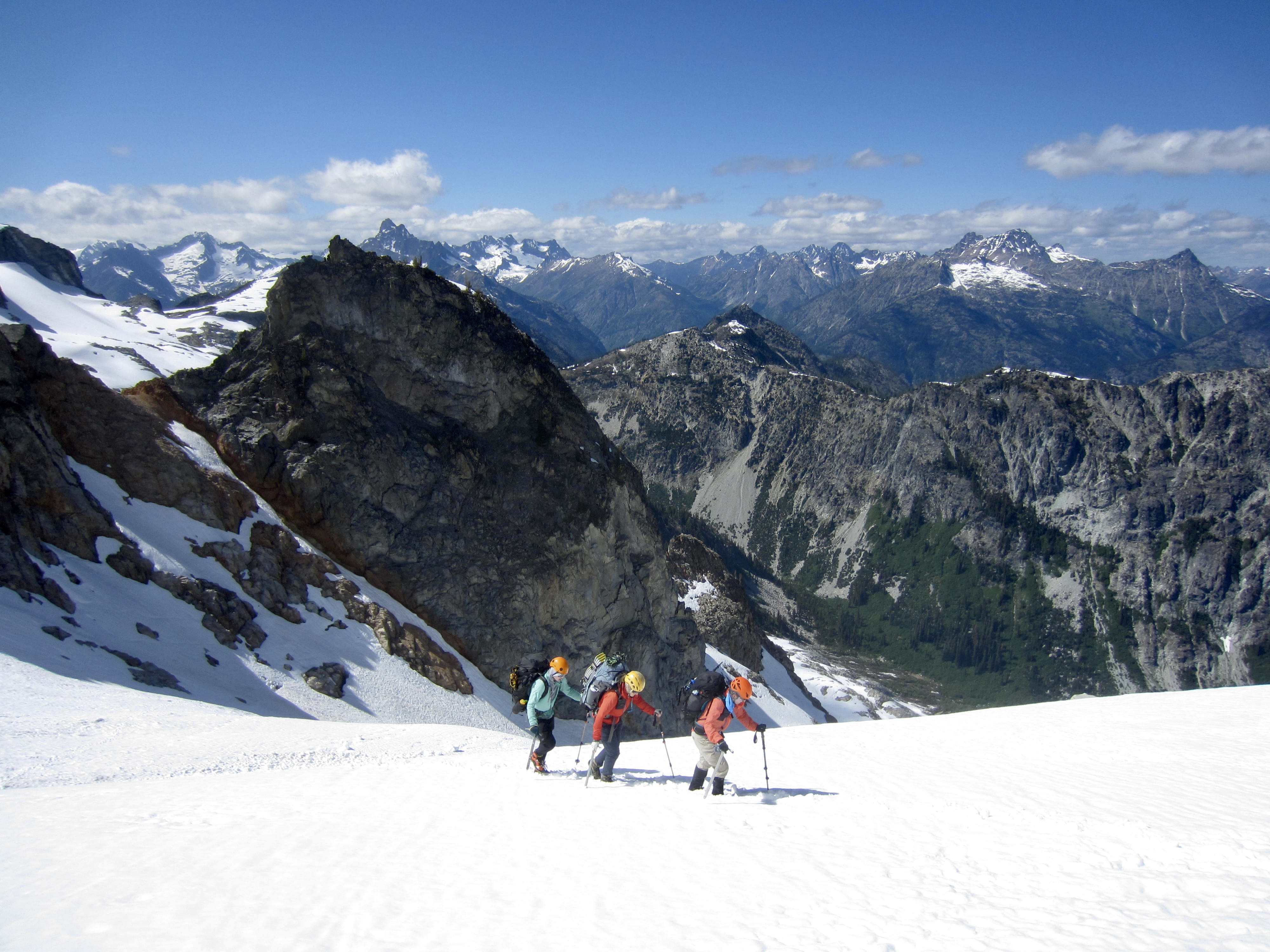
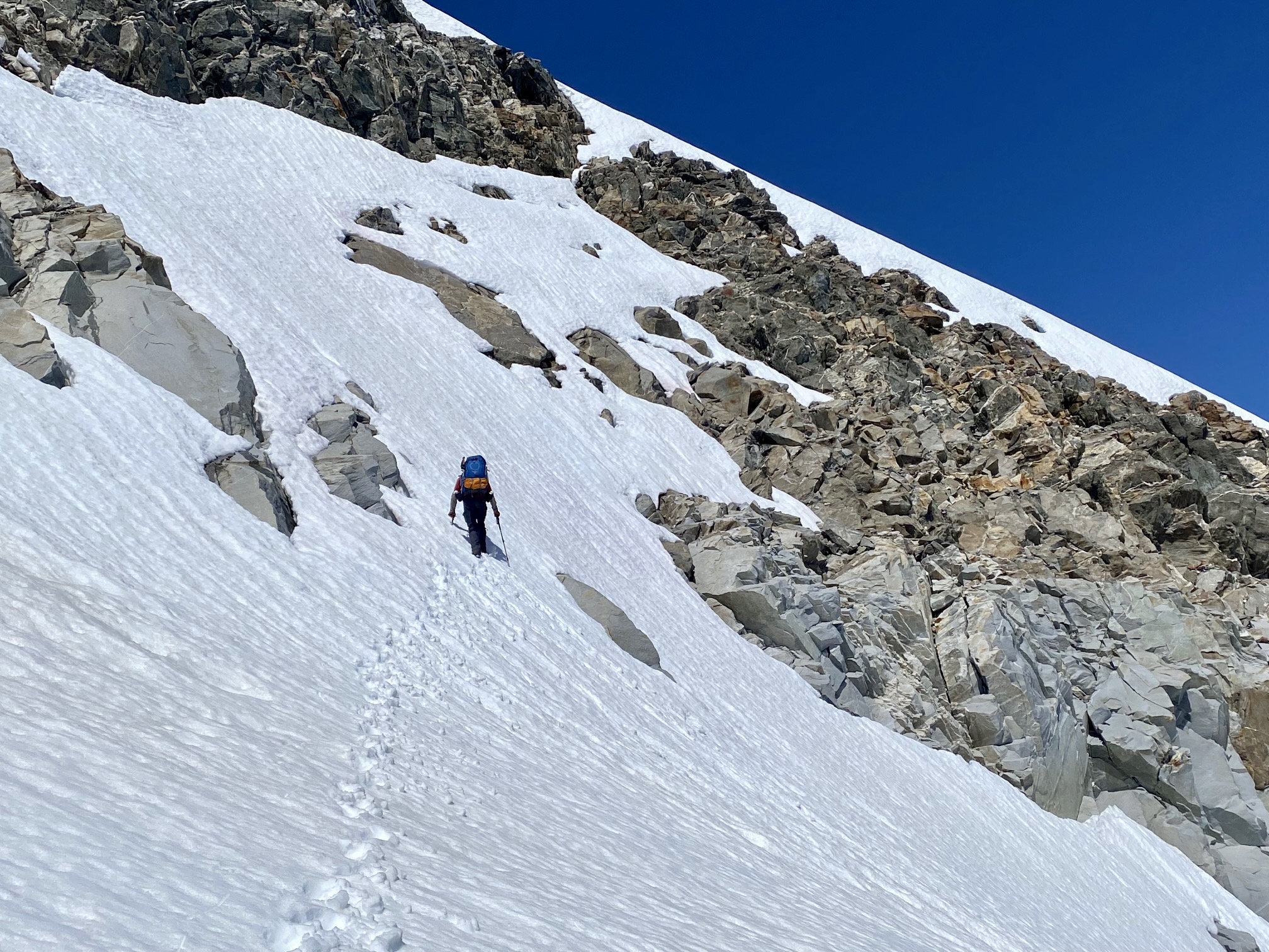
From the snow saddle, we could see the summit directly above us, but the route ahead was unclear. We discussed several options and decided to climb up a right-leaning snowpatch until able to exit onto a blocky cliff band. If the cliff band was reasonable, we could gain the summit snowfield that was visible on the right-hand skyline. If the cliff band was too steep or loose, we would need to retreat and try something else.
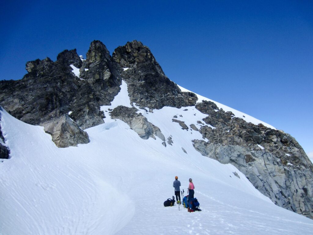
.
The snowpatch was very steep (about 50 degrees) but gratifyingly firm, and we were able to step off to the right on a blocky ledge. This ledge turned out to be easier than it first appeared; a straightforward Class 2-3 traverse led us over to the eastern edge of the summit snowfield.

.
.
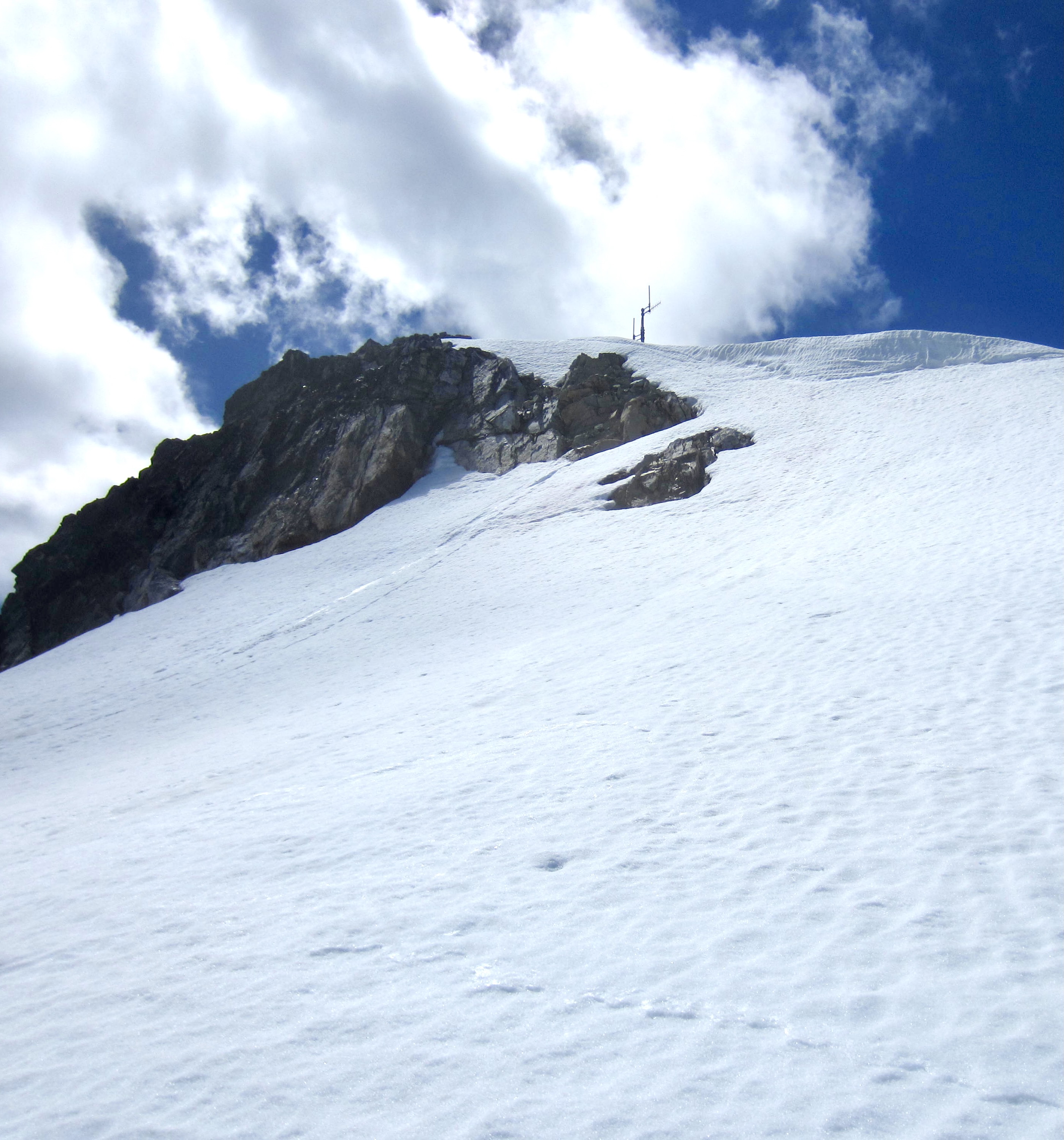
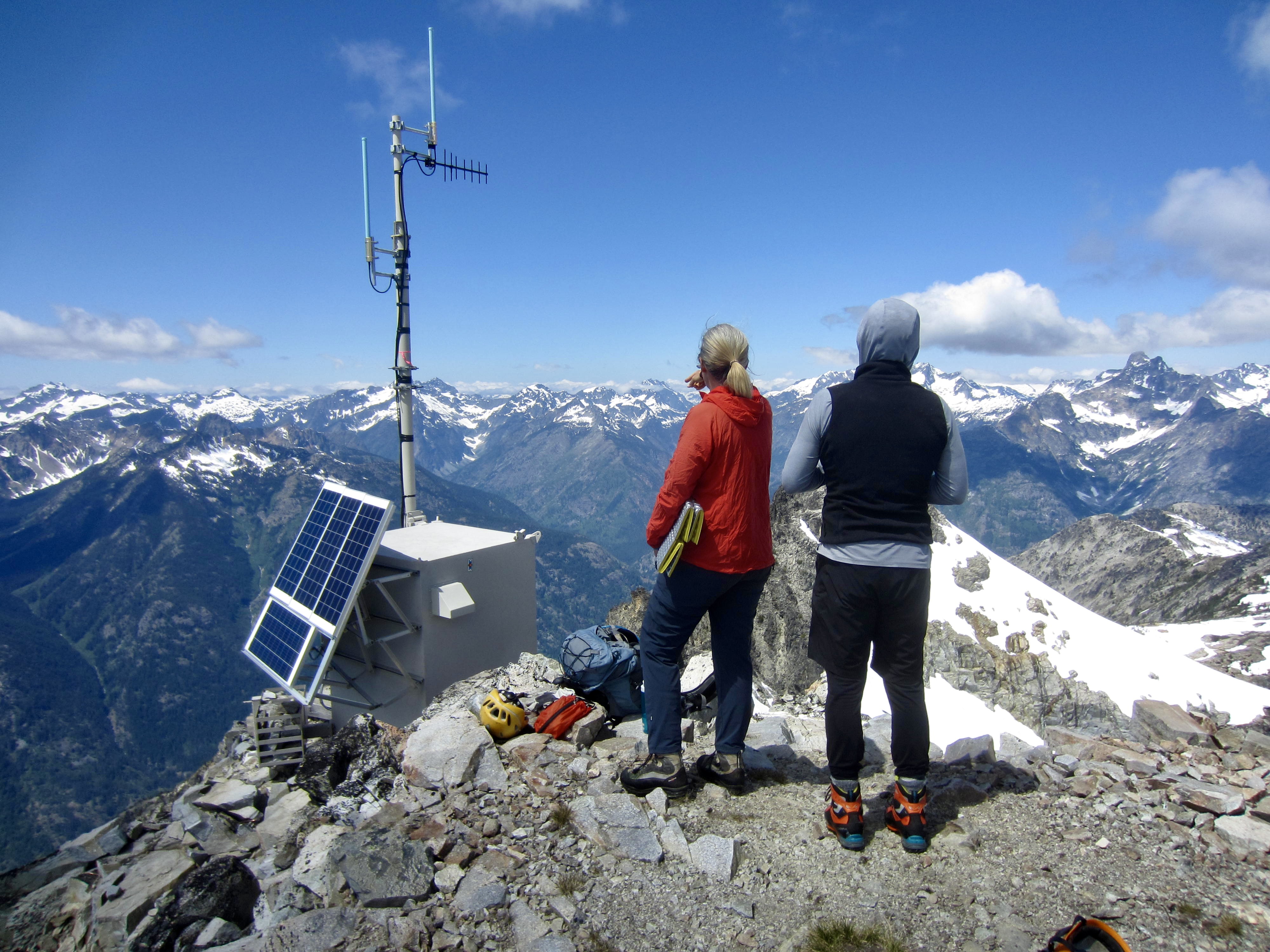
Once on the summit snowfield, we easily traversed across to the northwest flank of the summit block. The sight of the radio antenna only 200 feet above us provided visual assurance that we finally had the summit in hand; there were no more obstacles to be teased out.
.
.
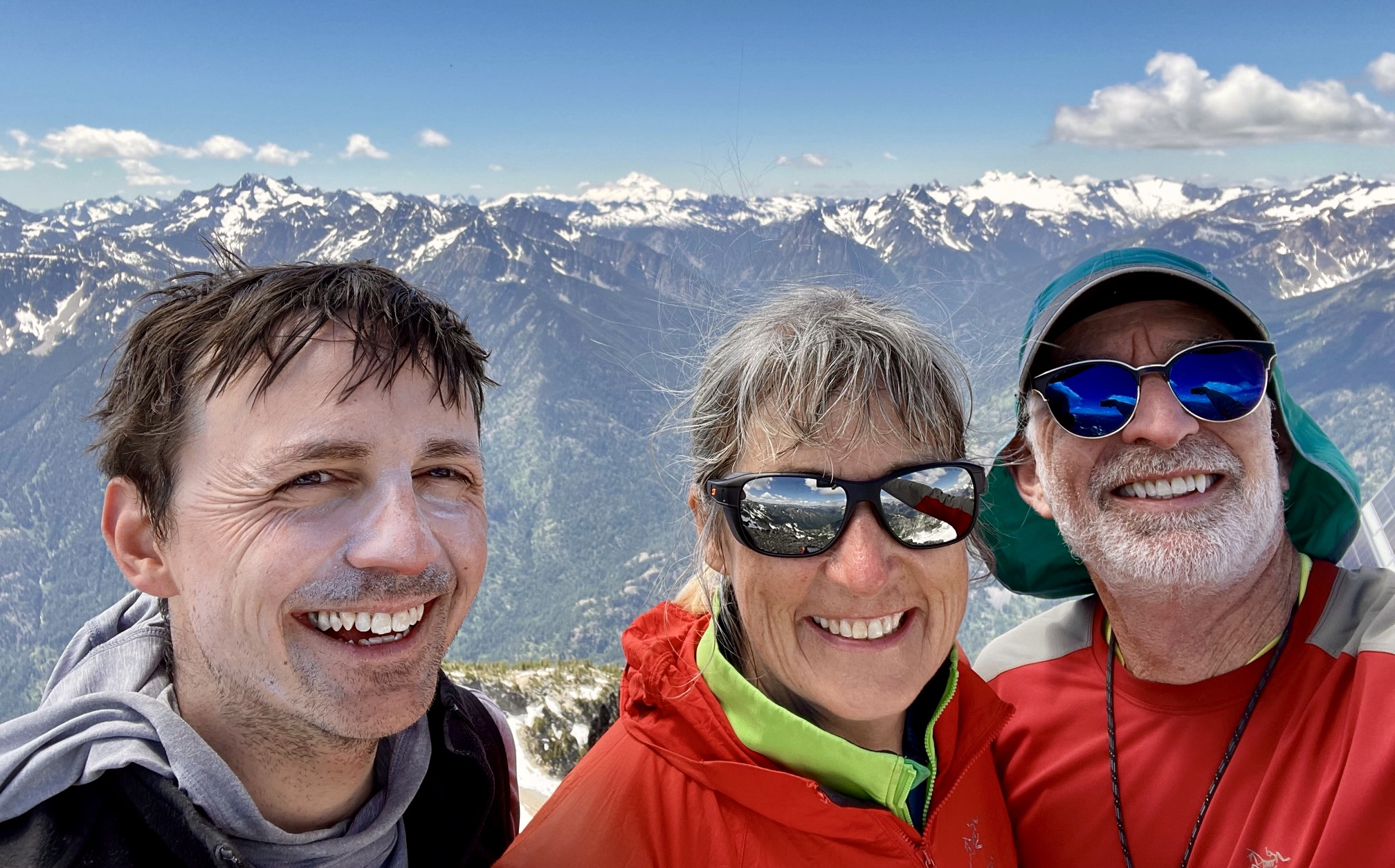
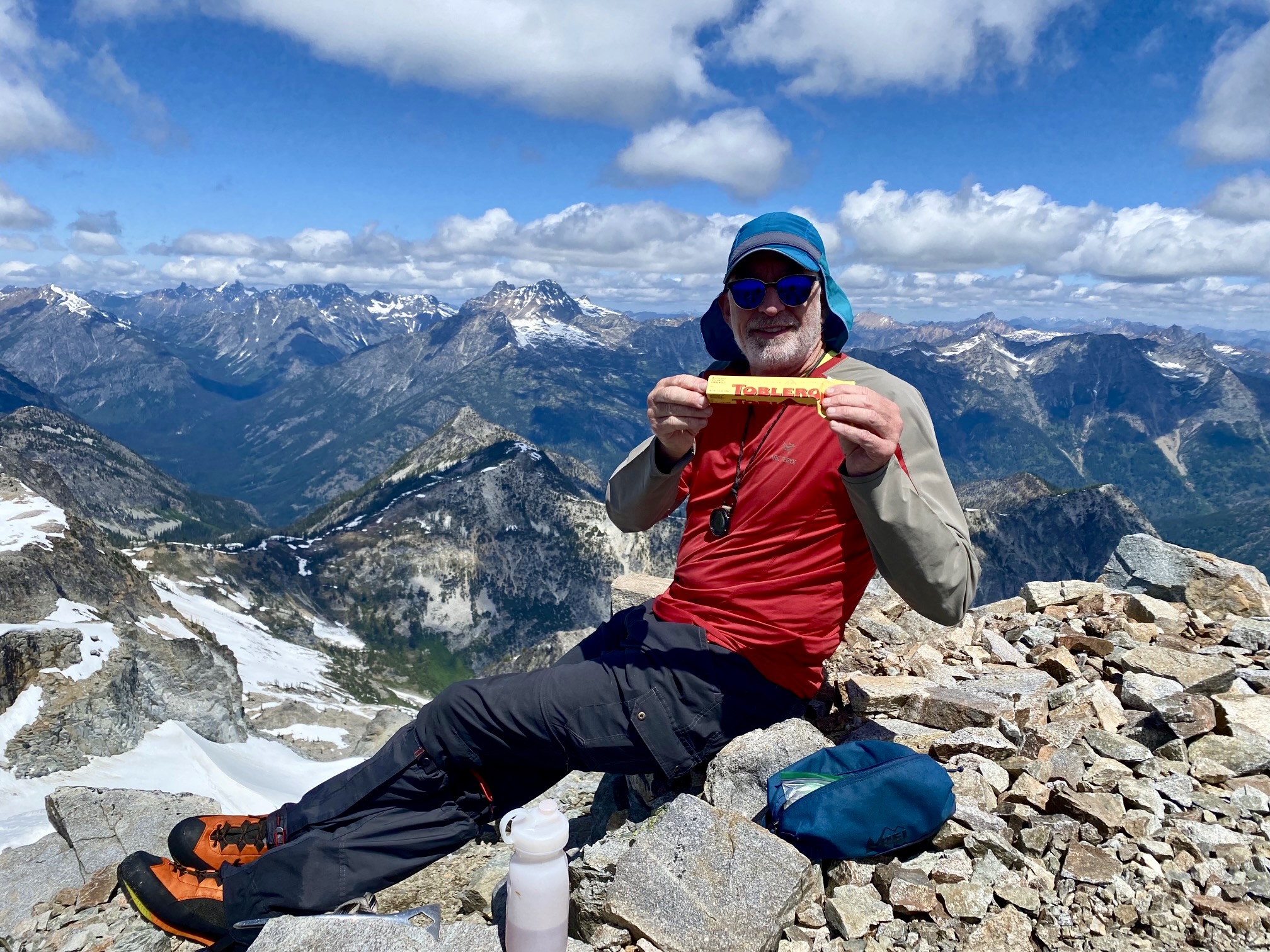
Shortly after noon, we stepped onto the 8122-foot summit platform where the former lookout cabin had sat (2.0 hours + 750 feet from Camp 3). It had been a marvelous mountaineering adventure, with enough difficulties and uncertainties to keep our success in doubt right up until the last few minutes. We celebrated with a Toblerone chocolate bar that Lisa had sent up with us.
.
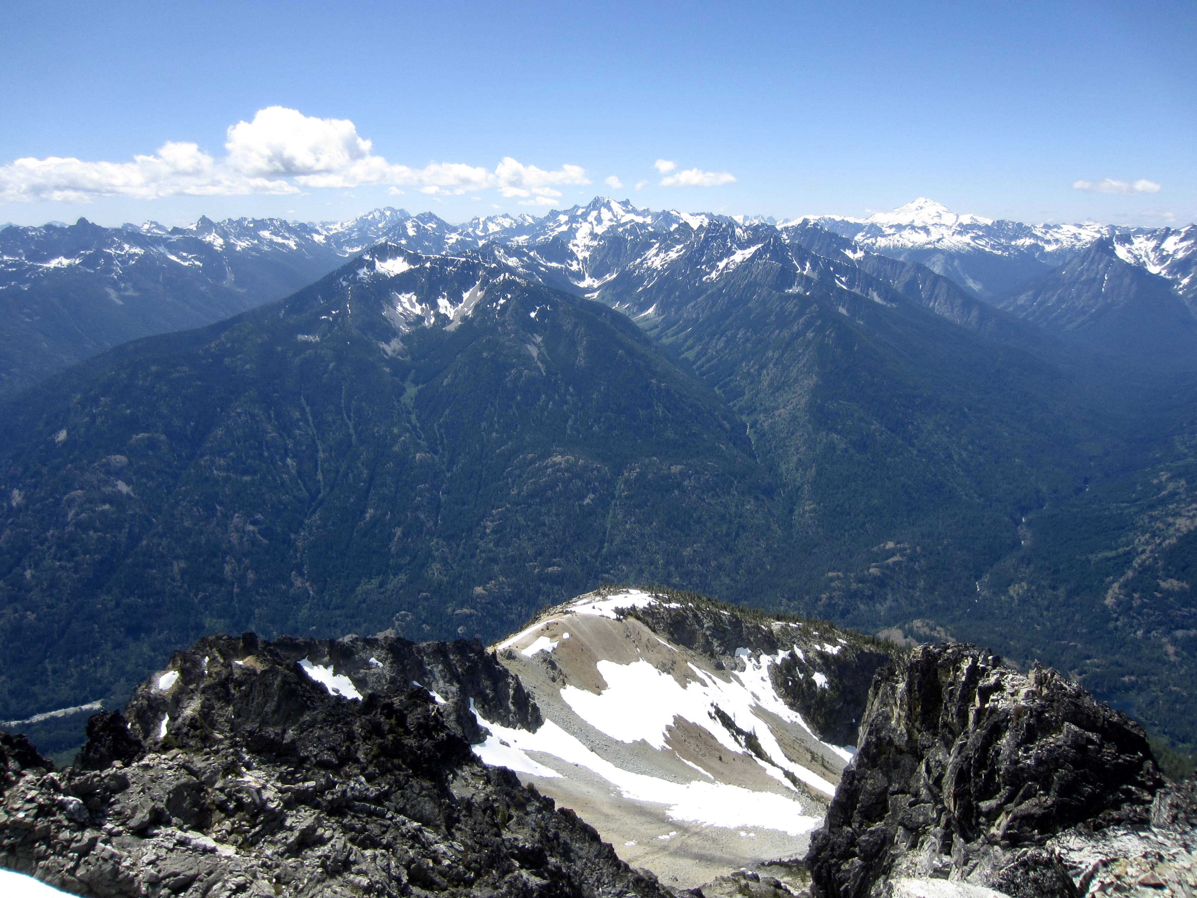
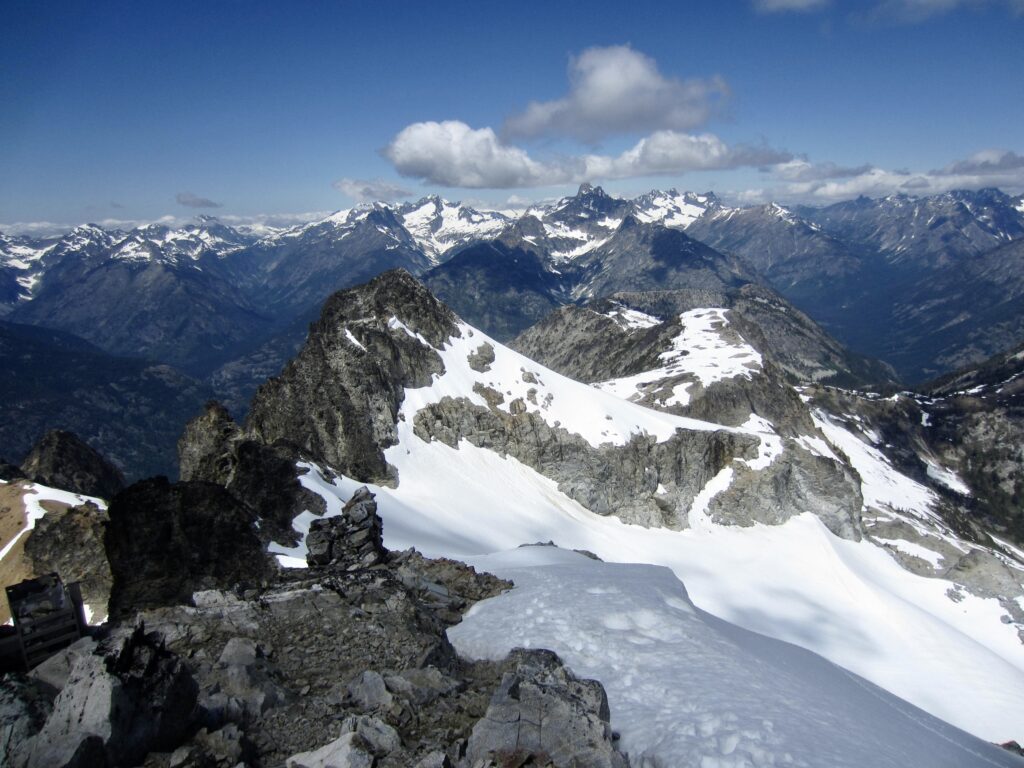
We spent a full hour on the summit, eating lunch and enjoying the panoramic view. The upper part of Lake Chelan was visible to our southeast, while the dominant peaks included Bonanza, Glacier, Dome, Goode, Logan, Black, and Silver Star. It was a bit depressing, however, to see the Stehekin Valley Road a whopping 6500 feet below us. We were due for a long and arduous descent!

.

.
.
.
.
Day 4 (PM): Summit to High Bridge to Stehekin
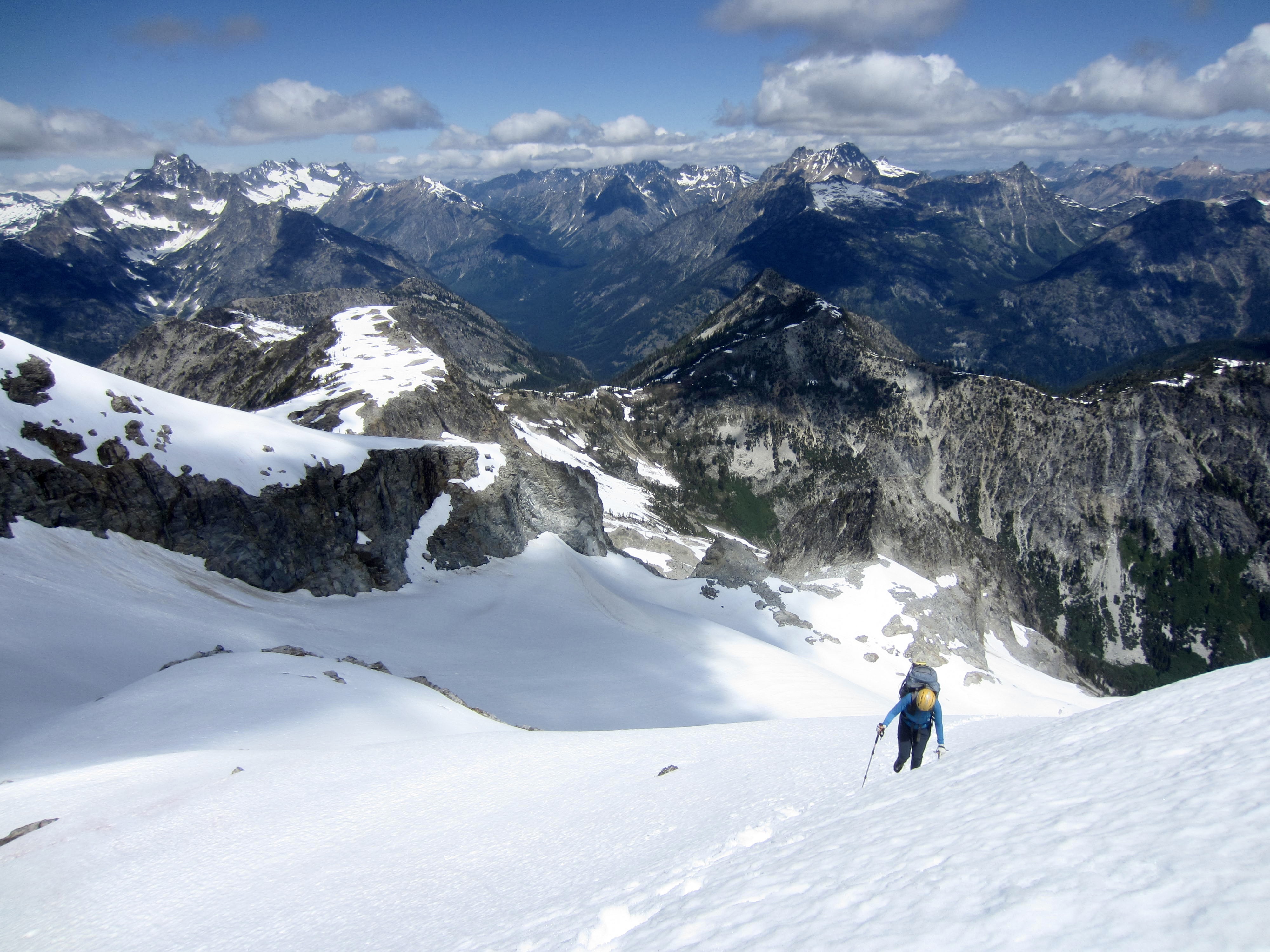
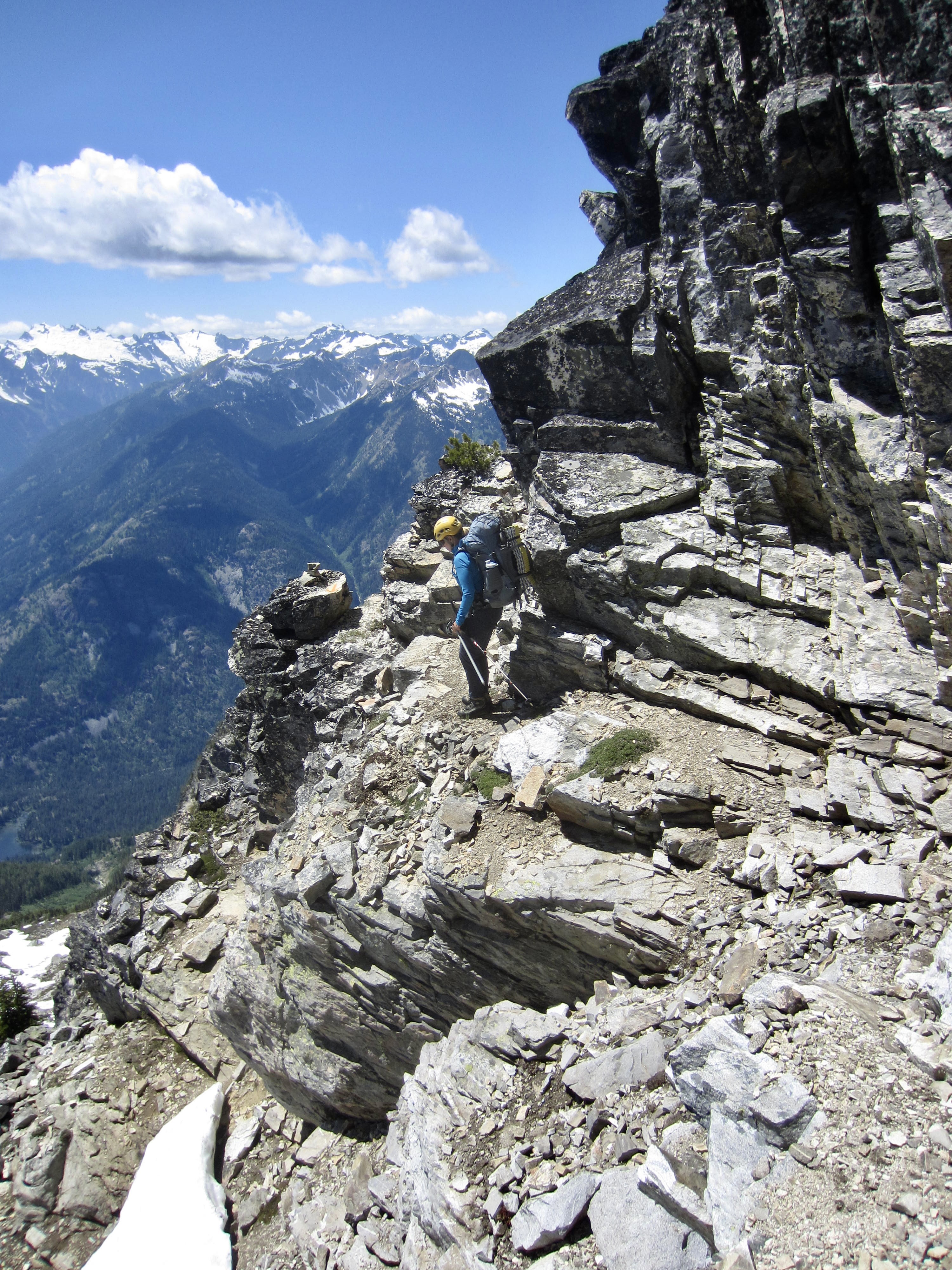
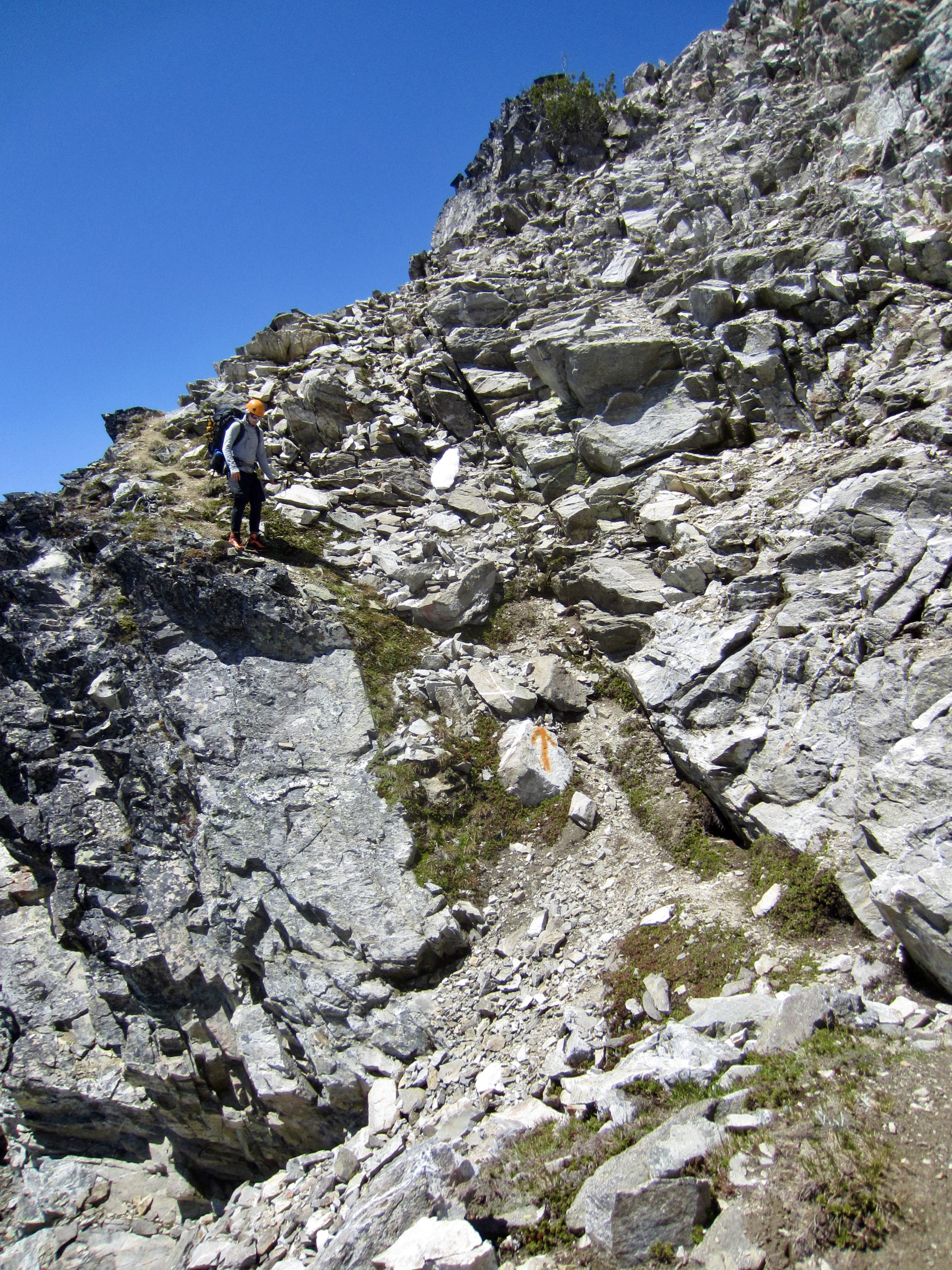
Shortly after 1:00pm, we began heading down the west ridge, following traces of the summit trail in the adjacent rocks. This trail led us through a small notch and then down the southwestern face of the mountain. There are numerous orange arrows marking the way, but the trail is really nothing more than a scrambling route. In several places, we found ourselves on loose Class 3 rock with serious exposure! This trail is clearly not suitable for the casual hiker or the faint of heart.
.
.
.
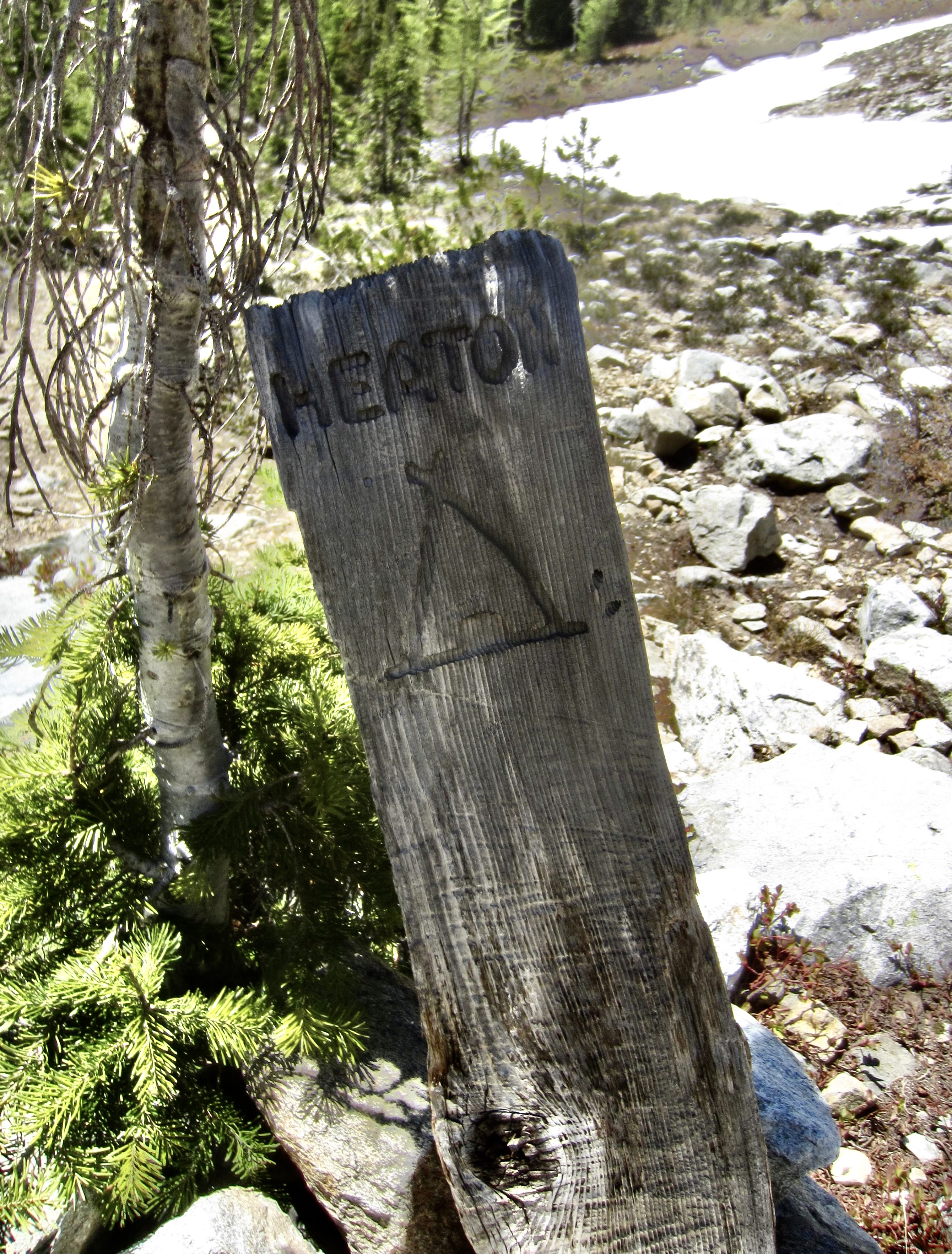
After 400 feet of careful down-climbing, we reached mellower slopes below and were able to speed up until stopping for water at a small creek near Heaton Camp (1.3 hours from summit). Interestingly, Heaton Camp was mislocated on all of our various maps. The actual location is a small, wooded bench at 6700 feet.
.
.
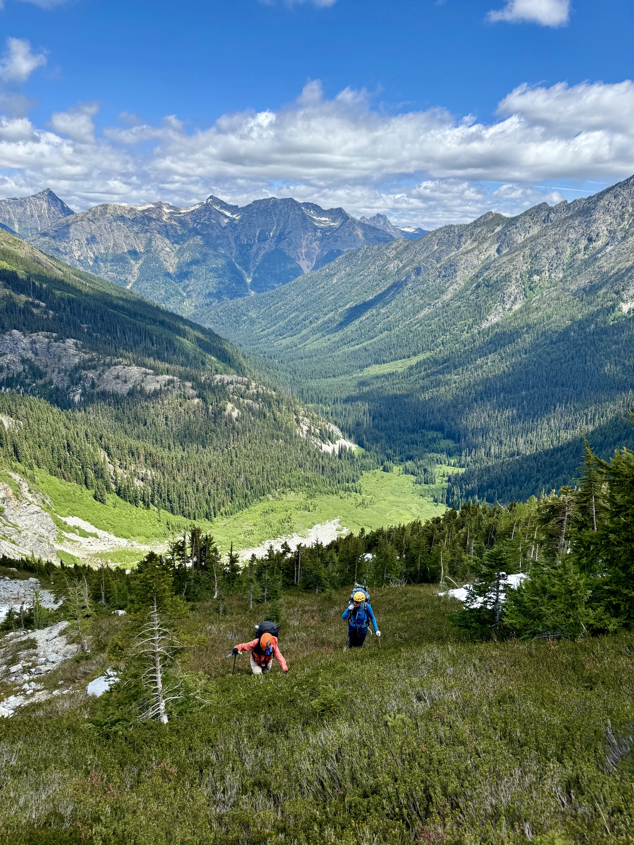
The remainder of our descent became a blur of switchbacks as we raced against the clock in an effort to catch the 6:15pm shuttle bus at High Bridge. If we missed this bus, we would have to spend a night at the campground—with precious little food—and then catch the 8:00am bus. Being much faster, Andrew hurried ahead in hopes of stalling the bus, while Eileen and I rumbled down the trail at our best pace.
Our strategy actually worked. Andrew reached High Bridge scant minutes before 6:15pm (5.2 hours from summit) and engaged both the bus driver and the resident ranger in a long conversation about our traverse. They had heard about yesterday’s helicopter evacuation on McGregor Mountain and so were not only interested in Lisa’s rescue but were also sympathetic to our plight, so they were willing to hold the bus for an extra 30 minutes. The bus driver finally ran out of patience and motored back towards Stehekin, but he soon spotted Eileen and me hiking down the last stretch of trail. He returned to High Bridge, and all three of us were able to get a ride into town. It seemed to be a fittingly hectic finish to a topsy-turvy mountain trek!
Day 5: Stehekin to Fields Point
After a quiet night at Lakeview Campground in Stehekin, Eileen, Andrew, and I went to the bakery for breakfast (of course!), then we returned to Stehekin and addressed the problem of how we would get back to Fields Point. We possessed tickets for yesterday’s 3:00pm Lady Liberty speedboat, but we now wanted to board today’s 11:40am Stehekin Ferry catamaran. It turned out to be a simple resolution: Lake Chelan Boat Company graciously refunded our money for the Lady Liberty tickets (after Eileen played the “delayed-by-rescue card”), and the Stehekin Ferry had plenty of room for us.
Thanks to Starlink access on the catamaran, we were able to pick up texts and emails from Lisa during our ride down to Fields Point. She had been short-hauled to a flat landing zone on the northwest side of McGregor Mountain, then flown in the helicopter to Chelan, then taken to Lake Chelan Hospital for evaluation. The attending physician found no serious problems, and she was released at midnight. A hospital worker drove her up to Fields Point, where she spent the night in her car, and then she drove home the next morning. She remains cautiously optimistic about doing more mountaineering trips in the future. All in all, this was a happy outcome.
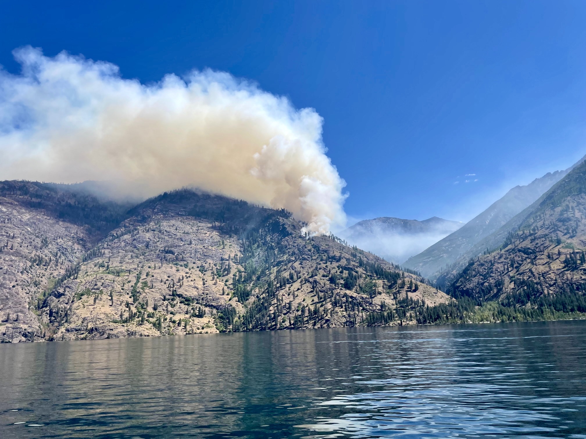
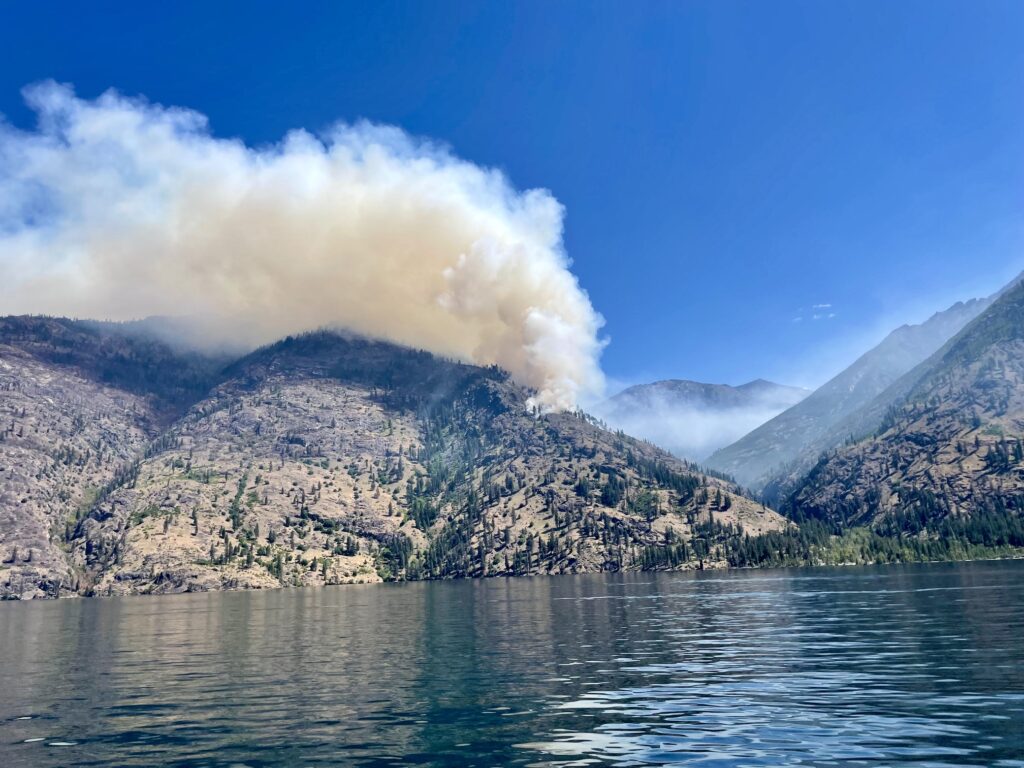
On the negative side, we saw that the Pioneer Fire, which had been burning on the northeast side of Lake Chelan for more than a month, has grown over the past few days. It has now moved into the Prince Creek Valley and is producing a lot of smoke.
.
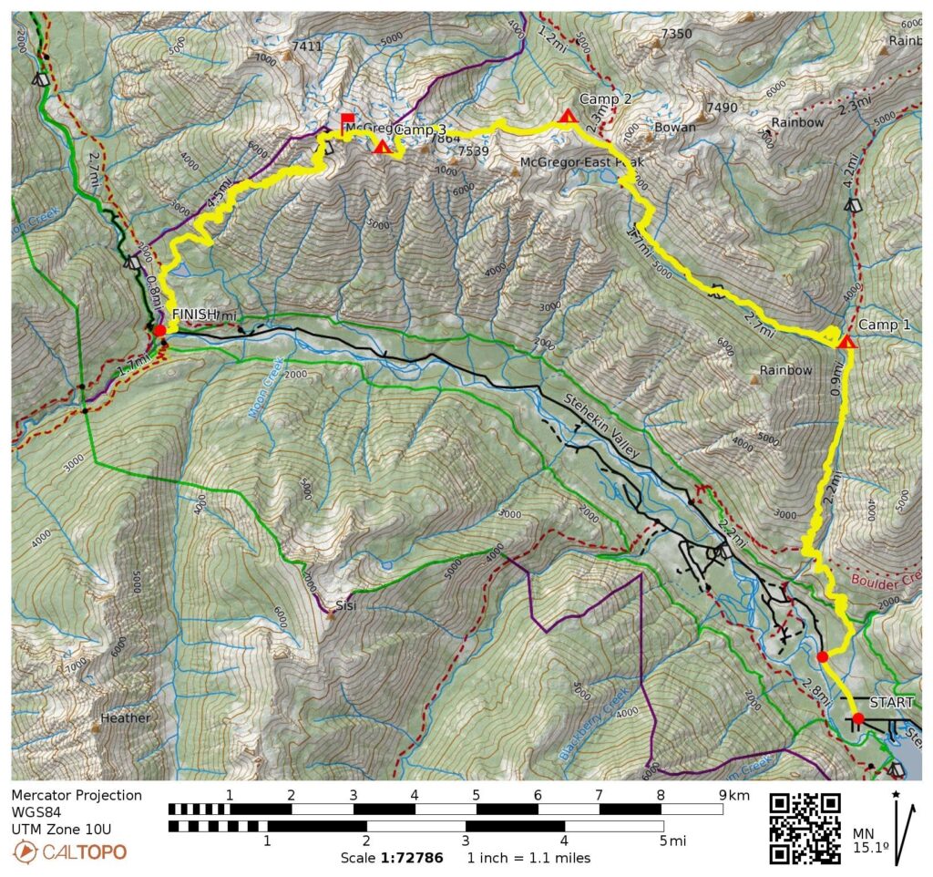
Route Maps & Profiles
…
…
…
…
Photo Gallery
Click to enlarge…