Trip Date: July 11-18, 2024
Luna Cirque Traverse: Luna Pass to Challenger Gap
Big Beaver Valley
Access Basin
Luna Pass
Luna Peak (8311 ft)
Luna Lake
Challenger Gap
Big Beaver Peak (7374 ft)
Eiley Lake & Wiley Lake
Little Beaver Peak (6984 ft)
- Trip Report Summary
- Related Posts
- Trip Overview
- Full Trip Report
- Day 1: Ross Dam Trailhead to 39-Mile Camp
- Day 2: 39-Mile Camp to Access Creek Flats
- Day 3: Access Creek Flats to Luna Pass
- Day 4 (AM): Luna Peak Summit Climb
- Day 4 (PM): Luna Pass to Luna Lake Knoll
- Day 5: Luna Lake Knoll to Luna Cirque Floor
- Day 6: Luna Cirque Floor to Wiley Ridge Crest
- Day 7: Wiley Ridge Crest to Luna Camp
- Day 8: Luna Camp to Ross Dam Trailhead
- Route Maps & Profile & Sketches
- Photo Gallery
Trip Report Summary
Region: Northwestern Washington Cascades
Sub-Region: Picket Range
Areas: Ross Lake National Recreation Area & North Cascades National Park
Starting & Ending Point: Ross Dam Trailhead at Happy Flats on Highway 20 (Elev. 2150 feet)
Way Points: Ross Lake Landing (trail hike); Ross Lake & Big Beaver Landing (boat ride); 39-Mile Camp & Luna Camp (trail hike); Big Beaver Creek logjam & Access Creek footlog & Access Creek flats & Access Basin & Access Col & Luna Pass & Luna Tarns & Luna Lake & Lousy Lake bowl & Luna Cirque outwash plain & Challenger Gap & Big Beaver Peak summit & Wiley Lake & Eiley Lake & Wiley Ridge crest & Little Beaver Peak summit & Wiley Point & Big Beaver Creek crossing & Big Beaver Trail junction (off-trail hike & bushwhack & rock scramble & snow climb); Luna Camp & 39-Mile Camp & Big Beaver Landing (trail hike); Ross Lake Landing (boat ride); Ross Dam Trailhead (trail hike)
Campsites: 39-Mile Camp & Access Creek flats & Luna Pass & Luna Lake knoll & Luna Cirque outwash plain & Wiley Ridge crest & Luna Camp
Summit: Luna Peak (rock scramble & rock climb via South Slope—East Ledges)
Summit: Big Beaver Peak (rock scramble & snow climb via Southwest Ridge; descent via Northwest Ridge)
Summit: Little Beaver Peak (rock scramble via Southwest Slope; descent via Southeast Ridge)
Approximate Stats: 40.5 miles traveled on foot; 11,500 feet gained & lost.
Related Posts
>>> Luna Peak via Access Creek–South Slope–East Ledges – August 2003
>>> Mt. Challenger via Wiley Ridge–Challenger Glacier–Northeast Face – July 2015
>>> Mt. Challenger via Wiley Ridge–Challenger Glacier–Northeast Face – July 2005
Trip Overview
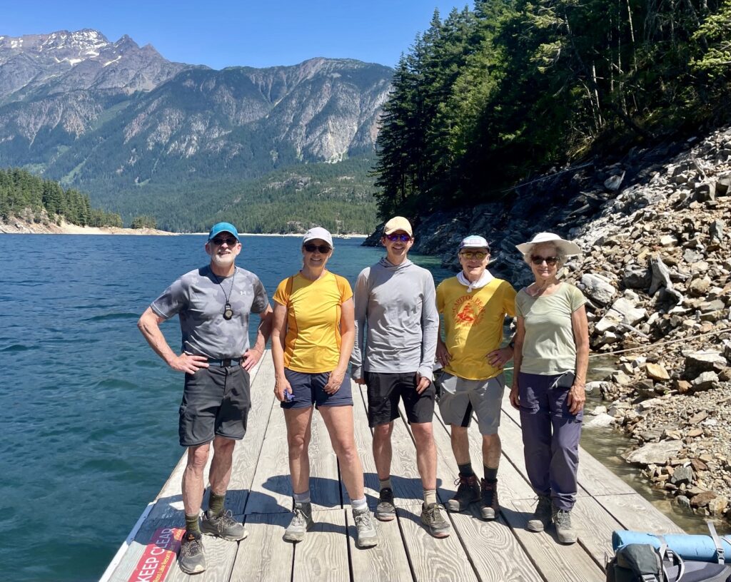
Eileen, Andrew, George, Beth, and I spent eight days in mid-July completing a 40-mile hiking and climbing loop through the Picket Range in North Cascades National Park. The heart of our loop was a traverse through Luna Cirque, a glacially carved bowl surrounded by towering peaks on three sides. It is a spectacular place to visit, but the price of admission is very high. In addition to traveling over rugged terrain and battling through hellacious brush, we were dogged by sweltering heat and tormented by insects (mosquitoes, gnats, and blackflies) all week.
We started our trek at the Ross Dam Trailhead on Highway 20, entered Luna Cirque via Access Creek and Luna Pass, exited via Challenger Gap and Wiley Ridge, and then ended our trek back at the same trailhead, thereby creating a big “lollipop loop.” Along the way, we climbed Luna Peak—a primary objective for our group—plus a couple minor summits on Wiley Ridge. Sadly, we weren’t able to climb Mt. Challenger due to time constraints.
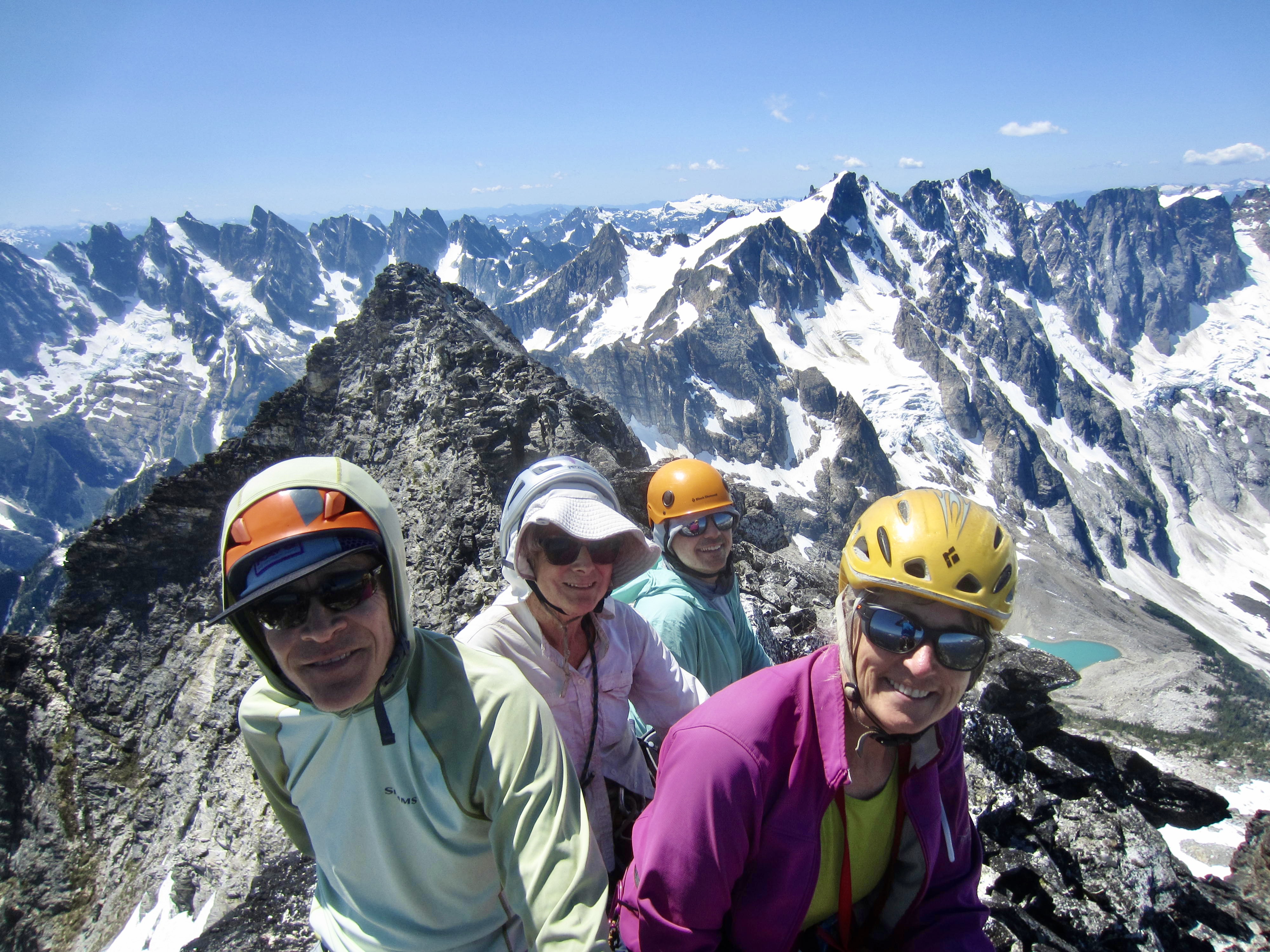
Our eight-day schedule for this trek might seem unnecessarily relaxed, considering that many mountaineers would probably take only four or five days to complete the same itinerary. However, the geriatric composition of our quintet warranted a slower pace. Everyone except Andrew was over 60 years old, and Beth was a remarkable 78! With an average age of 61, we were probably one of the oldest groups to ever venture into the Picket Range.
In the end, our Luna Cirque Loop proved to be much more difficult than any of us anticipated. Except for Day 1 and Day 8, every day brought serious challenges in the form of miserable and/or risky conditions—albeit, much of it imposed by our own route-finding choices. As a matter of comparison, George, Eileen, and I completed the legendary Picket Traverse six years earlier, and we agreed that, despite looking easier on paper, this trek was harder in many ways. To me, the Picket Traverse was like a sword fight; the stakes were high, but it had a somewhat civilized feeling overall. The Luna Cirque Loop, in contrast, was like a back-alley brawl—uncivilized and even brutish at times.
.
Full Trip Report
Day 1: Ross Dam Trailhead to 39-Mile Camp
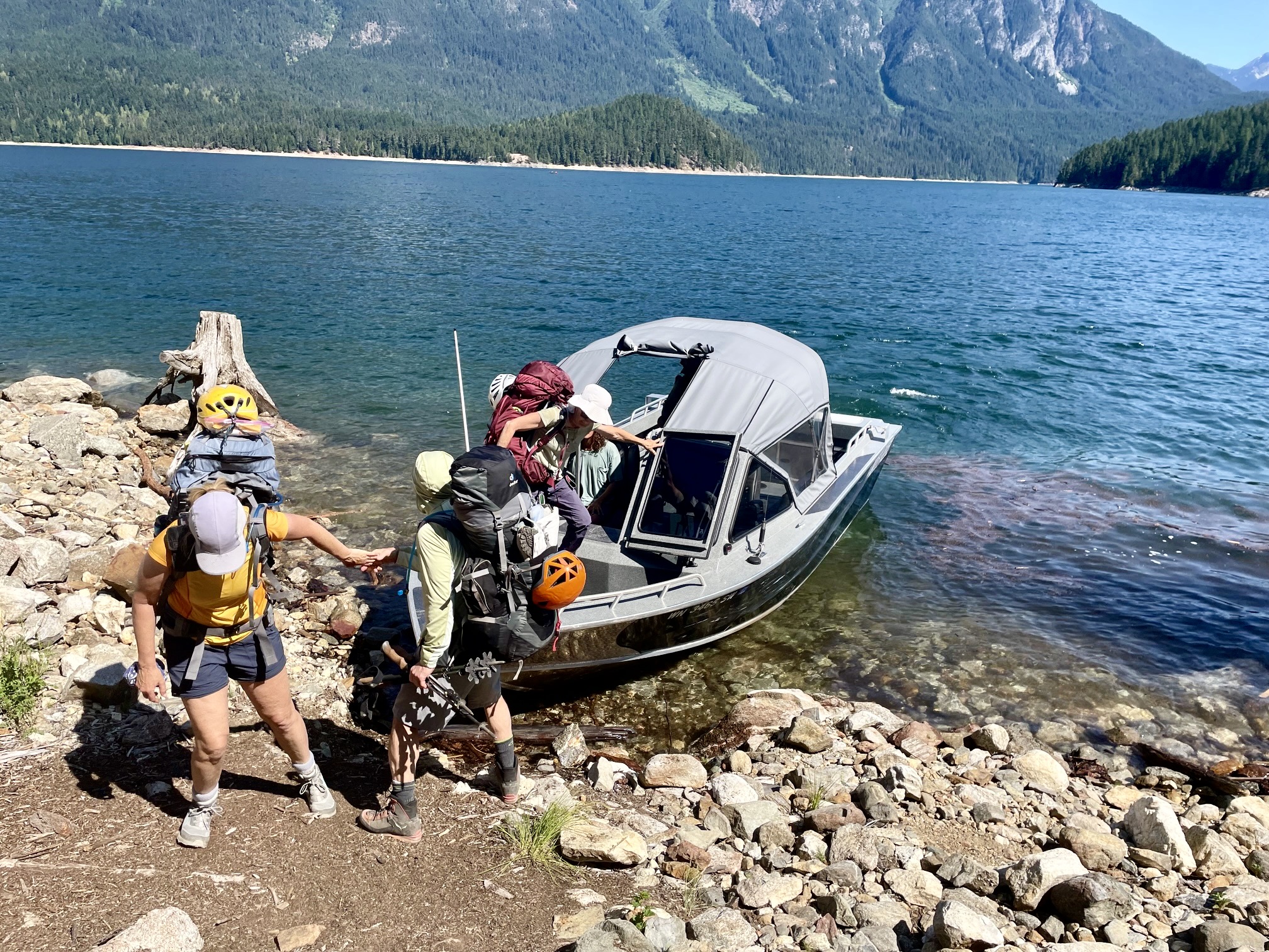
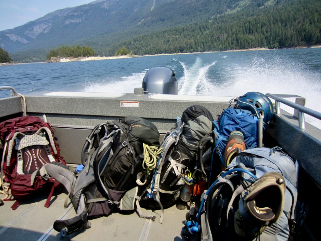
We departed from the Ross Dam Trailhead on a sunny Thursday afternoon and hiked a mile downhill to catch our pre-arranged water taxi that would take us up Ross Lake. Unfortunately, the water taxi was running 2 hours behind schedule, so we didn’t reach Big Beaver Landing until nearly 4:00pm. Because Ross Lake was about 10 feet below its normal summertime level, we had to disembark on the shoreline rather than at the dock.

.
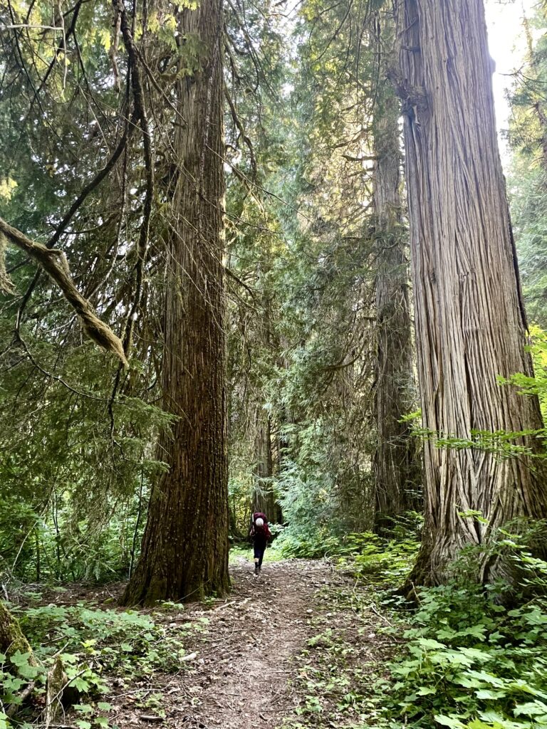
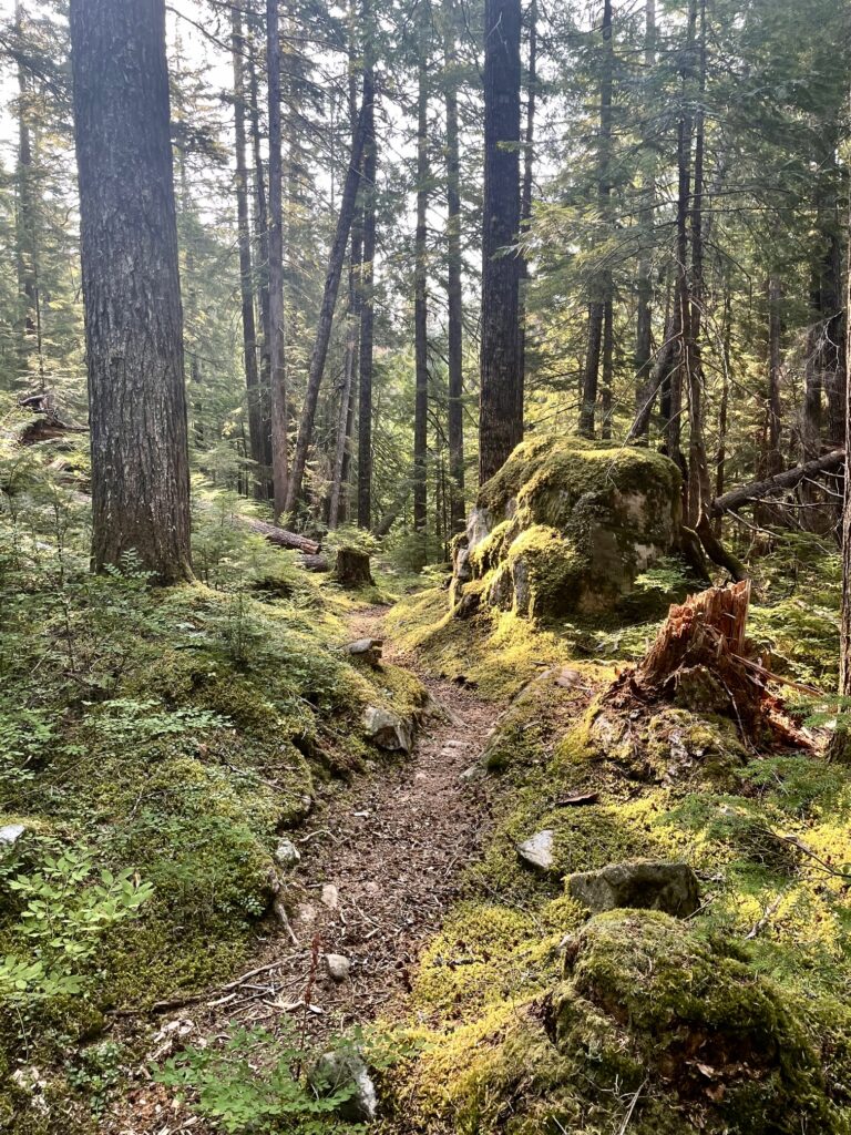
Once on the Big Beaver Trail, we each settled into our own pace as we hiked through the valley-bottom heat and humidity. Thankfully, the trail had recently been cleared out, and the many giant cedar, hemlock, and Douglas fir trees along the trail provided a nice distraction.
.
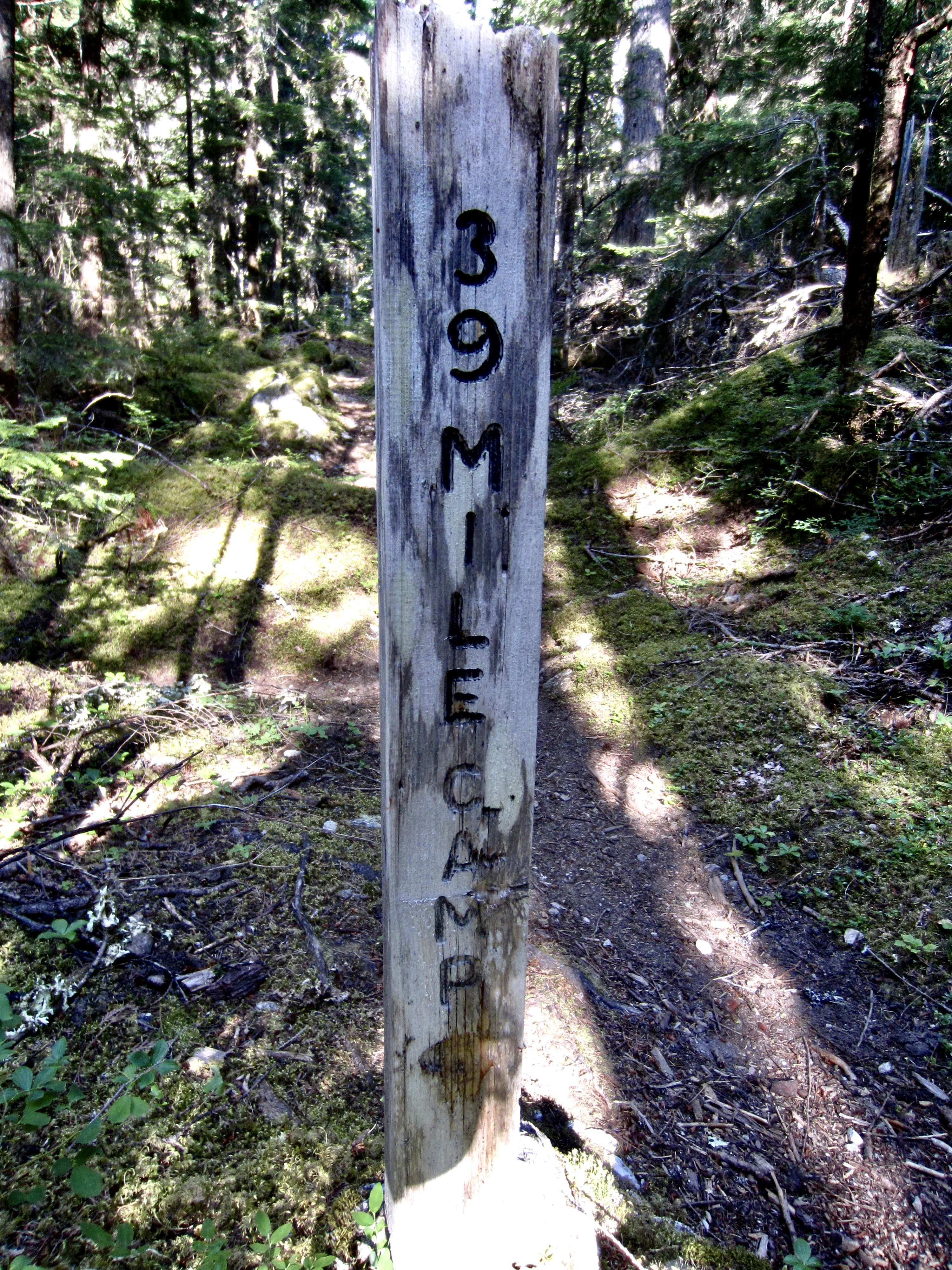
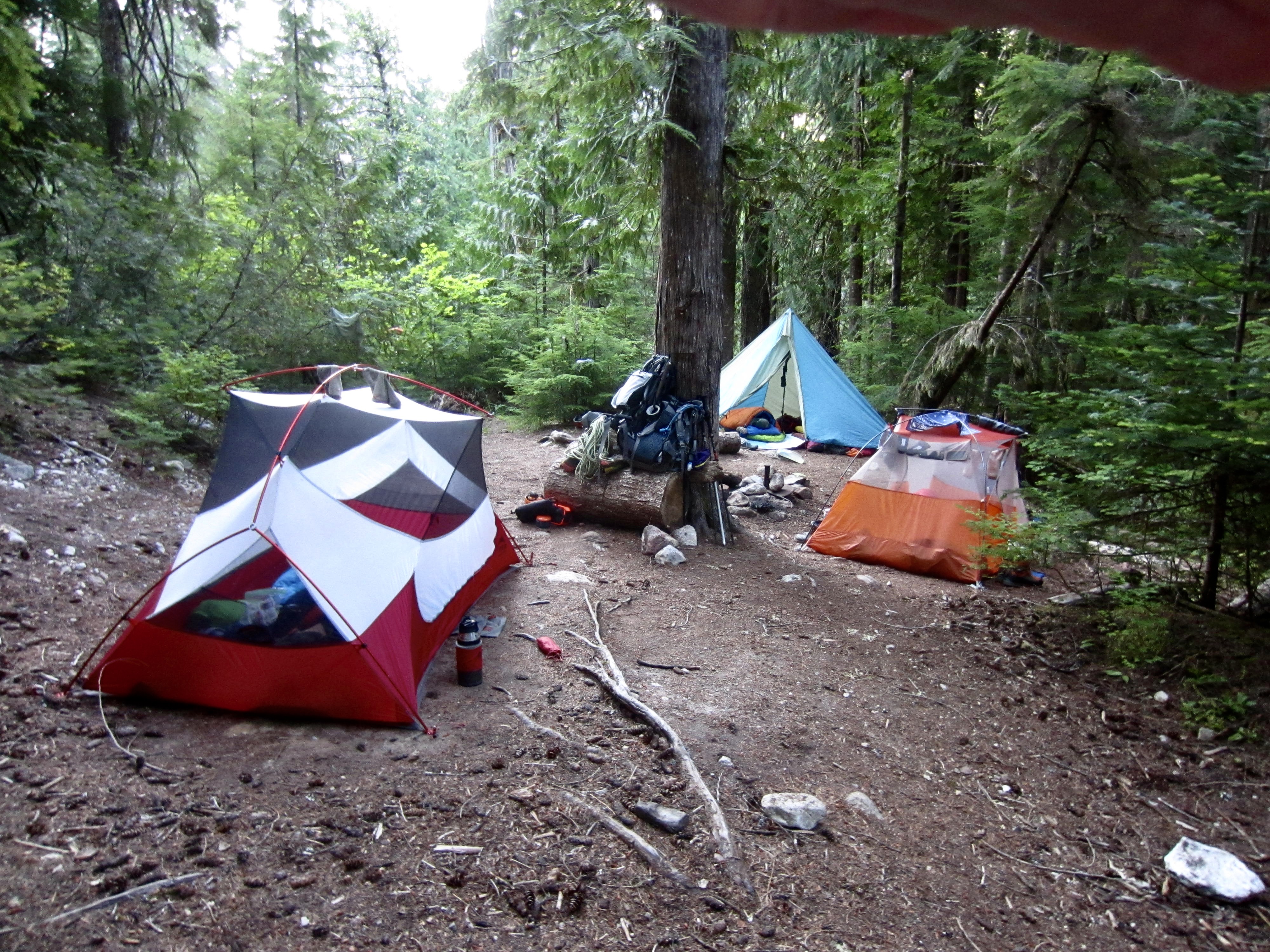
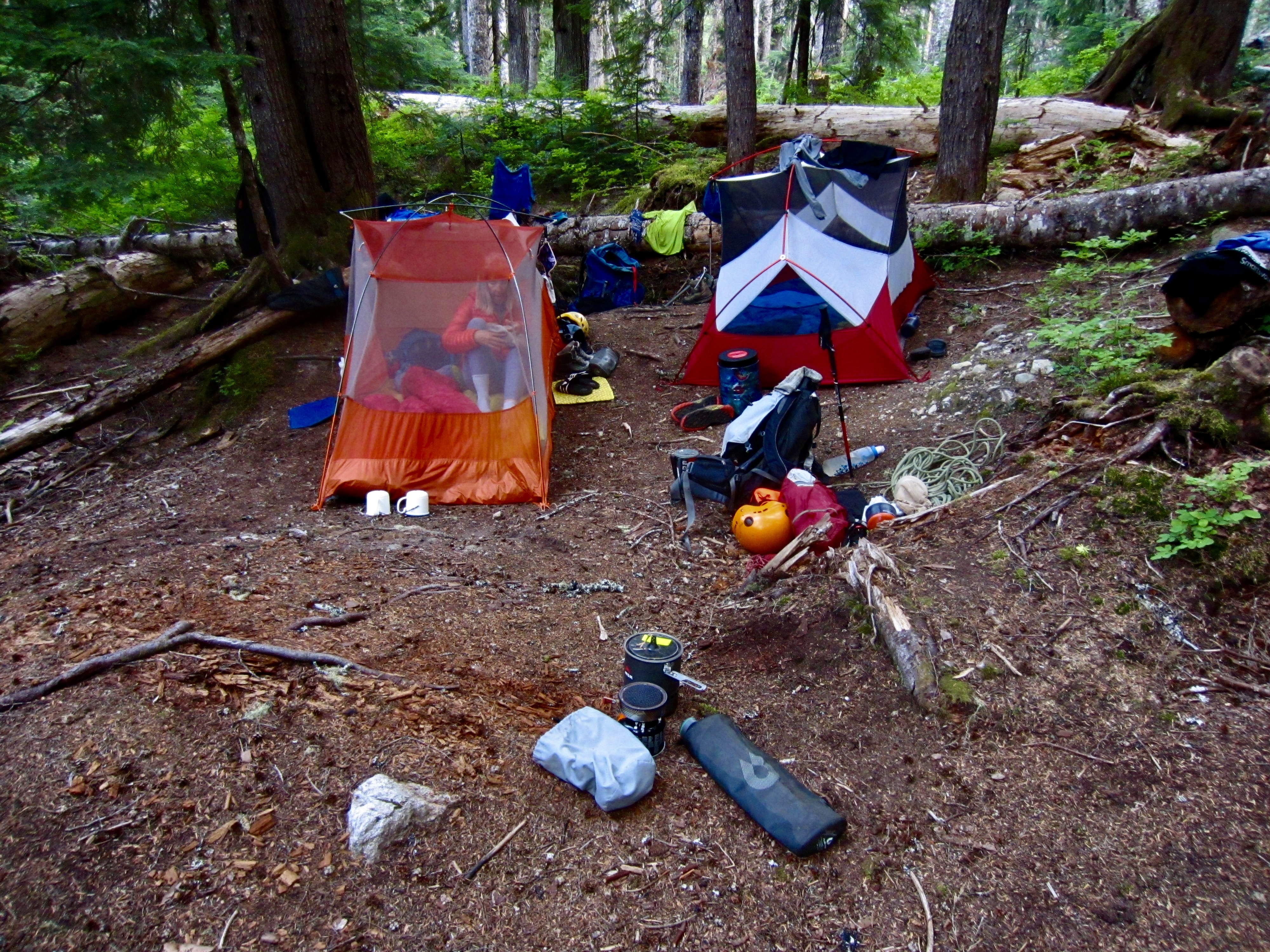
We all arrived at 39-Mile Camp by early evening (2.8 hours + 5.0 miles + 300 feet from landing) and spread out as best we could in the limited space. Considering that the the water taxi had put us in camp 2 hours later than expected, we were glad to have planned for a short approach hike today.
.
Day 2: 39-Mile Camp to Access Creek Flats
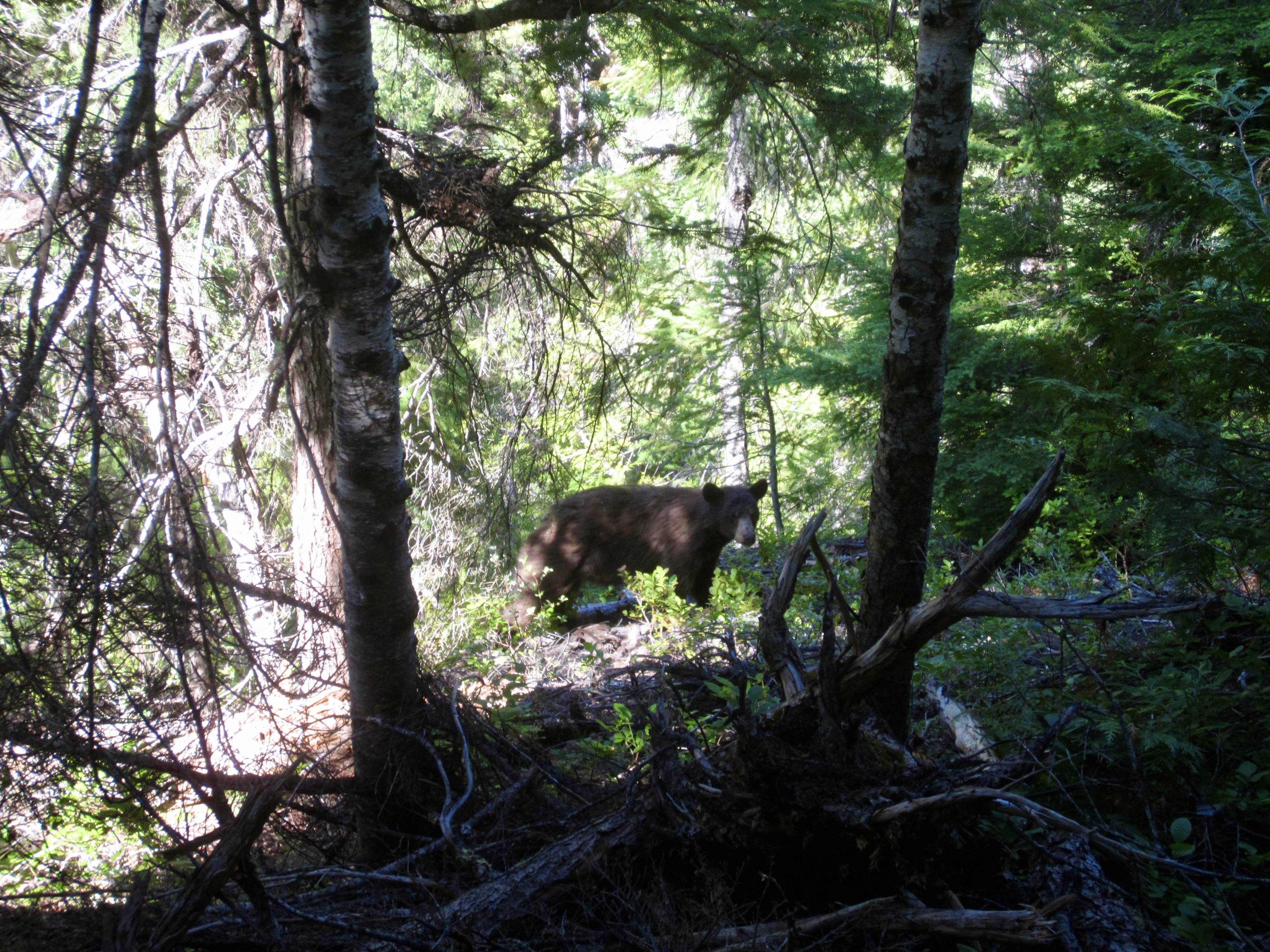
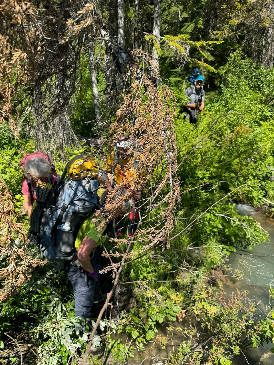
We were back on the Big Beaver Trail at 8:30am, knowing that there was a hot bushwhack in our immediate future. Several miles up the trail, we passed a young black bear munching on huckleberry leaves and showing little interest in humans.

.
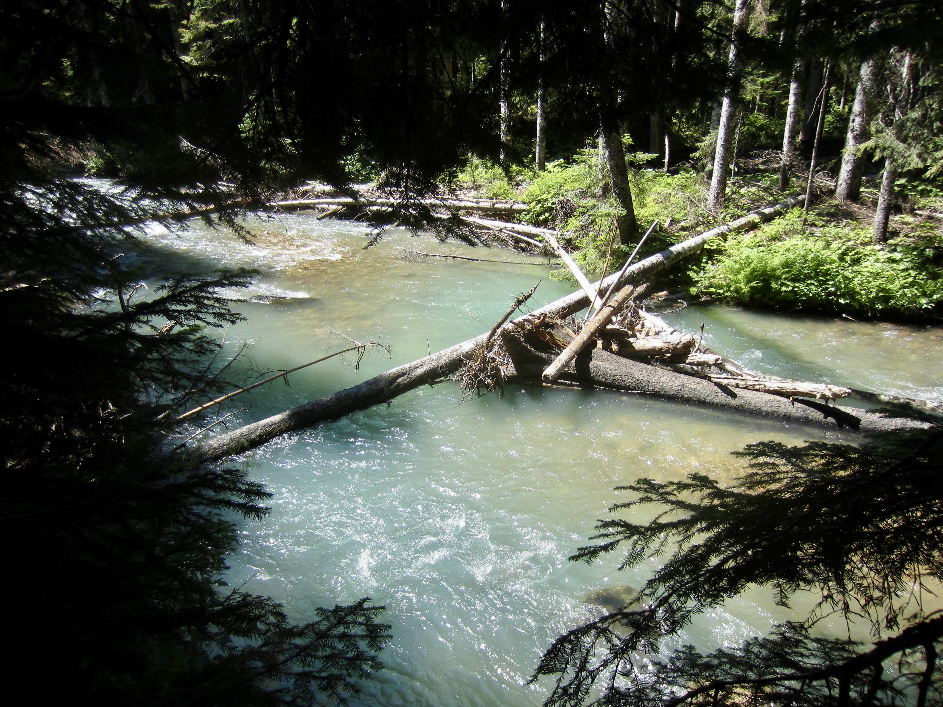
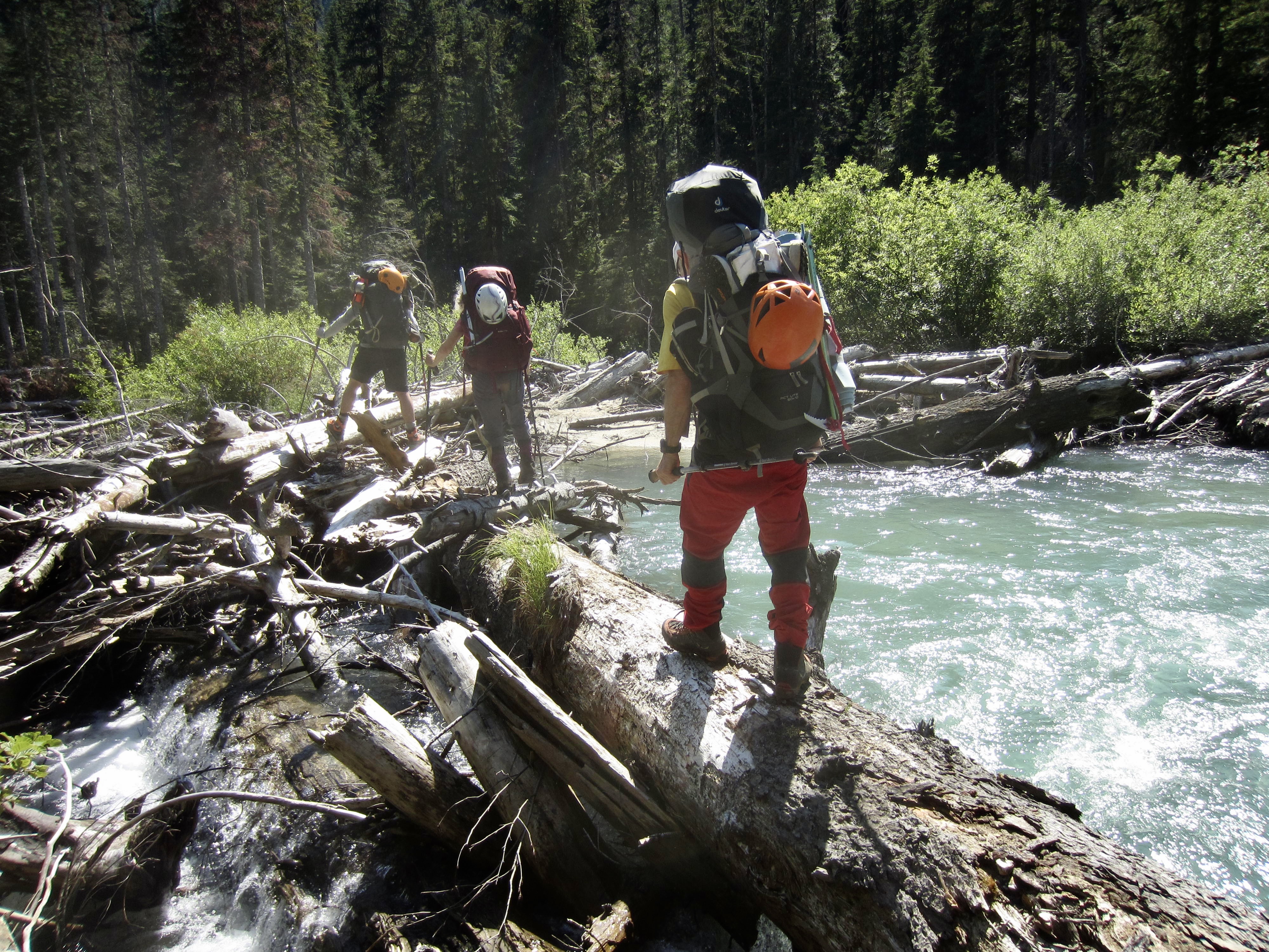
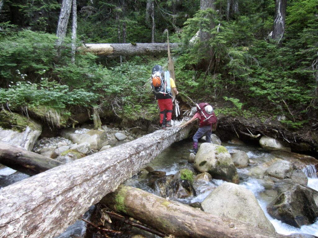
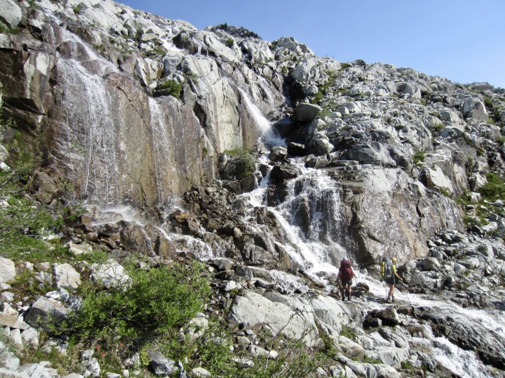
We passed Luna Camp at 11:00am (2.4 hours + 4.0 miles + 950 feet from Camp 1) and continued up-trail for another mile until Big Beaver Creek came into view. Here, we hiked down to the creek to check out a footlog that has been used by other climbing parties this year, including our friends Kellie and Gordy. It turned out to be too long and narrow for our comfort level. I recalled Kellie saying that anybody who was uncomfortable crossing this log should probably not be going into the Pickets anyway. Hmmm…perhaps we needed to take her admonishment more seriously.

.
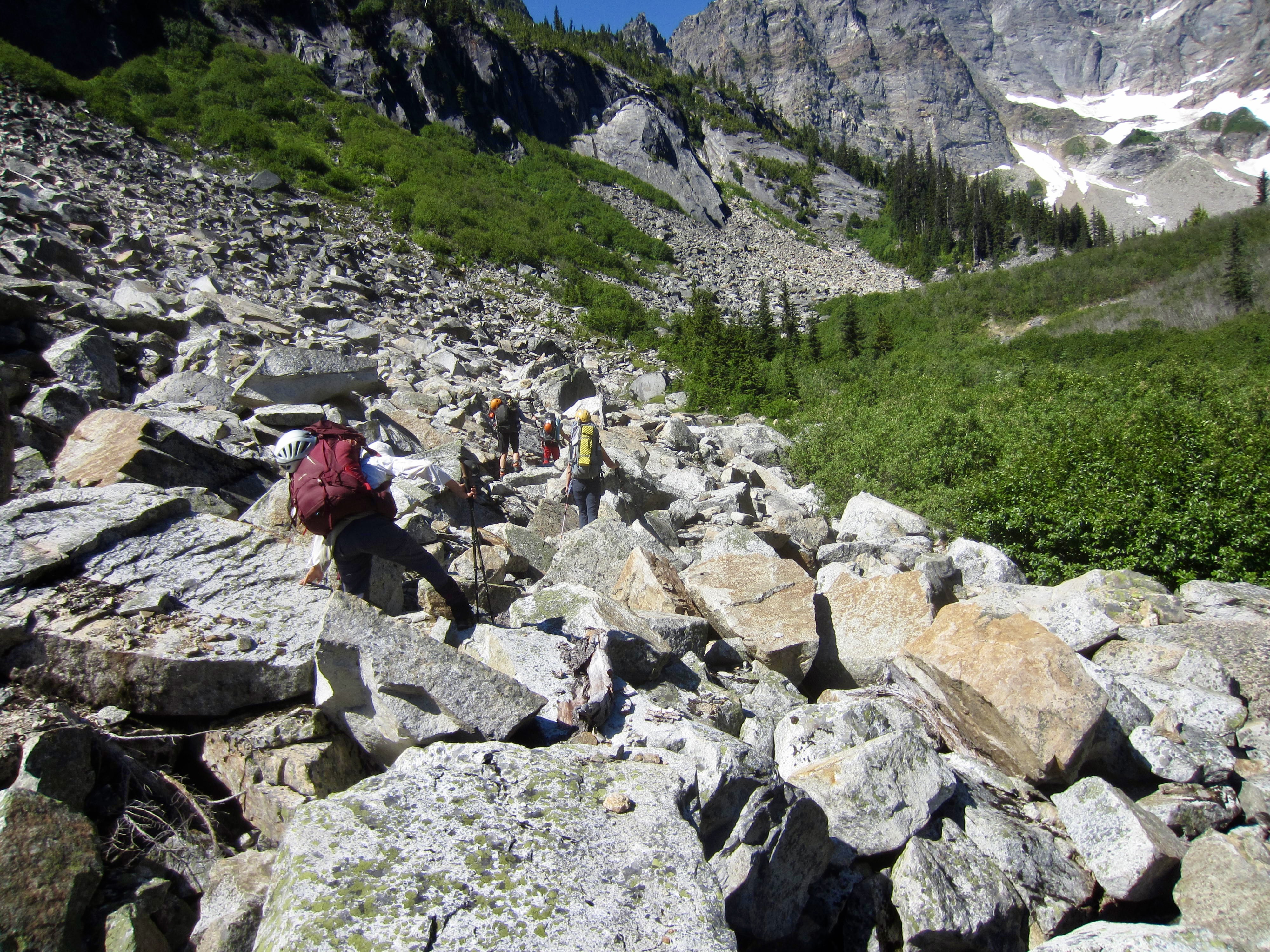
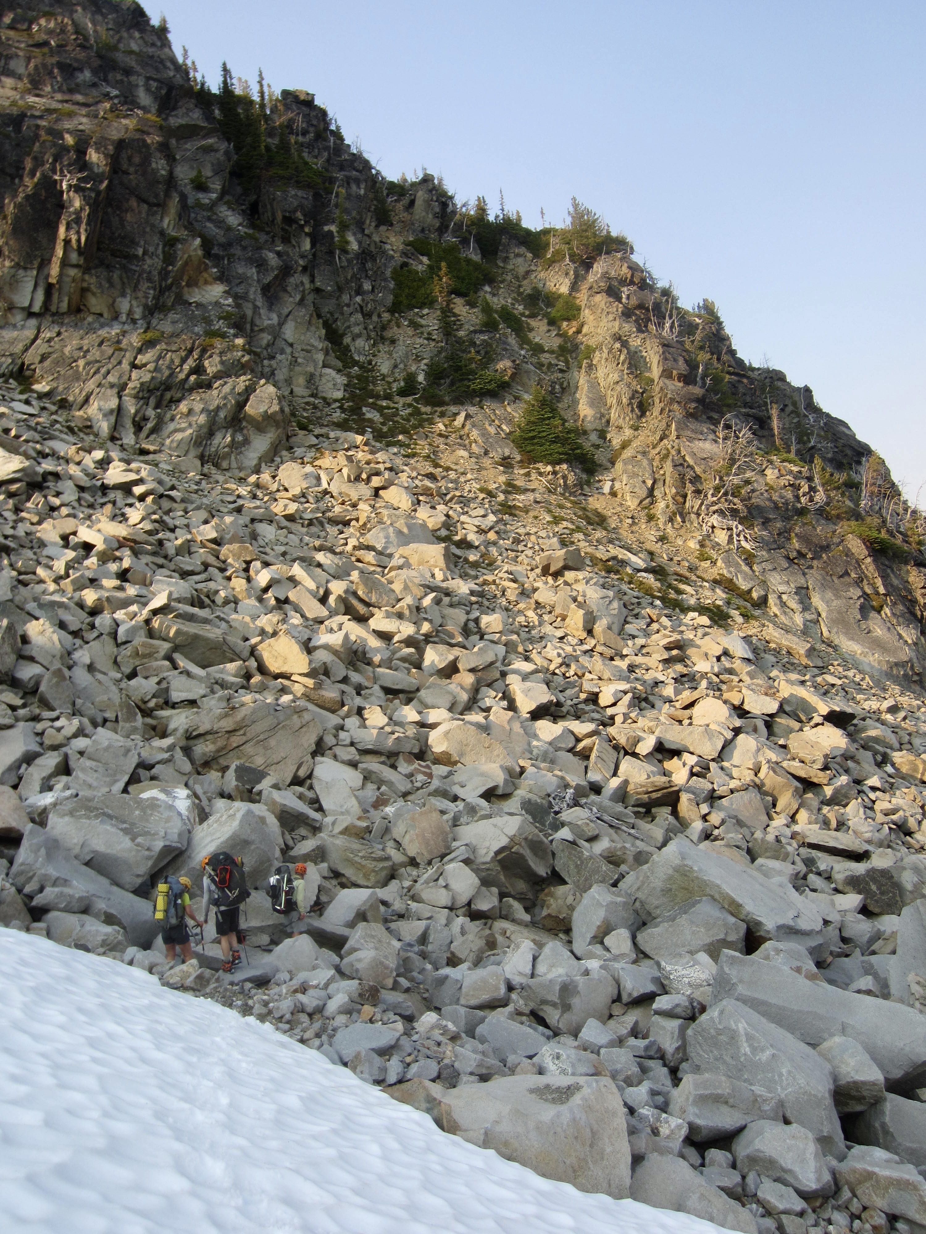
Fortunately or unfortunately, depending on how we now choose to look back on our trek, there was another option for crossing Big Beaver Creek: a perennial logjam that forms ½ mile downstream. We returned to the trail, hiked ½ mile back whence we’d come, and then spent more than an hour thrashing through brushy forest and swampy alder groves to locate the logjam. The crossing here was simple enough, but it was mid-afternoon (6.7 hours from Camp 1) by the time we all got across the creek.

.
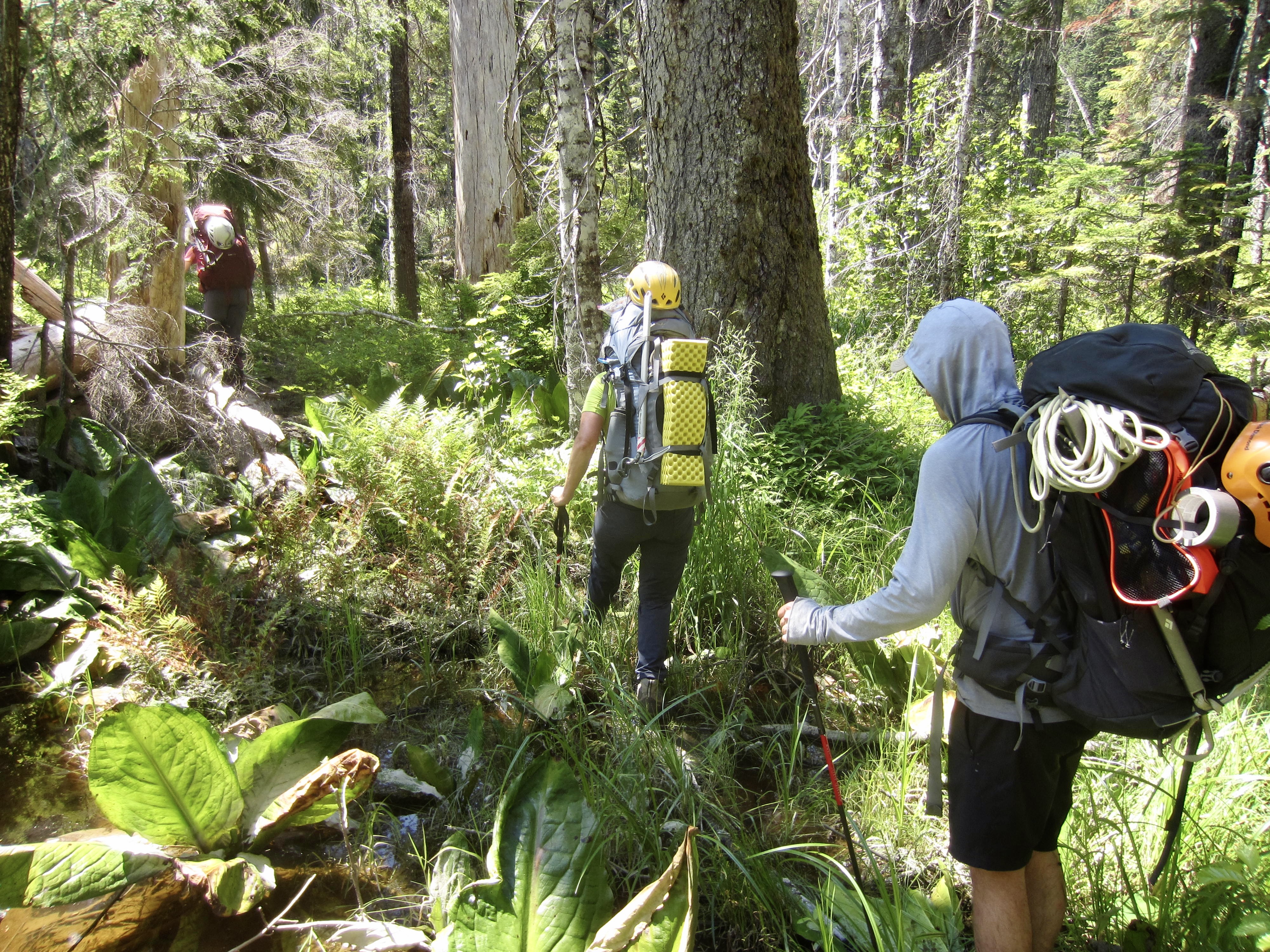
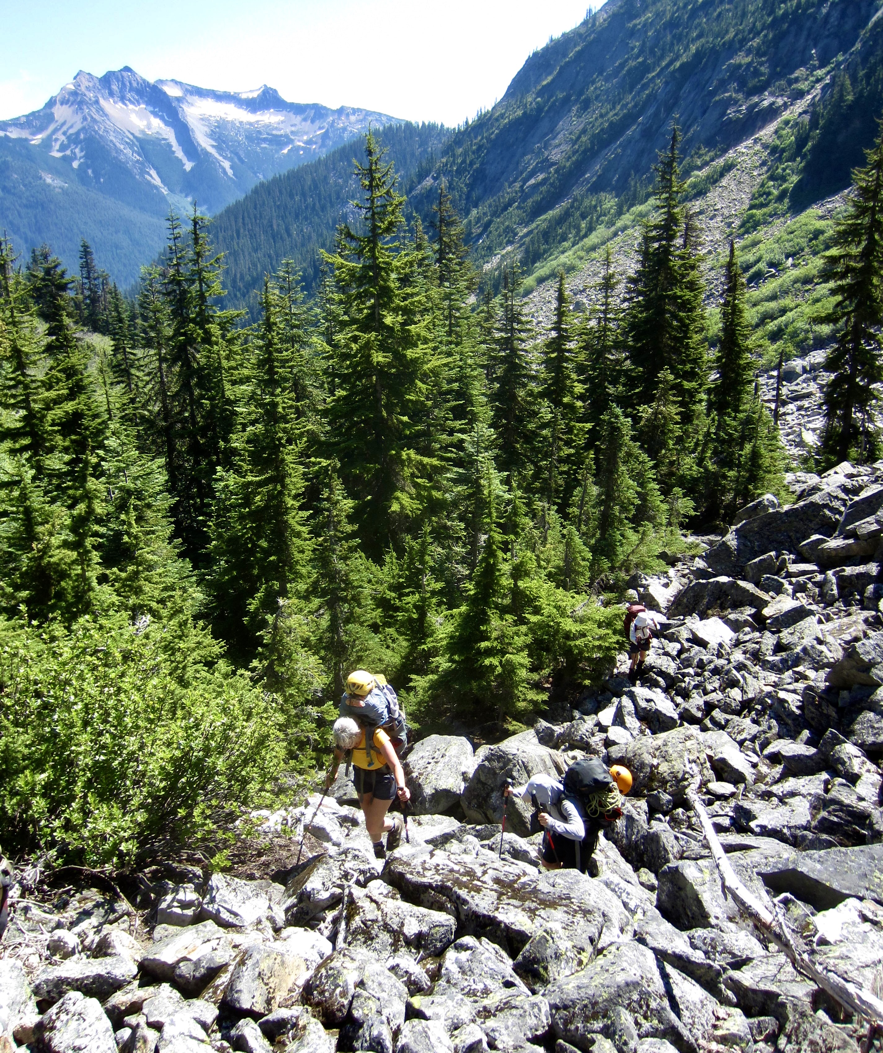
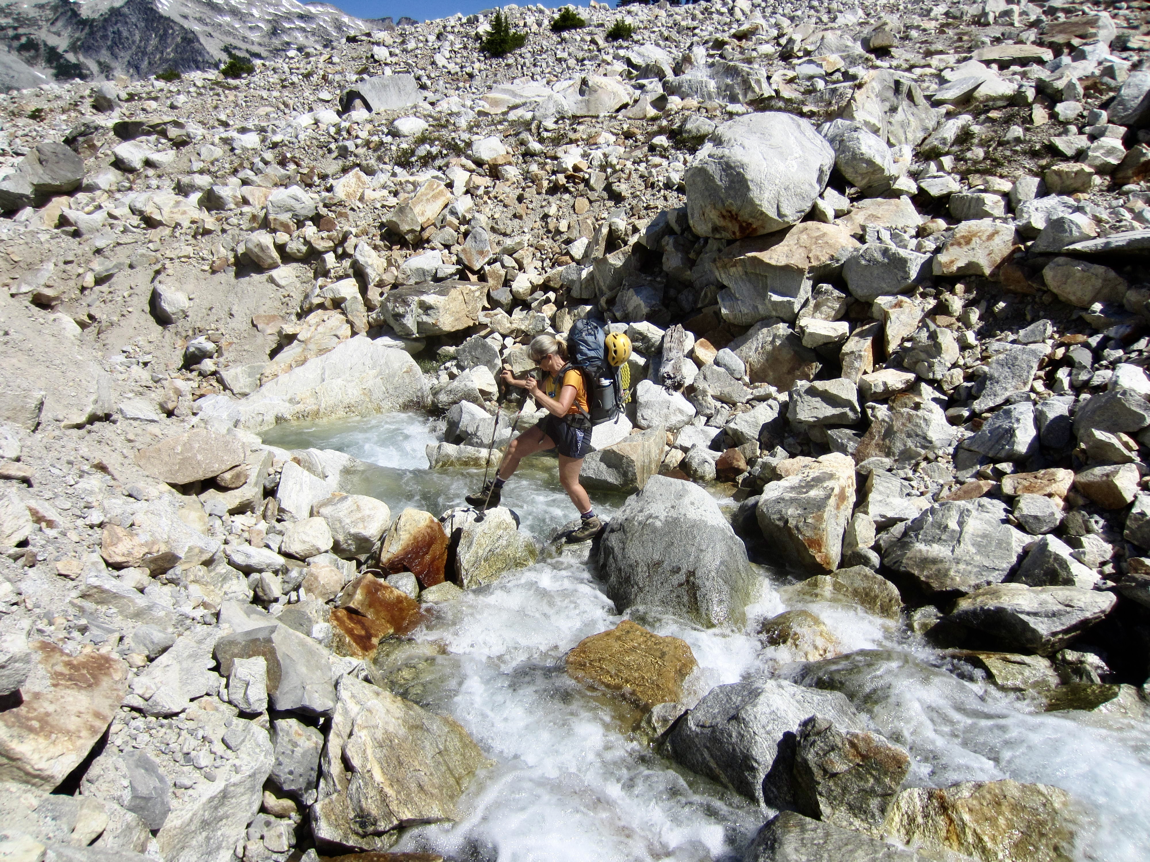
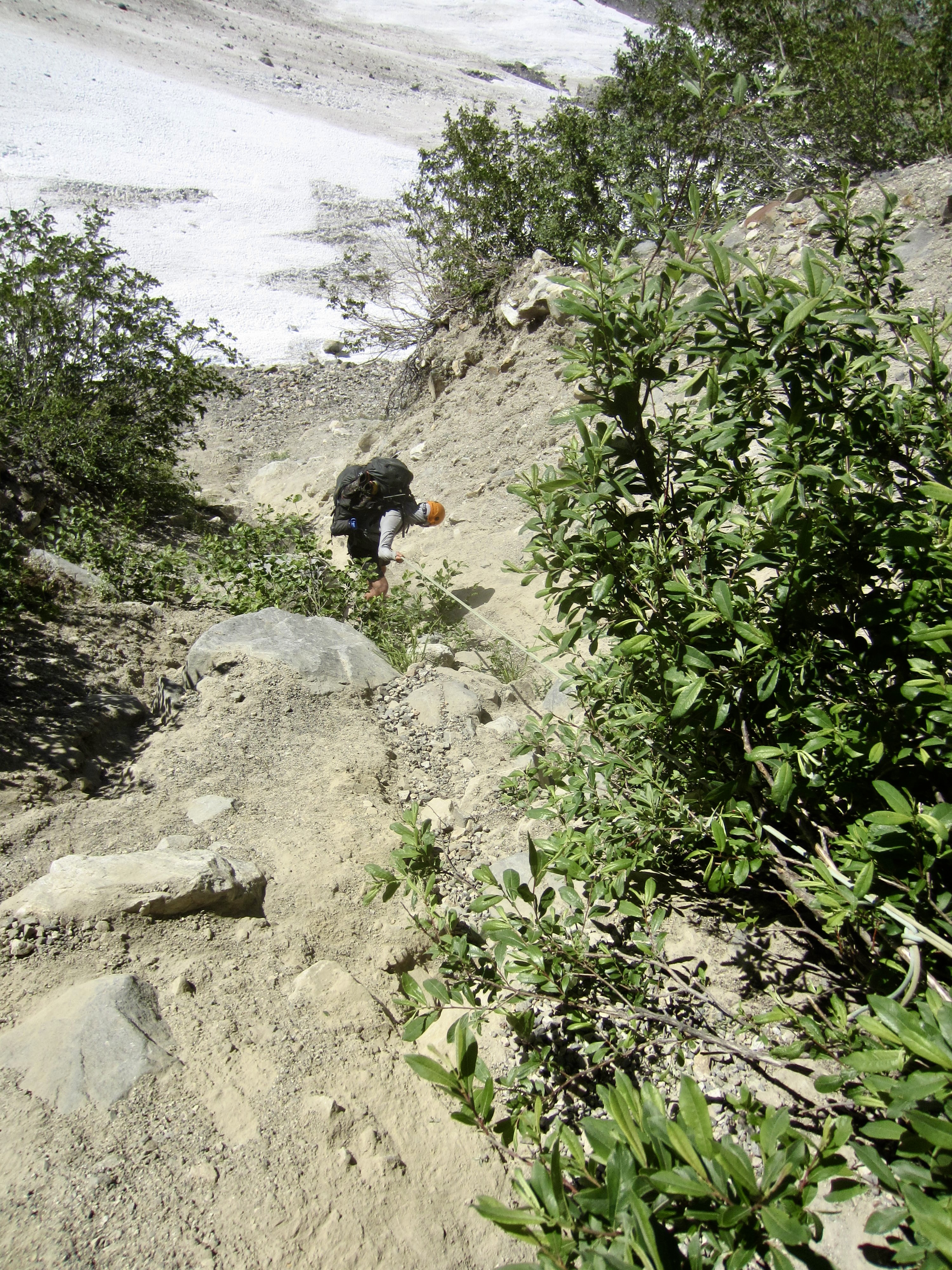
Having finally crossed Big Beaver Creek, our misery was only just beginning. We spent the next 3 hours bushwhacking up the hillslope, angling rightward, and looking for a place to cross Access Creek. Just above an elevation of 3000 feet, we found a sturdy log that took us over the rushing creek. We then clawed our way 100 feet up the northern bank in hopes of finding some semblance of a climber’s path. What we actually found was a remarkably well-defined path running along the top of the bank. It was a welcome discovery for all of us, and also a surprise for me. I had been up this side of Access Creek in 2003, when there was nary even a footprint to be seen, let alone an actual path!
.
.
We followed the path upstream as it faded in and out, occasionally losing the path completely where it was obscured by fallen trees. Our progress was now much faster, but after nearly 1 mile it became obvious that we would not reach Access Basin before nightfall. We made camp in an area of reasonably flat forest at 3650 feet, adjacent to the creek (11.7 hours + 2150 feet from Camp 1). It had been a long and taxing day, but we were confident that all of the miserable bushwhacking was now behind us. (We were wrong about that.)
Day 3: Access Creek Flats to Luna Pass
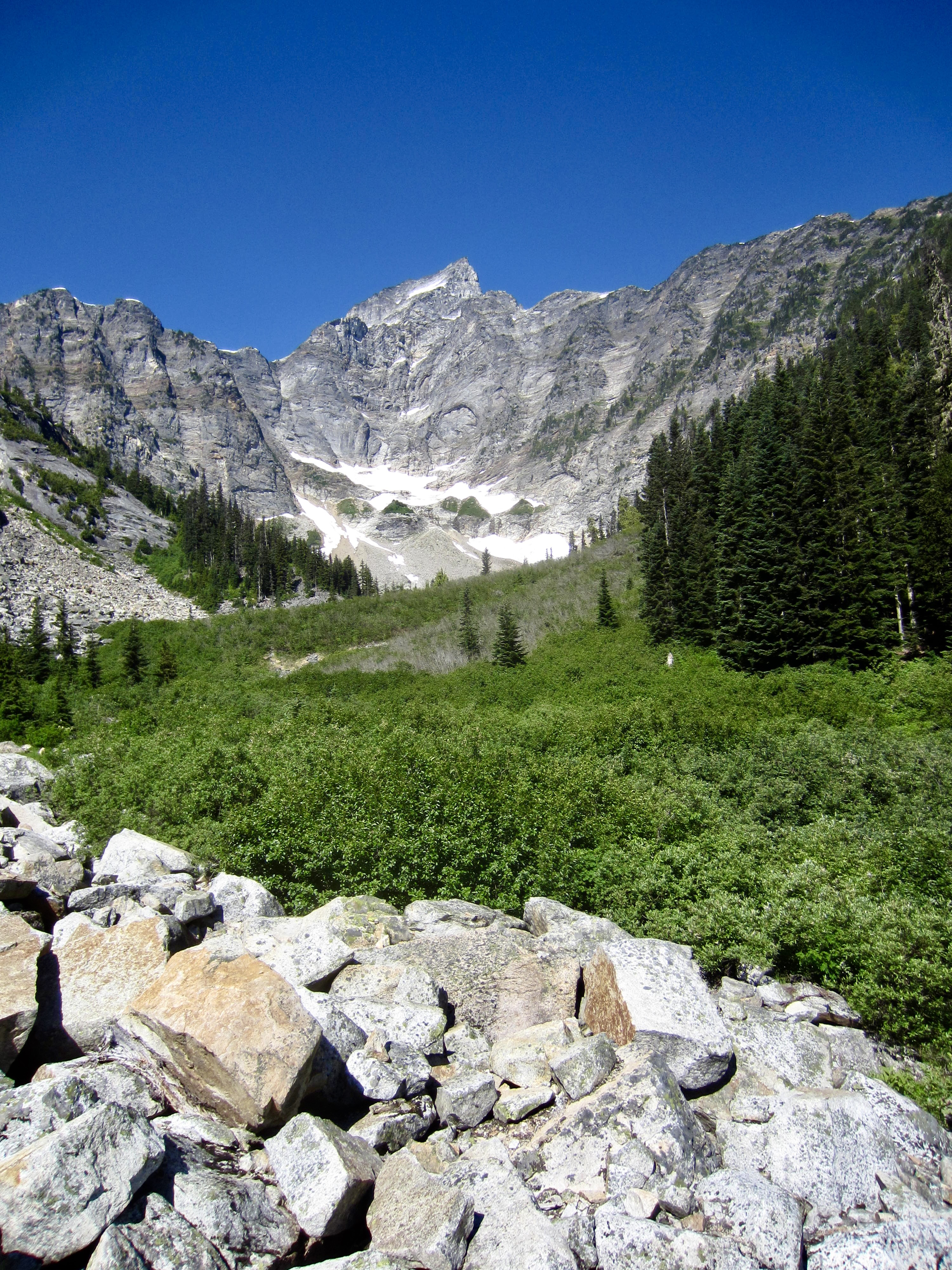
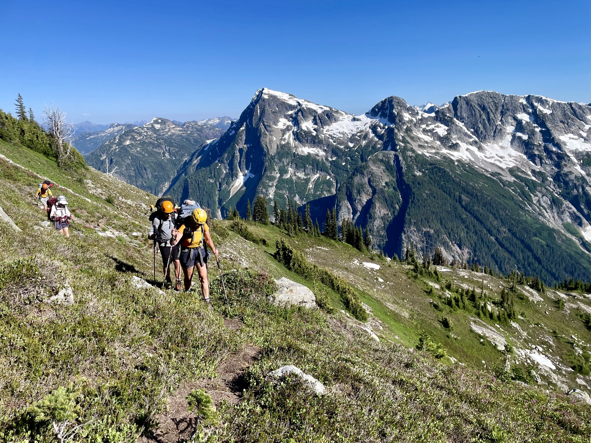
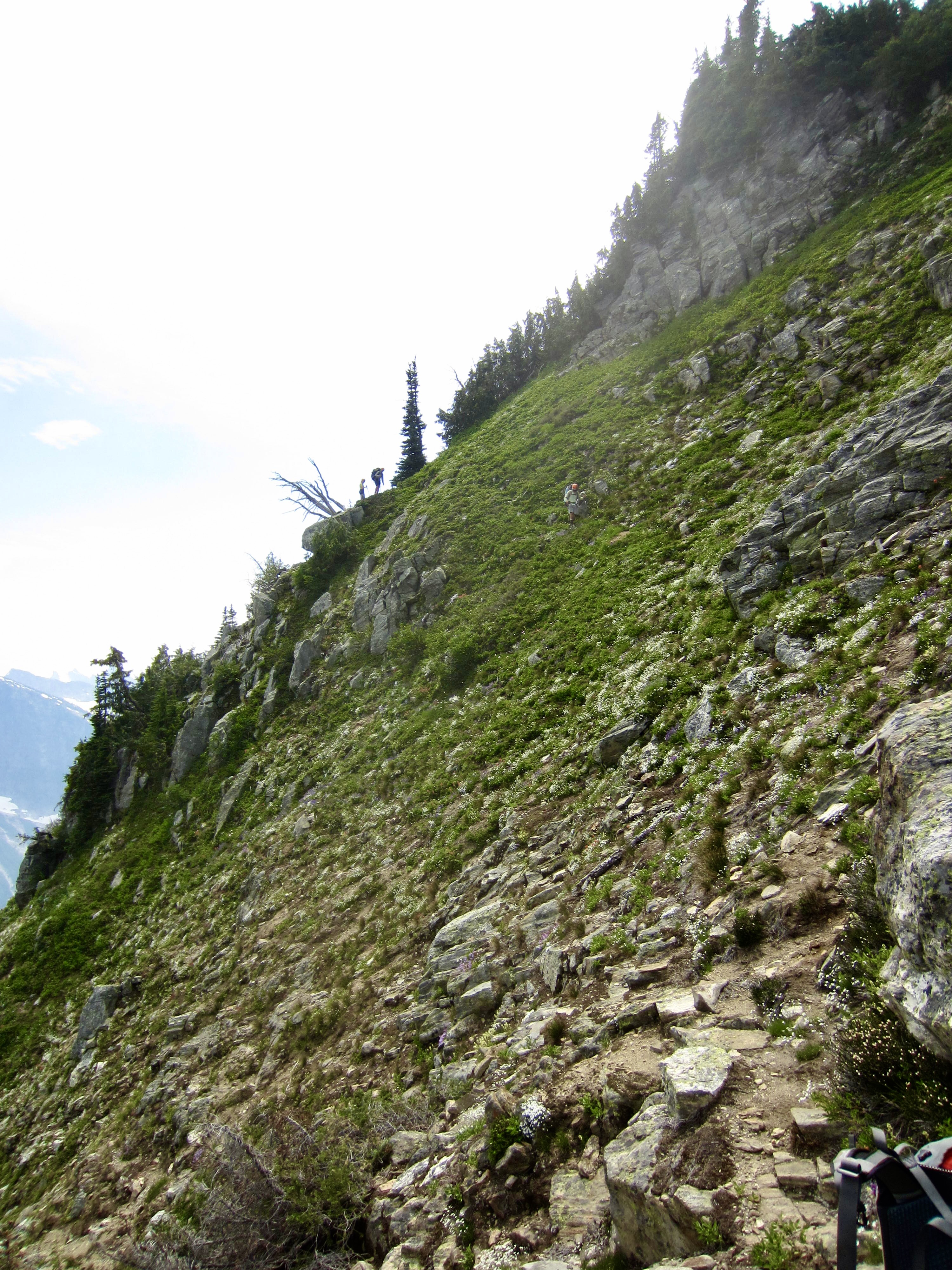
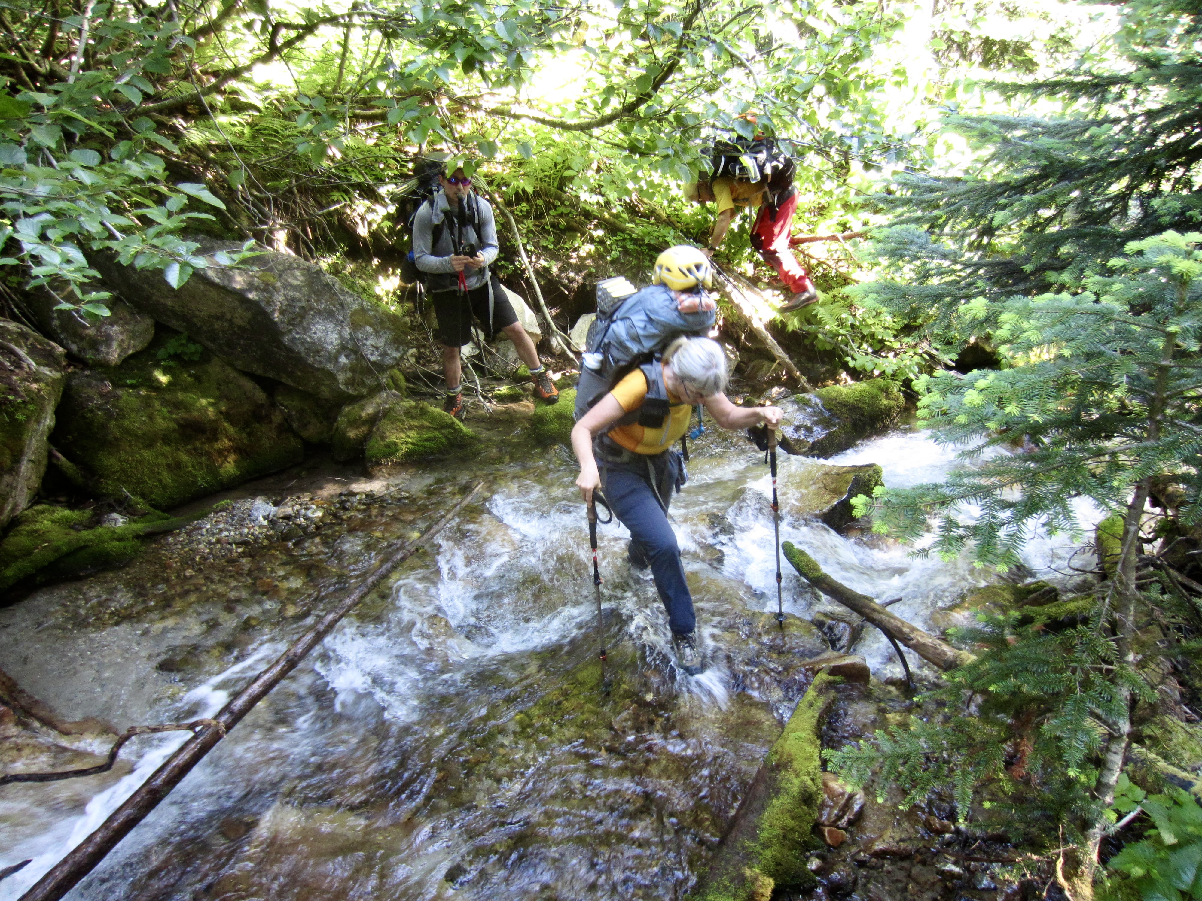
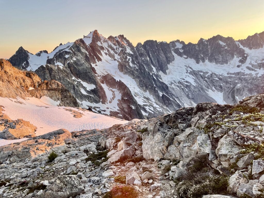
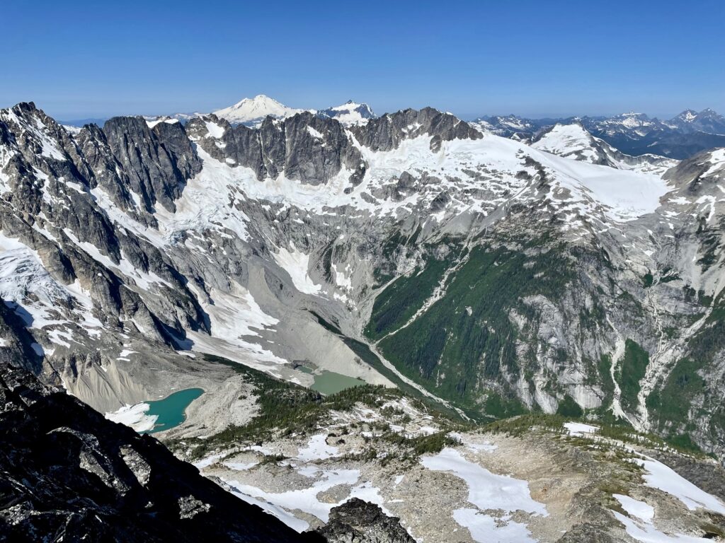
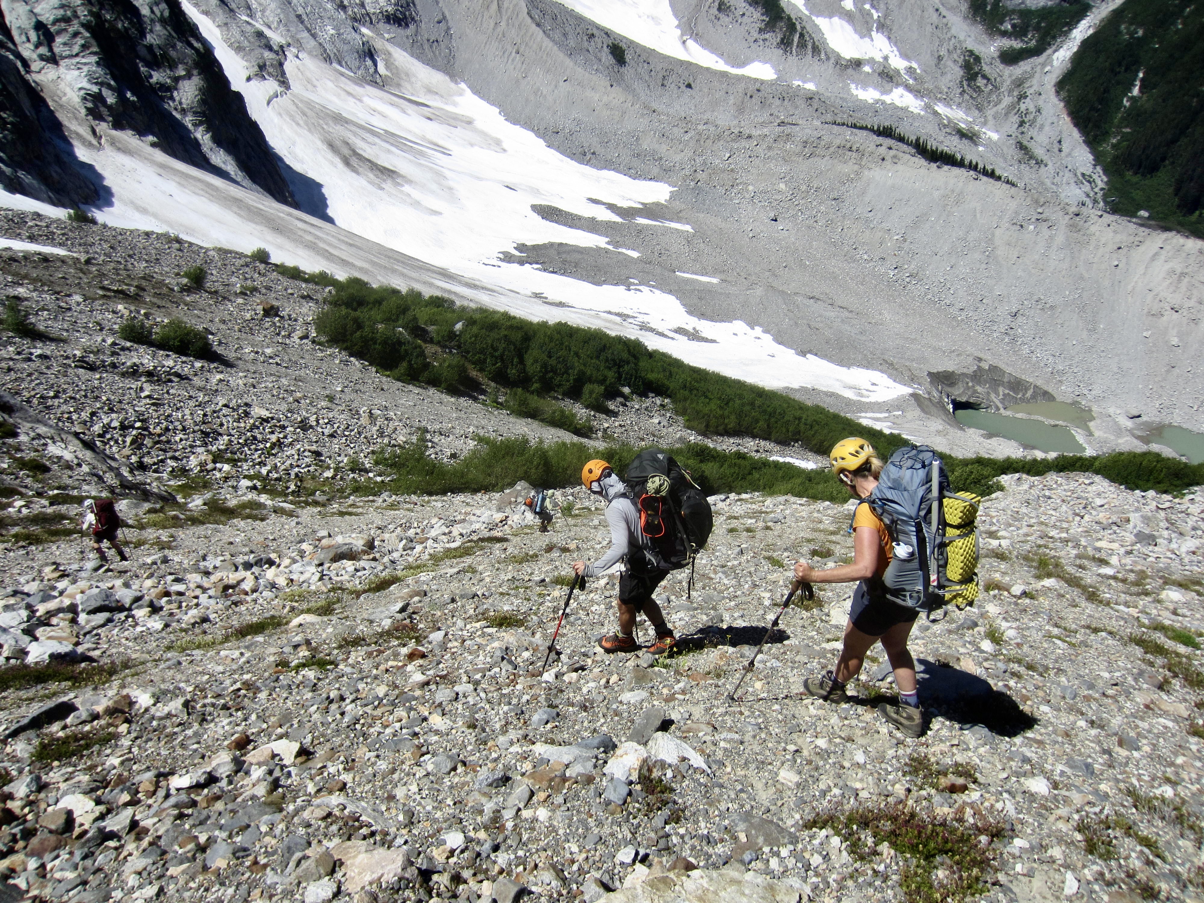
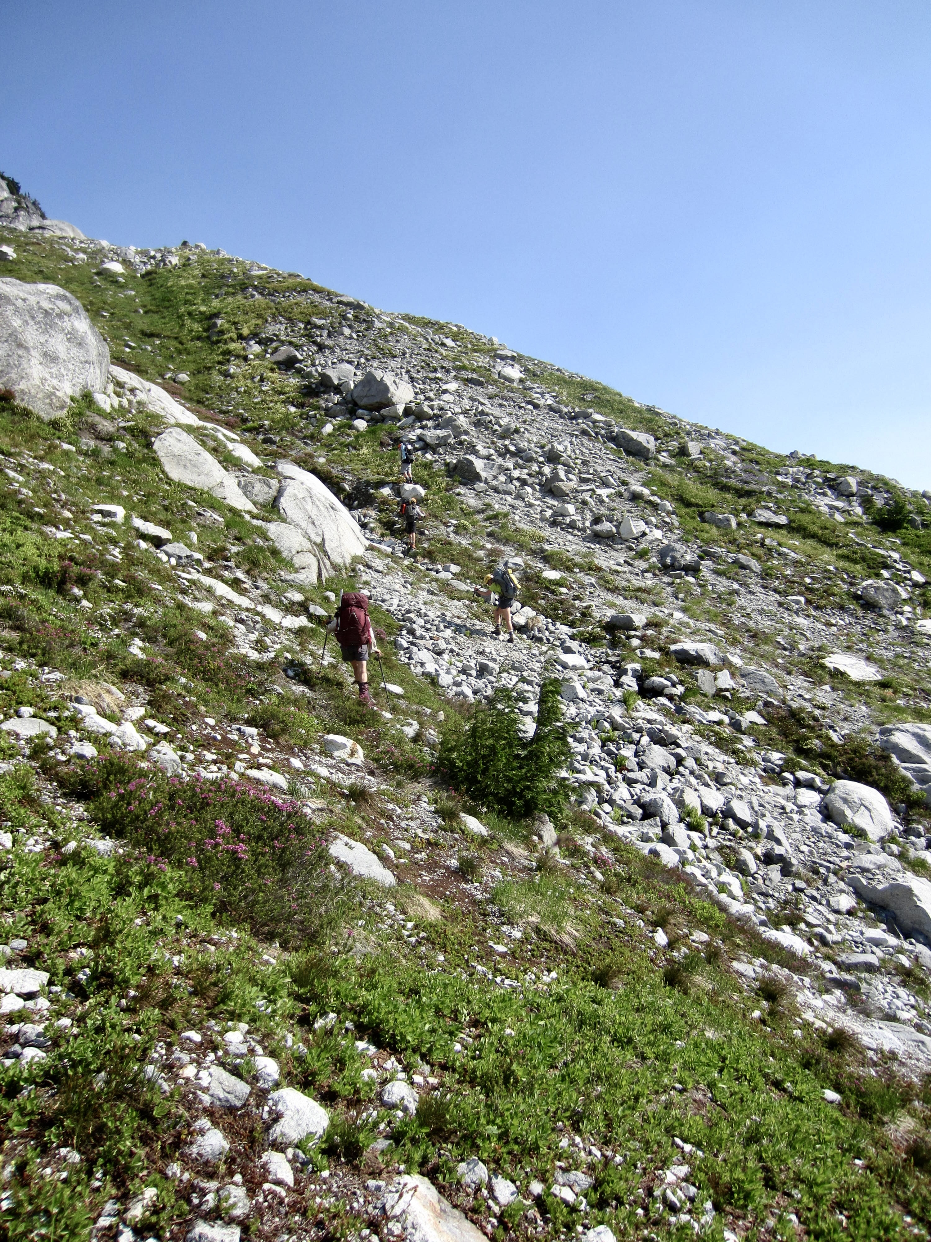
Next morning, we continued hiking up the climber’s path for ⅓ mile, at which point it disappeared in a thicket of slide alder. Here, we rock-hopped across the creek and picked up a path on the southern bank. Forest gave way to a field of large boulders that led us farther up-valley toward Access Basin. The eastern face of Luna Peak, with its banded gray metamorphic rock, was visible above the head of the valley.
.

.
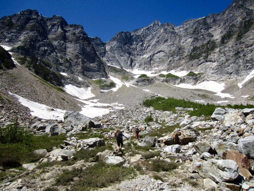
We strolled into Access Basin in late morning (2.2 hours + 550 feet from Camp 2) and stopped to assess the route ahead. The key couloir that would take us out of the basin could be seen as a swath of talus and heather angling up to the left, and Access Col appeared as a tiny notch in the ridge crest above.
.
.
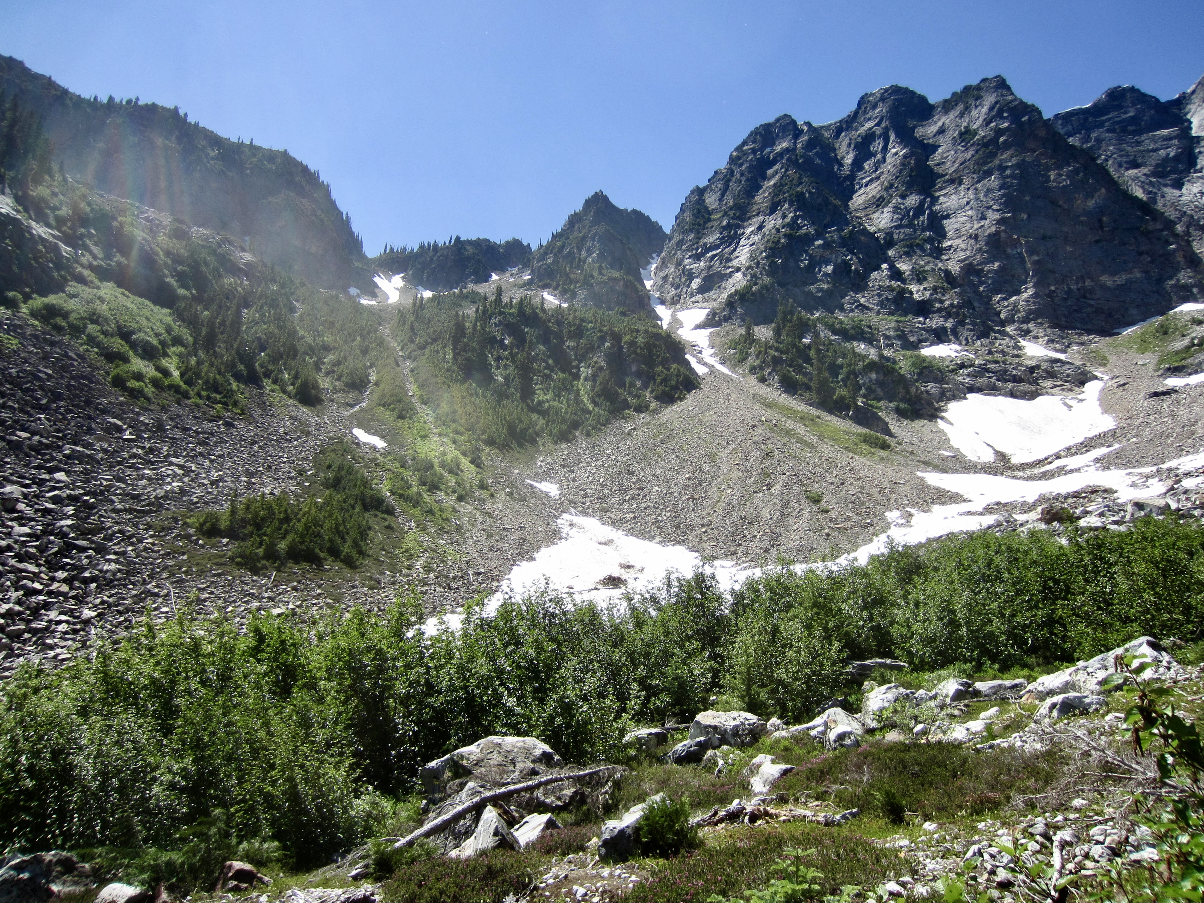
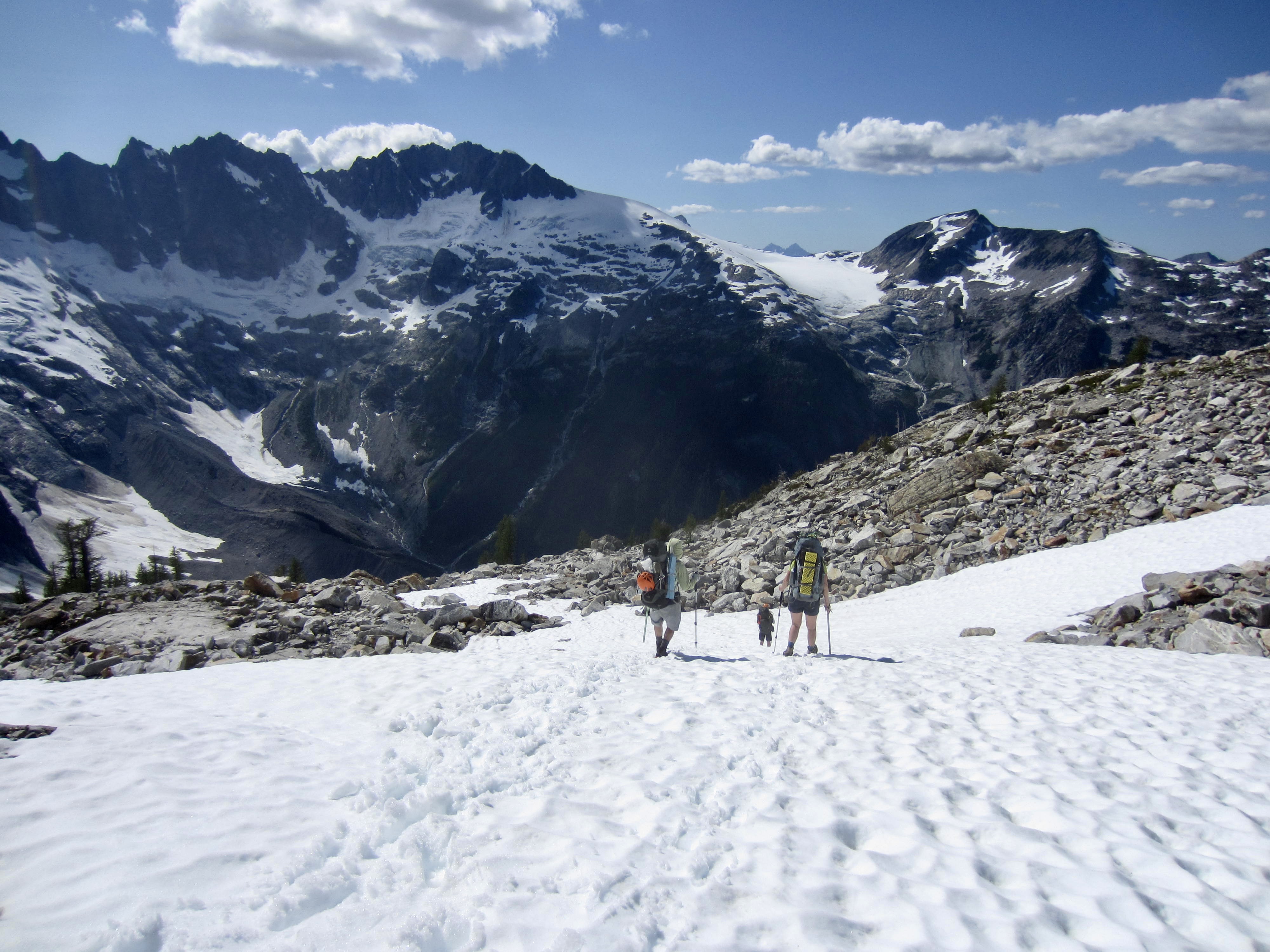
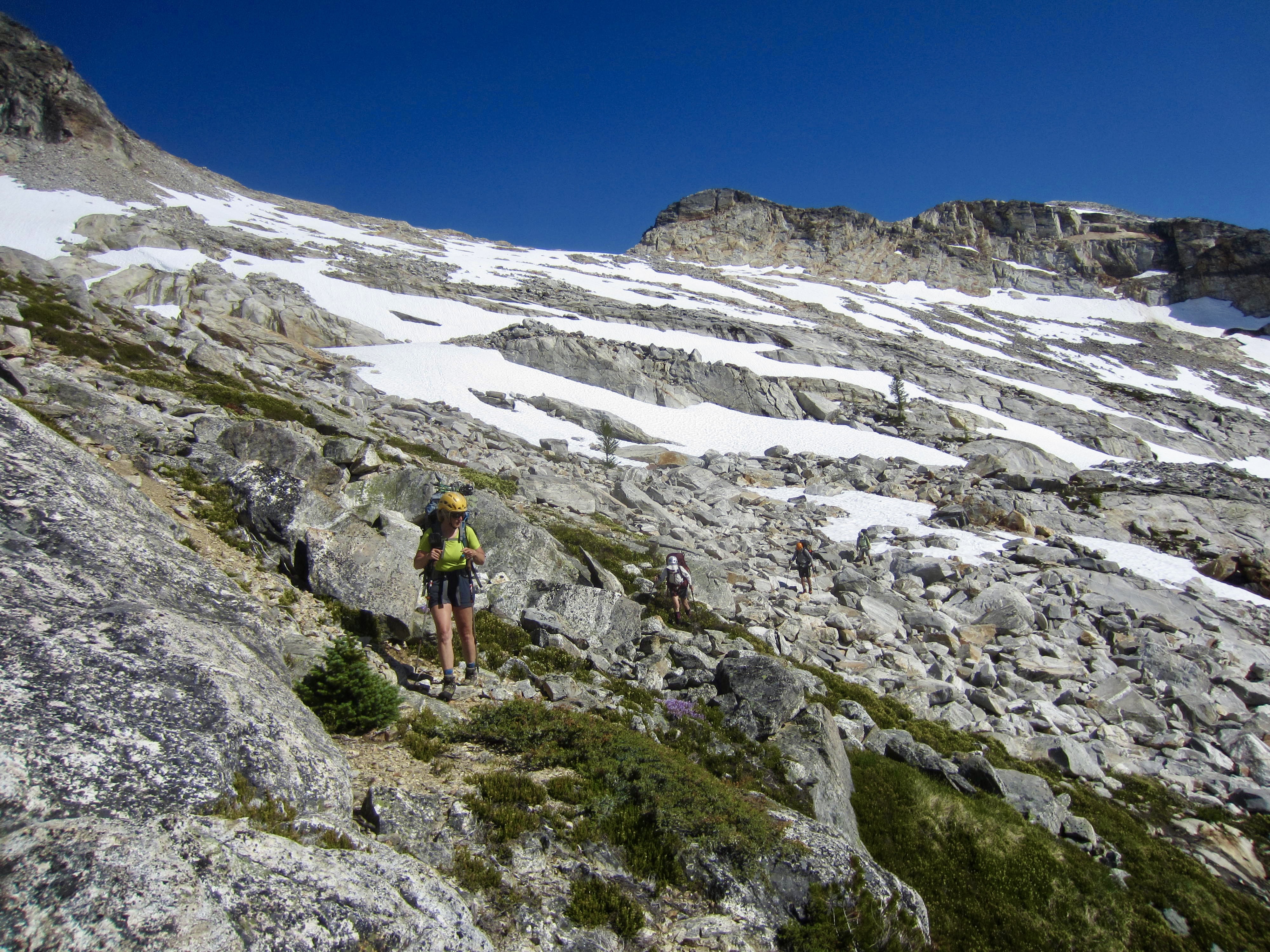
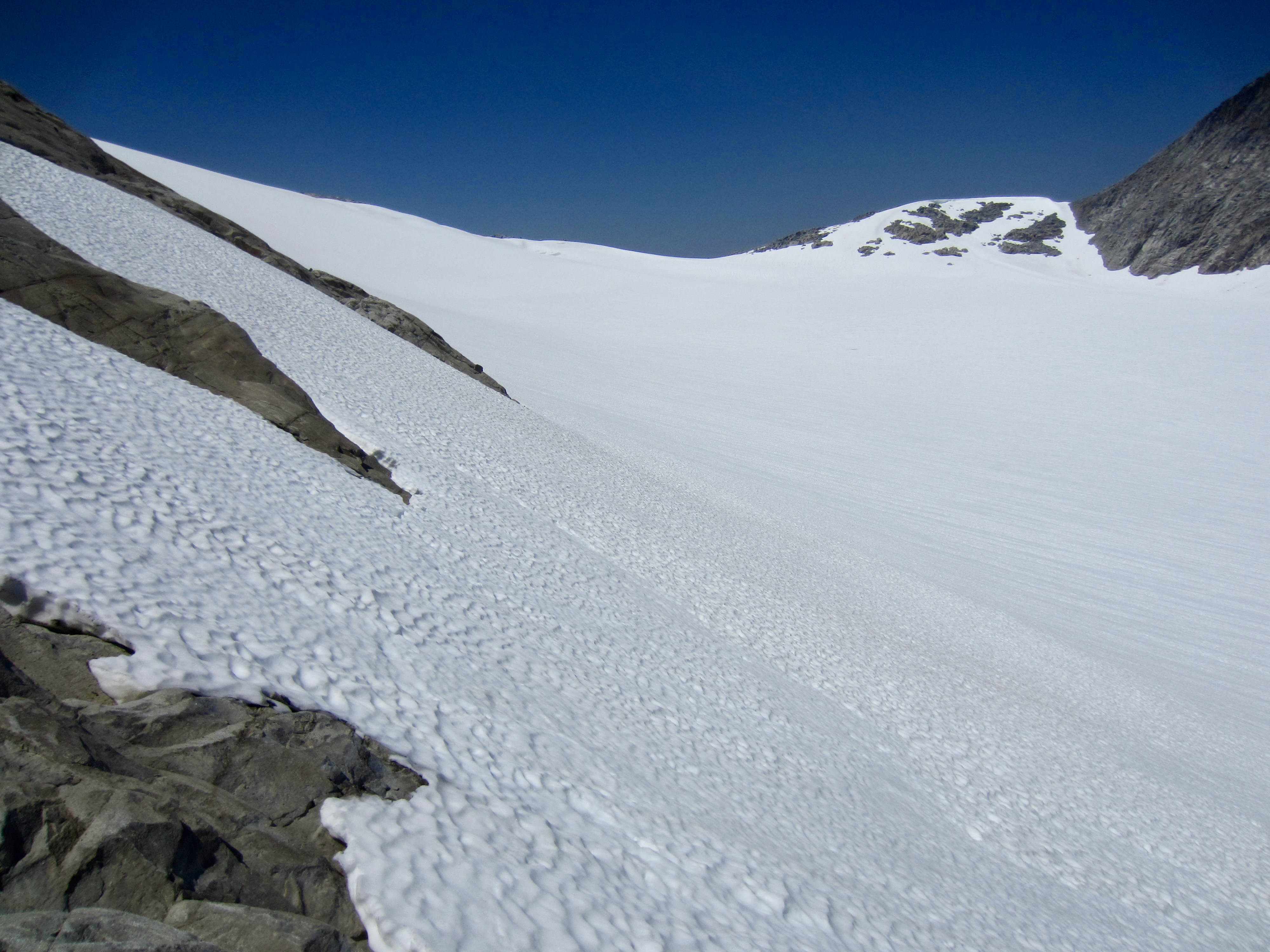
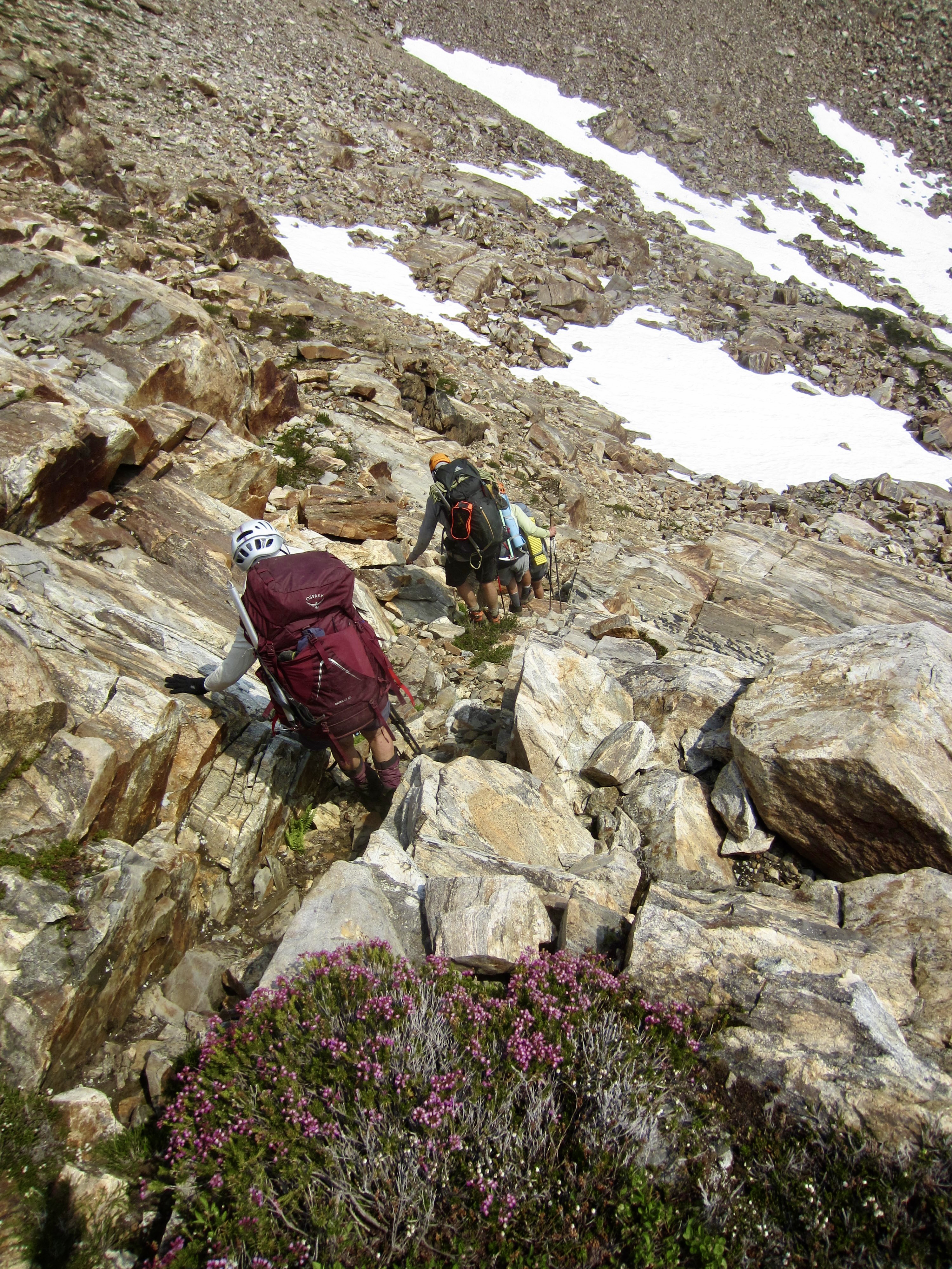
The ascent of Access Couloir involved 1500 feet of tedious scree and talus with scattered patches of snow. The upper portion, which dog-legs to the right, is very steep and loose. We all took numerous slips as we made our way upward. Near the top, I found myself on Class 3 dirt, grasping desperately for clumps of heather.
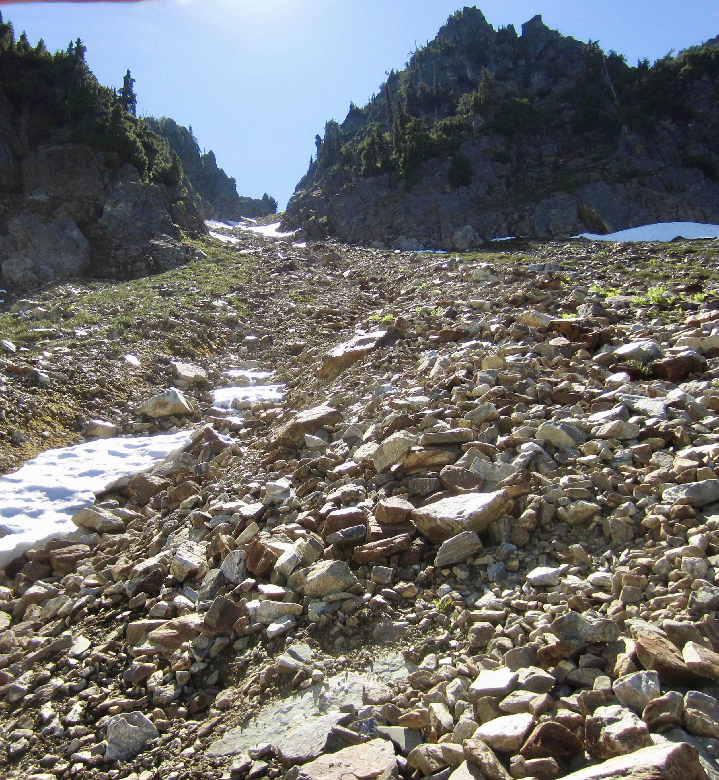
.

.
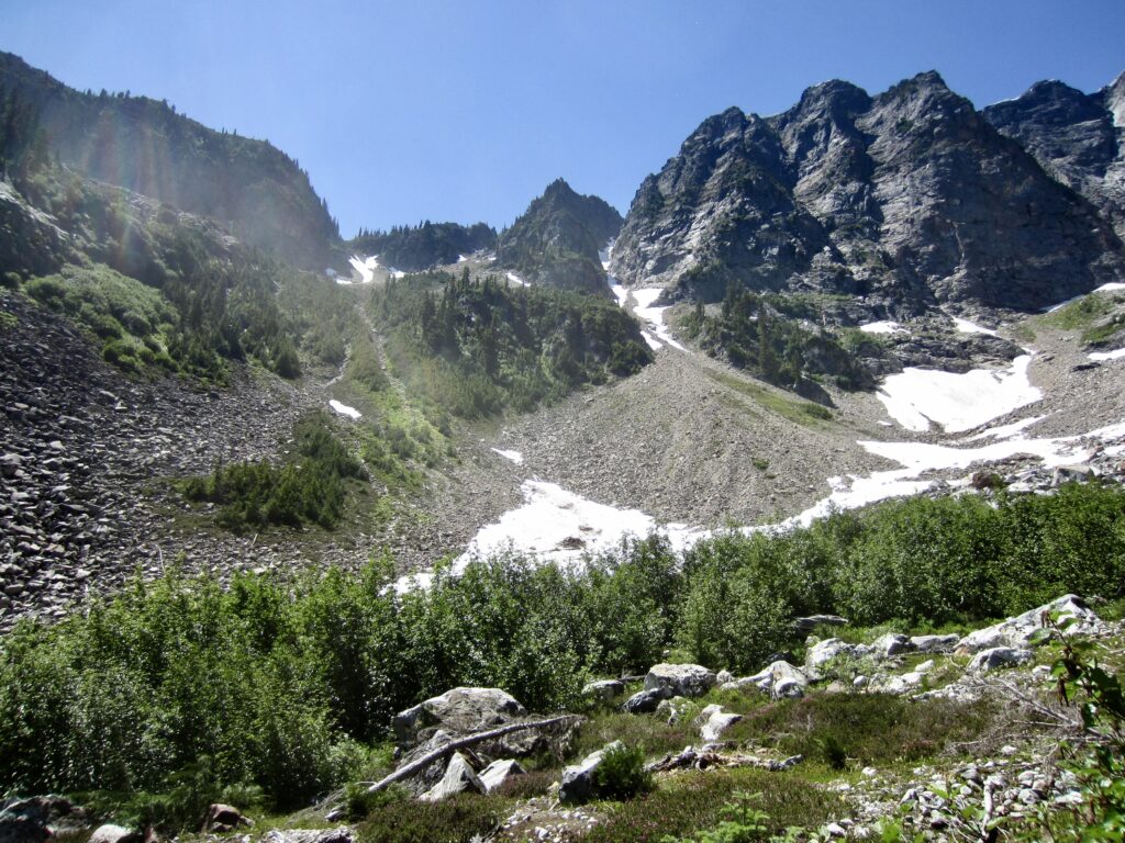
It was a huge relief to finally gain the ridge crest at 6300-foot Access Col (7.1 hours + 2350 feet from Camp 2). However, we had to be careful that we weren’t knocked off our feet by the iconic in-your-face view of the Southern Pickets. Wham!
.
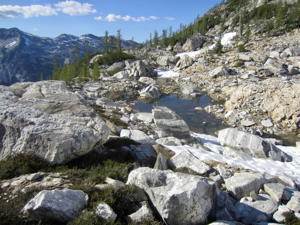
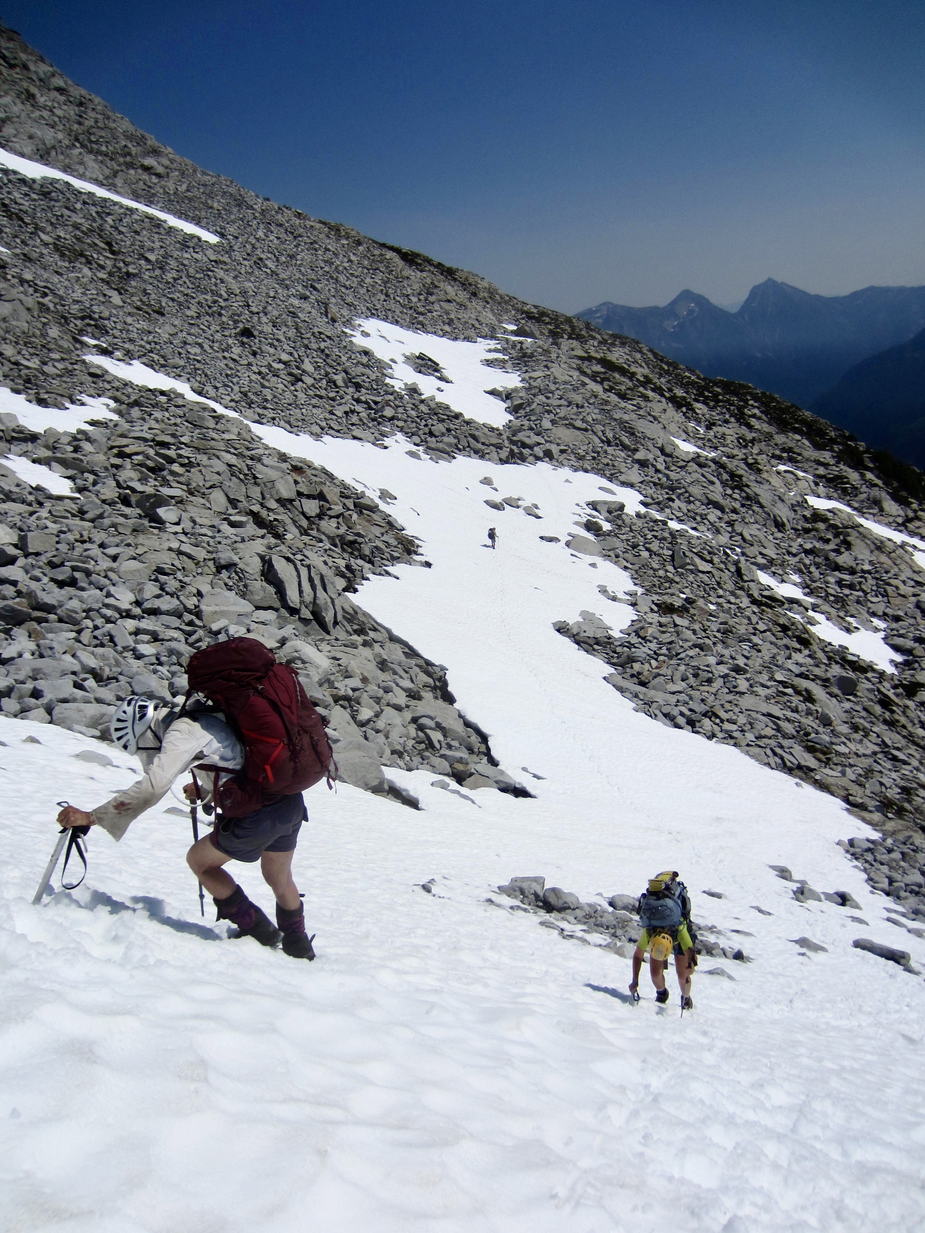
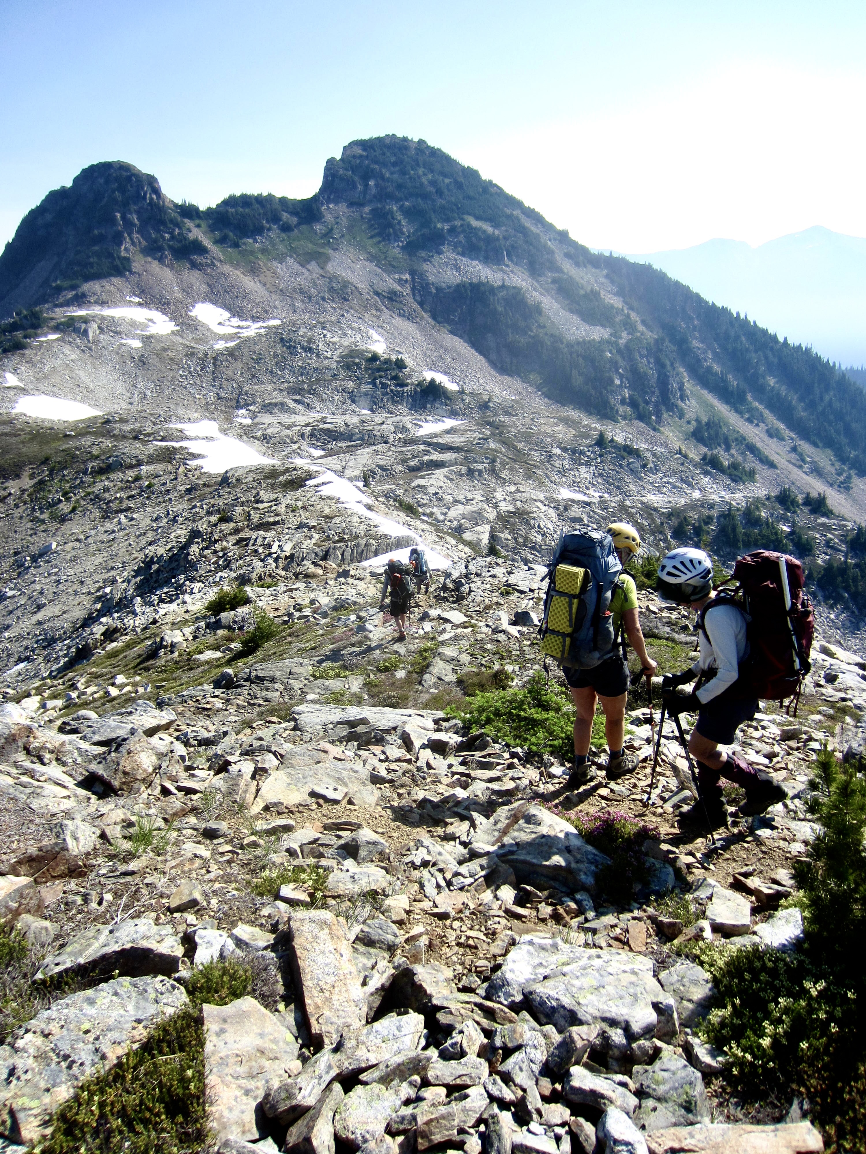
From Access Col, we followed a faint climber’s path westward across slopes of heather and talus, aiming for distant Luna Pass. Upon getting closer to the pass, we angled up a series of snowfields on the southeastern flank of Luna Peak.

.
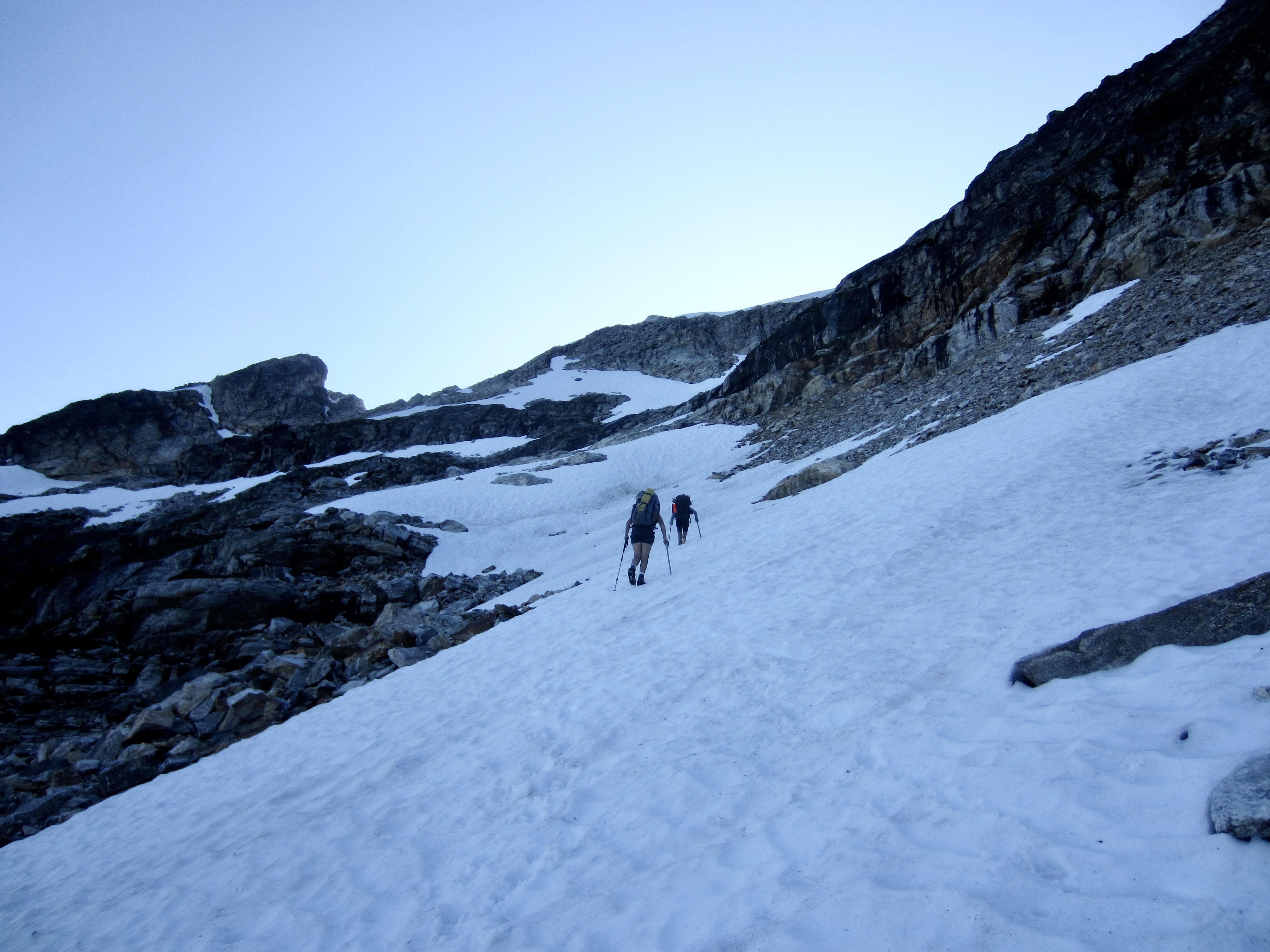
.

,
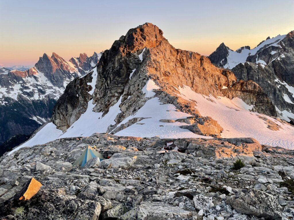
Minutes before 8:00pm, we stepped onto the flat snow patches of 7200-foot Luna Pass (10.4 hours + 3300 feet from Camp 2). A bit of scouting revealed several established tent sites 50 feet above the pass to the north. We ate dinner at this magical spot while watching alpenglow wash over McMillan Spires and Mt. Fury. I explained to Andrew, who is relatively new to the Cascades, that we were now officially in the Picket Range.
.
.
Day 4 (AM): Luna Peak Summit Climb
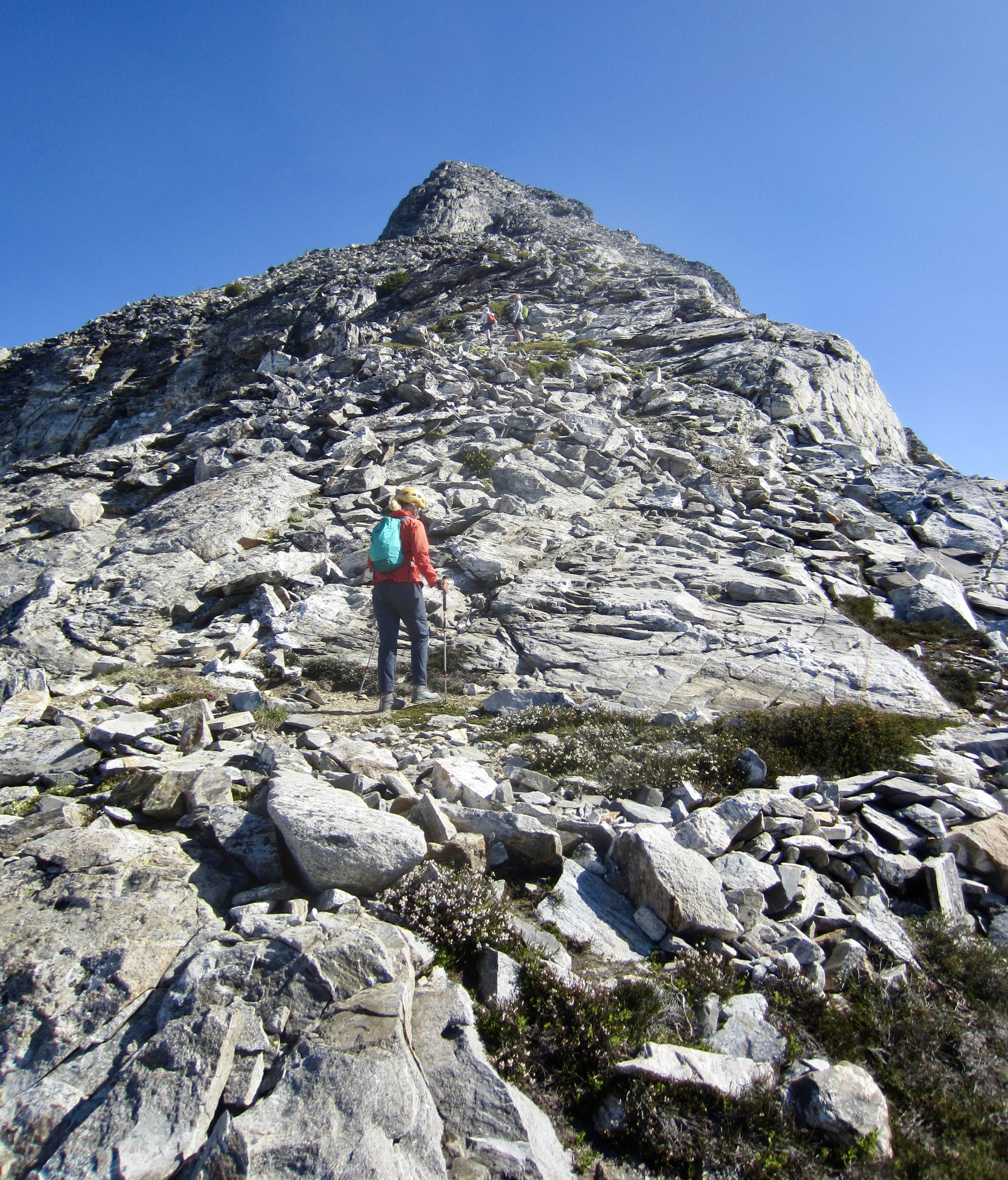
After narrowly surviving a breakfast egg-tastrophe, we headed out to climb Luna Peak. This peak was not only on everyone’s wanna-do list but was the primary trip objective for both Eileen and Beth. An easy scramble up the broad south ridge took us to the false summit, where we got a clear view of the true summit. It’s a sobering view: The true summit stands 150 yards away, at the end of a narrow ridge that drops off steeply on both sides. “Holy crap!” is a common reaction.

.
.
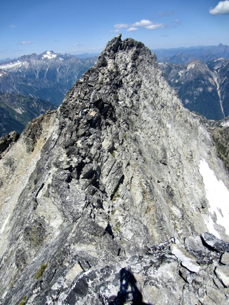
There are three general routes to Luna Peak’s true summit: a low-level traverse on the left (west) side; a high-level traverse along the ridge crest; and a mid-level traverse on the right (east) side. I had done the right-side traverse before and knew that it actually plays out better than it initially appears, so that was our choice. This traverse begins with a 15-foot Class 4 chimney that descends directly from the false summit, followed by a series of narrow Class 2-3 ledges across the face, and it ends with a Class 3 scramble up to the base of the summit horn. Although the climbing is never too difficult, the 4000 feet of exposure is dramatic! For safety, we all tied into a 35-meter scramble rope and used running belays to make the traverse. Eileen did the honor of leading us over, placing numerous slings and chocks along the way.
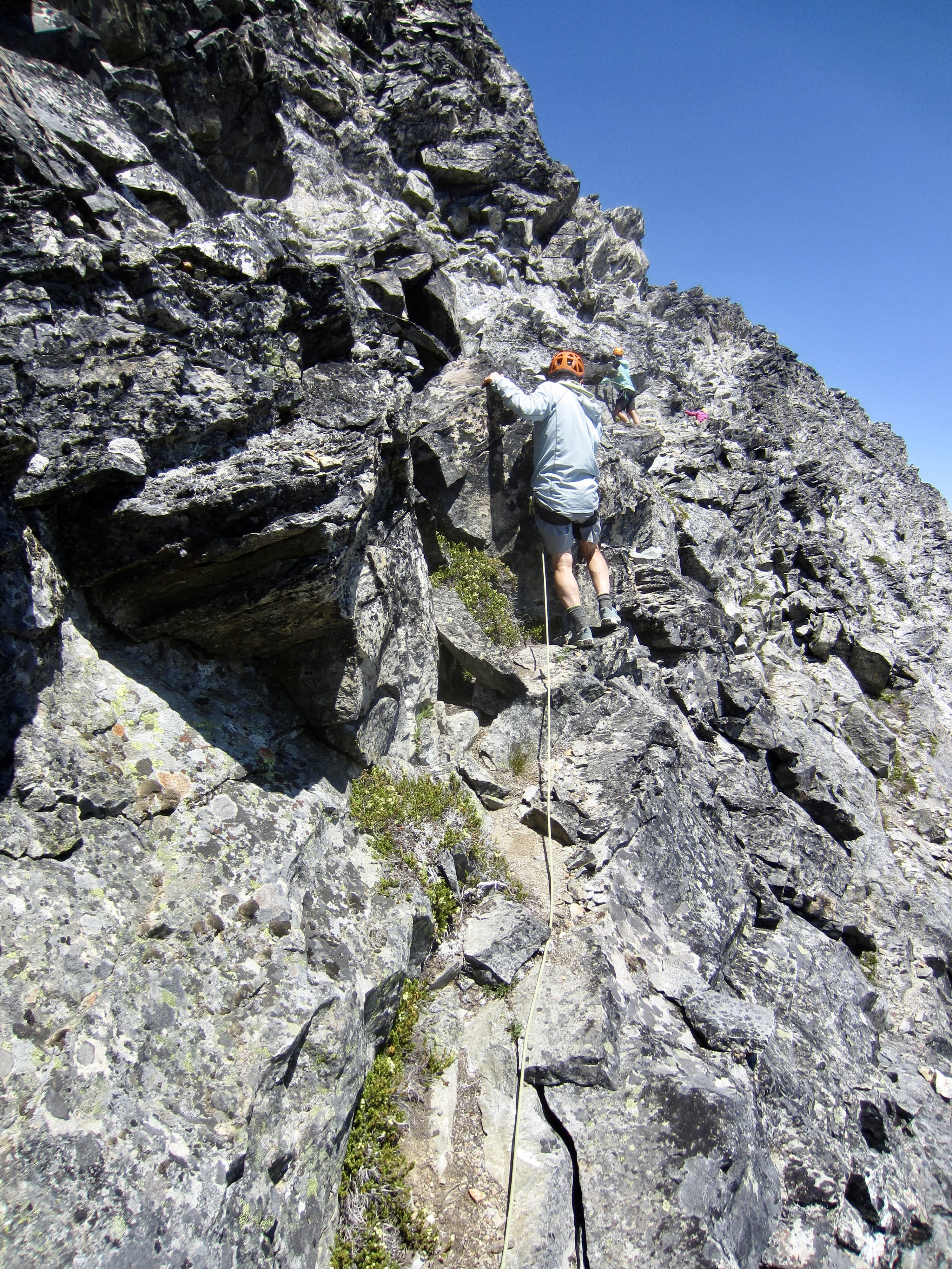
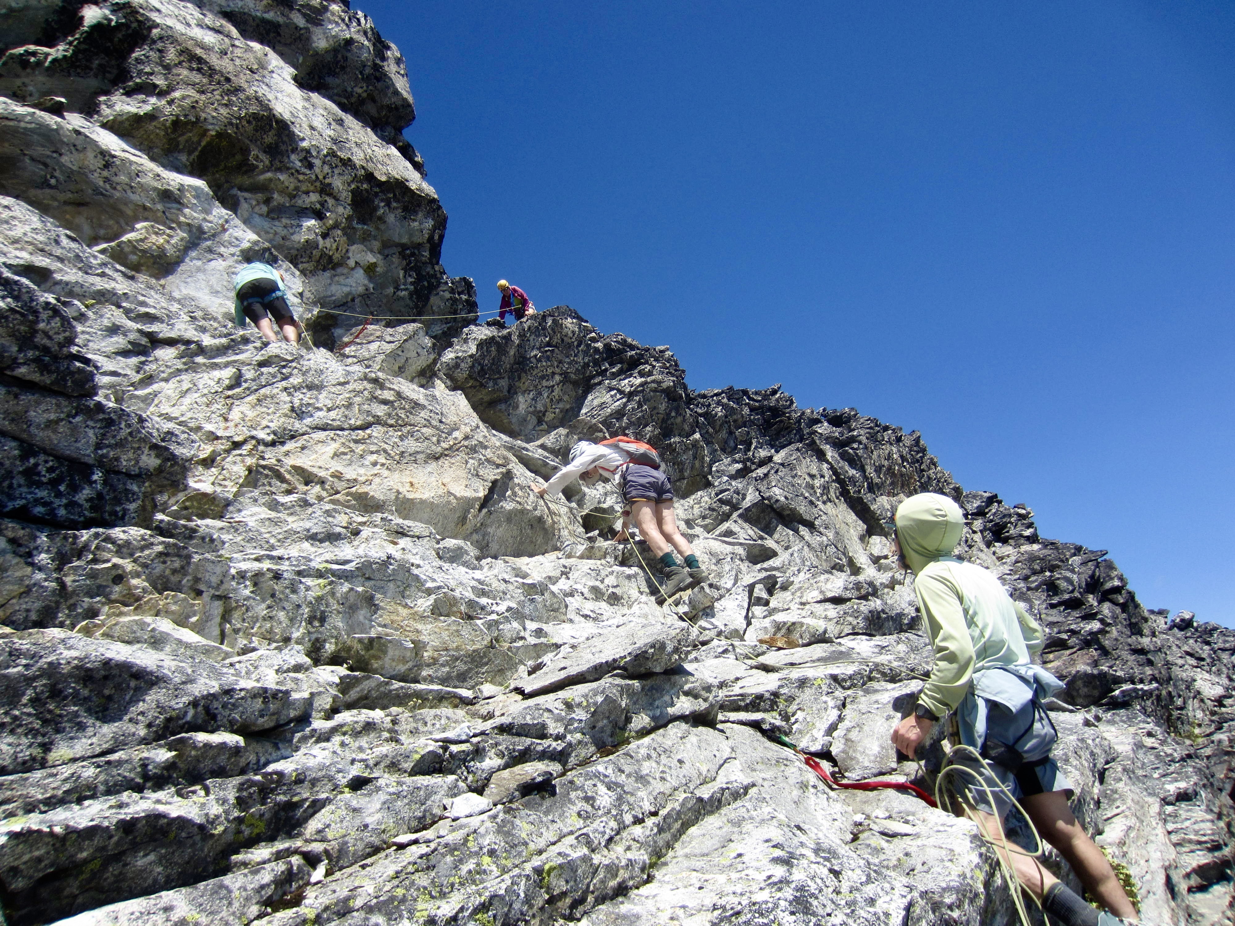
.
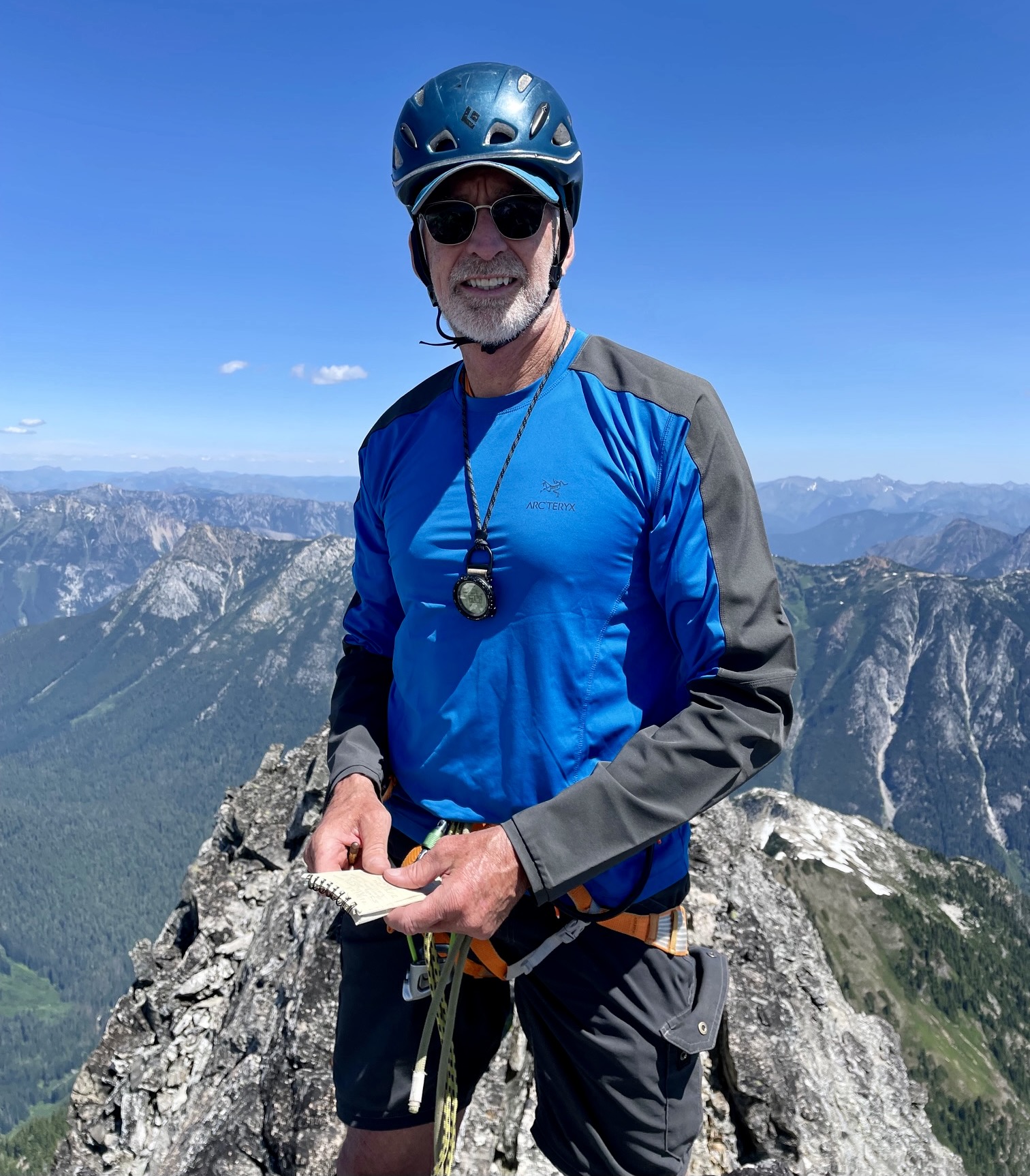
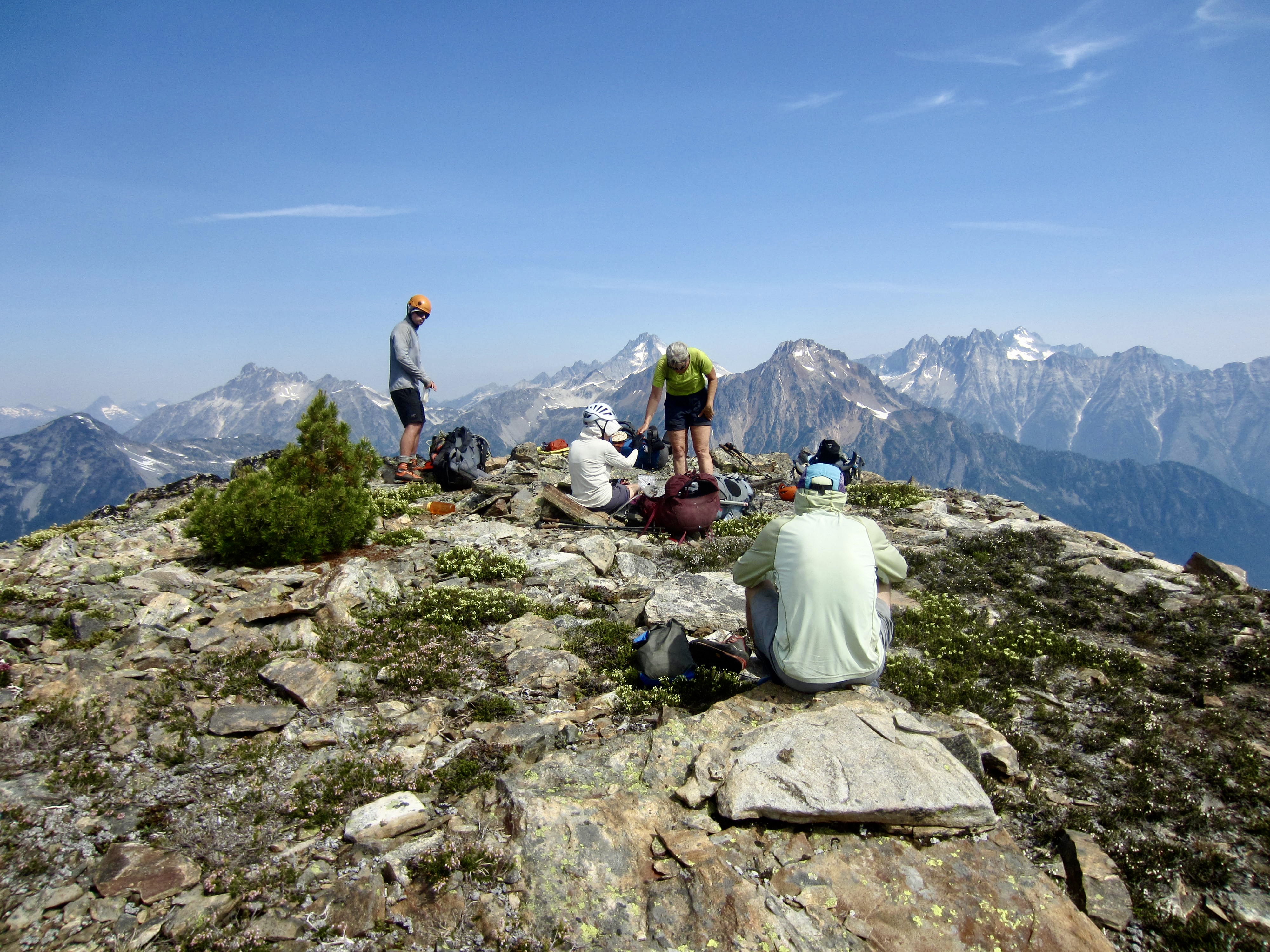
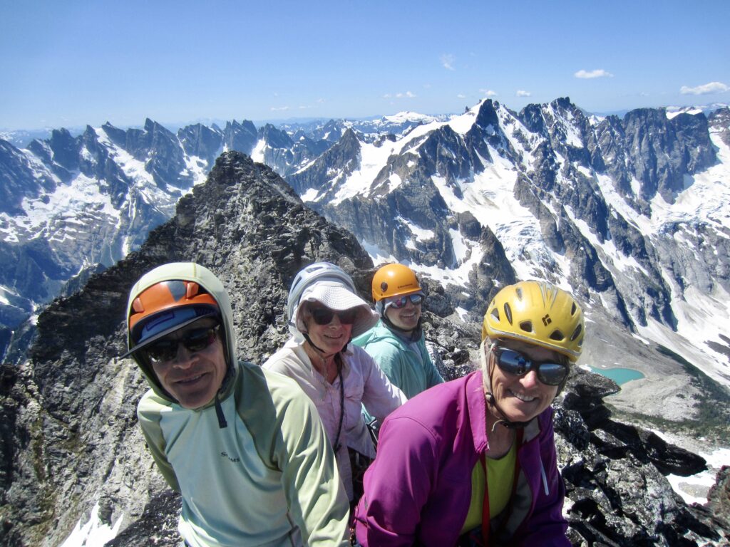
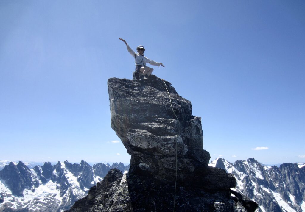
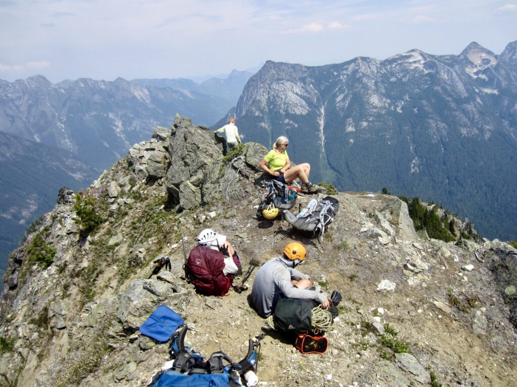
A few final moves on good rock delivered us all atop the summit horn shortly past noon (3.3 hours + 1000 feet from Camp 3). This marvelous vantage provides a breathtaking view of the entire Picket Range and surrounding peaks. Beth perched on the summit like a queen, having accomplished a longtime goal. At the age of 78, but still seeming to be indefatigable, she might be the oldest person to climb Luna Peak.
.
.
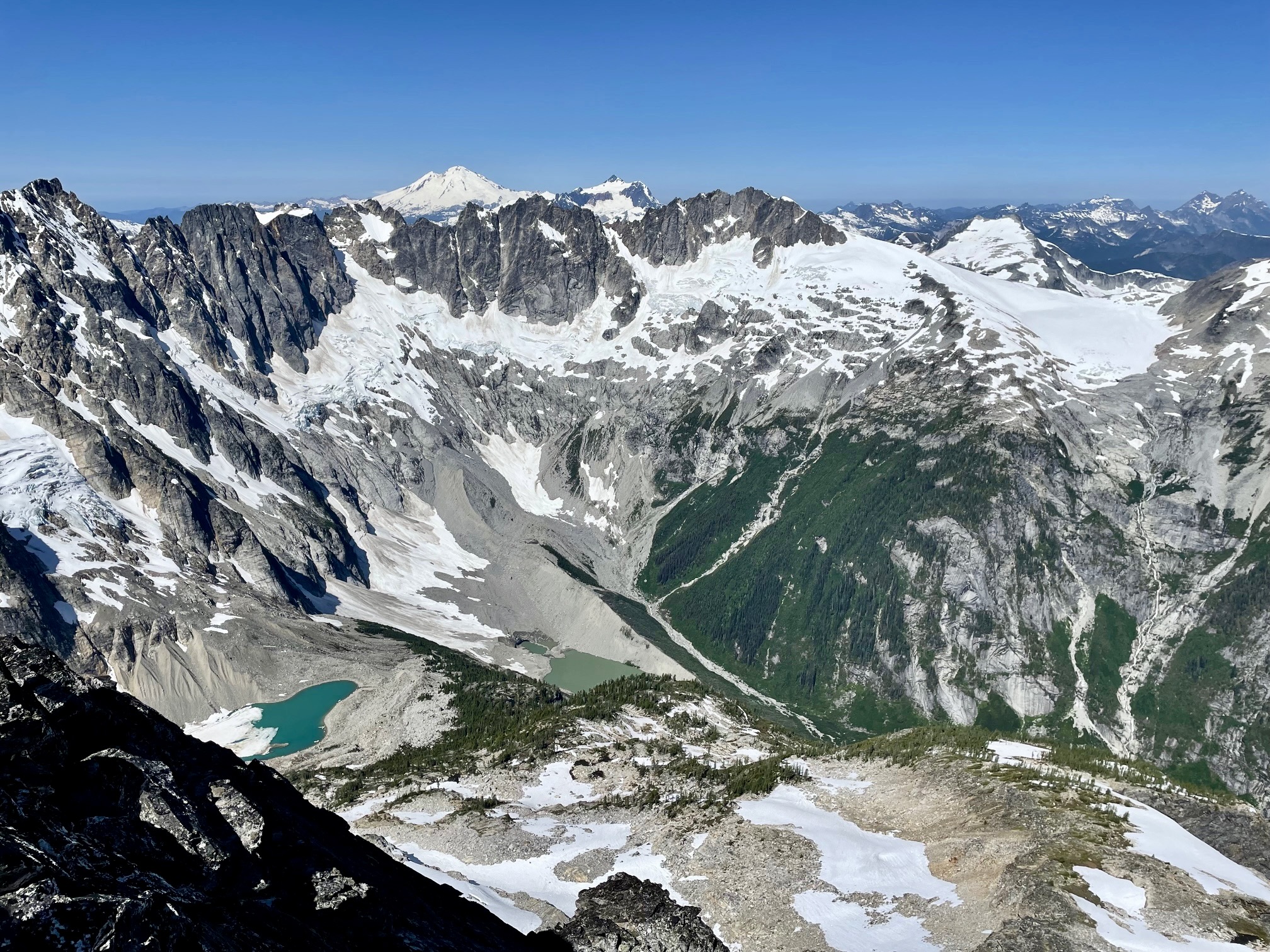
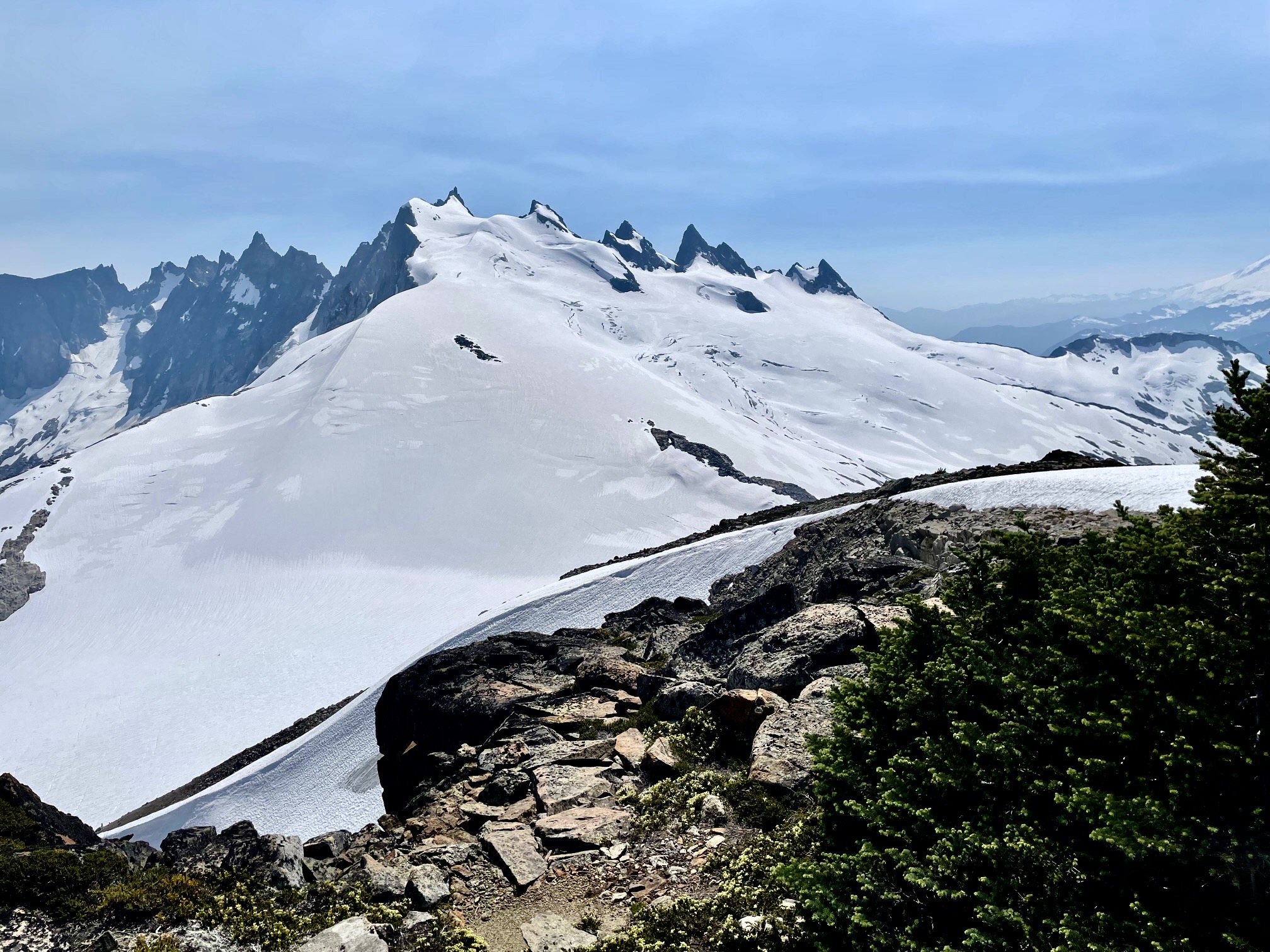
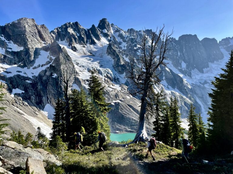
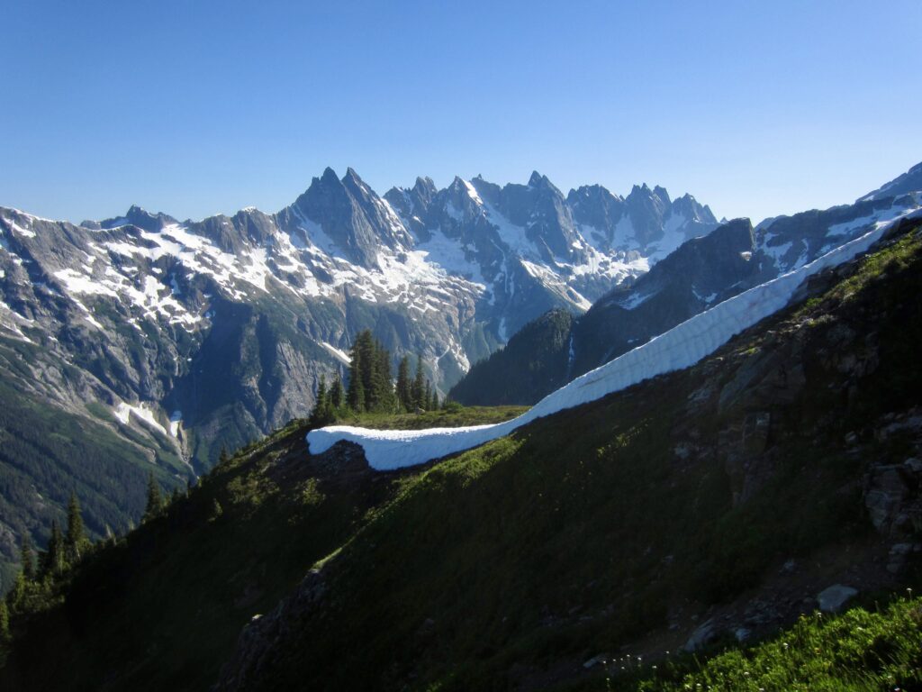
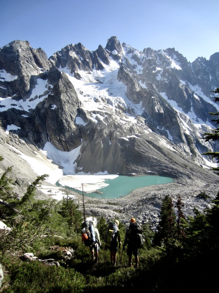
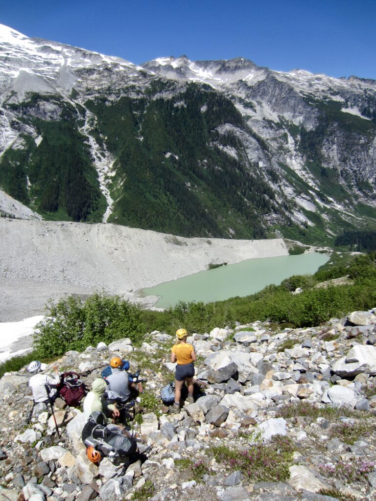
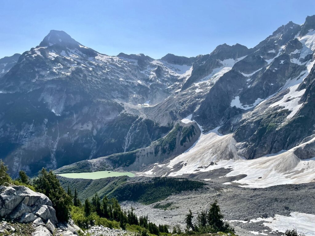
Of particular interest to our group was the view down into Luna Cirque. We could see Luna Lake and Lousy Lake, where we planned to camp tonight, and tomorrow’s route up to Challenger Gap was visible on the opposite flank.
.
We returned to the false summit using the same running belay technique, then we hurried down to our campsite, arriving in mid-afternoon (2.0 hours from summit).
Day 4 (PM): Luna Pass to Luna Lake Knoll
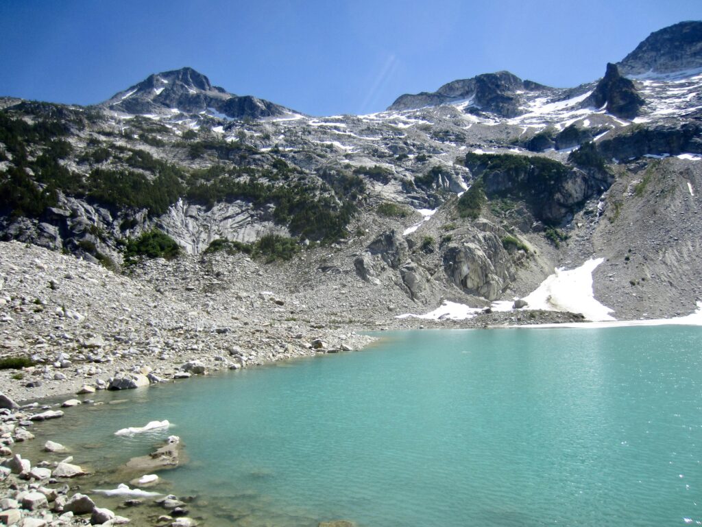
After breaking camp, we shouldered backpacks and headed down the west side of Luna Pass. A northwesterly diagonal descent across alternating snowfields and rocky ribs took us to a 6300-foot bench adorned with larch trees (a rarity in the Northwestern Cascades) and several little tarns. We stopped for a snack and celebrated the fact that our descent was going so well. Clearly, it would not be long before we were cooling off in Luna Lake. (We were wrong about that.)

.

.
.
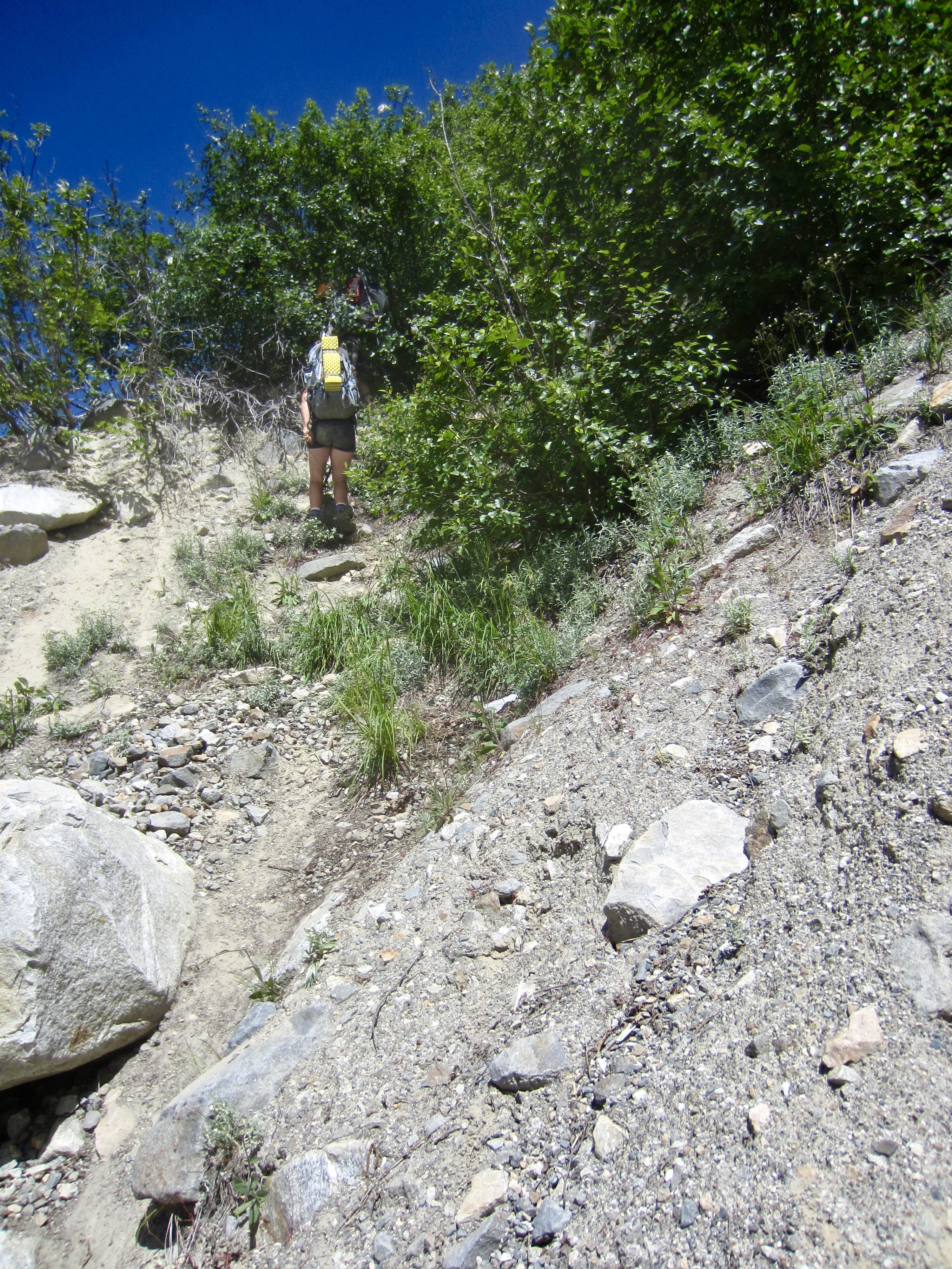
From Luna Tarns, we easily descended westerly for another 400 feet, at which point the hillslope steepened noticeably. Some route information that we’d obtained from a previous party indicated that we should turn sharply to the left here and begin contouring in a southeasterly direction before continuing downhill. Heeding this recommendation, we contoured across a heather slope for about 250 yards until directly above Luna Lake. The sight of the refreshing lake was too alluring to resist on such a hot day, so we began descending again. (We should have gone further.)
.
The remainder of the day was a blur of frustration and misery as we picked our way down steep slabs and fought through bands of impenetrable scrub cedar, repeatedly running into dead ends and having to backtrack. To make matters worse, our party became separated into two smaller groups. George, Eileen, and I eventually made our way down to Luna Lake and then up to a wooded knoll closely above the northern end of the lake. It was nearly 9:00pm when arrived at a suitable campsite atop the knoll (5.3 hours from Camp 3). Soon afterwards, we were relieved to hear a “We’re OK!” shout from Andrew and Beth, who were still working their way across the brushy and slabby hillside. Around 11:00pm, their headlamp beams appeared on a talus slope across the lake. What a welcome sight that was! By 12:30am, we were all reunited in camp—tired, dirty, and scratched up but unhurt.

.
Day 5: Luna Lake Knoll to Luna Cirque Floor
On the heels of yesterday’s descent debacle, we all slept late and didn’t leave camp until 10:45am. Today’s itinerary called for us to drop onto the floor of Luna Cirque near Lousy Lake and then make a long ascending traverse to Challenger Gap. This seemed ambitious, given our late start, but it would be possible if everything went smoothly. Shucks, what could go wrong, now that our difficulties were behind us? (We were wrong about that.)
.
We hiked down to Luna Lake, rock-hopped across the outlet stream, and then made a gradually descending traverse across a broad talus slope directly beneath Mt. Fury. Upon reaching a major rock buttress, we dropped down a blocky rib until encountering a thicket of slide alder. It soon became apparent that we were on an old lateral moraine with a loose, over-steepened slope on the left (west) and a relatively new erosion gully on the right (east). Picking our way down through the alder thicket now seemed to be our best way forward.
.
.
At first, the thicket wasn’t too bad; we were able to work back and forth between small clearings. Eventually, though, the alders closed in around us, and the ground steepened considerably, such that we found ourselves dangling from branches while trying to kick our feet into the rocky soil. None of us wanted to fight our way back uphill, so we were left with only one option—and it was an ugly one: We would need to rappel down a small but very steep gully that angled down the side of the moraine. This gully consisted of hard dirt embedded with loose rocks. By using alder limbs as anchors for our two scramble ropes, we executed two rappels down the dirt gully, somehow managing to avoid hitting each other with falling rocks.
.
Once off rappel, we carefully picked our way across the lower moraine slope and gained the welcome stability of a nearby snowfield. The whole descent had been a risky and nerve-racking experience that consumed a full 2 hours. I’ve made several hundred mountain rappels in my lifetime, and these were by far the worst ever—truly horrible! It later became apparent that there were two better descent routes we could have chosen: (1) Stay higher against the rock buttress and down-climb a narrow strip of snow that hugged the cliffs. (2) Stay farther right and hike down the long crest of the moraine until closely above the middle of Lousy Lake and then drop straight down to the lake.

.
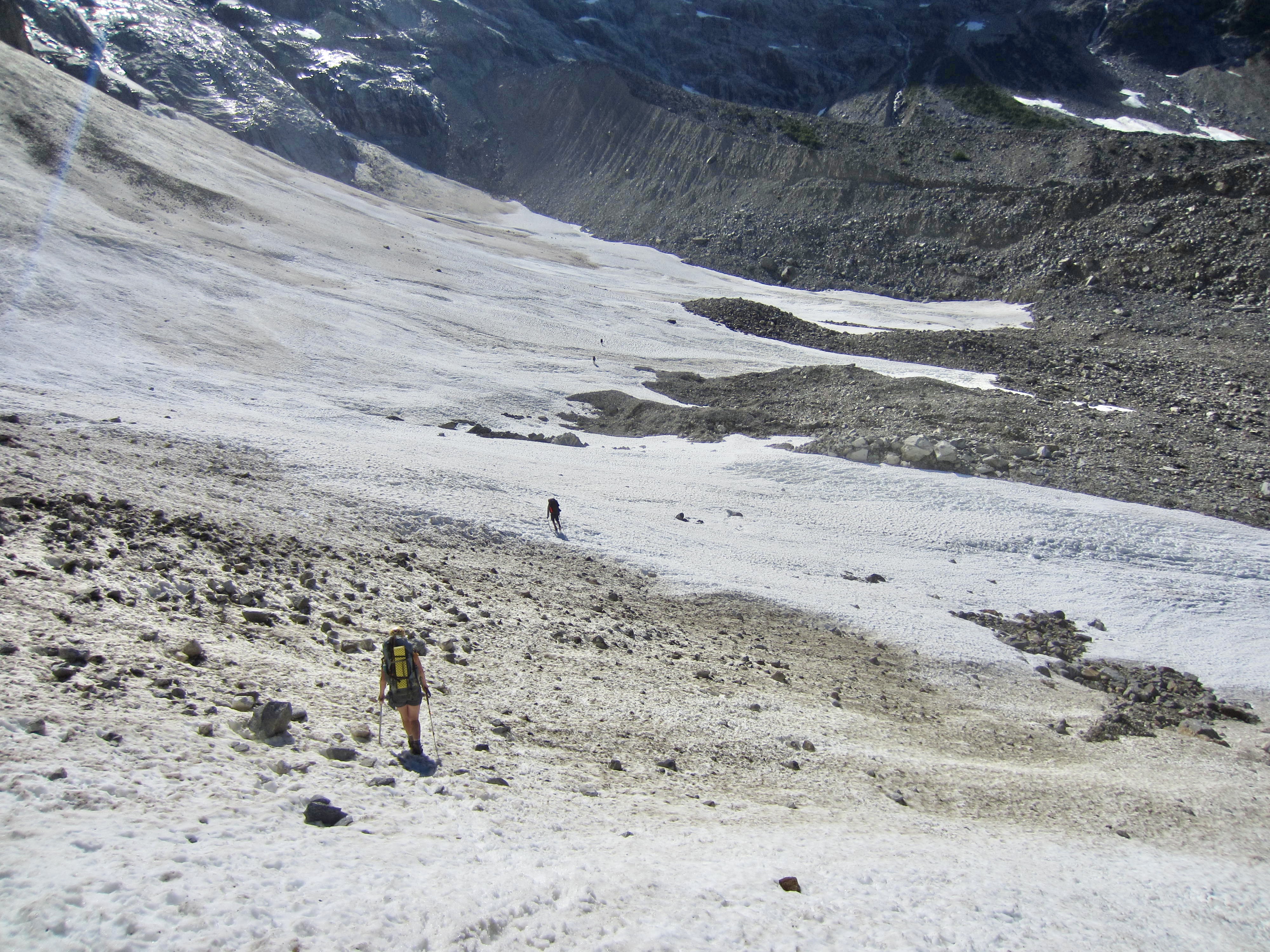
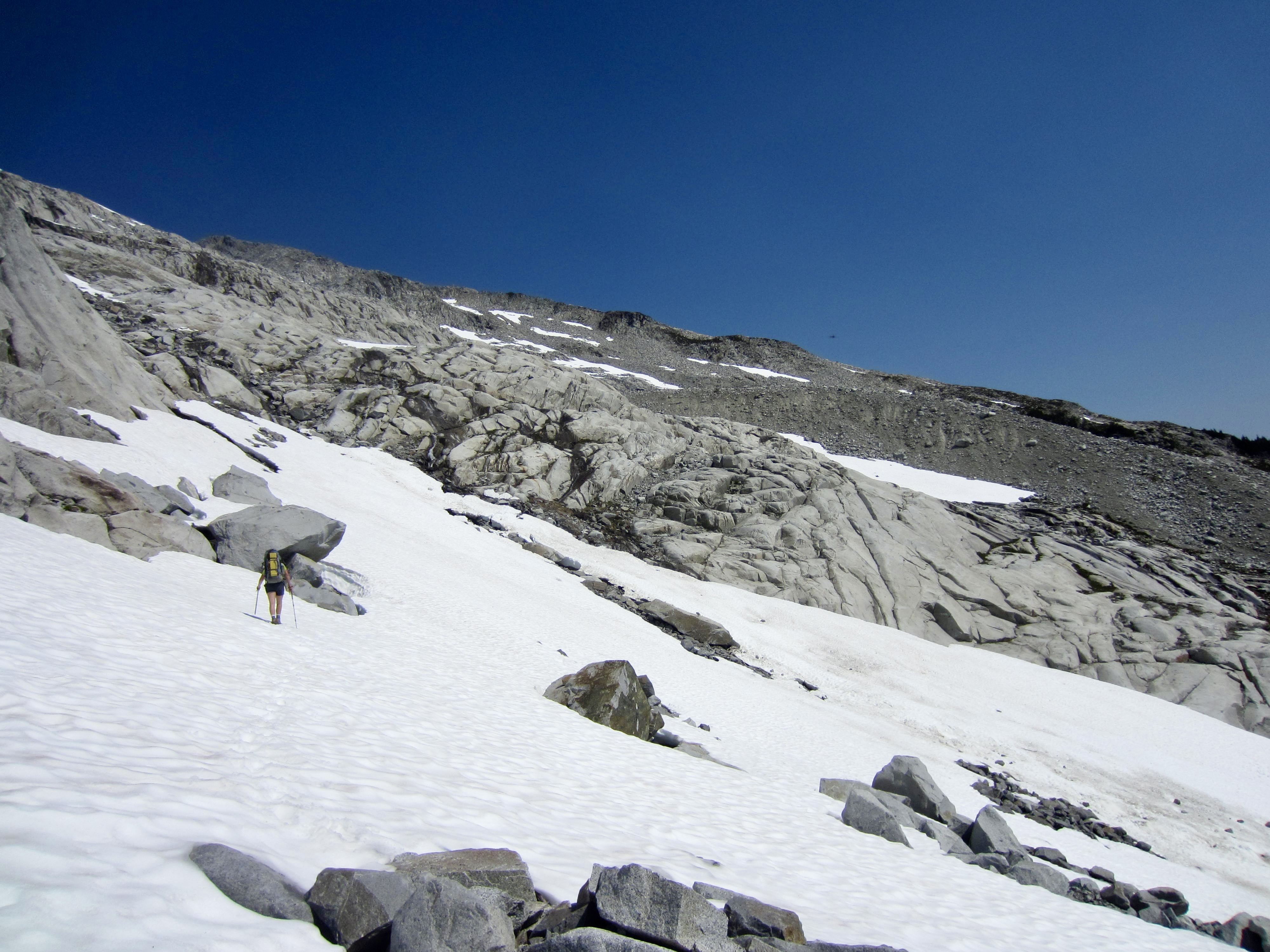
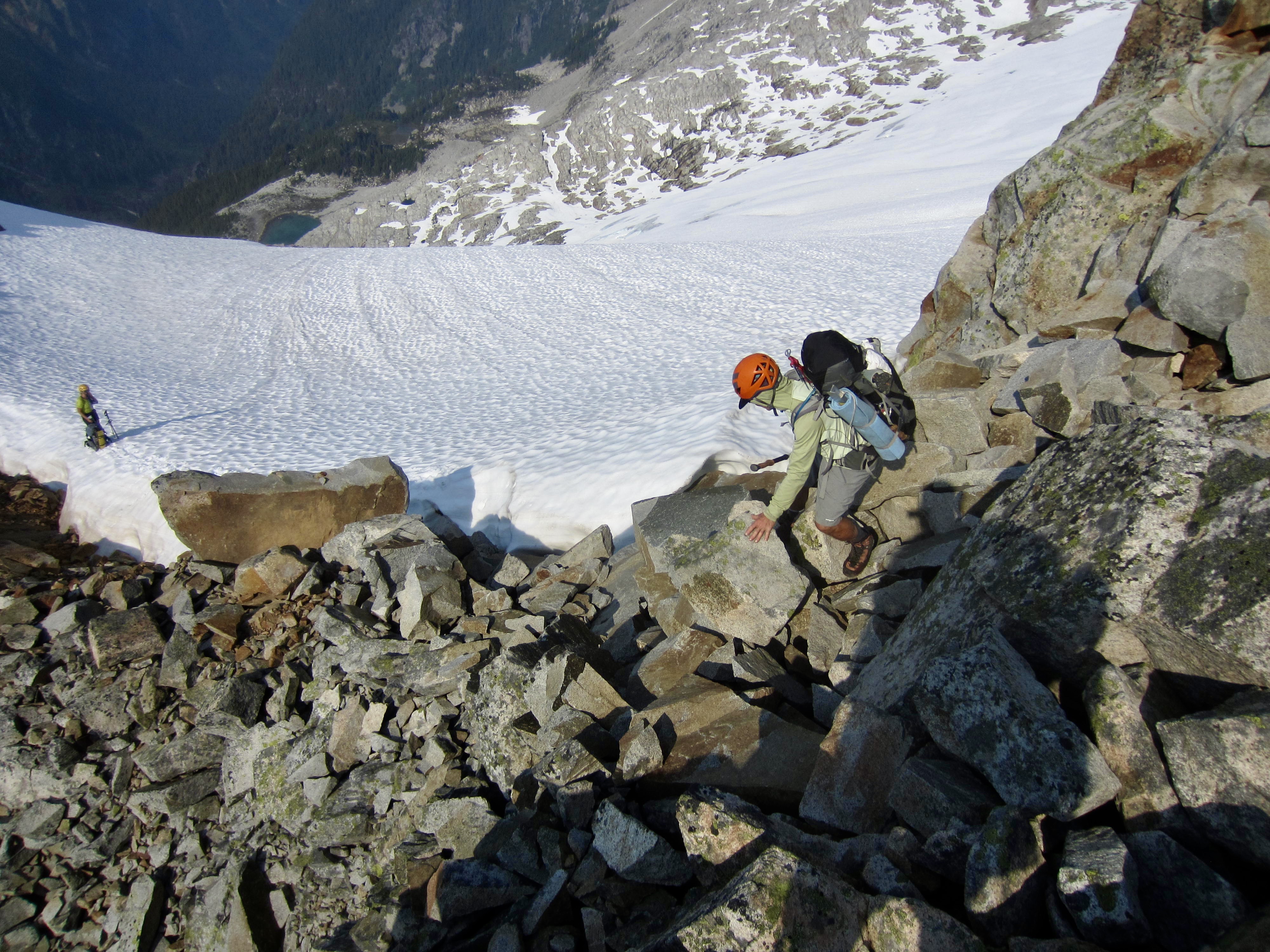
After regaining some composure, we continued our descent into Luna Cirque. A slightly downward traverse took us across several avalanche fans that covered the stagnant glacier apron. We stayed approximately 400 vertical feet above Lousy Lake and used crampons for traction on the hard snow.

.
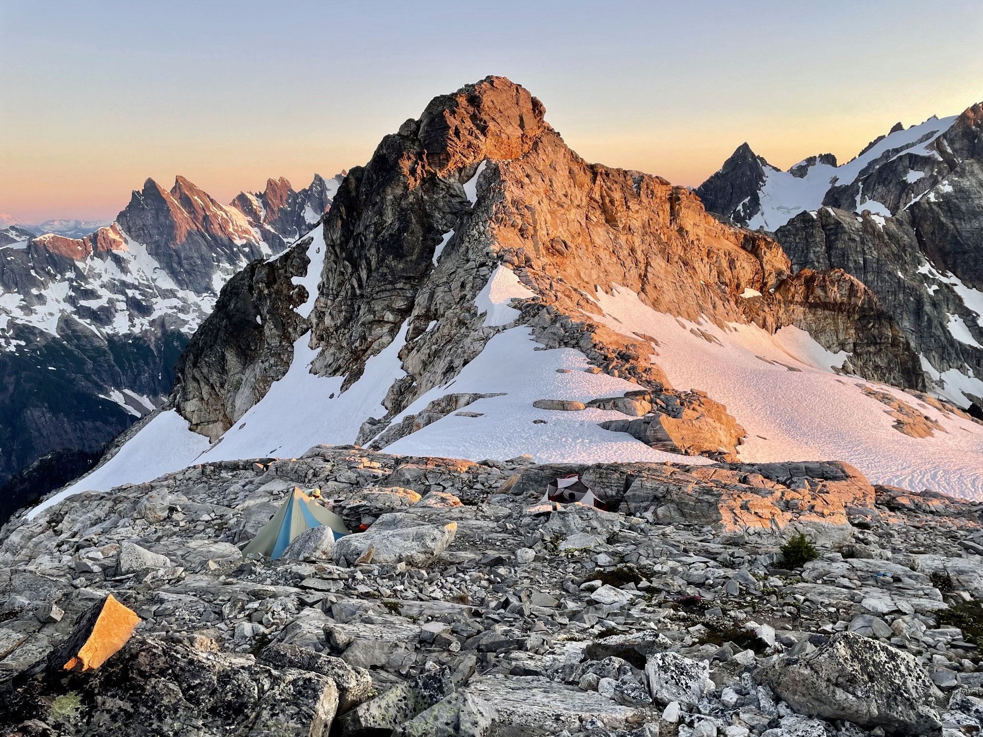
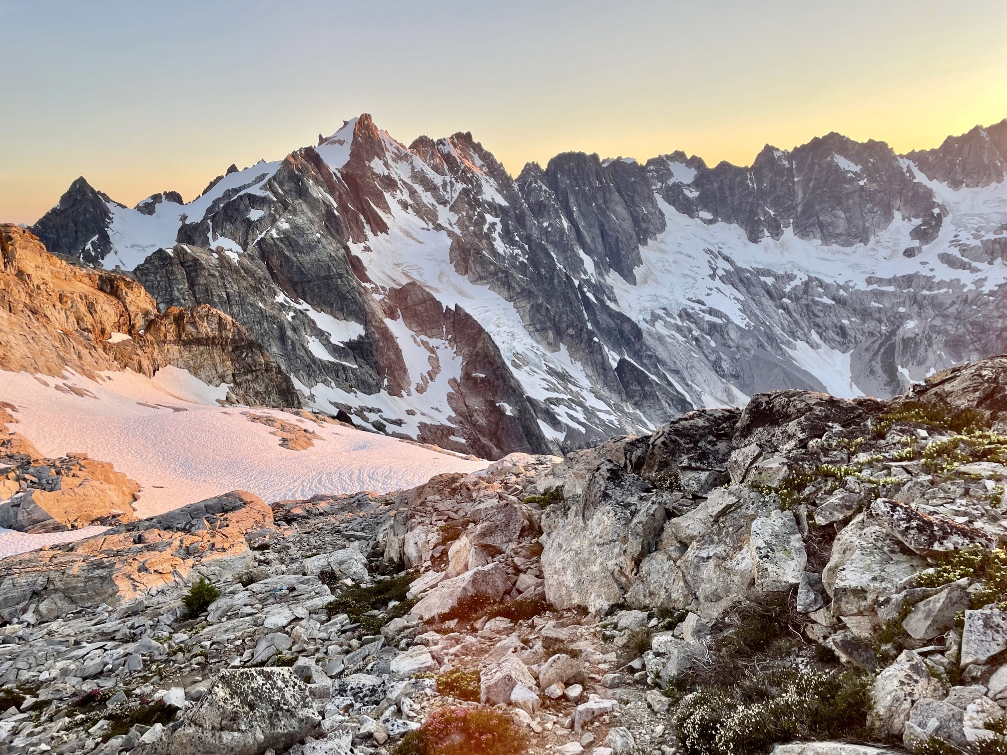
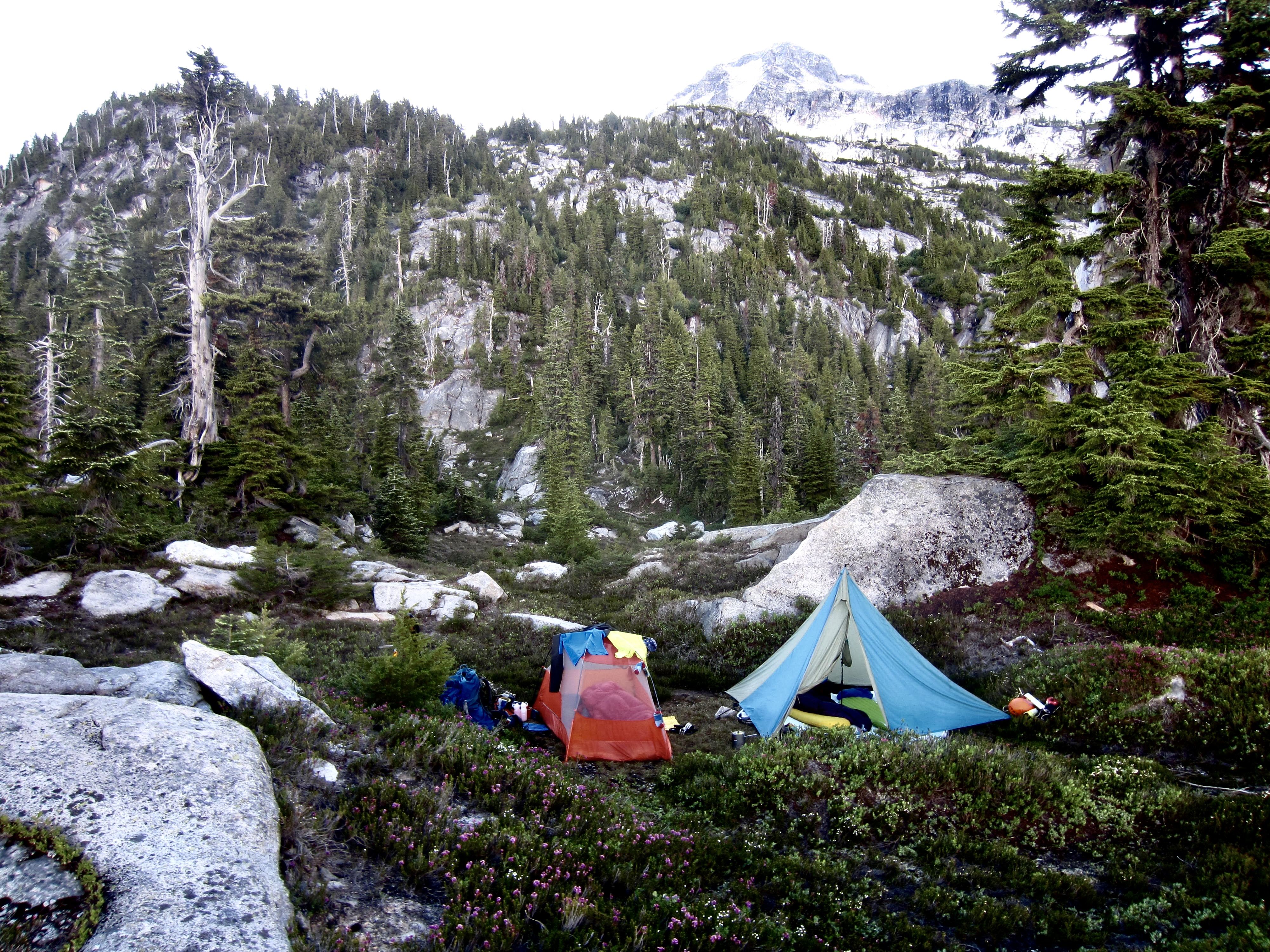
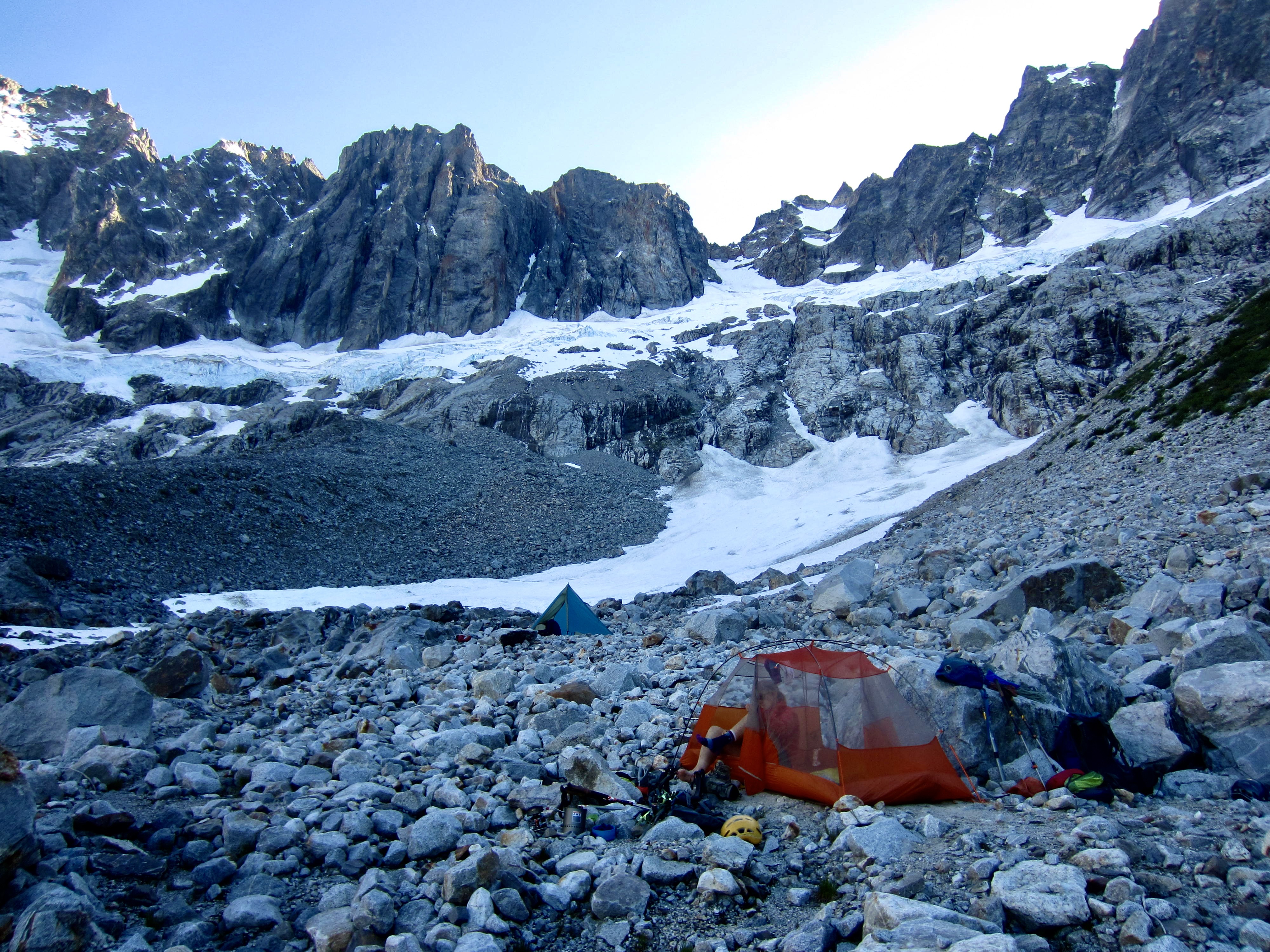
At the western edge of the avalanche fans, we had to scramble up a tall lateral moraine composed of precarious boulders. Yet another negative result of glacial recession is that more moraine slopes have become exposed, and these newly exposed moraines tend to be extremely unstable. Beyond the tall moraine, we entered a gently sloping ablation plain covered by rocks of various sizes. Shortly past 7:00pm, we encountered a few small patches of sand suitable for tent pads, with running water nearby (7.2 hours from Camp 4). Our campsite here was surrounded by the awesome facades of Mt. Challenger, Crooked Thumb Peak, Phantom Peak, Mt. Fury, and Luna Peak, all towering a full 4000 vertical feet above the cirque floor.
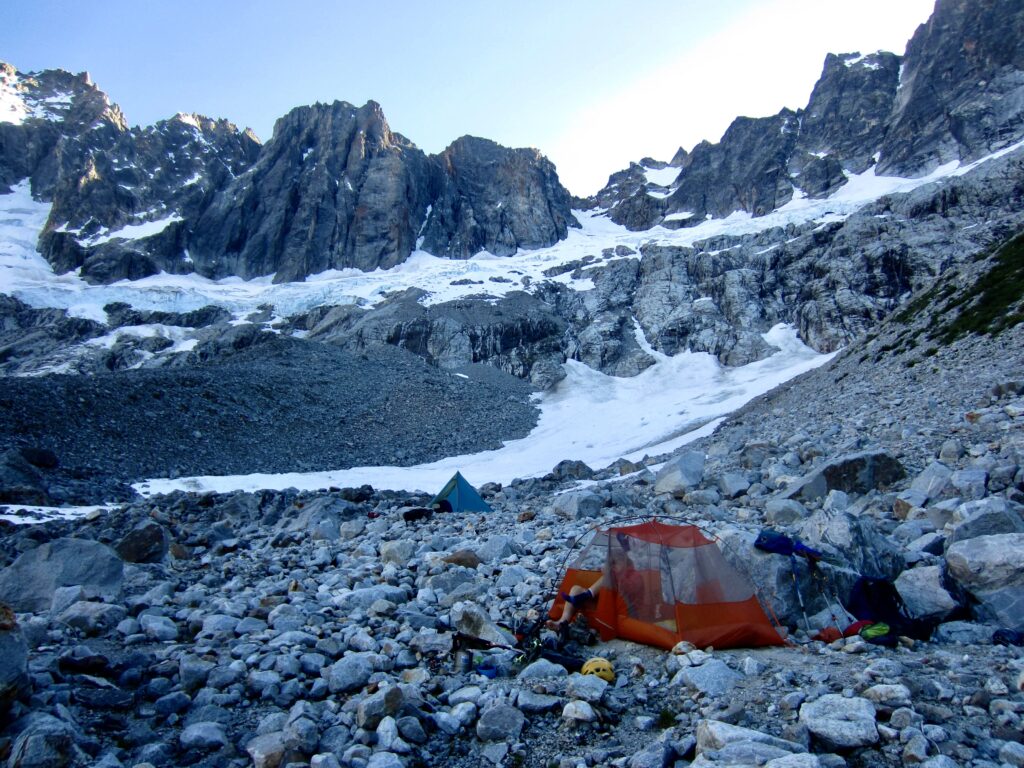
.
Day 6: Luna Cirque Floor to Wiley Ridge Crest
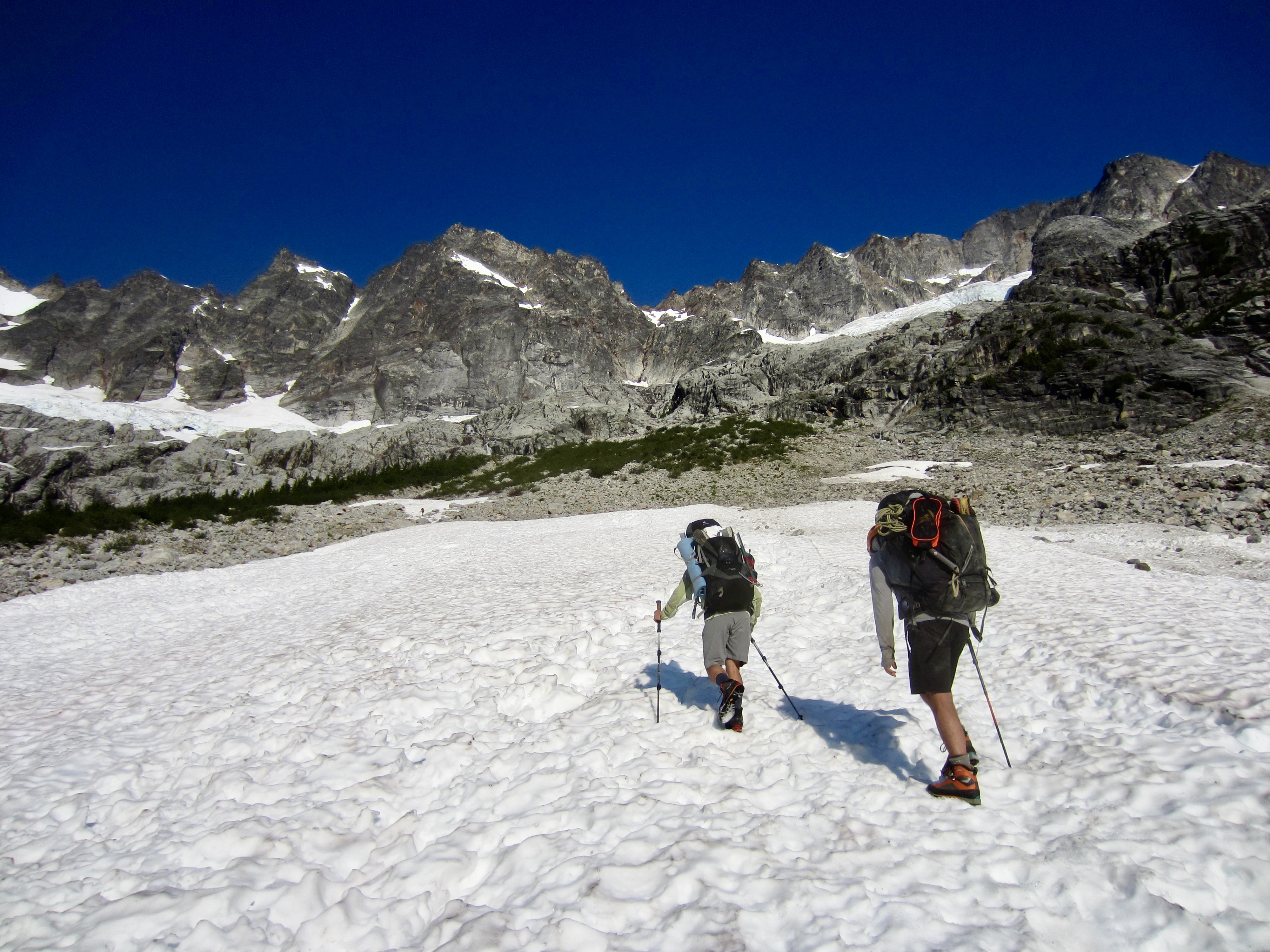
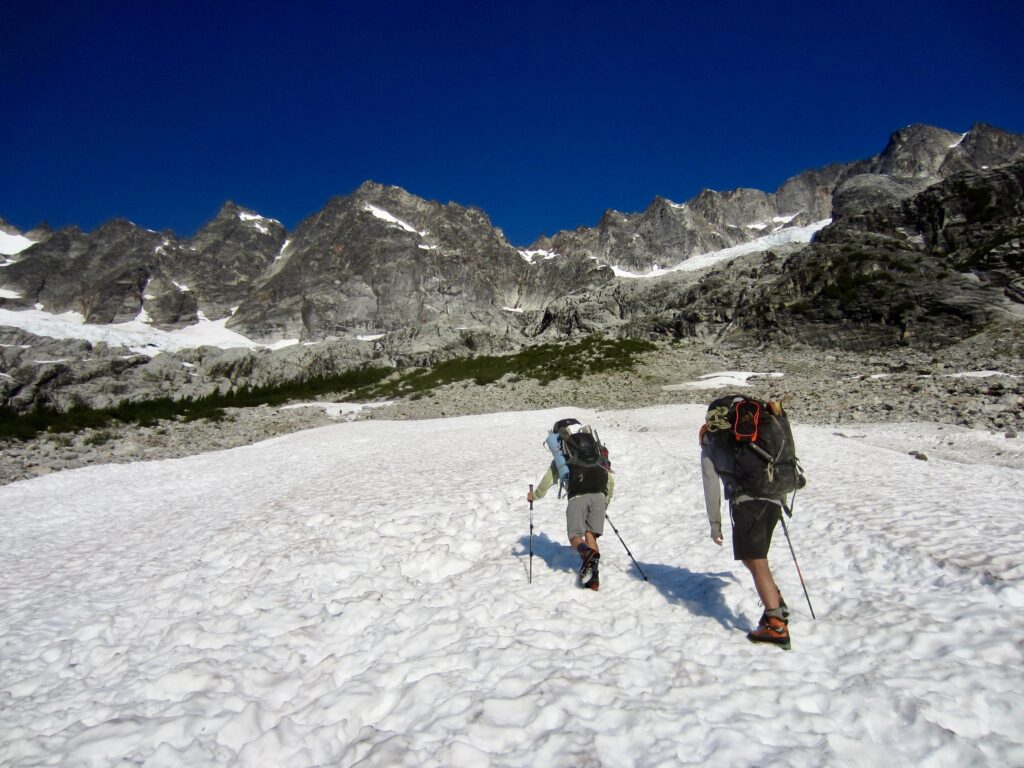
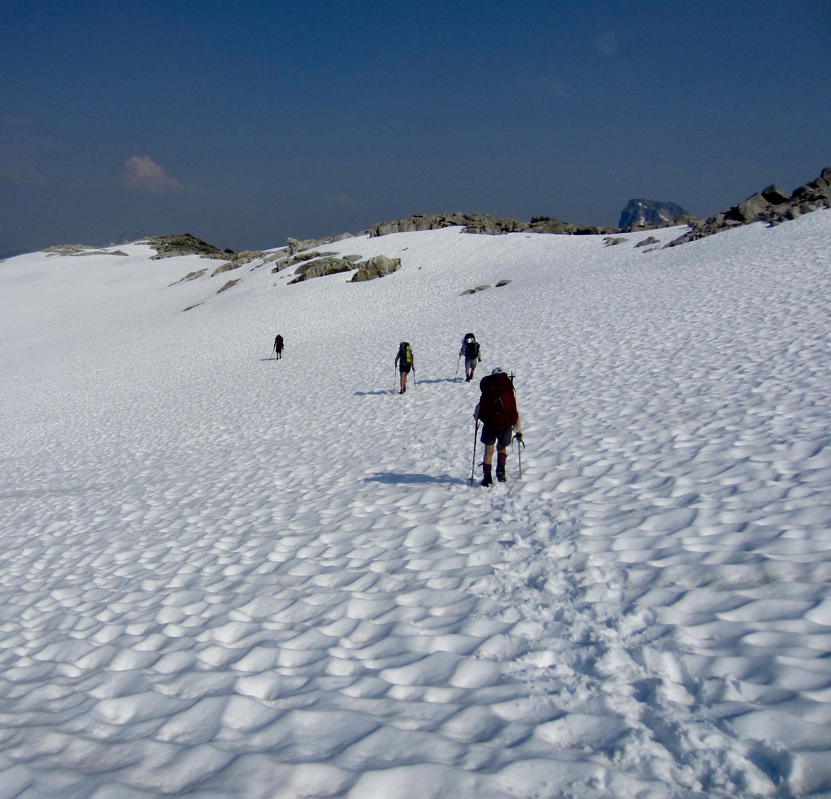
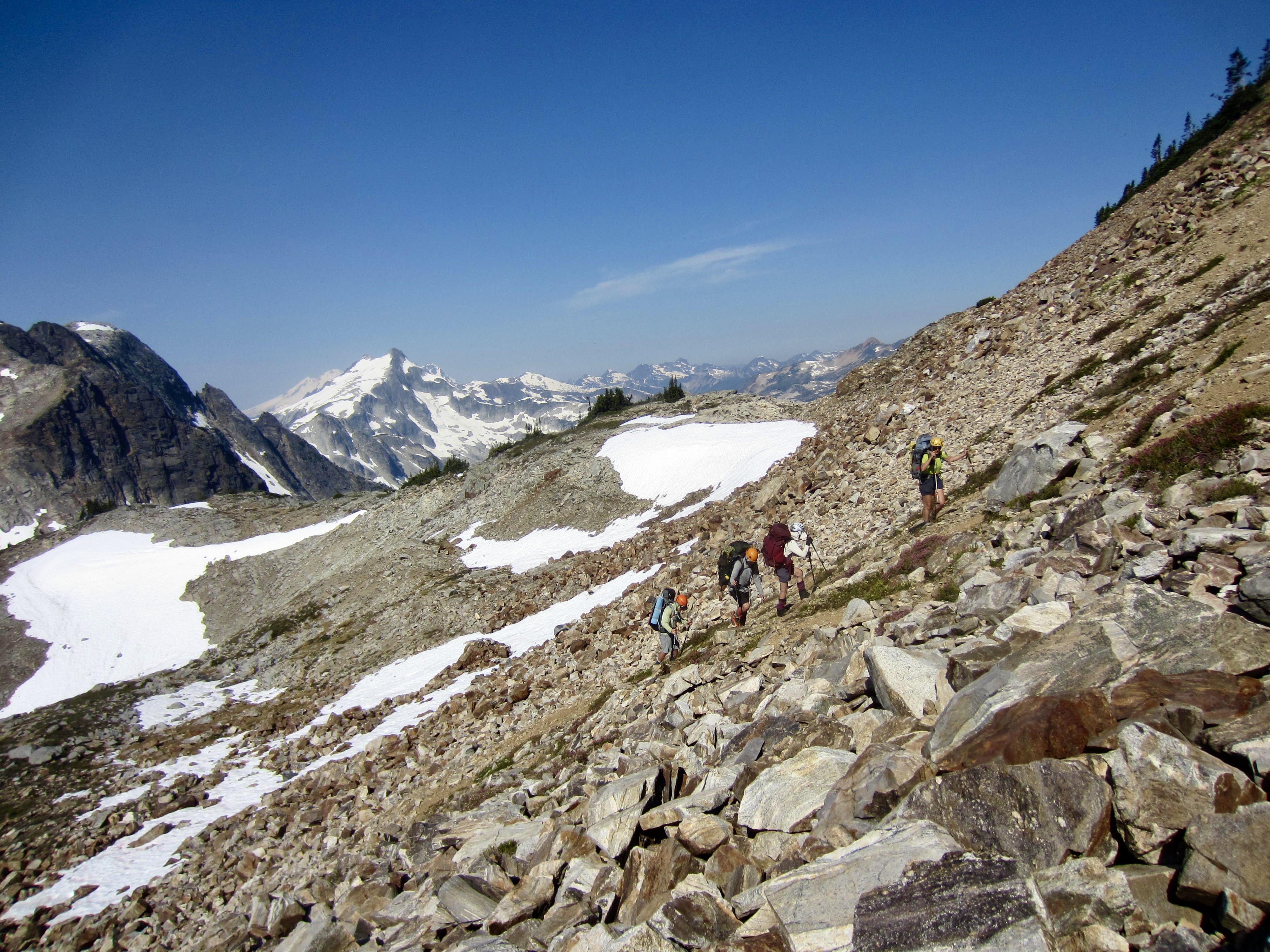
Due to our faint hope of climbing Mt. Challenger and still making significant progress along Wiley Ridge, we were up at the unusually early (for us) time of 6:00am and on the move by 7:30am. We began with a 1000-foot climb up a snowfield and band of arroyo willows, followed by a low-angle traverse across the western side of Luna Cirque.
.
Our northerly traverse was mostly pleasant and very scenic, with marvelous views across the cirque. We could see our entire descent route from Luna Pass, including the troublesome slabs above Luna Lake and the awful rappel gully above Lousy Lake.
.
There was no path to follow on our traverse, but route-finding was fairly straightforward. We crossed through one cascading waterfall, ducked between a large buttress and deep erosion gully, and climbed over several rocky ribs.
.
.
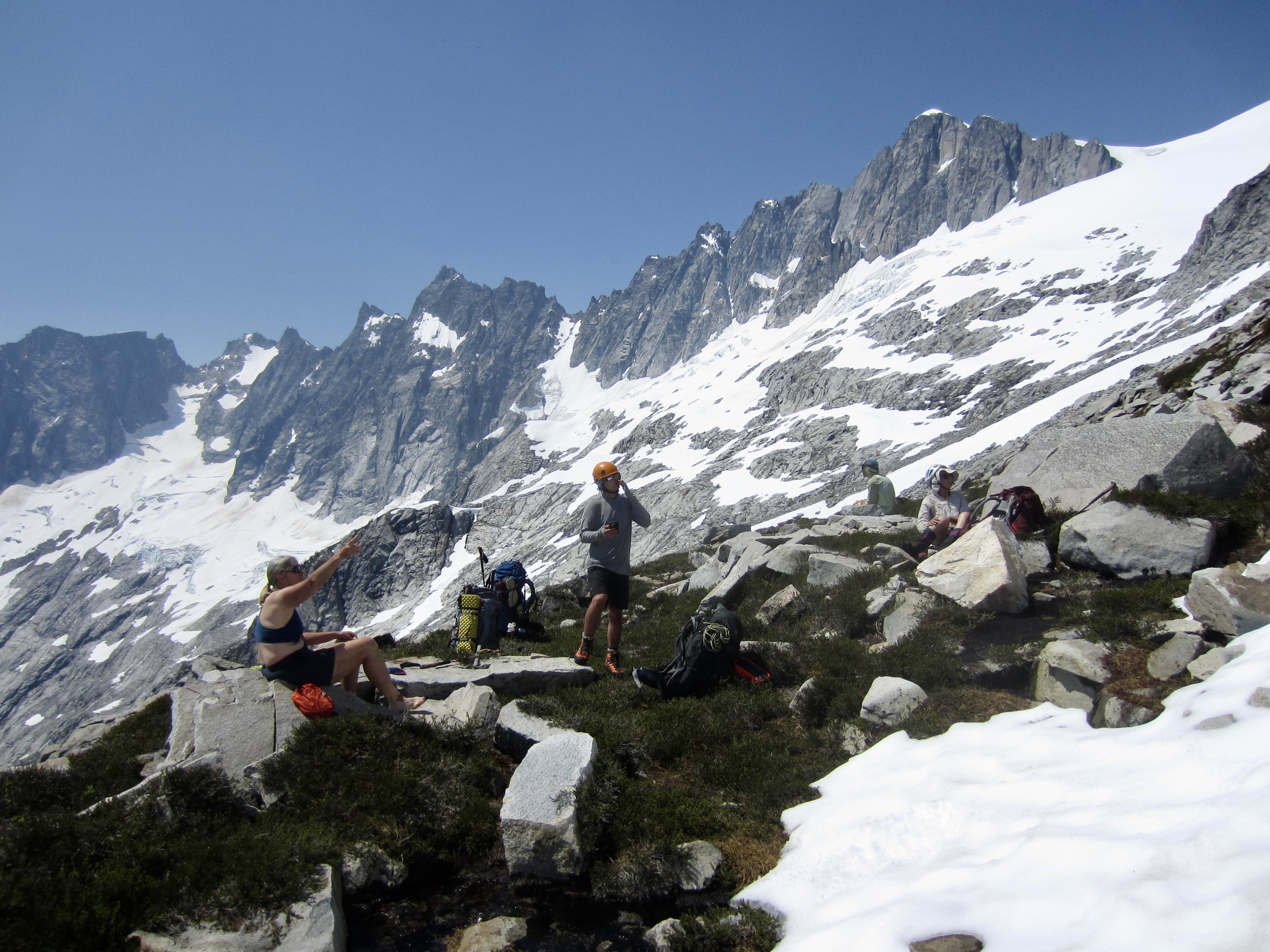
With increasing elevation, snow patches became more prevalent and our progress increased. At 6600 feet, we stopped for lunch on a rounded ridge before heading up to Challenger Gap at the edge of the Challenger Glacier.
.

.

.
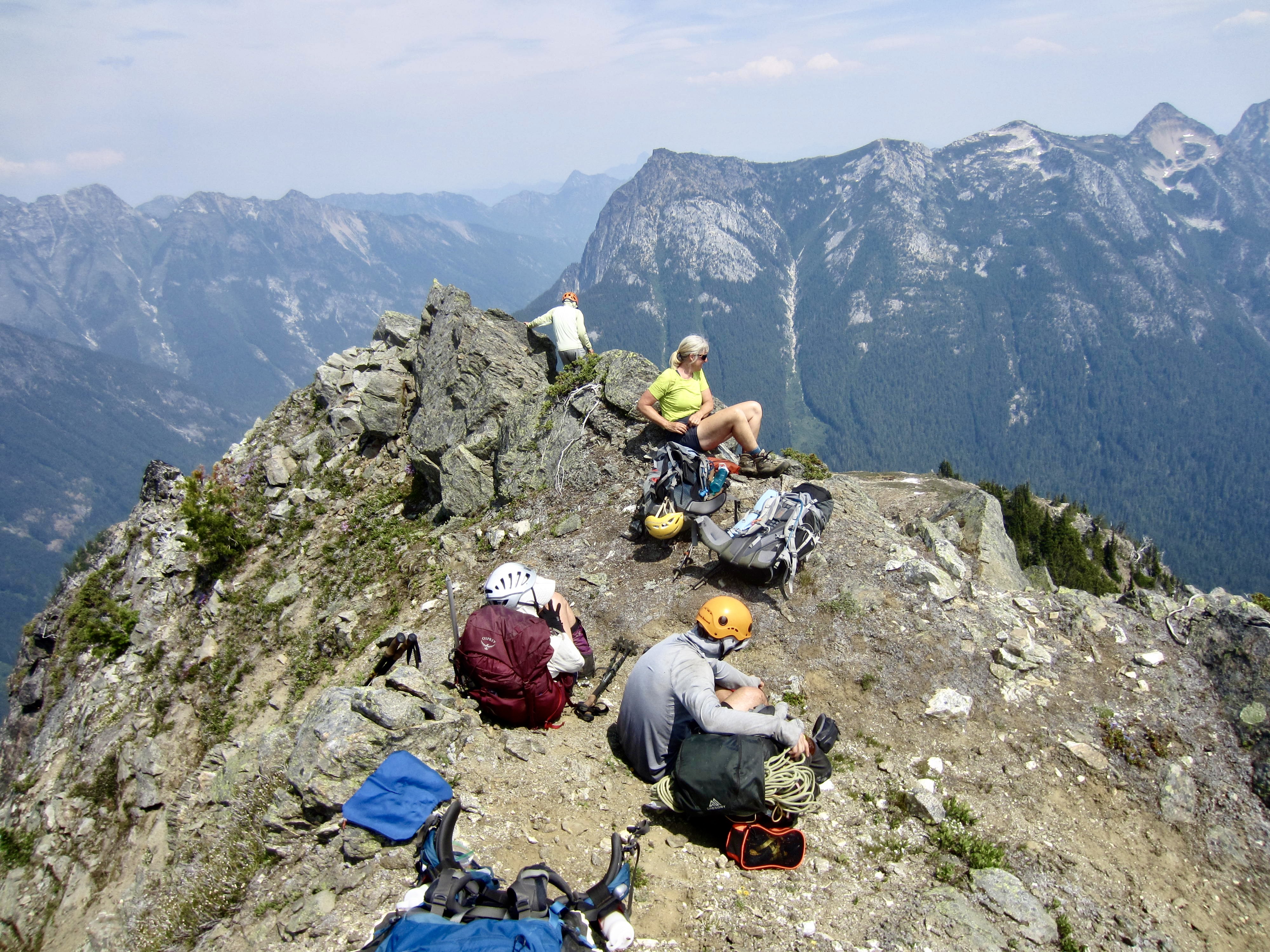
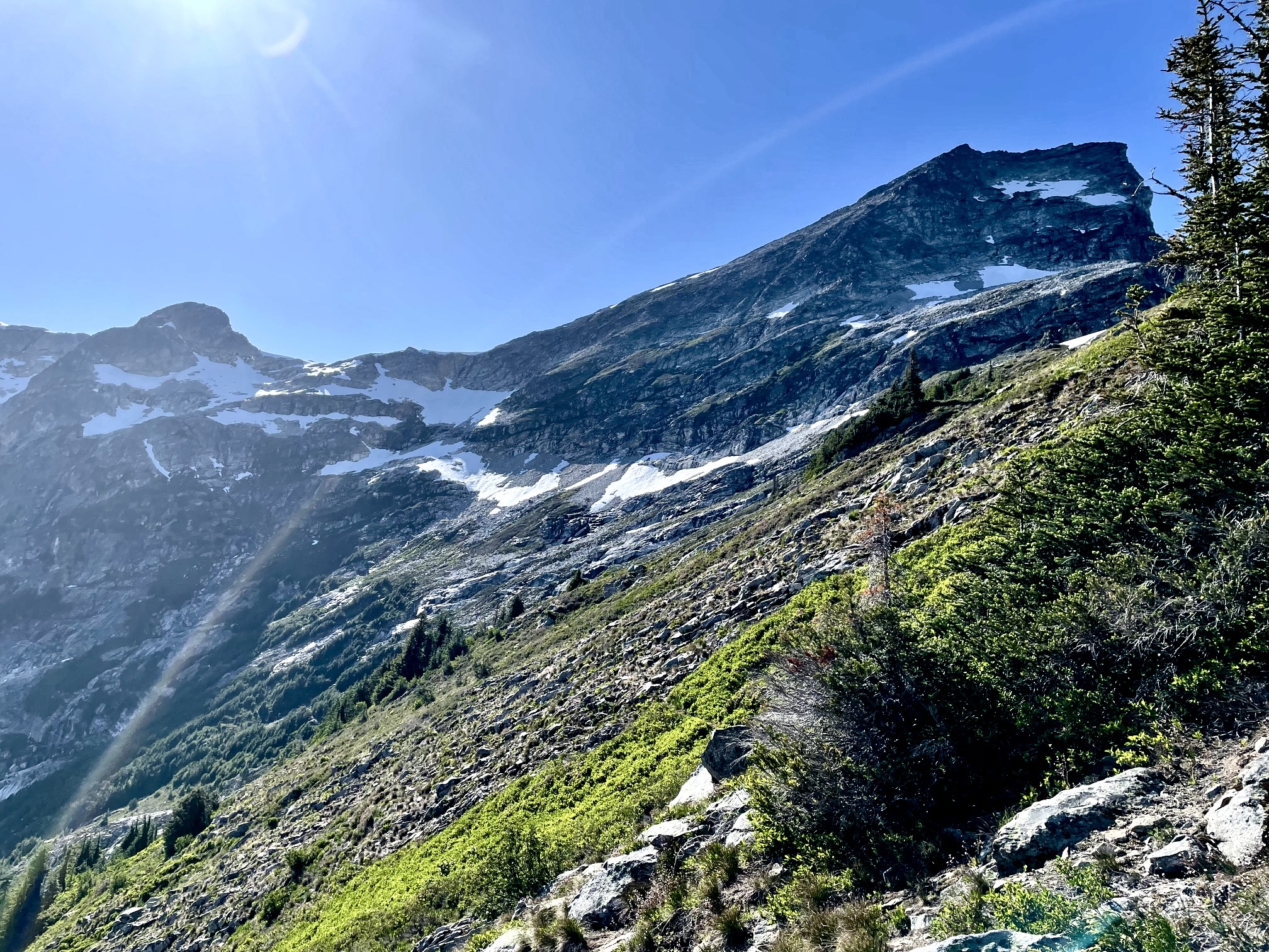
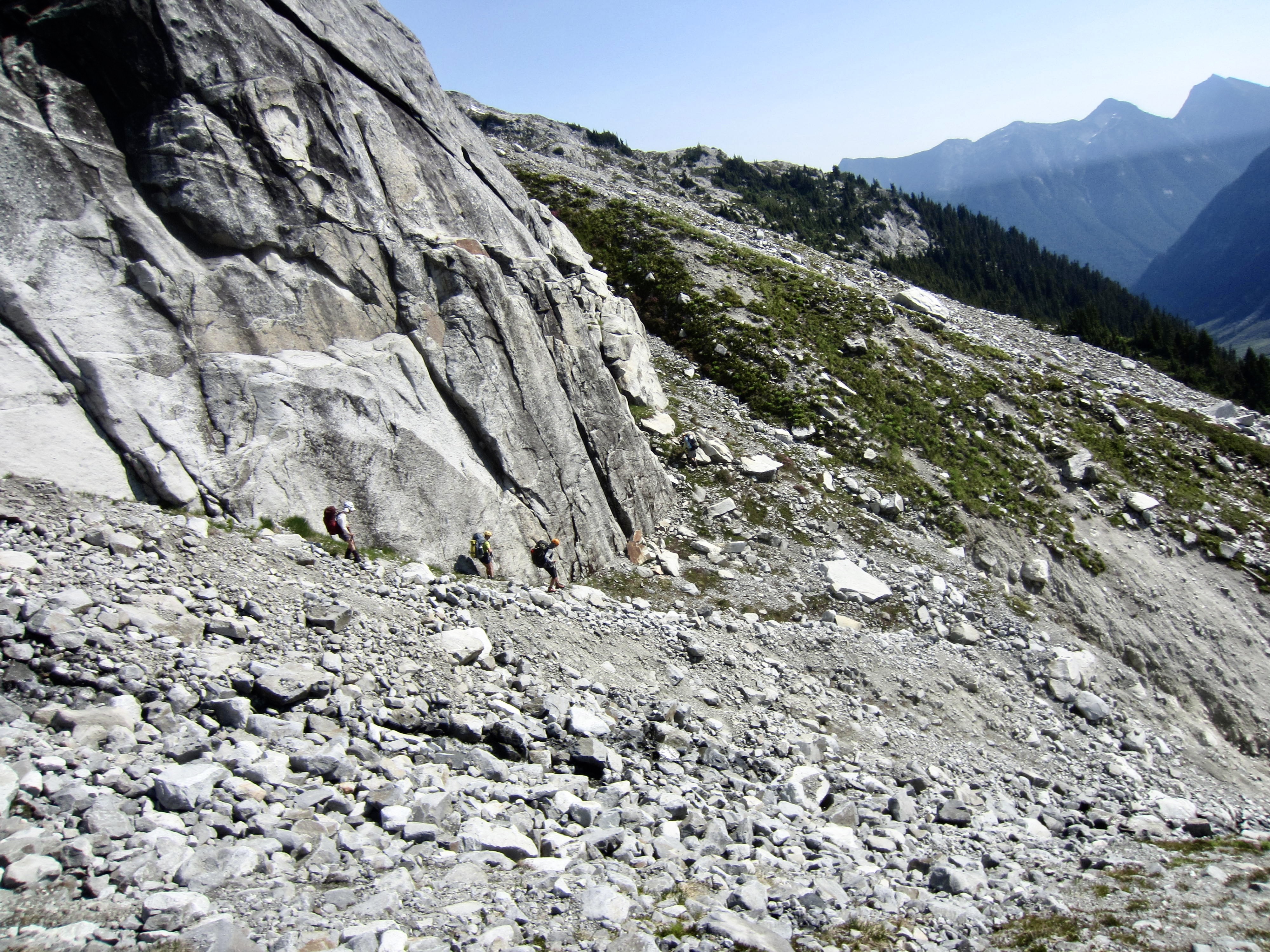
By the time we reached 6700-foot Challenger Gap, it was 2:00pm (6.4 hours + 2300 feet from Camp 5) and too late for a climb of Mt. Challenger if we still hoped to make good progress along Wiley Ridge. As a meager consolation, we all climbed up nearby Big Beaver Peak for a grand view of the Picket Range’s crown jewel.

.
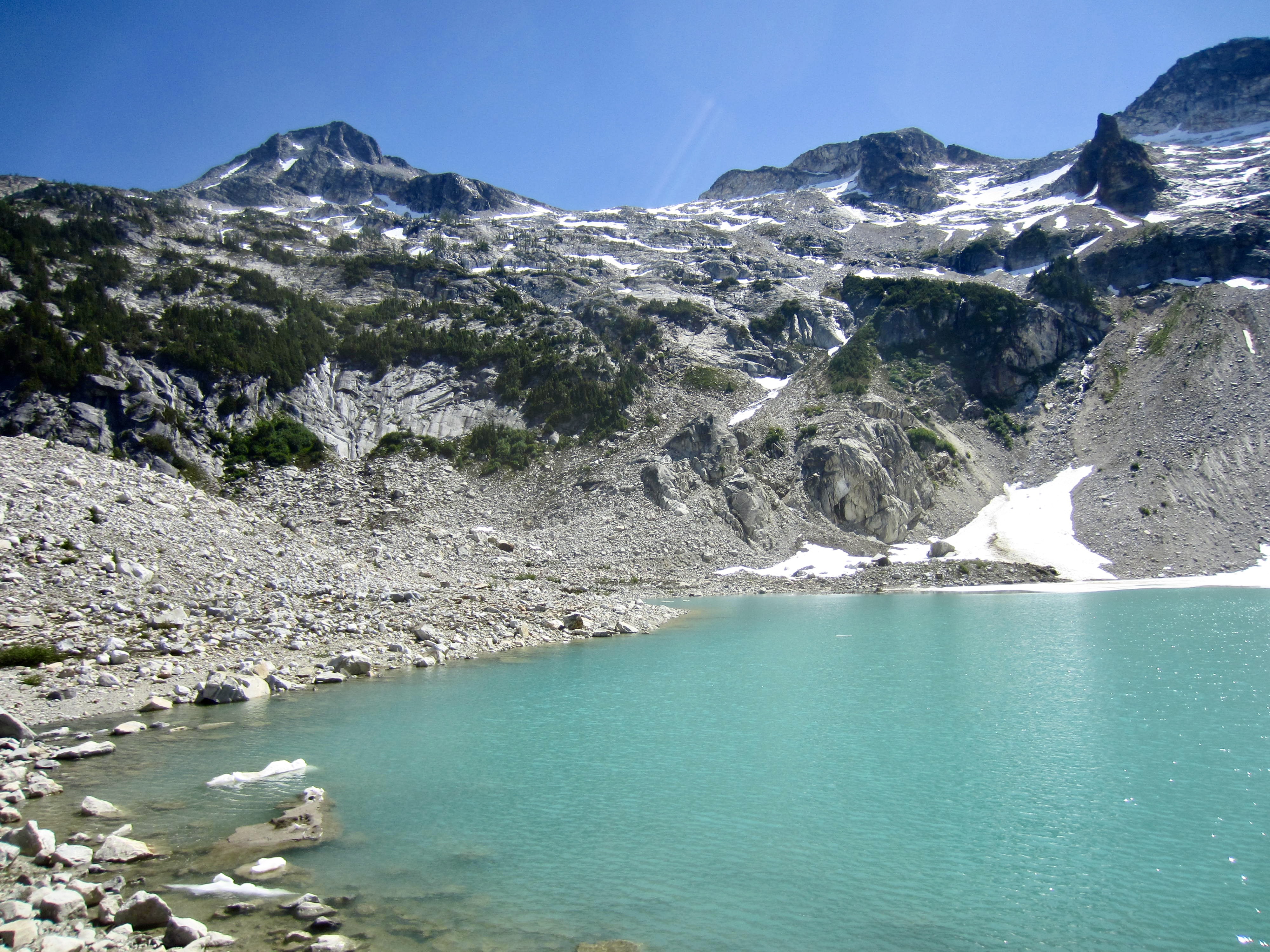
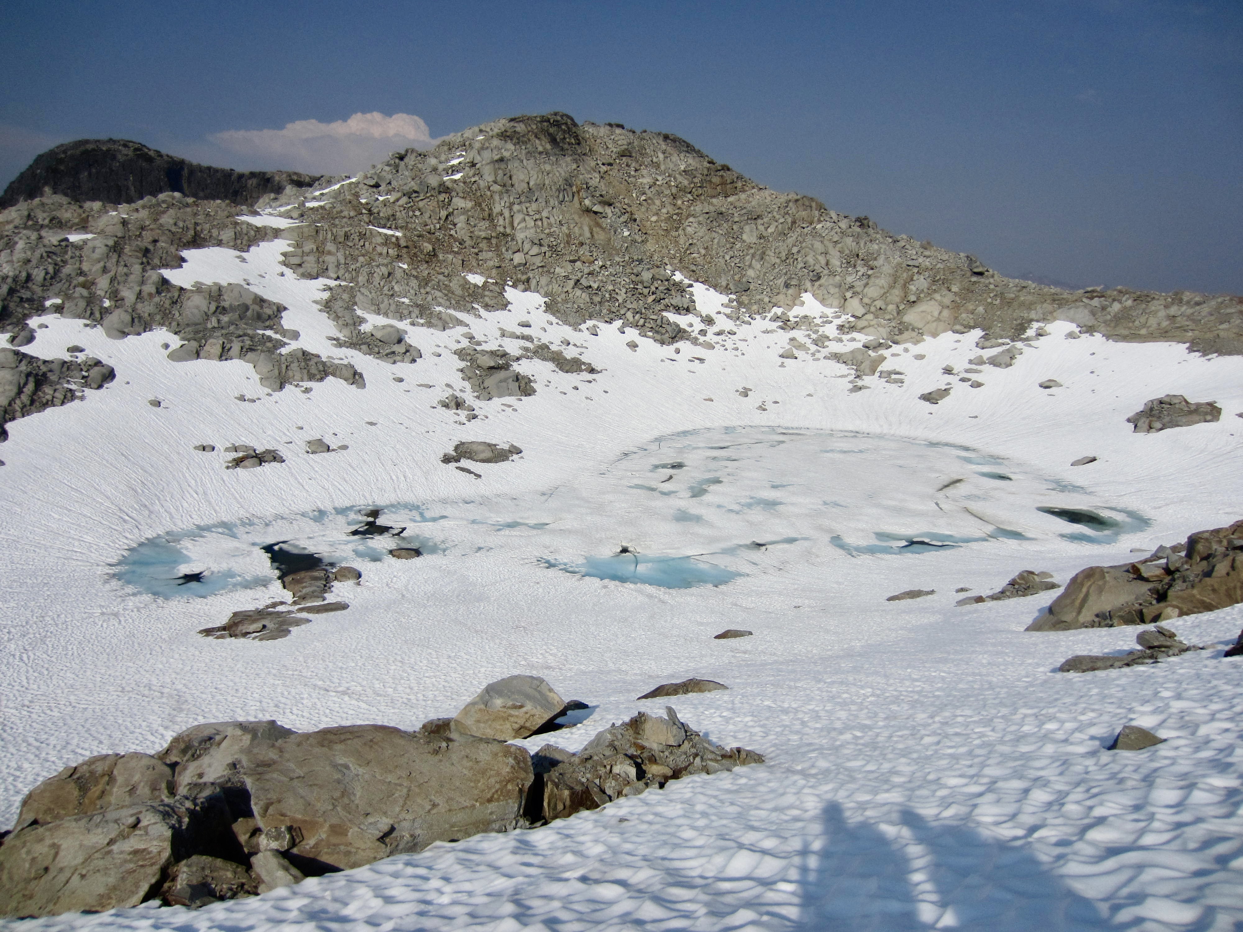
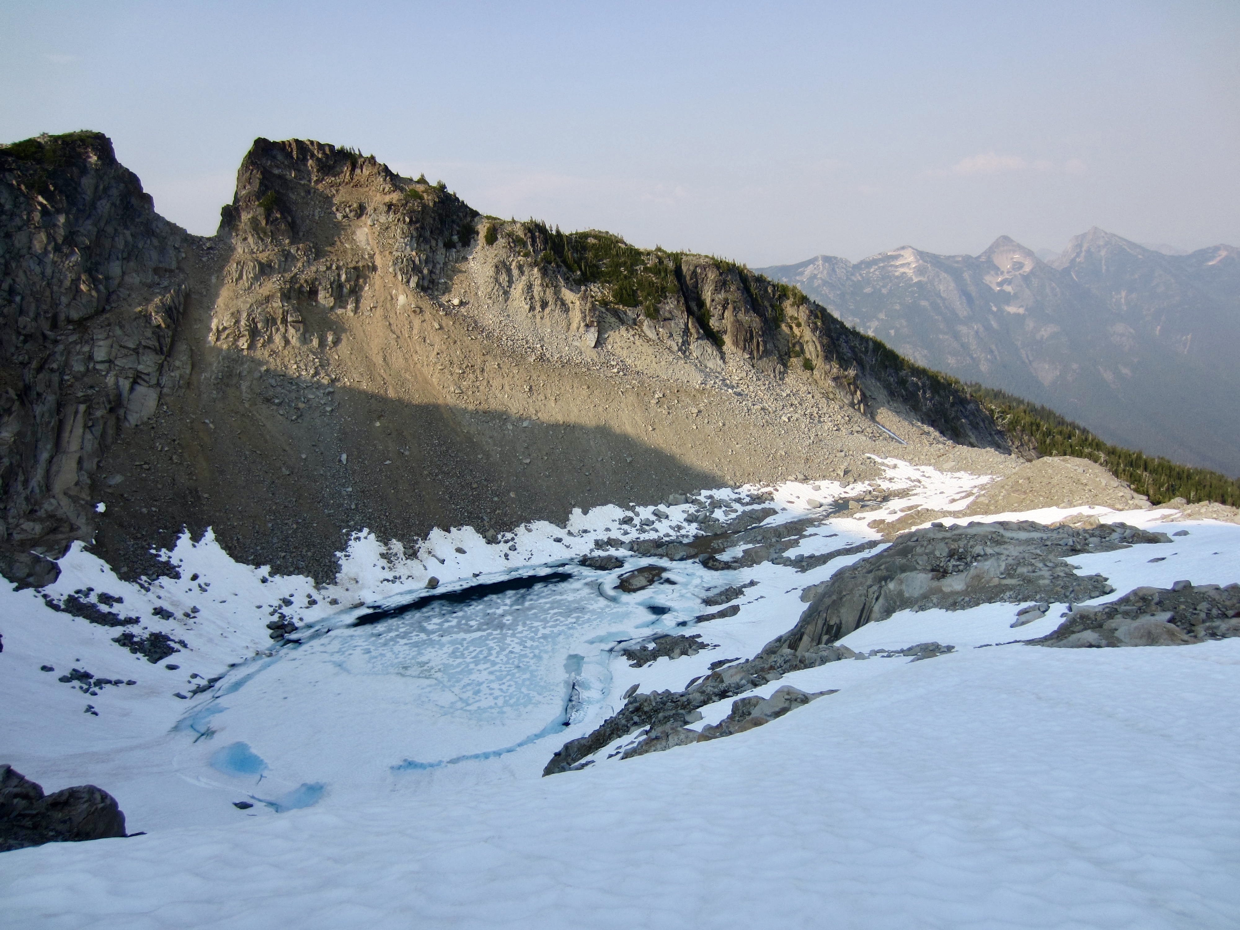
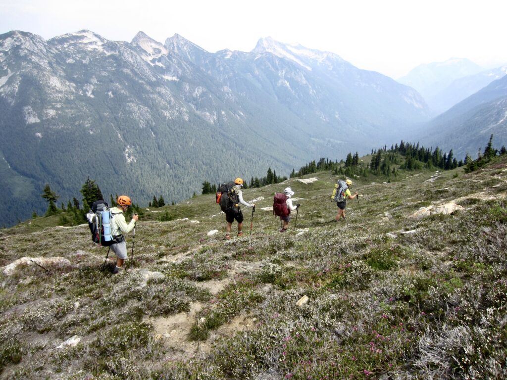
From Big Beaver Peak’s summit, we scrambled down the northwest ridge to a large snowfield on its northern flank and then traversed over to Wiley Lake. Continuous snowcover took us across the lake outlet and up the other side, then through a 6850-foot ridge saddle that led toward Eiley Lake. Considering that the past winter produced below-average snowfall, we were surprised to have such good snowcover on the ridge.
.

.
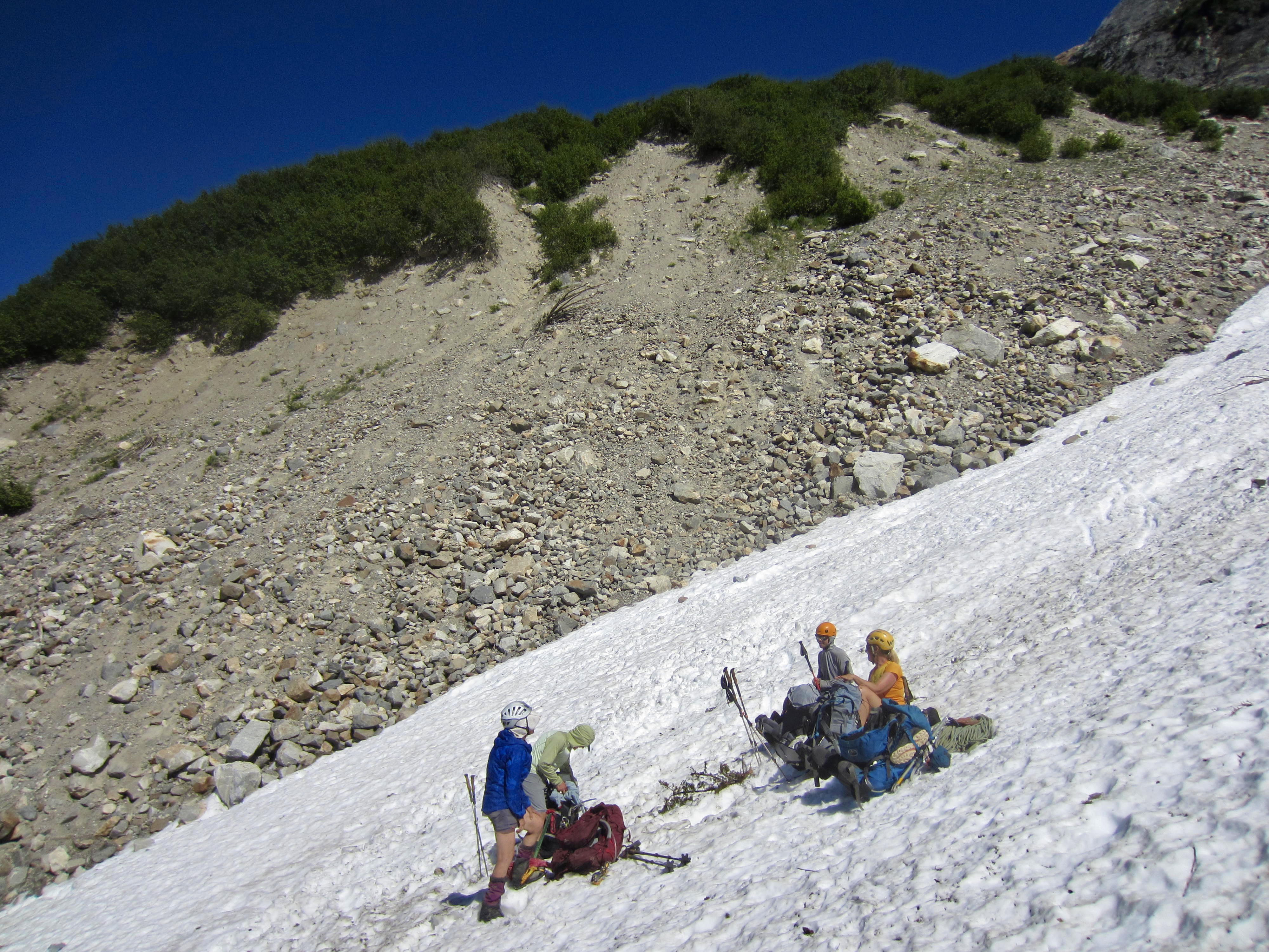
Before dropping down to Eiley Lake, we eyeballed the terrain on the opposite side of the lake bowl. Based on three previous trips through here, Eileen had found that the easiest route out of the bowl is a small chute located northeast of the lake outlet. We descended into the bowl and then groveled our way up the chute, which consists of rotten granite and sandy dirt. This was the grungiest part of our whole day, but it seemed pretty minor compared to the past four days!
.
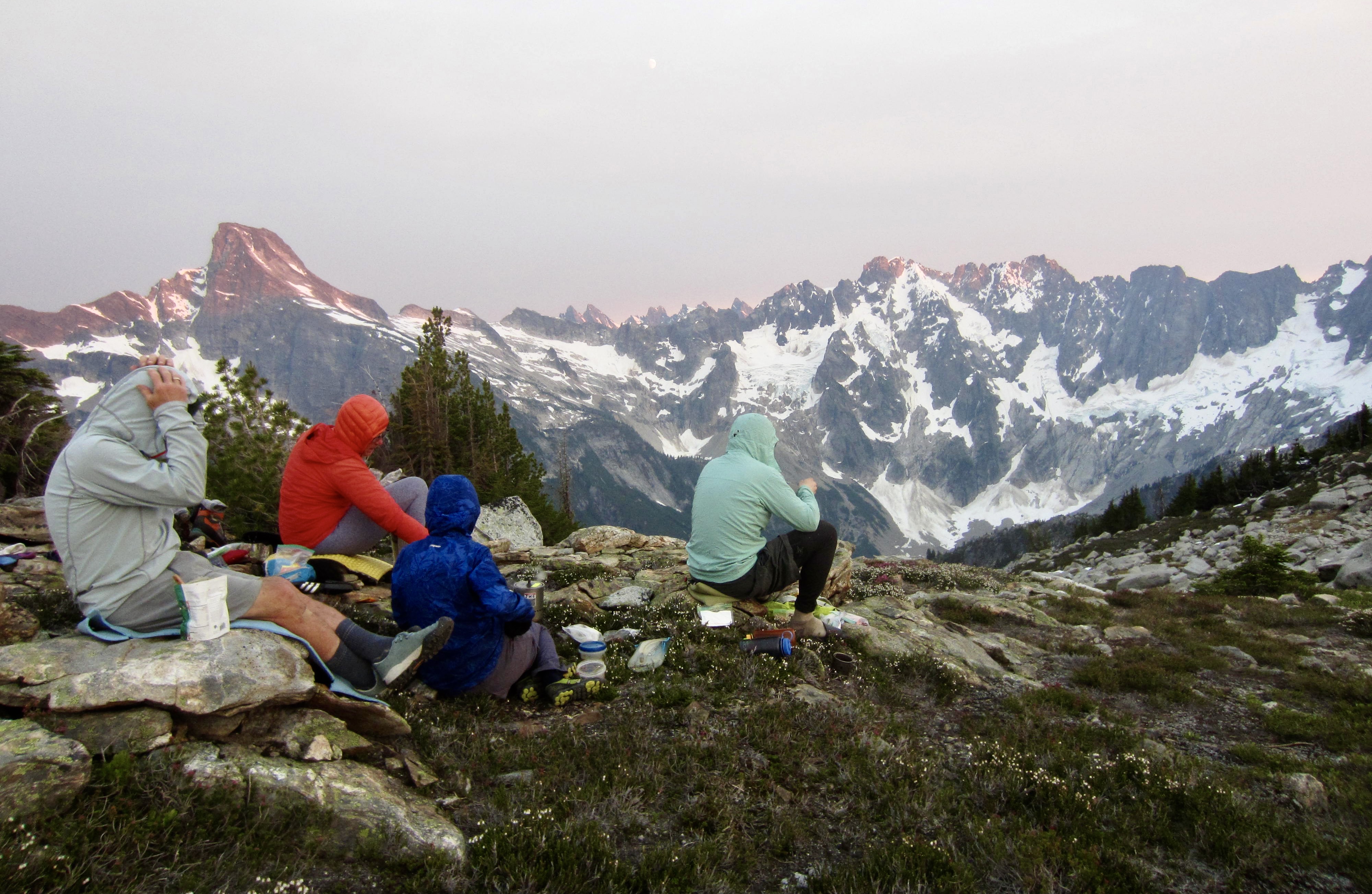
The rotten chute topped out at a flat bench on the ridge crest, with heather and rocks on one side and snow on the other side. We stopped and pitched our tents here at 7:30pm (12.1 hours + 3000 feet from Camp 5). Wildfire smoke had been slowly filling the atmosphere throughout the day and was now reducing visibility to about 10 miles. (We thought this was caused by the Pioneer Fire at Lake Chelan but later learned that a new fire had ignited near Easy Pass.)

.
Day 7: Wiley Ridge Crest to Luna Camp
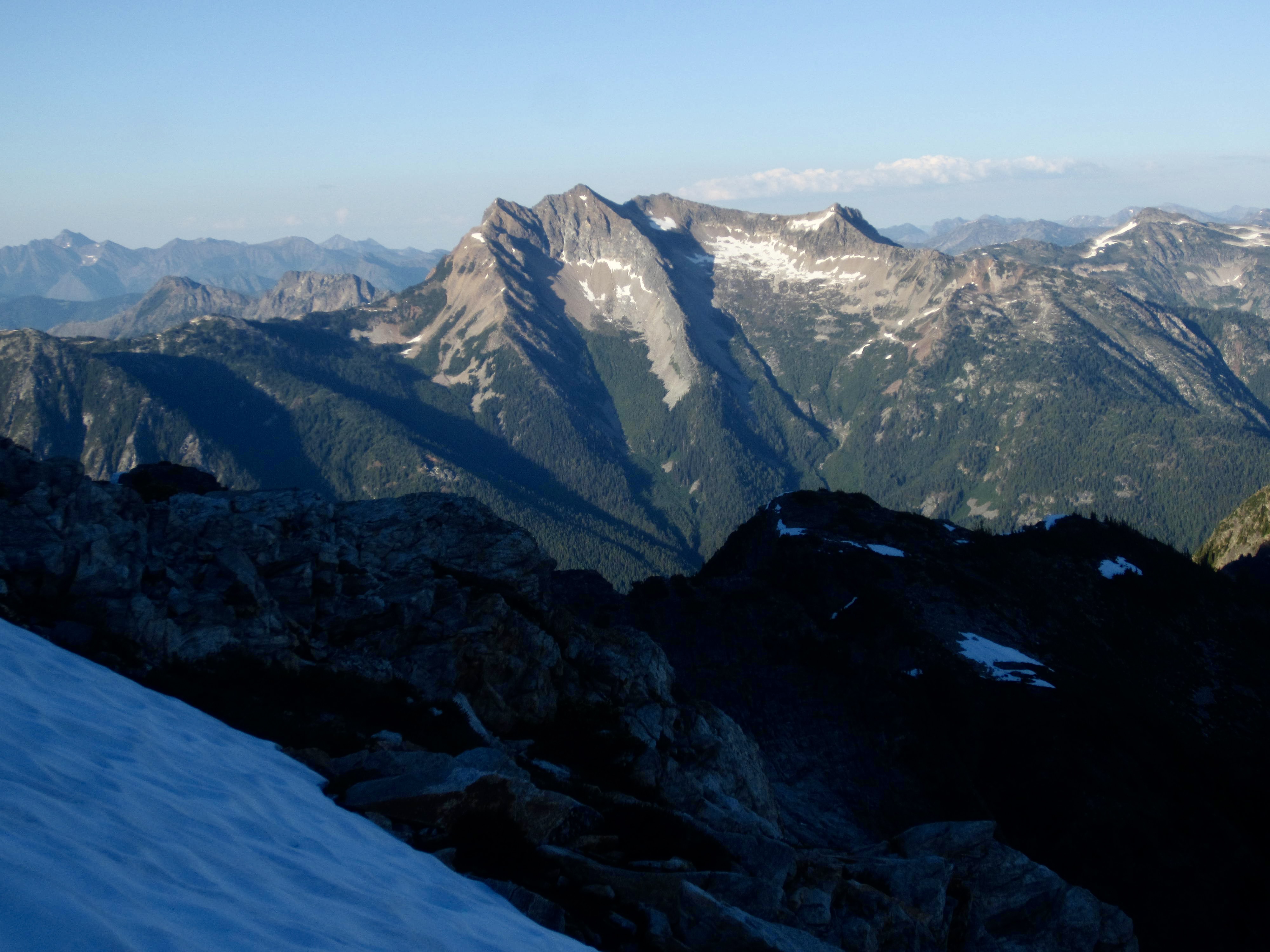
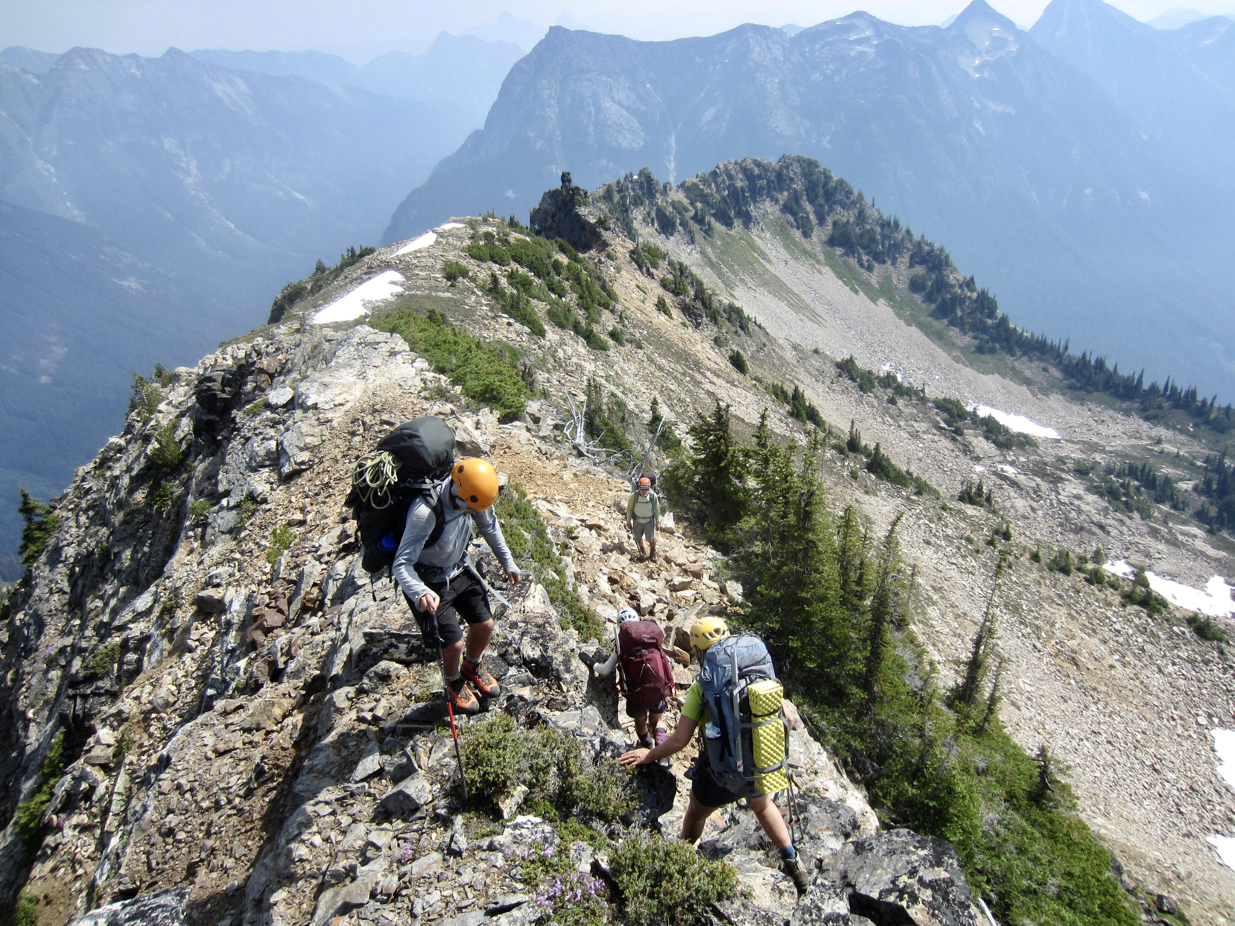
We awoke to somewhat clearer air, presumably due to a change in wind direction. Our goal today was to get at least as far as Luna Camp, but we really hoped to get all the way to 39-Mile Camp if things went well. We headed northeasterly along the ridge crest, dropping into a saddle and then swinging around the right side of the crest. Our route took us high around the southern flank of Little Beaver Peak, so we all made a short sidetrip to the summit. Eileen and Beth were delighted to find Fay Pullen’s tiny register from their 2012 “all girls” trip together.
.

.
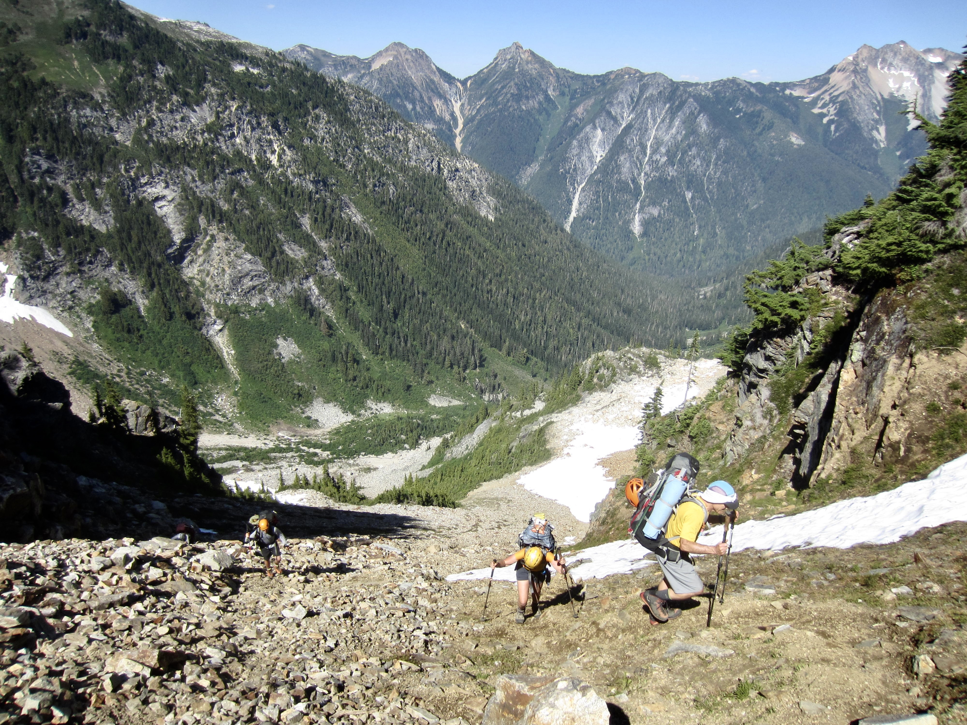
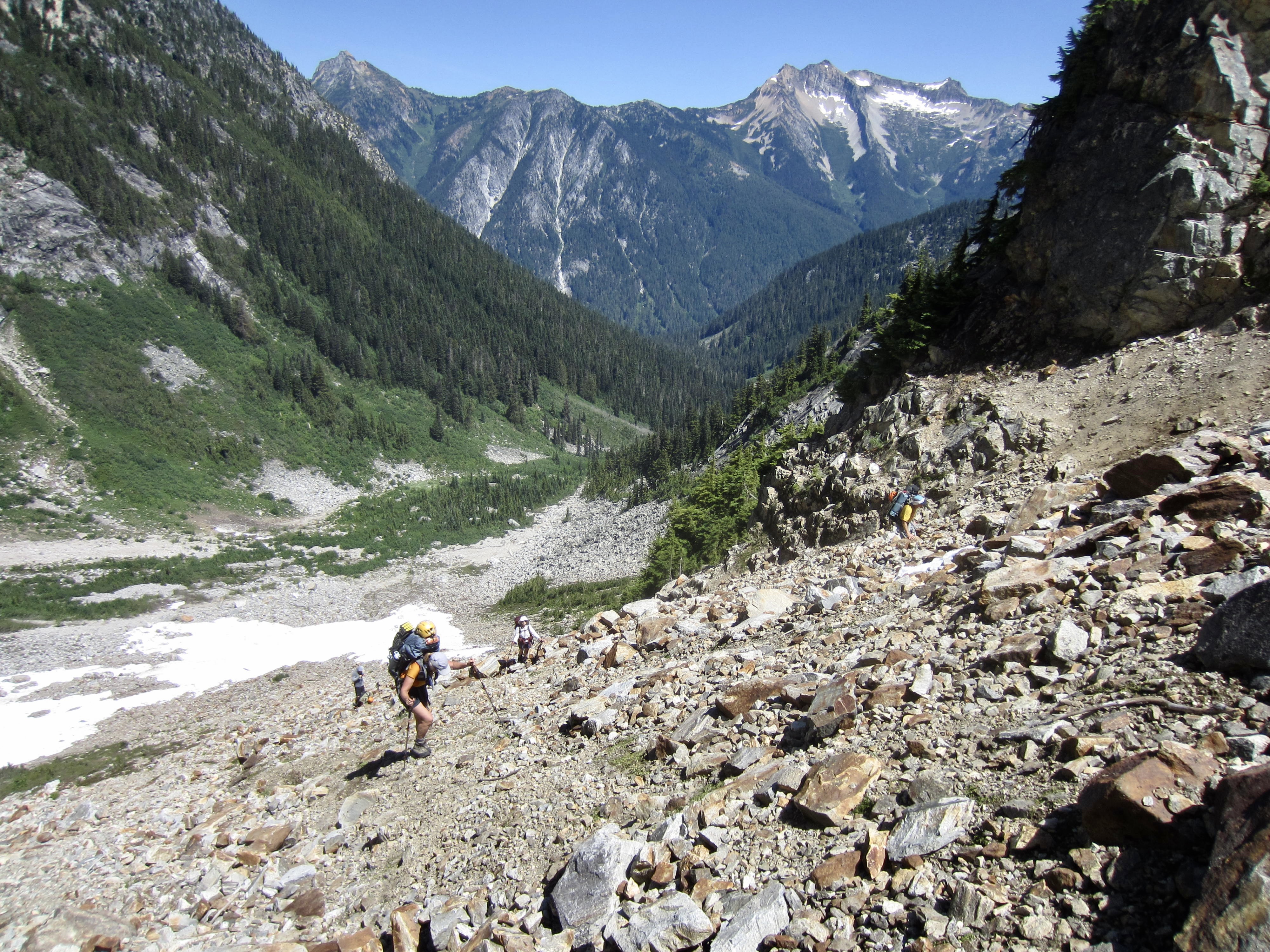
From the summit of Little Beaver Peak, we scrambled down to the east, working along the top of a cliff band. The key to getting down this cliff band is a diagonal slot that starts at 6550 feet and ends in a talus basin below. We then traversed northeasterly across the talus basin and climbed back up to a notch in the ridge crest. Some exposed scrambling over or around several ridge horns brought us to “Wiley Point,” a distinctive 6640-foot rock knob at the northeastern end of Wiley Ridge. We stopped here for lunch at 1:30pm (4.5 hours + 750 feet from Camp 6), feeling that there was only smooth sailing ahead. (We were wrong about that.)
.
.
Getting off Wiley Point turned out to be much trickier than we expected—a recurring theme of our trip! We started with an exposed Class 3 down-climb that put us at the top of an intimidatingly steep heather slope. Although Eileen had been here several times before, she was completely puzzled by the terrain. It initially appeared that would need to do a rappel, but after scouting around, Eileen found the key: a faint bootpath that cuts across the steep slope and leads down to a small notch directly east of Wiley Point.
.
Soon, we were all merrily marching down the gentle ridge crest and then down pleasant heather slopes on the east-trending nose of the ridge. Our progress was very good until we came to a rocky shoulder at 5750 feet. Here, the good times came to an abrupt halt. Easy heather slopes transitioned to steep forest slopes covered with slippery duff, fallen logs, and patches of brush. We spent the next 2300 vertical feet and 4 hours sliding, stumbling, and tumbling downhill.
.
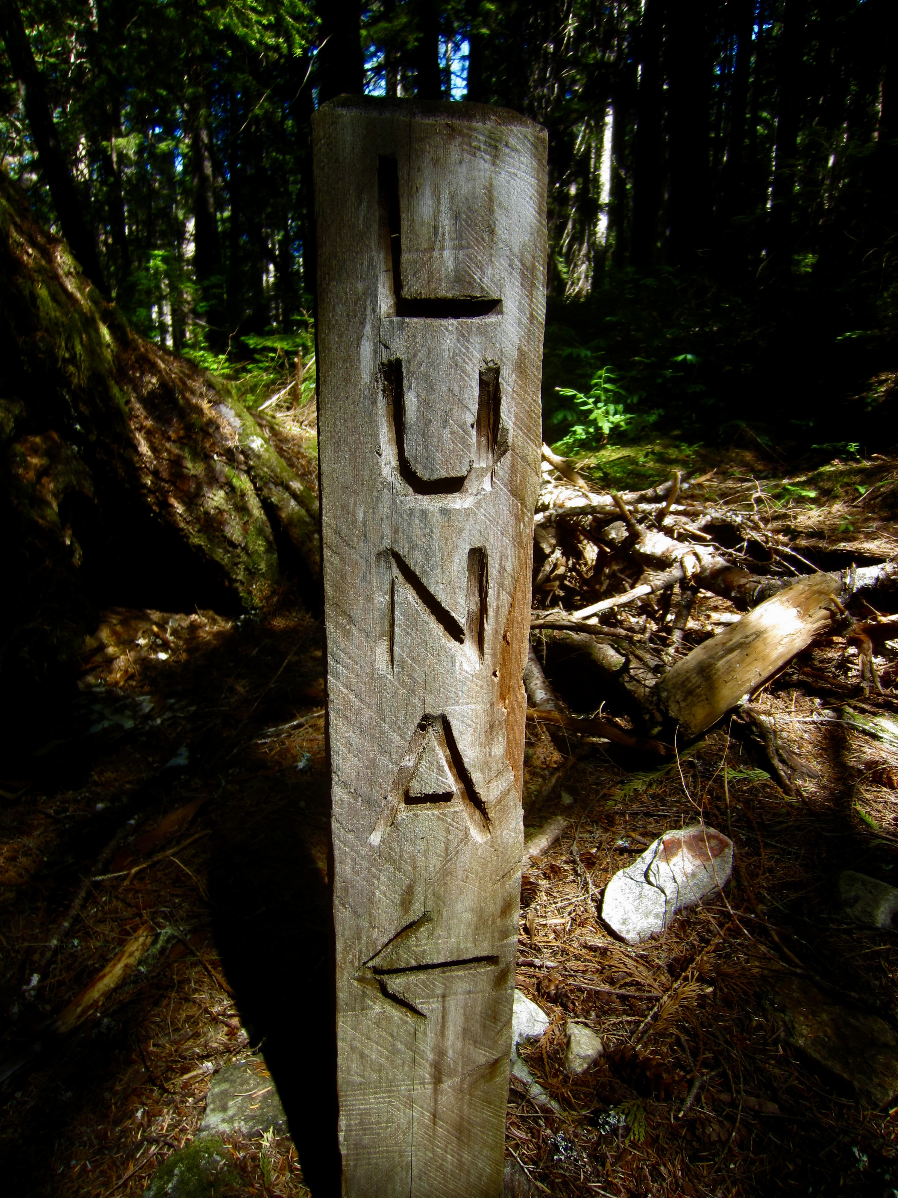
Upon reaching the valley bottom, we crashed through dense patches of devils club, vine maple, and slide alder to reach Big Beaver Creek. Once across the creek, we crashed through more of the same until intersecting the Big Beaver Trail at 3600 feet, scant minutes before 7:30pm (10.4 hours from Camp 6). There were big smiles all around at having finally completed the off-trail portion of our loop! It then became a simple 3½-mile hike down the trail to Luna Camp for our last night. We arrived in camp at various times between 9:00pm and 10:00pm, devoured our last dinners, and went to bed.
.
Day 8: Luna Camp to Ross Dam Trailhead
We were back on the trail at 7:30am and enjoyed some morning coolness during our 9-mile hike down to Big Beaver Landing. George and Andrew were already there when Eileen and I arrived at 1:10pm (5.7 hours + 400 feet from Camp 7). Beth arrived a bit later, just in time for us to catch a water taxi heading down-lake.
.
.
The 500-foot hike from Ross Lake Landing up to the trailhead was oppressively hot and put an appropriate cap on our arduous trek. We stepped onto the parking lot in mid-afternoon, feeling at once happy, tired, satisfied, sore, and relieved. The Picket Range always manages to serve up a full-meal deal, and this one came with an extra helping of butt-whip!
Route Maps & Profile & Sketches
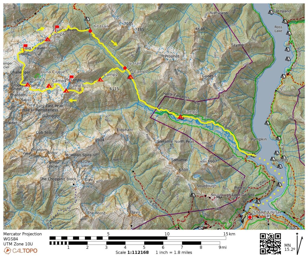
…
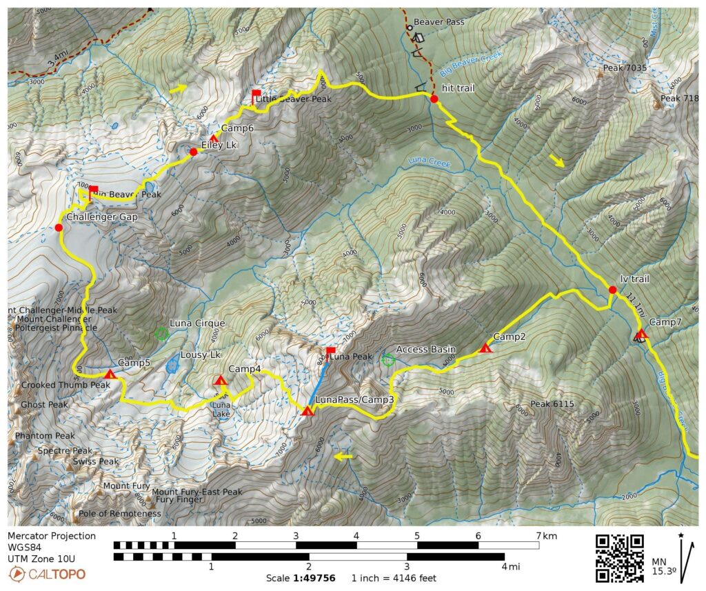
…
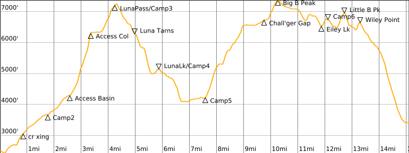
…
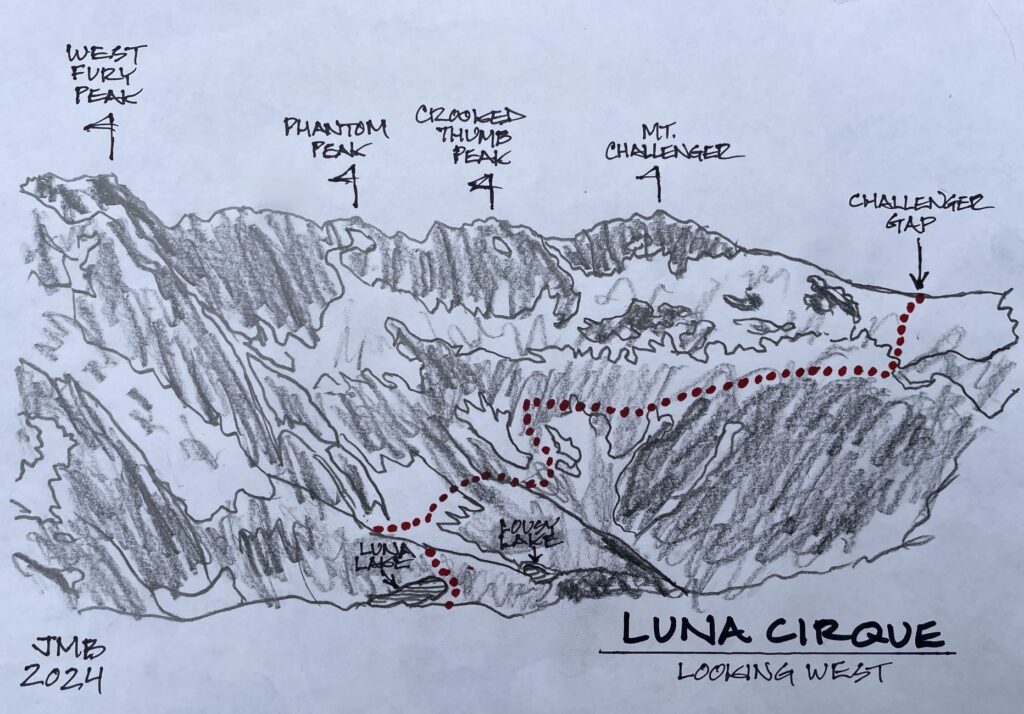
…
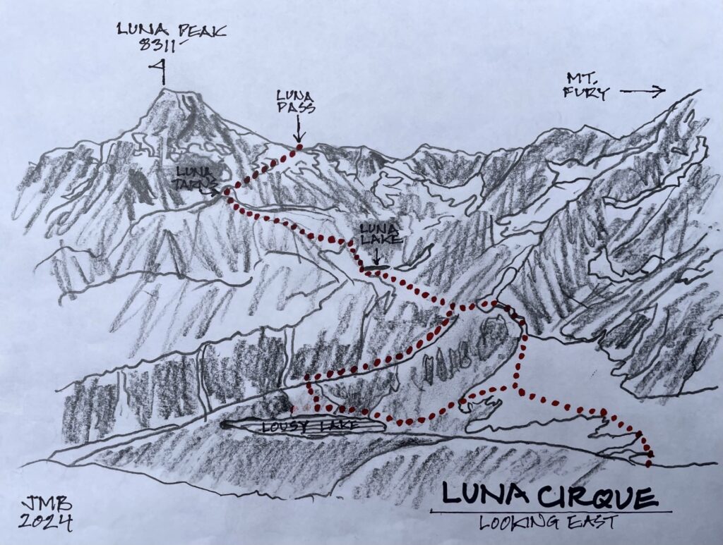
…
Photo Gallery
Click to enlarge…