Trip Date: July 25, 2024
2024 IDAHO & WYOMING ADVENTURE VACATION
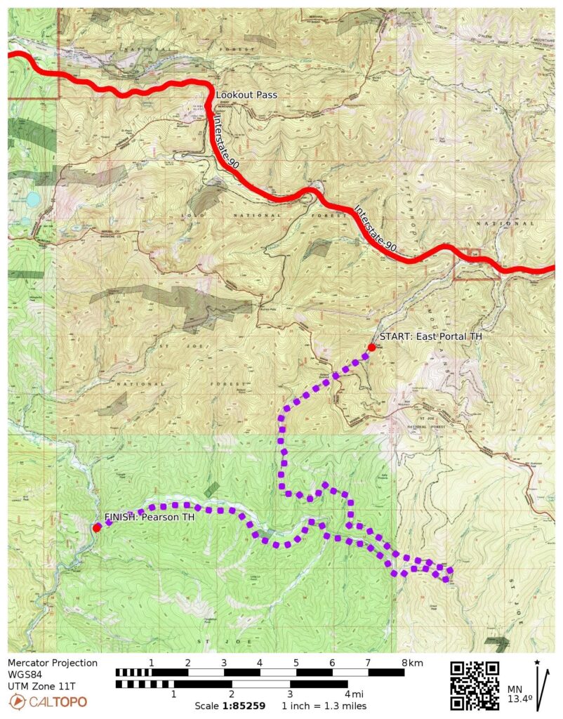
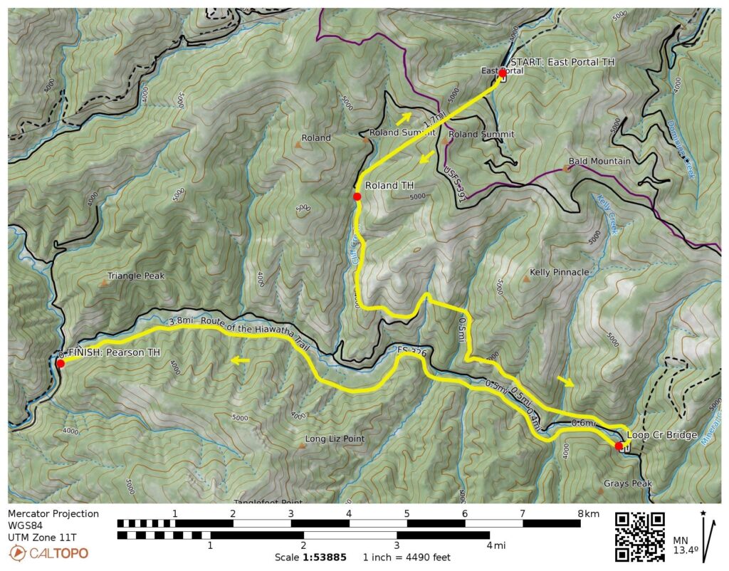
Hiawatha Bike Traverse: East Portal Trailhead to Pearson Trailhead
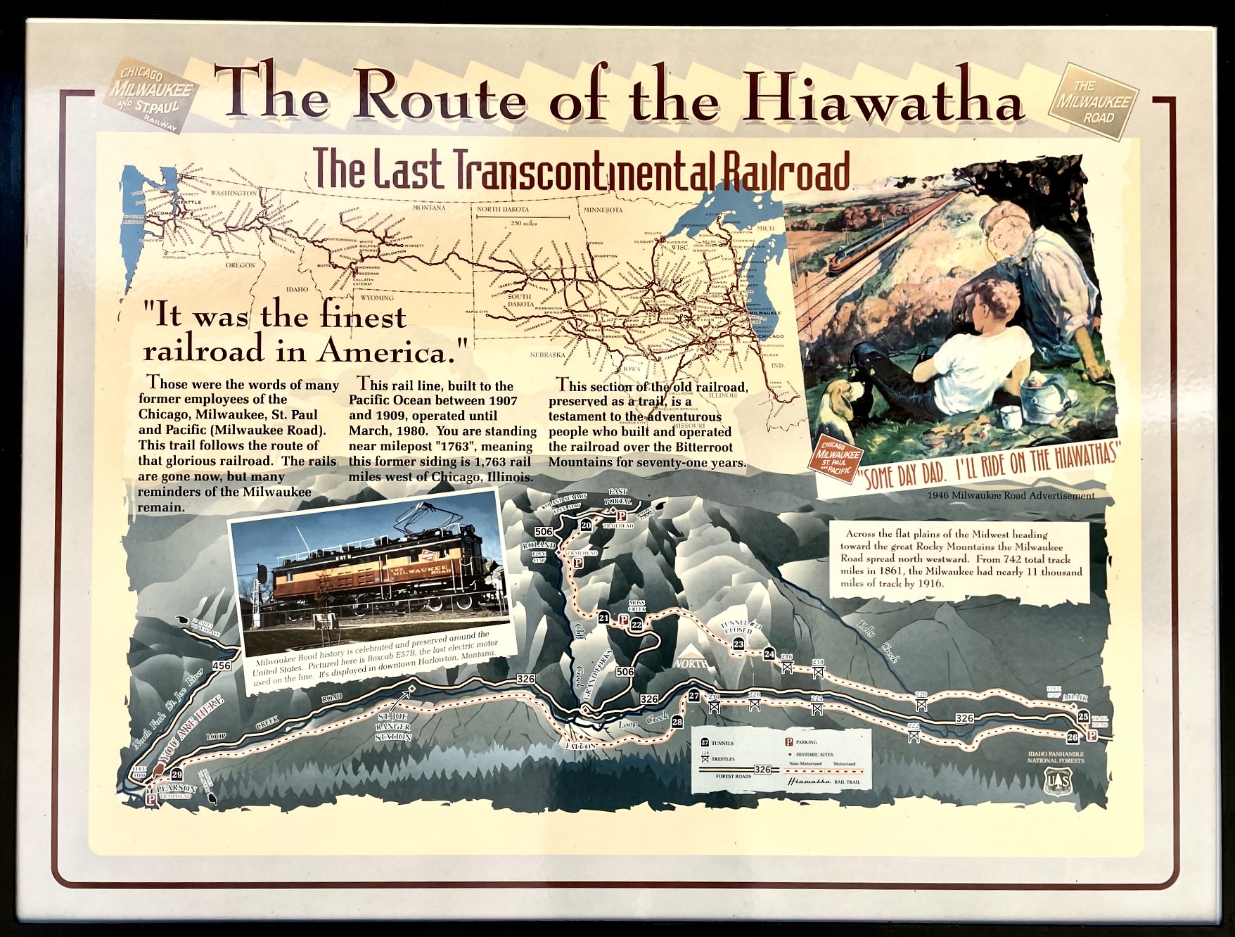
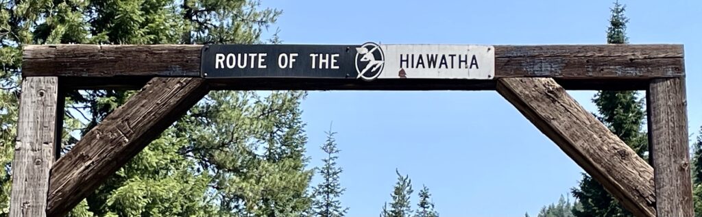
Route of the Hiawatha Scenic Bike Trail
The Milwaukee Road Rail-Trail
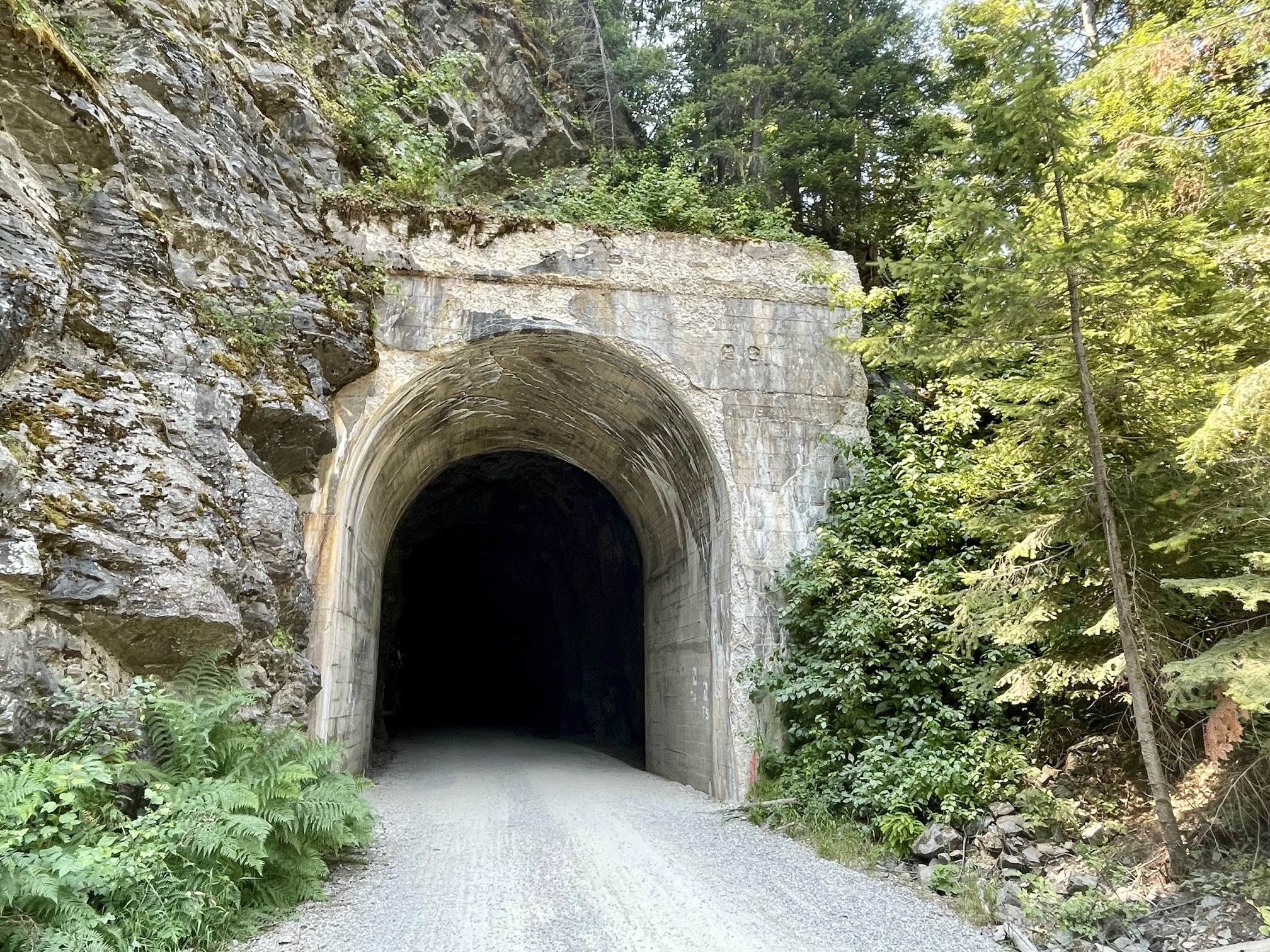
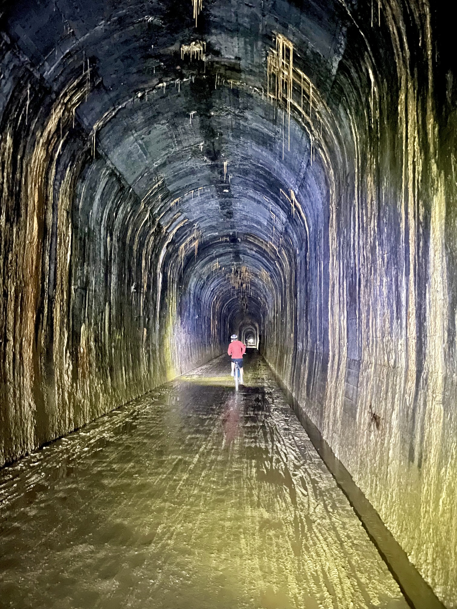
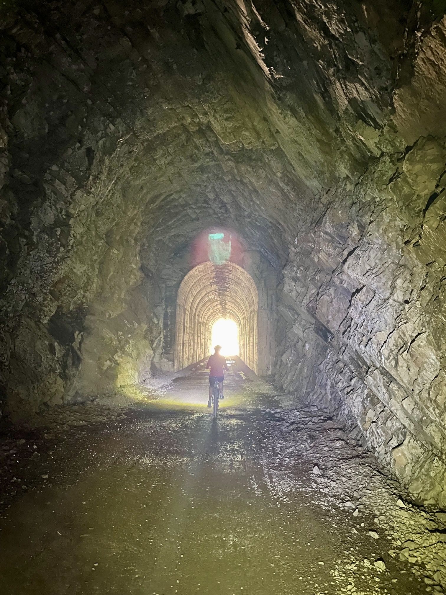
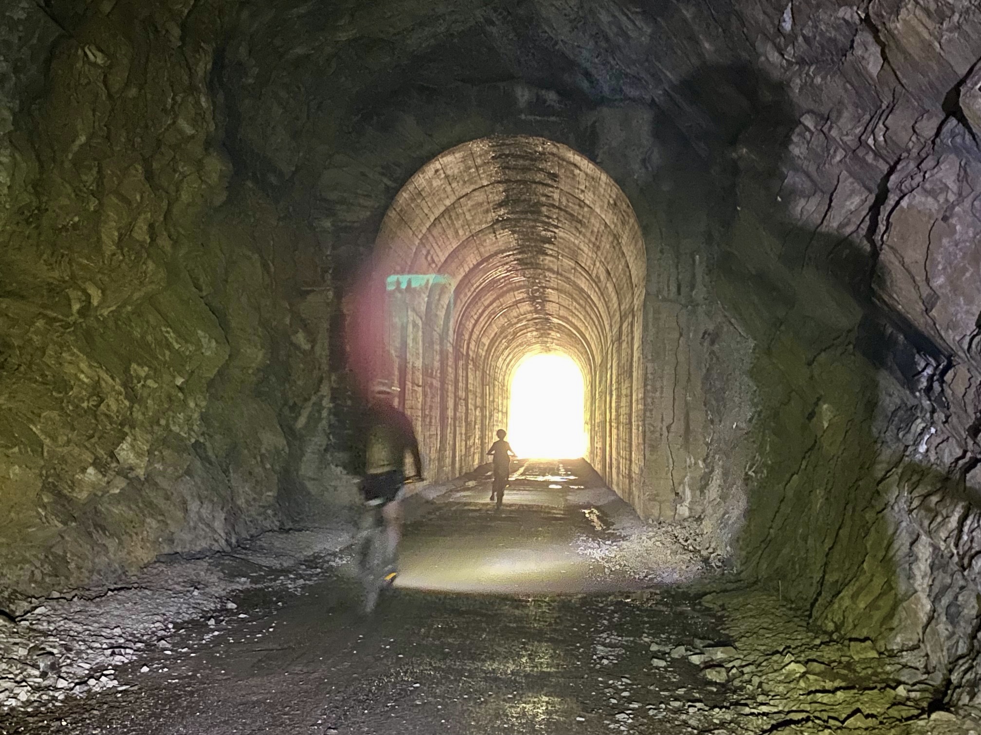
St. Paul Pass Tunnel #20
Trip Report Summary
Region: Montana & Idaho Rockies
Sub-Region: Bitterroot Range
Sub-Sub-Region: St. Joe Mountains
Areas: Lolo National Forest & St. Joe National Forest
Primary Starting Point: East Portal Trailhead on Road 506 (Elev. 4150 feet)
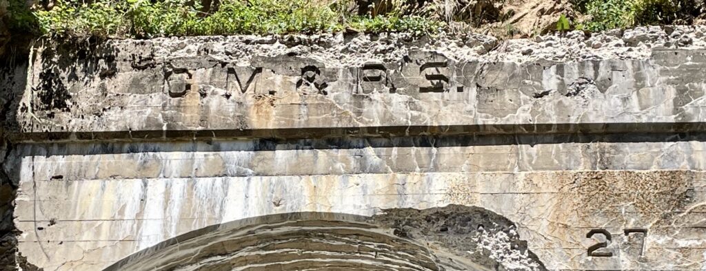
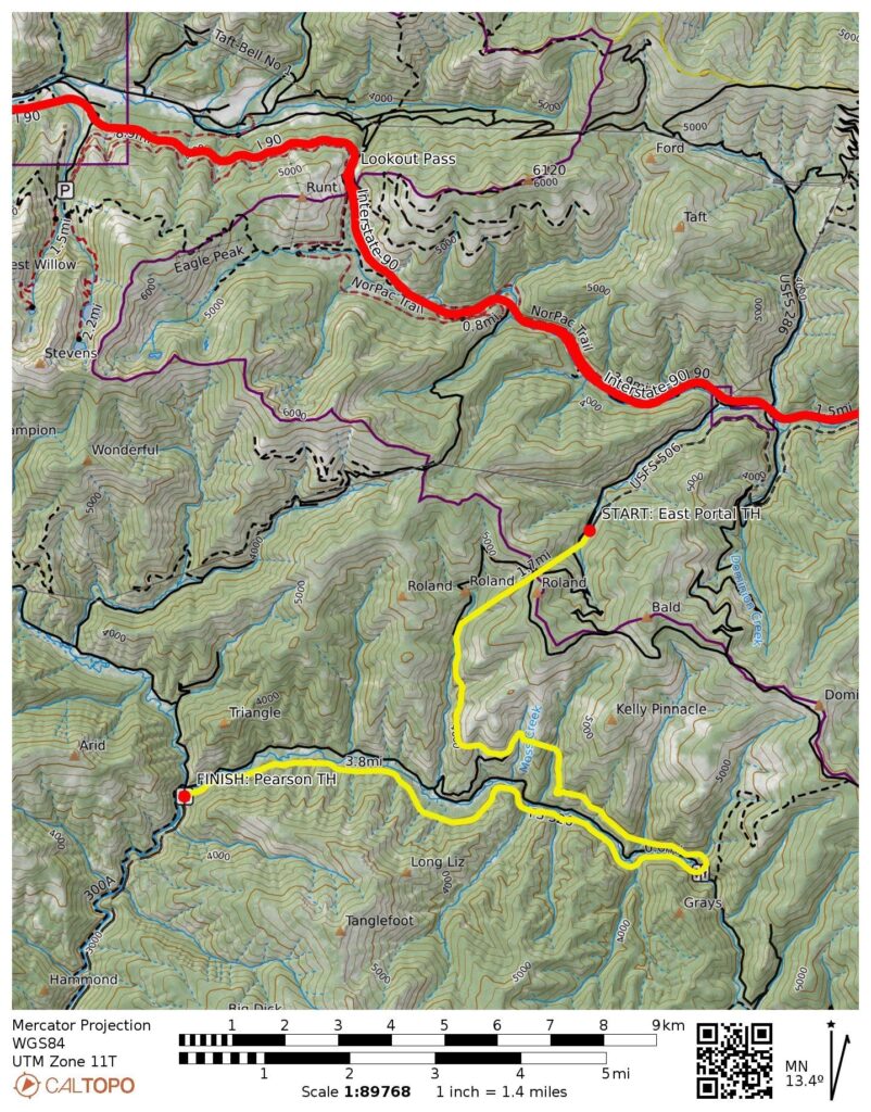
Primary Way Points: Tunnel 20 east portal & Tunnel 20 west portal & Roland Trailhead & Tunnel 21 & Tunnel 22 & Tunnel 24 & Small Creek Trestle & Barnes Creek Trestle & Kelly Creek Trestle & Adair Trailhead & Tunnel 25 & Tunnel 26 & Turkey Creek Trestle & Russel Creek Trestle & Bear Creek Trestle & Clear Creek Trestle & Tunnel 27 & Tunnel 28 & Falcon Trailhead & Tunnel 29 & Pearson Trailhead (bike ride)
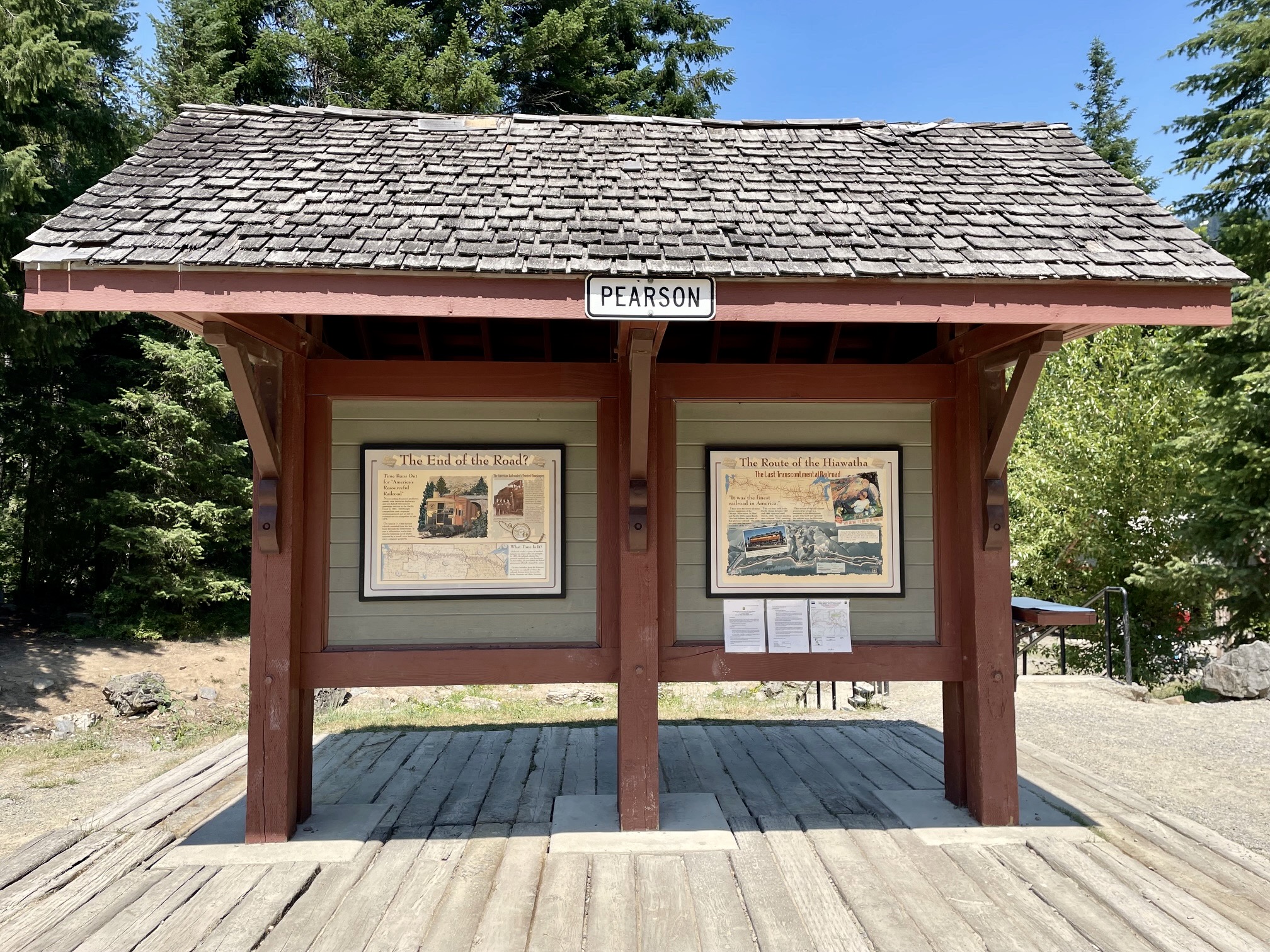
Primary Ending Point: Pearson Trailhead on Road 456 (Elev. 3180 feet)
Secondary Starting Point: Roland Trailhead on Road 506 (Elev. 4150 feet)
Secondary Way Points: Tunnel 20 west portal & Tunnel 20 east portal & East Portal Trailhead (bike ride)
Secondary Ending Point: East Portal Trailhead on Road 506 (Elev. 4150 feet)
Approximate Stats: 16.7 miles ridden; 0 feet gained; 970 feet lost; 4.0 hours elapsed.
Trip Overview
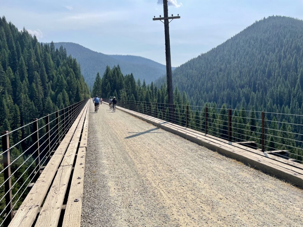
The Hiawatha Bike Traverse is a 15-mile ride along the Route of the Hiawatha Scenic Bike Trail, which begins at the East Portal Trailhead in Montana and ends at the Pearson Trailhead in Idaho. This short segment of a very long rail-to-trail conversion project has become one of the most popular “rail-trails” in the entire country. Strictly speaking, the traverse is neither a road bike ride nor a mountain bike ride; instead, it epitomizes a new genre of cycling known as gravel bike riding.
.

.
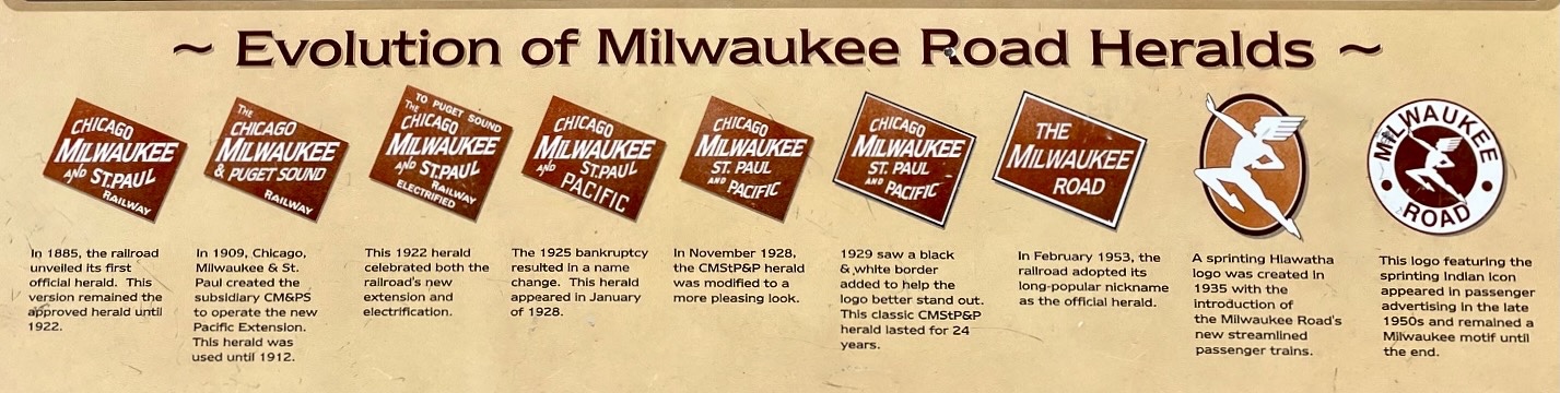
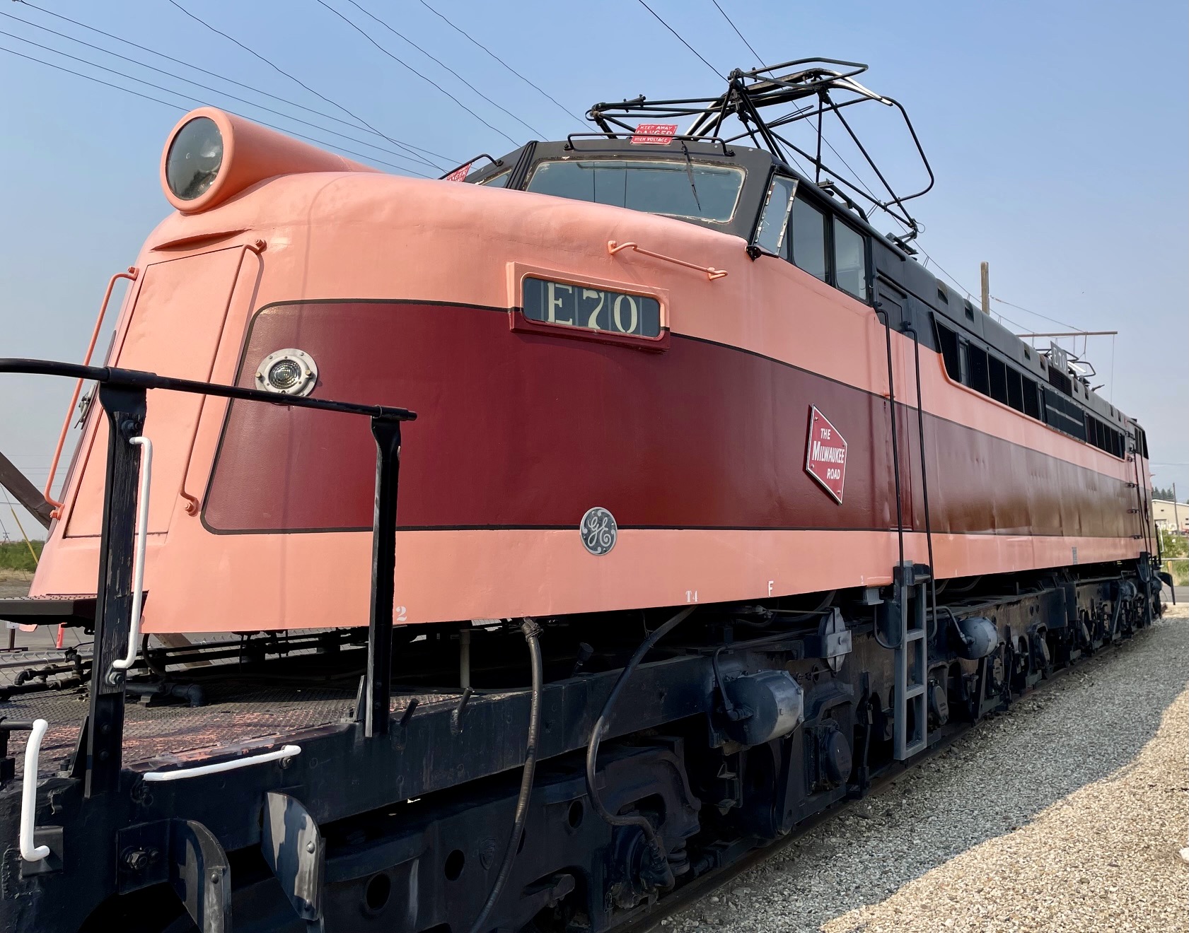
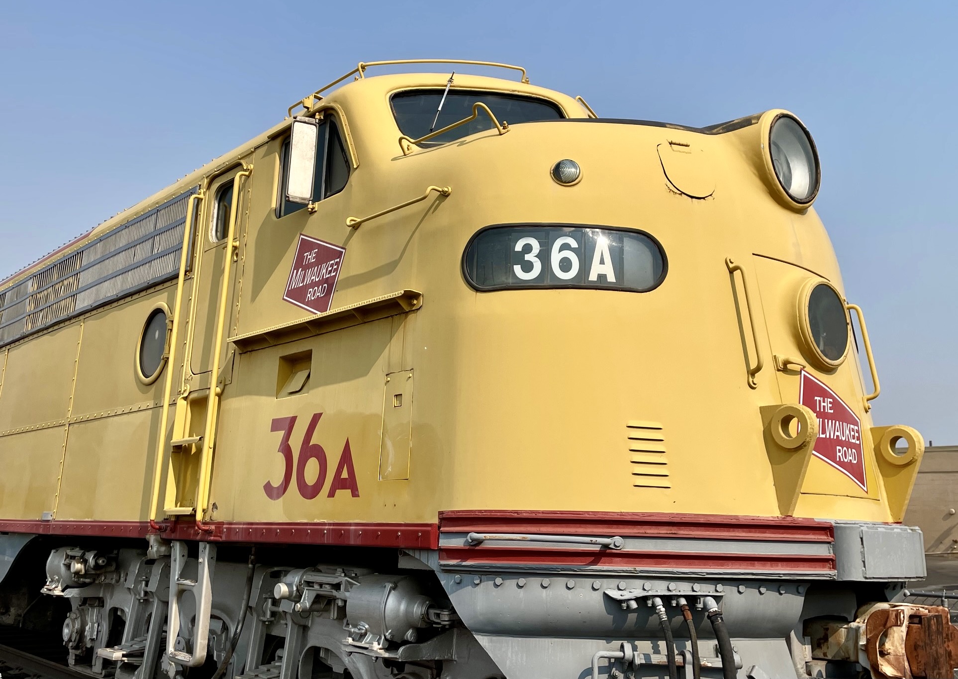
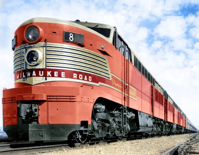
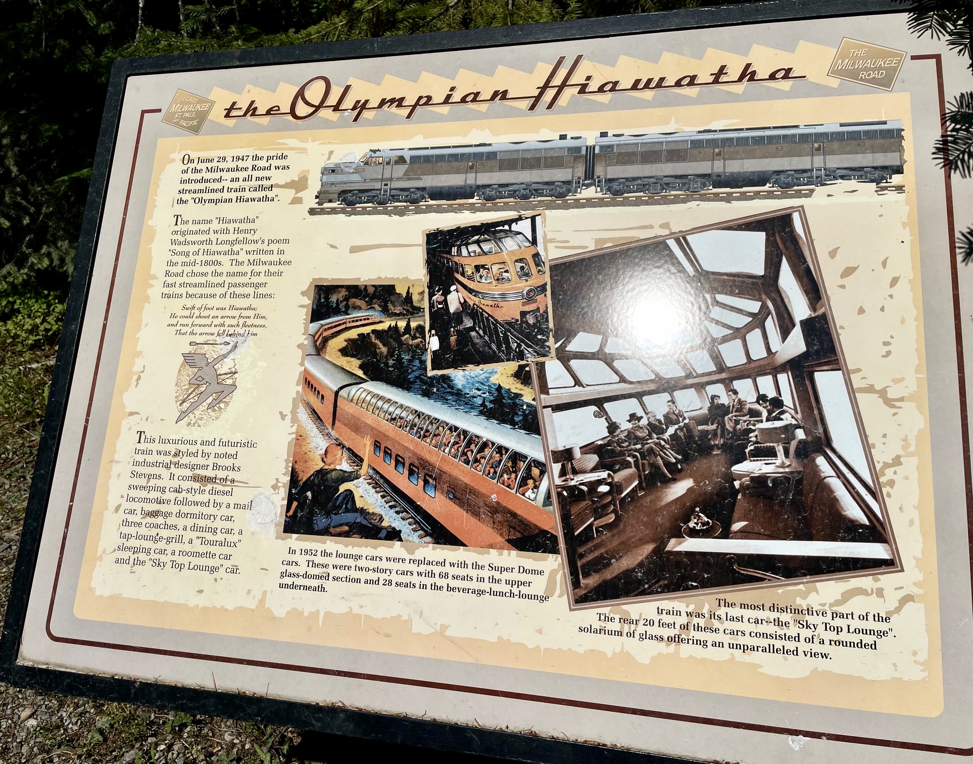
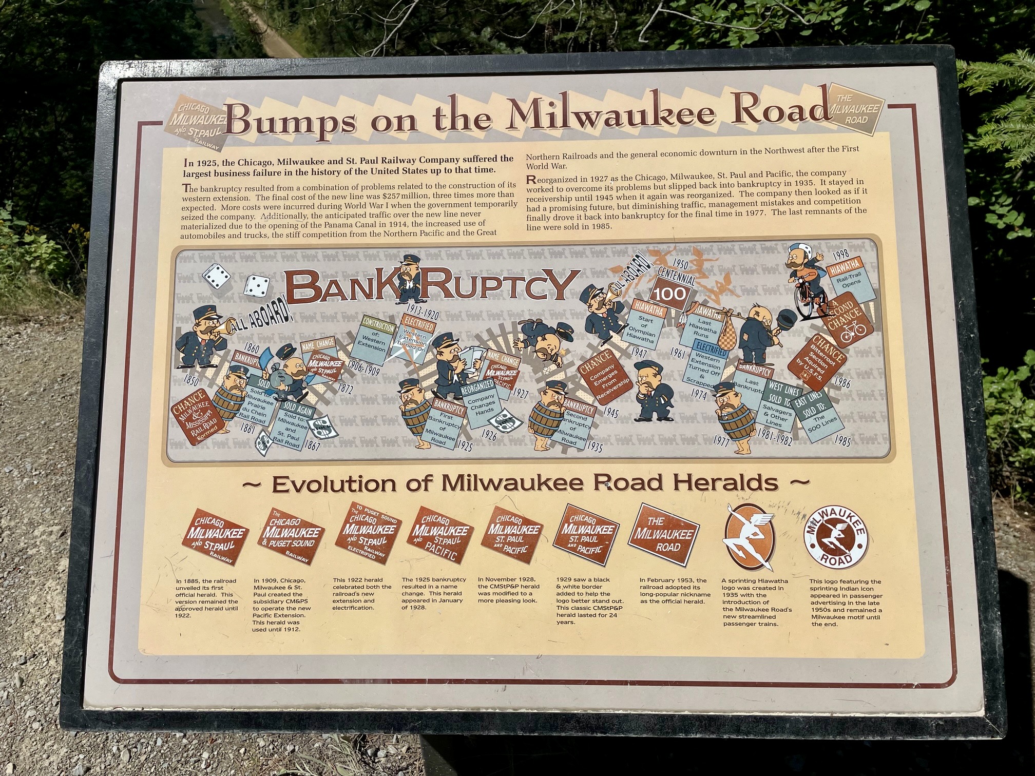
The Hiawatha Bike Traverse owes its name to the Olympian Hiawatha, a fleet of streamlined passenger trains operated by the Chicago, Milwaukee, St. Paul & Pacific Railway throughout much of the 20th Century. These “speedliners” traveled back and forth from Chicago to Seattle/Tacoma and offered an unsurpassed level of luxury at the time. The name Milwaukee Road was eventually given to both the railroad route and the railway company itself.
.
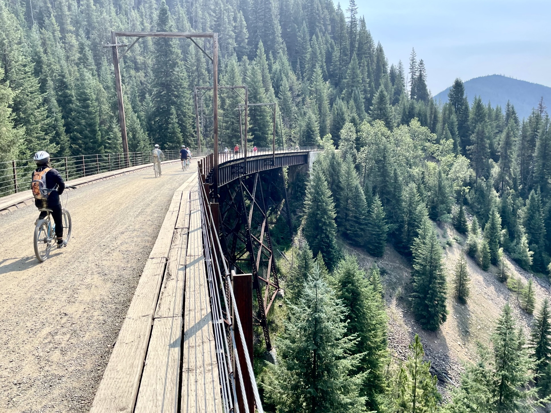
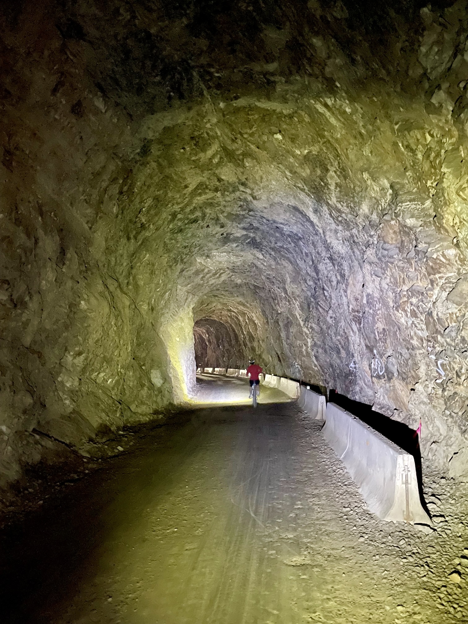
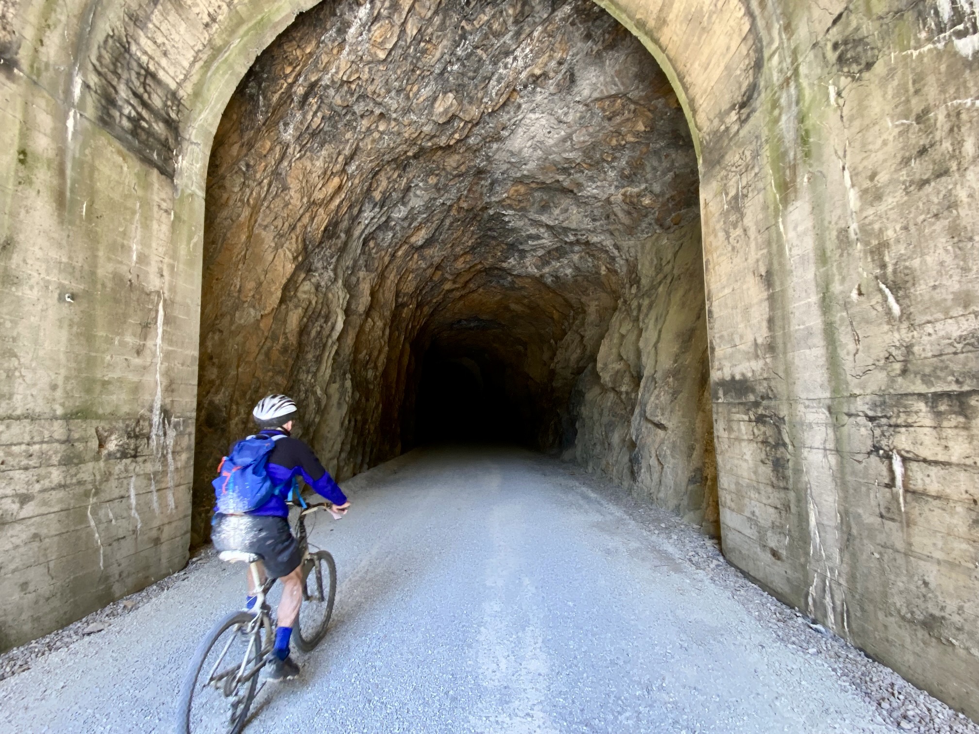
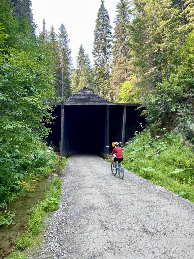
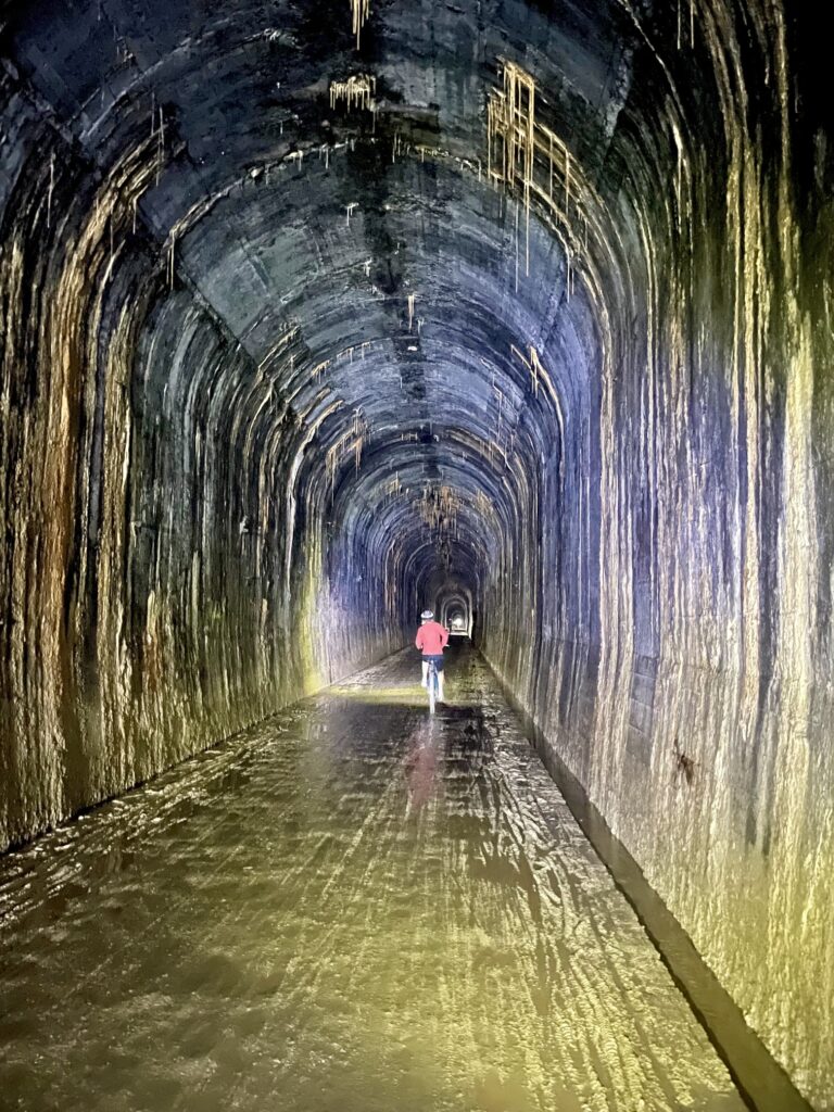
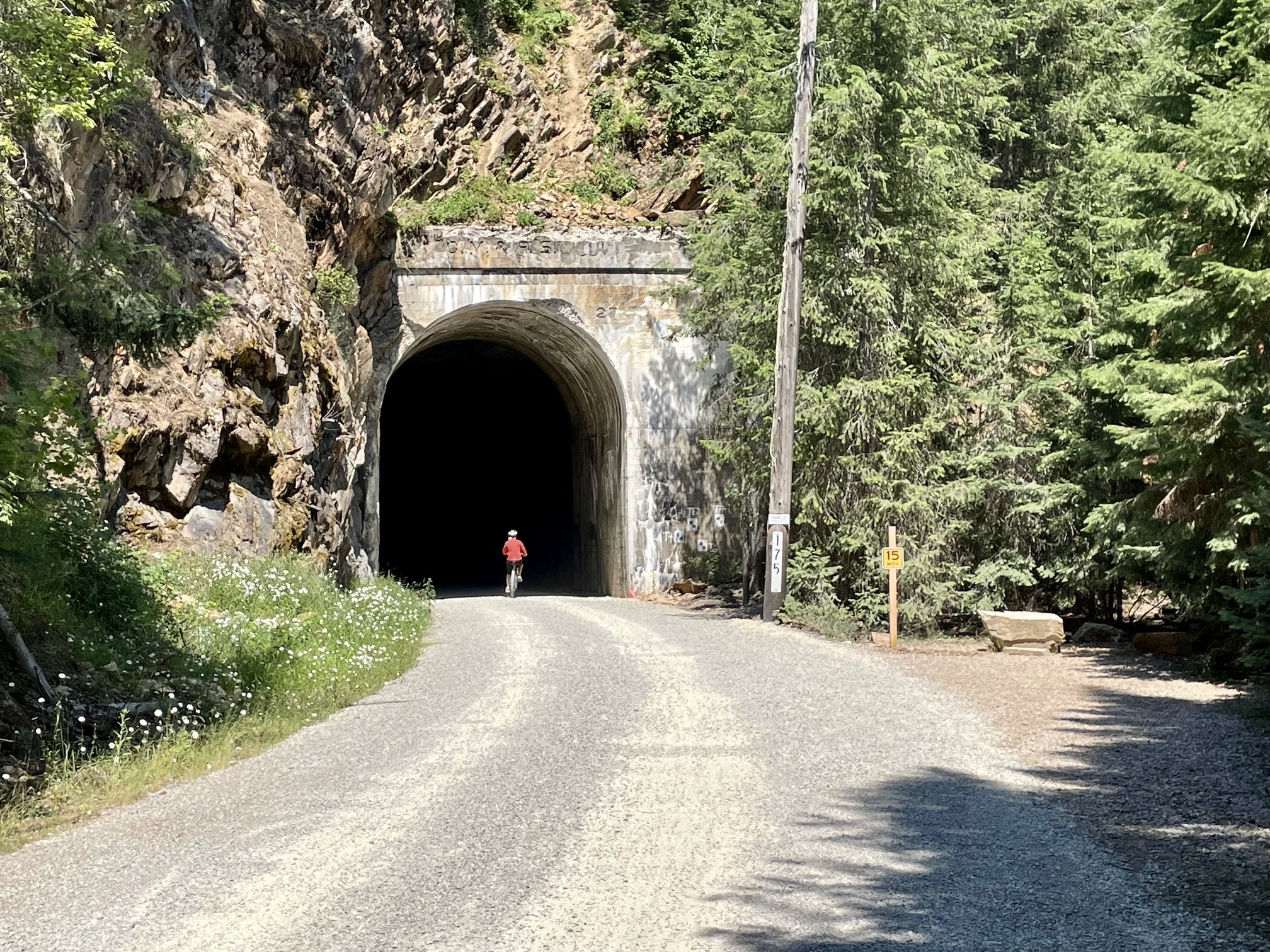
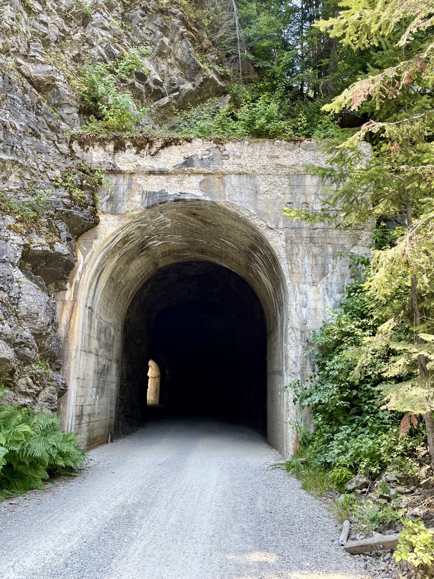
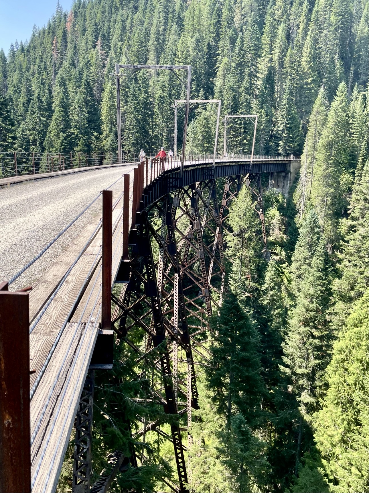
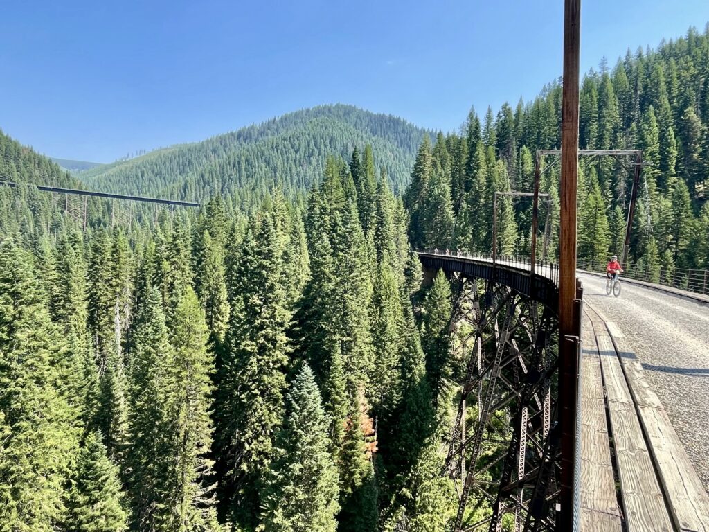
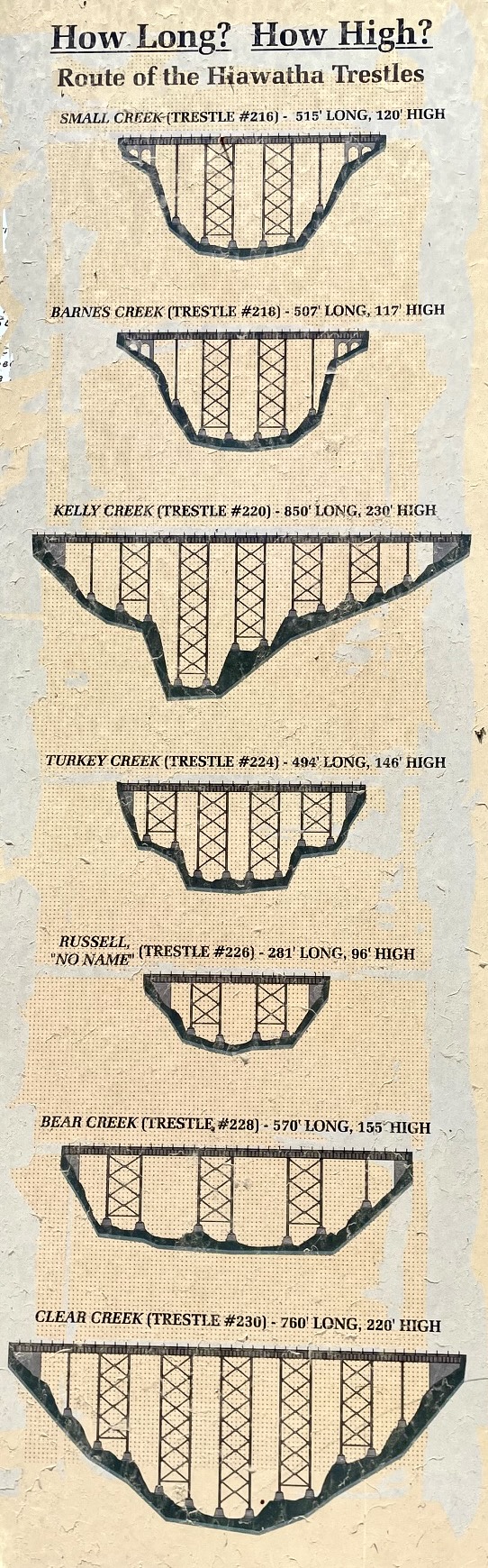
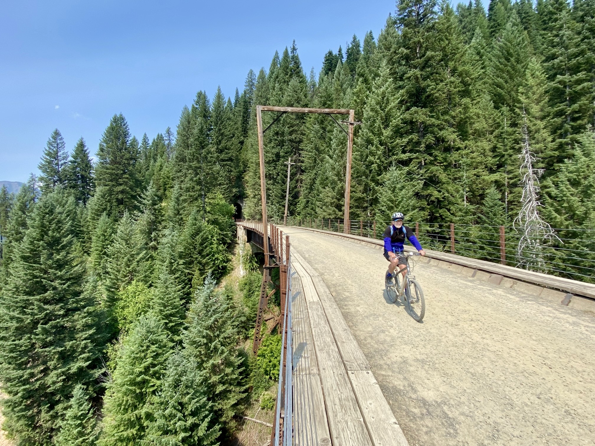
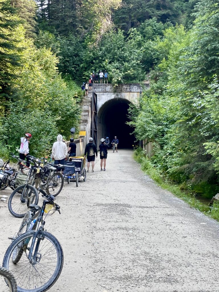
What sets the Hiawatha Bike Traverse apart from other gravel bike rides is the historical railroad infrastructure encountered along the way. Over the course of 15 miles, you will travel across seven high trestles and through nine or ten narrow tunnels (one of the tunnels is temporarily closed). The longest of these tunnels—the St. Paul Pass Tunnel—is a remarkable 1.66 miles long! Most of the trail crosses steep hillsides above deep canyons, with sweeping views of the densely forested Bitterroot Mountains.
.
With a starting elevation of 4150 feet and an ending elevation of 3180 feet, the entire bike traverse is all level or downhill. The lack of uphill riding, combined with gentle downhill gradients and fairly smooth trail surfaces, makes the ride suitable for a wide range of ages and abilities. It’s not uncommon to see riders as young as 5 and as old as 85 on any given day.
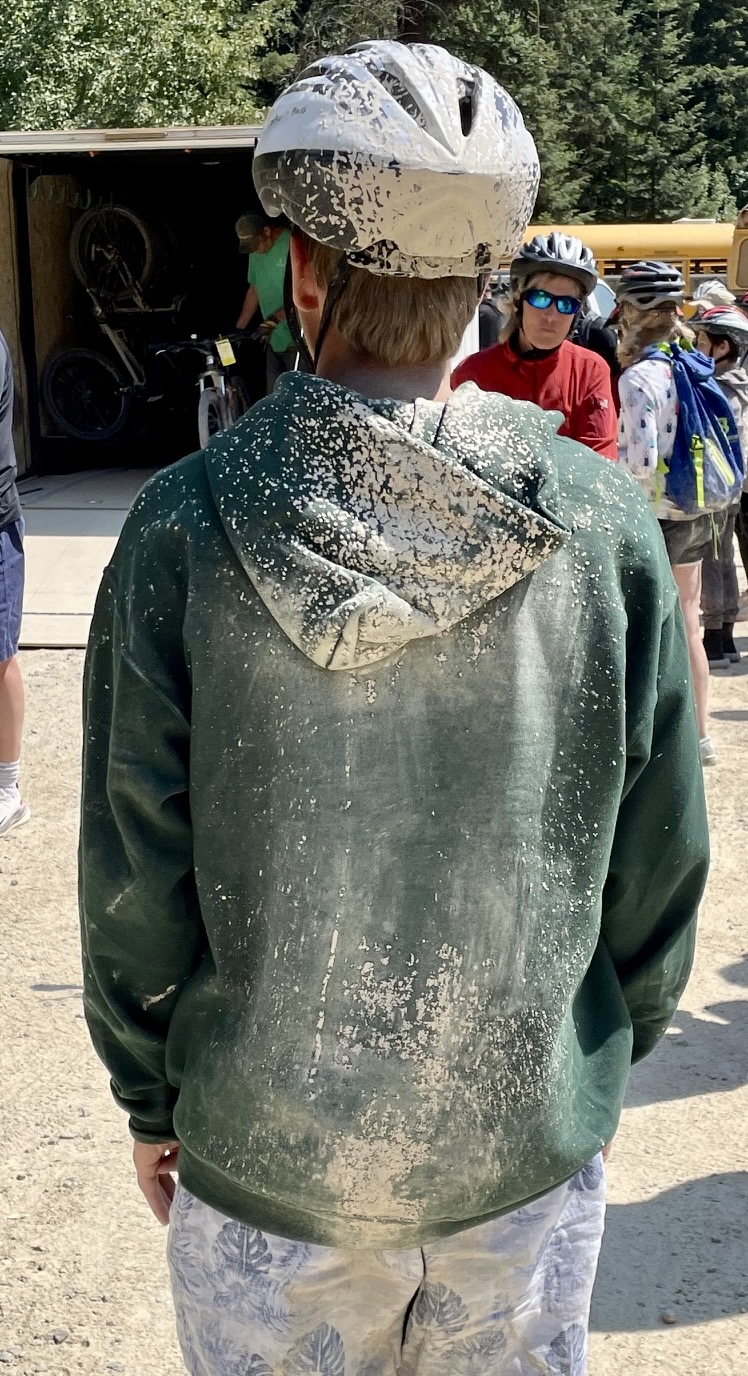
Aside from being exceptionally fun, scenic, and easy, I would also say that the Hiawatha Bike Traverse is the dirtiest gravel ride I’ve ever done. Even on dry summer days, the St. Paul Pass Tunnel is cold and drippy, creating a constant veneer of wet silt and clay over the trail surface. Unless you have front and rear fenders, your clothing will be splattered with gray mud, and even with fenders, your feet and legs will be splattered. Most riders simply embrace the mud and proudly wear their backside splatter marks like a badge of honor!

.
The Hiawatha Trail is typically open from Memorial Day Weekend through mid-September but is closed throughout the winter season. Be aware that a trail pass is required for all riders. Passes can be purchased at the starting point, but advance purchase (available online here) will speed up your registration and get you a small discount.
The Lookout Pass Ski Area and U.S. Forest Service have made it extremely convenient to do the bike ride as a one-way traverse. They have established a shuttle service that will transport you and your bike from the ending point to the Roland Trailhead, leaving you with a level 2-mile ride back to the actual starting point. You can also rent a bike, helmet, and handlebar light for a reasonable fee.
If you don’t want to pay for the shuttle service, you can arrange your own shuttle using private vehicles. It is also possible to avoid a shuttle entirely by doing an out-and-back ride, resulting in a total distance of approximately 30 miles.
Full Trip Report
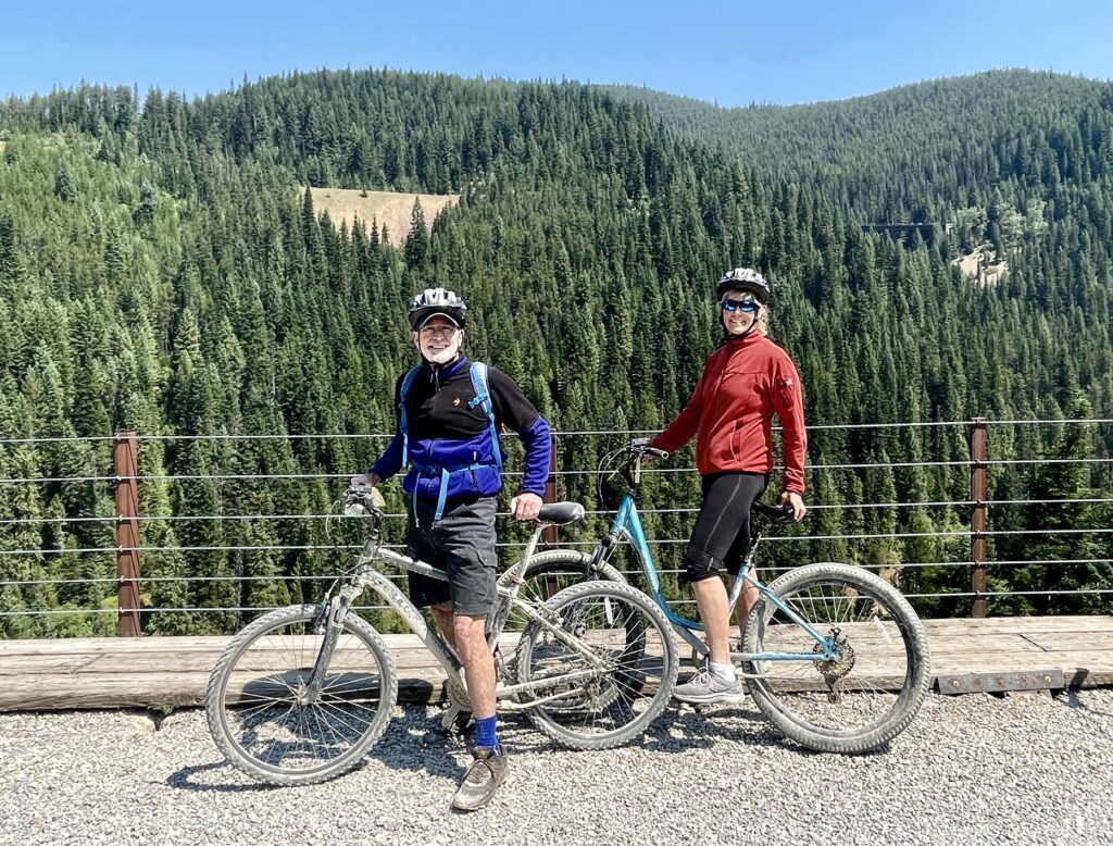
Eileen and I did our Hiawatha Bike Traverse on a warm Thursday in July. Coming from Wallace, Idaho, we stopped at Lookout Pass Ski Area to check in at the lodge desk. This wasn’t actually necessary, since we had purchased trail and shuttle passes in advance, but we did get some updated information about driving conditions and the ride itself.
From Lookout Pass, we drove 10 miles east on Interstate-90, made a U-turn, drove 5 miles back west, and got off the freeway at Exit 5 near Taft. (This circuitous approach was due to temporary road construction.). Signs directed us through a huge gravel yard and then 2 miles up Road 506 to the East Portal parking lot. Even at 10:00am on a weekday, there were more than 100 cars already parked here! We regretted not getting an earlier start.
.
At the registration tent, we were given trail passes and then taken around to the rental corral, where we were each outfitted with a bike, a helmet, and a handlebar light (all reserved and paid for in advance.). I carried a small rucksack with water and snacks for both of us. By 11:00am, we were ready to roll.
.
Within a minute after starting out from the East Portal Trailhead, we entered the St. Paul Pass Tunnel. This 1.66-mile-long tunnel is the longest of the entire ride, thereby also making it the eeriest and coldest. If you’ve never ridden through a long railroad tunnel before, I can assure you that it is a unique and surreal experience! The tunnel is so dark and monochromatic, it seems to absorb light from even the brightest headlight, and voices echo confusingly off the walls. Even though we wore sweaters going in, we were thoroughly chilled by the time we emerged from the west portal.
.
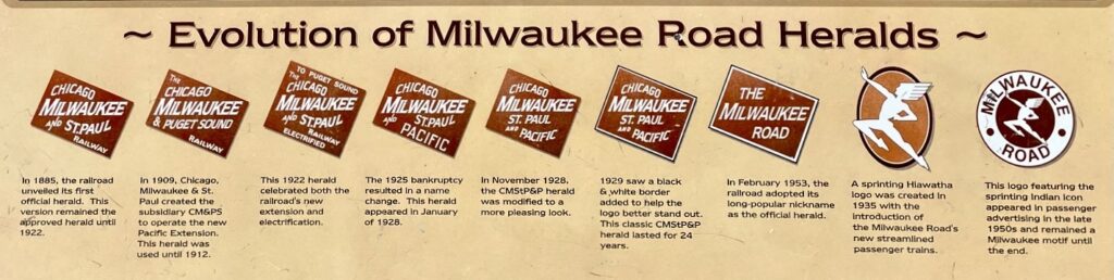
During the remaining 13 miles of our ride, we passed through eight more tunnels (Tunnel 23 was closed at the time). The next longest tunnel (Tunnel 22) was 0.28 miles long, but most other tunnels were fairly short. It was interesting to see the initials “CM&PS” stamped in the concrete headwall of many tunnel entrances, as a reference to one of the railroad’s interim names: Chicago, Milwaukee & Puget Sound.
.
.
.
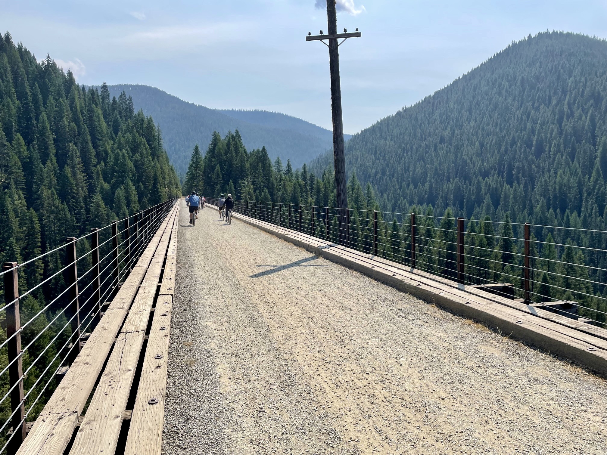
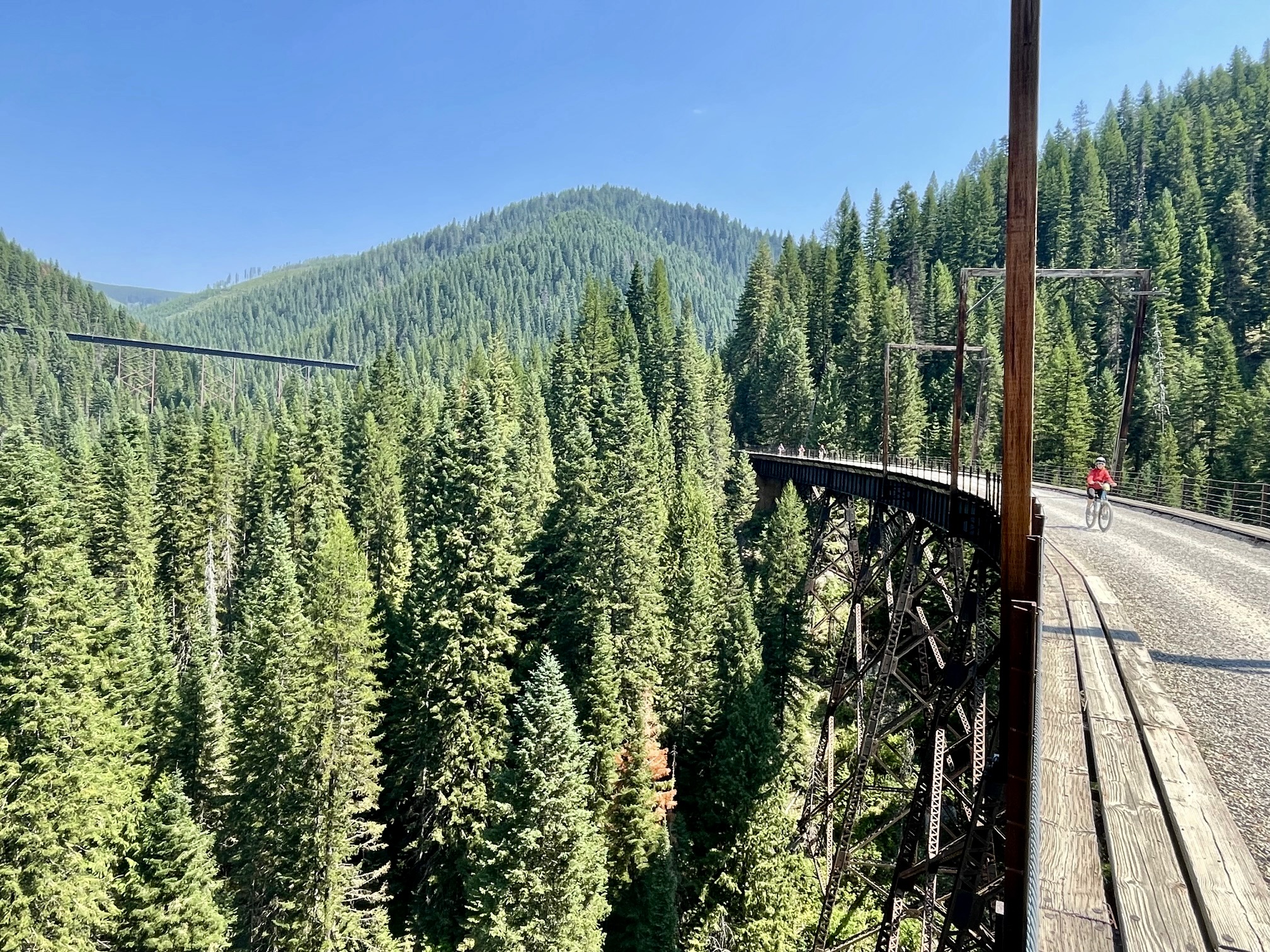
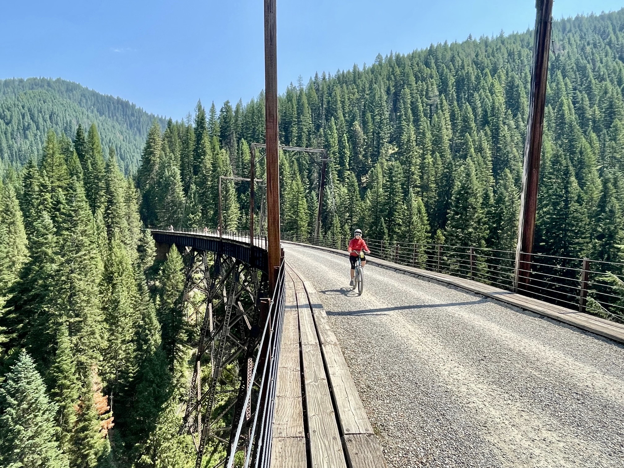
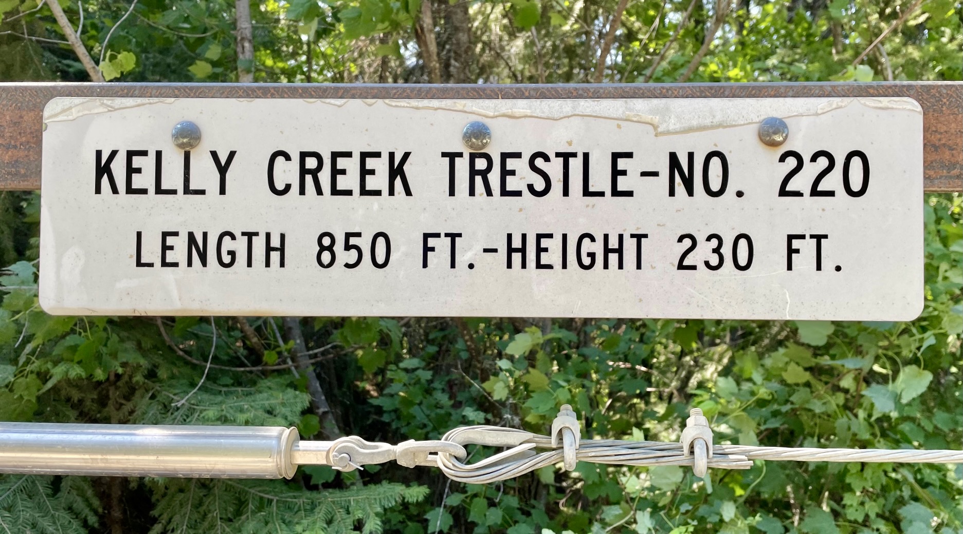
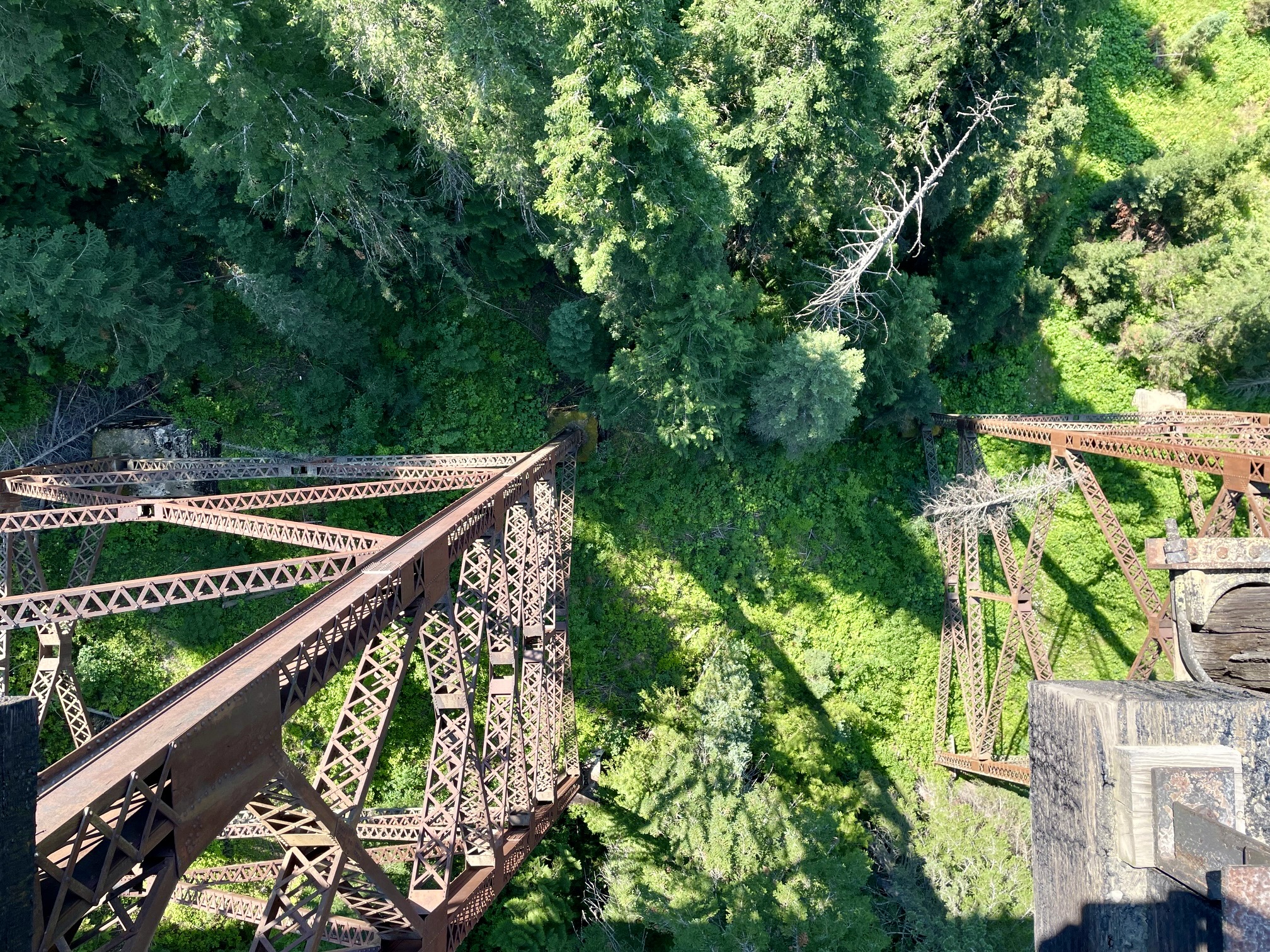
Whereas the first half of the traverse features most of the tunnels, the second half features most of the trestles. These steel lattice structures range from 280 to 850 feet long, and they span creek valleys ranging up to 230 feet deep. We tried to imagine the construction challenges encountered when they were built in the early 1900s.
.
.
.
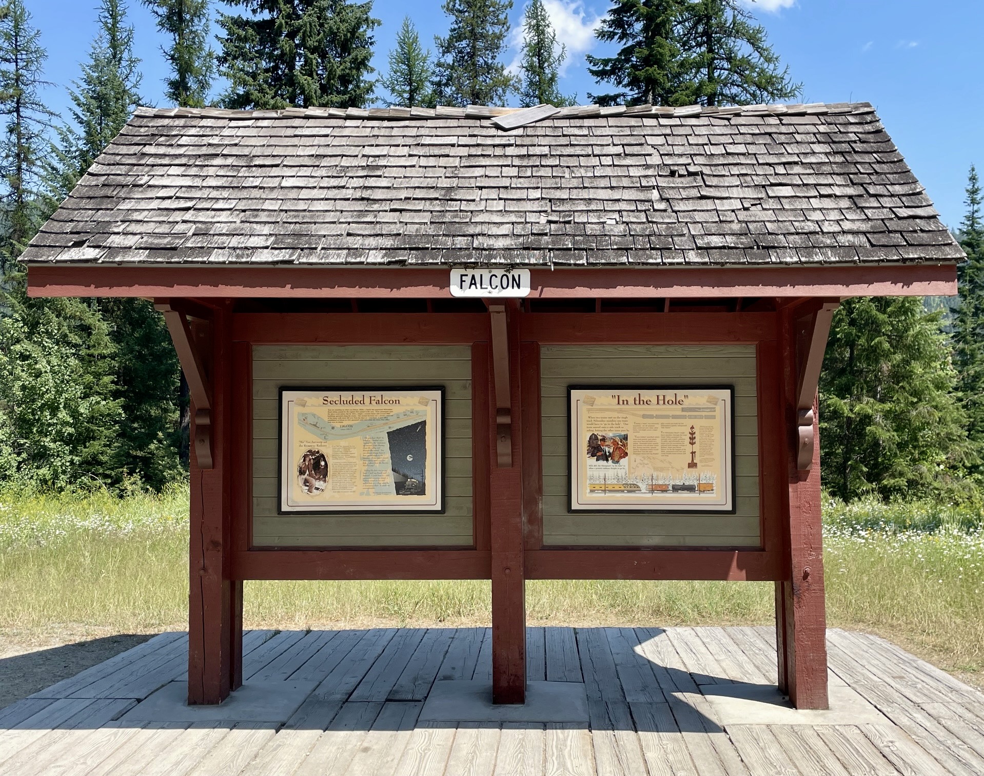
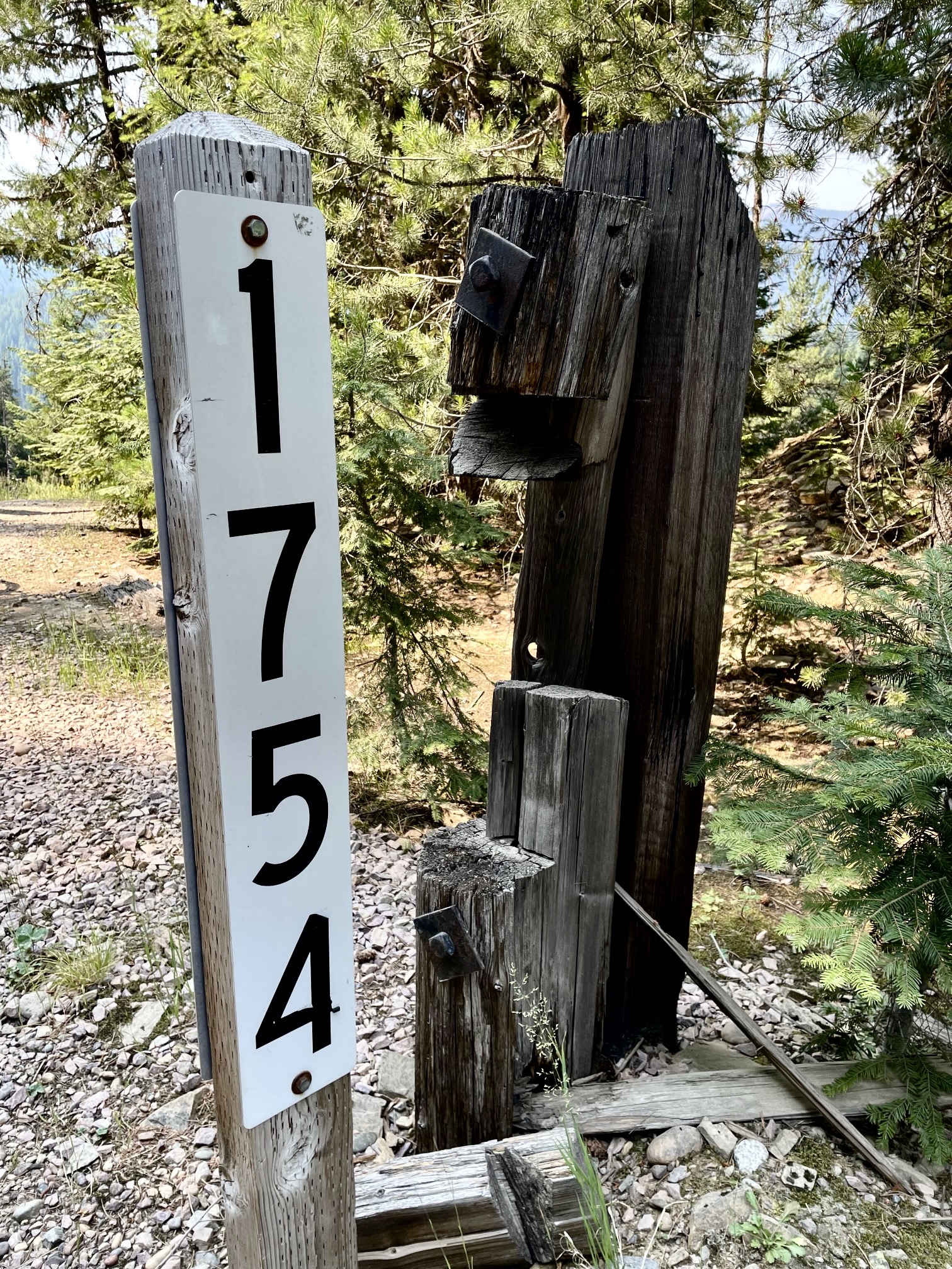
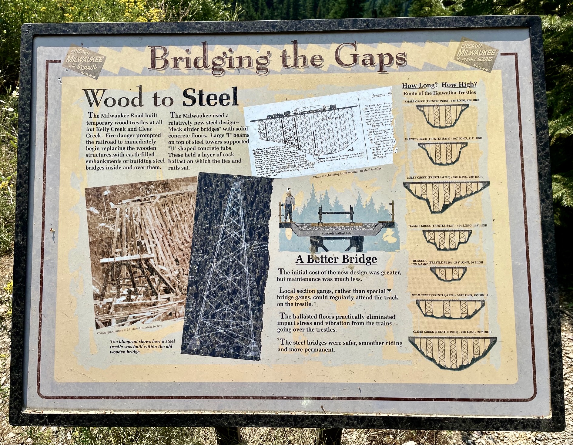
In between the tunnels and trestles, we cruised along the smooth trail with scarcely any effort. Only modest pedaling and braking were needed to negotiate the flats and downhills. However, our progress was continually interrupted by the presence of numerous historical information signs, which describe interesting details regarding the railway company, the tunnels, the trestles, and other railroad issues. Old mileposts along the trail tick off the rail distance from Chicago.
.
.
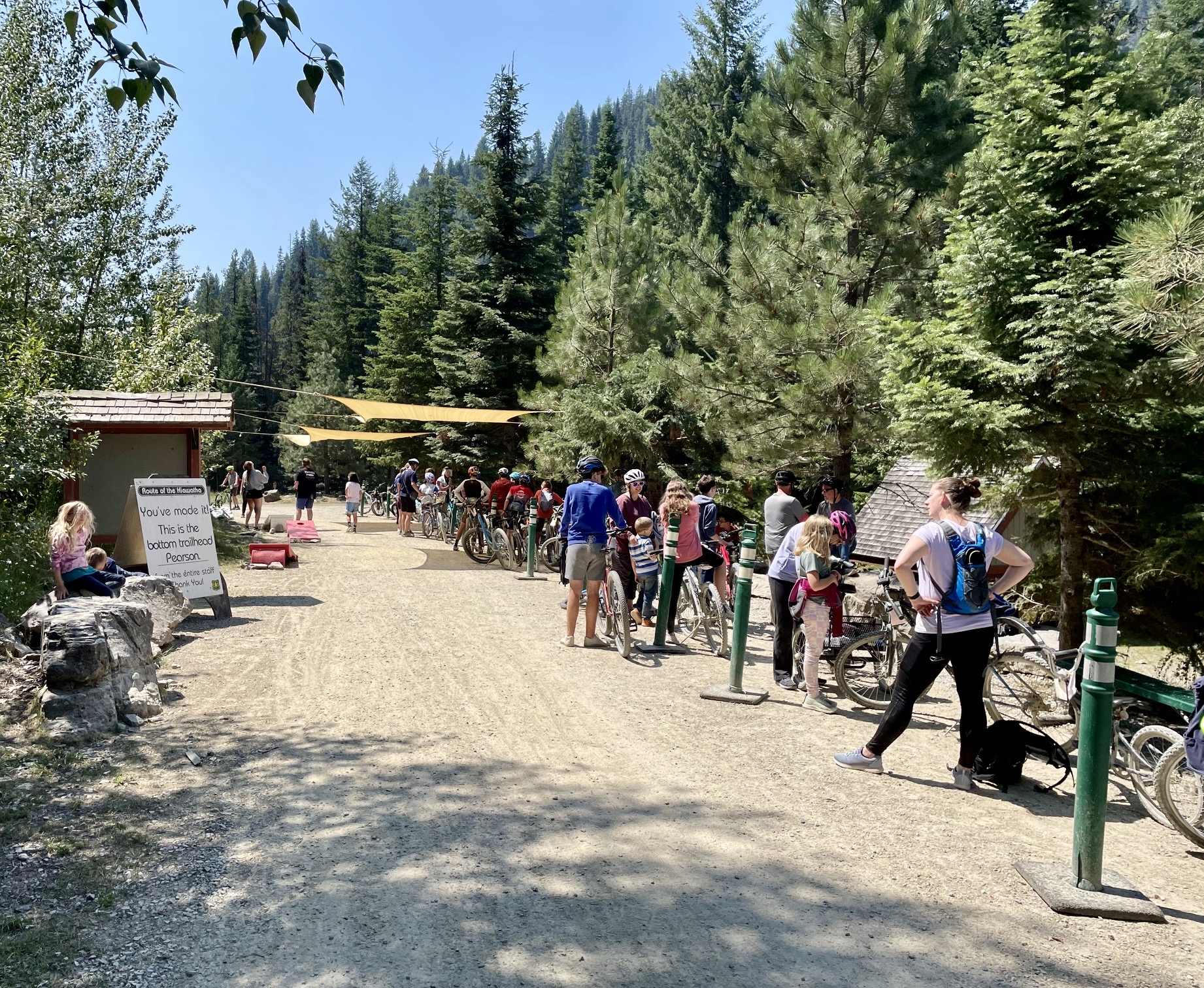
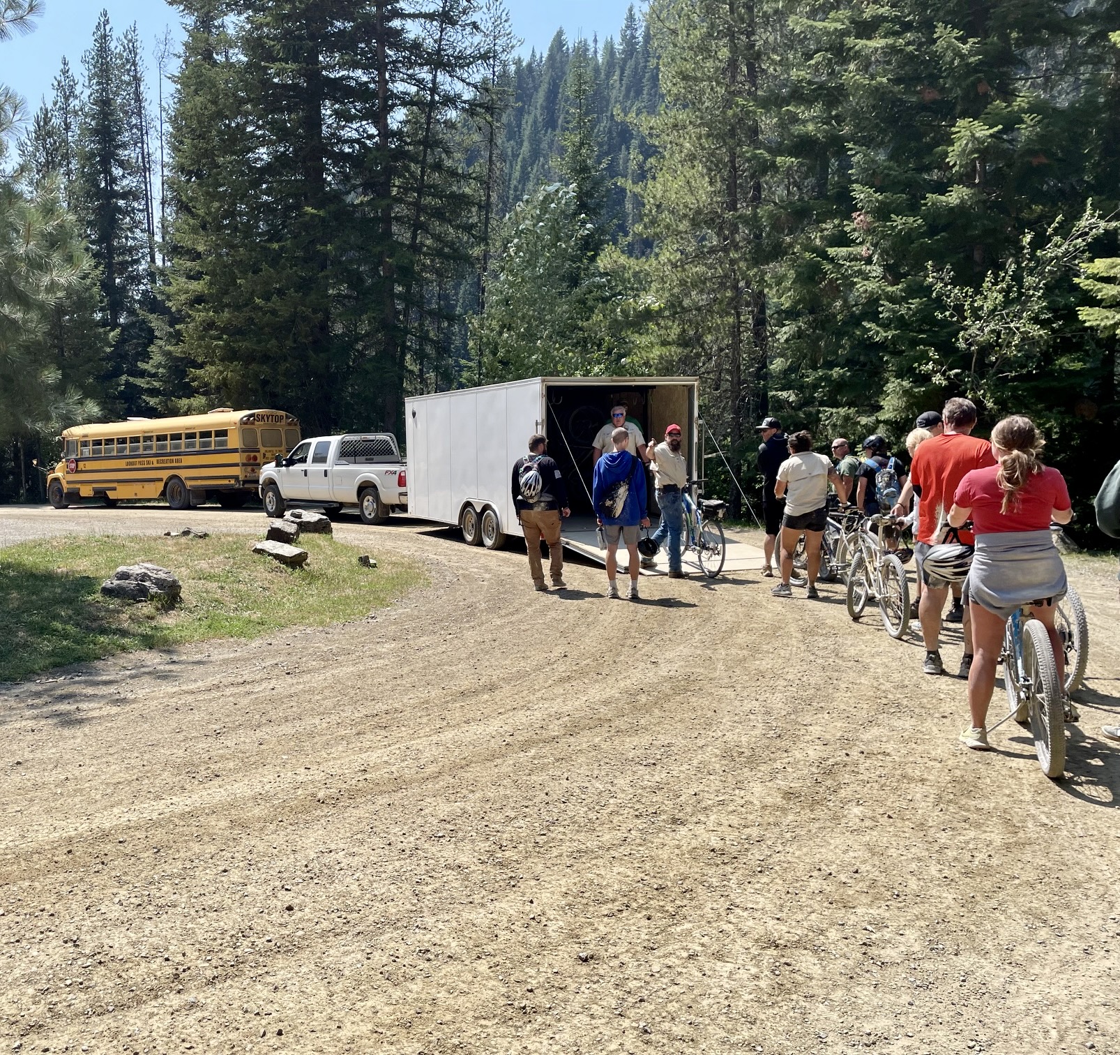
All too soon, we arrived at the Pearson Trailhead, our primary finish line for the traverse. It was early afternoon, and a long queue had formed for the shuttle bus. After a wait of about 45 minutes, our bikes were loaded into a trailer, and we hopped aboard a repurposed school bus with 50 or so other riders. A 30-minute bouncy ride delivered us all back at the Roland Trailhead near the St. Paul Pass Tunnel’s west portal.

.
.
Because our traverse had begun at the East Portal Trailhead, everyone got to enjoy another ride through the 1.66-mile-long St. Paul Pass Tunnel in order to reach our actual starting point. This gave us all a chance to refresh and enhance the mud splatters that we’d earned the first time through!
.
Eileen and I turned in our rental bikes, helmets, and lights at the registration tent, thereby formally ending our ride. It had taken us about 4 hours from start to finish while maintaining a relaxed pace that allowed us to savor the whole experience. The Hiawatha Trail had served up a one-of-a-kind rails-to-trails bike traverse that we’ll never forget!
Equipment Comments
The Hiawatha Trail is well-suited to either a conventional mountain bike, a fat-tire bike, or a specialized gravel bike. A standard road bike with narrow tires would not be suitable, due to random rocks and potholes along the way. Class 1 e-bikes are allowed, as are Class 2 e-bikes with a disabled throttle. Regardless of bike type, a bright handlebar light is required, and a helmet is strongly recommended.
Conventional mountain bikes and Class 1 e-bikes are available for rent at the East Portal Trailhead and can be reserved online. Eileen and I rented our bikes for $40 each, including a handlebar light and helmet. We both found this equipment to be fully adequate for the traverse. I spoke to several people who had rented e-bikes, and they all indicated that the pedal-assist feature was really unnecessary, since the trail has no uphill segments.
After completing the ride, we were very happy to have rented bikes and other gear rather than bringing our own gear from home. The fine-grained silt and clay particles contained in the trail mud tend to infiltrate every tiny gap and orifice on a bike and, over time, will wreak havoc on mechanical components.
As previously mentioned, you should expect that your clothing and shoes will become splattered with silt and clay. We observed numerous riders employing various means to protect their backsides, such as using disposable plastic capes and cardboard shields. Even with these means, I suggest that you not wear your best cycling clothes, and I recommend that you bring a complete change of clothing and shoes for after your ride.
Route Maps
…
…
…
Photo Gallery
Click to enlarge…