Trip Date: July 13-19, 2019
Chelan Mountains Climbing Trip & Grouse Pass Loop: South Pyramid Creek to North Fork Entiat River
South Pyramid Creek
Pyramid Mountain / Lookout (8243′)
Squaretop Mountain (8189′)
Grouse Pass
Grouse Pass Pinnacle (7362′)
Saska Basin
Saska Pass
Gopher Mountain (8001′)
Snow Brushy Creek
Cardinal Peak (8590′)
Emerald Peak (8422′)
North Fork Entiat River
- Trip Report Summary
- Related Posts
- Full Trip Report
- Day 1: Trailhead to Corral Creek Confluence
- Day 2: Corral Creek Confluence to Pyramid Mtn Summit to Knoll 7378
- Day 2 (late PM): Squaretop Mtn Summit Climb
- Day 3: Squaretop Ridge Loop + Cloudcomb Peak Reconnaissance
- Day 4 (AM): Knoll 7378 to Saska Basin + Grouse Pass Pinnacle Climb
- Day 4 (PM): Gopher Mtn Summit Climb
- Day 5: Snow Brushy Creek Hike
- Day 6 (AM): Cardinal Peak Summit Climb
- Day 6 (PM): Emerald Peak Summit Climb
- Day 7: Saska Basin to Trailhead
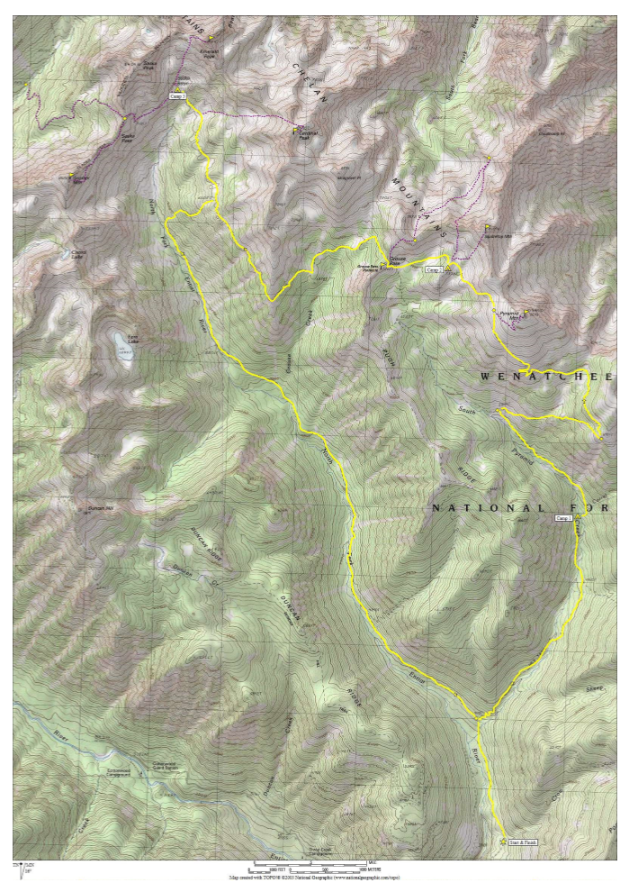
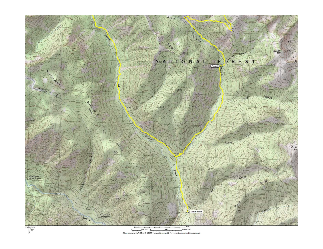
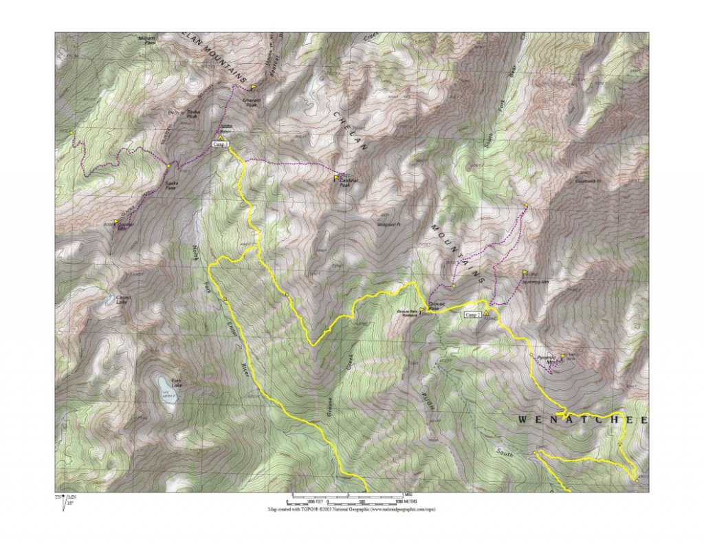
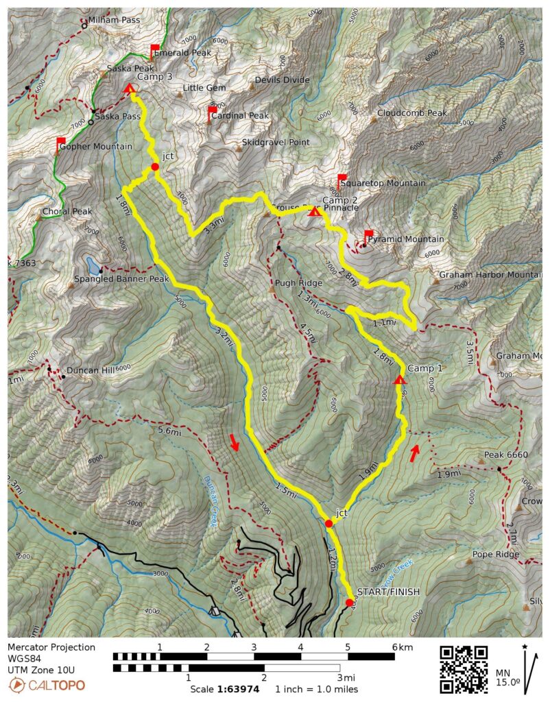
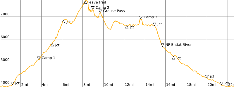
- Route Maps & Profile
- Photo Gallery
Trip Report Summary
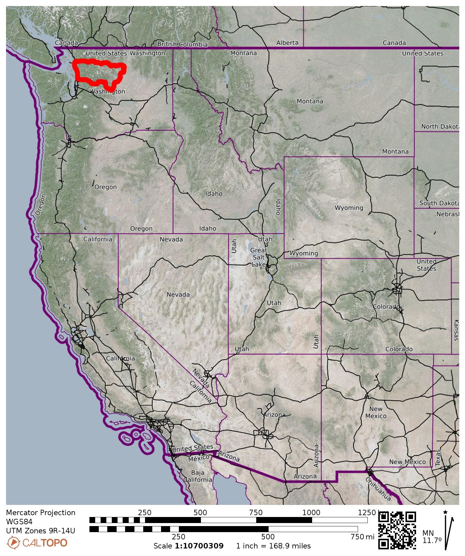
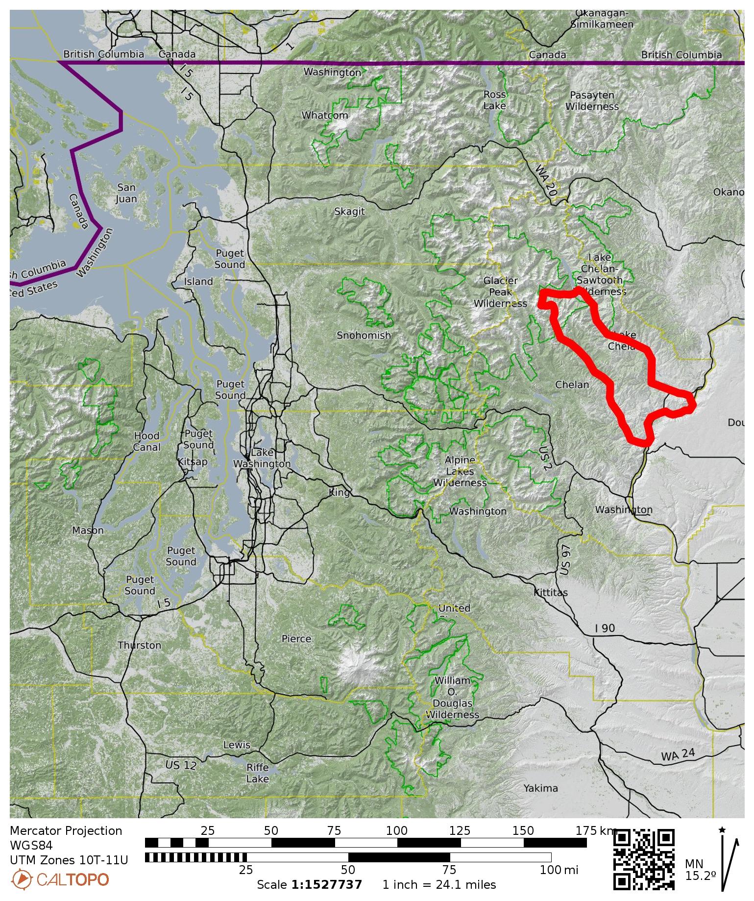
Region: North-Central Washington Cascades
Sub-Region: Chelan Mountains
Area: Okanogan – Wenatchee National Forest
Starting & Ending Point: North Fork Entiat River Trailhead at end of North Fork Entiat River Road #5606 (Elev. 3950 feet)
Way Points: Crow Creek & South Pyramid Creek & Corral Creek Confluence & Junction 6901 & Pyramid Mountain summit & Knoll 7378 & Grouse Pass & Saska Basin & North Fork Entiat River & Grouse Creek & South Pyramid Creek (trail hike & rock scramble)
High Point: West flank of Pyramid Mountain (Elev. 7700 feet)
Campsites: Corral Creek Confluence & Knoll 7378 & Saska Basin
Summit: Pyramid Mountain (ascent via lookout trail; off-trail descent via Northwest Slope)
Summit: Squaretop Mountain (off-trail hike & rock scramble via Southwest Slope)
Sidetrip Loop: West Squaretop Ridge Notch & South Fork Bear Creek Cirque & West Squaretop Ridge Saddle & Grouse Pass (off-trail hike & rock scramble & rappel)
Summit: Grouse Pass Pinnacle (rock climb via Northeast Chimney)
Sidetrip: Saska Pass (trail hike)
Summit: Gopher Mountain (off-trail hike & rock scramble via Northeast Ridge—East Face)
Sidetrip: Saska Pass & Snow Brushy Creek (trail hike & off-trail hike)
Summit: Cardinal Peak (off-trail hike & rock scramble via Northwest Couloir—Northeast Ridge)
Summit: Emerald Peak (off-trail hike & rock scramble via Southwest Slope—Northwest Ridge)
Approximate Stats (basic loop hike only): 23 miles traveled; 7000 feet gained & lost.
Approximate Stats (including all sidetrips & summits): 42 miles traveled; 19,000 feet gained & lost.
…
Related Posts
Grouse Pass Loop: North Fork Entiat River to South Pyramid Creek – September 2006
Milham Pass Traverse + Cardinal Peak + Emerald Peak + Saska Peak + Pinnacle Mtn – September 1998
Full Trip Report
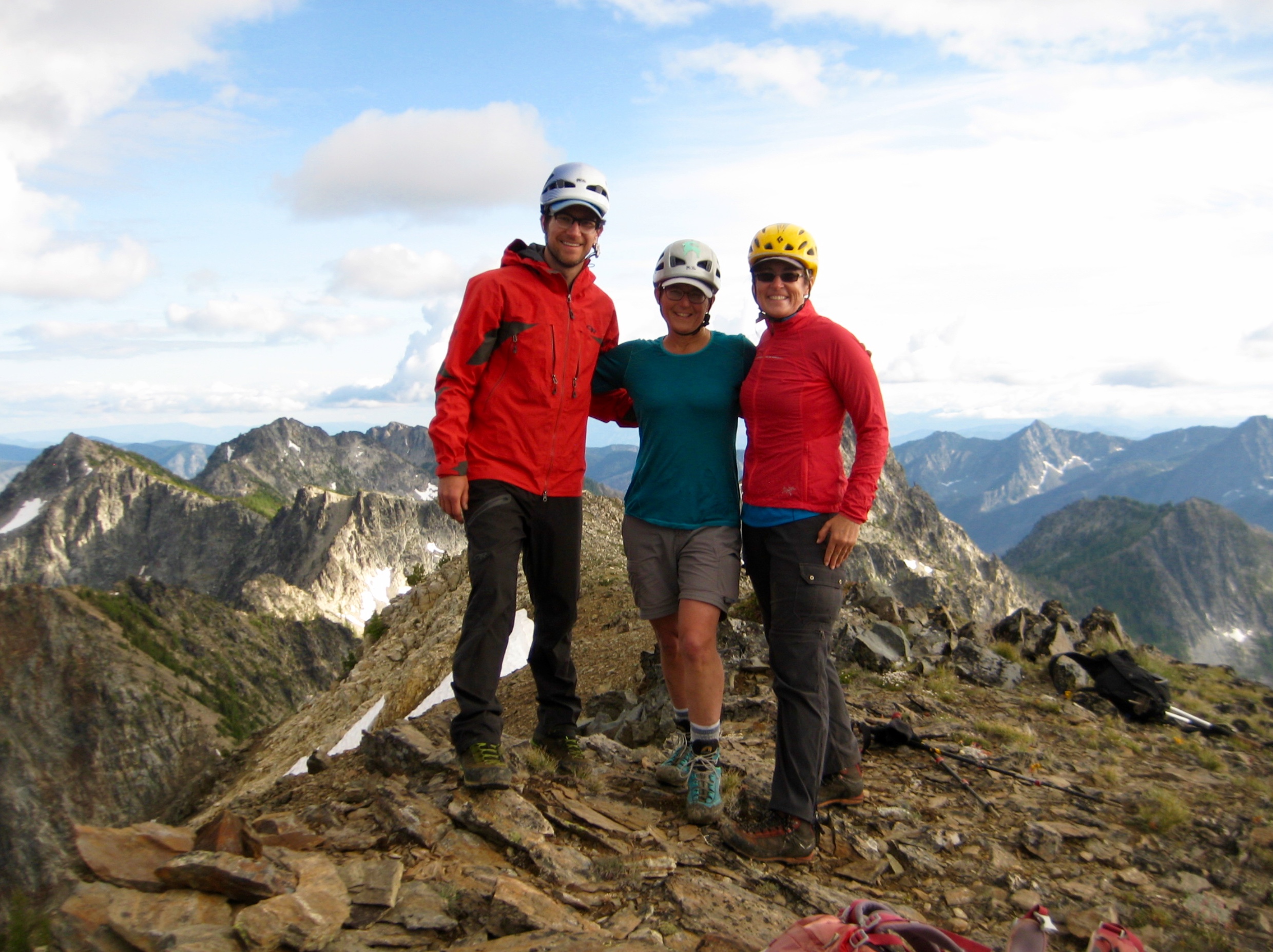
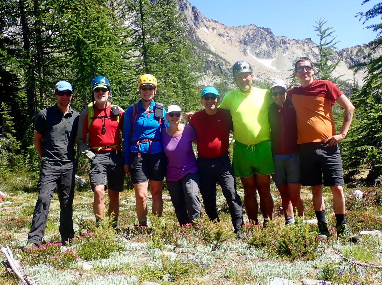
After having our planned weeklong trip to the Olympics rained out, Tony, Susie, Eric, David, Lisa, Kevin, Eileen, and I quickly shifted gears and headed to the Chelan Mountains. In a normal July, the Chelan Mountains would be uncomfortably hot, but this July has been far from normal. What we got was a lot of pleasantly cool weather, as well as some unpleasantly frigid weather and an unusual amount of rain. Nonetheless, we all had a fun trip with plenty of trail miles, summit views, and camp chatter.

- Full Group At Saska Basin (photo by Eric)
Day 1: Trailhead to Corral Creek Confluence
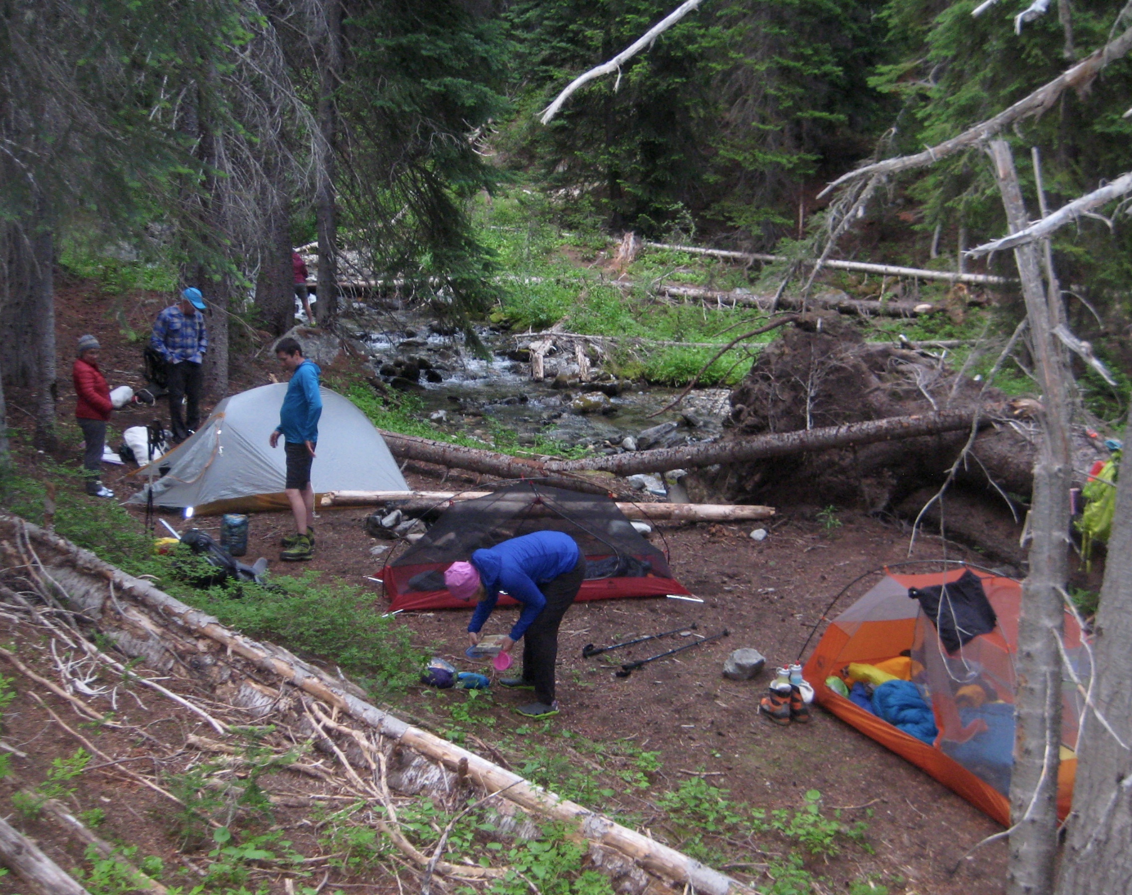
Our group of eight met at the North Fork Entiat River Trailhead on a warm, sunny, Saturday afternoon. We shouldered backpacks and began hiking up the river trail, which passes through burned-out forest with numerous fallen logs. After a long mile, we turned up the South Pyramid Creek Trail, and burned trees were soon replaced by green forest with fewer downed logs. We stopped for the night at a nice established campsite near the confluence of South Pyramid Creek and Corral Creek (3.2 hours + 1500 feet from TH).

- Camp 1 At South Pyramid Creek & Corral Creek Confluence
Day 2: Corral Creek Confluence to Pyramid Mtn Summit to Knoll 7378
The morning was cool and clear as we hiked farther up South Pyramid Creek and then up the Pyramid Mountain Trail. At a 6901-foot junction, Kevin, Eric, and David dropped backpacks and scurried off to Graham Mountain, while the rest of us continued up Pyramid Mountain.

- High On Pyramid Mtn Trail
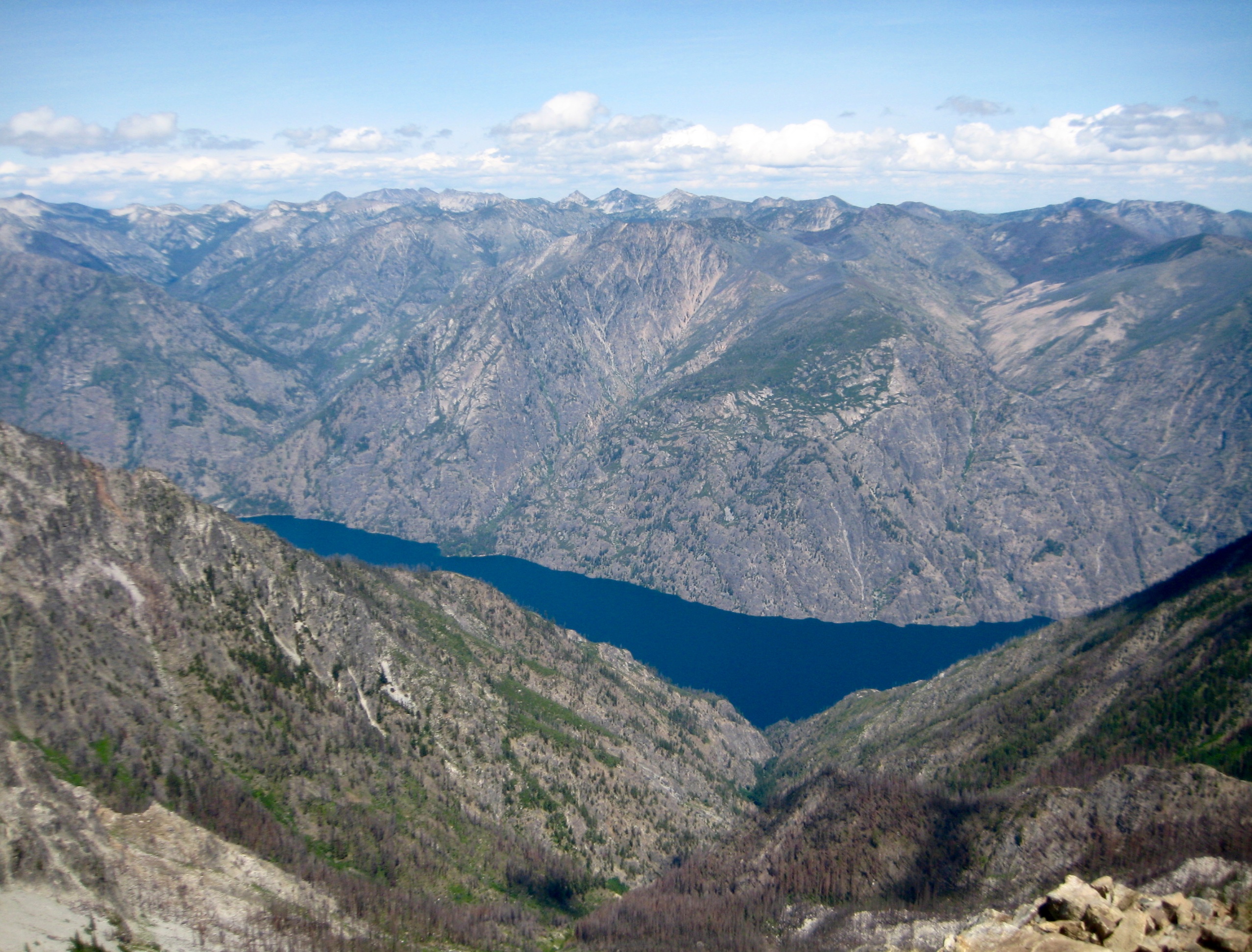
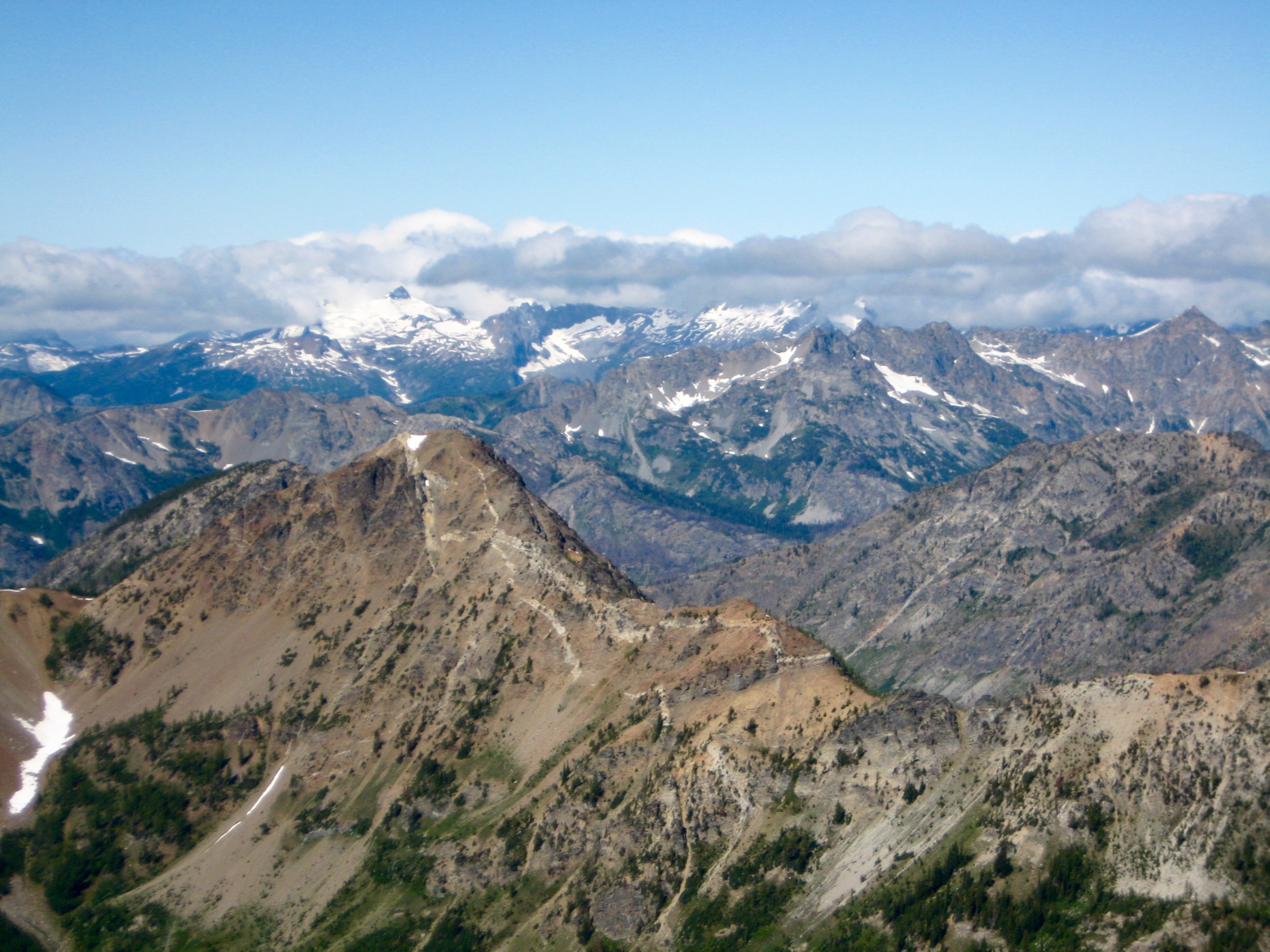
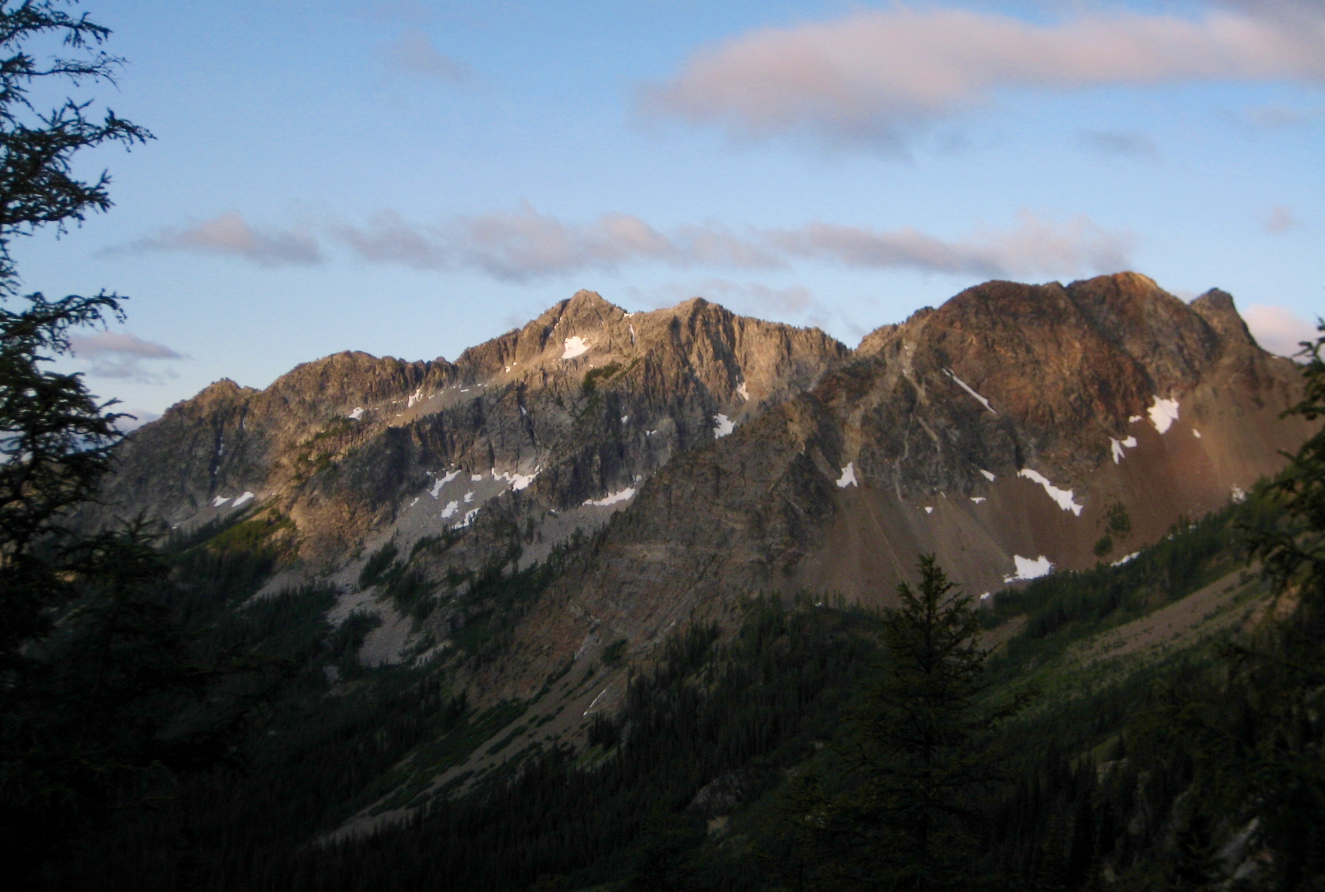
We reached the summit in time for lunch (5.8 hours + 3300 feet from Camp 1), and our side-trippers joined us a while later. This former lookout site has always been one of my favorite places, with remarkable views over the eastern Cascades and 7000 feet down to Lake Chelan.

- Lake Chelan From Pyramid Mtn

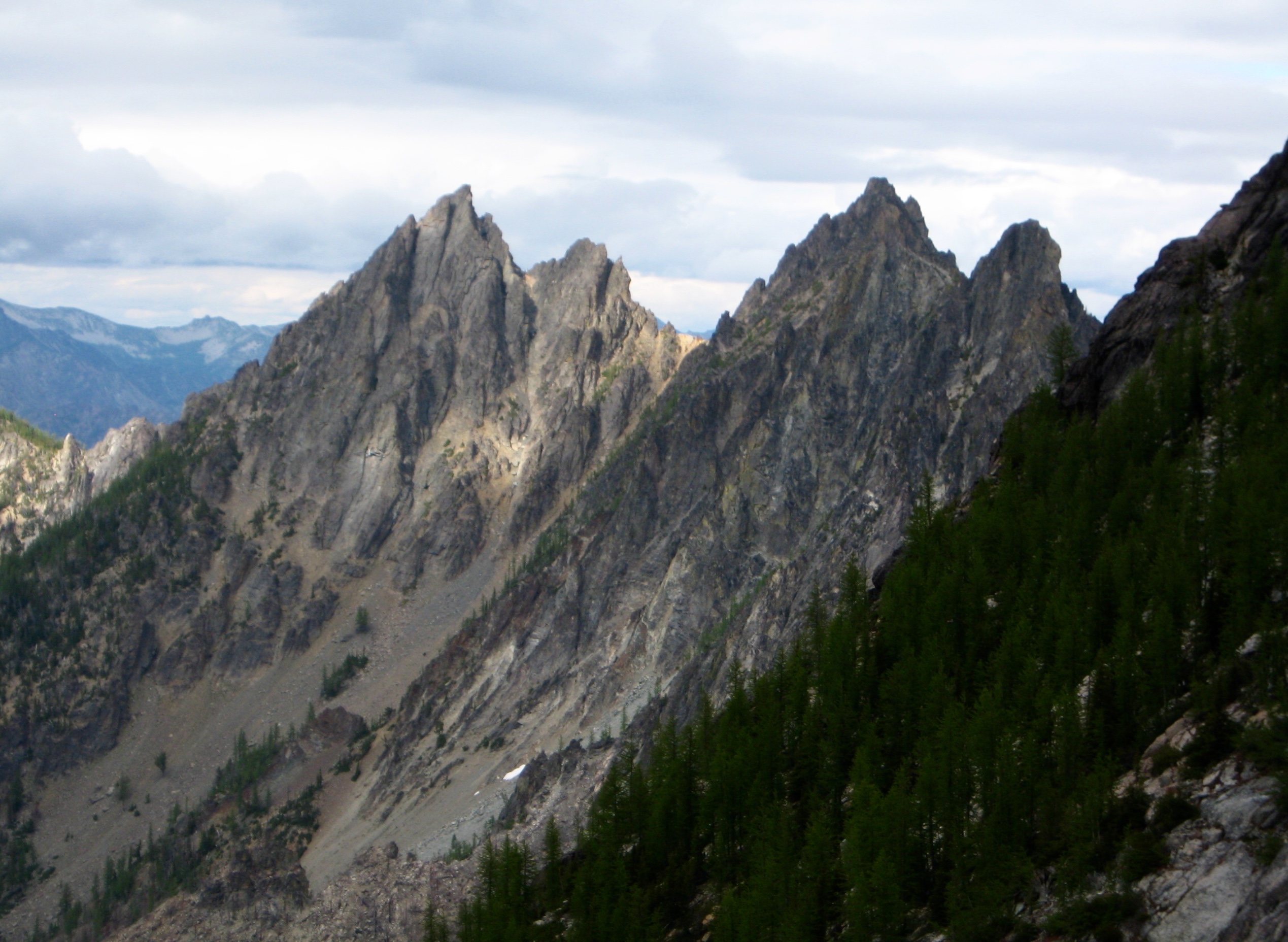
- Squaretop Mtn & Cloudcomb Peak From Pyramid Mtn
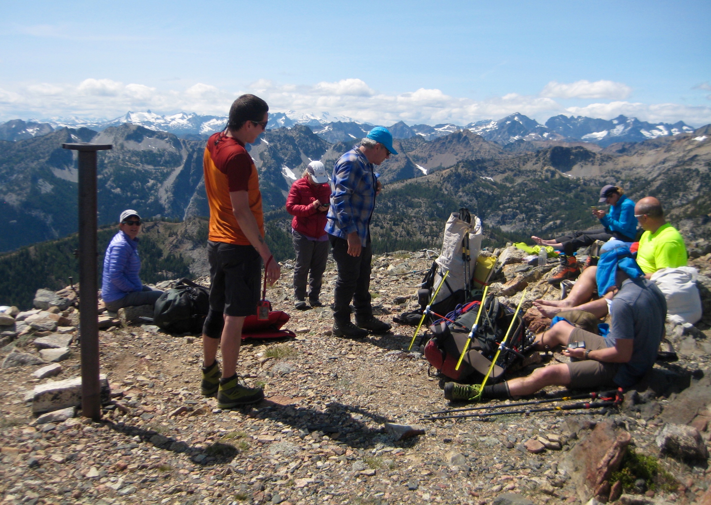
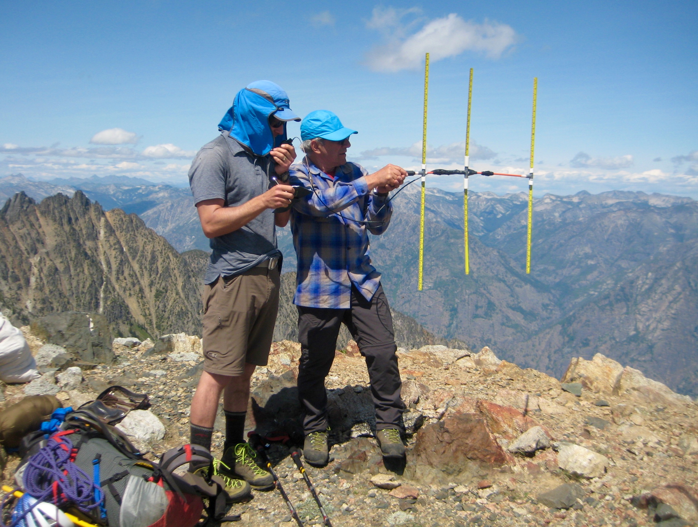
During our lunch break, David surprised us by pulling a short-wave radio and portable antenna from his pack. It turns out that he is an avid participant of Summits On The Air (SOTA) and is working toward his “Mountain Goat” certificate. With Tony carefully aiming the antenna, David was able to contact four other “hams” around the state, thereby collecting 10 SOTA points.

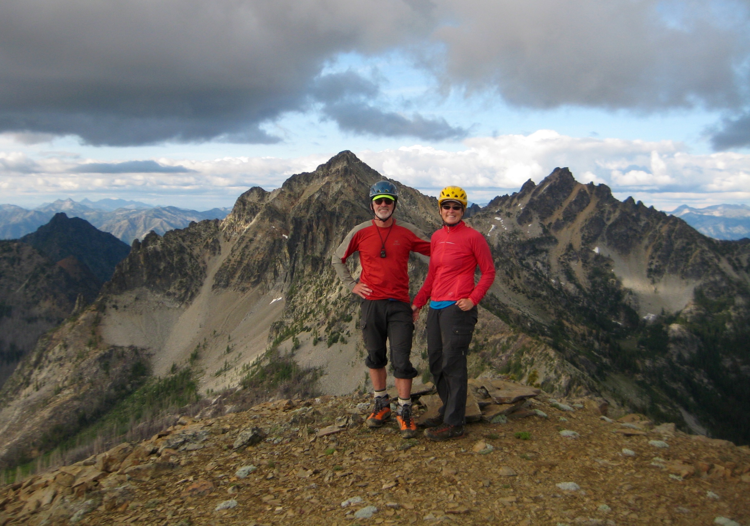
- Group On Pyramid Mtn Summit

- David With Radio & Tony With Antenna On Pyramid Mtn Summit
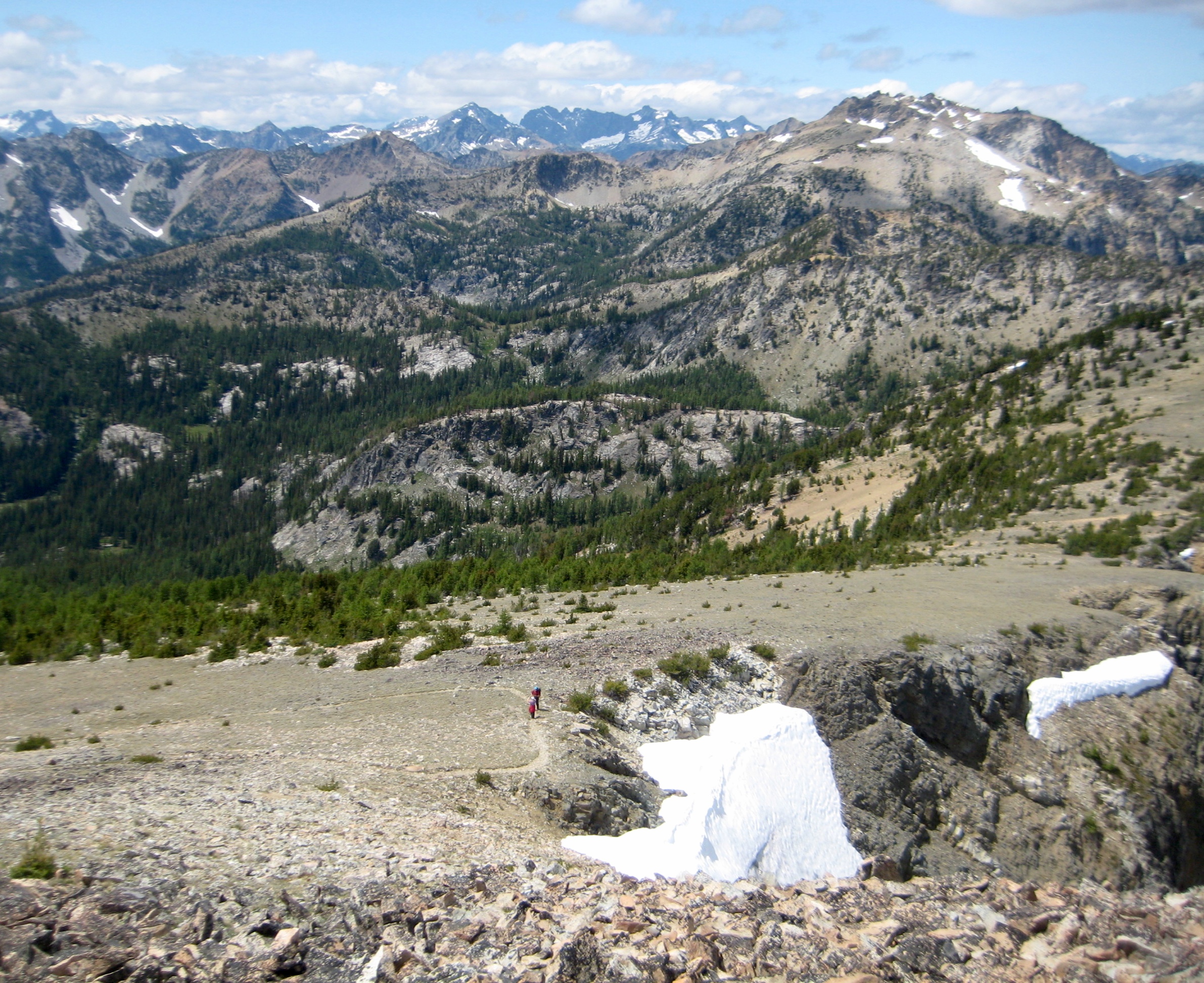
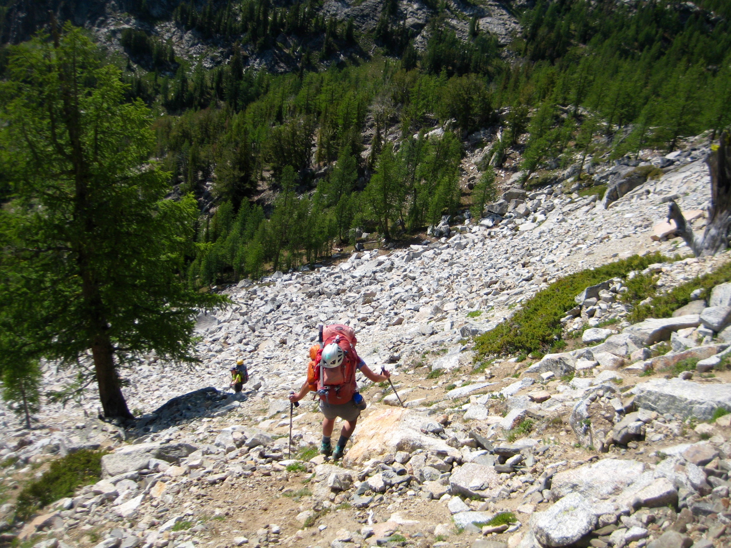
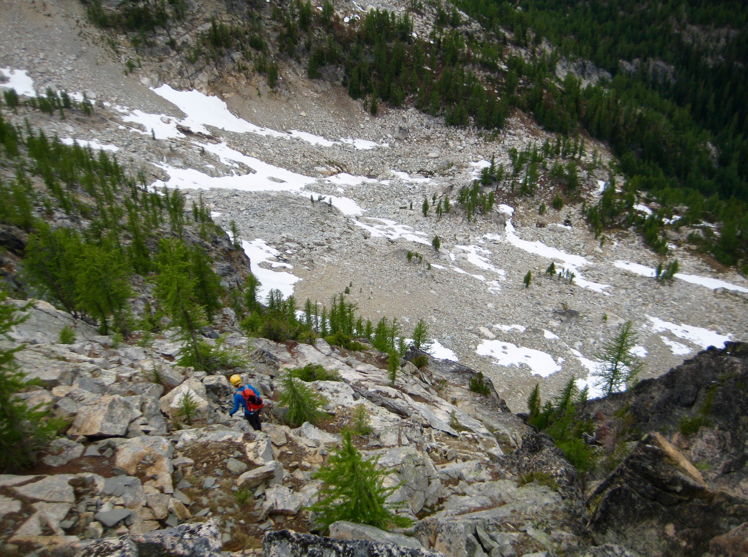
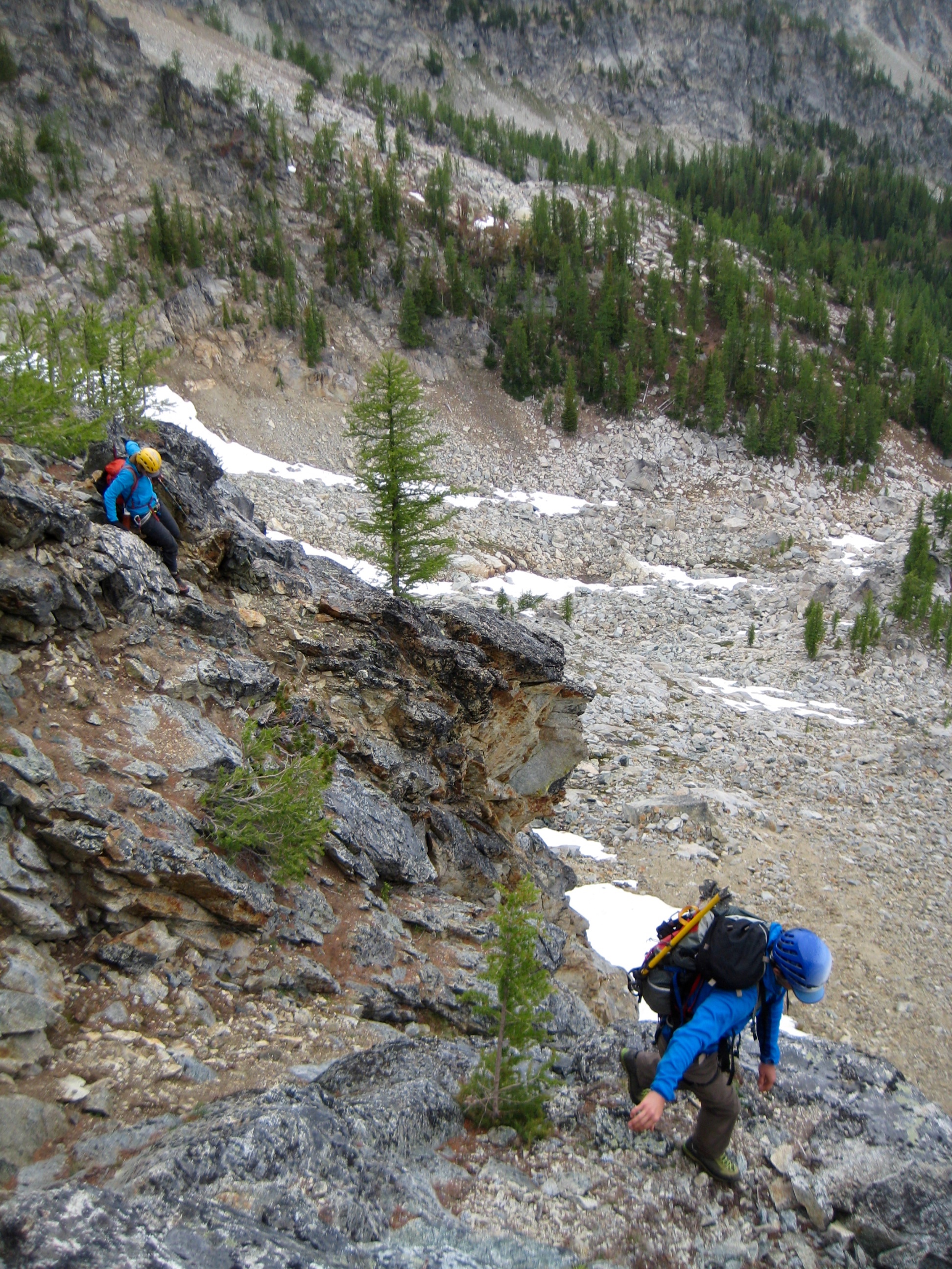
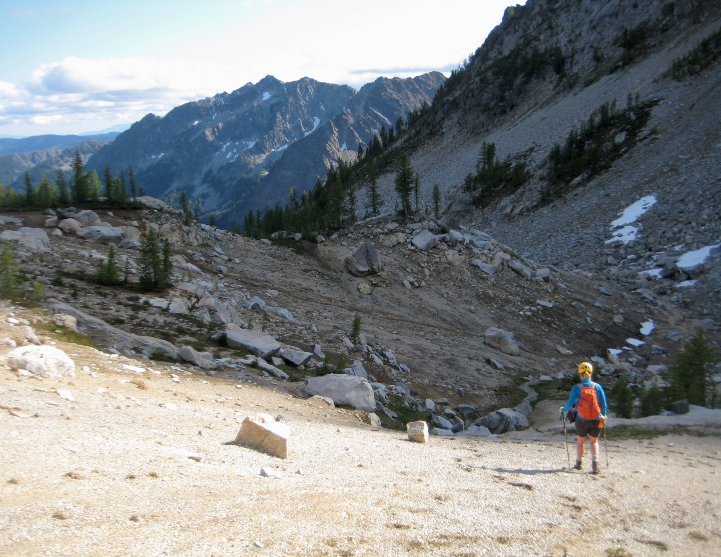
After a long lunch, we all packed up and headed down the trail to a 7700-foot switchback, then began a descending cross-country traverse in a northwesterly direction. Our only difficulty was a steep, loose scree and talus slope.

- Descending Toward Camp 2
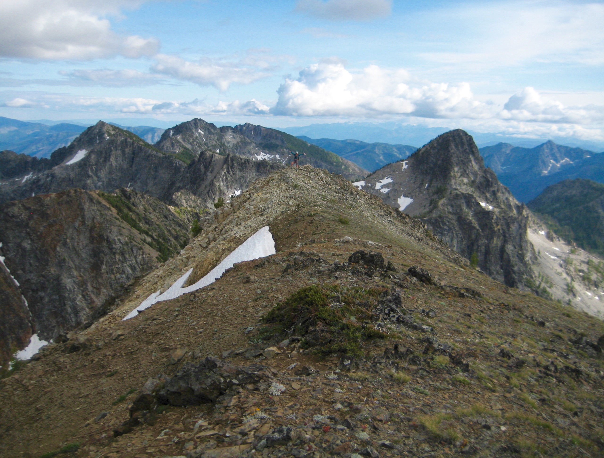
Terrain gradually transitioned into gentle meadows and larch groves as we steered toward Knoll 7378. Most of our group proceeded to the knoll and established Camp 2 (9.0 hours + 3500 feet from Camp 1), but David, Eileen, and I took the opportunity to scramble up nearby Squaretop Mountain.
Day 2 (late PM): Squaretop Mtn Summit Climb
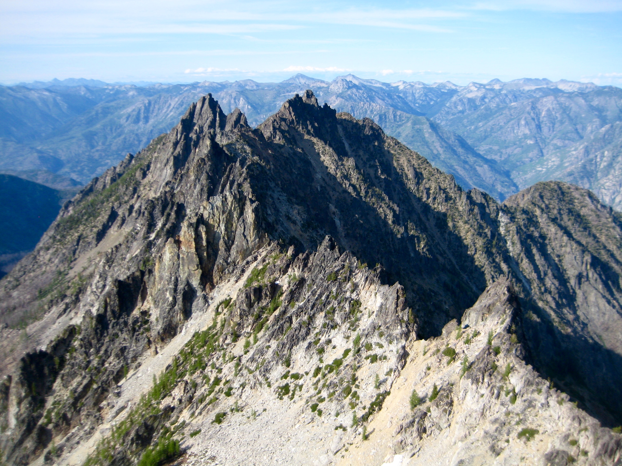
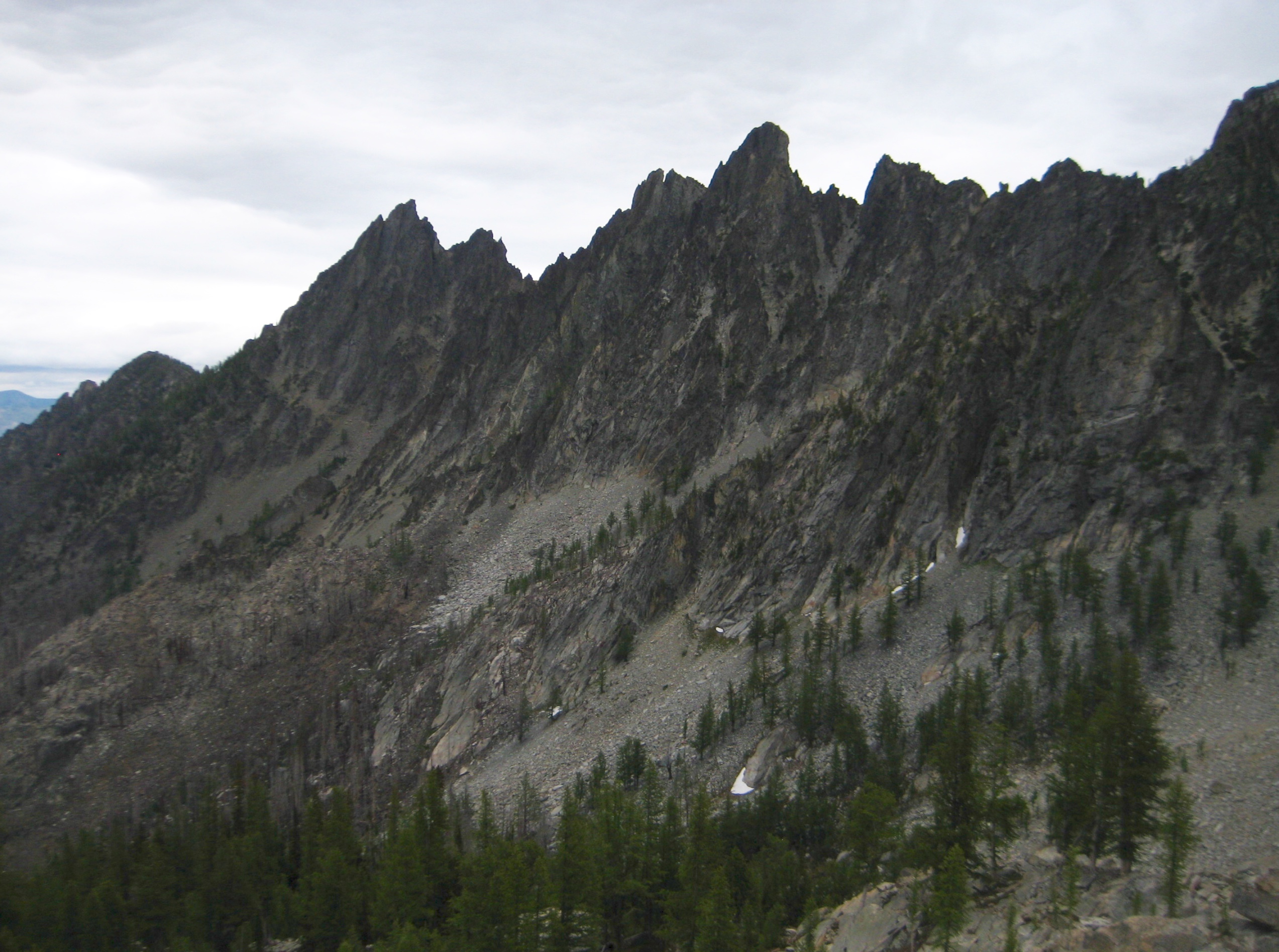
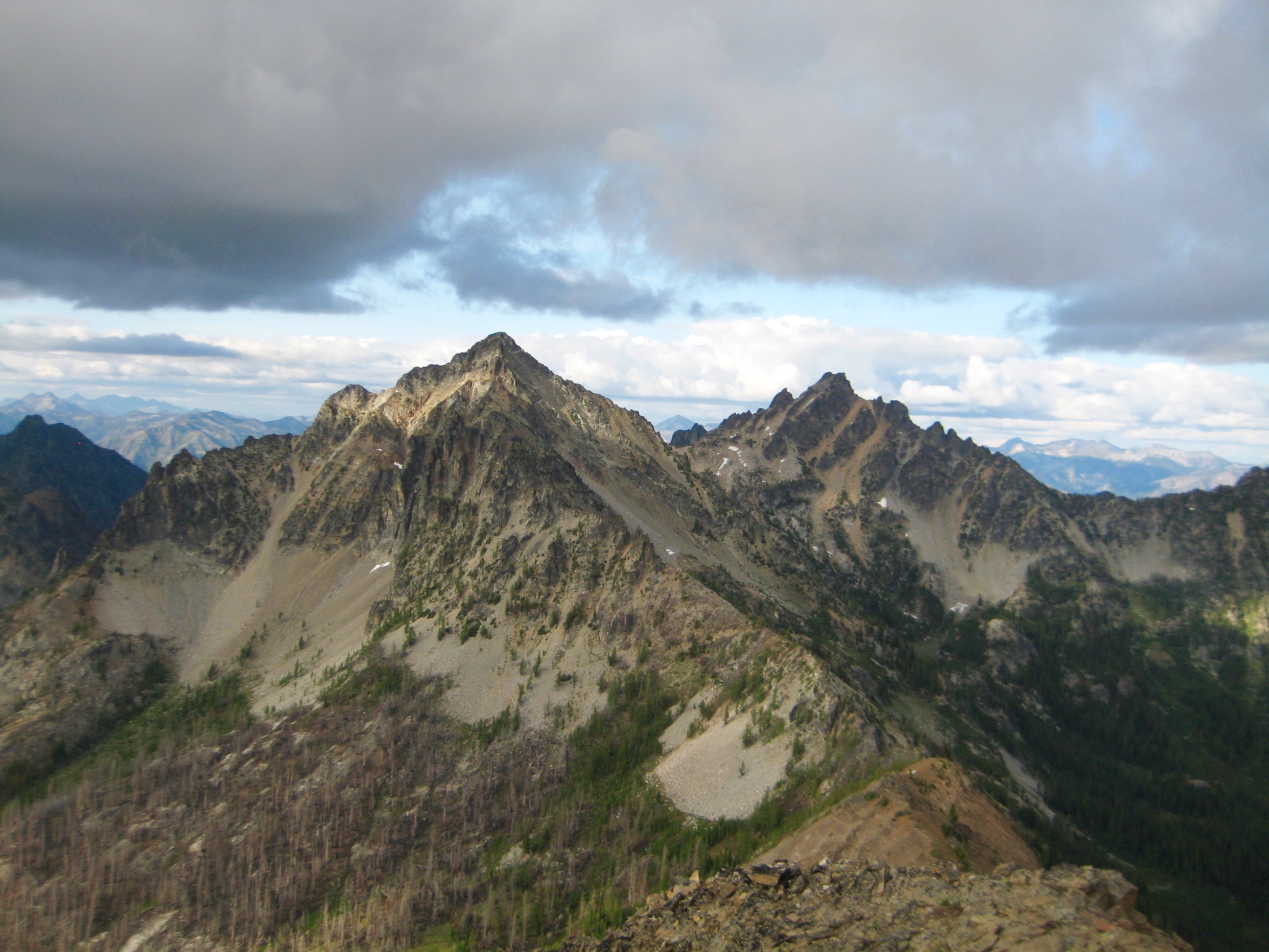
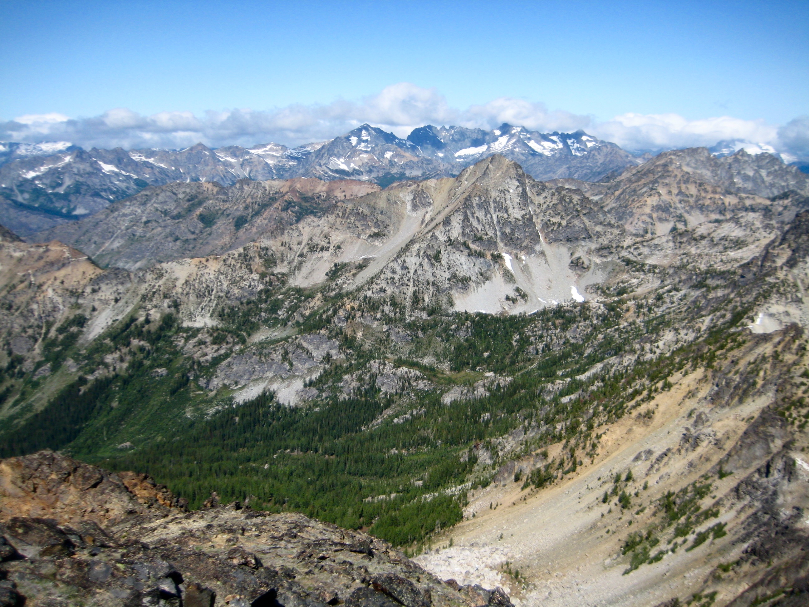
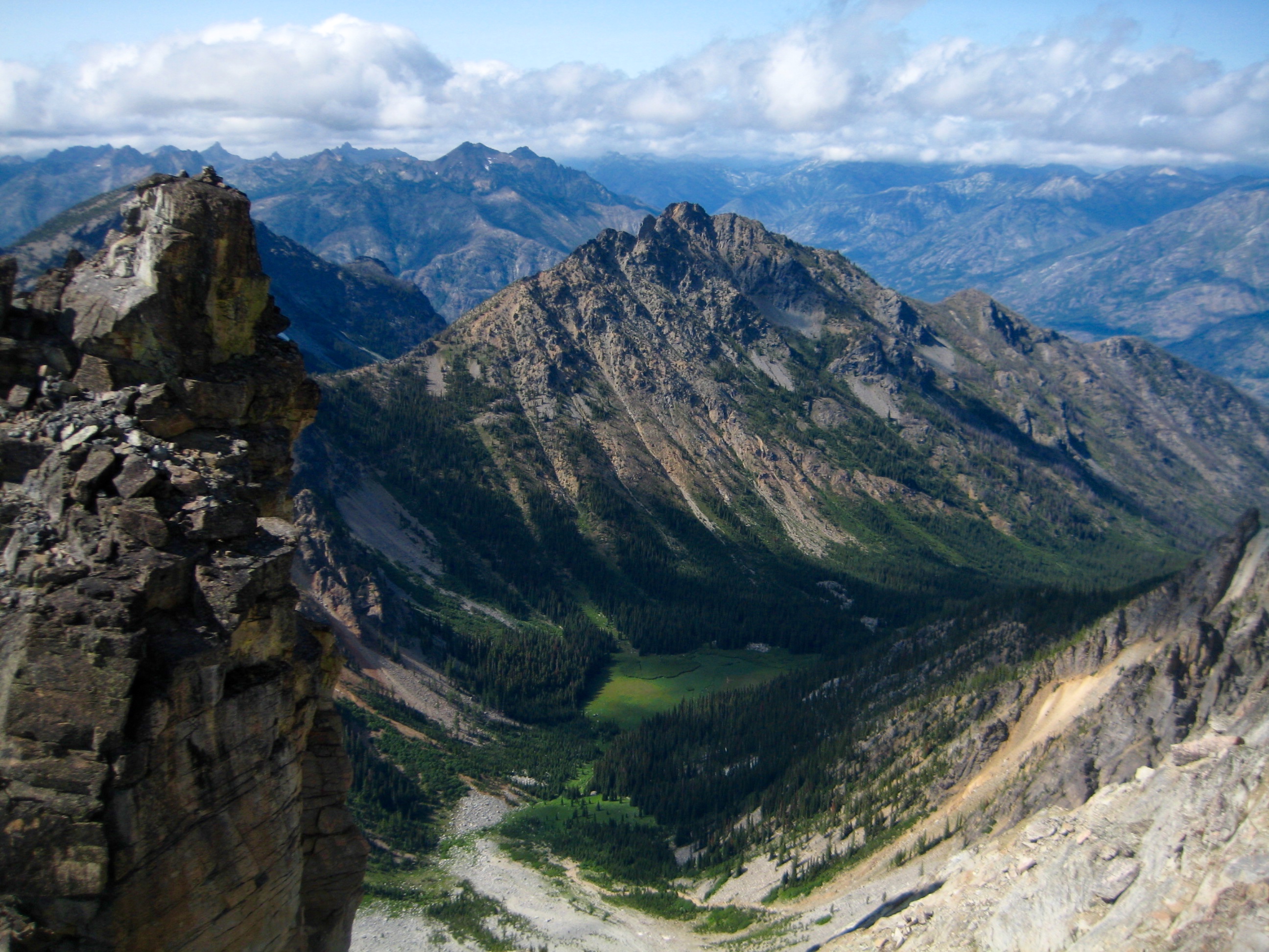
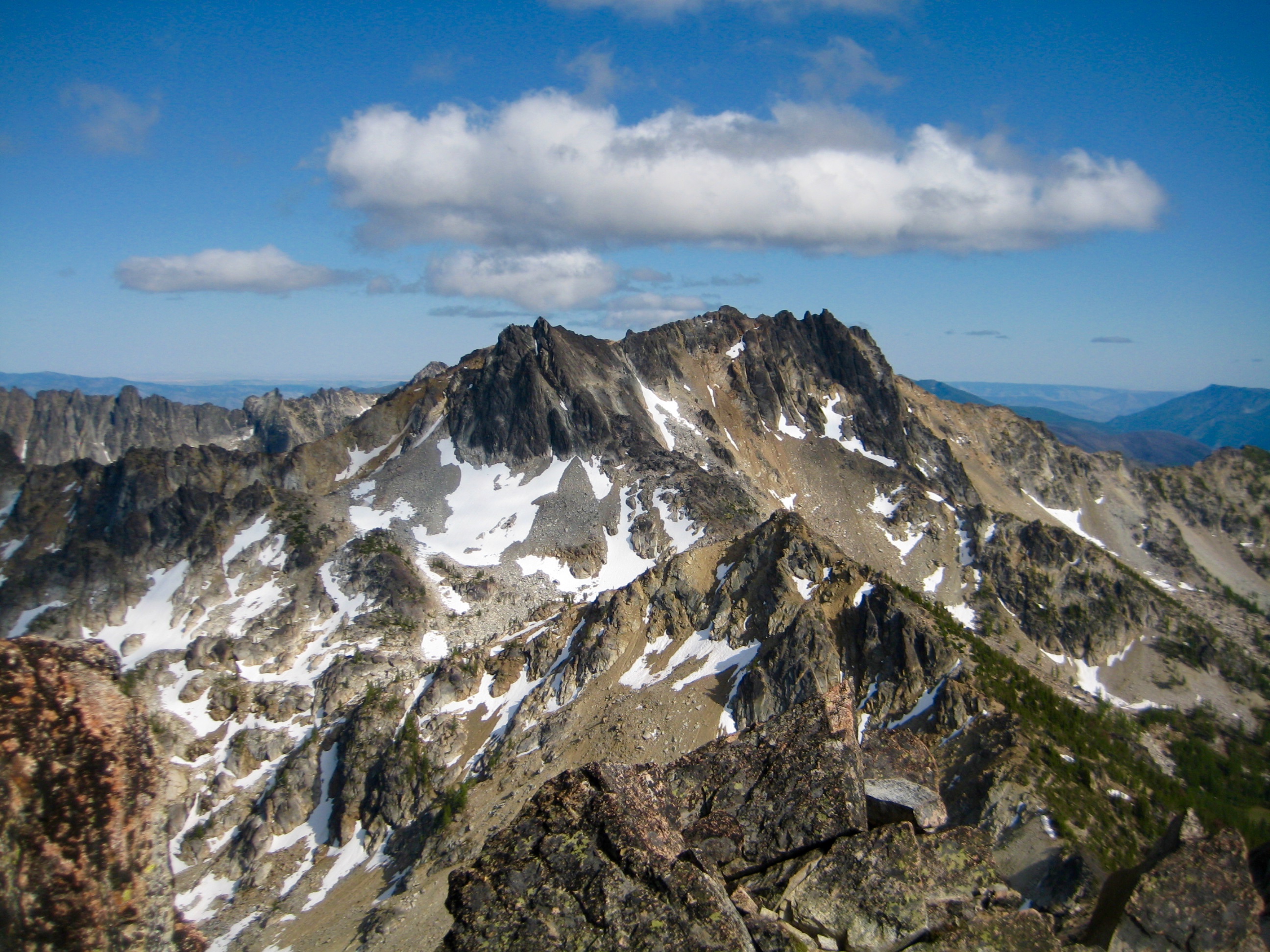
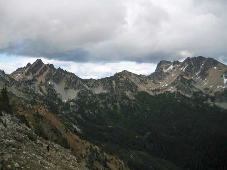
Squaretop offers an easy ascent and a good view of Cloudcomb Peak, which sits at the end of an extremely jagged ridge. We hoped to tuck in this impressive and seldom-climbed peak tomorrow.

- Pyramid Mtn From Squaretop Mtn

- Eileen & David On Squaretop Mtn Summit

- Cloudcomb Peak From Squaretop Mtn
After scoping out possible approaches, we agreed that the left (western) side of the ridge looked feasible, although the right (eastern) side seems to be more standard. We then made a quick plunge down to Camp 2 and joined our comrades for dinner.

- Camp 2 On Knoll 7378
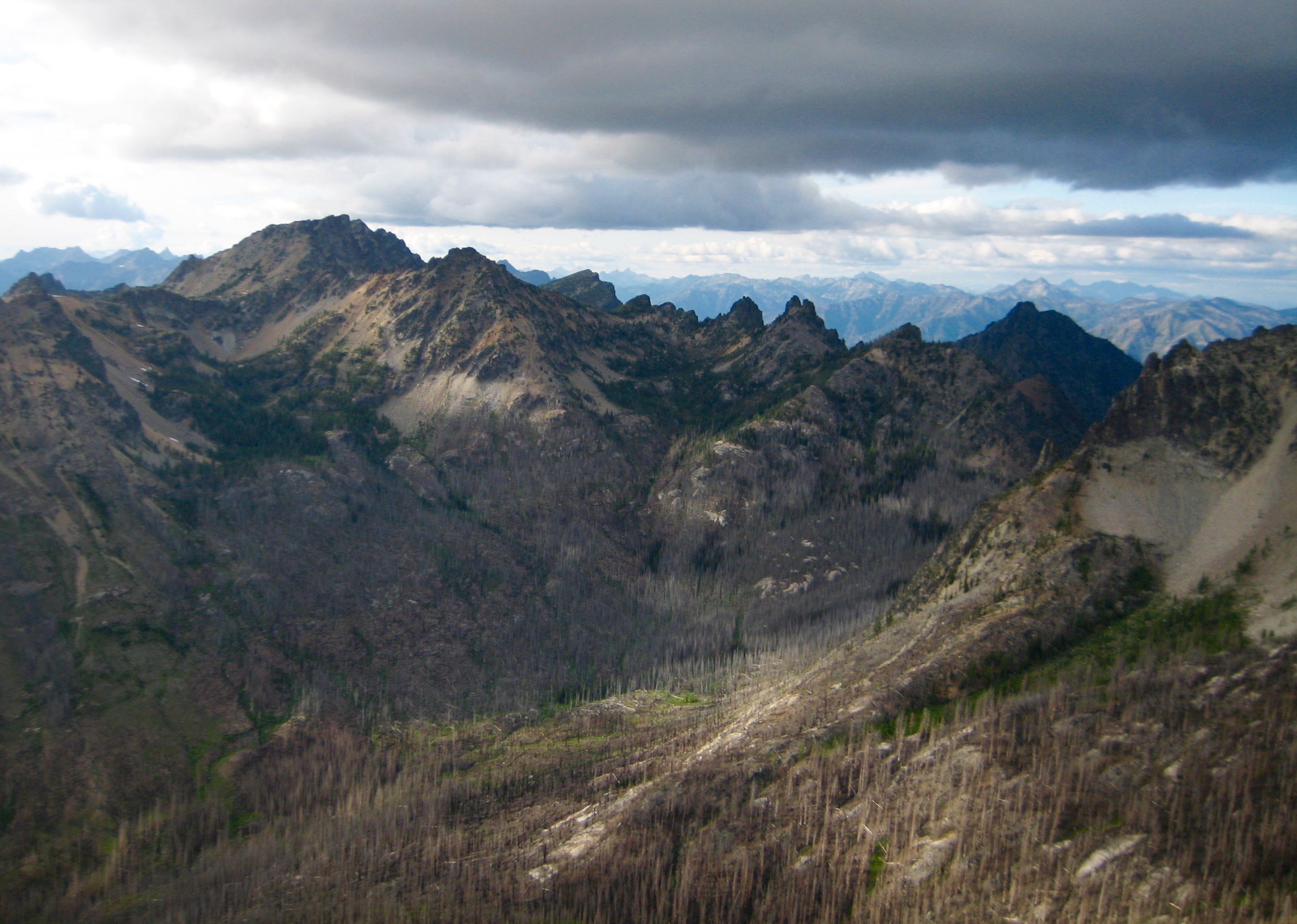
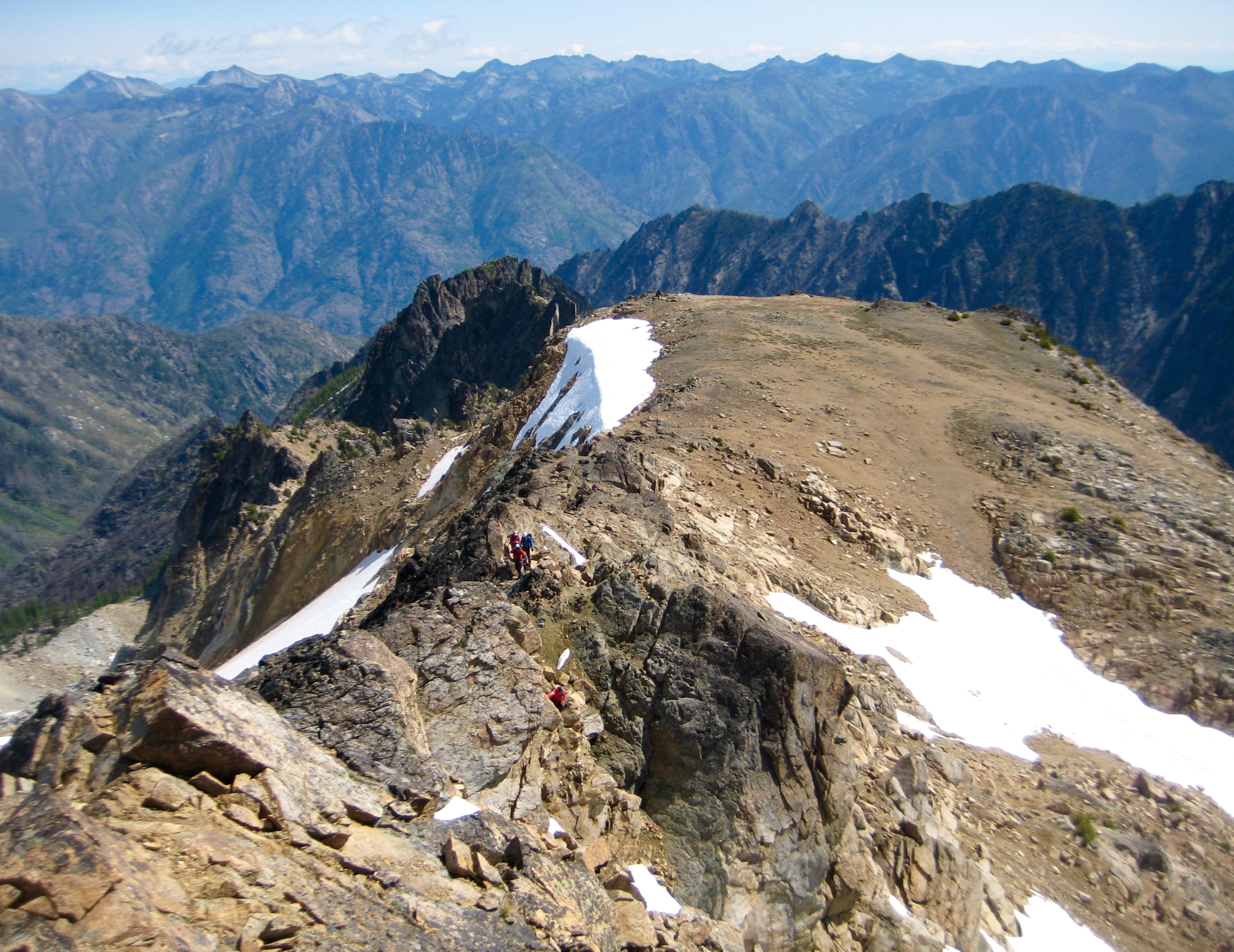
Day 3: Squaretop Ridge Loop + Cloudcomb Peak Reconnaissance
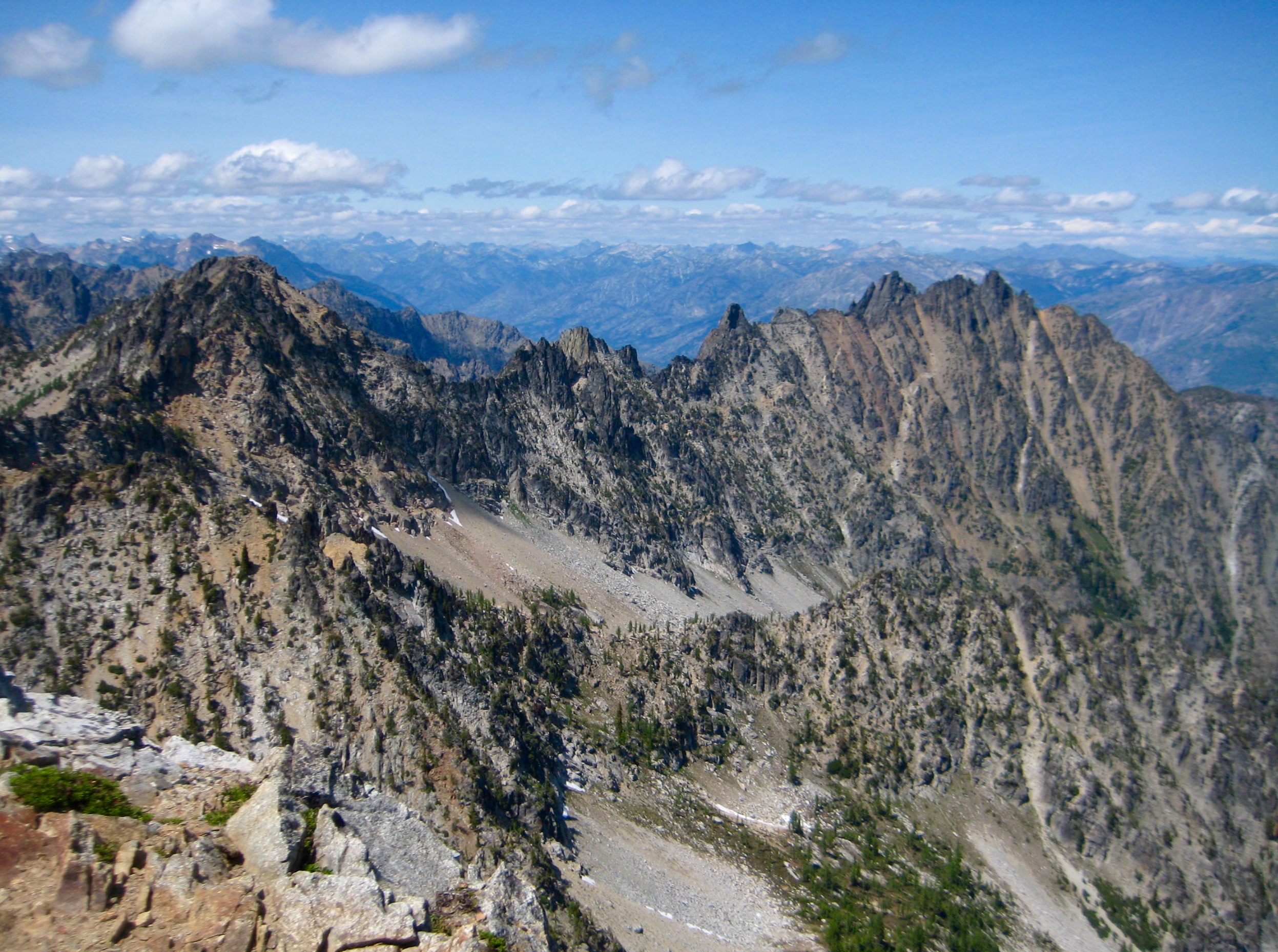
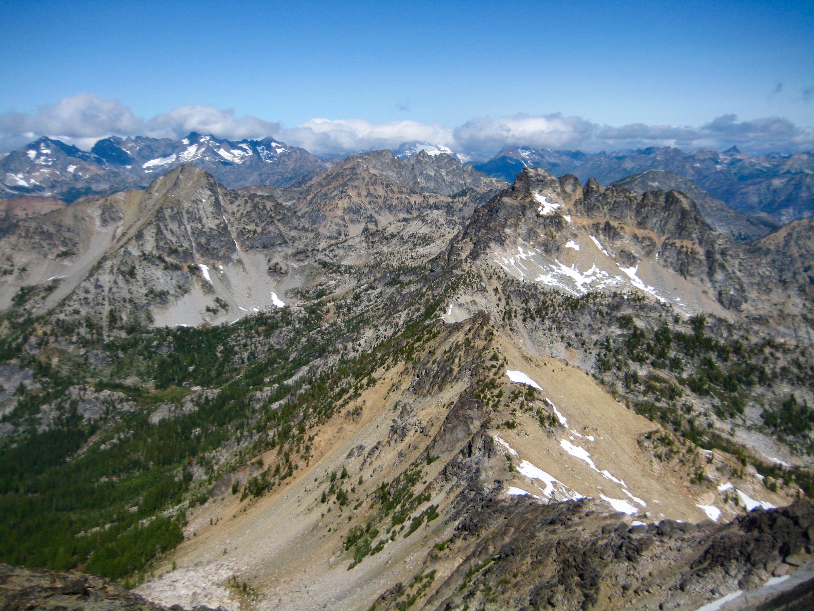
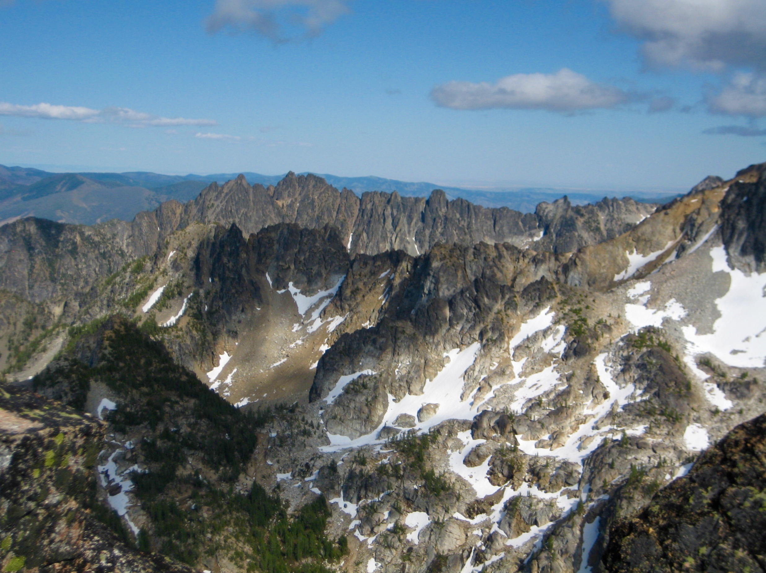
Today was planned to be a layover day, so our group scattered in various directions. David, Eileen, and I spent the entire day making an attempt on Cloudcomb Peak. Our route took us up to Squaretop Mountain’s west ridge, through a 7800-foot notch, and down a steep cliff in the South Fork Bear Creek cirque.

- Descending From Squaretop Ridge
Numerous complications during our descent consumed a full 2 hours, so it was early afternoon by the time we finally reached talus slopes below the steep cirque cliffs. Our window for a Cloudcomb Peak climb seemed to be closing.

- Rappelling Off Squaretop Ridge
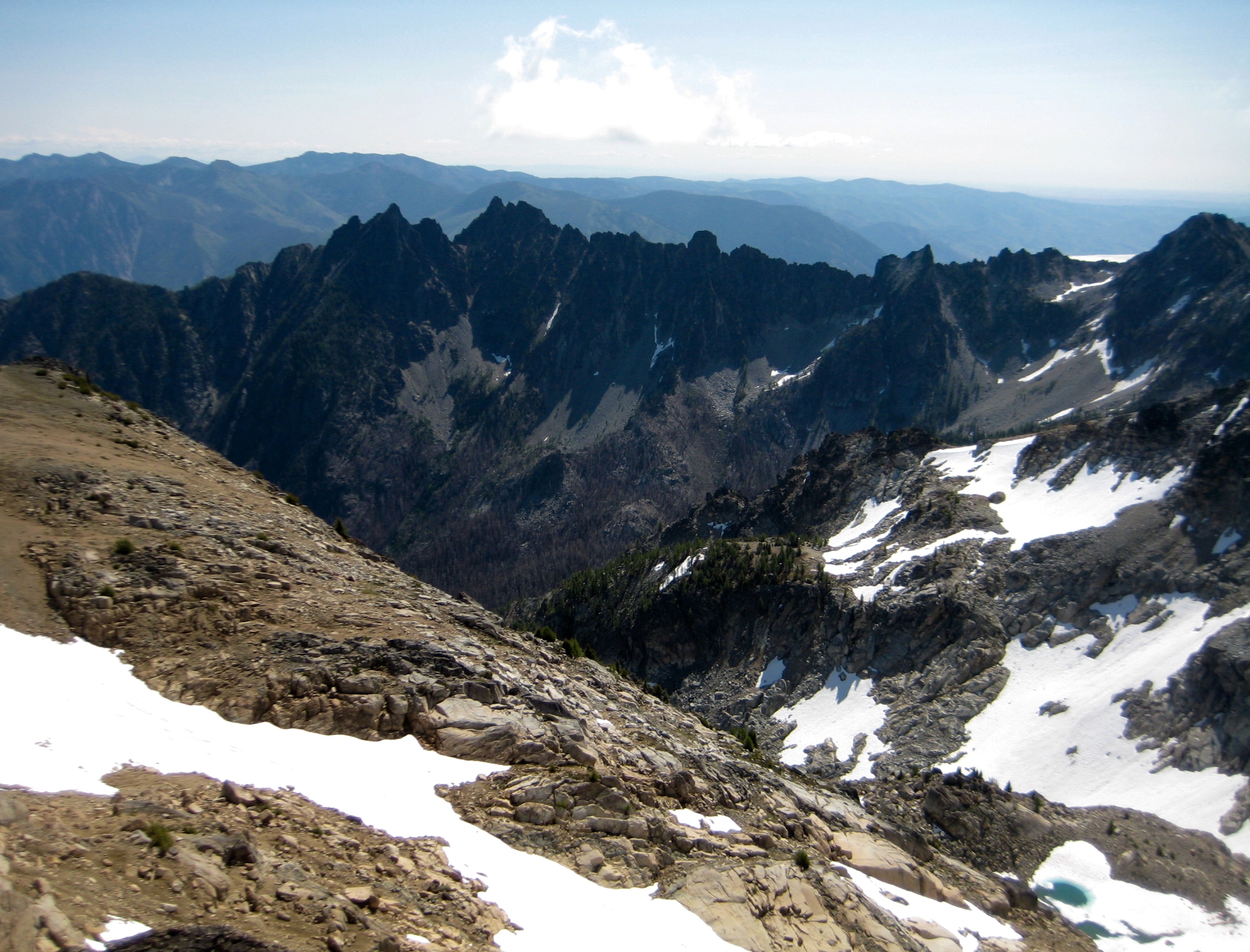
Eileen peeled off to the west in hopes of finding an easier route back over the ridge, whereas David and I traversed northward across the cirque to get a closer look at Cloudcomb Peak. We turned around at a rock rib (5.2 hours + 1500 feet from Camp 2) after concluding that our chosen west-side approach might indeed be feasible but certainly not straightforward.

- Cloudcomb Peak From Traverse Route
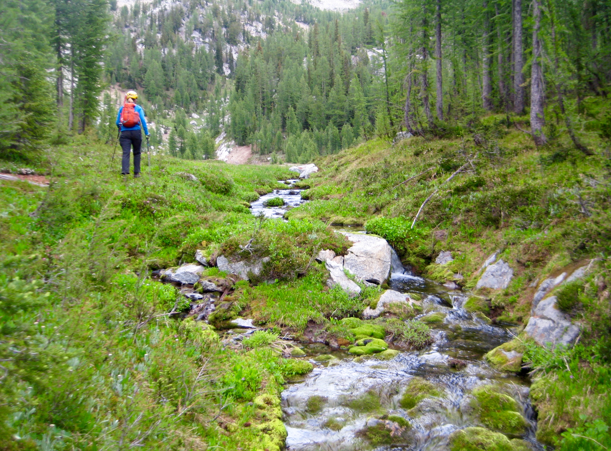
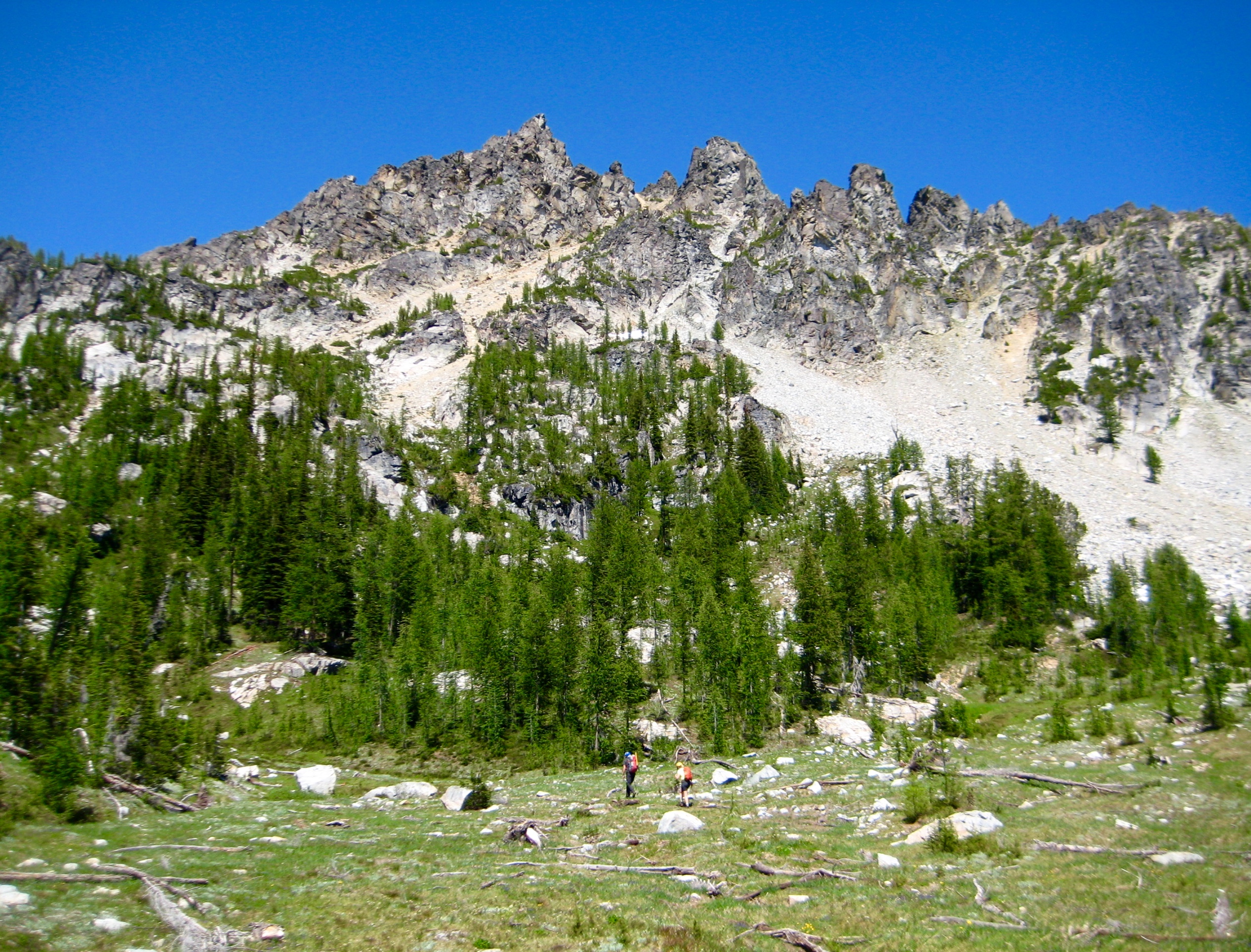
David and I traversed back across the broad cirque and booted up a snow couloir that led to a 7700-foot saddle in the ridge crest. Eileen had been watching our progress from Point 7872 and met us at the saddle. Together, we dropped southwesterly on sandy slopes to reach Grouse Pass, then wandered up through verdant meadows to our campsite (3.5 hours + 1500 feet from turnaround rib).

- Grassy Creek Below Camp 2
Dinnertime gave each group a chance to describe their day’s adventure. Kevin, Lisa, and Eric had spent most of the day scrambling up Squaretop Mountain and traversing out its west ridge, while Tony and Susie had hiked over to Grouse Pass.
Day 4 (AM): Knoll 7378 to Saska Basin + Grouse Pass Pinnacle Climb
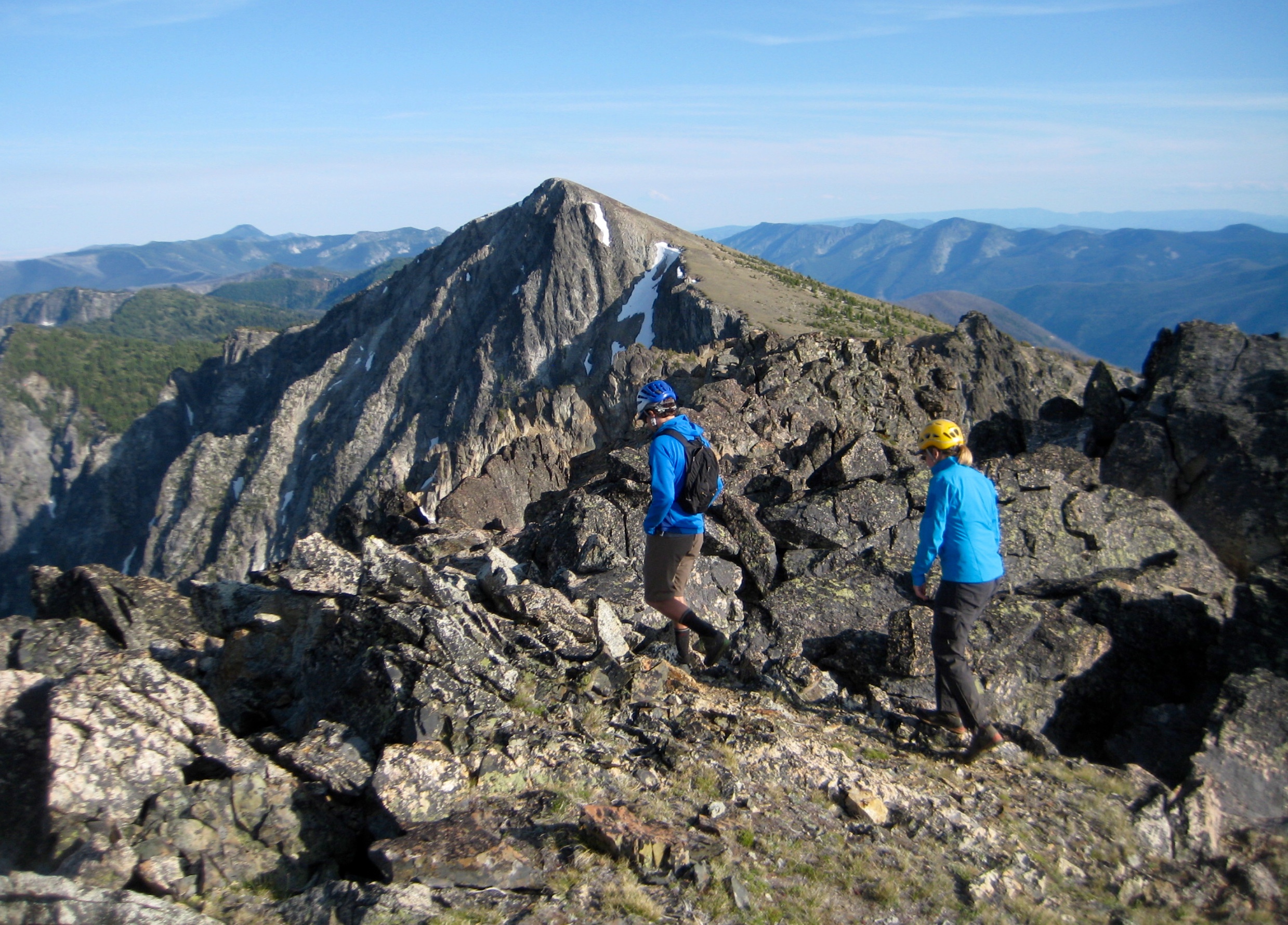
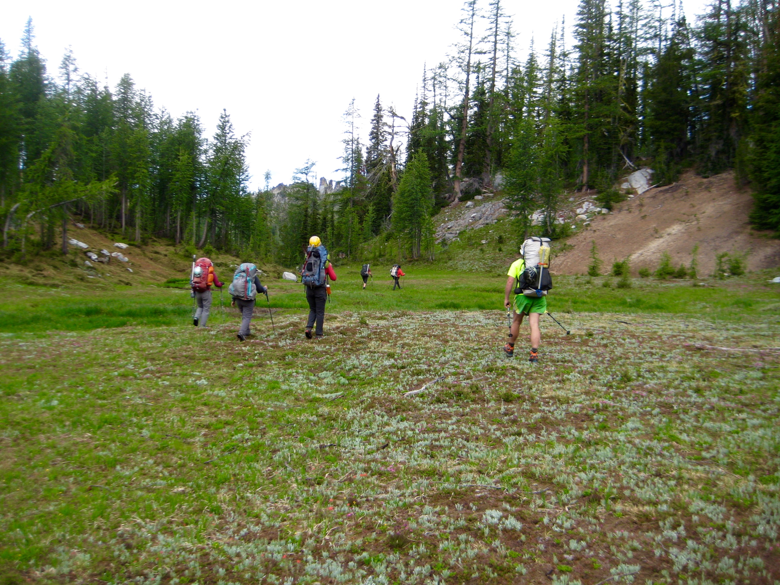
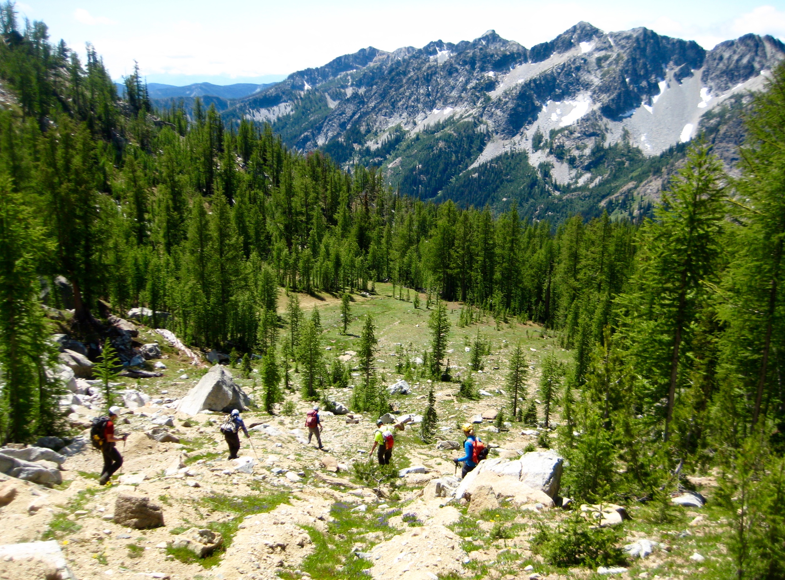
We all packed up and hiked over to Grouse Pass, wandering through spacious meadows along the way.
- Heading Toward Grouse Pass On Day 4
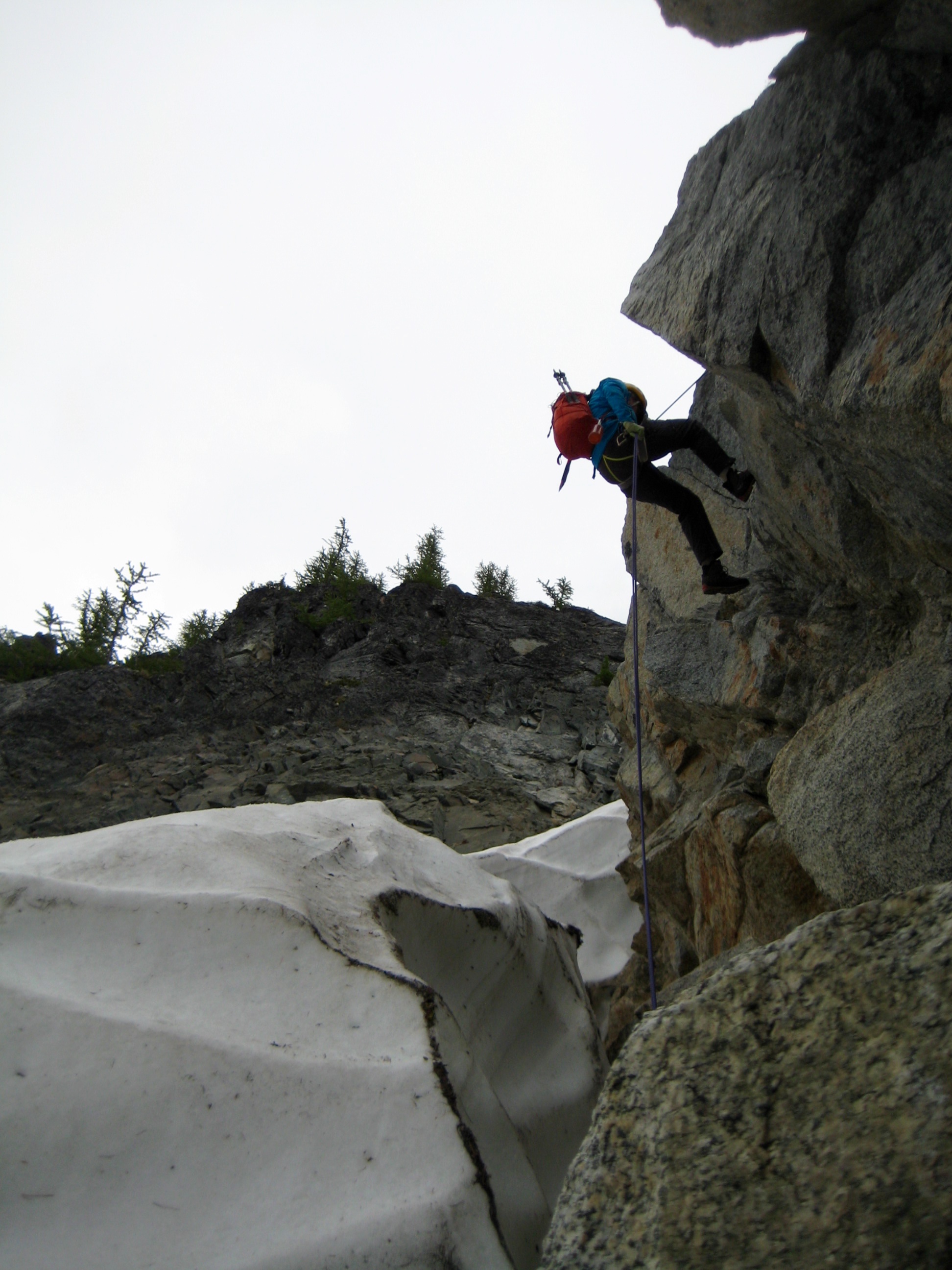
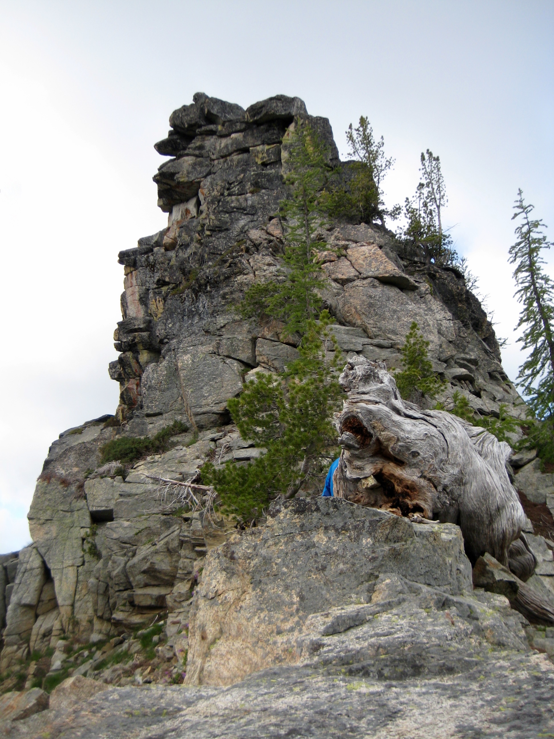
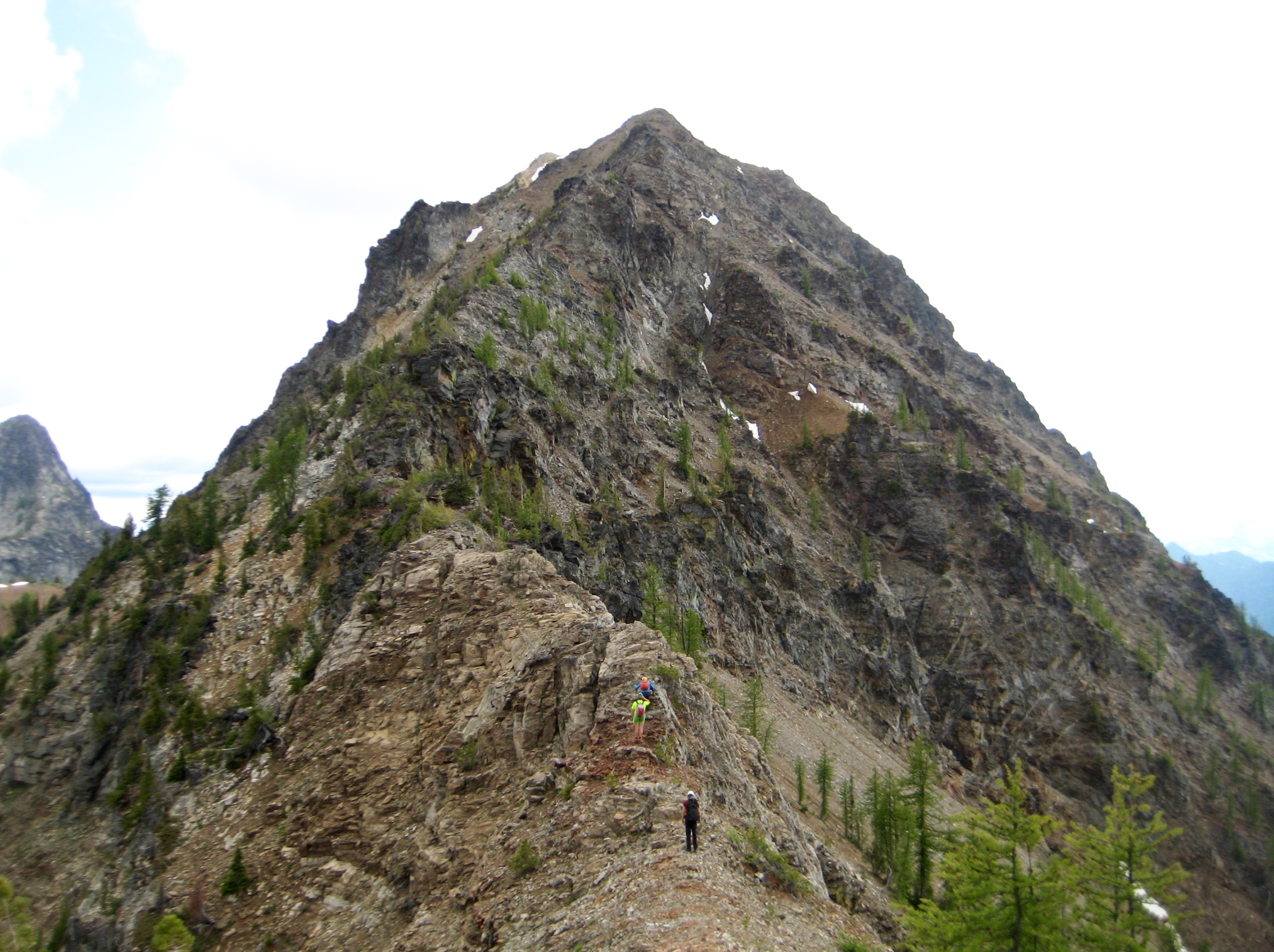
At the pass, we dropped packs and made a short walk up to Grouse Pass Pinnacle. Anybody who has hiked over Grouse Pass has no doubt admired this tall stack of gneissic rock.
- Grouse Pass Pinnacle
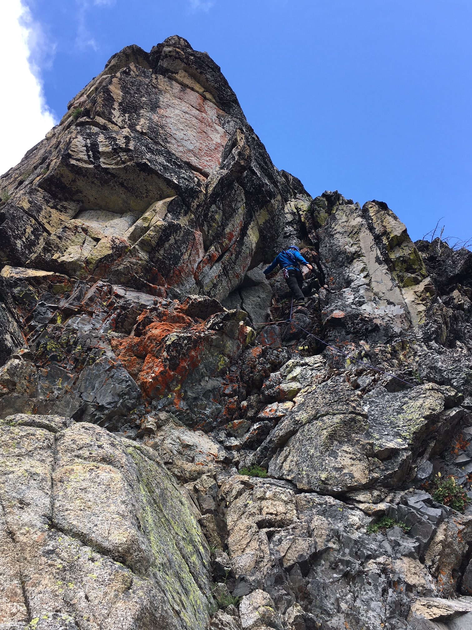
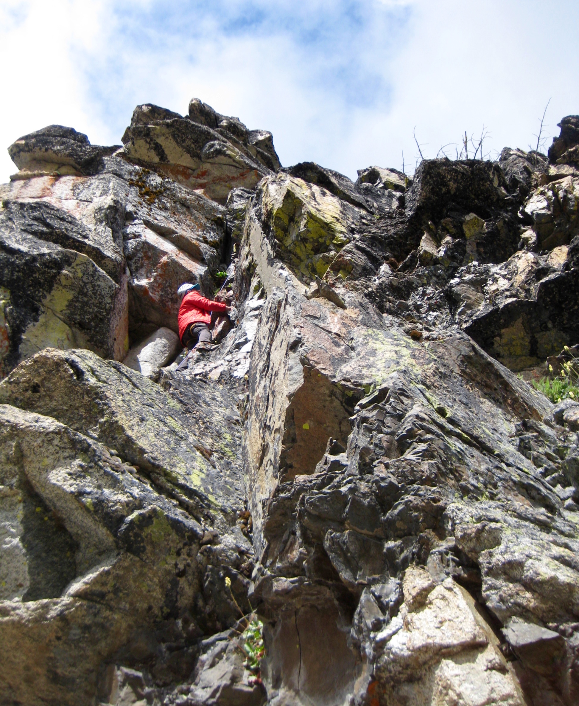
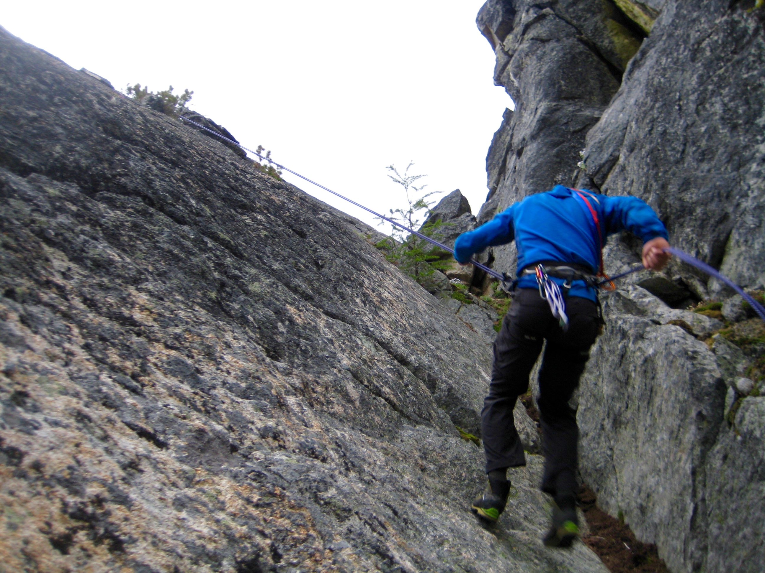
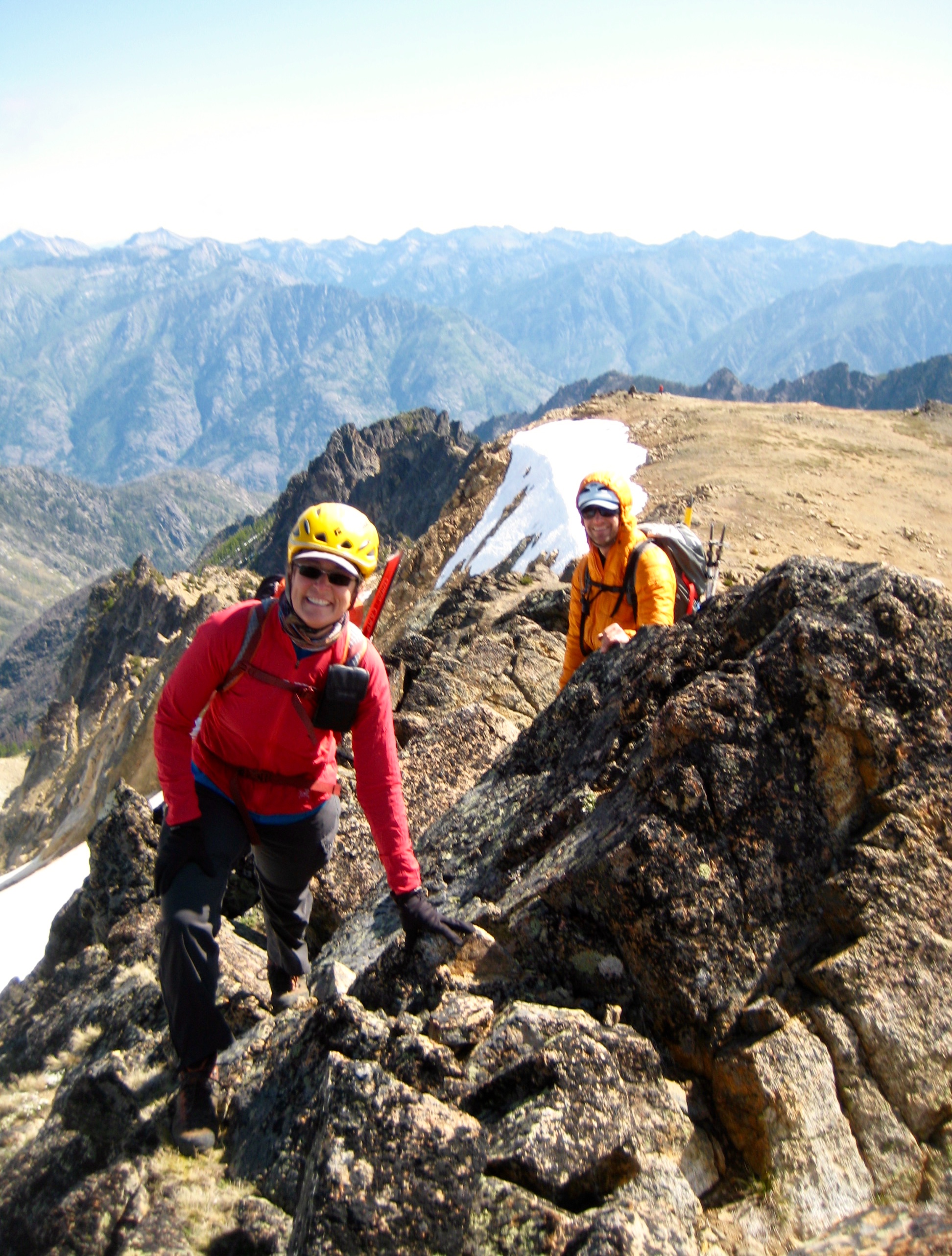
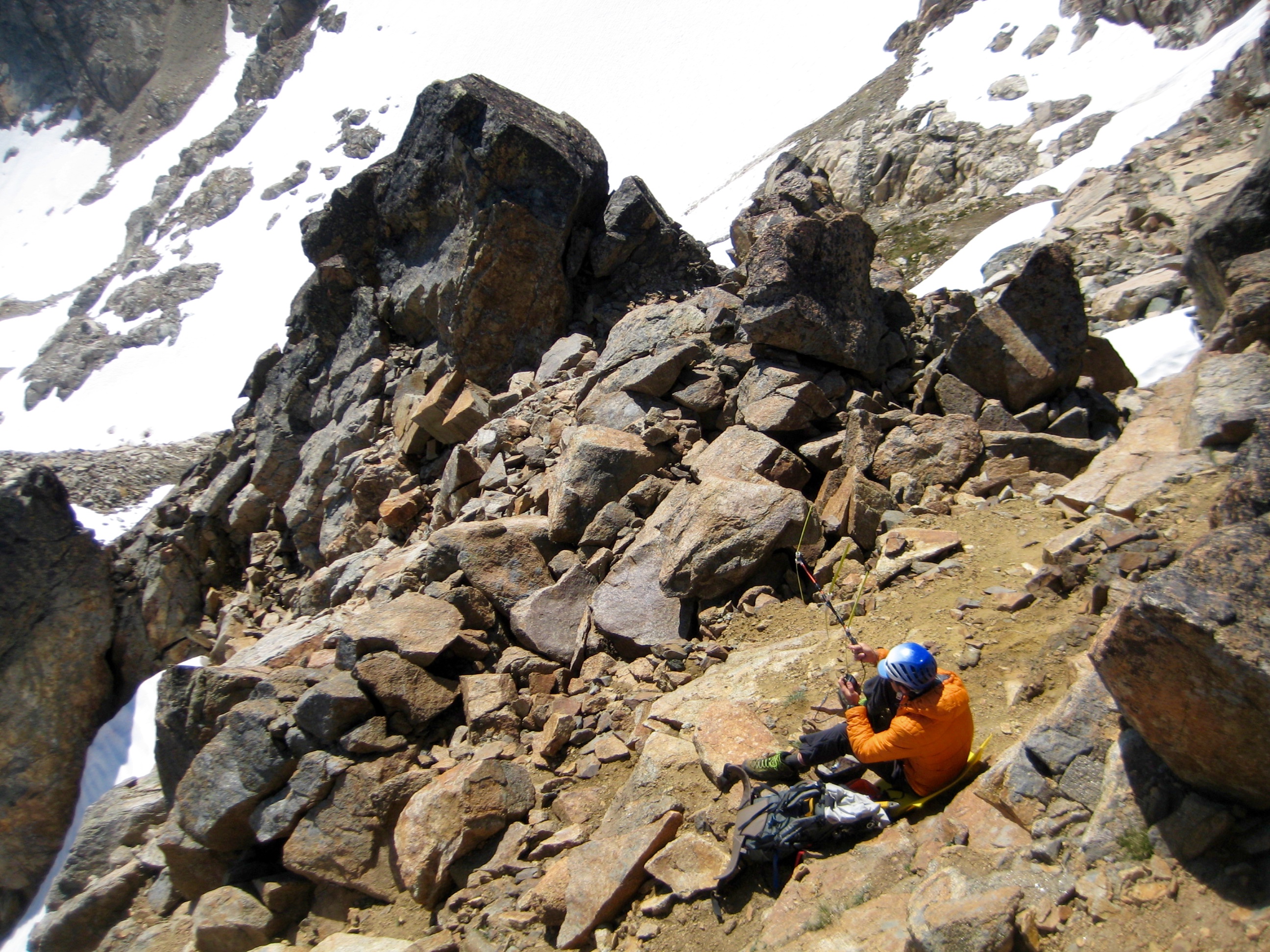
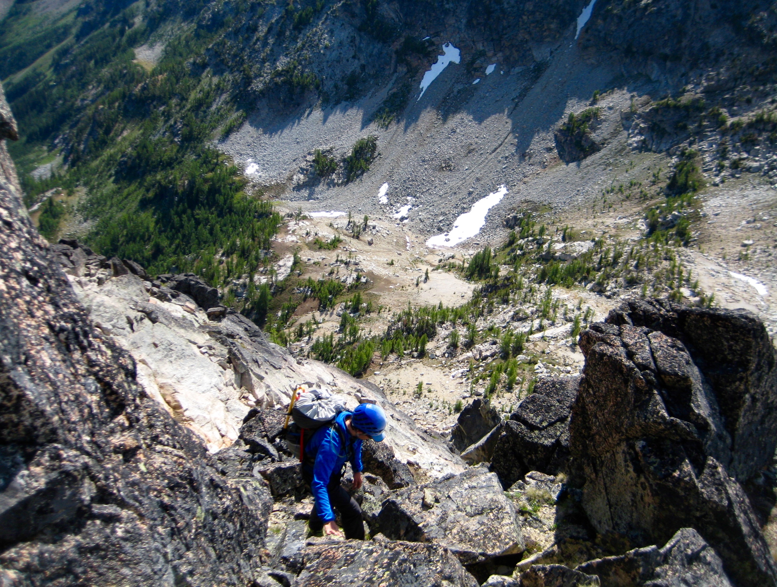
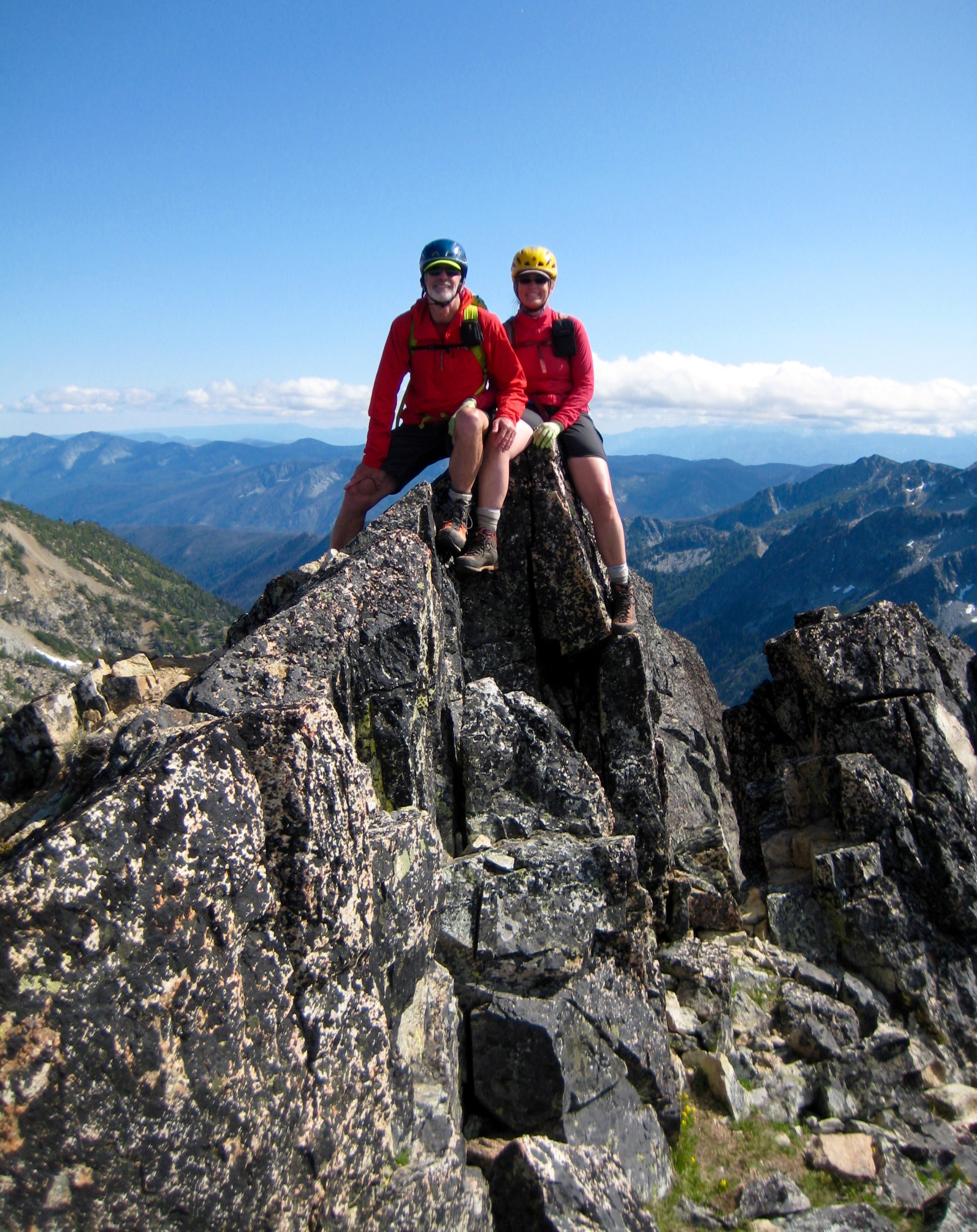
Although our trip agenda did not include any serious technical climbing, the lure was too strong for some of us. David tied into our 30-meter scramble rope and led a Class 5.8 pitch up a chimney route on the northeastern corner. Tony and I followed his lead with much grunting and huffing.

- David Leading Chimney Pitch On Grouse Pass Pinnacle (photo by Eileen)

- Tony Climbing Chimney Pitch On Grouse Pass Pinnacle
What was most impressive about David’s lead climb is that he accomplished it using only runners and knotted slings; we hadn’t brought any stoppers, cams, or other regular rock pro. I suggested the name “David’s Delight” for his route.
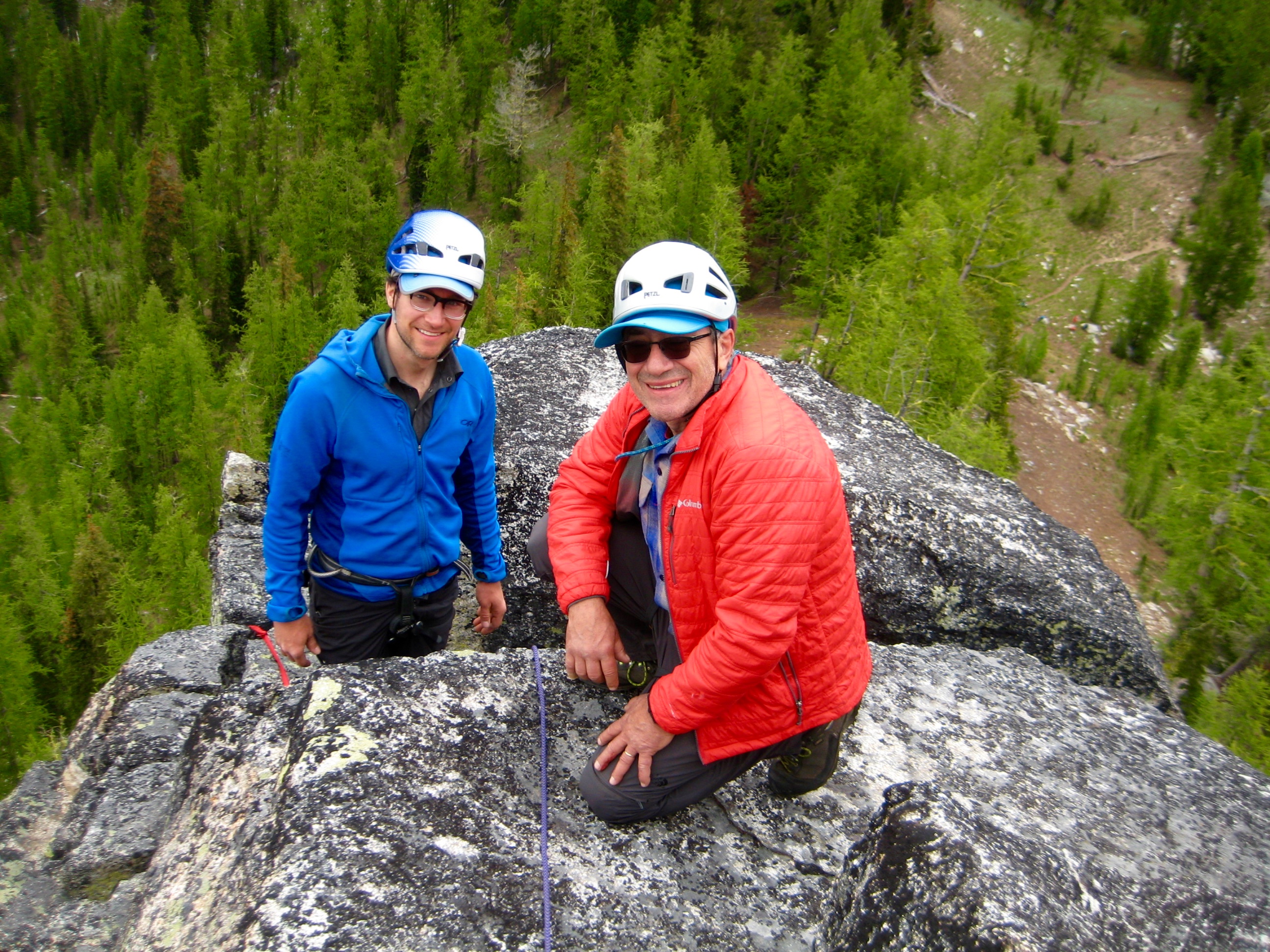
- David & Tony On Grouse Pass Pinnacle
While we were occupied with our technical climb, Eric, Kevin, Lisa, and Eileen skirted around the pinnacle and found a Class 3 route up the southwestern side. Our two different routes ended at two different summit points, separated by a deep notch.

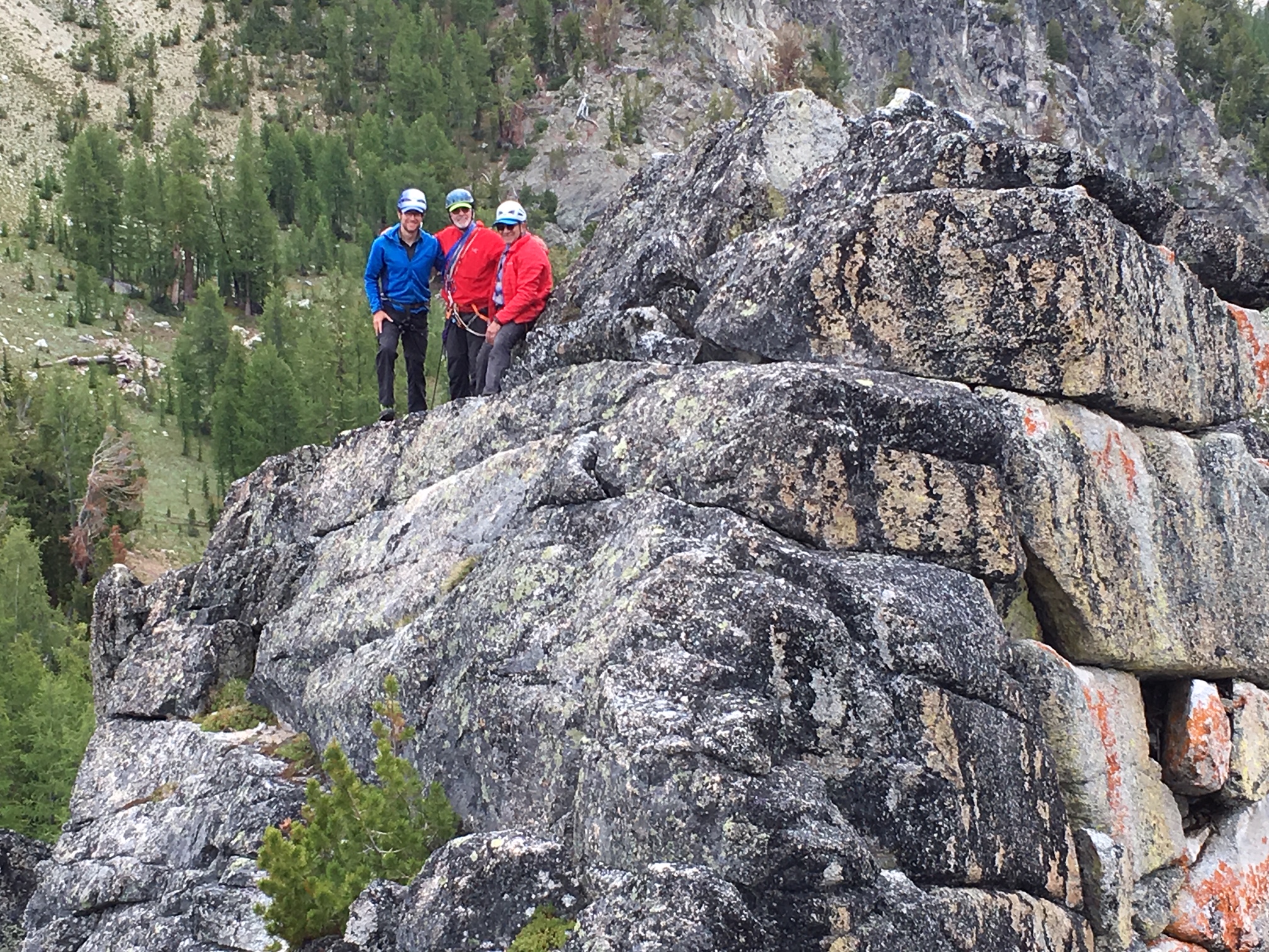
- David & Jim & Tony On Grouse Pass Pinnacle (photo by Eileen)
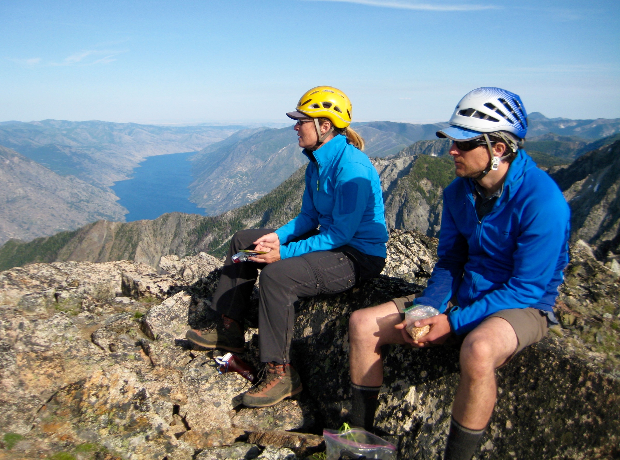
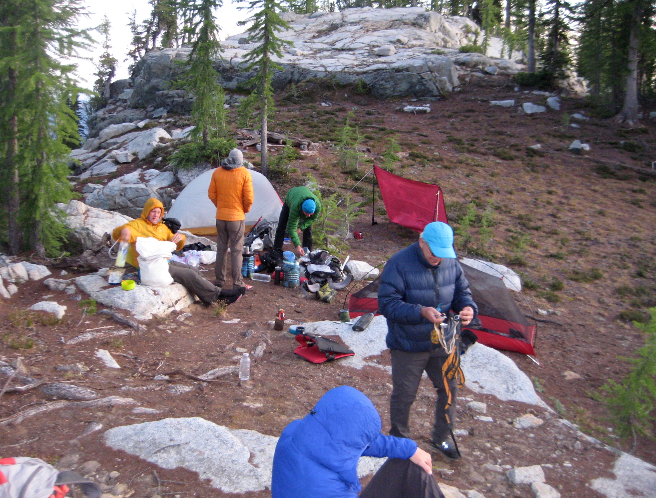
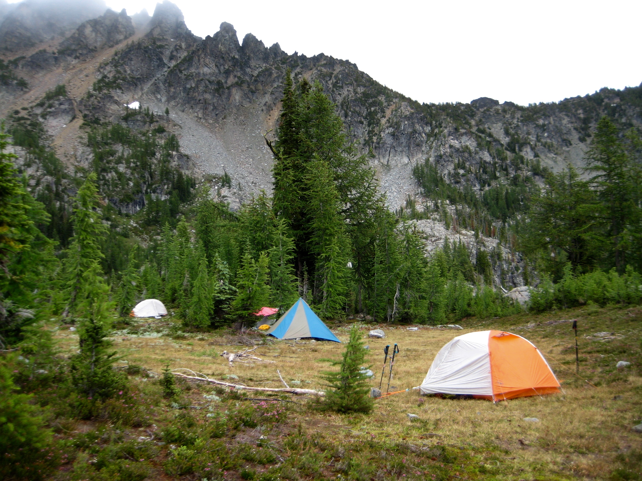
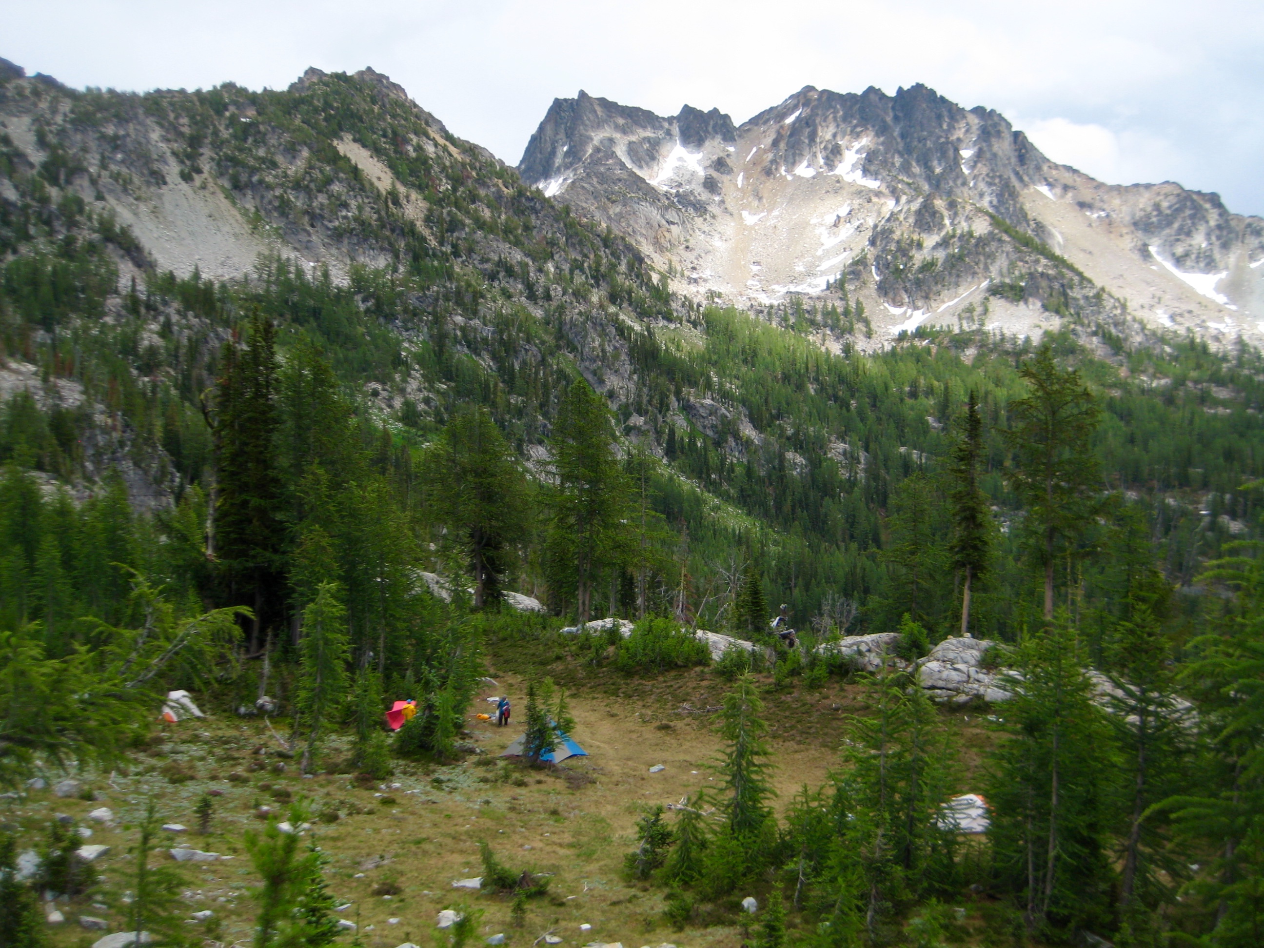
With summit urges temporarily satisfied, we all returned to Grouse Pass and continued hiking on the northbound trail. A series of rain showers soon moved in and doused us during our 4.5-mile hike, but the sky started to clear by the time we reached Saska Basin and set up Camp 3 (6.2 hours + 1600 feet from Camp 2).
- Camp 3 In Saska Basin
Day 4 (PM): Gopher Mtn Summit Climb
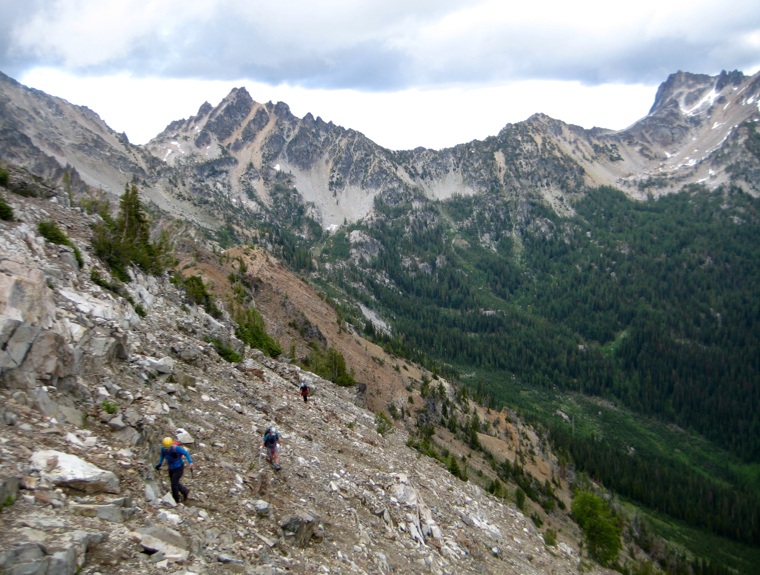
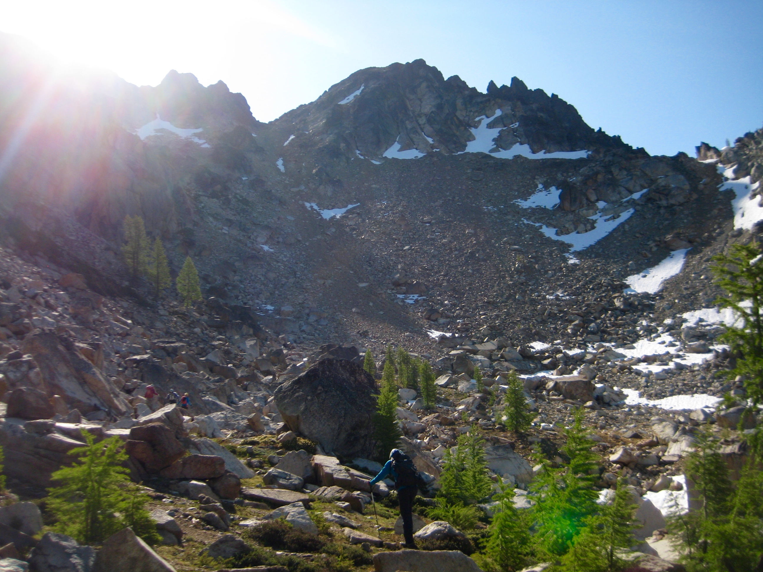
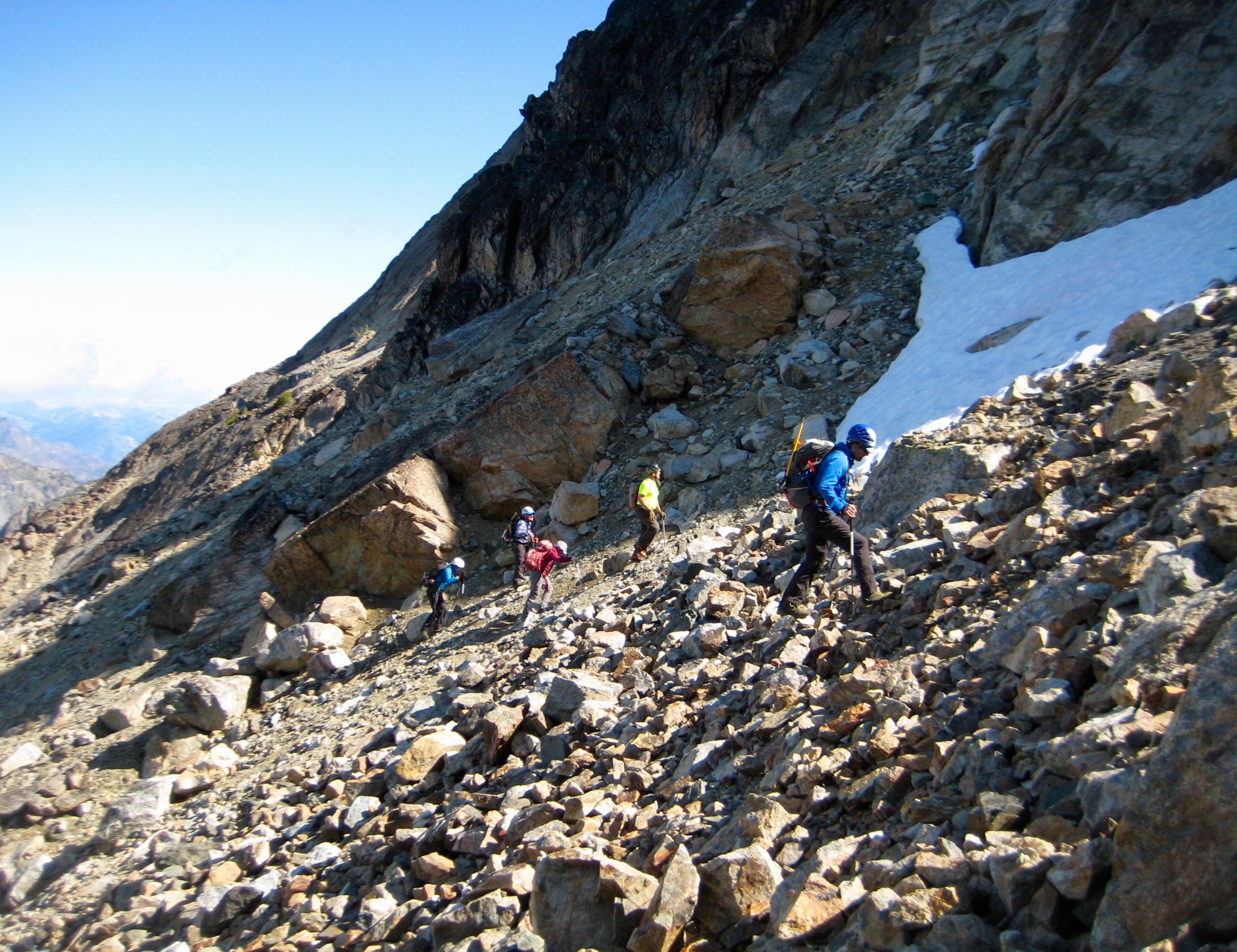
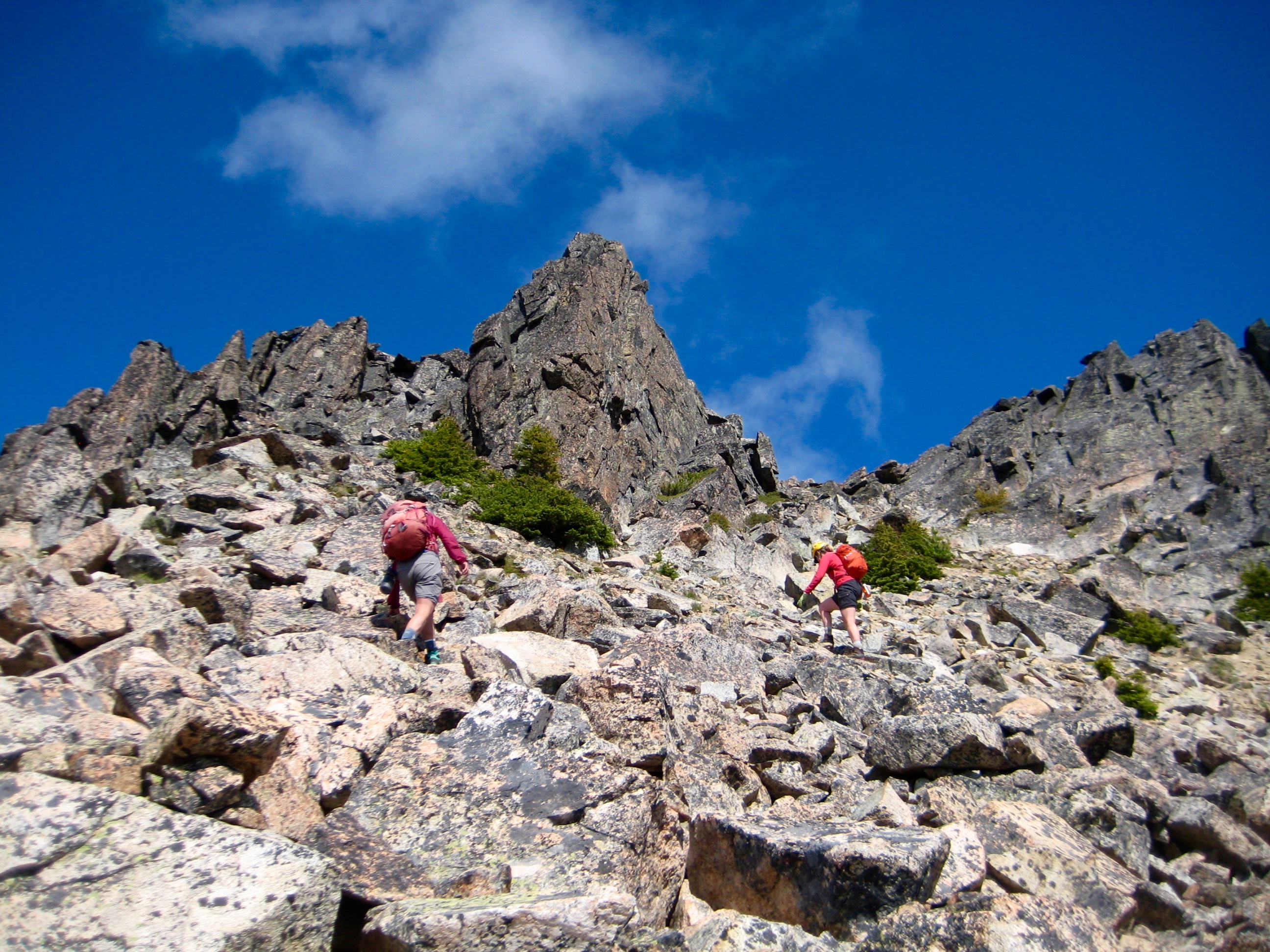
Given a few hours of dry weather before dinnertime, most of our group decided to climb Gopher Mountain. We hiked up to Saska Pass, then made a long traverse back and forth along Gopher’s northeast ridge.

- Scrambling Up Northeast Ridge Of Gopher Mtn
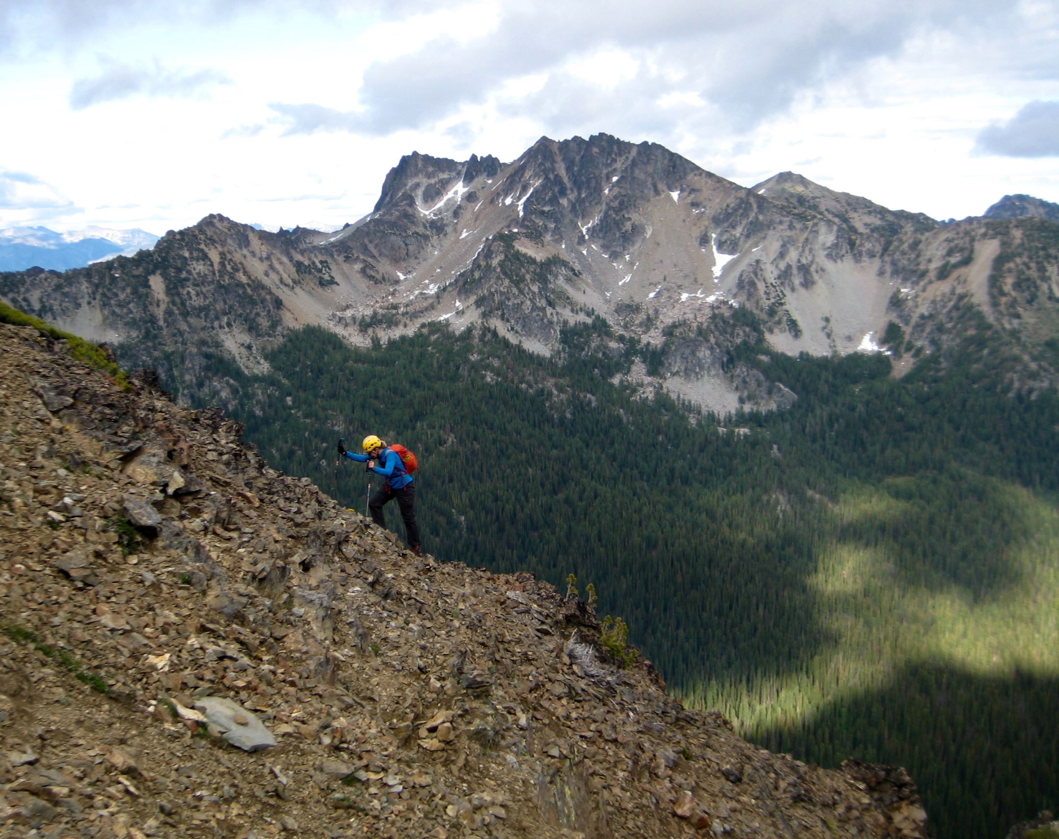
This tedious effort caused some group attrition, leaving just Lisa, David, Eileen, and me to continue groveling up the horribly loose east face.

- Scrambling Up East Face Of Gopher Mtn

- Cardinal Peak From Gopher Mtn
We topped out in late afternoon (2.5 hours + 1600 feet from Camp 3). Our route up Gopher Mountain had little to offer in the way of elegance or enjoyment, but the summit did give a nice view of more interesting peaks nearby. The broad, gentle summit would also provide a reasonable venue for a game of Ultimate Frisbee or touch football. I left a mini register in the existing cairn.

- David & Lisa & Eileen On Gopher Mtn Summit

- Pinnacle Mtn & Snow Brushy Creek From Gopher Mtn Summit

- Lisa On Gopher Mtn Summit
We descended the peak by plunging down the east face and then contouring northeasterly below the ridge crest until intersecting the trail near Saska Pass. This lower traverse turned out to be much faster than trying to run the ridge crest, and we were back in camp by early evening (1.7 hours from summit).
Day 5: Snow Brushy Creek Hike
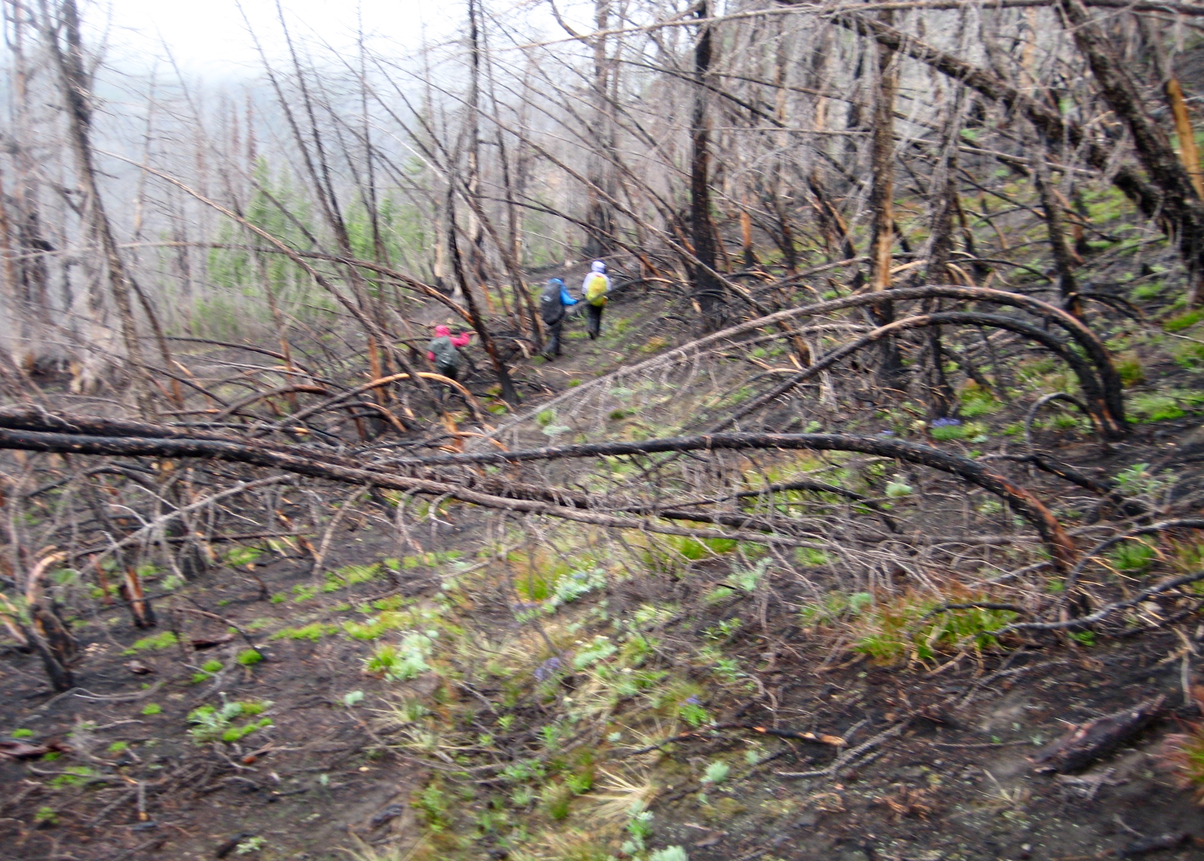
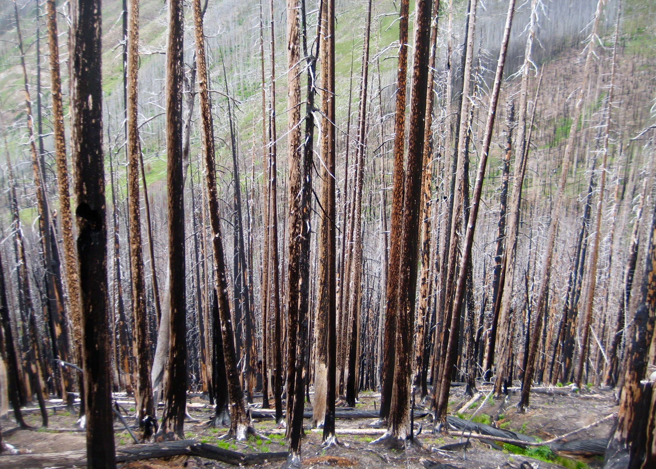
A dark, threatening sky and a poor weather forecast conspired to scrap any plans for peak-bagging today. Instead, Eric, Lisa, Eileen, and I spent most of the day hiking over Saska Pass and down to Snow Brushy Creek. The entire section of trail between the pass and creek lies within burned forest resulting from the 2015 Wolverine Creek Fire. Ordinarily, such terrain would be uninviting for a day hike, but on this rainy morning we extracted considerable satisfaction in teasing out the trail remnants.

- Hiking Thru Burn On Day 5

- Artistic Burned Forest Above Snow Brushy Creek
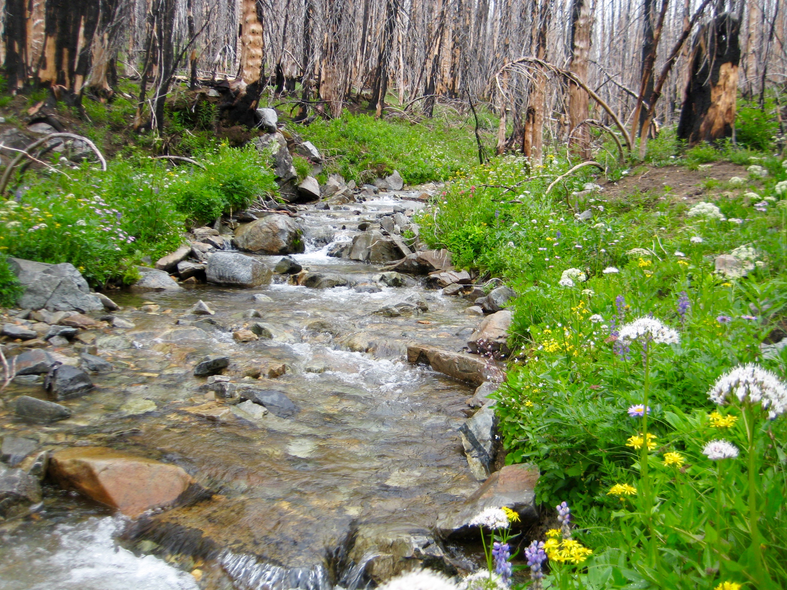
After navigating through the charred trees, we arrived at Snow Brushy Creek (2.4 hours + 600 feet from Camp 3). Both sides of the creek were vegetated with lush greenery and wildflowers—in great contrast to the blackened forest.
- Wildflowers Along Snow Brushy Creek
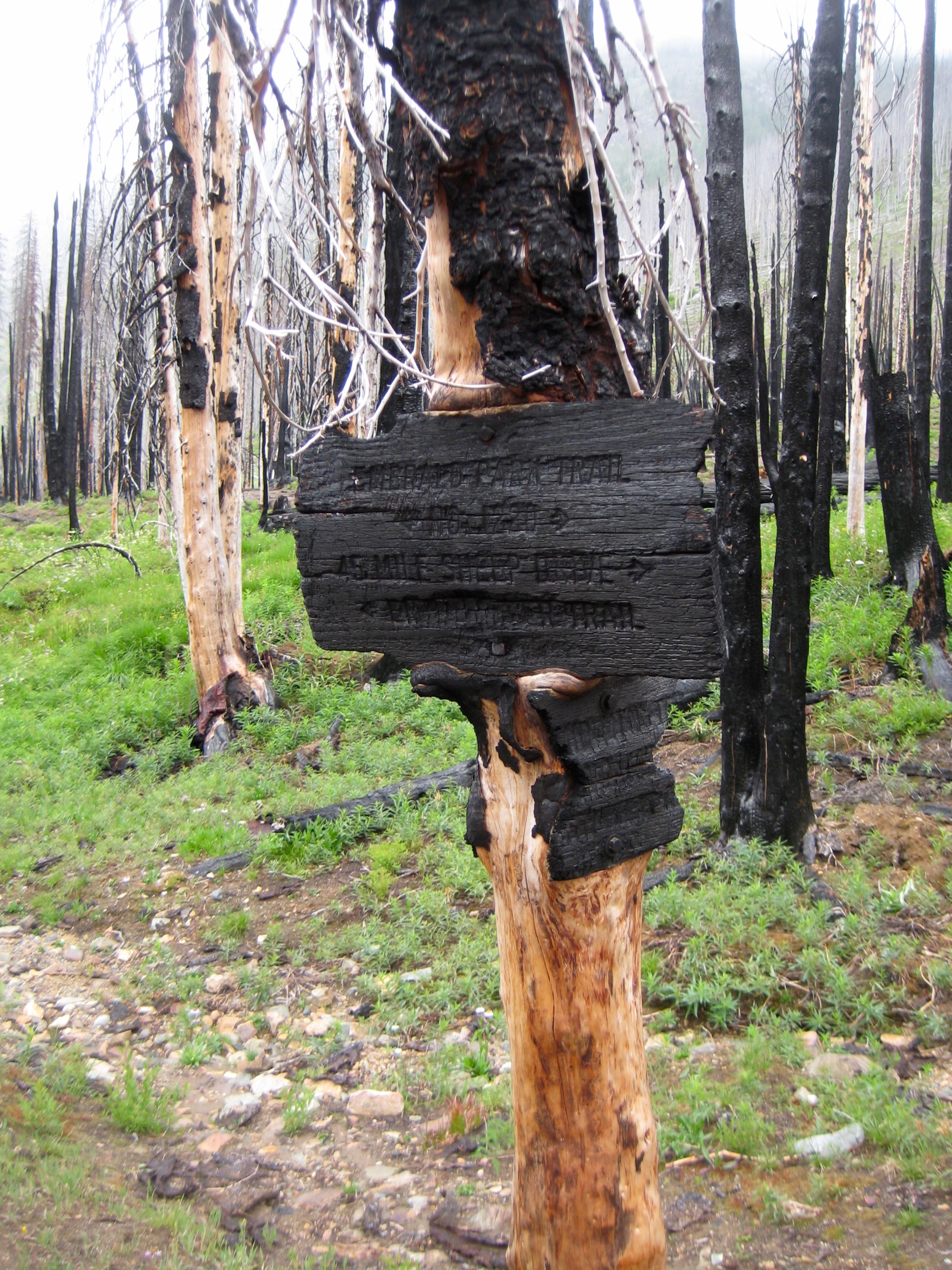
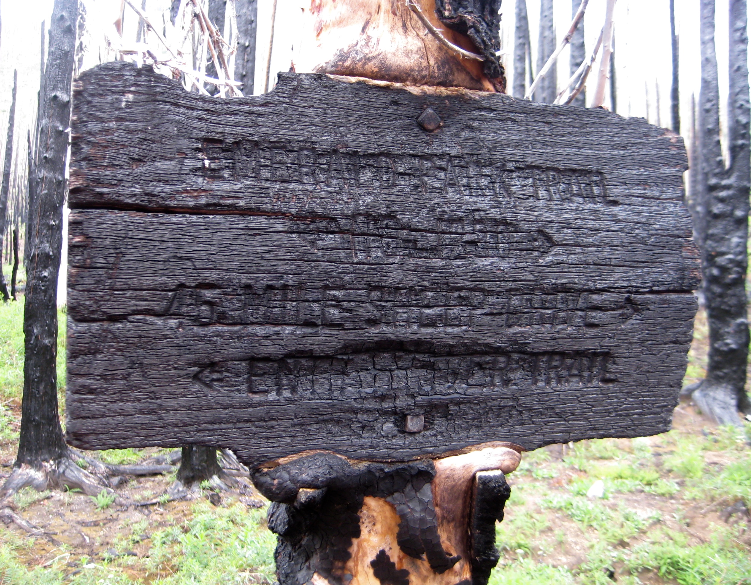
Just across the creek, our descending trail intersected the valley trail. This junction is marked by a sign that has been cooked to crispy perfection.

- Snow Brushy Creek Trail Junction

- Charred Snow Brushy Creek Trail Sign
We ate lunch next to the picturesque creek, then headed back up to Saska Pass. About halfway up, we encountered Kevin hiking down; he was wielding a long stick and had gotten a jump-start on trail maintenance. Together, we returned to camp in early afternoon (2.0 hours + 1700 feet from creek).
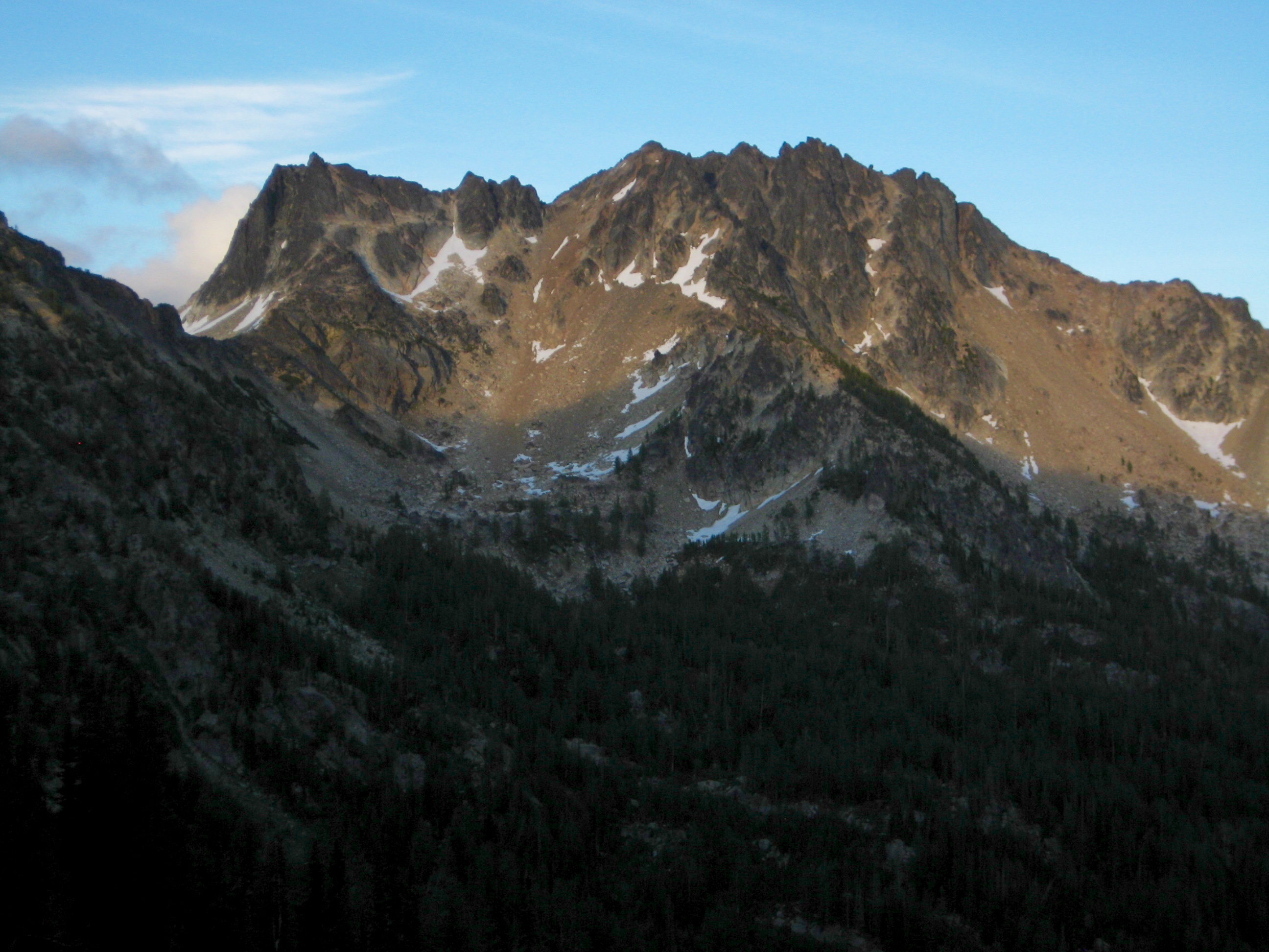
- Cardinal Peak Above Saska Basin Camp
Our group of eight spent the remainder of the afternoon standing around a campfire as rain and wind squalls moved through. We could hear a chain saw in the distance, and a few hours later two Forest Service rangers appeared in camp. They had been cutting fallen logs and, much to our delight, reported that the entire North Fork Trail was now completely cleared out!
Day 6 (AM): Cardinal Peak Summit Climb
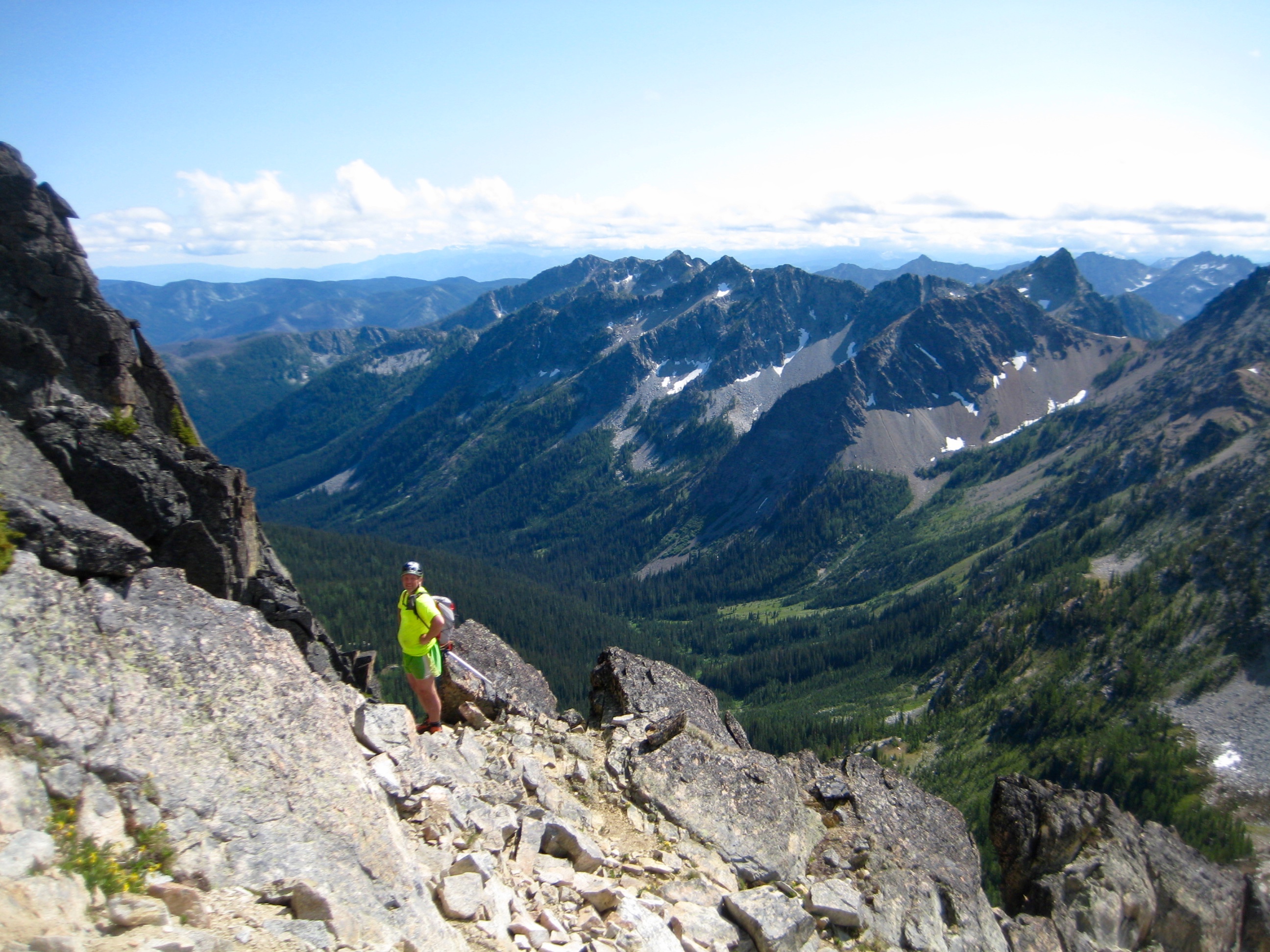
Following a night of continual squalls, we awoke to a cold, clear morning. Everyone except Susie eagerly jumped at the opportunity to climb Cardinal Peak. We hiked a short distance down the trail, then headed up through larch forest to reach a talus basin. A broad scree and talus couloir on Cardinal’s northwestern flank was ascended to the north ridge.
- Heading Up Cardinal Peak On Day 6
Class 2-3 scrambling on or east of the north ridge led to the summit in late morning (2.3 hours + 2000 feet from Camp 3).

- Looking Out Northeast Arm Of Cardinal Peak

- Eileen & David High On Cardinal Peak
Everyone took a long summit break to soak in the sunny morning. David pulled out his radio and antenna in hopes of contacting four other hams, but an hour of effort produced only one response.

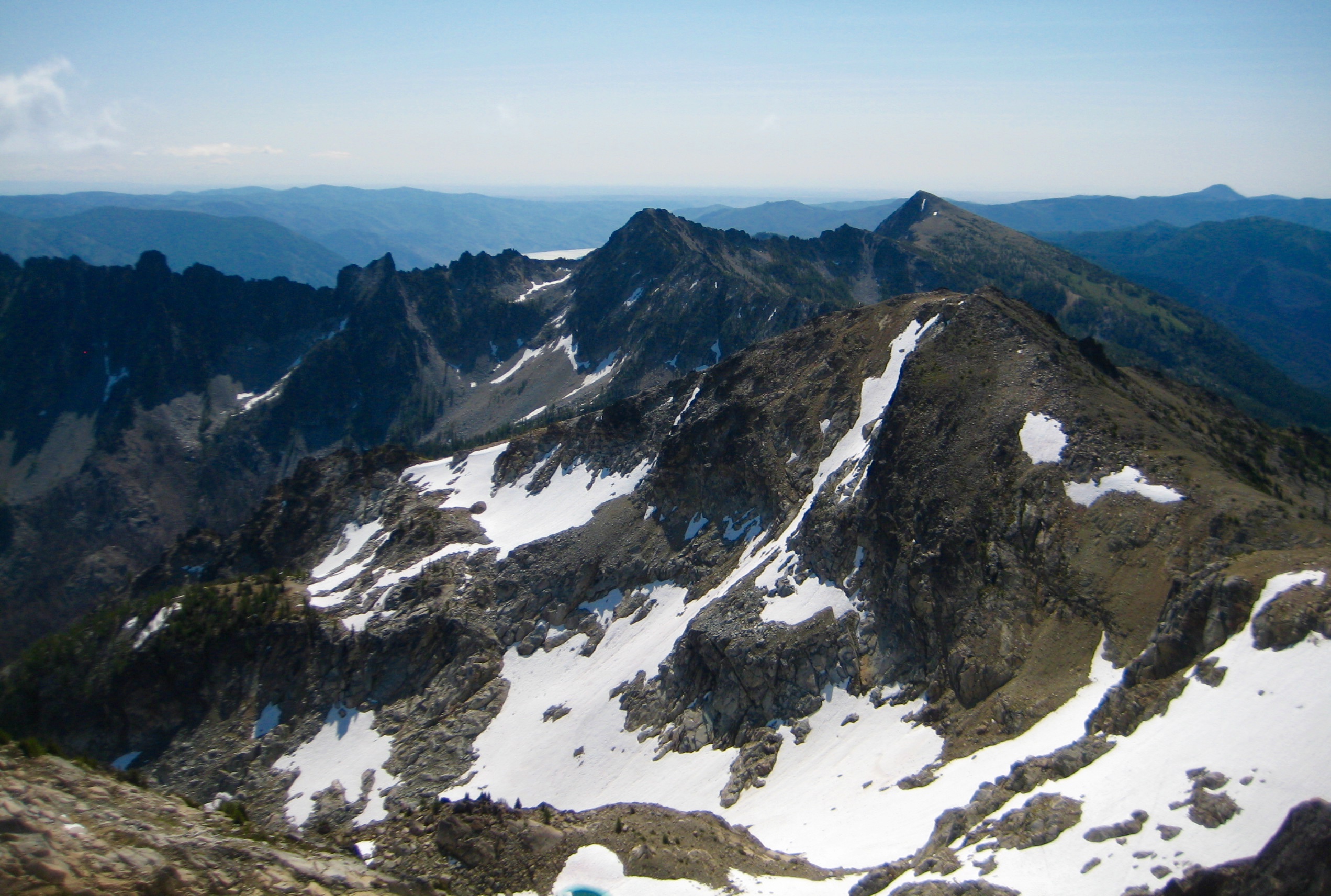
- Squaretop Mtn & Pyramid Mtn From Cardinal Peak
- Saska Peak & Emerald Peak From Cardinal Peak
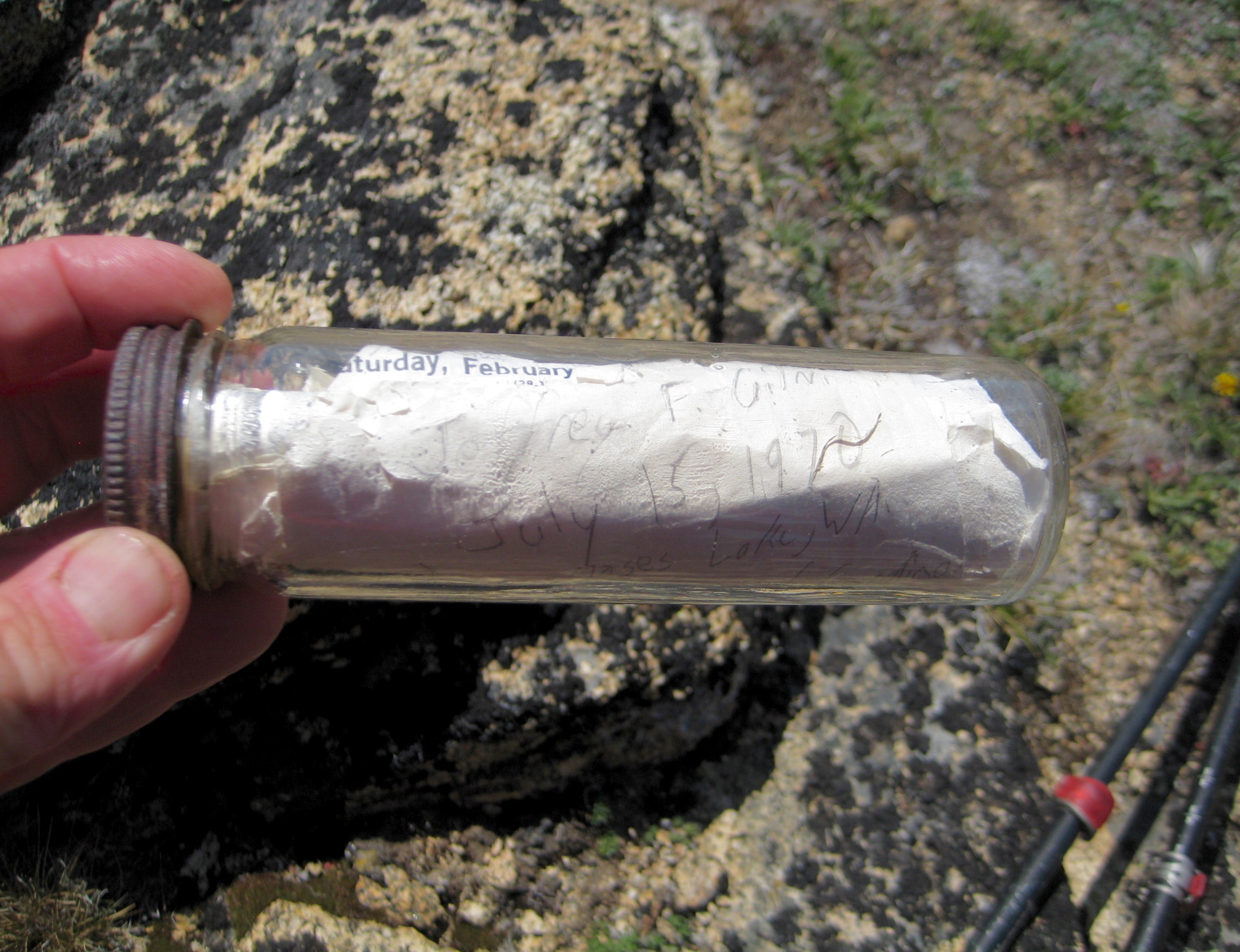
On our descent, several of us walked out the peak’s northeastern arm to gander at an old survey cairn. Surprisingly, this cairn houses a glass bottle that contains a register dating back to at least 1970. Why someone placed the register here rather than on the summit is anybody’s guess.

- Old Register On Northeast Arm Of Cardinal Peak
We continued our descent to camp, where we joined Susie for a final group lunch.

- Descending Into Northwest Basin Of Cardinal Peak
Day 6 (PM): Emerald Peak Summit Climb
After lunch, Tony, Susie, and Eric packed up and headed toward home, whereas Kevin, Lisa, David, Eileen, and I took the afternoon to climb nearby Emerald Peak. We hiked up to the peak’s northwest ridge, then made a hard right turn and ascended a hidden scree chute.

- Heading Up Emerald Peak On Day 6
- Lisa & Eileen Scrambling Up Emerald Peak
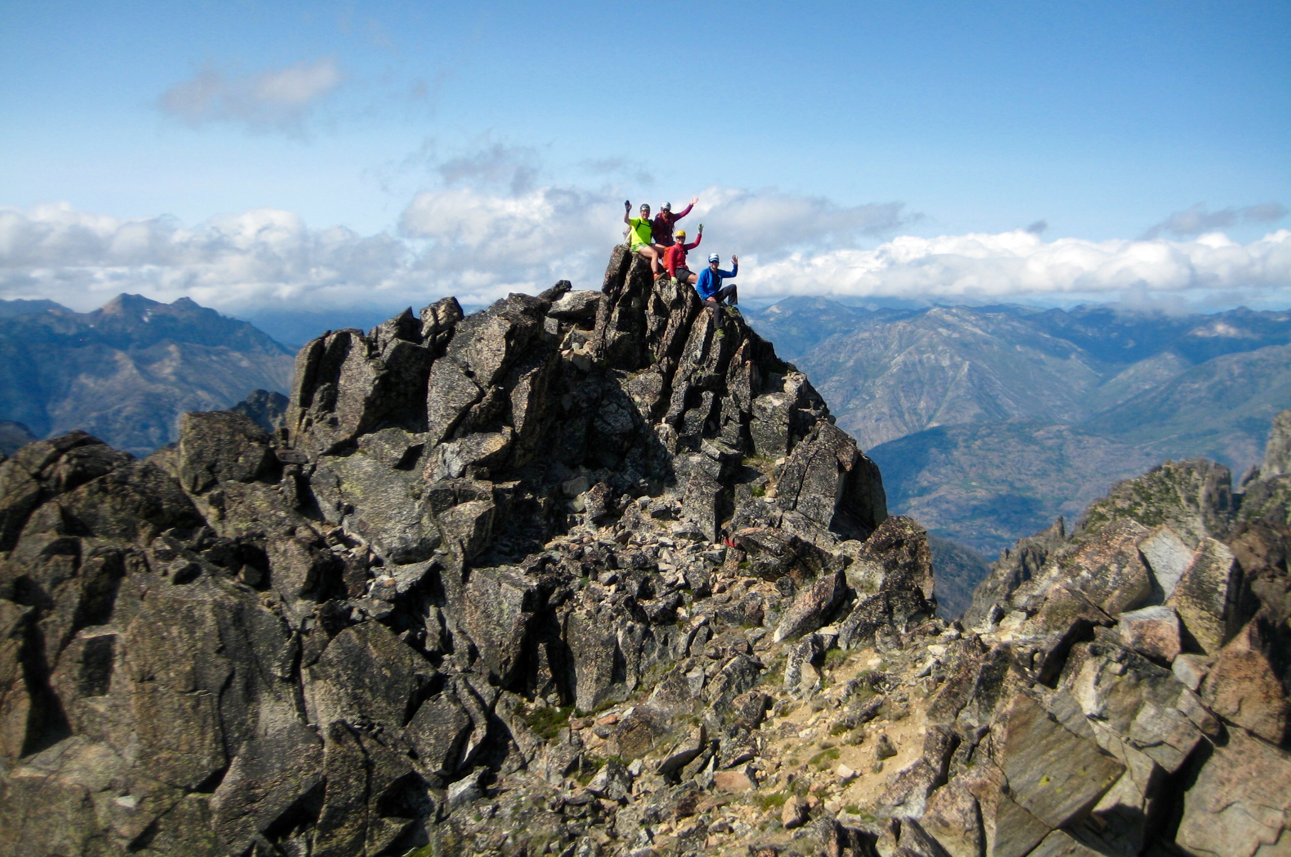
A fun Class 3 scramble up the final rock rib led to the airy summit horn in late afternoon (1.7 hours + 1600 feet from Camp 3). Far below lay the strikingly green expanse of Emerald Park, which was thankfully spared by the Wolverine Creek Fire.

- Group On Emerald Peak Summit
- Cardinal Peak From Emerald Peak Summit
- Mirror Mtn & Emerald Park From Emerald Peak
We signed the summit register, then made a quick descent back to Saska Basin (1.2 hours from summit) and savored our final dinner of the trip.
- Evening Sun On Cardinal Peak From Camp 3
Day 7: Saska Basin to Trailhead
The night was clear and extra cold, and in the morning we awoke to frosty tents and frozen ground. Breakfast was hastened by a frigid northerly breeze. It was difficult to believe that this was July rather than October!

- Morning Sun On Fern Peak From Saska Basin
We began our 9-mile hike down the North Fork Entiat River Trail bundled up in hats, coats, and gloves. However, by the time we reached the trailhead at noon (4.5 hours + 500 feet from Camp 3), we were stripped down to light clothing. It was pleasantly warm…but still felt like October!
Route Maps & Profile
…
…
…
…
Photo Gallery
Click to enlarge…