Trip Date: June 1-3, 2020
Gunn Basin Climbing Trip
Barclay Creek
Tailgunner Pass
Gunn Basin
Gunn Peak: east summit aka East Gunn Peak (6160’+)
Gunn Point (5760’+)
Tailgunner Peak (5842′)
Wing Peak (5760′)
Trip Report Summary
Region: North-Central Washington Cascades
Sub-Region: Skykomish Mountains
Area: Wild Sky Wilderness
Starting & Ending Point: Barclay Lake Trailhead at end of Barclay Creek Road (Elev. 2300 feet)
Way Points: Barclay Creek Spur Road junction & Barclay Creek shore (road walk); Tailgunner Creek & Tailgunner Ravine & Tailgunner Couloir & Tailgunner Pass & Gunn Basin (off-trail hike & bushwhack & rock scramble & snow climb)
Campsite: Upper Gunn Basin (Elev. 5360 feet)
Sidetrip: Gunn Lake Saddle (snow climb)
Summit: East Gunn Peak (snow climb & rock climb & rock scramble via Southwest Couloir—South Face—West Ridge)
Summit: Gunn Point (rock scramble via Southwest Ridge)
Summit: Tailgunner Peak (snow climb via North Slope—West Ridge; descent via East Slope)
Sidetrip: Tailgunner Pass (snow climb)
Summit: Wing Peak (snow climb & rock climb via Northwest Ridge)
Approximate Stats: 7 miles traveled; 6000 feet gained & lost.
Related Posts
Gunn Peak via South Face—East Ridge – August 2020
Gunnshy Peak via Southeast Slope – March 2015
Tailgunner Peak + Gunn Point – May 2009
Gunn Peak via South Face—East Ridge – June 2002
Full Trip Report
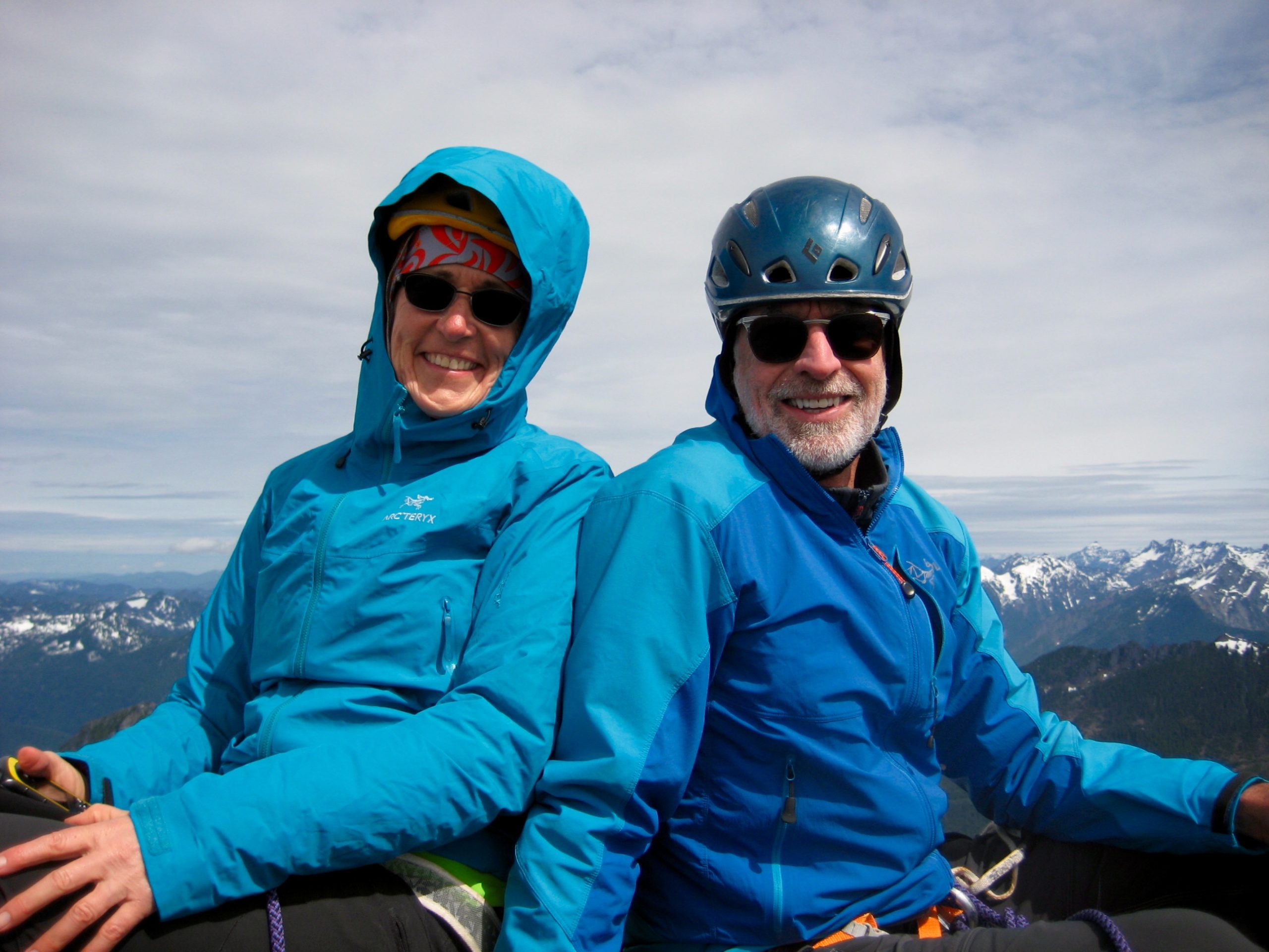
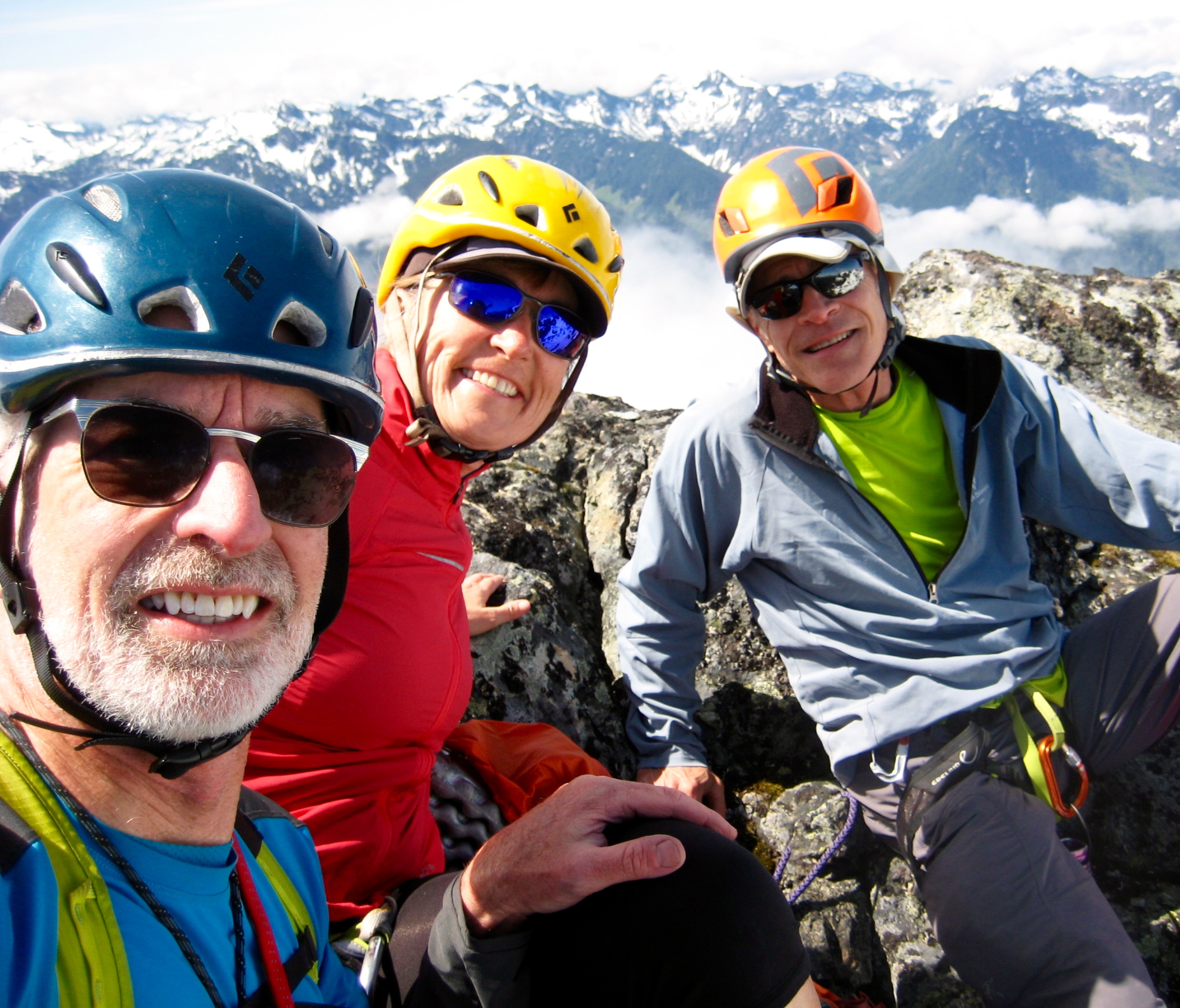
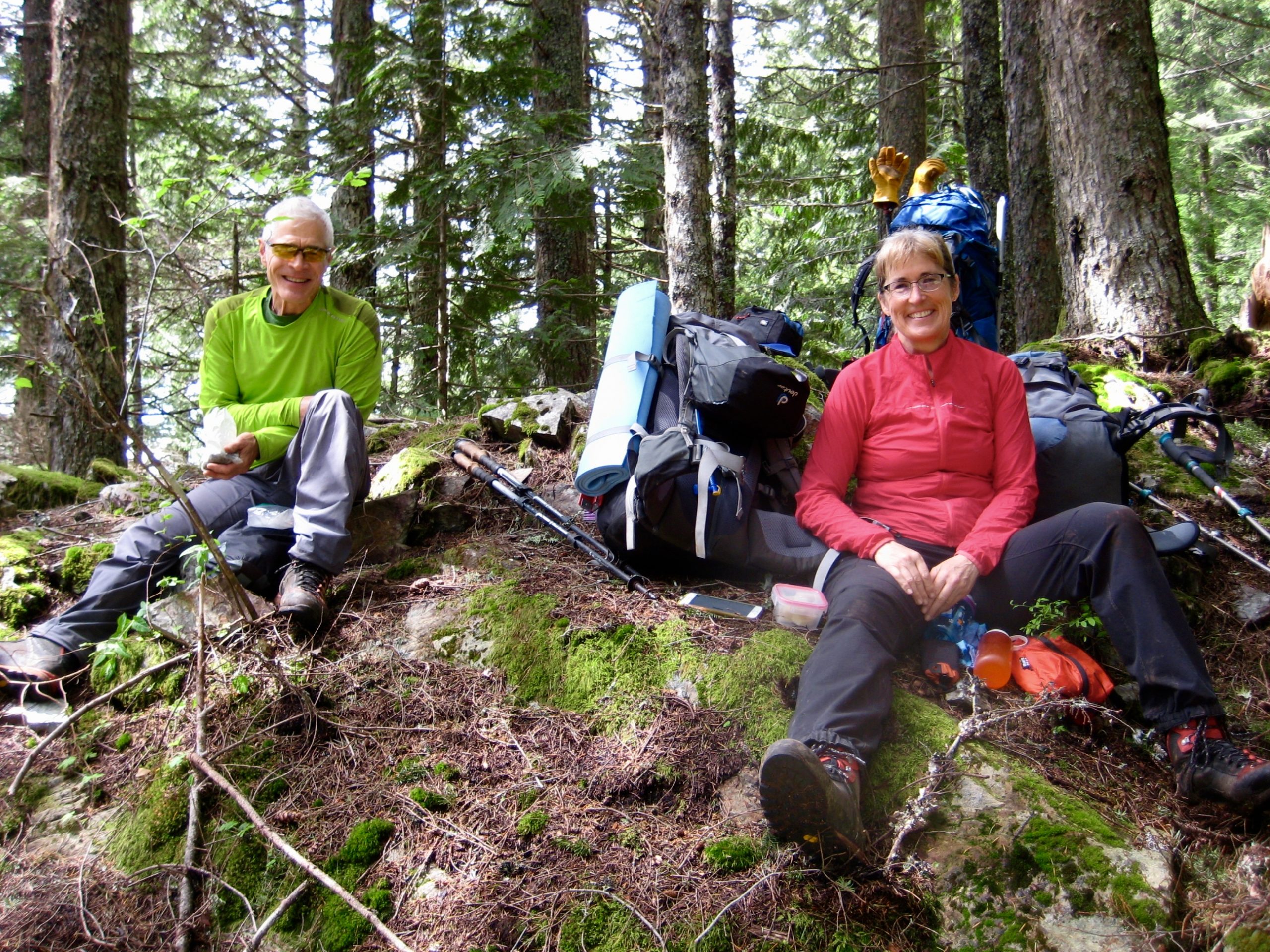
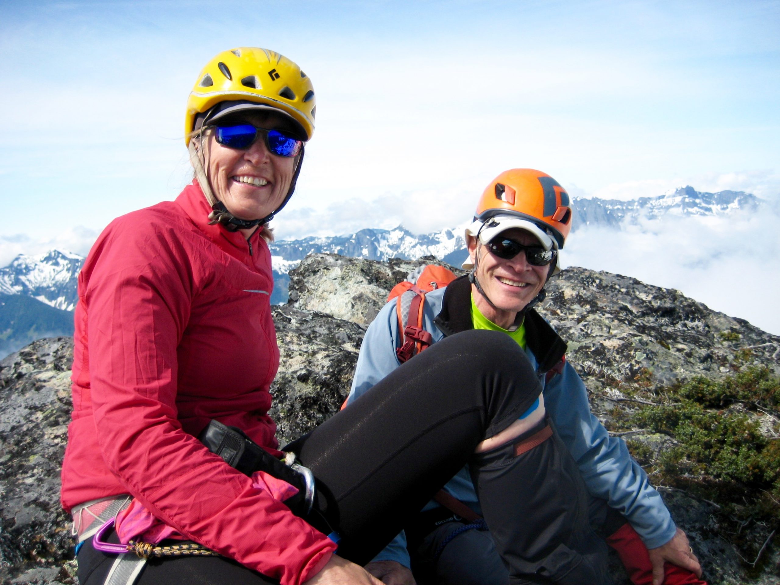
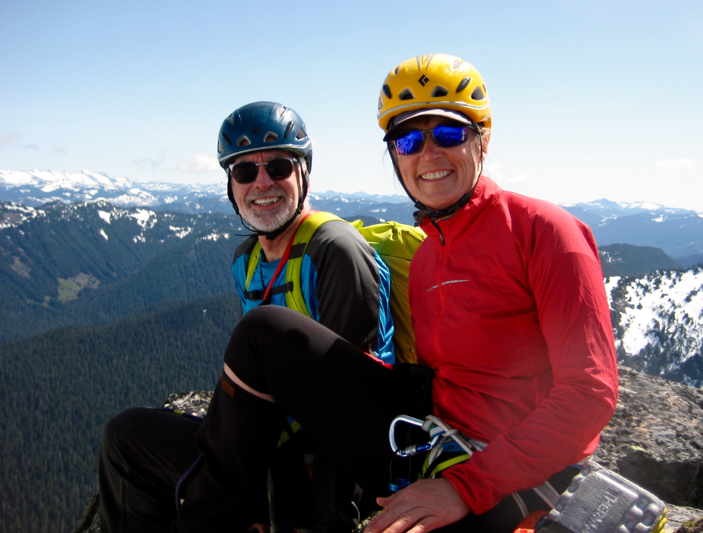
Wanting to take advantage of a good late-spring snowpack, George, Eileen, and I kicked off June with a three-day climbing trip in the Skykomish Mountains. This timing worked out quite well for our approach hike but worked against us for some of our climbing objectives. Ultimately, we were happy to tuck in four summits and gain valuable intel for a future trip.
Day 1: Trailhead to Gunn Basin
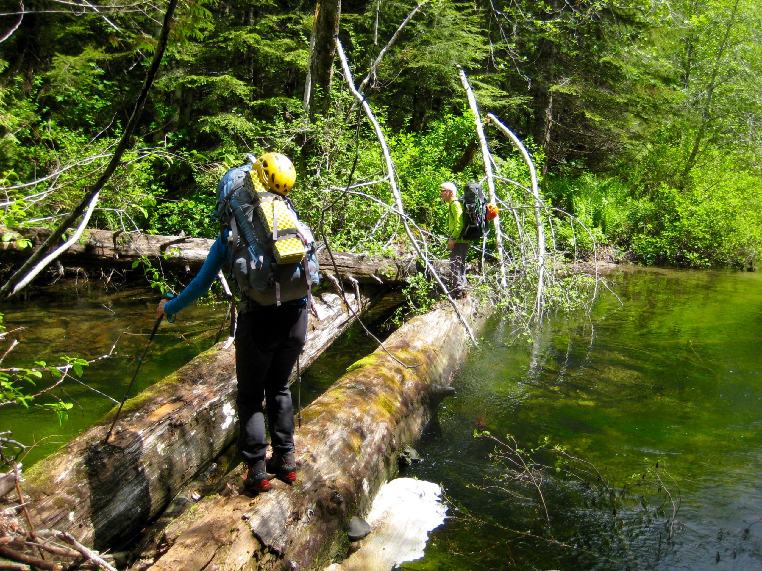
We parked at the Barclay Lake Trailhead in late morning and walked ¼ mile back down the main road to a short spur road, which we then followed downhill a short distance to Barclay Creek. Although in recent years the creek has been crossed on a nearby logjam, the current water level made this a risky prospect, so we spent some time scouting for a better crossing point. Luck was with us; we found a small but stout logjam located 200 yards upstream of the spur road. (For reference, this logjam is 30 yards past a huge creekside boulder and almost directly across from the confluence of “Tailgunner Creek,” a side-stream flowing in from the northeast.)
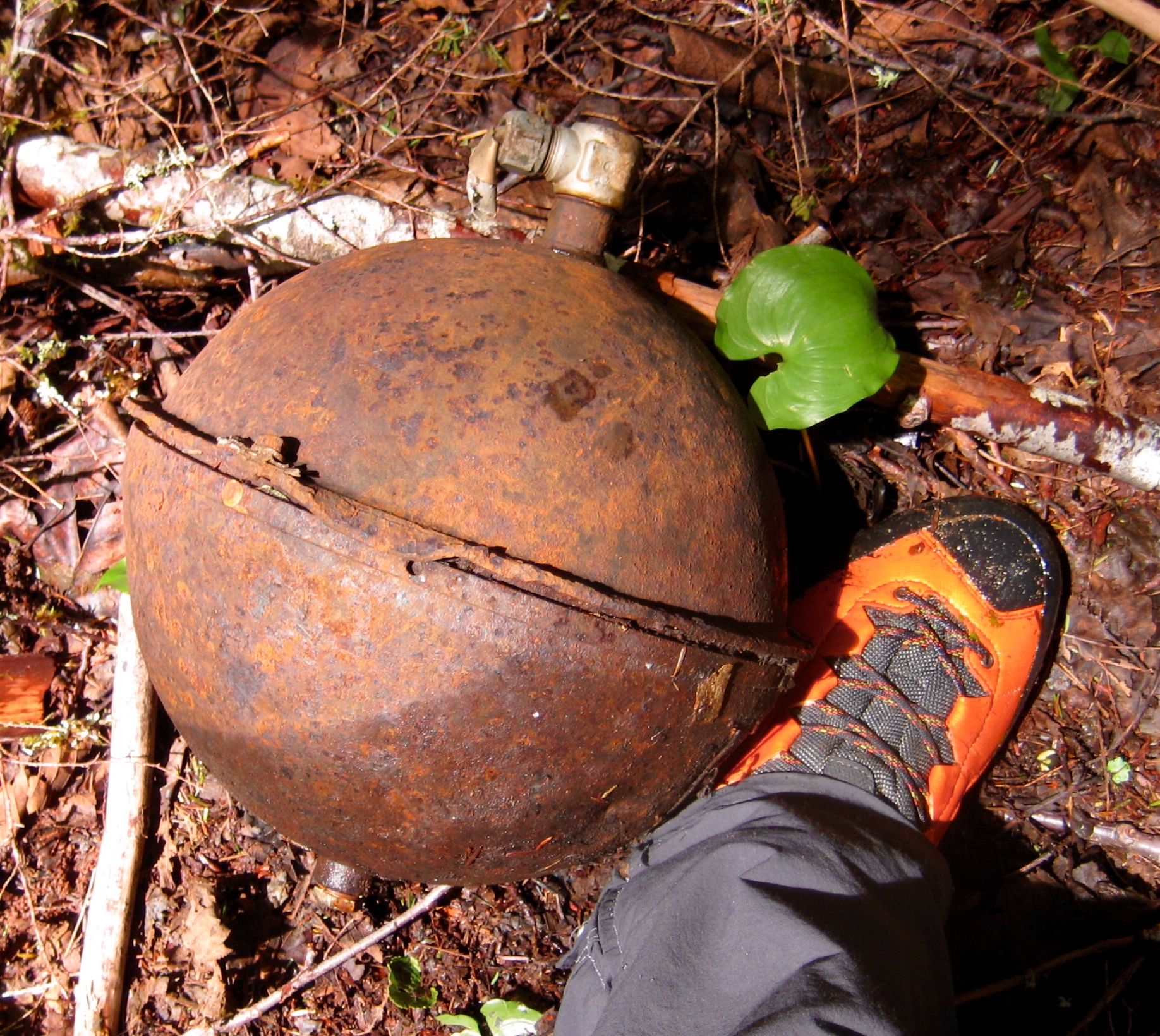
Once across Barclay Creek, we bushwhacked northward beside (or in) the Tailgunner Creek channel for 200 yards until encountering an old corrugated metal culvert. This culvert marks the creek’s intersection with an overgrown logging road. Look closely for old logging equipment and new plastic flagging in the vicinity.
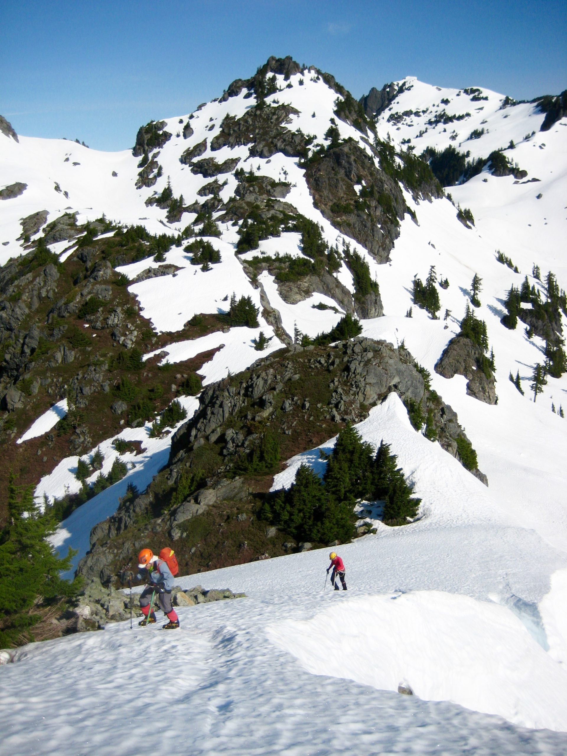
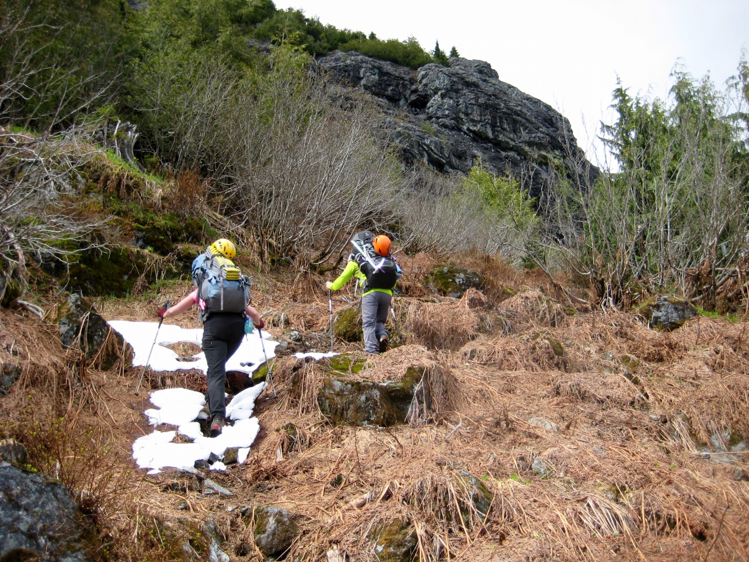
Turning left here, we followed the overgrown road northwestward for 300 yards, then turned sharply to the right and followed a vague bootpath uphill on a perpendicular overgrown logging road. Around Elev. 2800 feet, the bootpath enters mature forest and becomes better defined. The path is fairly easy to follow overall, but recent windstorms have covered it with a large amount of litter, branches, and logs. This was my fourth time up the path during a 20-year span and was by far the worst conditions I’ve seen. We were more than ready to stop for a rest on an inviting rocky knob at 3600 feet (2.8 hours + 1400 feet from TH).
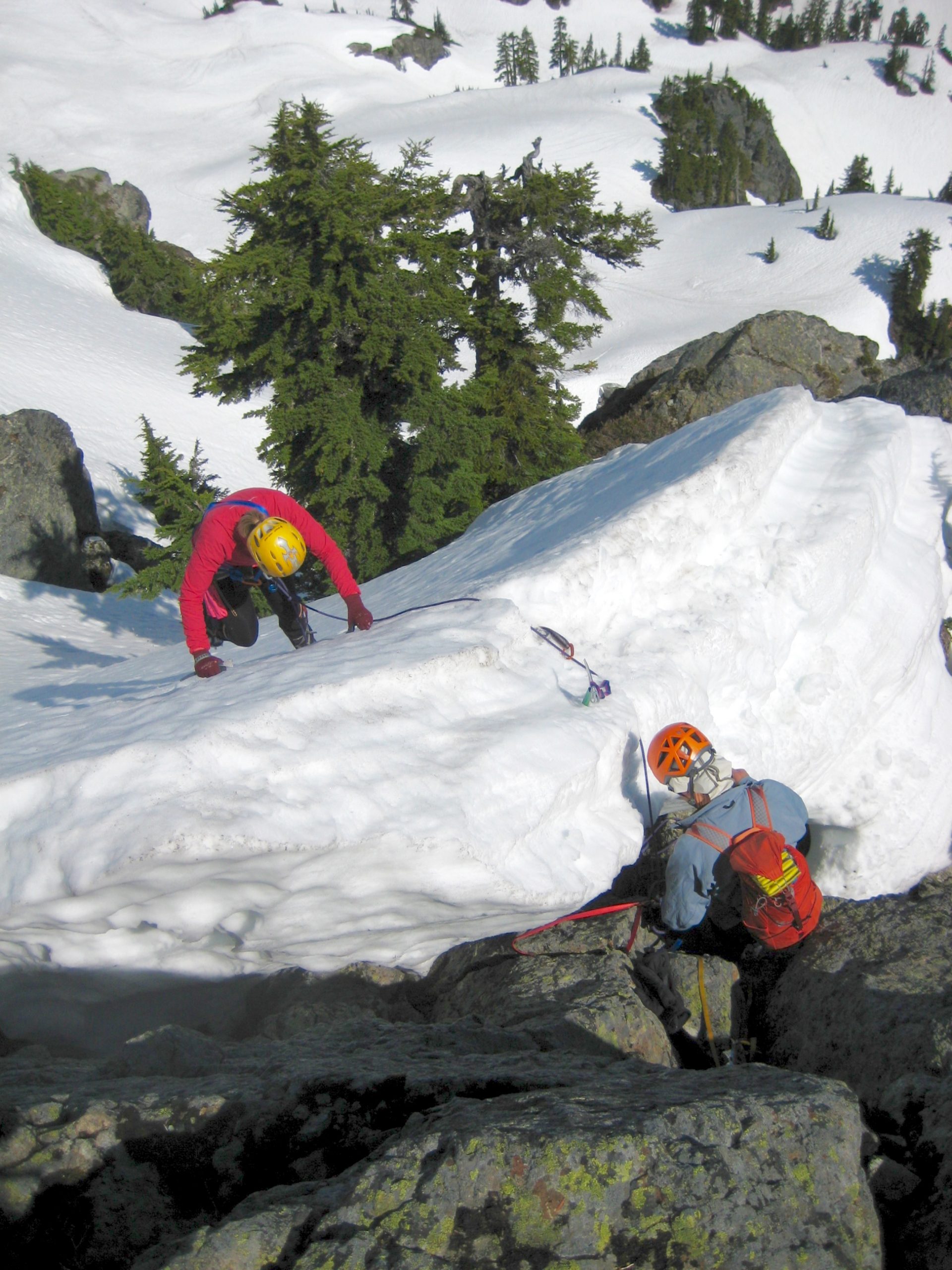
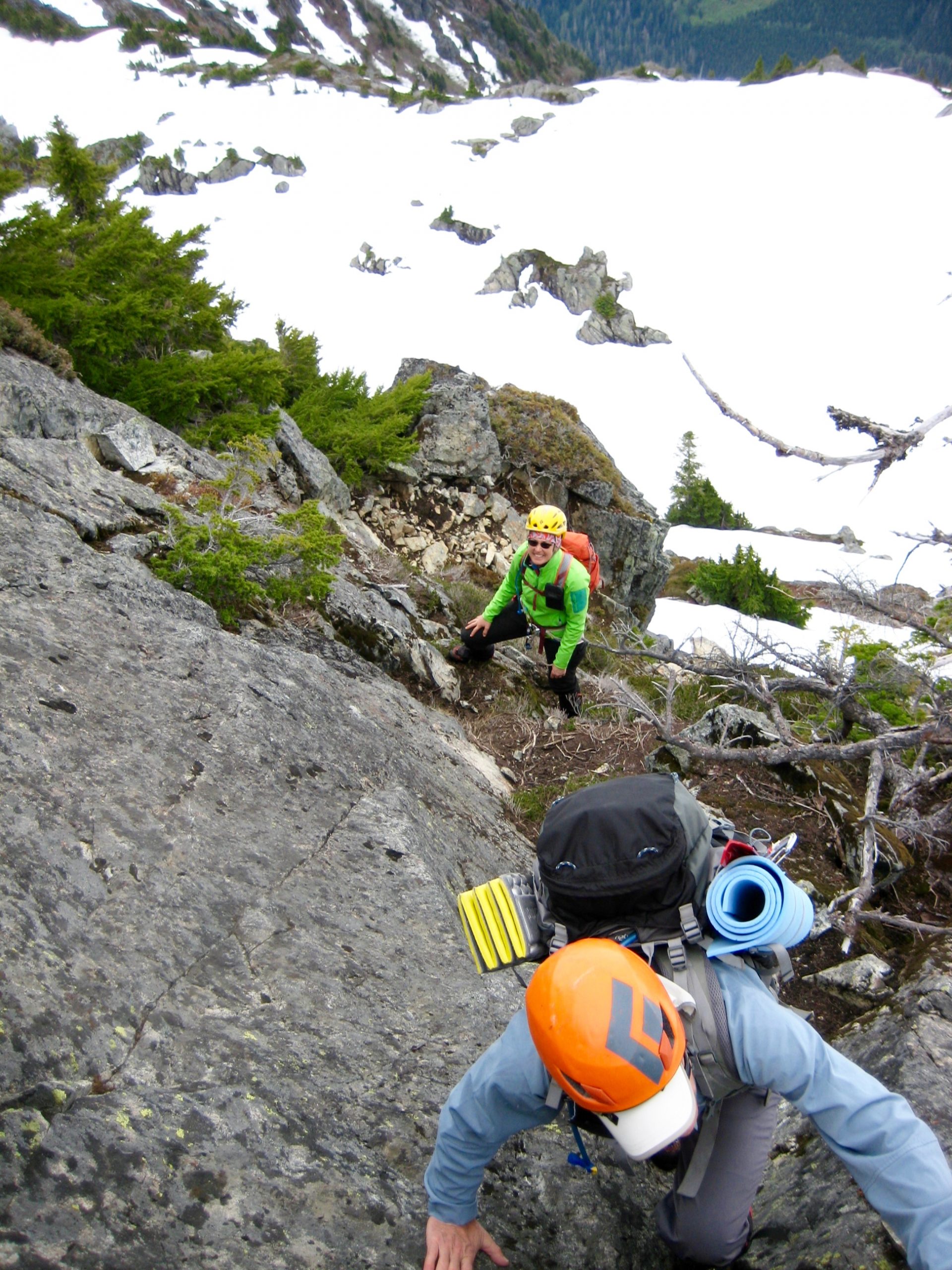
Proceeding upward, the steep bootpath reaches the base of a huge cliff at 4000 feet, then angles rightward for 150 yards until abruptly encountering the infamous waterfall ravine. This ravine always gives pause to uninitiated travelers but actually can be crossed quite readily by descending 50 feet to the invert and re-ascending ledges on the other side. Our heavy backpacks were not appreciated on the moderately exposed Class 2-3 scramble!
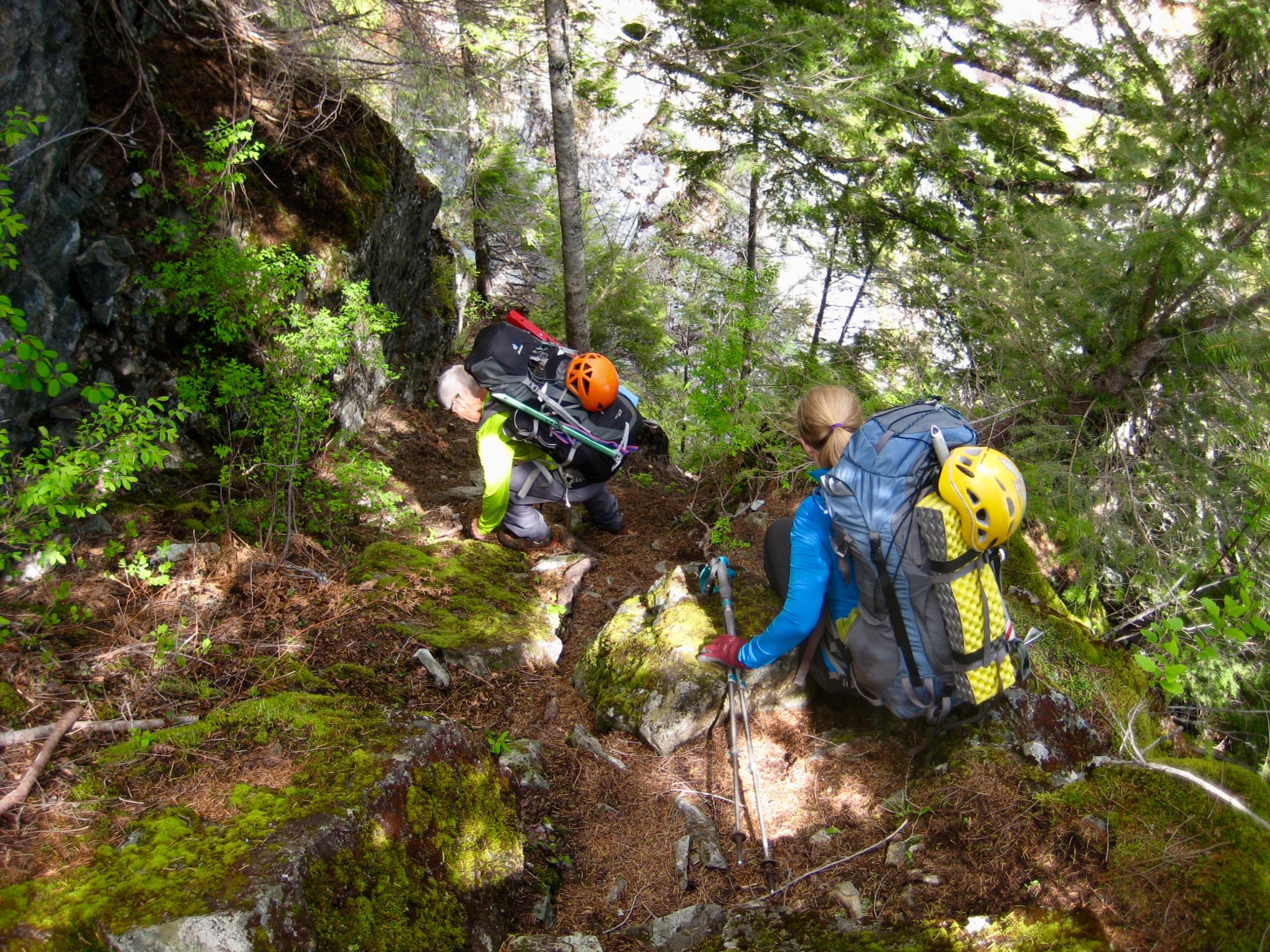
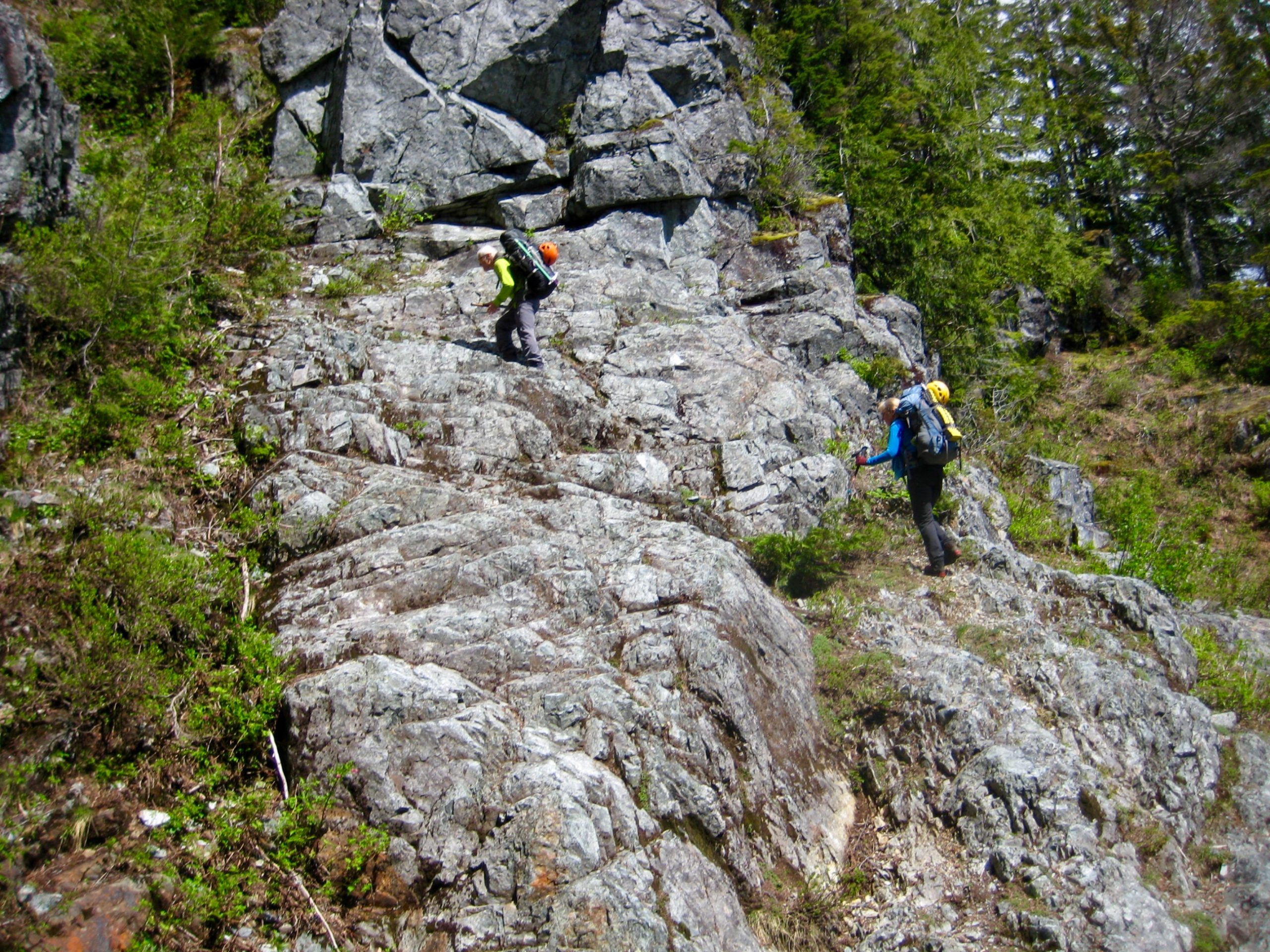
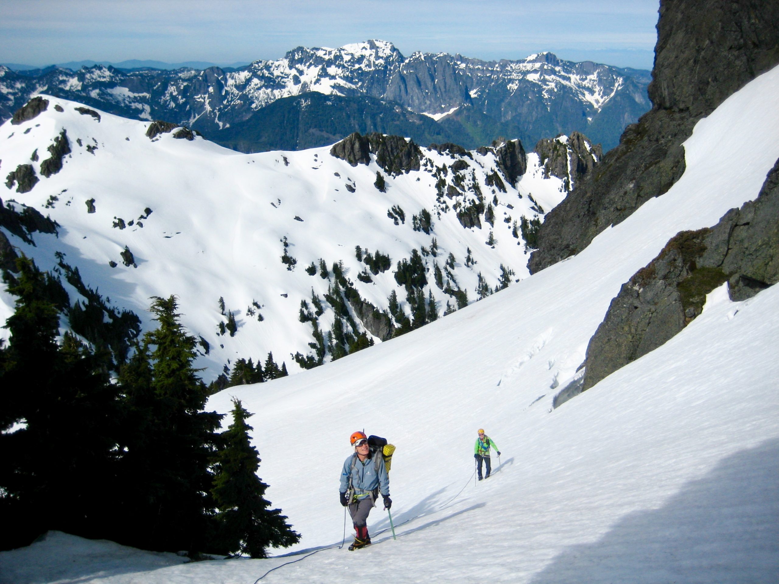
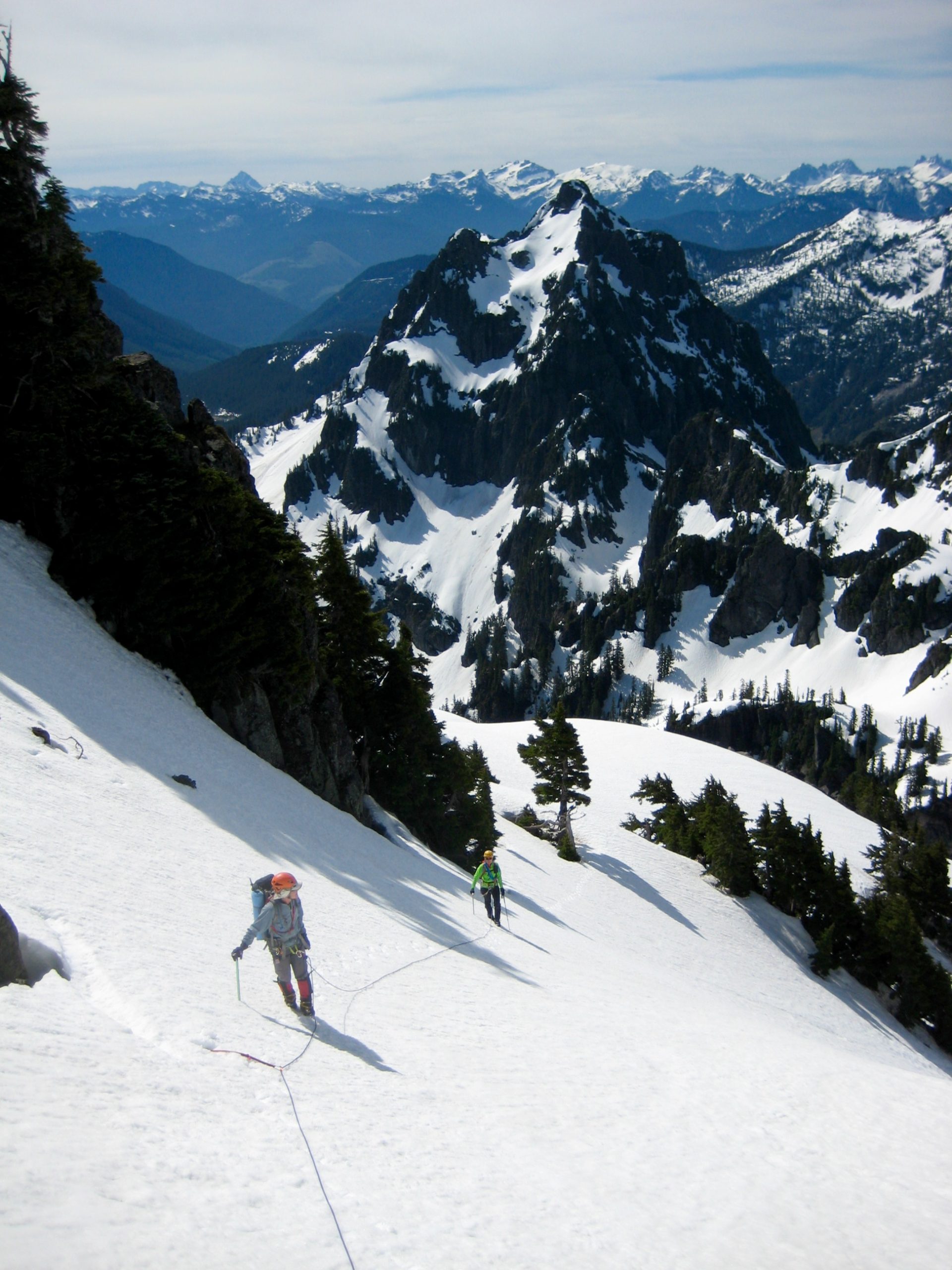
The bootpath climbs onto a steep, forested rib just east of the ravine and then continues traversing right (eastward) along the cliff base. In this vicinity, one of the “summer routes” turns sharply up a gully that cuts through the overhead cliff; however, our “spring route” took us farther eastward to the broad Tailgunner Couloir. As usually happens in early season, the entire couloir offered a straightforward, brush-free ascent on grassy slopes and firm snowpatches.
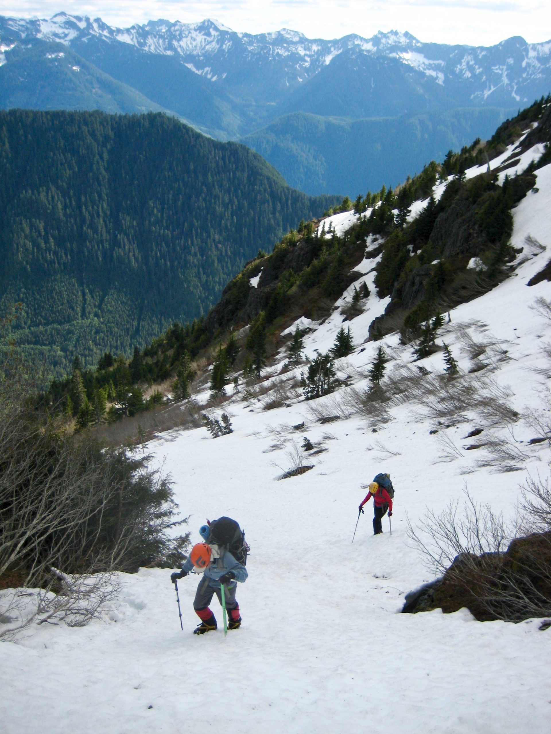
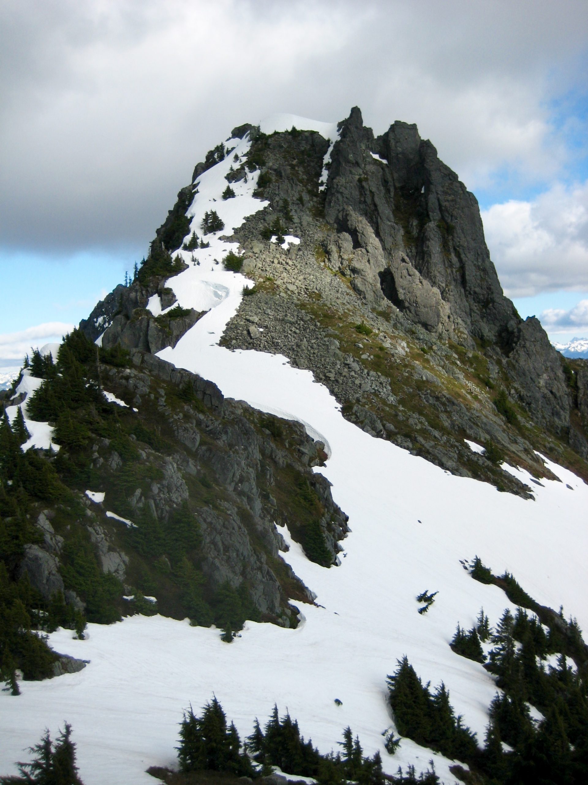
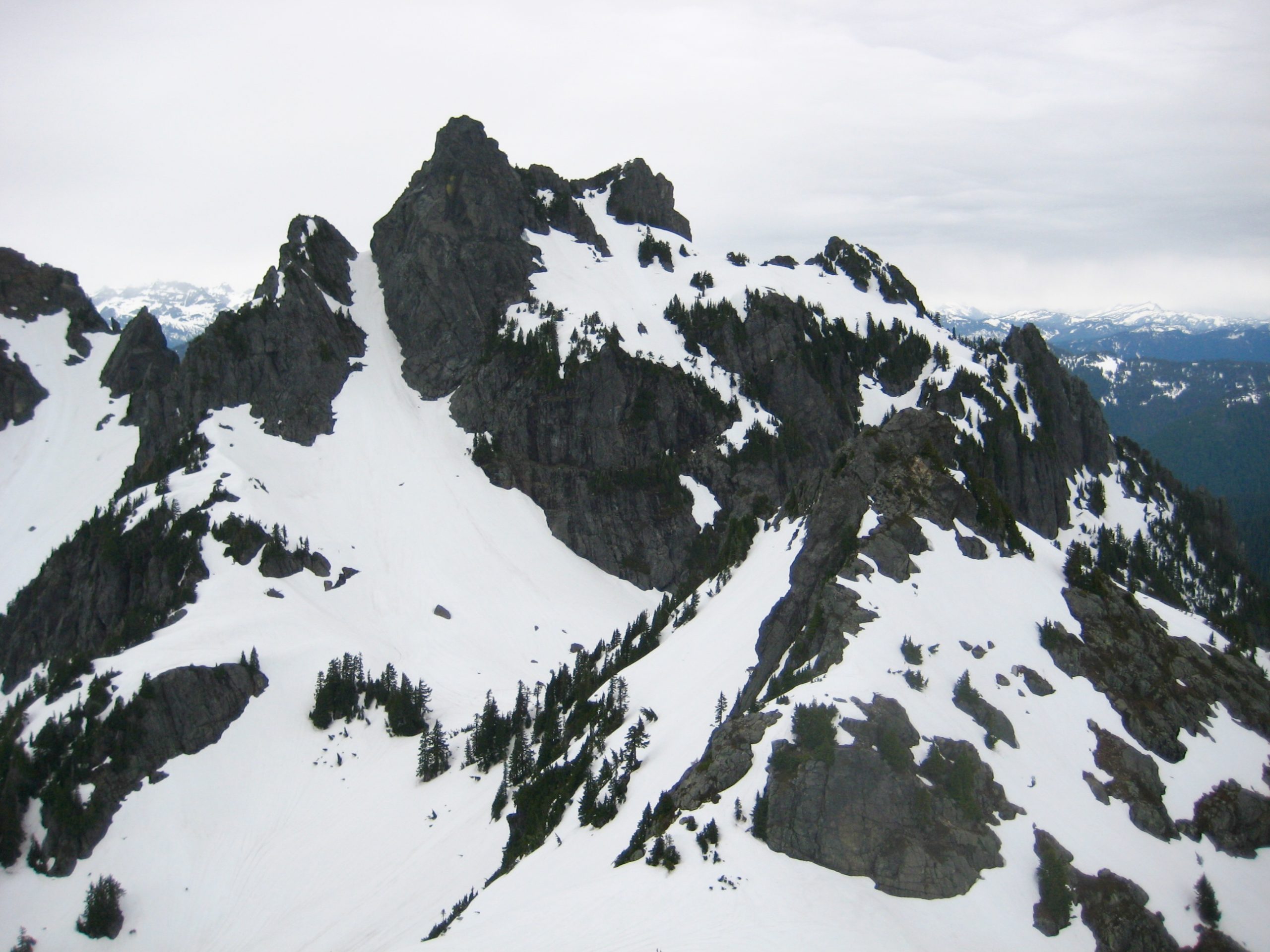
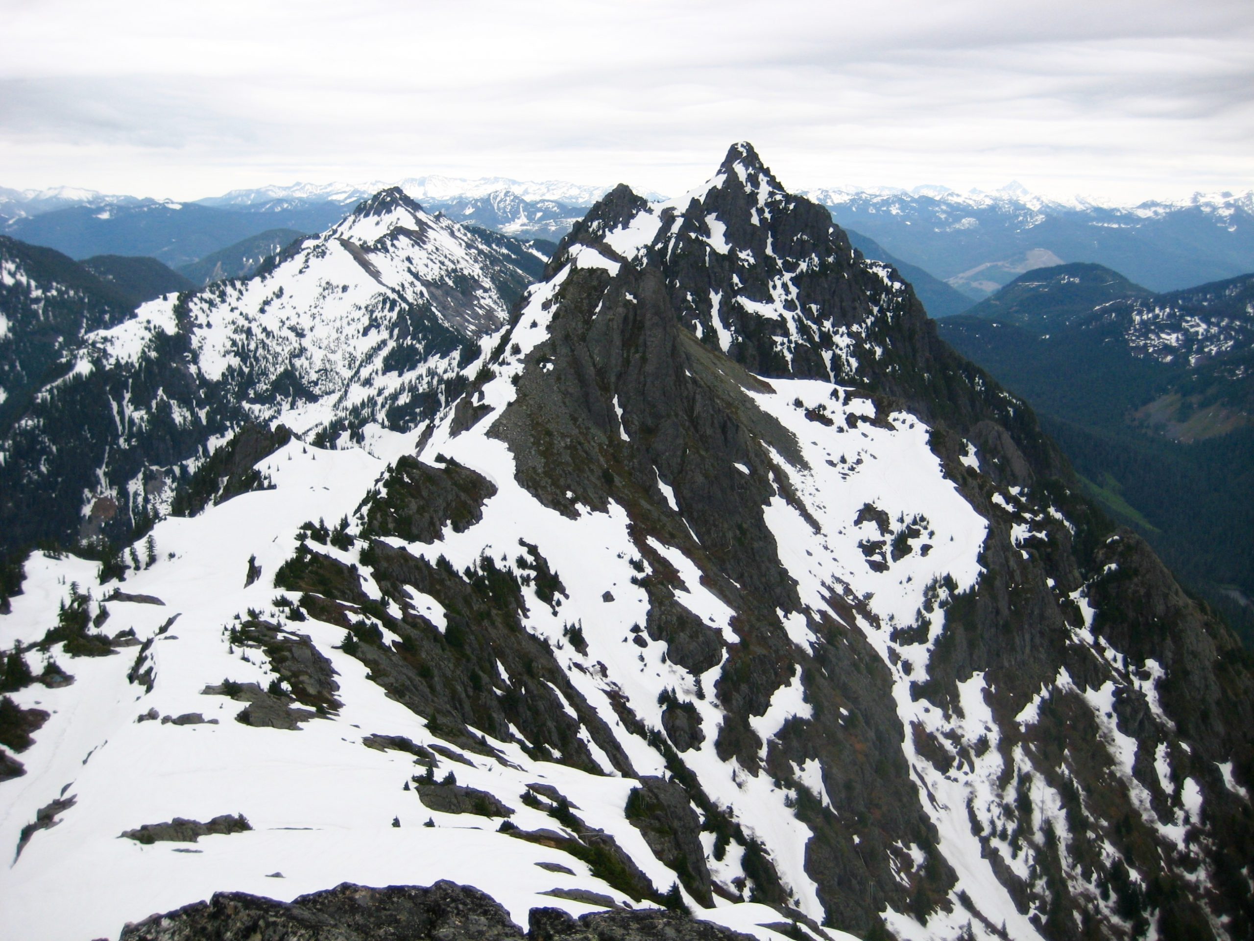
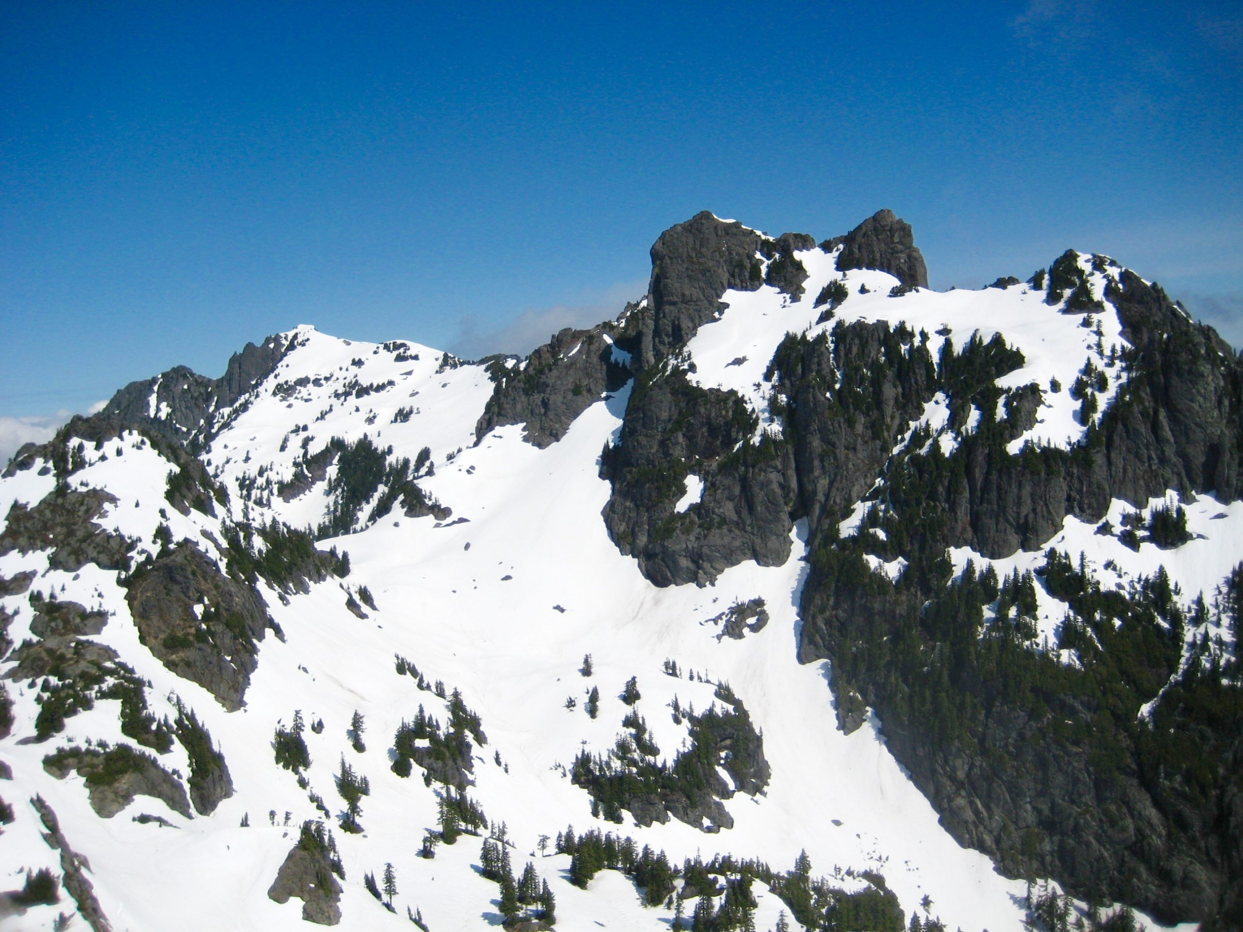
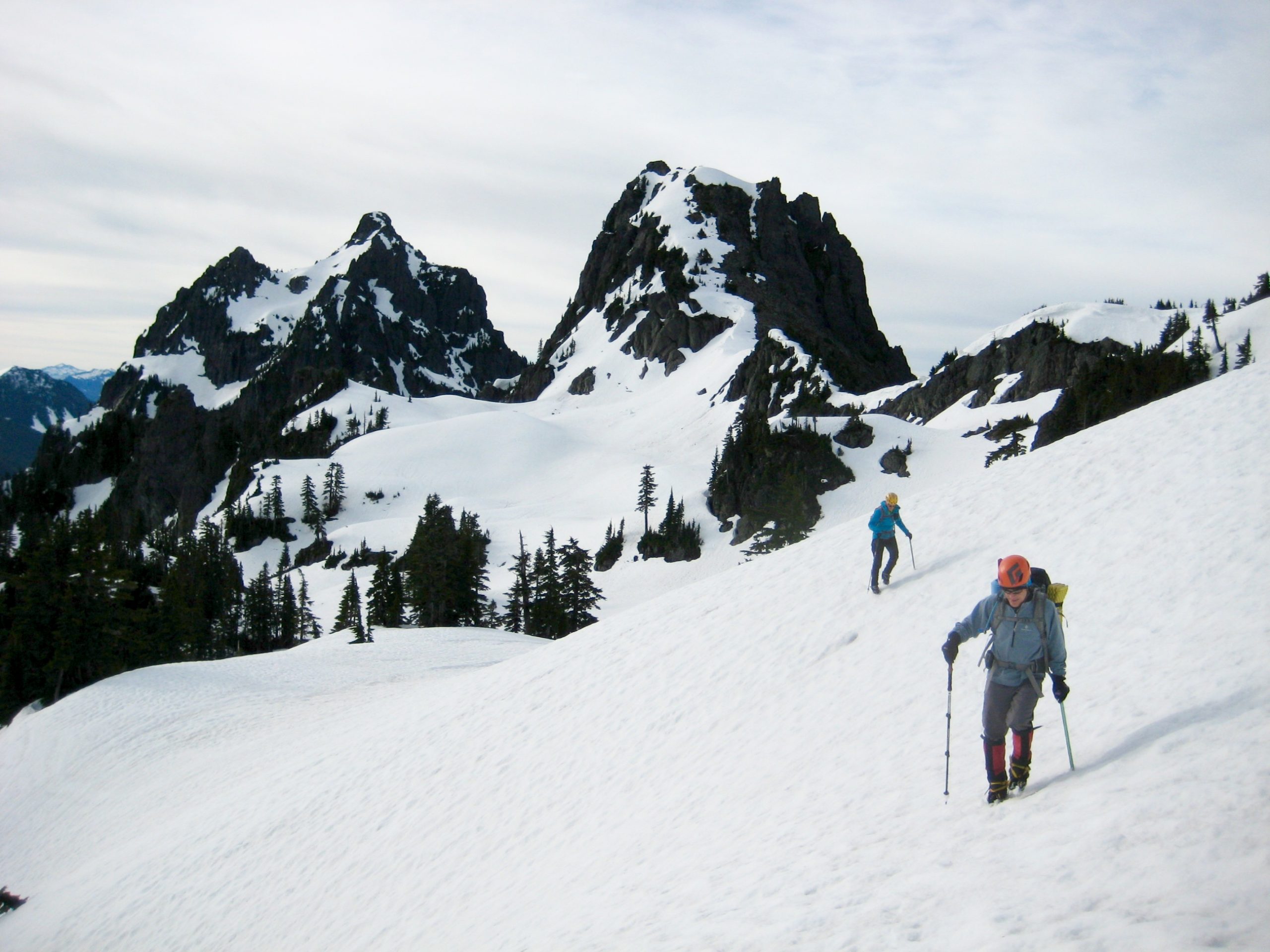
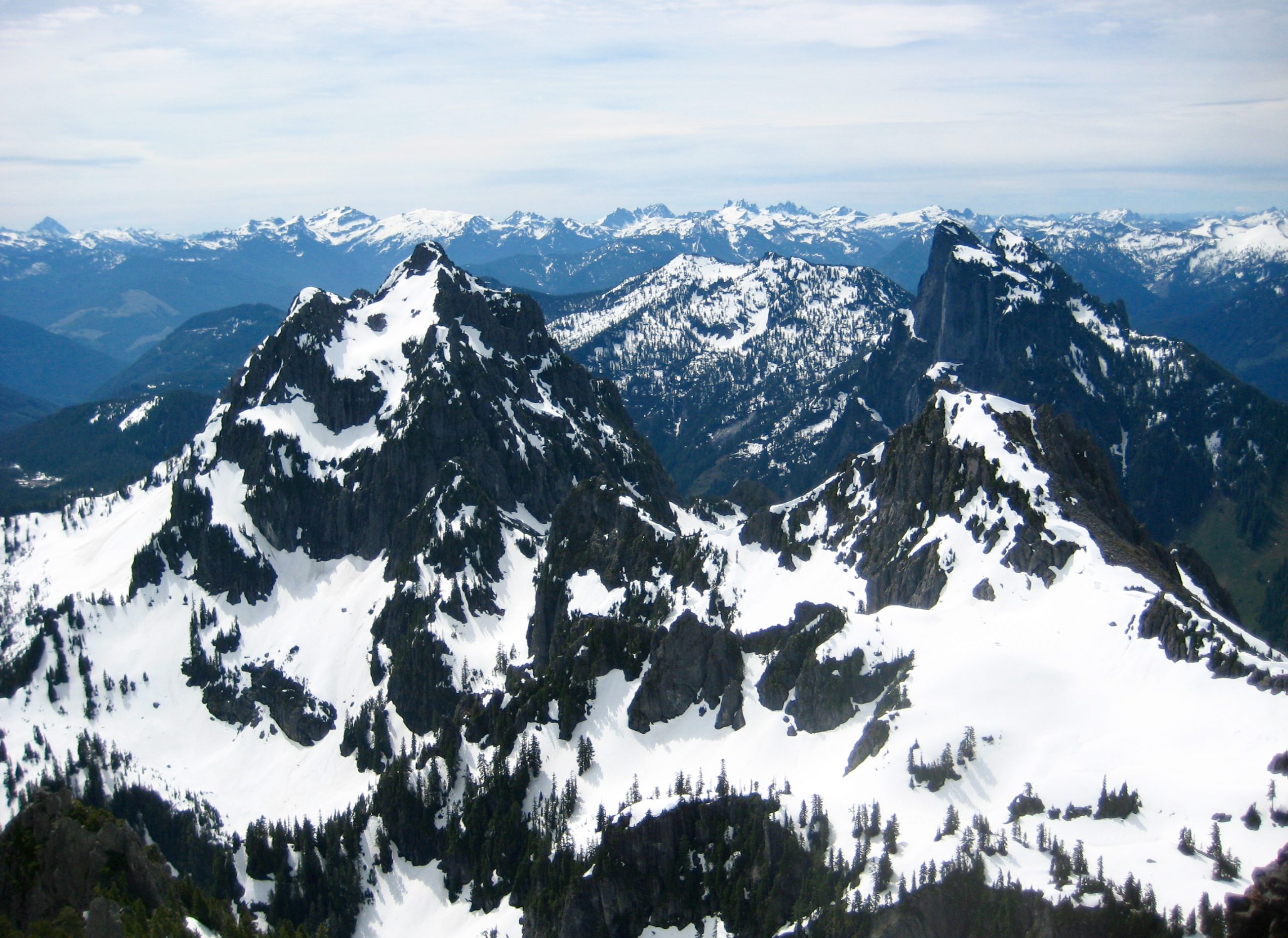
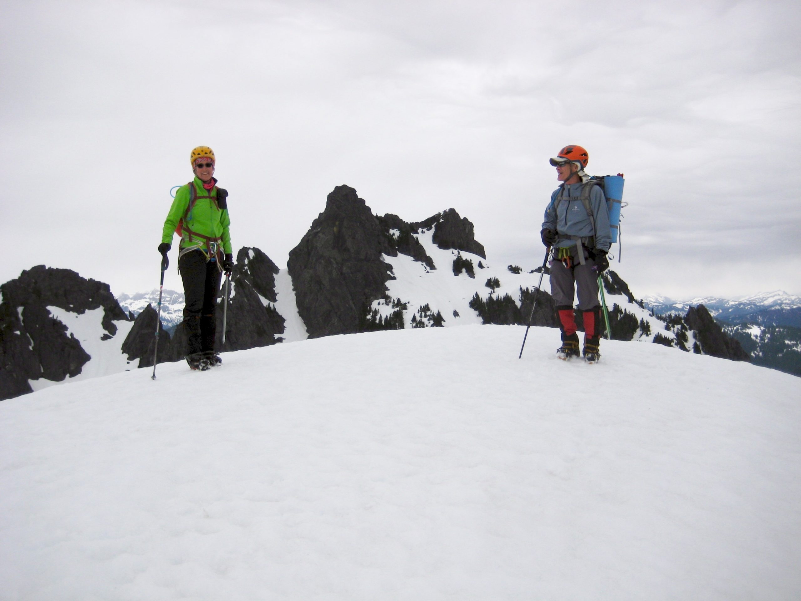
We gained 5320-foot Tailgunner Pass at 6:00pm (6.6 hours + 3200 feet from TH) and got a close-up view of our various objective summits: Gunn Peak (6240 feet) to the north, Gunn Point (5760+ feet) to the northwest, Tailgunner Peak (5842 feet) to the west, and Wing Peak (5760 feet) to the southeast. It became immediately obvious that we would have no shortage of snow on this trip!
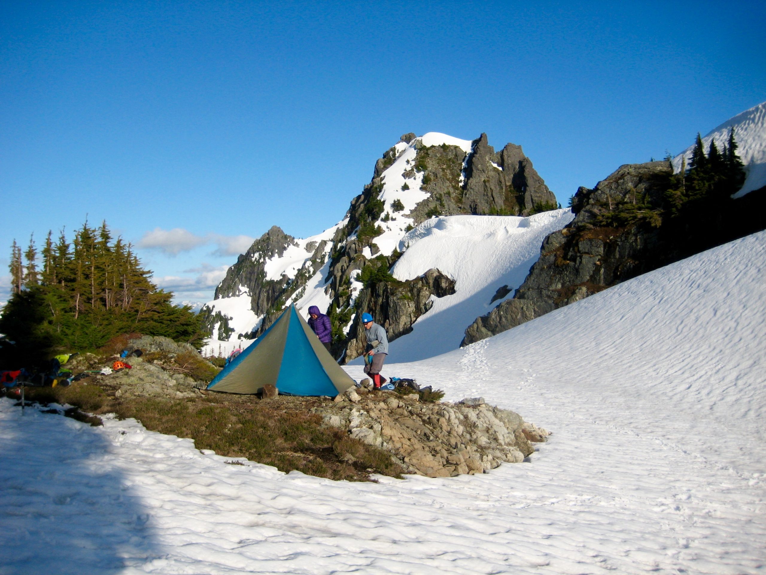
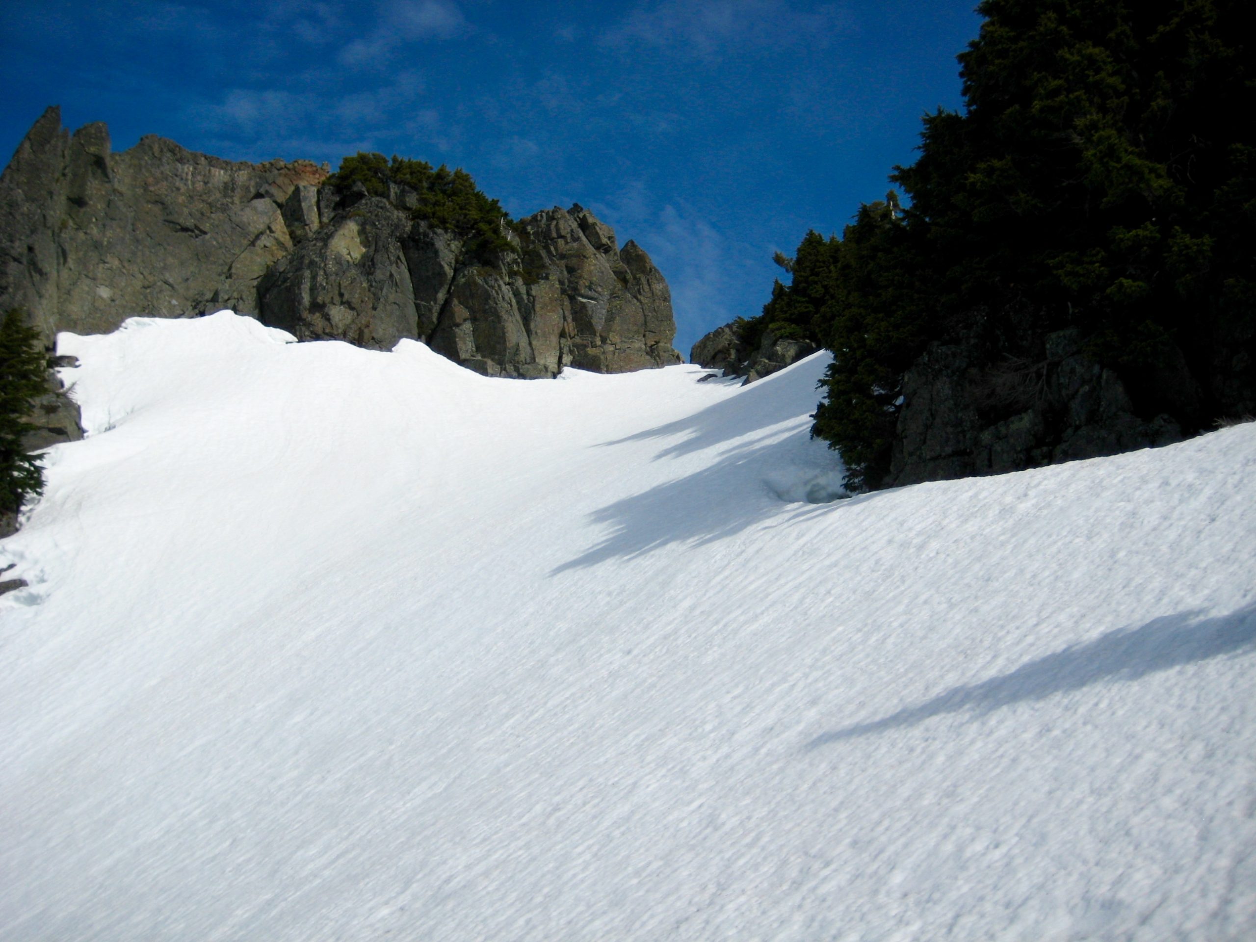
Because a cliff band on the northern side of Tailgunner Pass prevents a direct descent, we hiked westward on the ridge crest for 150 yards before dropping into upper Gunn Basin (6.9 hours + 3300 feet from TH). A gravelly bench at 5360 feet provided a dry campsite, with drinking and cooking water available from a tiny trickle on a nearby cliff.
Day 2: East Gunn Peak + Gunn Point + Tailgunner Peak Climbs
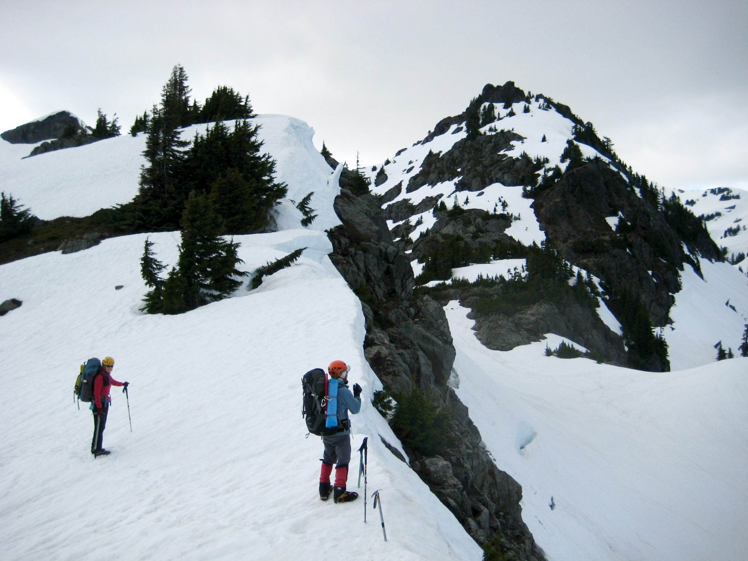
We awoke to mostly clear skies and a forecast of sunny weather all day (it wasn’t). Our first objective today was Gunn Peak, so we contoured around the eastern flank of Gunn Point to Gunn Lake Saddle and then ascended a south-facing couloir. Crampons were essential due to the refrozen snow surface.
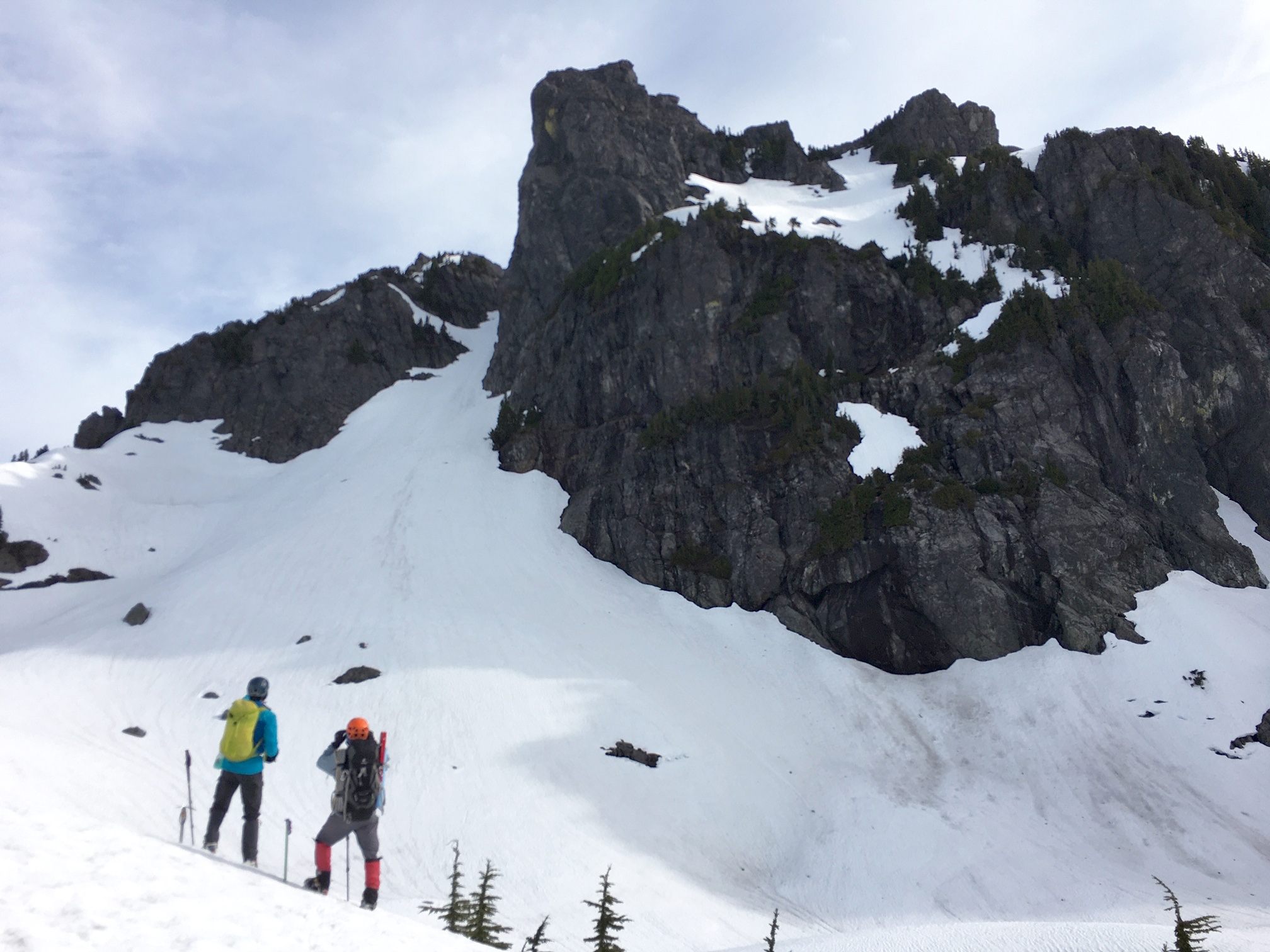
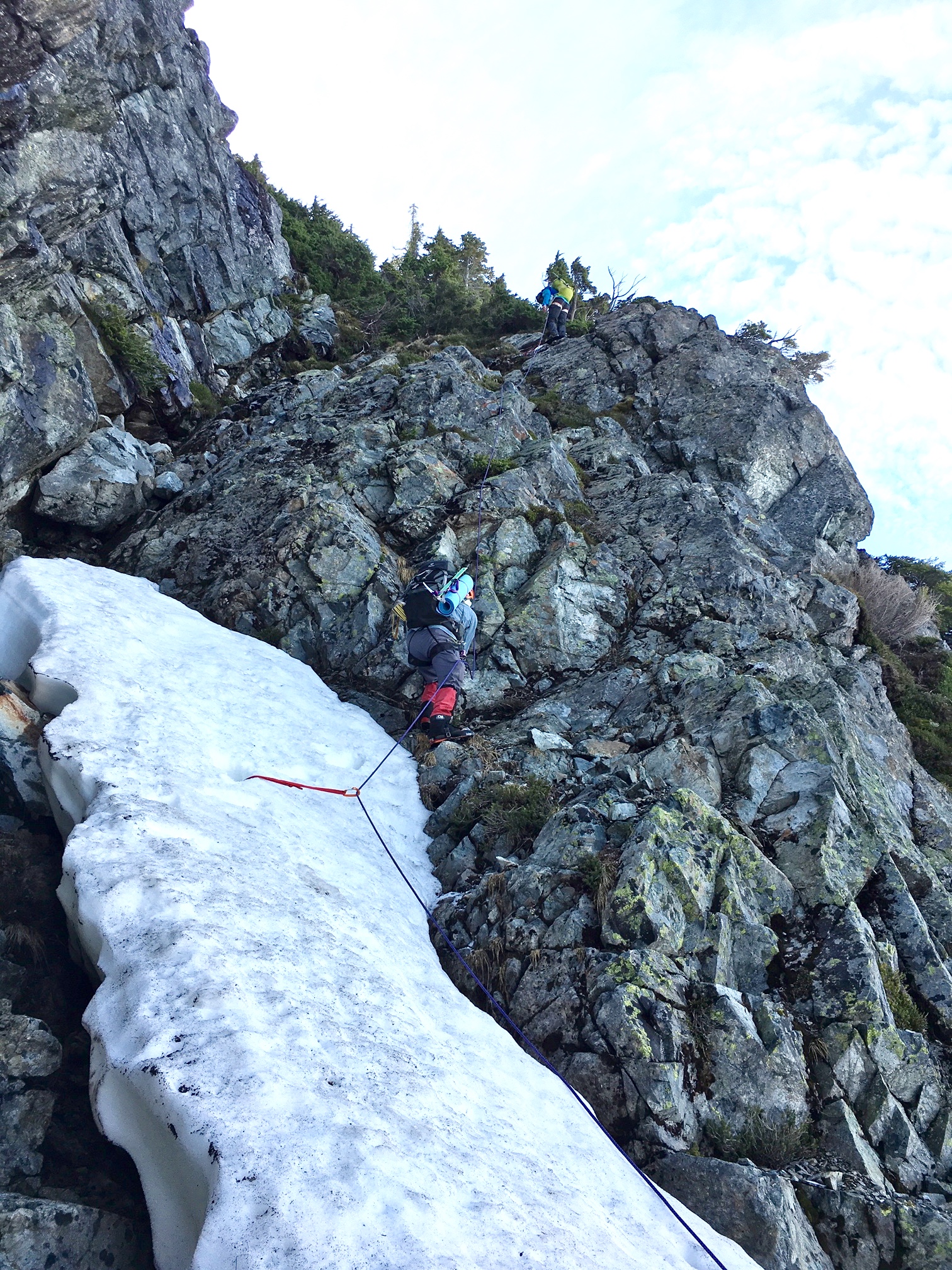
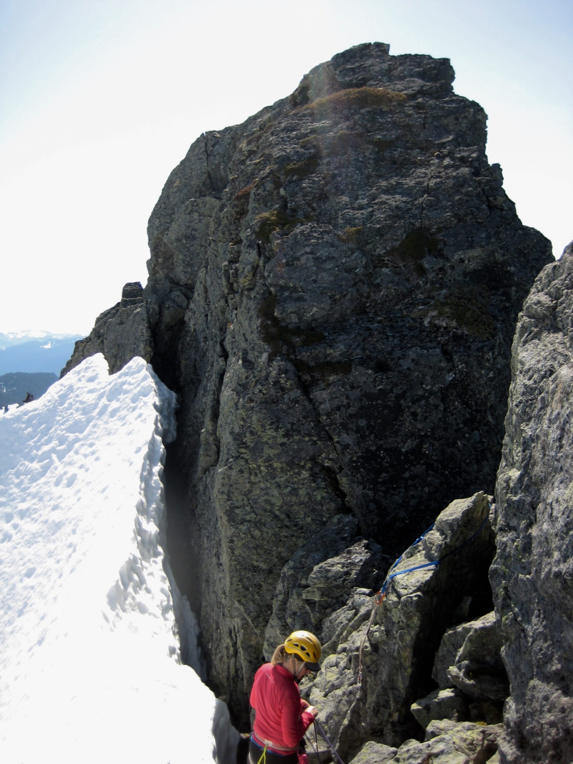
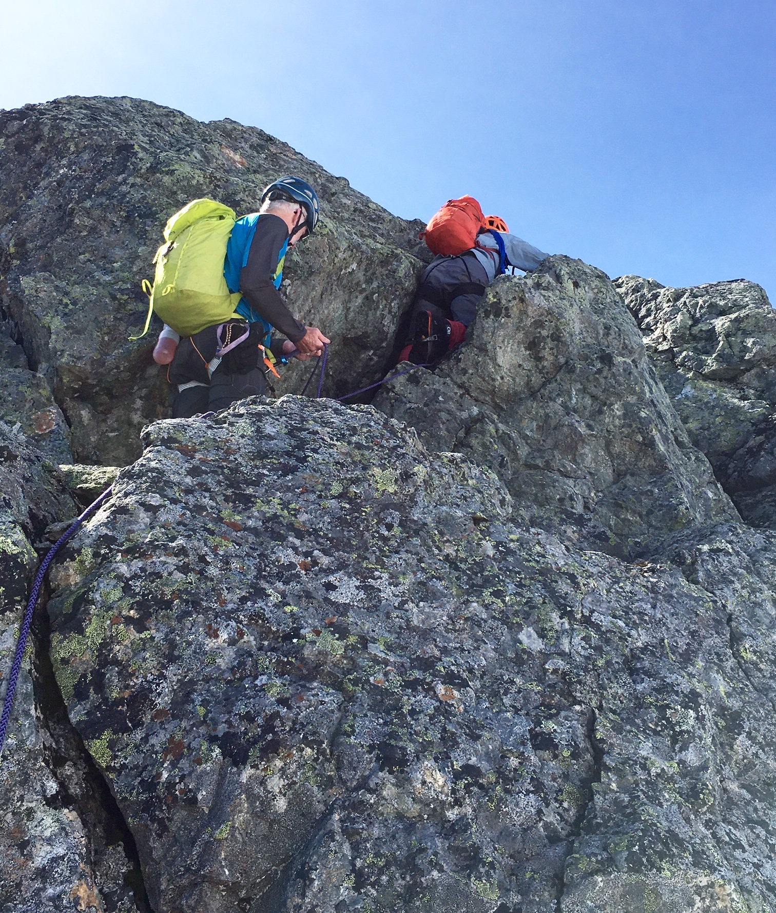
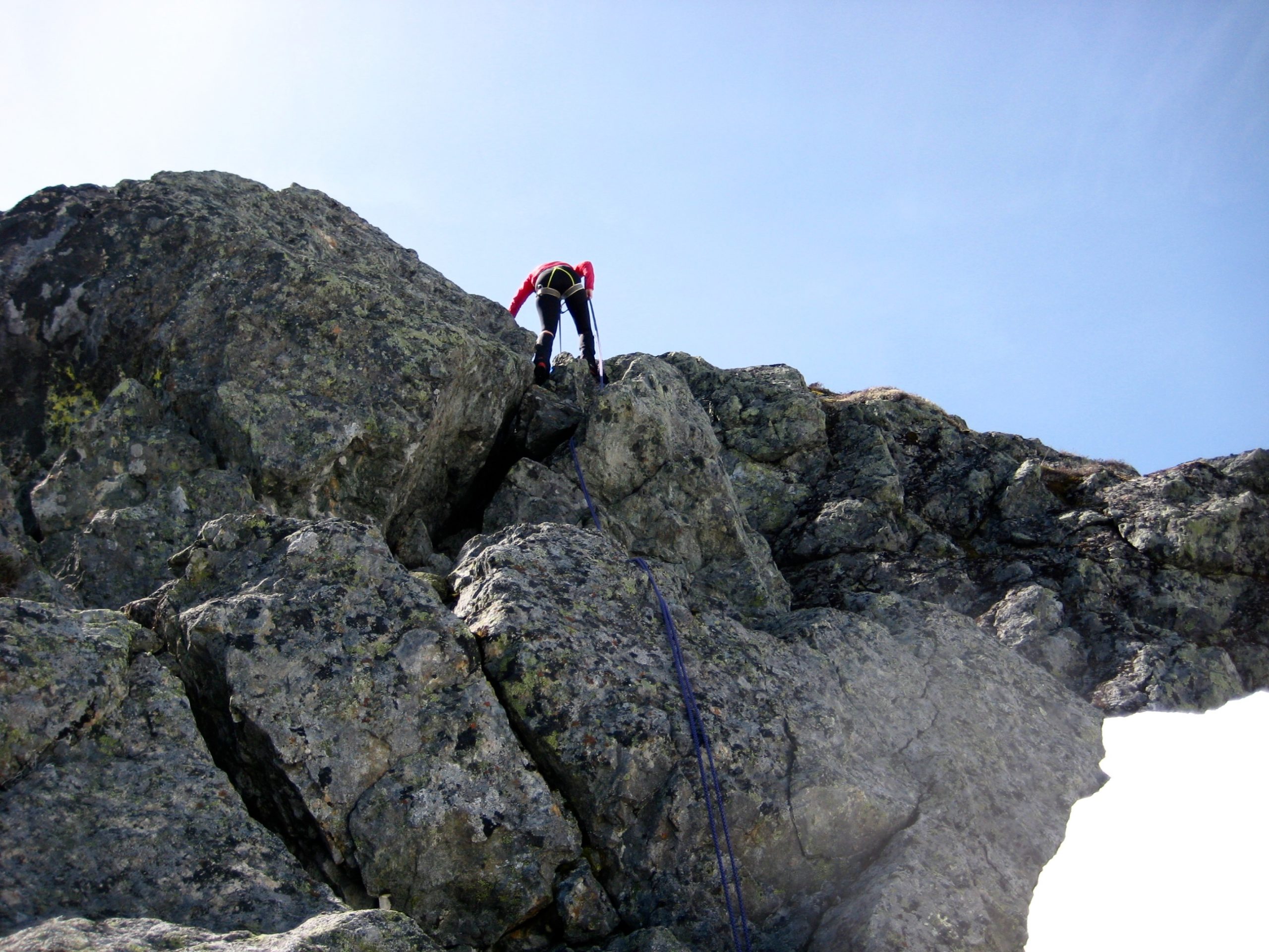
Approximately halfway up the couloir, a hidden right-slanting ramp—the key to climbing Gunn Peak—came into view. We tied in and used running belays while scrambling up the exposed Class 3 rock ramp and the steep snow slopes above.
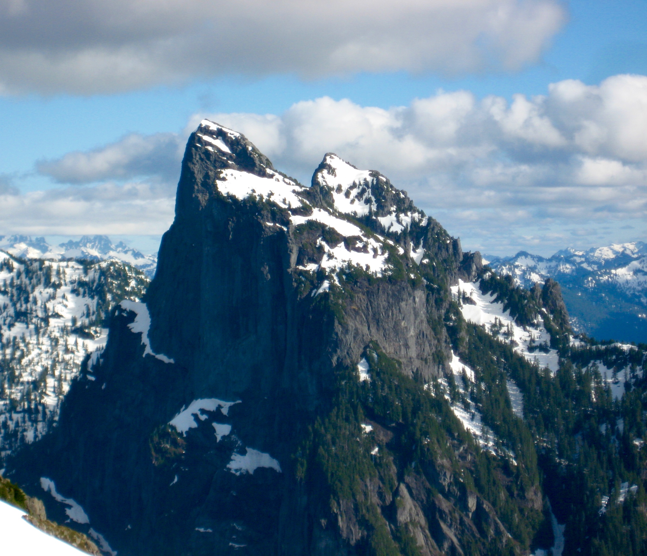
Slope gradients eased back as we continued upward on a hanging snowfield that leads to an obvious notch in the ridge crest above. This ridge spans between Gunn Peak’s west (true) summit and east (lower) summit.
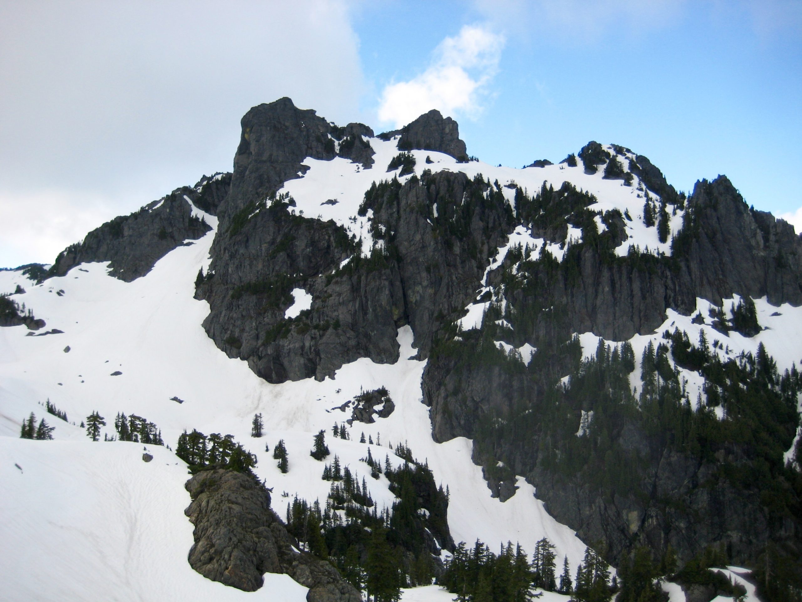
Upon reaching the ridge notch, we were dismayed to see that the entire north face of the peak was plastered with super-steep snow patches. Our meager gear arsenal—one 30-meter rope, one picket, six slings, and a limited tolerance for exposure—were no match for this daunting face! It appeared that the normal Class 2-3 scramble route up the west summit will not be in good condition until next month.
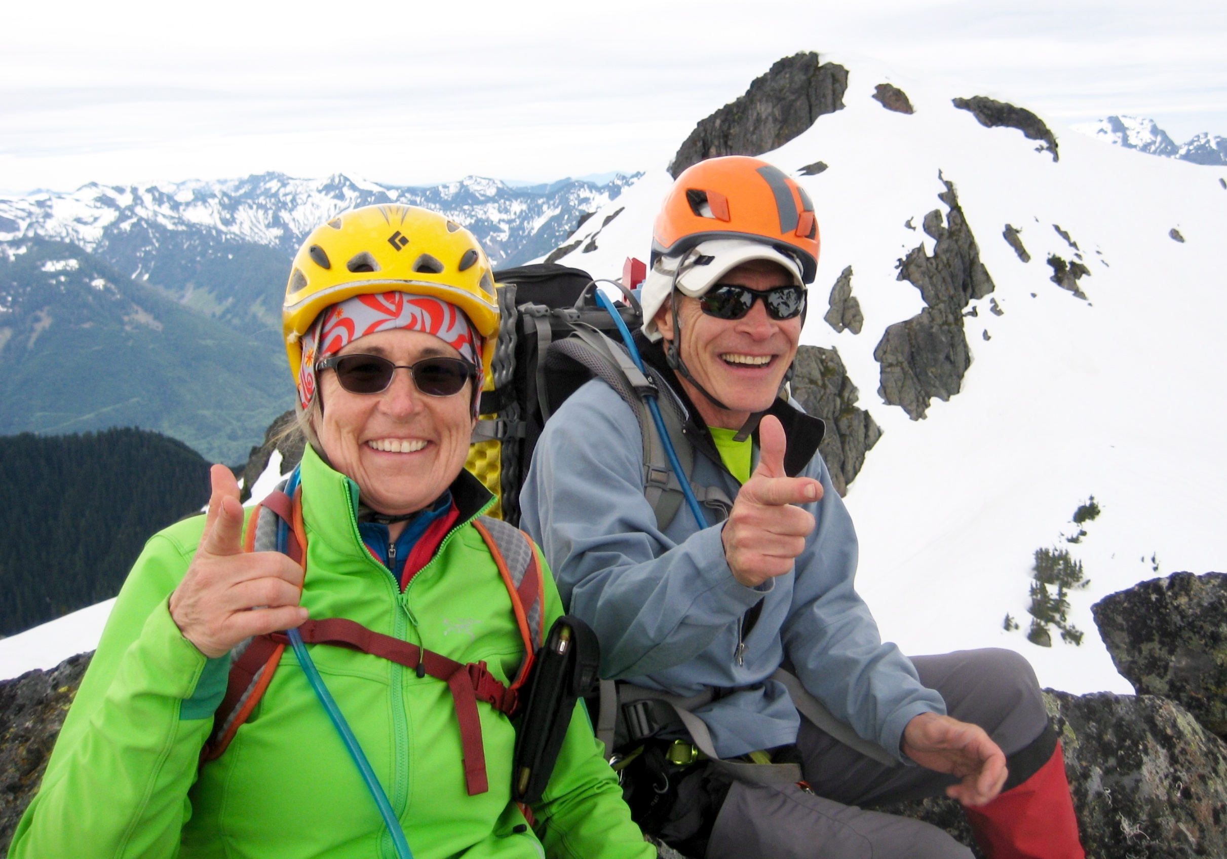
As a consolation, we dropped down the hanging snowfield a short distance and then angled up toward the east summit. A series of snow patches and rock outcrops led to the blocky top in late morning (3.1 hours + 950 feet from camp).
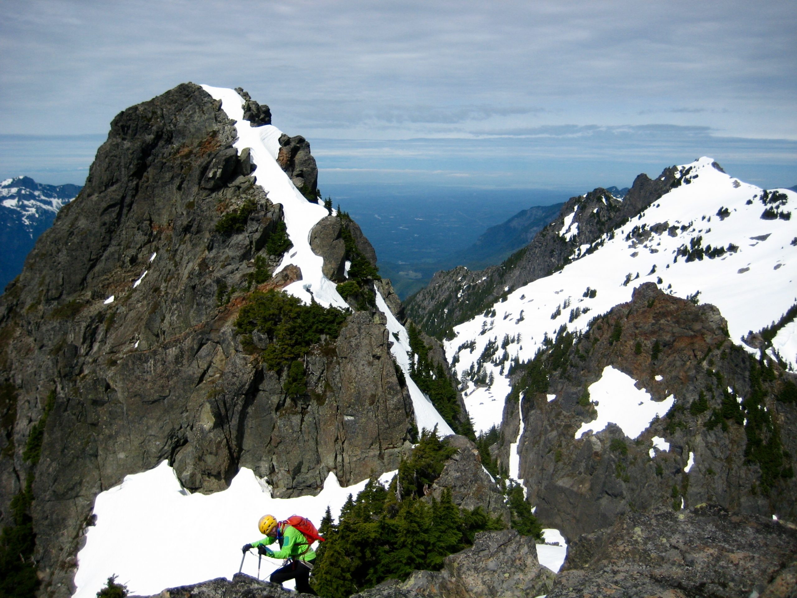
Next on the itinerary was Gunn Point, a small but attractive summit between Gunn Peak and Tailgunner Peak. We descended to Gunn Lake Saddle by following our up-tracks and making one short rappel down the hidden ramp. From this saddle, we traversed around the northwest face of Gunn Point and curled back up the southwest ridge, finishing with a Class 3 rock scramble.
With two minor summits tucked in, our last goal for the day was Tailgunner Peak, which sits closely southwest of Gunn Point. We cramponed up the north slope and surmounted a relic-cornice headwall on the west ridge. Light rain started just as we reached the summit dome and signed in.
Given the deteriorating weather, we made a quick descent of Tailgunner’s east slope and hurried back to camp in mid afternoon (7.5 hours + 1800 feet total tour). Moderate wind and rainfall kept us tentbound for the remainder of the afternoon and evening.
Day 3 (AM): Wing Peak Summit Climb
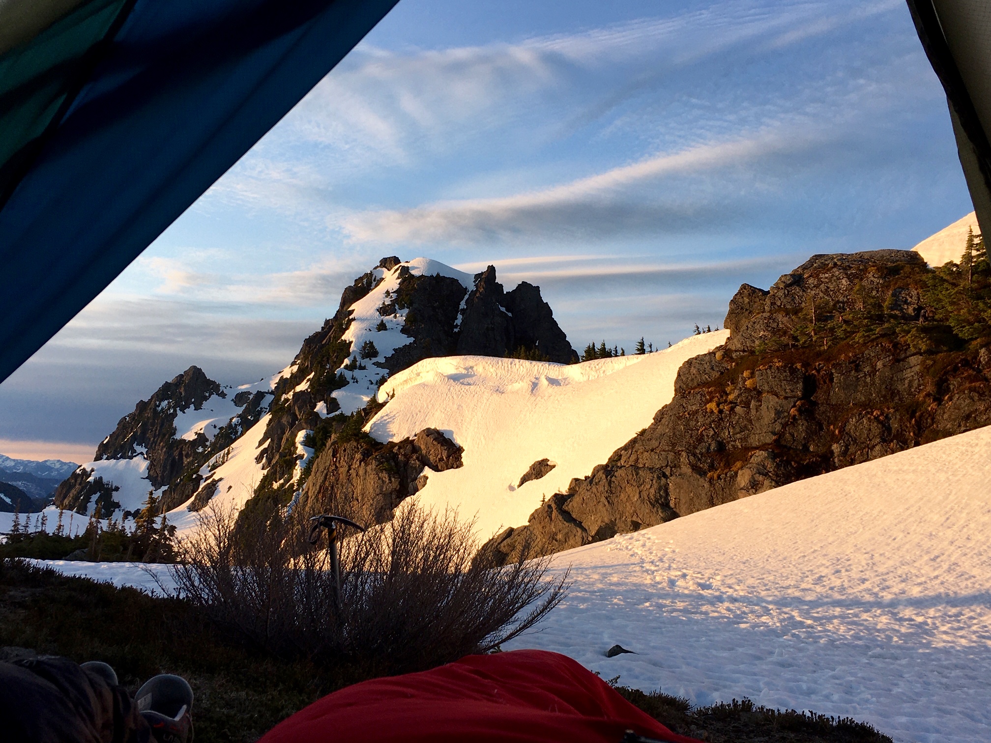
Today’s plan was to climb Wing Peak on our way back to the Barclay Lake Trailhead. As such, it was appropriate that the sunlit peak was neatly framed by our tent doorway in the morning.
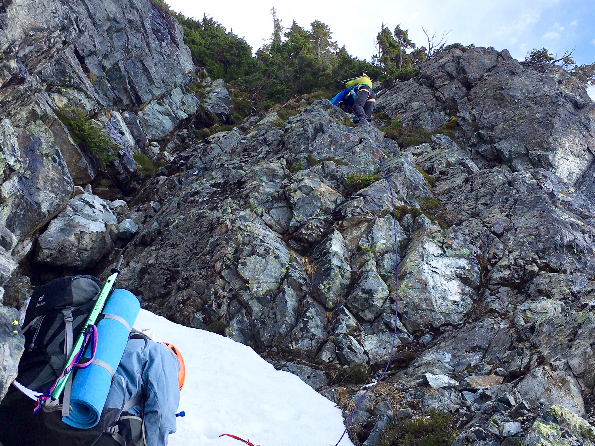
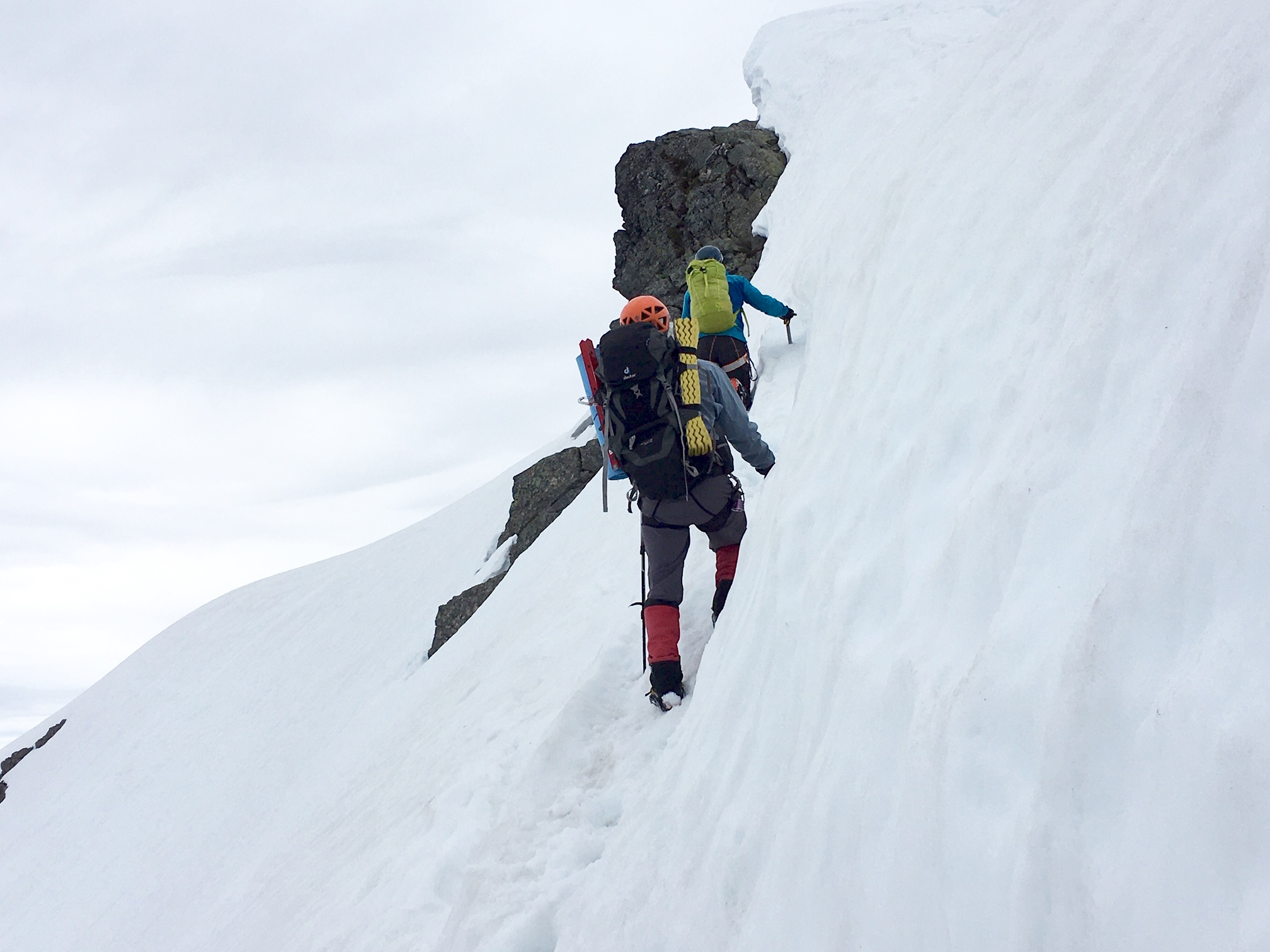
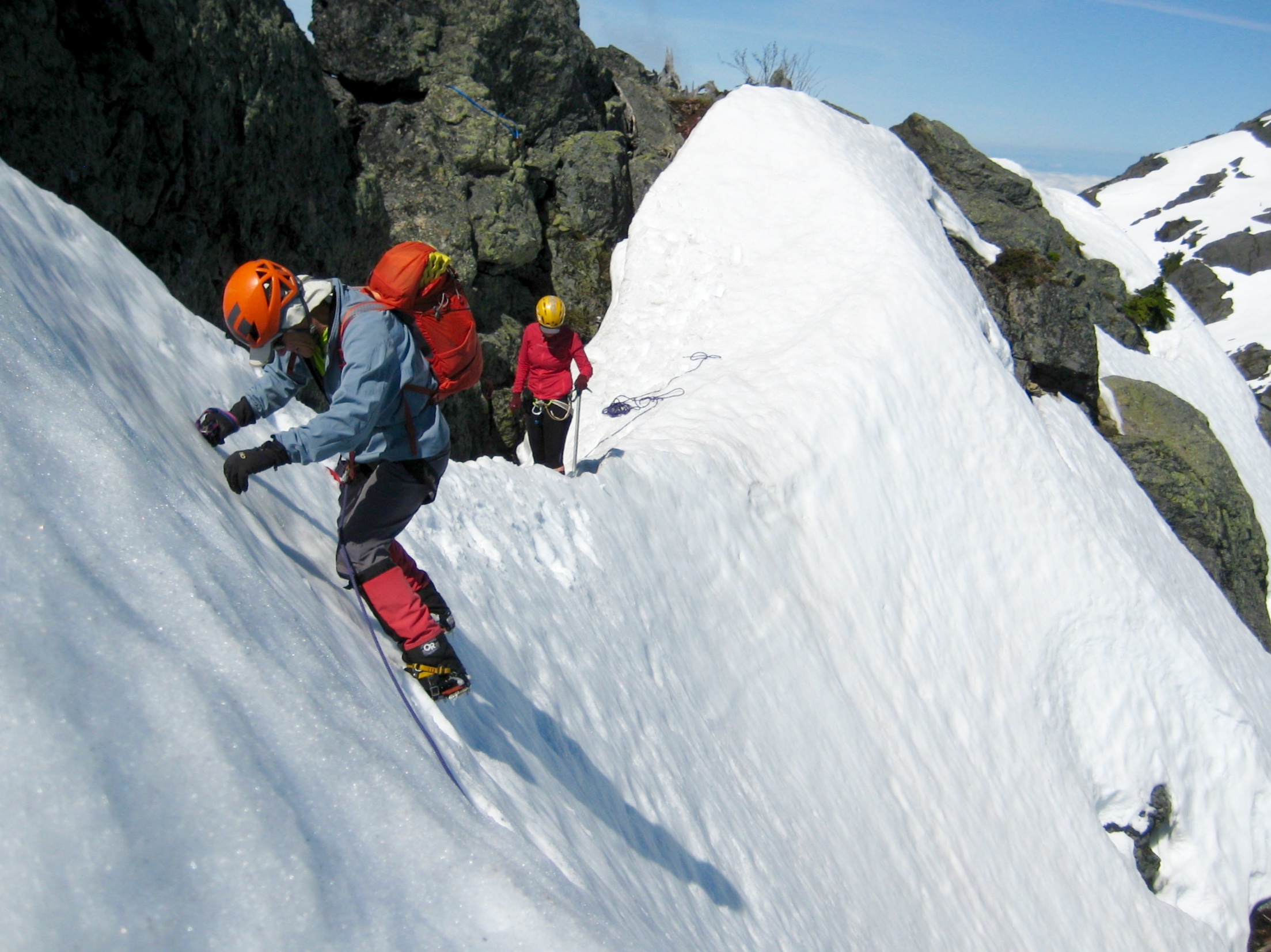
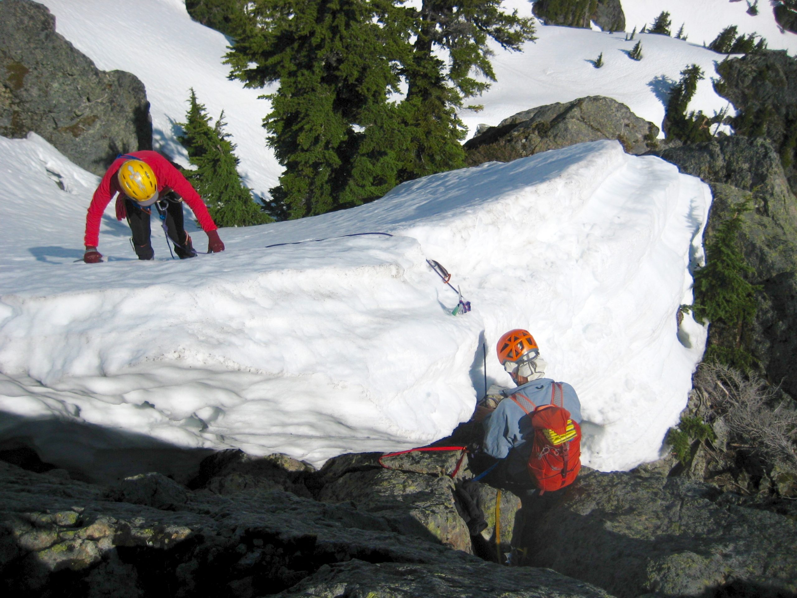
We broke camp, cramponed up to Tailgunner Pass, dumped our backpacks, and then headed up the northwest ridge of Wing Peak. A series of steep faces and gentle benches led us upward on rock-hard snow, prompting the use of running belays.
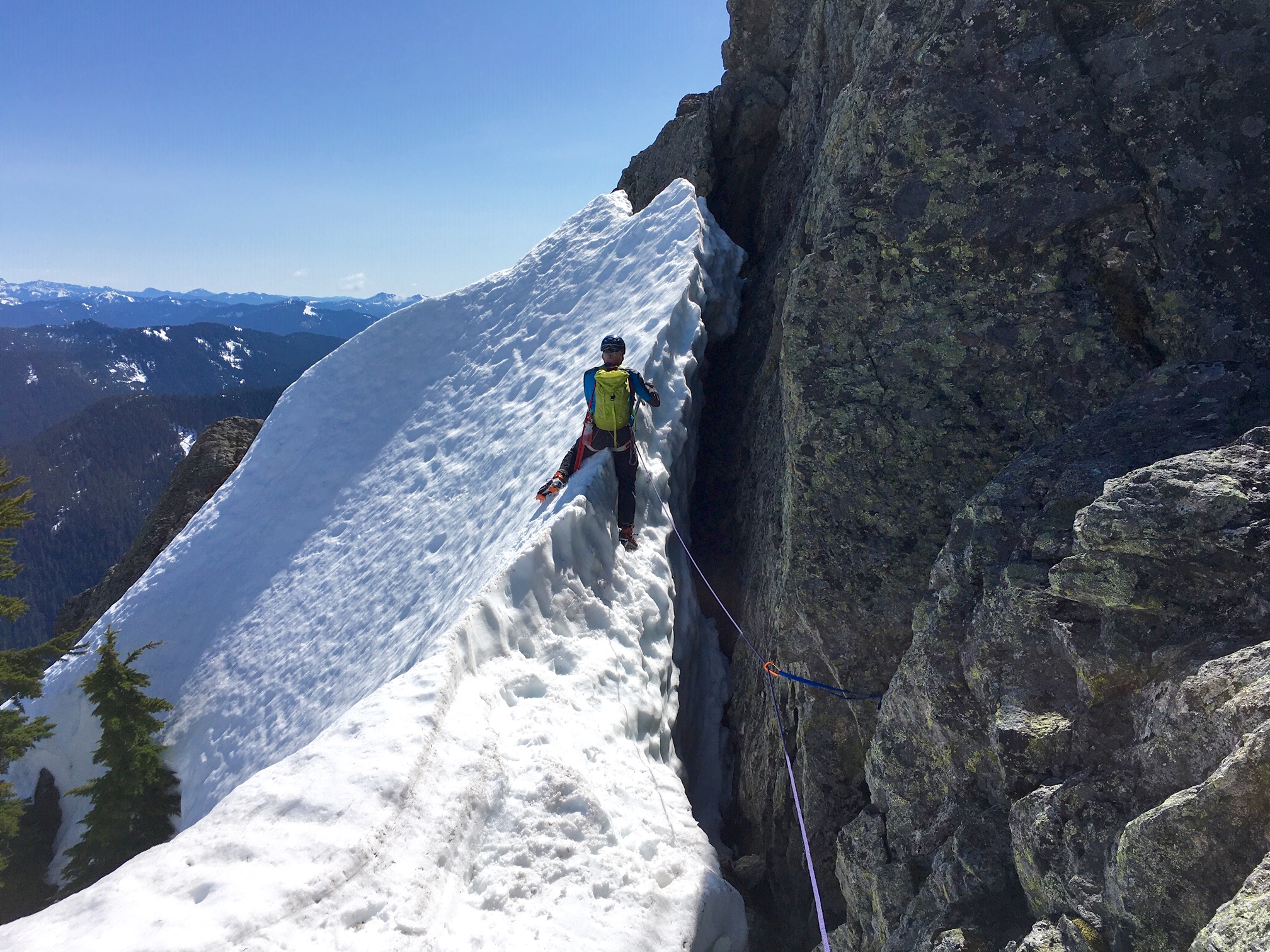
After surmounting the uppermost snow face on front-points, we were greeted with the summit horn a short distance away. Once again, however, the north-side snowpack presented an intimidating sight: a 70-degree, horribly exposed snowfinger that blocked our passage over to the scramble route!
Employing every piece of gear that we’d brought, George and I tag-teamed the final short pitches across the steep snowfinger and up the slippery Class 4 summit rock.
With hearts thumping, we hoisted ourselves onto the small, rocky summit in late morning (2.5 hours + 600 feet from camp). This feisty little peak had given us a handful of excitement!
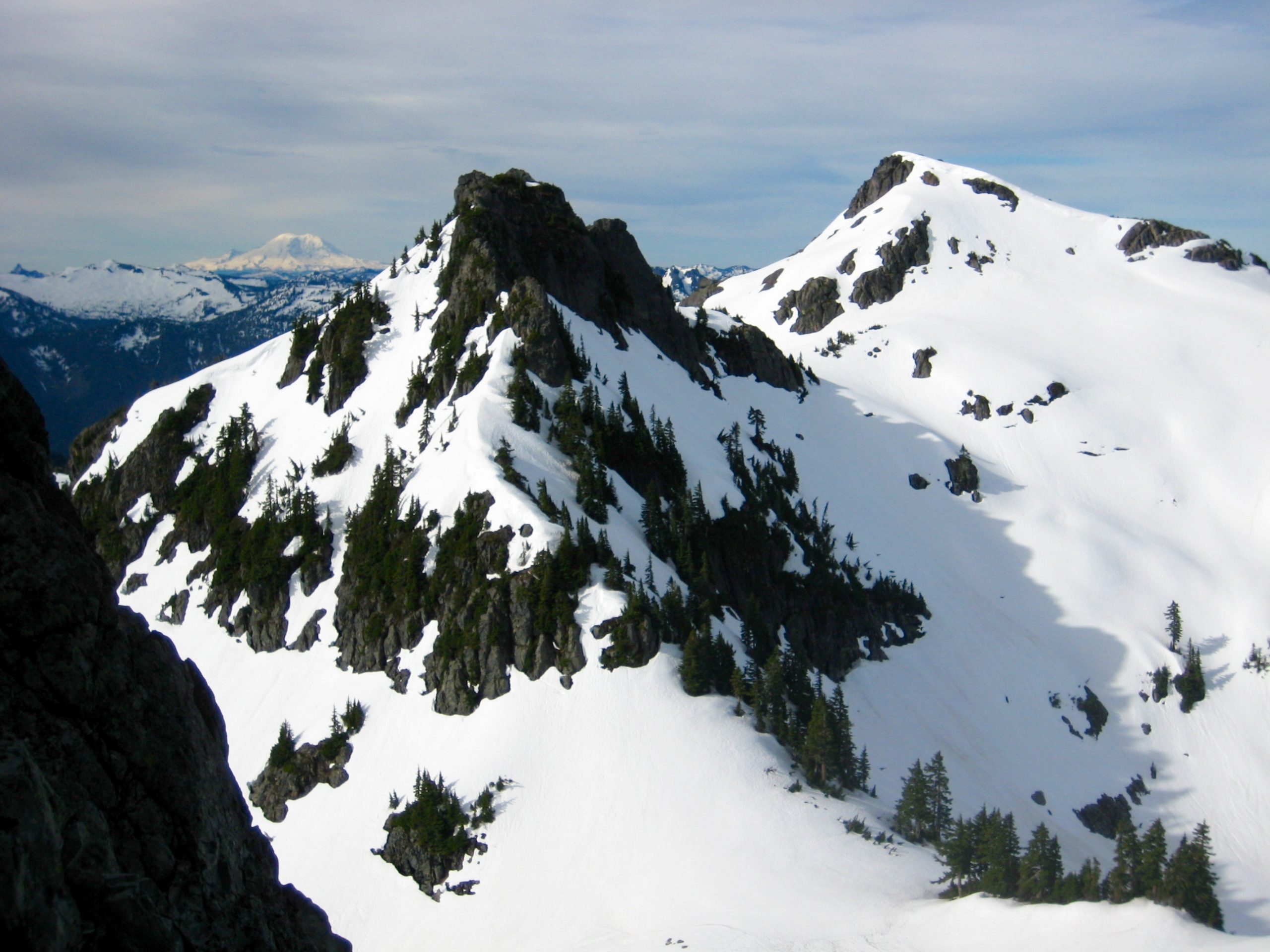
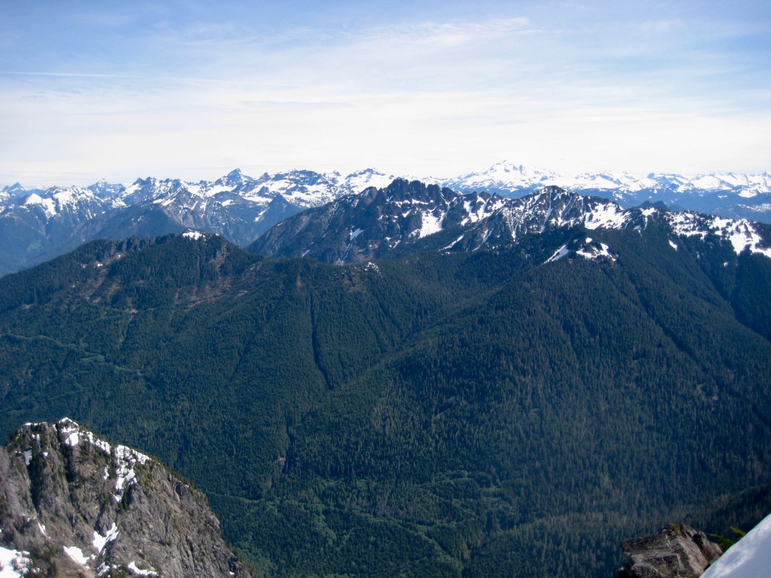
Adding to the mood were swirling clouds moving in from the southwest and filling the valley below. Nearby Merchant Peak, surrounded by an apron of fog, was especially impressive.
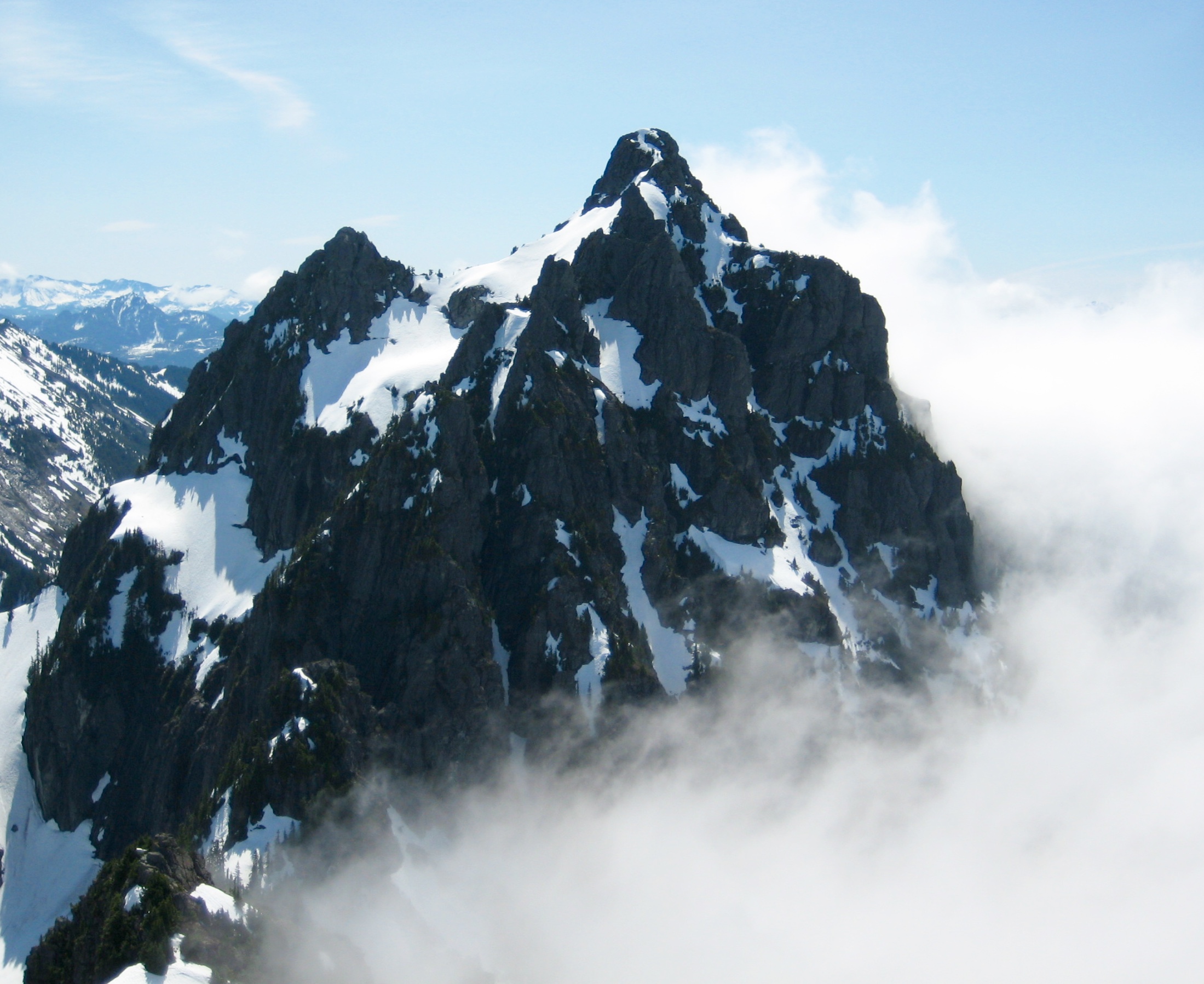
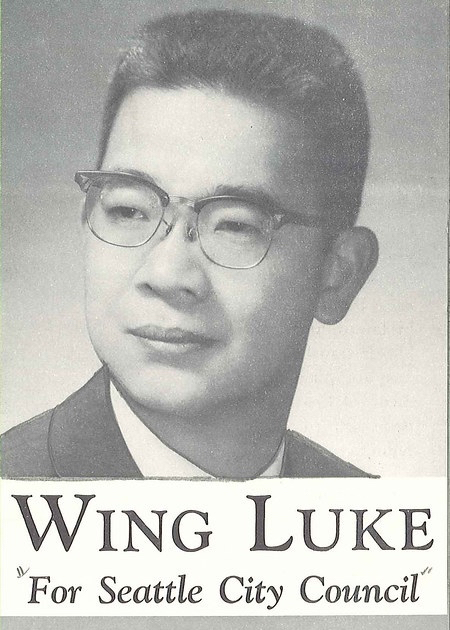
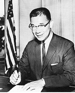
Wing Peak is informally named as an homage to former Seattle councilman Wing Luke, whose chartered airplane collided with the peak in 1965. The southern side of the summit is littered with a large amount of crash debris, such as fuselage panels, wing parts, propellers, and interior components, all lying in silent testimony to a terrible accident. But is this debris from Wing Luke’s airplane? Recent reports and comments on NW Hikers indicate that the visible debris is actually associated with a U.S. Navy airplane that crashed in 1953, whereas Luke’s airplane crashed into the opposite side of the peak 12 years later. Could there really have been two different airplane crashes on the same peak? Perhaps an aviation historian will fully unravel this mystery some day.
For our descent, we made a short rappel off the summit, belayed back across the snowfinger, made one more rappel down the highest snow face, and then scrambled down Class 2-3 talus on the northwest ridge. We reached our backpacks at Tailgunner Pass around noon (1.2 hours from summit).
Day 3 (PM): Tailgunner Pass to Trailhead
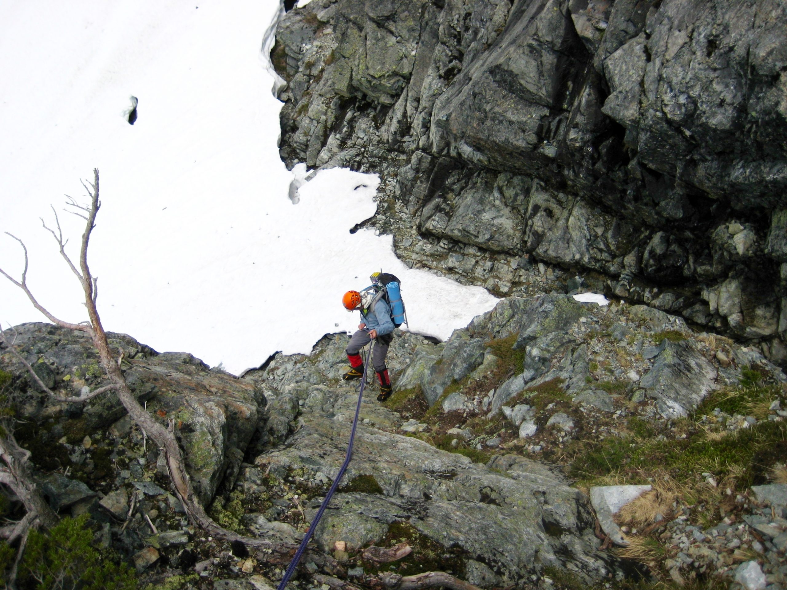
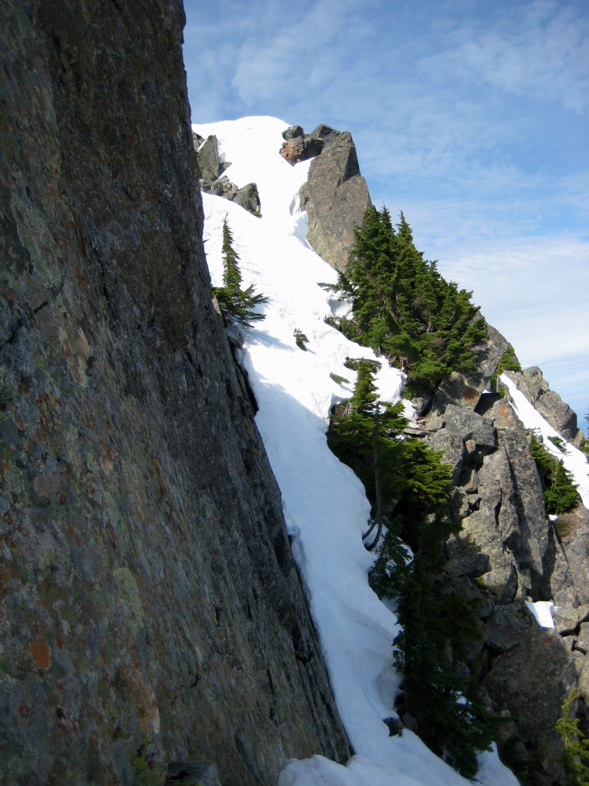
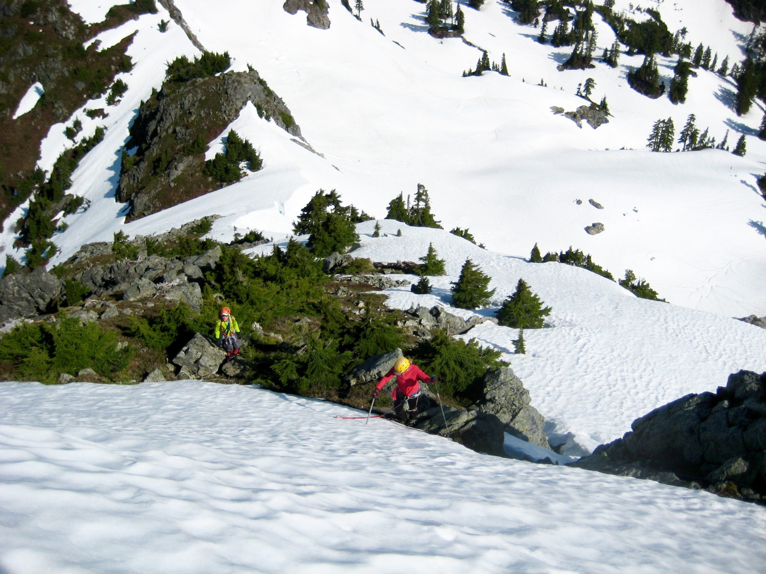
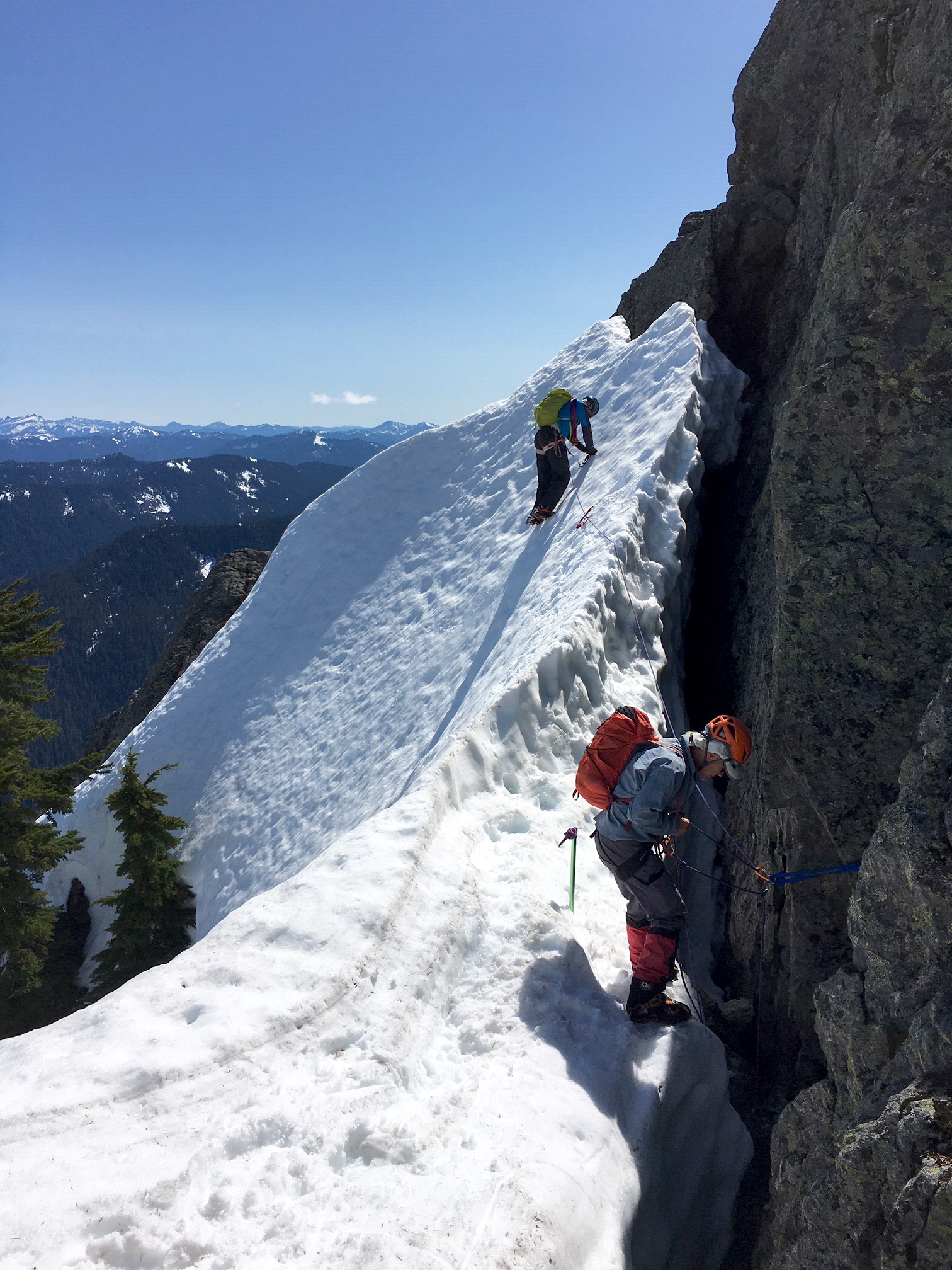
Our descent from Tailgunner Pass to Barclay Creek was fairly uneventful. The most unnerving part was cramponing down through a rock defile, where a narrow ribbon of snow winds between deep moats. In a few weeks, this defile will not be passable.
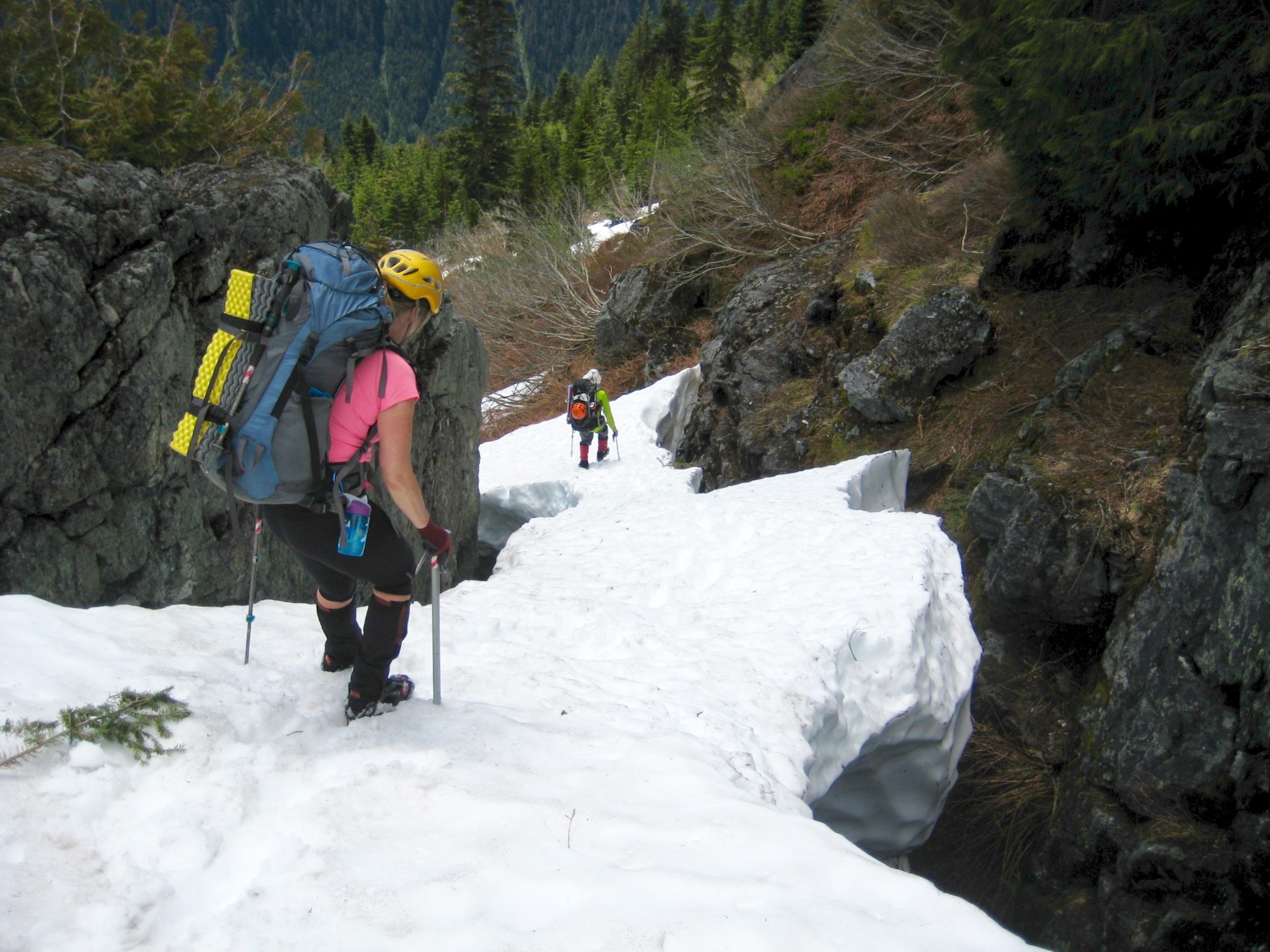
Aided by our GPS pins, we easily found the logjam across Barclay Creek, then finished out the day with a short forest hike and road walk back to our car at the Barclay Lake Trailhead (4.0 hours + 200 feet from pass). It had been a challenging trip, but plans were already in the works for a summertime return to Gunn Basin.
Route Map
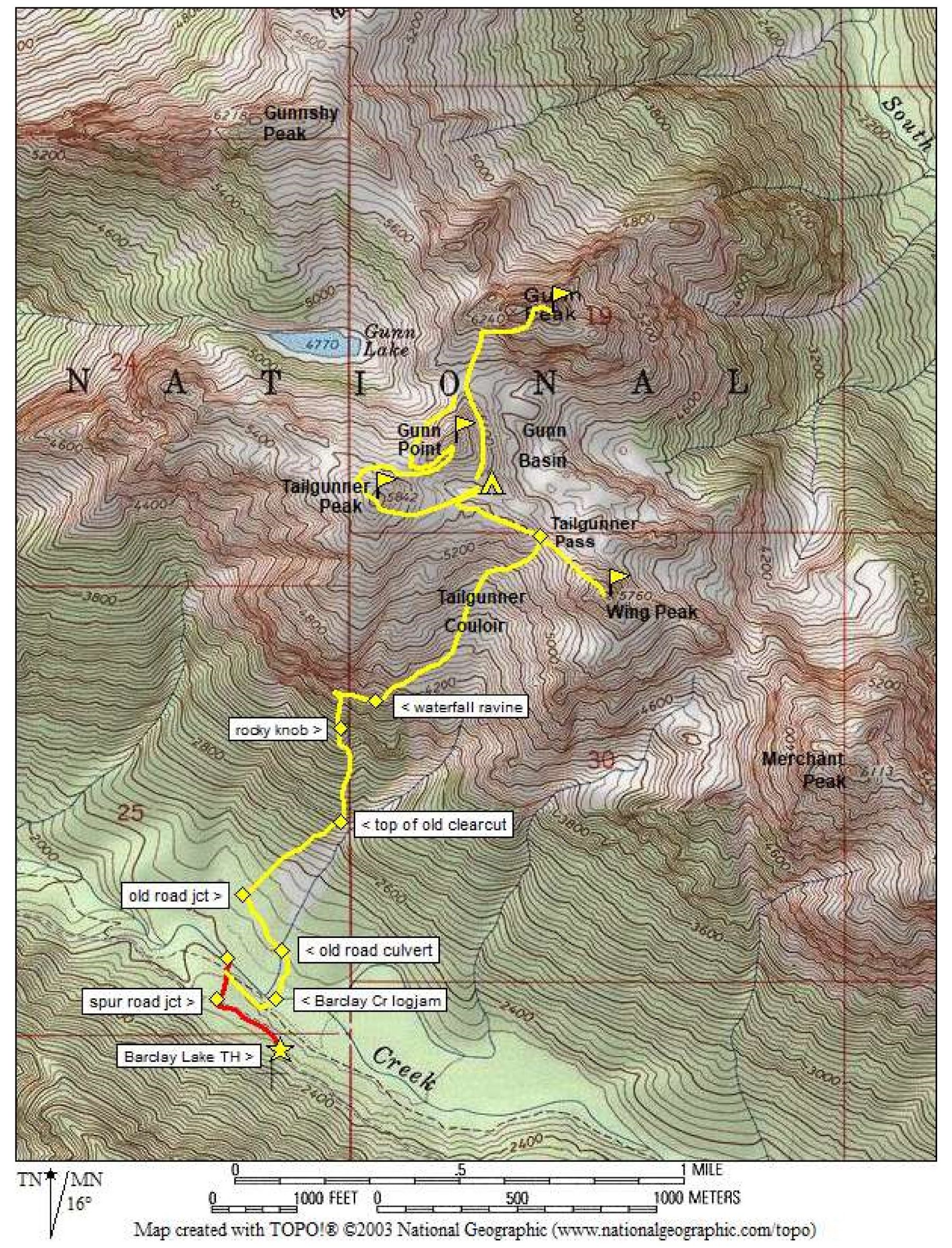
Photo Gallery
Click to enlarge…