Trip Date: September 3-5, 2005
The Bull’s Tooth Climbing Trip & Bullseye Traverse: Stevens Pass to Bullseye Pass to Frosty Pass
Tye-Mill Pass
Lake Susan Jane
Josephine Lake
Chain Lakes
The Bull’s Head (6840+ ft)
Bullseye Pass
The Bull’s Tooth (6680+ ft)
Doelle Lakes
Frosty Pass
Lake Margaret
Trip Report Summary
Region: Central Washington Cascades
Sub-Region: Upper Icicle Mountains
Area: Alpine Lakes Wilderness
Starting Point: PCT-Southbound Trailhead at Stevens Pass on Highway 2 (Elev. 4050 feet)
Way Points: Stevens Pass Ski Area & Tye-Mill Pass & Lake Susan Jane & Josephine Lake & Upper Icicle Creek & Chain Lakes & Bullseye Pass & Doelle Lakes & Doughgod Meadow & Frosty Ridge & Frosty Pass & Lake Margaret & Frosty Pass & Wildhorse Creek Basin & Grace Creek & Deadhorse Creek & Whitepine Creek (trail hike & off-trail hike)
High Point: Bullseye Pass (Elev. 6200 feet)
Ending Point: Whitepine Creek Trailhead at end of White Pine Road (Elev. 2800 feet)
Campsites: Middle Chain Lake & Lake Margaret
Summit: The Bull’s Head (rock scramble via Northwest Slope)
Summit: The Bull’s Tooth (rock climb via South Ridge)
Approximate Stats (excluding summits): 25 miles traveled; 6000 feet gained; 7300 feet lost.
Approximate Stats (including summits): 27 miles traveled; 7600 feet gained; 8900 feet lost.
Related Post
>>> Bullseye Traverse + The Bull’s Tooth + Lake Grace – September 13, 2020
Trip Overview
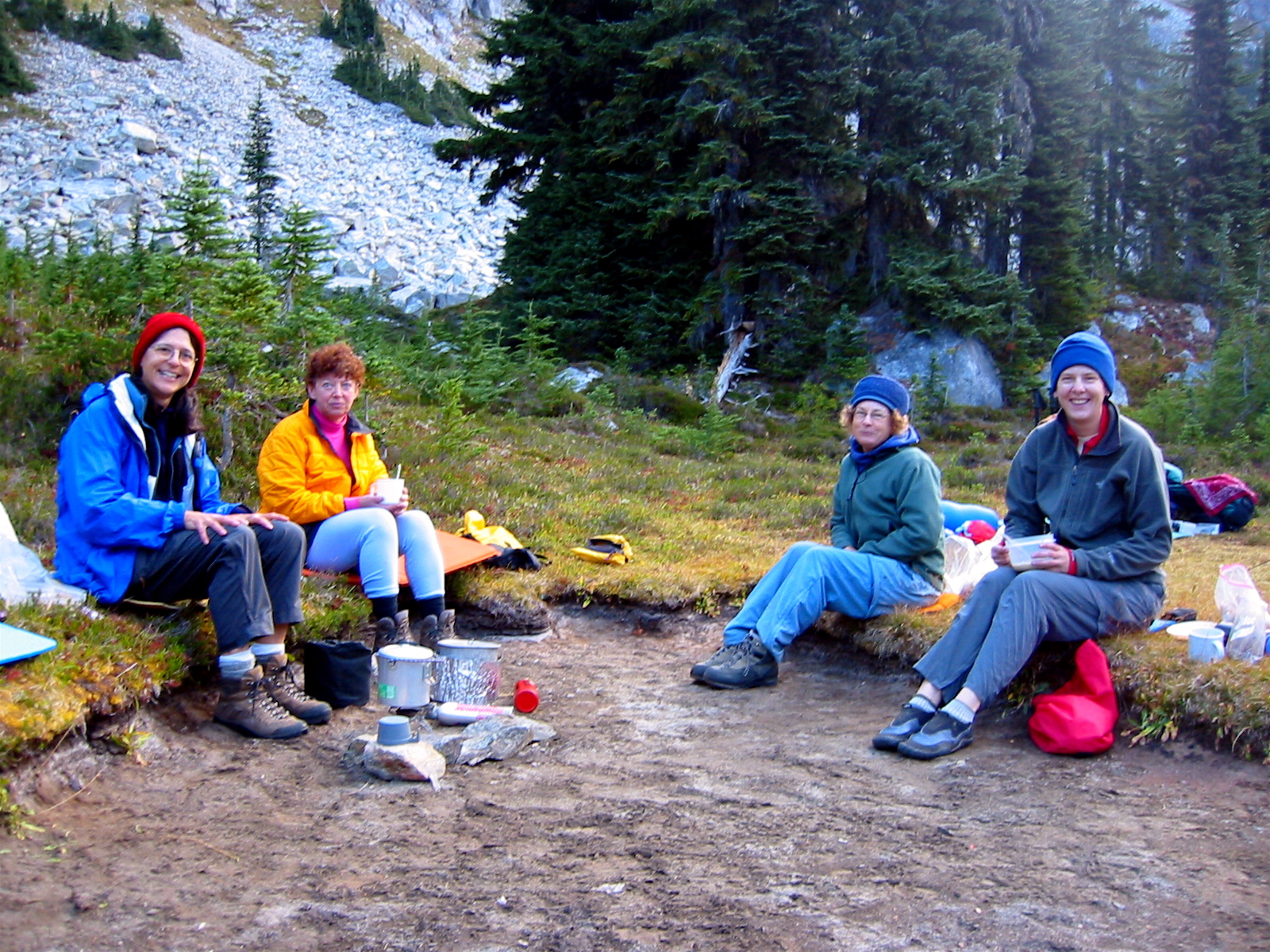
For Labor Day weekend, Deborah, Beth, Janet, and Julie joined me for a hiking traverse from Stevens Pass to Whitepine Creek via Chain Lakes, Doelle Lakes, and Frosty Pass. All of the weather forecasters had predicted low freezing levels and scattered rain showers—conditions that almost seem like a Labor Day tradition in the mountains. As things turned out, we did experience unseasonably cold weather, but the rain showers were short and inconsequential. On the other hand, Deborah’s trademark brownies were gooey and tasty.
In addition to completing this scenic trail-traverse, I wanted to climb the Bull’s Tooth. However, that would first require solving a little mystery that had puzzled me for the past several years: what and where is the Bull’s Tooth? The U.S.G.S map shows it to be a 6807-foot triangulated point located due southeast of Chain Lakes, on an arcuate ridge that encircles the lakes. So what’s the mystery?
For one thing, Beckey’s Cascade Alpine Guide identifies the Bull’s Tooth as the 6840-foot+ high point of this ridge rather than the lower triangulated point, and then he offers the following comments: The actual “tooth”…is 6800 ft+, just SW of the listed name. There is a 6680-ft summit SE of the 6200-ft trail pass between Chain and Doelle lakes. Ahh, so that means the map label is misplaced, but it also means that the “tooth” is not really “The Tooth.” Huh?
To further complicate the picture, John Roper told me several years ago that the name “Bull’s Tooth” was originally intended for the 6680-foot+ peak located closer to the trail pass, not for the 6807-foot triangulated point nor the 6840-foot+ high-point on the ridge nor the 6800-foot+ “tooth” that Beckey mentions. So, we now have four different suspects in this bovine dental mystery. A climbing investigation was clearly needed!
Full Trip Report
Day 1: Stevens Pass to Chain Lakes + The Bull’s Head
After dropping off a vehicle at the Whitepine Creek Trailhead near Cascade Meadows, we drove back to Stevens Pass and started hiking south on the Pacific Crest Trail. The sky was overcast and the air cool, making for ideal hiking conditions. We crossed 5200-foot Tye-Mill Pass and continued over to Josephine Lake for lunch.
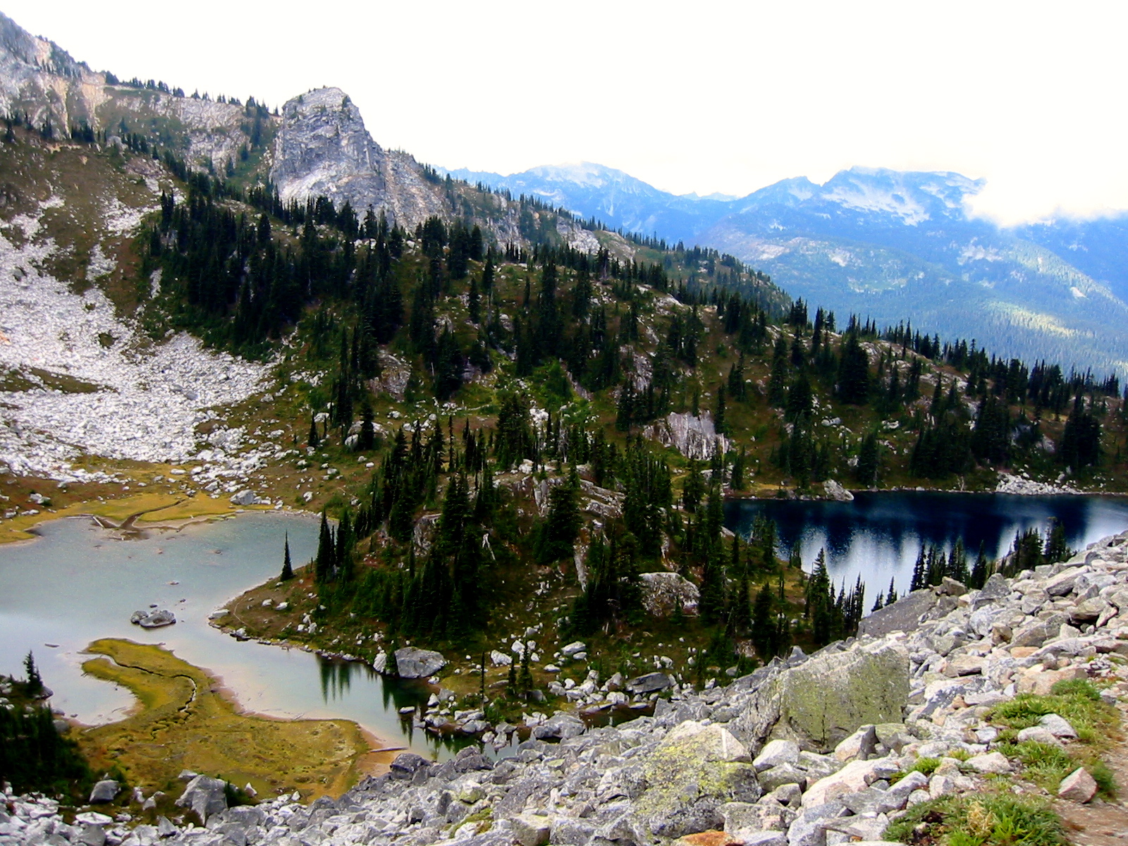
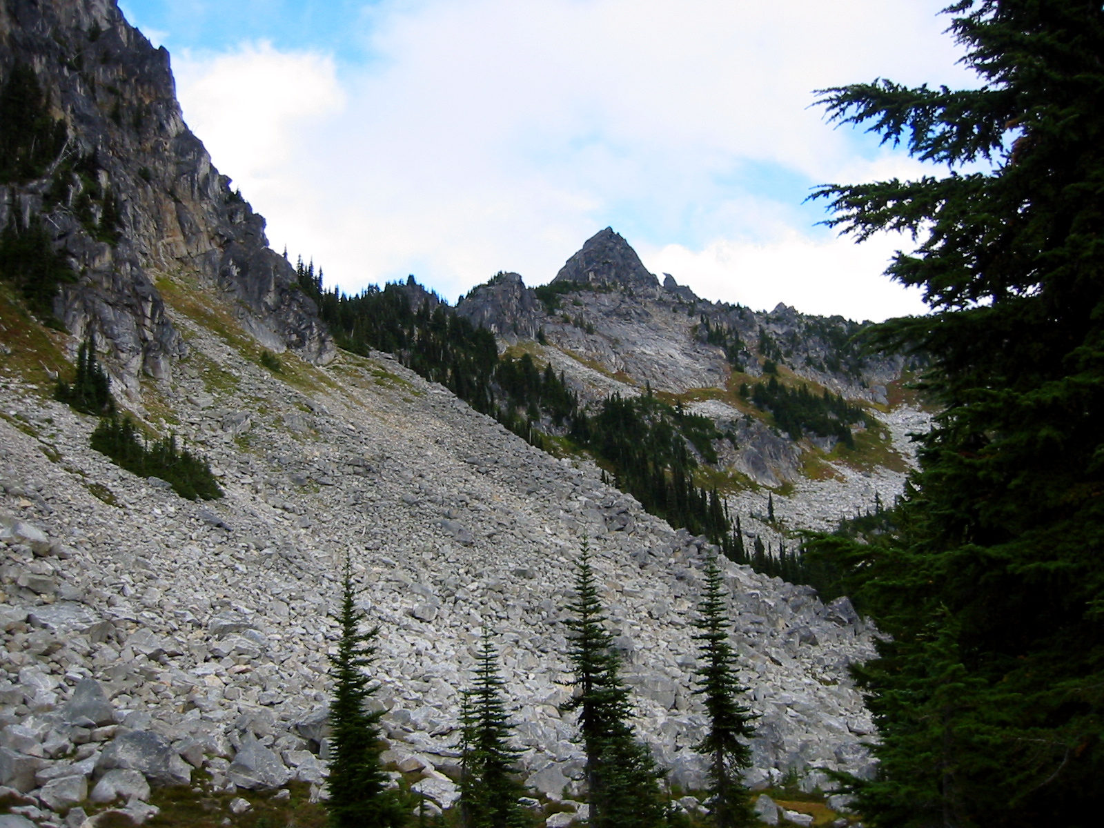
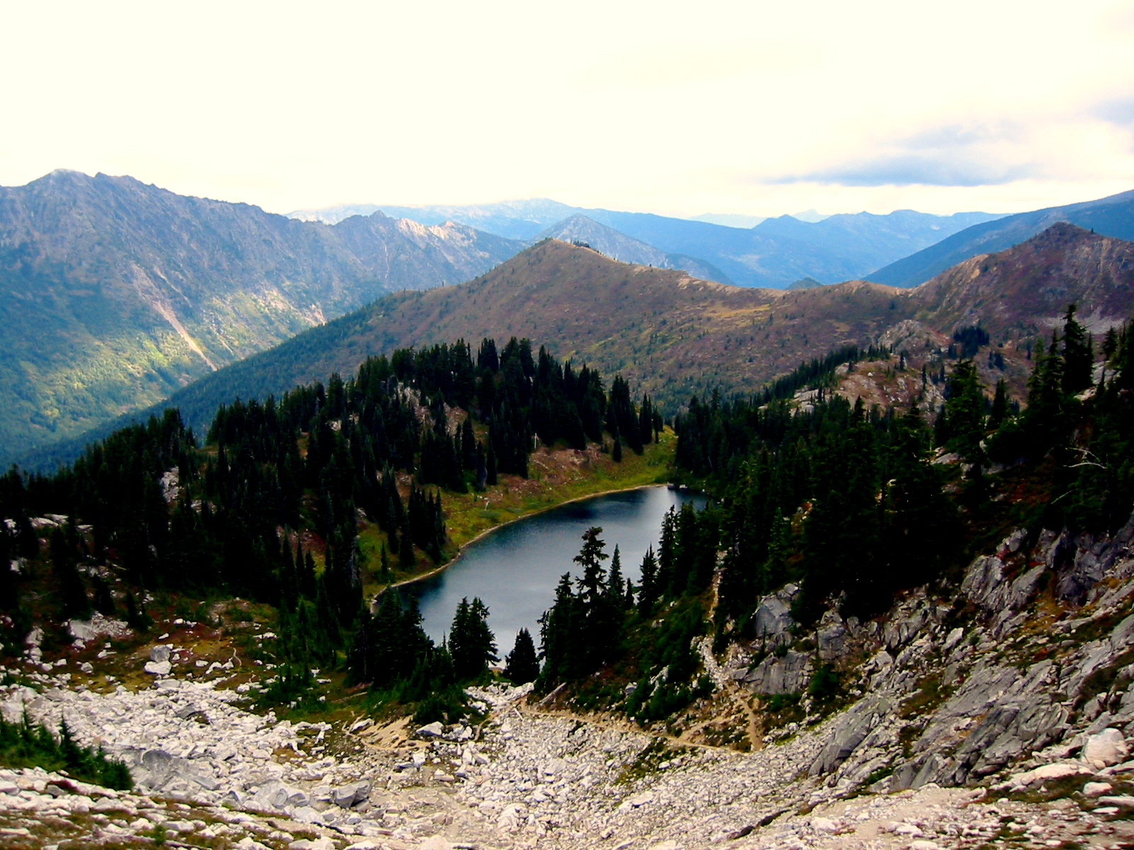
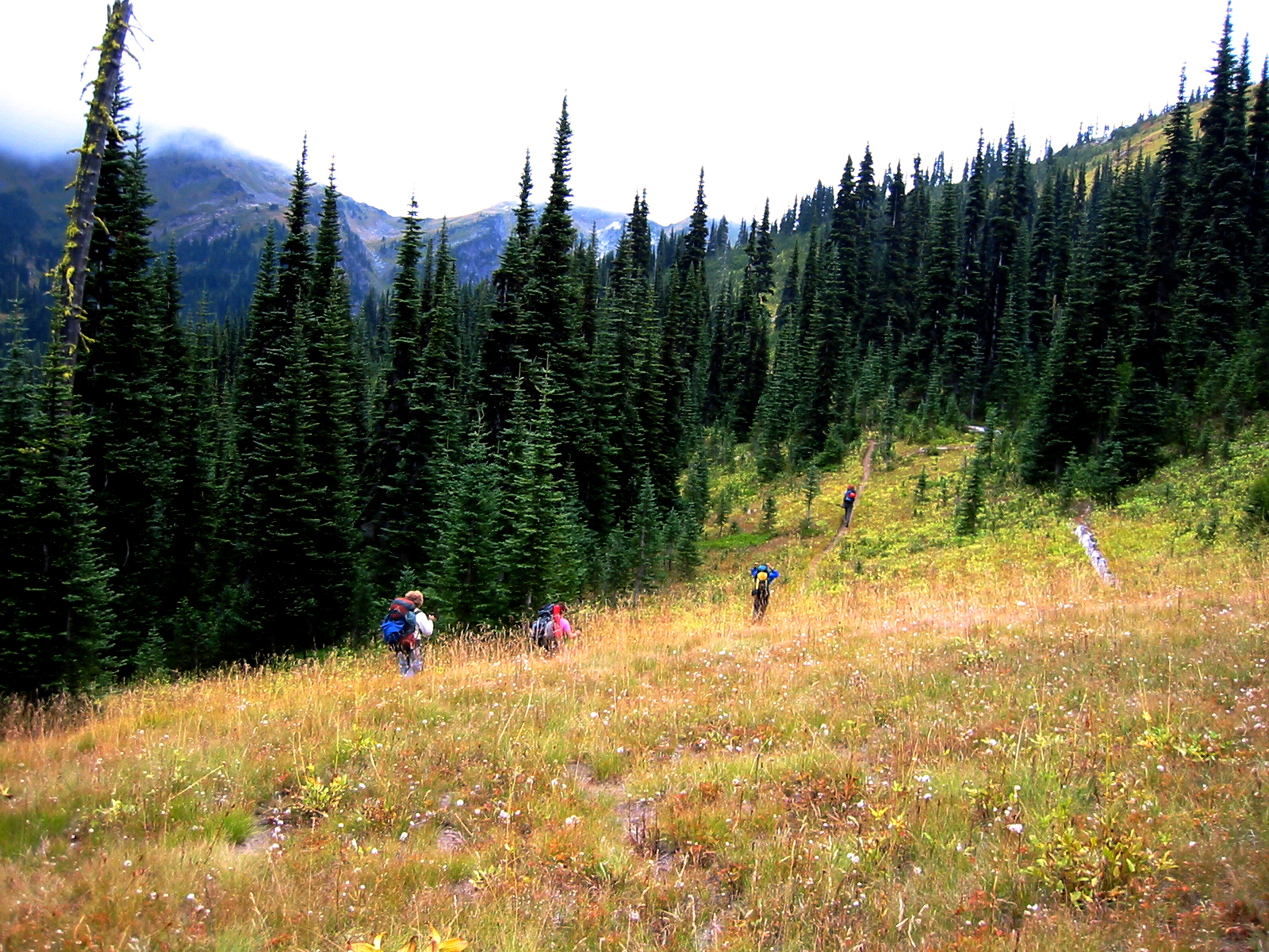
From there, the Icicle Creek Trail took us down 900 feet to the Chain Lakes Trail, which we followed uphill for 3 miles to the picturesque lake basin at 5700 feet (6.3 hours + 3600 feet from TH). We made camp in a grassy flat next to Middle Chain Lake.

- Julie, Deborah, Beth, and Janet At Middle Chain Lake
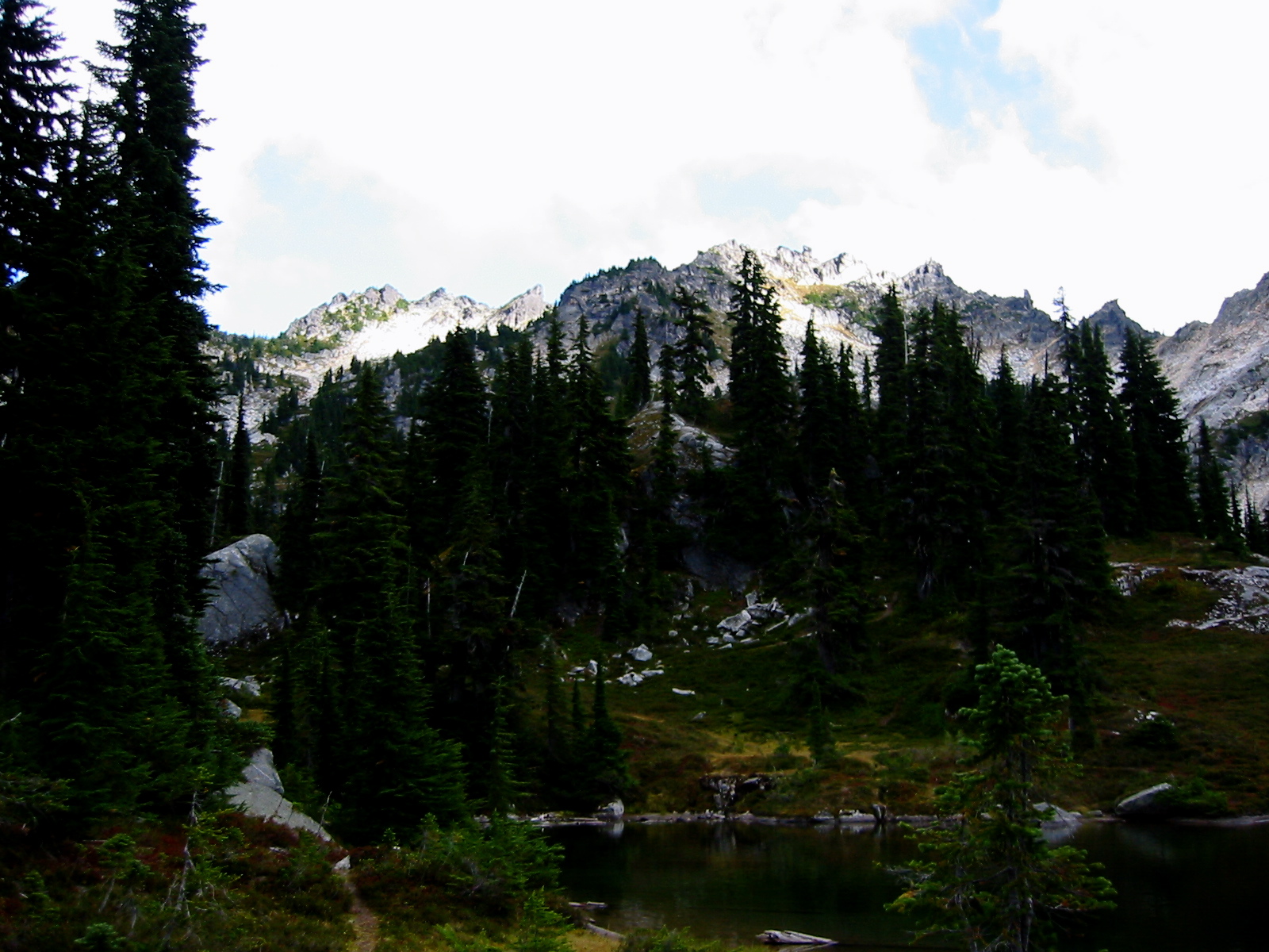
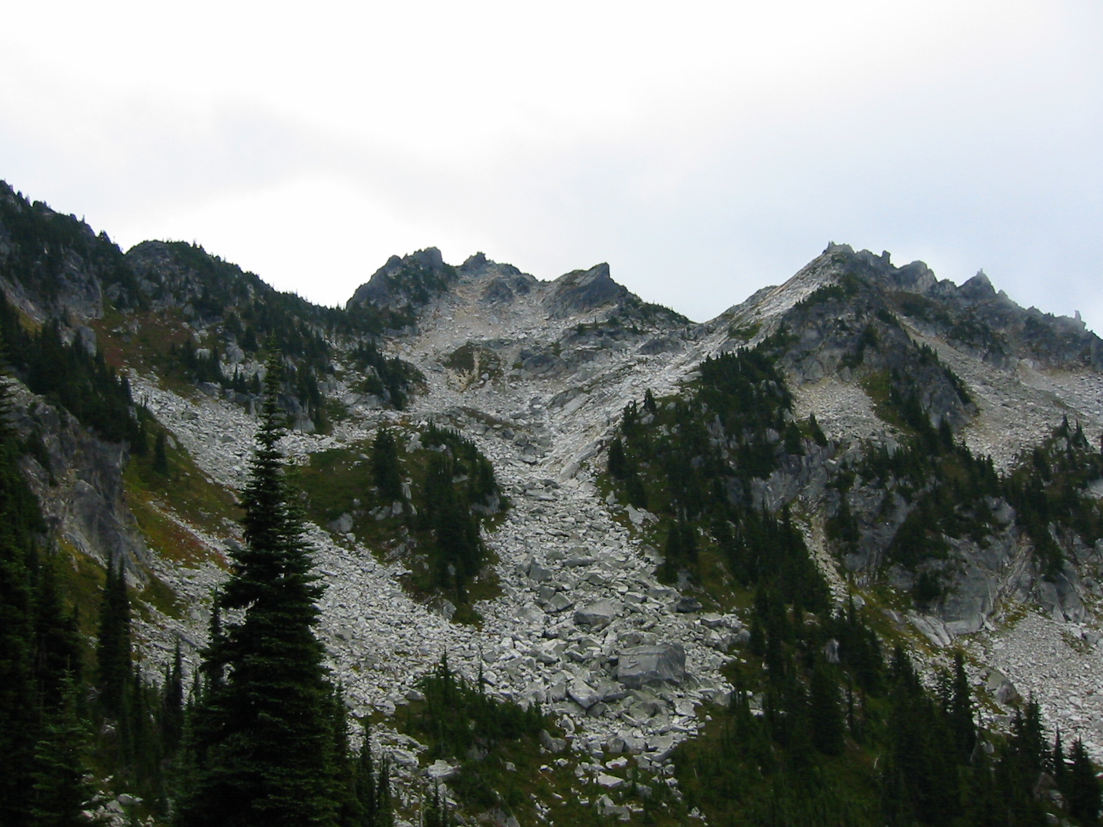
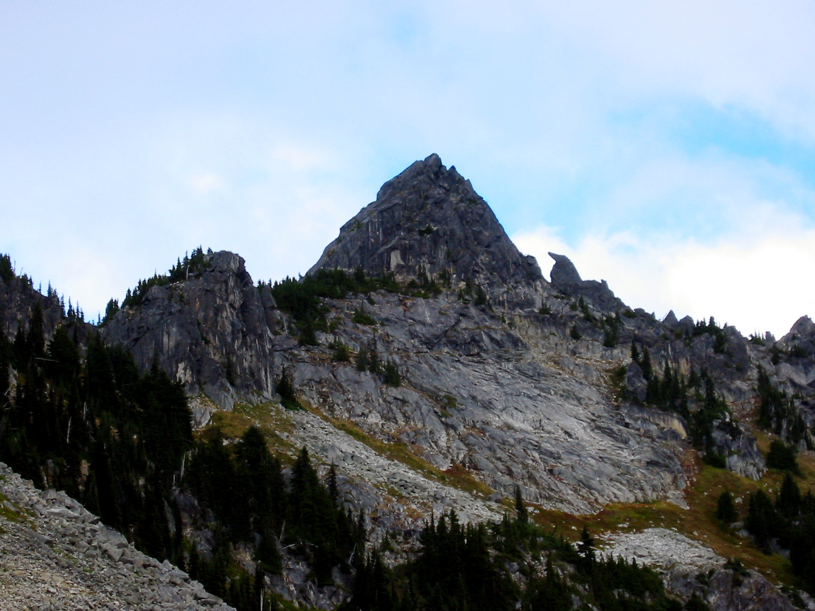
Having a little time before dinner, Beth and I decided to scramble up the 6840-foot+ high-point of the ridge above. We hiked around Upper Chain Lake and ascended huge, white talus in a northwest-facing couloir. Upon arriving at a notch between two points on the crest, it wasn’t obvious which was higher. I guessed that the right (southern) one was higher, and this was correct. We topped out at 6:00pm (1.2 hours from camp) and spent 10 minutes on the chilly summit.
- The Bulls Head (Point 6840+) From Chain Lakes
- Chain Lakes From The Bulls Head
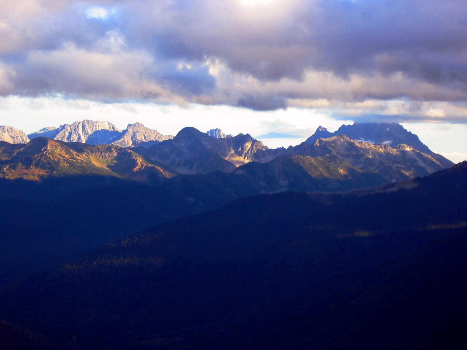
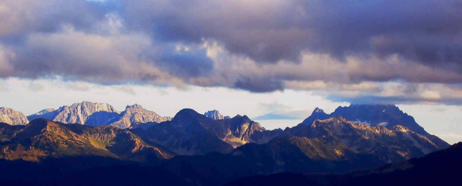
Although dark clouds were moving in from the west, low-angle sunshine was spotlighting the Stuart Range and Chiwaukum Mountains to the east. The summit register showed only two previous parties for 2005: Fay Pullen back in July, and another group in August.
- Beth On The Bulls Head Summit (Point 6840+)
- Clouds Over Stuart Range
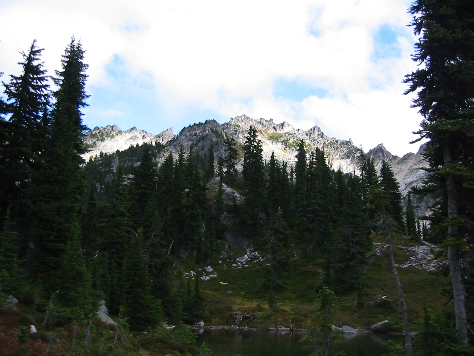
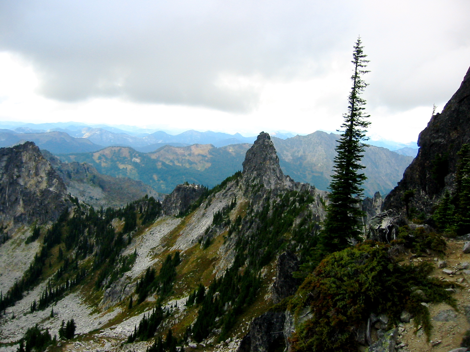
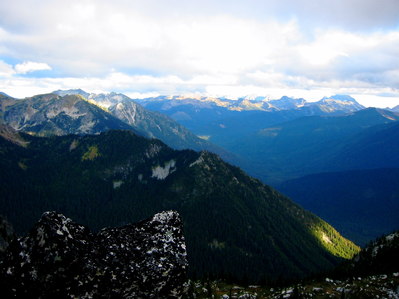
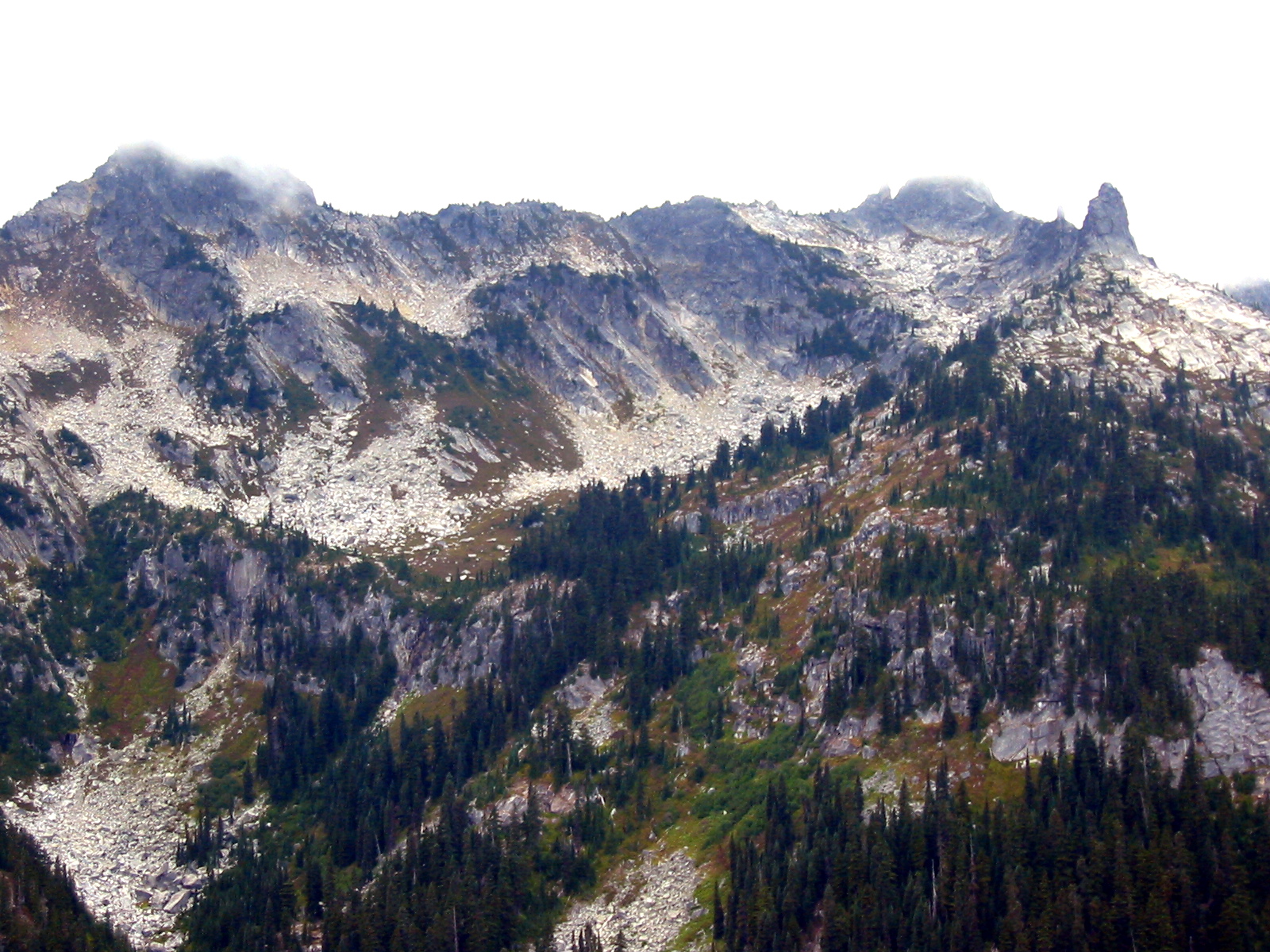
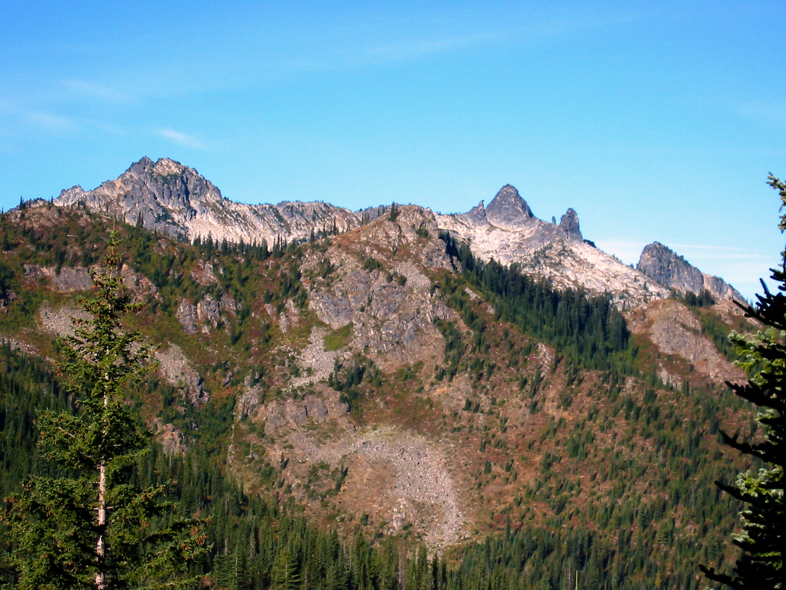
While on top, I scoped out the connecting ridgelines extending to the north and southwest. These granitic ridges have numerous little horns and pinnacles along their crests, but the most impressive by far is a large, granitic horn sitting about 1/3 mile to the north.
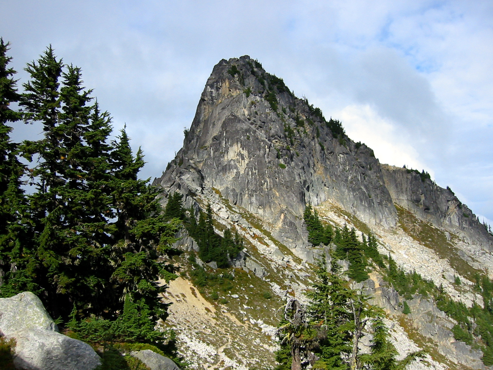
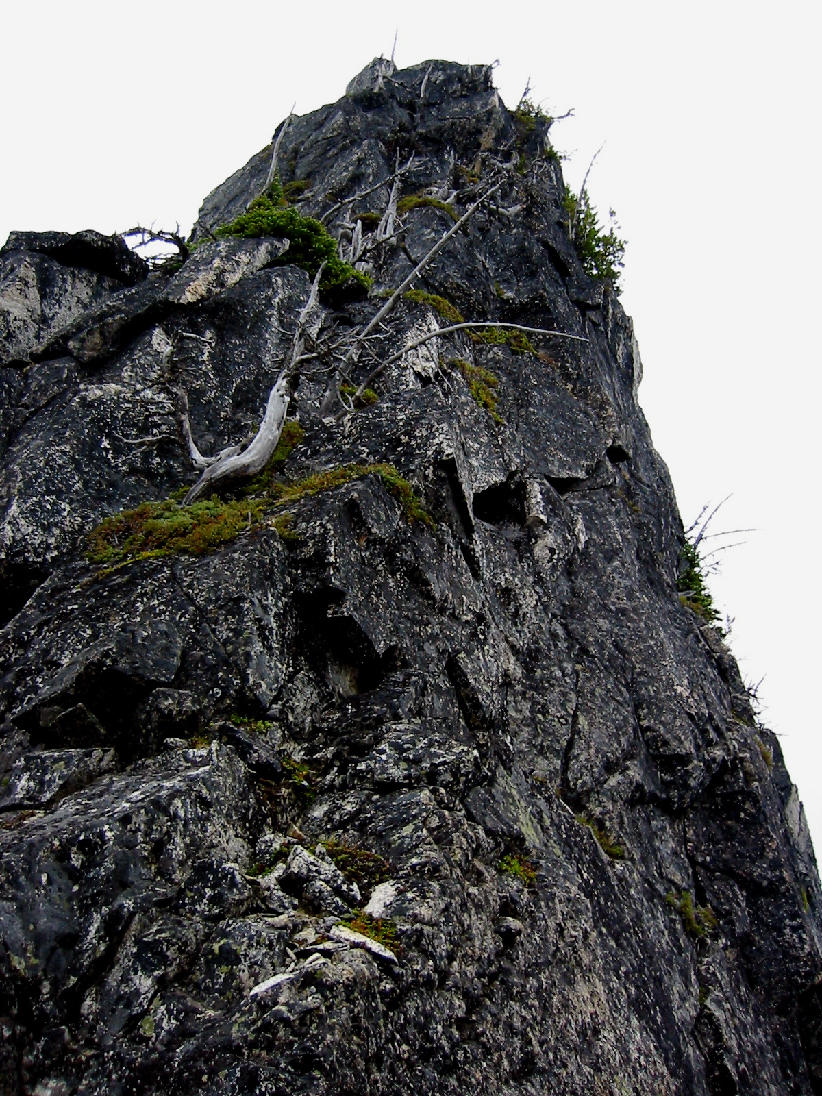
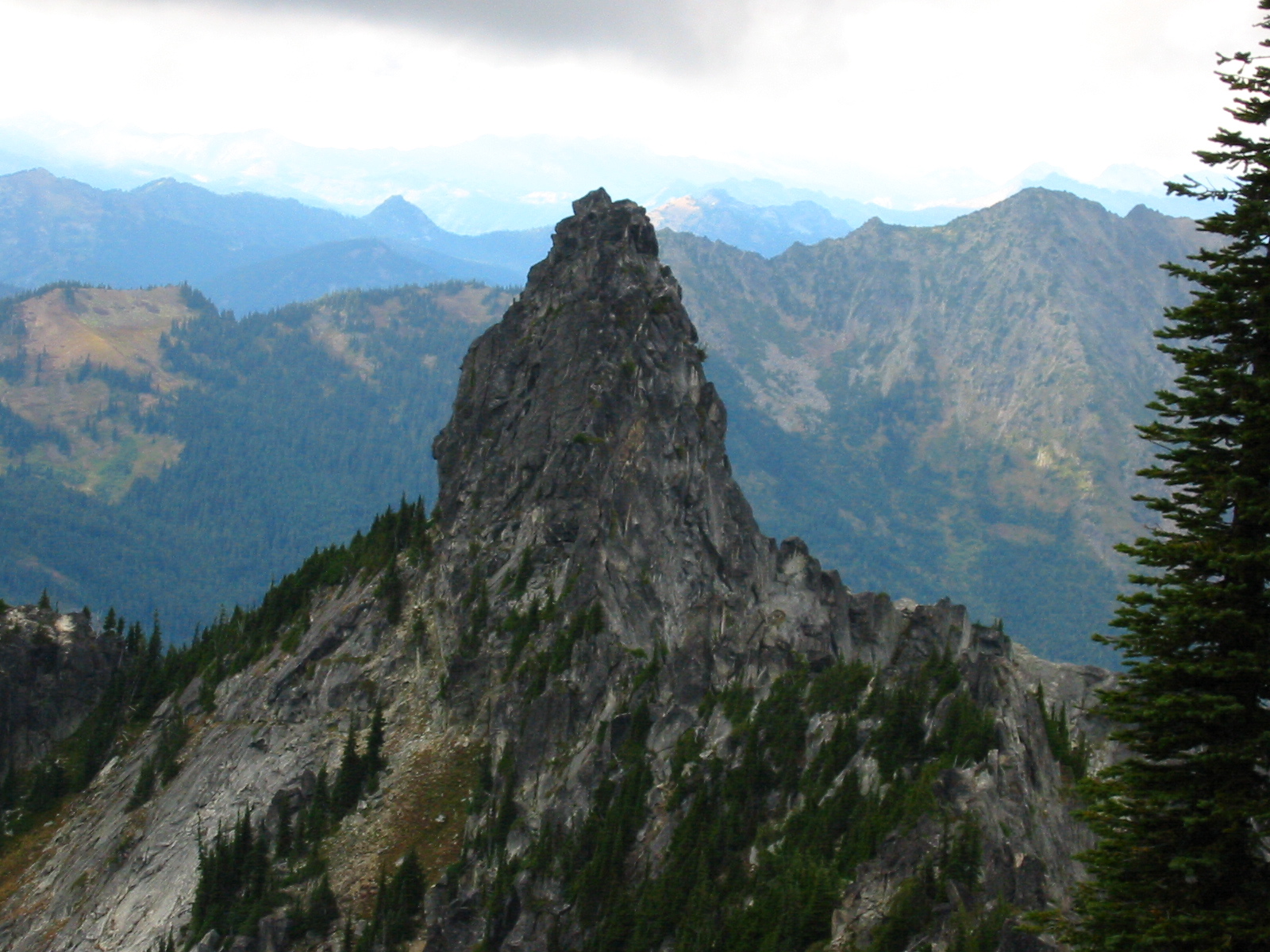
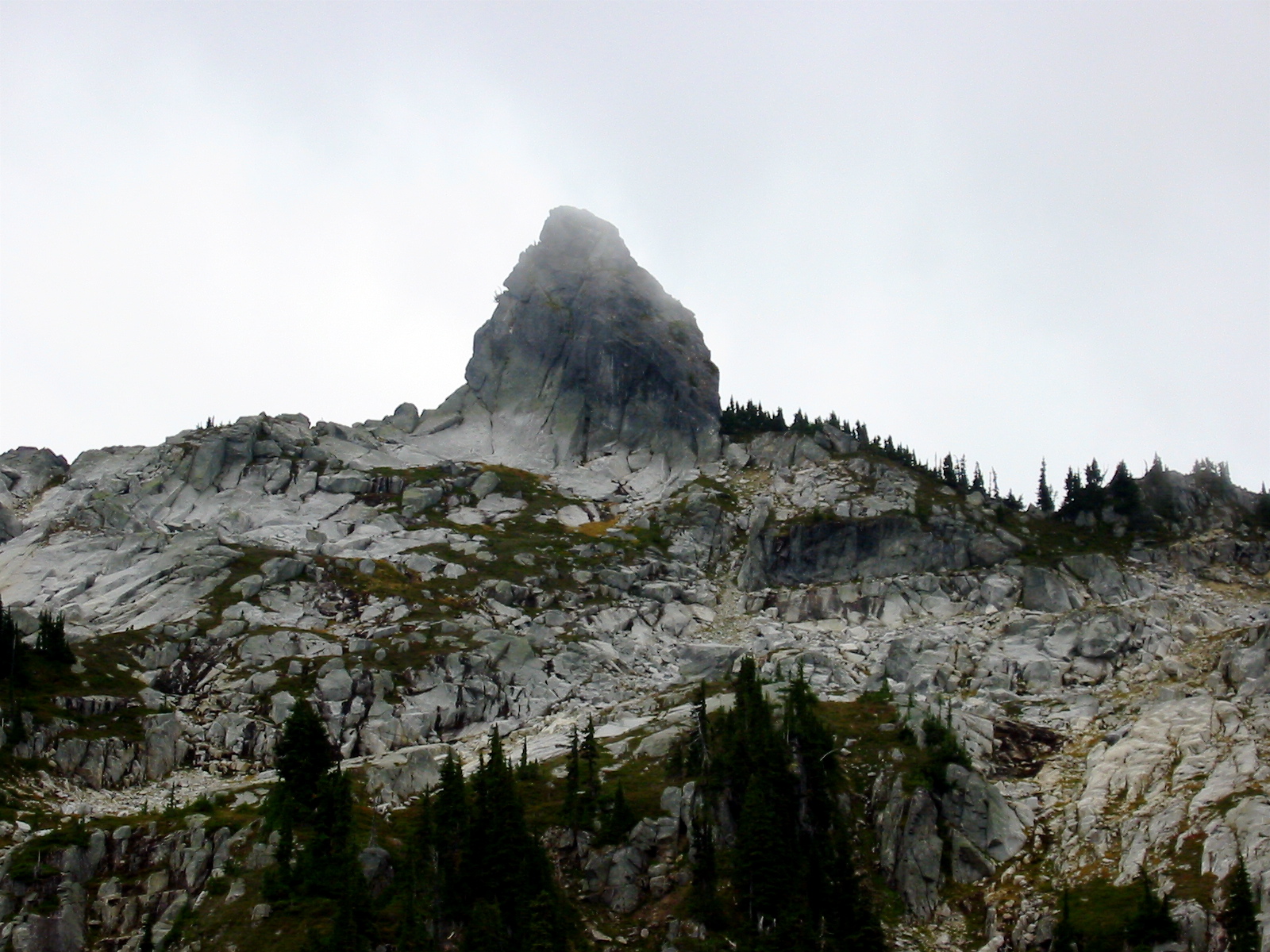
- The Bulls Tooth (Point 6680+) From The Bulls Head (Point 6840+)
This is the 6680-foot+ point shown on the U.S.G.S map, and it looks very much like a giant cuspid. I was now 75-percent certain that it represented the real Bull’s Tooth. Because there was nothing tooth-like about the bulky high-point that we were currently standing on, I temporarily dubbed it the “Bull’s Head” and hoped that tomorrow would further clarify the matter. We then turned our thoughts to dinner and scrambled back down to camp.
Day 2: Chain Lakes to Lake Margaret + The Bull’s Tooth
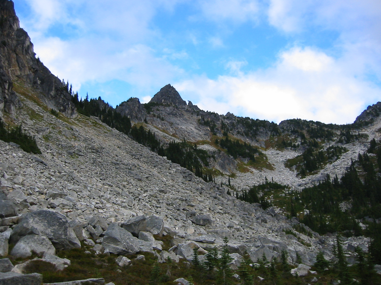
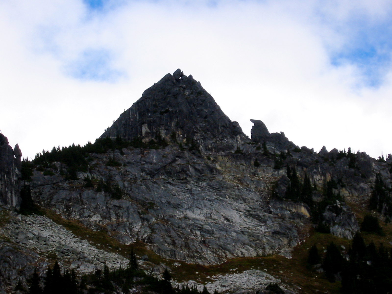
The night had been cold but windless and dry; happily, the predicted rains had not arrived…yet. After a leisurely breakfast, we were on the trail at 8:45am heading for 6200-foot Bullseye Pass overlooking Doelle Lakes. This would be our jump-off point for a climbing attempt of the 6680-foot+ “tooth” that Beth and I had eyeballed the previous evening from The Bull’s Head.
- The Bulls Hoof (Point 6604) From Bullseye Pass
We all dropped packs near the pass and ascended heather slopes to the tooth’s northwest ridge. This ridge seemed to offer the lowest overall gradient and the best chance for a feasible route; all other faces and ridges looked much steeper, with vertical or even overhanging portions. Deborah, Julie, and Janet opted to observe while Beth and I tried to tease out a route.

- The Bulls Tooth From SW Side
I tied in to the 75-foot scramble rope we had brought, grabbed a half-dozen runners (our only rock gear), and started up the northwest ridge. My lead didn’t last long, however; after a mere 25 feet of Class 4 climbing, I encountered a small Class 5 overhang that wasn’t protectable with runners alone. Now I was wishing I had brought some chocks and cams too!
After I backed down, we scrambled around a ledge to the right and checked out several other options on the west face. There were at least two possible routes here, each featuring good cracks and nice face holds in wonderfully solid granite—the sort of routes that would be classic crag climbs in the Tumwater or Icicle Canyons. However, both appeared to be sustained Class 5, and neither looked reasonable to do with our limited gear, even though Beth was able to climb partway up one of them with no protection.
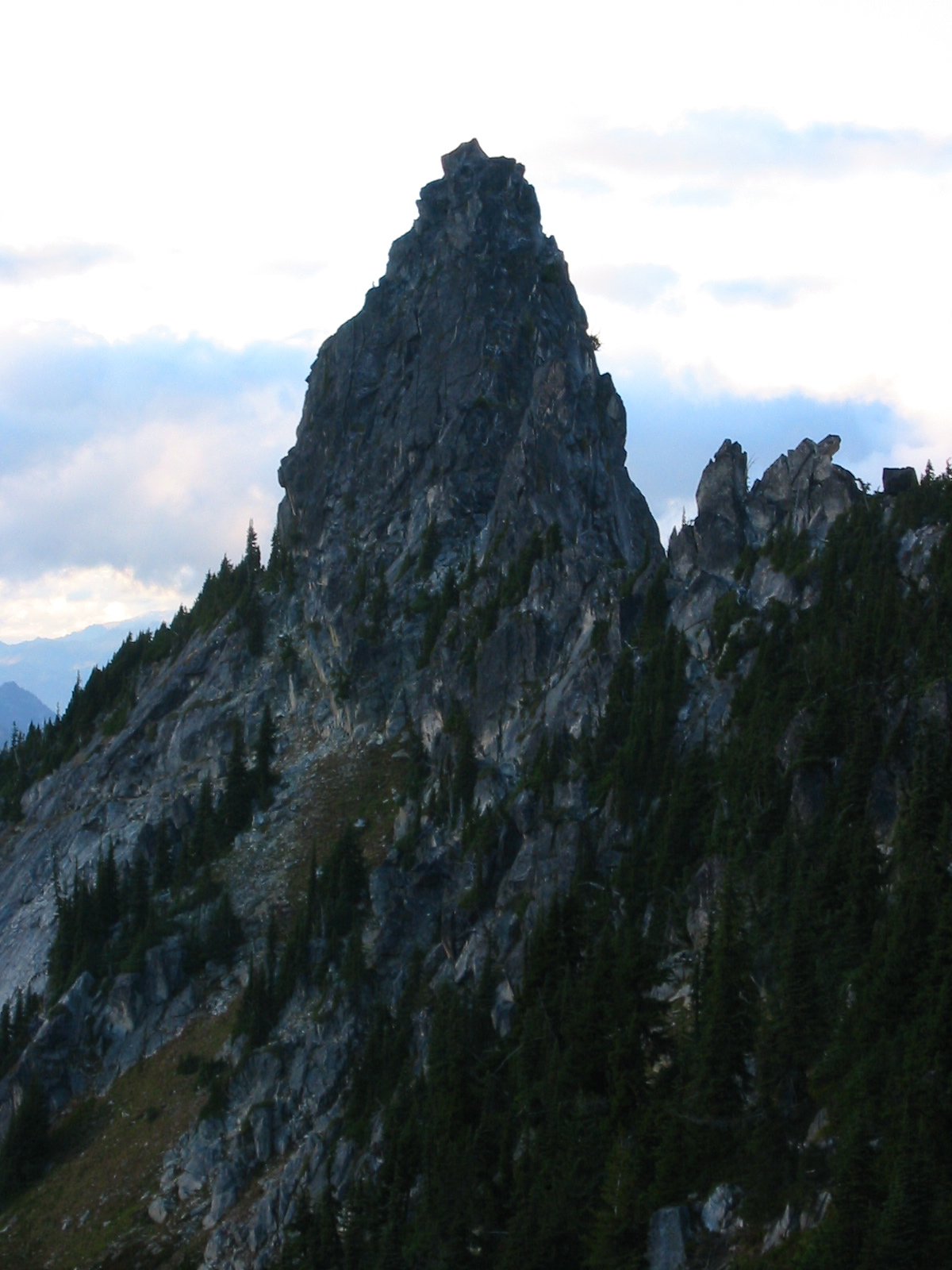
- East Ridge Of Bulls Tooth
We were both ready to concede defeat at the hands (or should I say teeth?) of this deceptively difficult crag. Purely for the sake of a post-defeat reconnaissance, I suggested that we circle clockwise around to the south ridge. I didn’t have any silly notions of climbing it (we had already seen that it is even steeper than the northwest ridge), but at least we would get a complete picture of the crag for future attempts.
- South Ridge Of Bulls Tooth
Working over to the base of south ridge involved crossing below the wickedly steep east ridge, then scrambling around a large detached flake on the south ridge itself. This took a bit of time, but upon reaching the cleft between the main crag and detached flake, I was amazed to see that the south ridge—despite being quite steep overall—is well-broken with small steps. It actually looked feasible!
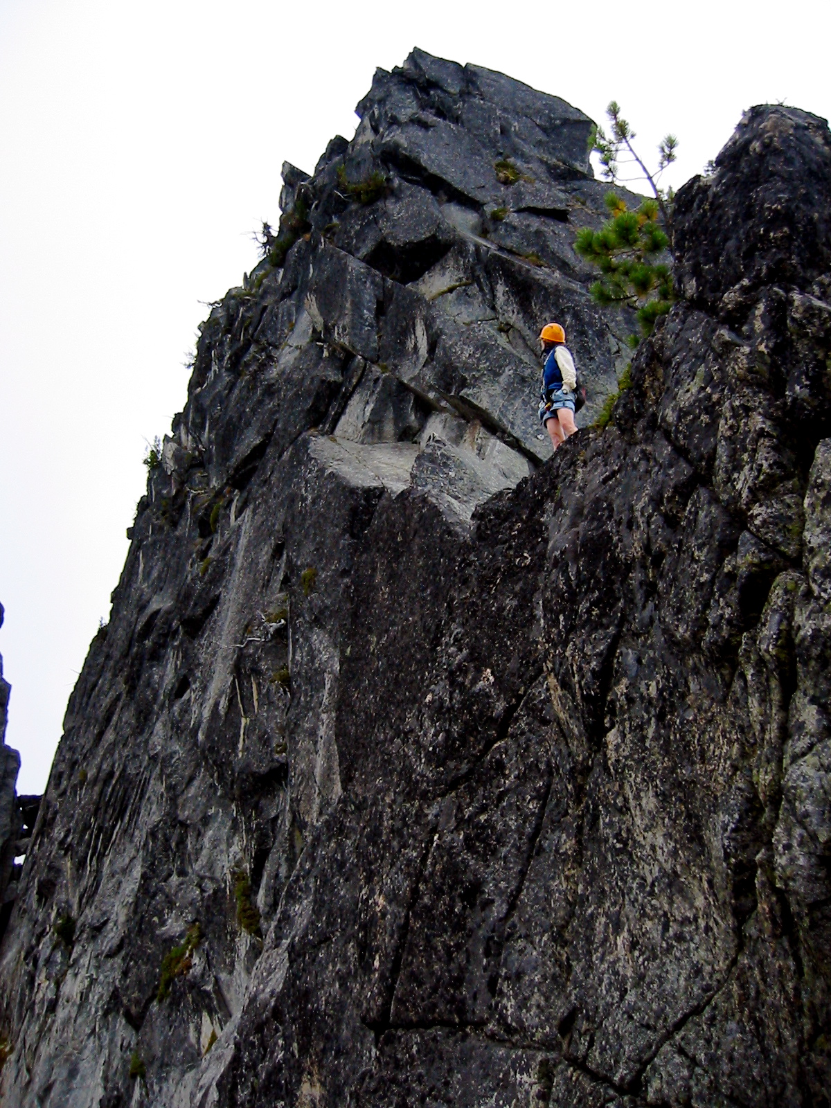
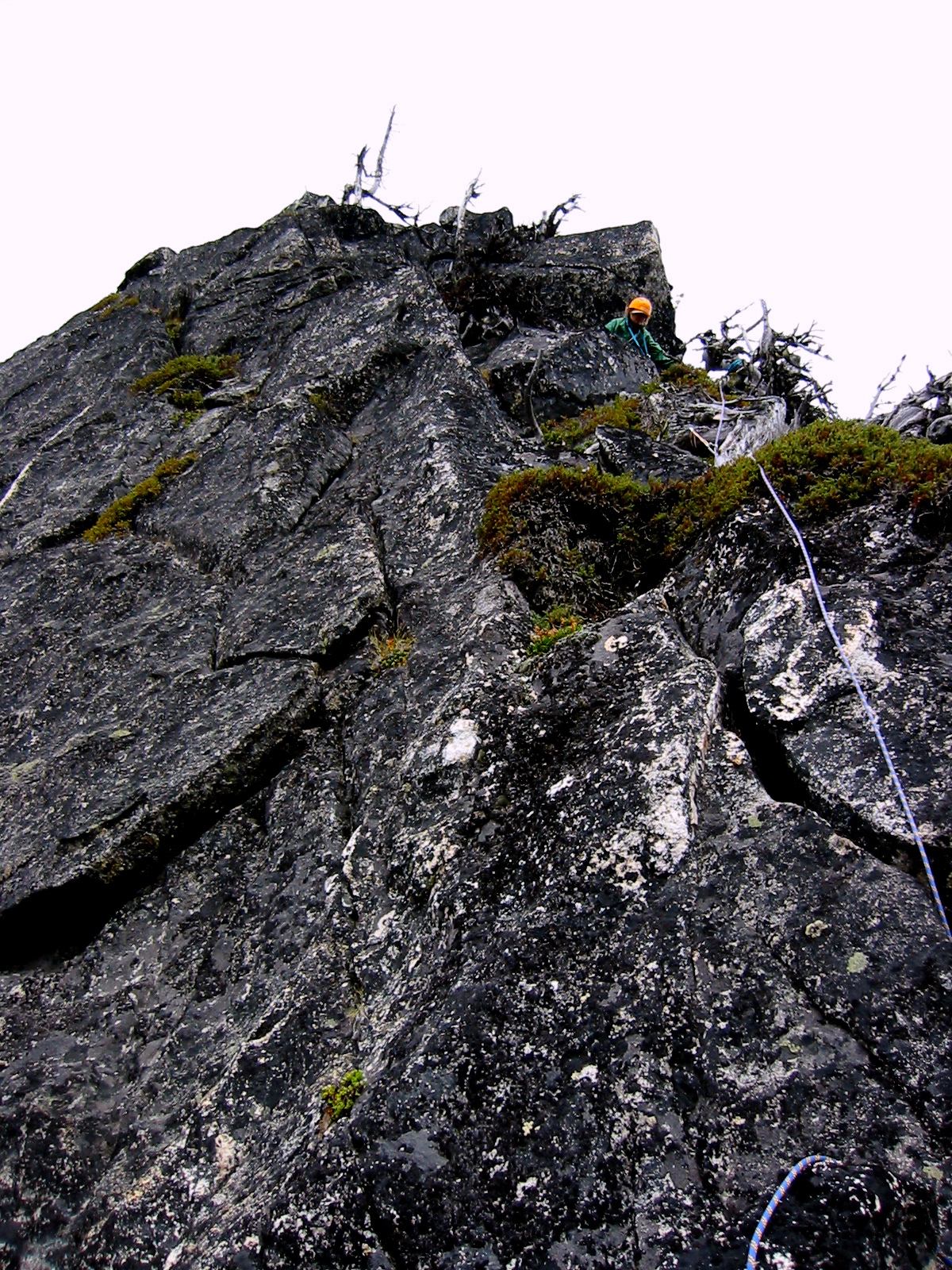
Beth and I scrambled upward on Class 3 rock for about 50 feet, at which point the ridge transitioned into Class 3+ and Class 4 terrain. We quickly roped up and each took a turn leading a half-pitch (remember, we had only a half-length rope), placing runners over horns and around tree trunks for protection along the way.
- Beth On South Ridge
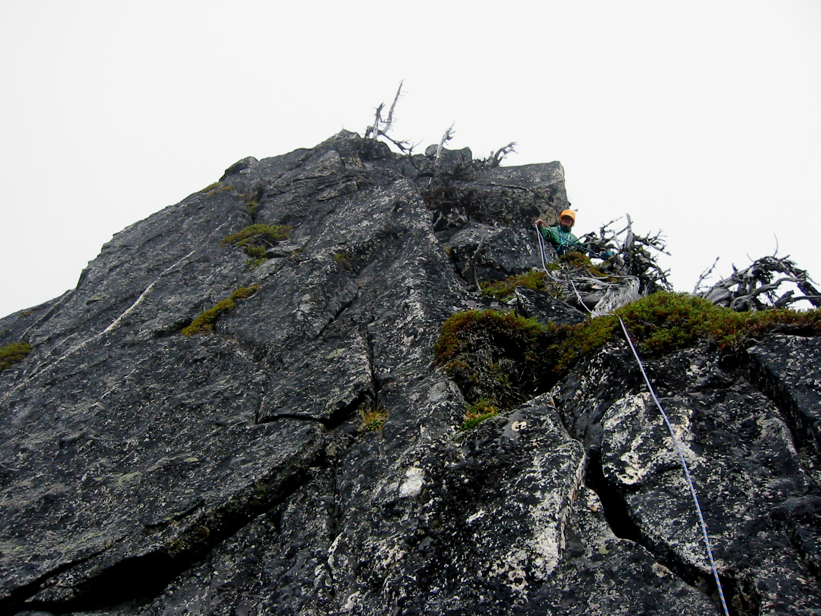
The climbing was never very difficult, and the rock was always very solid, but the exposure to each side of the narrow crest kept things exciting. Two more short pitches of delightful Class 4 and 5.0 climbing on the upper west face got us to the base of the summit block, which is a huge boulder that overhangs slightly on several aspects.
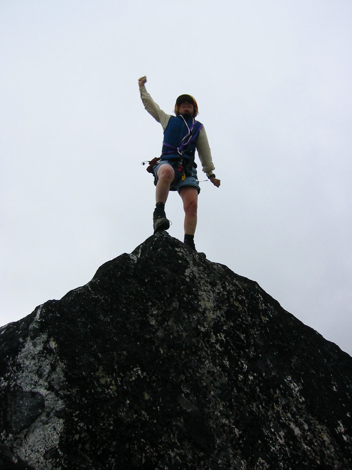
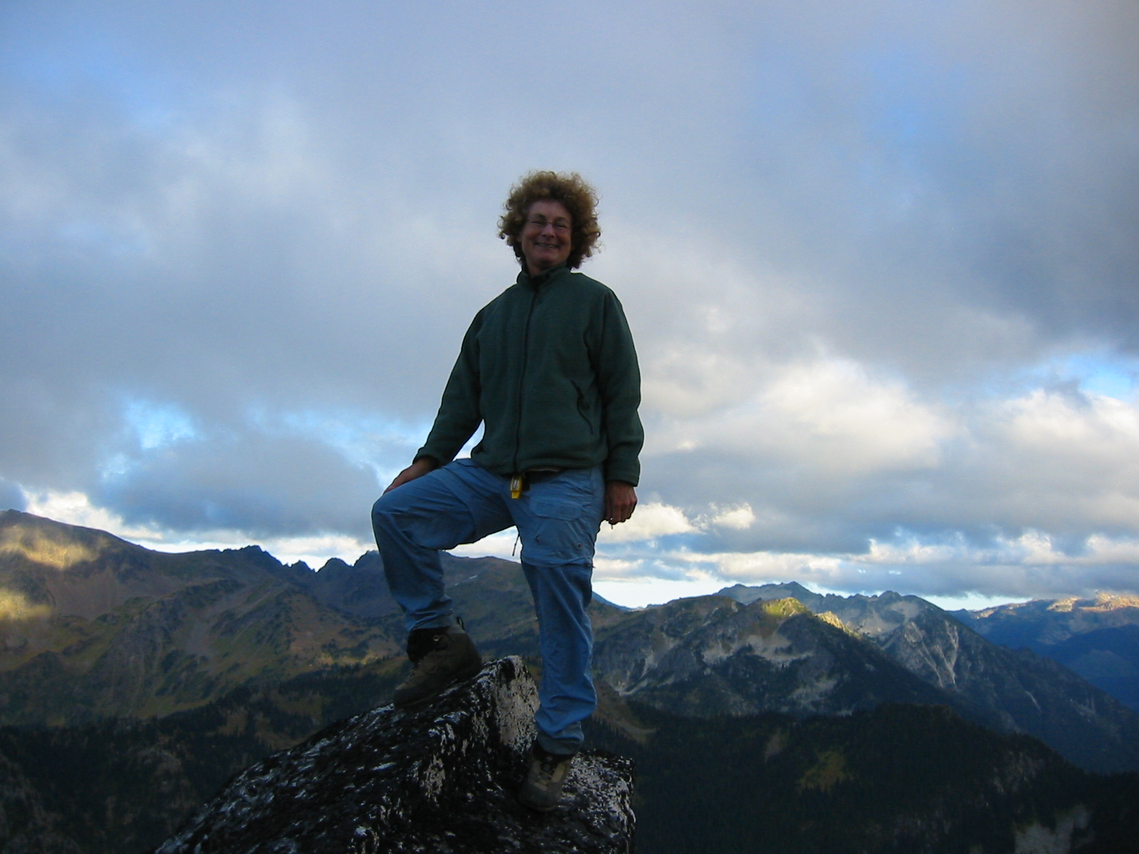
Fortunately, one aspect has a tall flake that allows the tip-top to be reached by means of a very interesting sequence of bouldering moves: first, a high-grab-and-mantle move, followed by an exposed step-across move. We took turns going up to the airy, one-person summit perch and then coming back down. I would have been entirely content to forego the step-across, but Beth insisted that we actually stand on—not just reach out and touch—the highest point. It was about noon (3.2 hours from camp) by the time we both finished topping out.
- Beth On Bulls Tooth Summit
There was an old rappel sling near the summit but no register, so we signed and placed one of my mini-registers. This very worthy summit doesn’t seem to get many visitors—probably only one party every few years. Unfortunately, hanging out to enjoy the view wasn’t really an option here because the wind was frigid, and ominous clouds were starting to engulf the nearby Bull’s Head. Rain was undoubtedly on its way.
We hastily completed a 20-foot rappel over the Class 4 face, then down-climbed the south ridge while using running belays. Our waiting comrades were cold and very happy to see us finally return to our jump-off point at 1:00pm.
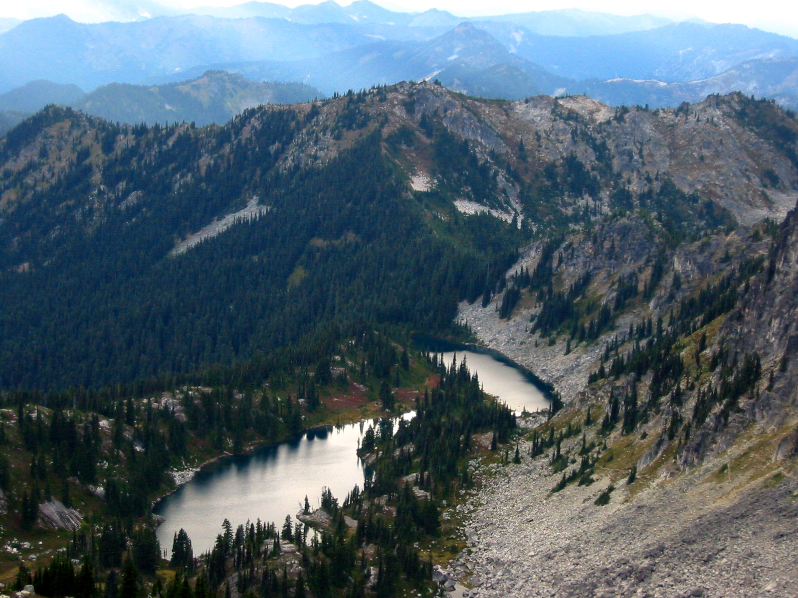
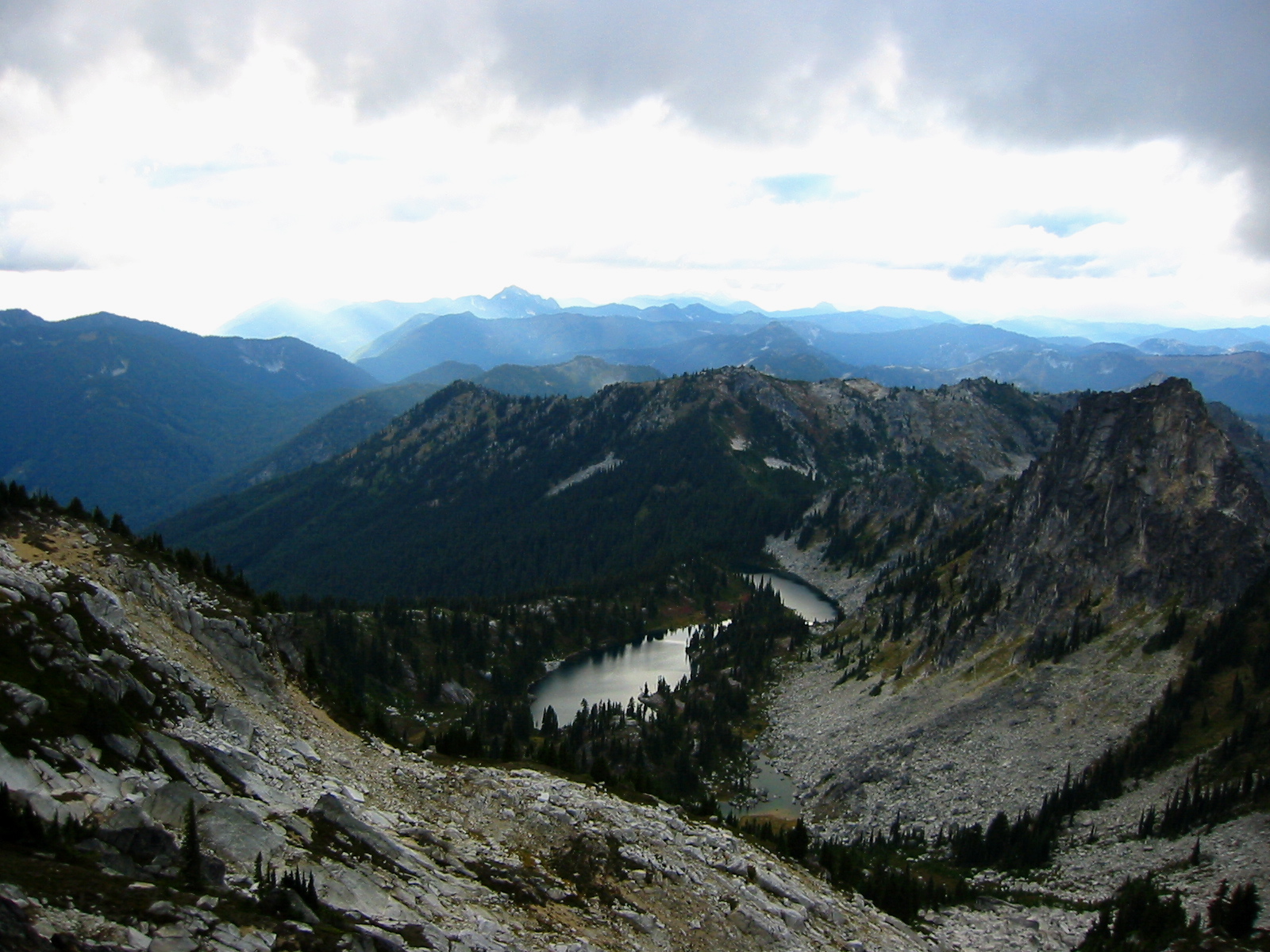
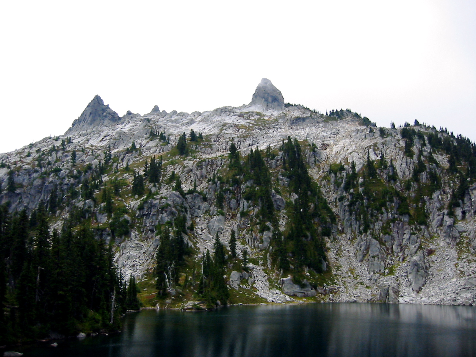
- Upper Doelle Lake From Bullseye Pass
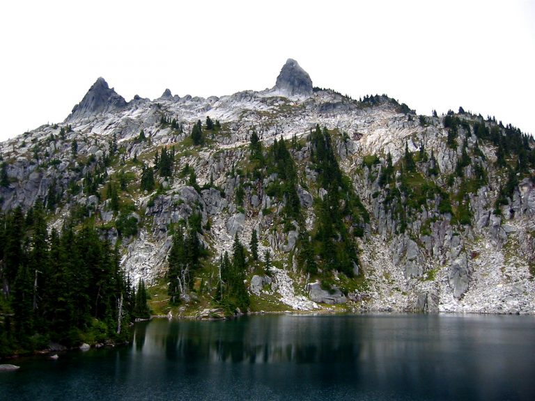
The five of us donned packs and hustled down the trail to Doelle Lakes, where we stopped for a late lunch. From this vantage, the 6680-foot+ fang of rock that Beth and I had just climbed juts into the sky and visually dominates the overhead view.
- The Bulls Tooth (Top Center) Above Upper Doelle Lake
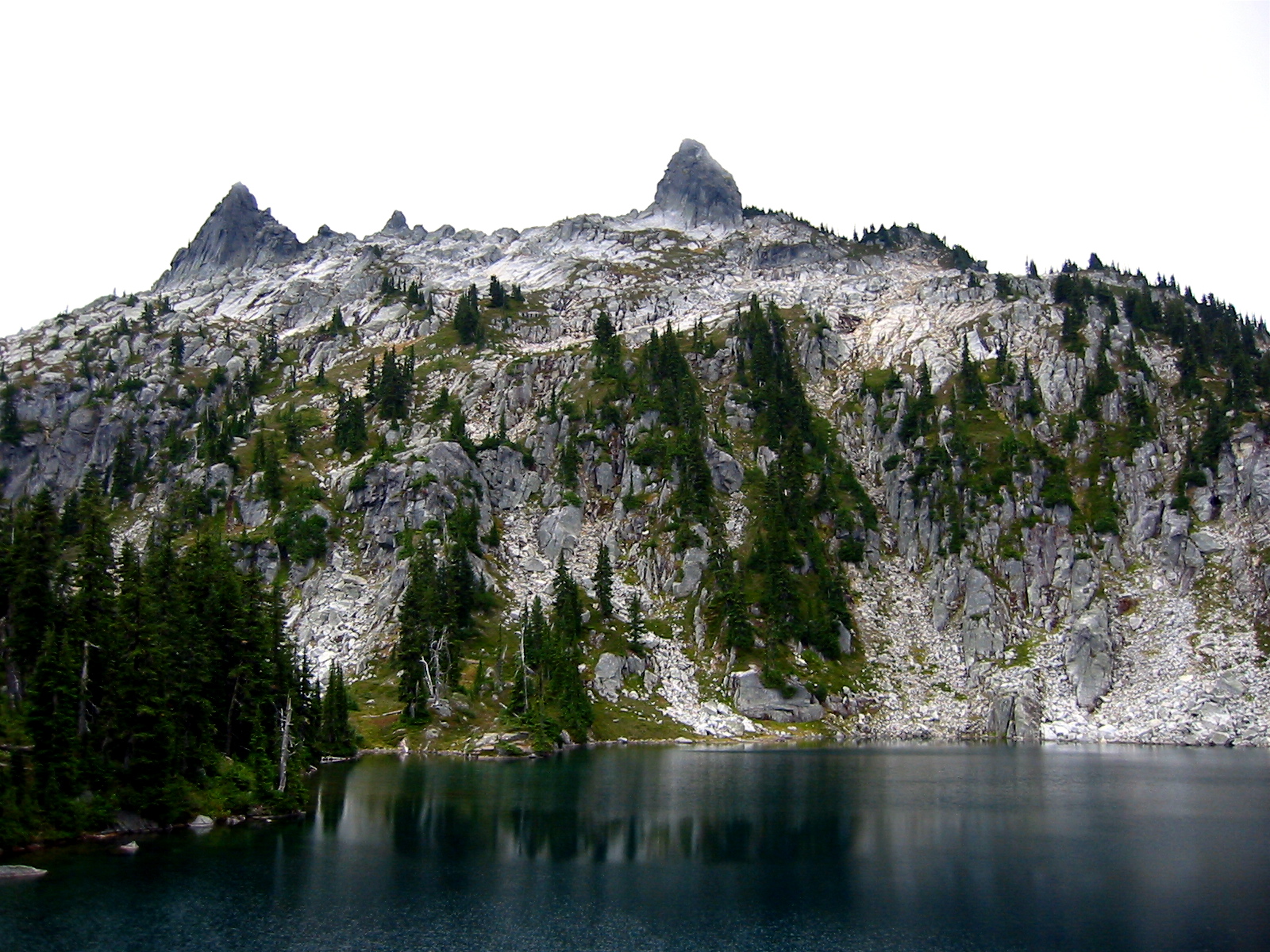
- The Bulls Tooth From Doelle Lake
If any geographic feature in this region could be aptly described as a “bull’s tooth,” this is definitely it! I was now entirely convinced that Cascade Alpine Guide mis-identifies the true Bull’s Tooth and that John Roper’s statement was correct. I was also pretty sure that whoever named it (A. H. Sylvester perhaps?) had done so after viewing it from this side, which looks the most tooth-like of all.
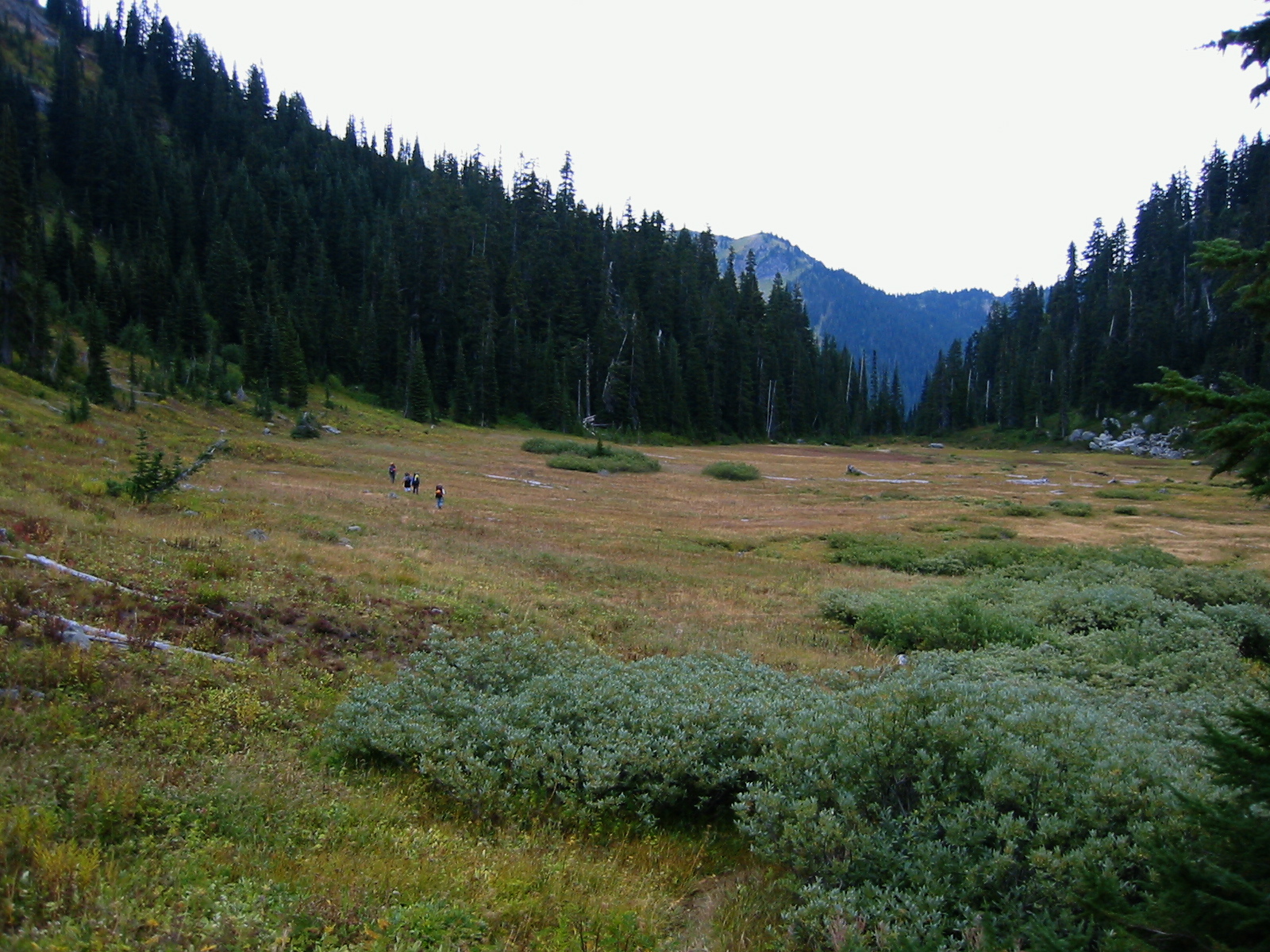
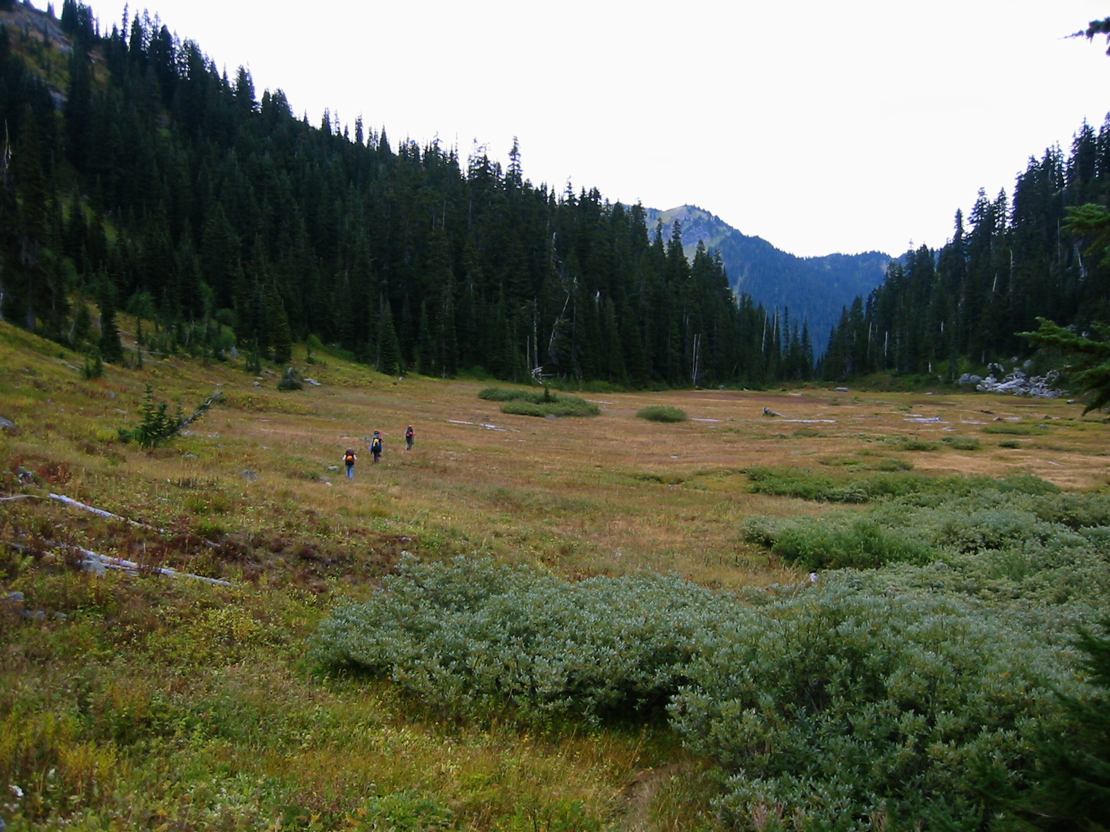
After lunch, we continued hiking down to the spacious meadow at the head of Doughgod Creek. (Deborah speculated that the U.S.G.S. and Green Trails maps have inadvertently misspelled “Doughgob,” which was a common food item in pioneer times.)
- Crossing Doughgod Meadow
We then ascended to a 5550-foot saddle on Frosty Ridge. This segment of trail is overgrown in places, and the tread nearly disappears in the meadow, but we were able to stay on it by keeping five pairs of eyes alert.
- Hiking On Frosty Ridge
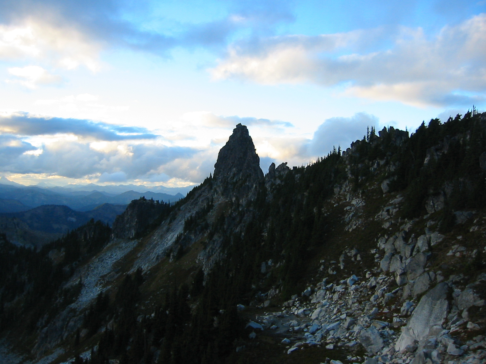
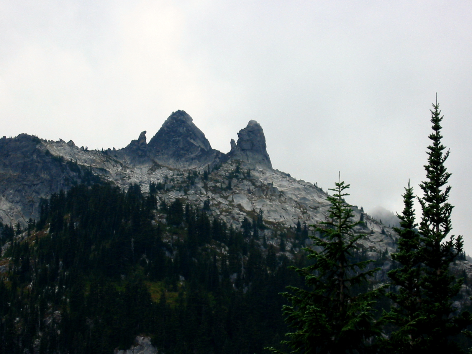
From the ridge saddle, a good trail traverses over and around a series of gentle bumps and eventually drops to 5750-foot Frosty Pass.
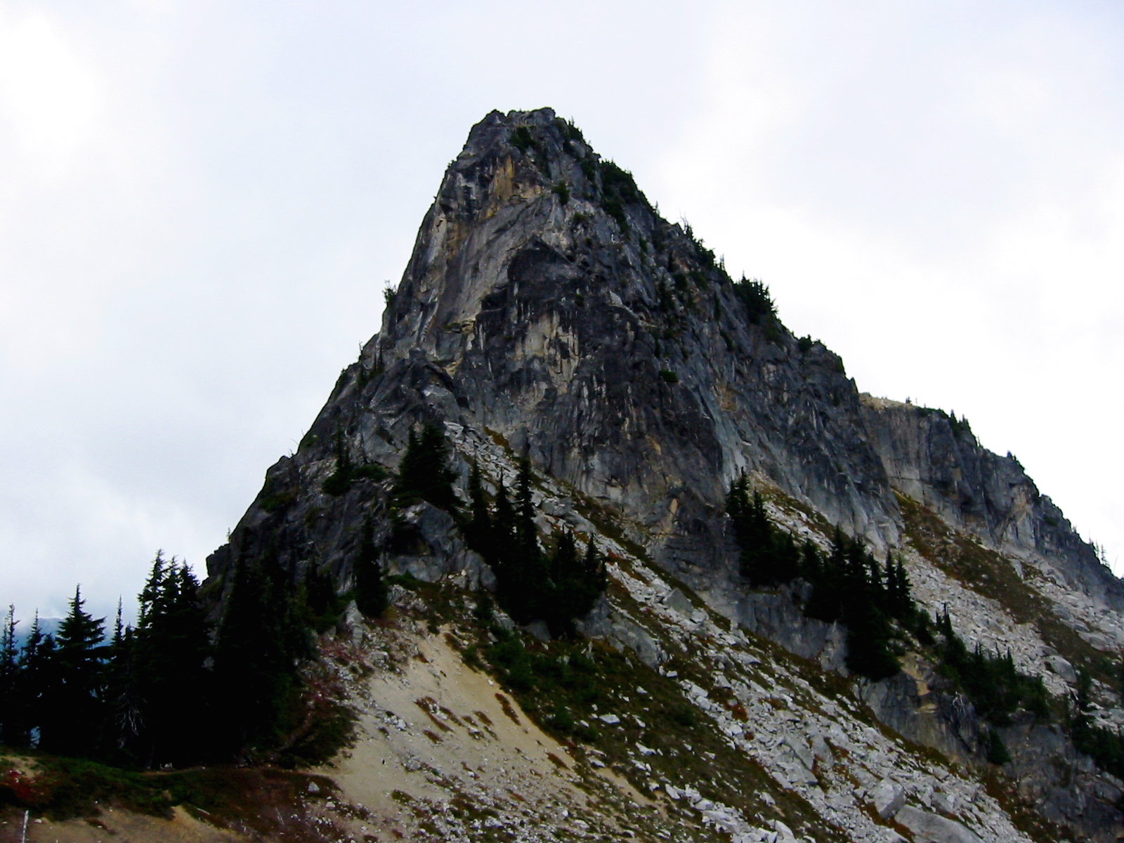
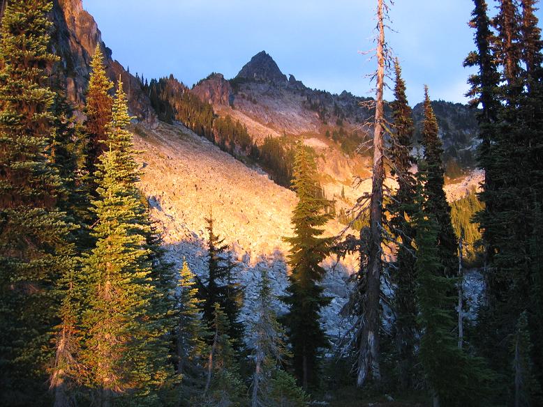
- The Bulls Tooth From Frosty Ridge
The colors of autumn were starting to show in the meadowlands along the way, and this autumnal feeling was enhanced by cool air, gray skies, and occasional raindrops. As we hiked the ¼ mile from the pass down to camp at Lake Margaret (8.9 hours from Chain Lakes camp), rainfall began in earnest. Intermittent showers continued through dinnertime, but the clouds completely dissipated soon after we retired for the night.
Day 3: Lake Margaret to Whitepine Creek Trailhead
We awoke at 6:30am to totally clear skies and frosty ground. Despite the pessimistic weather forecasts we’d heard before the trip, there had been scarcely two hours of actual rain showers all weekend. We were underway shortly after 7:30am, hiking back over Frosty Pass and down the Wildhorse Creek Trail.
- The Bulls Head (far left) and The Bulls Tooth (right of center) from Wildhorse Trail
I hadn’t been on this trail before and was pleasantly surprised by the high and scenic route it takes far above the valley; it’s not a typical creek trail at all. The morning sun highlighted the peaks to the west, including the Bull’s Head and the ever-impressive Bull’s Tooth.
We ambled onward as the frosty air of early morning gave way to the warm air of late morning. By 12:30pm (4.7 hours from Lake Margaret camp), we all reached our awaiting vehicle at the Whitepine Creek TH to complete an outstanding traverse.
Route Comments
Our Class 4-5 route up the south ridge is undoubtedly the easiest way to climb The Bull’s Tooth. The two routes at the left side of the west face looked to be in the 5.4 to 5.7 range to start with, but we couldn’t tell what they involved farther up. Several elegant cracks extend up the sweeping east face, and these are probably Class 5.7 or higher. The granite seems to be excellent on all sides of the crag.
Nomenclature Comments
For purposes of describing features on the arcuate ridge encircling Chain Lakes, I let myself get carried away with the “bull” theme. I applied the following names to the main features (listed from north to south).
- The Bull’s Hoof:: 6604-foot triangulated point just northwest of Bullseye Pass
- Bullseye Pass: 6200-foot trail pass between Chain Lakes and Doelle Lakes
- The Bull’s Tooth: 6680-foot+ untriangulated point just southeast of Bullseye Pass
- The Bullfinch: bird-shaped pinnacle immediately south of The Bull’s Tooth
- The Bull’s Head: 6840-foot+ untriangulated high-point of ridge
- Bull Roar Point: triangulated Point 6807, erroneously labeled “Bulls Tooth” on USGS map
Route Maps & Sketch
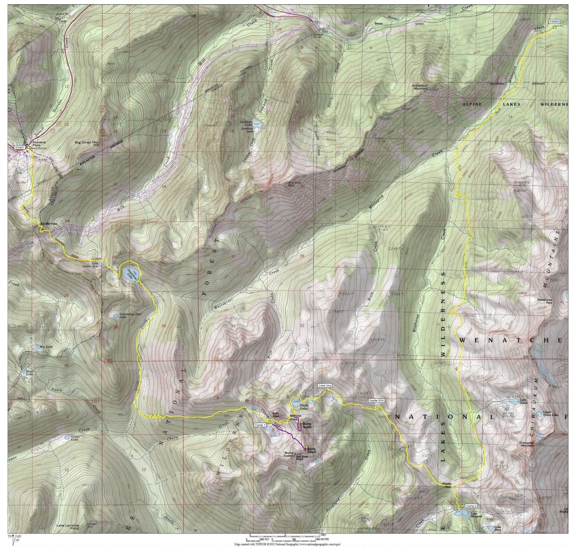
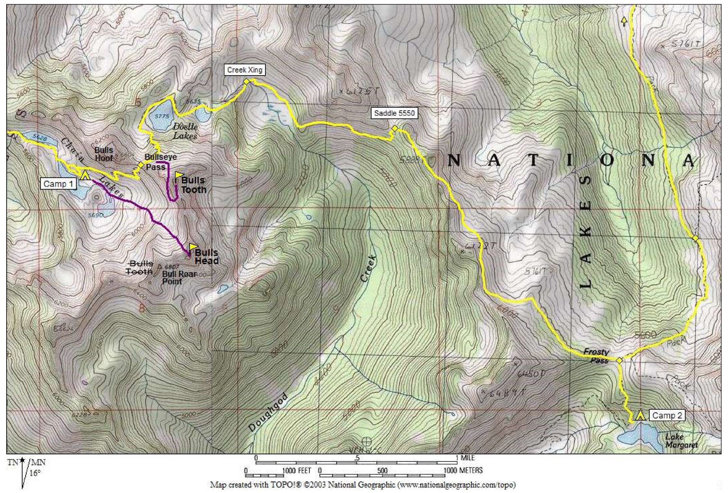
Photo Gallery
Click to enlarge…